Tahoe Rim Trail – Marlett Lake campground to Spooner Summit

Lessons Learned:

1.  Being smelly is good?

2.  Toilets are NOT over- rated.

3.  Water Bladders (internal and external) are not easy to regulate.

The trail out of the Marlett Lake campground seemed to go on forever.  Luckily it wasn’t that strenuous and had great vista views of Lake Tahoe, and of course, Marlett Lake.  Today apparently my husband discovered how truly BAD I smell when we got together to take a picture, via our new hiking buddy Desk Jockey.(Can’t find the picture)  As we smooshed together for the photo op, Paul exclaimed, “Geez you STINK!”.  In my mind I was thinking, you’re not a stinking rose either, and…you just noticed?  I can barely stand myself!  I must have now reached a new height of stankiness.  Since our son played ice hockey and we were both familiar with the horrible stench of his gear (even when “washed”), I asked him to rate my hiker stench.  Apparently the stench-o-meter had me between the stench of our son’s collective gear bag and his gloves (of which are vomit inducing)…and this was only Day 4!  As we continued on our way, we have noticed a pronounced lack of game tracks traversing the TRT and dirt roads.  It wasn’t until last evening while en route to the campground, that we spied our first actual animal life in the form of several mule deer grazing in the bitter brush.  There appears to be plenty of vegetation and food sources, but then we are in fairly close proximity to “civilization”, so that might have something to do with it.  An interesting event occurred about mid day, as we had just “parked” ourselves on our custom cut Z-Pads up against a giant granite boulder to have a snack and air out our feet.  A day hiker and his dog came quickly striding up the trail towards us, a little winded and wide-eyed.  He asked if we had seen the Bears!  He described one as being “really BIG” coming up from Marlett lake.  (Note to self – don’t ever camp at Marlett Lake…proper). Unfazed, we shrugged and said, “No”., to which he looked at us like we were blind and/or clueless and said, “okay then…well just be careful”, and hurried on his way toward Spooner Summit.  Considering Paul’s remark about my hiker stench, we surmised that collectively (as he doesn’t really smell much better…well okay, maybe a little, but I’m done with trying to stay “clean”) we must smell much worse than the bear(s), which in the bear world means that we must be one “bad ass” bear (us).  Therefor once those bears got a whiff of us as we passed by them, they hid out until we passed, not wanting an encounter with a bigger/tougher bear.  And frankly, we are good with that.

DSCN0603As the day went on, the mercury began to rise to a near unbearable level, so much so that we unknowingly had sucked our water bladders dry, with 2 more miles till Spooner Summit.  It’s like that moment when you’re scuba diving, and you realize that your regulator is not failing, you are just out of air.  I guess you should have paid better attention to your gauges now right?…not that I’ve ever done that (more than once).  It’s not so much a feeling of panic, but of “what idiots”…how’d we turn into “those people”, we used to rescue “those people”.  Luckily I had squirreled away 1/2 liter of water in my G2 bottle and we rationed that until we got to Spooner Summit where we were told there was water and a bathroom by day-hikers.  I am not sure of which I was more excited.  The thought of water or an actual toilet.  Having had to pee like a race horse for the last 2 miles, I’ll say the bathroom wins it.  When we arrived at Spooner Summit, the day-hikers had it half right.  There was a bathroom, but NO WATER!  Considering the fact that I had to pee so bad (Paul had free use of nearby trees and shrubbery), we were pretty confident that we were appropriately hydrated.  When we arrived at Spooner Summit, we had an hour to spare before our trail angels were scheduled to arrive with our 3 day resupply.  This allowed us #1- to pee, of which I barely made it for the bathroom only served to increase the urgency, and of course “women’s” restroom sign made it even worse,  #2 – air our feet out, #3 – go through our gear and #4 – plan out the rest of the day(s) on our map.  As we were waiting for our resupply, Desk Jockey pulled up with his trail angel.  He was heading in the same direction with his final stop being Echo Summit (where he started in the first place).  He asked us how far we were going to go.  We told him that our destination for the day was another 6 miles to South Camp Peak.  He thought he was only going to get in 3 miles before setting up camp as he has two bad knees and the uphills always get to him.  We told him we would see him on our way up.  Once resupplied we headed on our way an hour and a half later.  On our way up we met a mountain biker headed down who told us “our buddy” was waiting for us on a bench”, near the top.  Apparently near the top of the 5 mile 1800ft climb there is a bench.  A bench on the trail, finally…what a concept!  The “bench” as it turns out was a log, but Desk Jockey had gotten about 4 miles and was within 1.5 – 2 miles to the top.  Once we met up,we were able to talk him into continuing another 2 miles, as he had been able to rest for about an hour.

We ended up finding a great spot to camp. It was flat, out of the wind, and allowed us to enjoy an amazing sunset over Tahoe City.
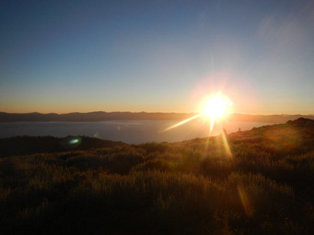
DSCN0604

Life is Good!

*Just a reminder, this was a trip we did July 9-17, 2013.  It’s a trip we’d encourage anyone to take, especially if you are training for the PCT or any other long distance trail.

Posted in Tahoe Rim Trail, Uncategorized | Tagged , , , , , , | Leave a comment

Tahoe Rim Trial – Relay Peak to Marlett Campground

We awoke to a chilly morning (for July) and Paul’s infernal alarm clock (if I could figure out how to disable it, I would).  We packed up and drank our remaining water in the form of Via coffee.  Considering how we felt the night before, it’s amazing how a decent nights sleep, 600mg of “Vitamin I” (Ibuprofin) and 8 hours off your feet will do for one’s soles.  We marched quickly to Galean Falls where we cameled up, drinking 1 liter of water each in-between bouts of brain freeze, and filled our water bladders with 1 liter as well. DSCN0597DSCN0599 With no one around, we took a quick wash in the frigid flowing water, which was an interesting form of invigorating.  We were on our way to meet up with our “trail angels”, Vern and Patrice, for our resupply at the Tahoe Meadows trail head.  En route, we met another thru-hiker, “Butters” (who of course was traveling in the opposite direction) as well as several other day-hikers headed to the falls…one, even with bells on.  Once at the Mt. Rose Campground, we met up with our trail angels +2 (Sonja and Hawk – their daughter and grandson) and crammed like circus clowns into their Subaru wagon for the short drive to the Tahoe Meadows trail head for the next section.  They brought us our supplies, PLUS two awesome Tri-Tip sandwiches and fresh cherries.  We each devoured half of our sandwiches (of which I doubt we actually fully chewed or tasted much), to the sounds of Hmmmm and mouthfuls of exuberant exclamations, “Oh my God!  Thank You! Thank You!  These are Awesome!”  I think I even did a little dance.  From here, the four of them walked , well Hawk (6month old) actually rode (lucky guy), with us for about 1.5 hours, where we stopped for “lunch” and finished the other half of our sandwiches.  Once we parted ways, we went back to our “plow horse” pace, as we had to “step up” to “thoroughbred” pace with them.  Our pace differences we chalked up to “altitude” and weight (our packs and our fat asses)…ya, that sounds good.

DSCN0601

Huh?

We found this section of the trail to be “easy” compared to the previous two days.  Dare I say we were starting to get the hang of this, or was it because the 750 ft elevation climb was over 1.8 miles as opposed to the 800 ft climbs in under 3/4 of a mile we did the last two days?  We were, however, confident that we had worked those sandwiches off.  Plugging in our iPods and Sony Walkman (Paul’s -he still uses his  bright yellow waterproof Walkman with AM/FM) we charged the uphills like we were ON FIRE…thinking why the hell did we not think of this before, especially during the arduous ascent (at the end of the day…of course) to Relay Peak?  In any event, we we delighted to walk on mostly decomposed granite, as opposed to slip shale and volcanic marbles, for most of the day.

DSCN0595

Huh?

While this specific section of trail is popular with the mountain bikers, we lucked out as we were hiking on an odd-numbered day, which meant no mountain bikes allowed.  Of course there were some “Special Needs” cyclist, who think they are “special” and don’t “need” to follow the rules.  But for the most part, today was a treat, as more than half the TRT is open to mountain bikes.  Per the signs, the mountain bikers are supposed to give the right of way to hikers, regardless of direction.  In theory this sounds like a good idea, but in practice, I prefer to move out of the way of fast moving objects.  We walked the edge of the Mt. Rose ski area, and enjoyed bird’s eye views of Lake Tahoe, and could now spy the other side of the lake from whence we started.  We reached the Marlett Lake campground, which ironically is not at Marlett Lake, and surveyed the campground.  It was complete with water (via a hand pump), a bathroom and bear boxes…and what we thought were flat campsites.  Yet again, a non-slippy site eludes us.  Here we thought we would ditch the Tyvek ground cover in hopes that maybe the tent bottom would stick to the dirt/pine needles/DG…whatever.  At the campground, we met another thru-hiker, Rick aka. “Desk Jockey” who was actually hiking in our same direction (clockwise).  This solved the mystery of the large single and untouched foot prints we saw as we worked our way to the campground.  We were curious about the prints because there were no “fresh” or similar prints heading back to the Tahoe Meadows trail head.  Generally the further you get from the trail head, the fewer people you see.  We joke that we now know when we are about 5 miles from a trail head, because we no longer see day-hikers.  After a pleasant conversation, and a small fire, with Desk Jockey we all retreated to our silicone impregnated rip-stop nylon “mobile homes”, wondering how necessary are those bear boxes.

Posted in Tahoe Rim Trail | Tagged , , , , , , | 4 Comments

Tahoe Rim Trail:  Brockway Summit – Relay Peak

Lessons Learned:

1.  Maps and or guide books are mere “suggestions”

2.  What looks “smooth” and “flat” from a distance usually is NOT.

3.  Don’t count on, or pass up an opportunity to get water.
We awoke to discover that we had NOT slipped down the hillside, and that our food had remained largely untouched.  Several early morning runners ran by as we broke camp.  The terrain for this section differed dramatically from the previous section.  Views along this path were spectacular and the vegetation was amazing.

We started in a densely forested area with a rich peaty smell whose trail was soft and dusty.  It morphed into one littered with scree and low growing vegetation, and then onto a powdery tread of finely ground granite, accented with unique rock formations in a sea of mule’s ear wriggling in the stiffly blowing wind, ending in a crechendoe of gradual downhill upon sharp marbles.

Our feet would require some TLC.

Most of the trial was uphill, as we expected, seeing there was to be a 3300ft elevation gain.  We noticed that most hikers were heading in the opposite direction (counter clockwise around the lake), could it be because it was mostly downhill for them?  From the beginning we had decided to travel clockwise around the lake in order to save the Desolation Wilderness for “last””.  We wondered however, if we had chosen the wrong direction.  Could we be making this harder than it needs to be?  This would not be the first time…or apparently, the last.    DSCN0571.JPG
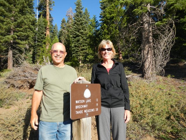
Paul and I had made an extra effort before we set off, and at each “break” to study the map and read the trail descriptions believing that we would have more success in estimating our distance traveled, and more importantly, how much farther we needed to go.  As with the day before, our ability to judge distance traveled was somewhat “off”, as was the signage.  The mileage posted at intervals along the trail, we figured had to be in nautical miles.

Nevertheless, the trail had so many dramatic views, the accounting of “mileage” became less and less important, with the exception of the next watering hole.  As we started fully hydrated and stocked with water, our plan was to water up at Gray Lake.  We scraped that plan when we finally got to the alternate path to the lake.  DSCN0563The path, one-way, was 1.3 miles.  In total, this was 2.6 miles too much, considering how far we had already covered, and the fact that we didn’t have much farther to go for the day…so we thought, we marched on.  Luckily, “2miles” earlier I had spied several 10 gallon jugs of water off the side of the trail.  We considered this “trail magic” and filled up 2 liters worth, “just in case” Gray Lake did not work out for us.  This would turn out to be our saving grace.

When we finally got to Relay Peak (10,335 ft), which is the highest point on the TRT, we were dog tired and had 1 liter of water between us.  We looked for a place to set up camp, but we could not find a suitable place to pitch our tarp tent in the rocky conditions, and it was getting late.  We knew there was water “2 miles” away at Galean Falls, in fact we could several small ponds down below us.  Thusly, we began our descent mistakenly thinking that the service road upon with the trail follows was in good condition and FLAT!  What things look like from 1000 ft above is not necessarily the case at “eye-level”.  By now our feet were screaming as they were swollen and blistered in a few strategic places (We were in the process of learning, the “hard way”, that just a half size larger than we had already gone, would have been a much better idea).   We decided that the first “flat-ish” place we came upon we would set up camp, as every moment off our feet, was a moment we were quickly learning to savor. We spied a spot, that was mostly “flat”, but once again were challenged by the elements.  Setting our tent up in the backyard had been easy-peasy, in the great outdoors the degree of difficulty, and need for creativity had increased.  No sooner than we had set up our tarp-tent, the wind began to blow, and not necessarily in a direction that the tent could best withstand.  Undaunted, and at odds with Mother Nature, we hunkered down and forced our tent to remain standing by placing HEAVY rocks (more like boulders) atop each tent stake.  SUCCESS!  We used a 1/2 liter of water to rehydrate our dinner and went to bed.  This time we slipped down to the bottom of our tent, and wondered if we would awake with a tree upon us in this crazy wind.

Posted in Tahoe Rim Trail, Uncategorized | Tagged , , , , , | Leave a comment

Blogging 101, Day One: Introduce Yourself to the World

In an effort to improve my skill set with regard to blogging, I have enrolled in WordPress’s “Blogging 101”.  This of course is in line with my seemingly perennial habit of doing thing bass-awkward.  Let’s write an on-line blog (Is “on-line” redundant?) for 2 years and then learn actually how to navigate all the bells and whistles later.  Today’s lesson is supposed to include using “tags”, to help others like minded or interested to find one’s (my) site.  I am still not sure how/why to use them. Being a Luddite, I am more comfortable with ink on paper, but one can not deny the ease in which the fingers fall upon the keyboard (or thumbs, mostly in my case, via my phone).  At some point, I figure I’ve got to evolve and get with the times, if I am to tell a proper story in this day and age.  Hence my enrollment in BloggerU.  Imbedding better pictures, picture collages, videos and links to other sites will be experimented with.  Hopefully you will see an improvement in at least the aesthetic quality of 2moremiles in the days and months to come.  The writing, I’m not so sure, but stranger things have happened.  To think I hated English, (and writing papers) in school (at every level), for the thought of opening up oneself to critical evaluation, of ones thought process etched onto fiberous pulp, was nearly debilitating.  Not many teachers would/could follow my thread of thought, which probably resembled something more like a ball of tangled yarn, yet still one strand.  The irony being, is that my previous work life involved, nothing but, putting pen to paper (or fingers to keyboard) in the form of reports, manuals, books on procedural processes, opinion pieces, employee evaluations and legal documents.  Funny how life works.  So, now I write freely of outdoor travels and mis-adventures.  This began initially at the behest of friends and family, so they could keep track of us (my husband and I), laugh along with us, and to memorialize memories in the event that they fade unwittingly with age, or most likely in my case, dementia.  The moral of the story being, if we can do this (whatever “this” is)…anyone can.  We figure you can wonder all you want, or wander and find out, and that’s what we intend to do…until we can’t.  Life is to be lived with no regrets…for the most part.(I do regret not having bought Ford stock when it was $1.67.  But then that’s hard to do when you don’t have $1.67 to spare.).

Posted in Uncategorized | Tagged , , , , , | 4 Comments

Tahoe Rim Trail – Tahoe City to Brockway Summit

Day One Lessons:

1.  All downhills have an uphill, but not all uphills have downhills.

2.  All trails start with an uphill, and generally end with an uphill.

3.  Filtered water out of a green pond full of tadpoles, tastes GREAT!…especially when thirsty.

4.  High School Physics is important.  When you put slipppy things on top of slipppy things, they still slip.
Our plan was to walk 50 minutes then break for 10 mins, and repeat until we got to our destination, so as not to burn ourselves out on the first day.  The intended destination was approximately 13 miles to Watson Lake.  We figured it would take us 8 hours or so.  Let’s just say we should have stopped there.

Having started at the Tahoe City trailhead at 0735 am, we literally made it to Brockway Summit at 8pm (12.5 hours later). Having missed a turn in the trail (this would become what one might call a “trend”), we exited the woods onto Hwy 267 where it aligned with the Brockway Summit (Elevation 7,179 ft) sign post.  This was not in the plan.  With a blister now firmly forming on Paul’s heel, he jettisoned his socks and hiking shoes for his Croc camp shoes and we began the walk down Hwy 267 to the Brockway Summit (section 2) pull out where we had stashed two gallons of water.

DSCN0471

Best Neighbors in the Whole World!

The day started full of smiles and nervous energy as our neighbors, Vern and Patrice dropped us off at the Tahoe City trail head. The beginning of the trail started with a steep uphill (of course).

We climbed and climbed most of the morning through shaded and forested areas filled with mosquitoes that would inundate you, like the paparazzi, when you stopped to take a breather.  Our 50 min on/ 10 min off plan of walking was quickly altered in favor of walking until we were too tired to care about becoming sucked dry by the swarms of mosquitoes that recognized us for the rookies that we were.

DSCN0492

Finally we get a view of Lake Tahoe

As we continued on our way and enjoyed the flora and fauna, it was becoming infinitely clear that while our sense of direction is collectively good, our ability to judge distance traversed was deeply flawed.  Every “2 miles” seemed to last six.   Having to step aside for mountain bikes, even though we have the right of way, became annoying and added to the misjudgment in distance traversed.  Likewise, the TRTA brochure states that this section of trail to Watson Lake is not more that a 10% uphill grade.  Of this we beg to differ.

DSCN0496 
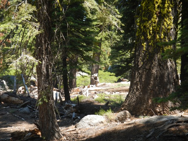
We arrived at Watson Lake (actually more like a pond) at nearly 4pm.  Now 4pm seemed like just too soon to stop, with all that daylight still left in the sky.  The bear prints near the water also made us a little uneasy about setting up camp by the lake.  So after an hour break, and after having filled Osprey 3 liter bladders with 2 liters of water each… with our Sawyer Squeeze, we began what the map showed to be an “easy” 6 mile hike to the end of this section at Brockway Summit.  Nothing about this was “easy” as the trail (for us, having mostly walked and trained on grated fire roads) was rocky and technical for most of the way, which made it difficult to get into a walking groove.  When we alighted onto a paved road, the map showed us to have only “2 more miles”…(NOT SO!) and directed us across the paved road and up the narrow TRT.  Ironically, had we stayed on said paved road we would have ended up in the same place we did after having wandered through the forest tripping over roots and kicking rocks, and cursing the sharp nosed insects who saw us as their personal food trucks.  Instead we traversed through what seemed like the Black Forest, which was dark and a little spooky.

DSCN0487

Is that a giant squirrel?

It is a place where sounds of unfamiliar animals, breaking branches, and hordes of mosquitoes dive bomb your every breath.  As such, those with an unnaturally fertile imagination (mwaw – yes I know the proper spelling, but it just doesn’t flow writing, moi) can’t help but spin ridiculous stories of bear maulings and serial killers, with oneself as the victim. When we finally emerged onto Hwy 267 it was practically dark.  By the time we got our water, and carried it another 1/2 mile up from the Brockway Summit trail head…it was pitch dark!  In the darkness, and with the aid of our head lamps, we found what we thought to be a relatively “flat” place to set up our tent (Six Moons Design, Lunar Duo) and cook (actually re-hydrate)our dinner…by that time, dirt clods would have tasted good.  No sooner did we get into our tent, did we realize that the spot we picked (in near total darkness) was not as flat as we thought.  In fact, it most certainly slanted significantly down hill, as did everything in the immediate area.  By then we were so tired that we said “screw it”, and promptly fell asleep in our hiking clothes.  As we “slept”, Paul slid closer to me and I slid closer to the tent’s downhill door.  It appears that we were experiencing Superlubricity  as the coefficient of friction with regard to our mass, the slippy materials and terra firma was nil.  The only thing that kept us from continuing to slide down the hill was the hiking pole holding up that side of the tent, which acted as a “brake” of some sort. Curled gently around the hiking pole, we halfway expected to wake up on the trail below us for we were too tired to do anything to rectify the situation, just as we were too tired to do anything about the rustling and sniffing we heard outside our tent door…by our food.

Posted in Uncategorized | Tagged , , , , | Leave a comment

Tahoe Rim Trail (TRT) 

DSCN0595

The Tahoe Rim Trail (TRT) is a 165 mile mountainous (often multi-use) trail that essentially circumnavigates Lake Tahoe.  A permit is required for traverse into and through the Desolation Wilderness and the trail joins with parts of the Pacfic Crest Trail (PCT) about 10 miles before Echo Lake and splits off just near Tahoe City.  The trial is divided into 8 sections, with each section approximately 20 miles.  Many people “day-hike” each section returning to the “comfort” of an expansive meal and a comfy bed.  We chose to hike it in its entirity in one fell swoop, for two reasons.  (1). We only had a 14 day window of travel to be away from home, and (2) We were seriously considering hiking the the PCT the following year and figured this was a good “shake-out” hike to see if walking 20ish miles a day with all our stuff on our back, in the great outdoors was something that we’d like, and could actually do.  The beauty of doing this trail is that it is relatively close to civilization (in the event of a medical emergency) and our next door neighbors volunteered to “trail angel” us, as they would be visiting their daughter who lives in Truckee.  We had both lost a few pounds following our first attempt at “back-packing” the Trans-Catalina Trail the previous March, and had lightened our load considerably to include a new ULA Catalyst pack for me, having downsized from my 70L Gregory Diva.   We had hoped we were better prepared and in better shape (physically) for this endeavor.  We had no illusions however that all would go absolutely “swimmingly” as Mr. Murphy (of Murphy’s Law) and his vindictive wife, Mother Nature, tend to accompany us on most of our adventures.

The Tahoe Rim Trail Association’s website ( http://www.tahoerimtrail.org ) was helpful in researching the segments and getting an idea of what we were in for, and provides an update on trail conditions and the prevelance or lack of water for each segment.  As this is the 21st Century, we found a few YouTube videos, read a few blogs and immersed ourselves in everything TRT in preparation for this adventure.  We bought a trail guide book, of which I will not name because all we did was cuss this guy out the entire time as his distances did not account for elevation gain and loss (took us 4 days to figure he was using as the “crow flies”) and his idea of “strenuous” and/or “mild” climbs were woefully inaccurate, and sometimes the exact opposite.  The information that the TRT provides, as I look at it now, and their maps are sufficient.

The adventure took us 8 1/2 days.  We did not take a single day off, thinking that “Zeros” we’re for wossies. I carried a college ruled notebook and kept a hand written account of each day’s travel/events (I have since evolved).  Many lessons were learned, often the hard way, but they would be lessons we’d take with us to the PCT and ones that would prove to quite valuable in our successful thru-hike of the PCT the following summer.  The poignant lessons learned were the following:

1.  ALL trails start and end with an UPHILL.

2.  If you have a choice between three trails and you are not sure which one is correct…choose UPHILL.

3.  YES you DO need a size and a half bigger shoe!

4.  If you think you are just about at your destination…you have another 2 Miles!

And with that, so begins the account of our adventures on the TRT, and the beginning of 2MoreMiles and a love affair with playing outside.  Over the next few days, I will post each day’s adventures, lessons and pictures.  We have evolved from this  hiking adventure in many ways, and to this day laugh about our foibles and how “green” we were.  Enjoy.

Posted in Tahoe Rim Trail, Uncategorized | Leave a comment

Das Boot

image

Grand plans of more grand hikes and adventures came to a screeching halt nearly 2 weeks upon our return from walking The Camino followed by sparse travel through the cities of Porto and Lisbon, Portugal.  It appears that the pain in my left foot followed me home.  Wanting to shed the delicious pound(s) we acquired as “souvenirs” from our time in Portugal, after having “broken even” walking across Spain (the food, Tapas, bread and wine were just too delectable), we began our 6-10 mile strolls in the back-country near our home.  Increasingly each day’s walk would end in excruciating pain.  Not good!  A trip to the doctor and an X-ray revealed no visible injury as in an actual fracture, but a visit to the podiatrist revealed something more sinister…inflammation of three metatarsals that if not allowed to heal could develop into a lifelong chronic problem.  It appears I clearly have an “overuse” injury of which the remedy included a lovely “walking” boot, and instructions to stay off my feet for a much as I can for 4 weeks.  Ummm, define “as much as I can”.  No more than “2 miles worth of walking”, whilst wearing the boot  from sunrise to sunset, was the response…real funny…2 miles.  4 weeks later, another 4 weeks was added with the pain subsideding to only one specific metatarsal that would send me to the roof upon palpation.  The latest visit to the podiatrist, who literally “feels my pain”, as he is recouping from a chronic knee injury and relegated to the exercise bike as I have been, is hoping that custom orthotics will allow for further healing and negate the sensation of a “rock” in my shoe under that pesky metatarsal.  I am now walking up to 5+ miles most days, (on mostly flat surfaces) with a strip of KT tape around the base of my forefoot.  It seems to lessen the pain and discomfort, for which the Doc says physiologically it doesn’t make any sense, but then if it helps, “more power to ya”.

The result of this ill-timed injury has been a cessation of our 2016 Appalachian Trail (AT) planning.  So my dear followers/readers, small adventures will have to suffice.  For kicks and giggles, in the next few weeks, I will post our final pre-PCT “training” hike of the Tahoe Rim Trail (TRT) we did in the summer of 2013.  I just re-read what I had written back then (in a composition note book that I carried).  It is on this trip that our collective trail name, “2MoreMiles” and blog site namesake was coined.  Ah yes, good times.

As far as upcoming adventures, and to test out my foot, we will re-visit the Trans Catalina Trail (TCT) which was the first “back-packing” trip we took as a means to see if the PCT would be something worth aspiring to.  Many a lesson was learned, amoung them being: (1)We were way too fat and out of shape (how the hell did that happen?); (2)Water is fricken heavy, but thirst is heavier; (3)We had way too much shit, and heavy shit at that;  (4)Being on top of a ridge line, above the low hanging clouds with no one else around is REALLY COOL!  And with that, serious effort went into preparing ourselves to do the PCT.  We are curious, if knowing what we know now, if the TCT experience will be any different this next time.  We expect to do this mid March or so.  Providing this goes well and my foot is not bothered, Mt. Whitney is on the short list via a long (4-7 days) route starting at Horseshoe Meadows heading up the Cottonwood Pass. When we go of course will be dependent on snow levels.  This will be followed by (or preceded by…again depending on snow levels) a few weeks of tromping around/through Yosemite and a few fly-fishing adventures.  The Grand Enchantment Trail (GET) is being researched but is frankly considered a long shot, and will be added to the “Bucket List”. And…with any luck, I will finally put the finishing touches on my compilation video of our 2014 PCT adventure, and another one for The Camino, and post to You-Tube and the blog.

As with everything, 

You can Wonder all you want, or you can Wander and find out.
…which we plan on doing as best we can this year.

Posted in Mini Adventures | 5 Comments

From whence we came

Fisterra – Santiago…and eventually Home.

The vicious storm that was on the forecast finally came in.  It rained and blew so hard that the power went out several times last night, for extended periods of time.  Having a roof over your head each night, and not having to carry several days worth of food (if any), were some of the many “perks” of  this “hiking” trip.  Regular laundry and fresh water were others.  I would say fewer daily miles, but the tread and terran were different so that aspect for me kind of balanced out.  This morning we took the bus back to Santiago, and from there we make arrangements to head to Porto Portugal for our next leg of this european adventure.  When we get to the bus stop, we are amazed at the number of people already at the “station”…and “waiting” in the cafe across the street having breakfast.  There is no formal cue for who is “first” in line to board and more and more people are arriving as the bus’s arrival time  nears.  We inquire if there is even an “informal” line or methodology, and there is not.  Knowing how humans can be, we are envisioning a disaster, and an episode of ‘humans behaving badly’, once the bus arrives.  The Americans “in waiting” discuss that “this” would never fly in the U.S.  We would have a cue set up and form an orderly line as in first come first serve, and would collectively block the “line-cutters”.  An official would also be there to ensure an orderly boarding.  But this is Spain, and here the assertive/agressive mouse gets the cheese.  Those who don’t, just “roll” with it, don’t get upset, and seize the next opportunity.  The concept and/or act of worry and stress seems non-existent here.  The bus arrives and a mad dash occurs to load the gear and get a seat on the bus.  There is some crowding, but for the most part it is as orderly as it gets with 100 people vying for 64 seats.  We did not know this, but you could have bought your tickets the day before (rather than upon boarding), but having a pre-paid ticket does not guarentee a seat on the bus you paid for.  It just means that eventually that day you will be able to take the (a) bus to your intended destination.  With that said, another bus pulls up across the street, to load the “stragglers”.  That bus is not direct to Santiago, but will eventually get you there, as it is a “city” bus, and costs the same as the direct bus.  You learn something new everyday.   What took us 3 days to walk took us less than 3 hours to travel via bus.  When we get into Santiago, we consider hopping the next bus to Porto, but we are hoping to check in with the travel office adjacent to the Pilgrim office for some better information on where to go and what to do…besides drink Port Wine and gorge on pastéis de Nata (Custard tarts), once we are there.  As luck would have it, the office is closed, it being a Spanish Holiday.  

image

Krystal and Ronnie (she's the grad student doing research on effects of technology on the Camino)

The good thing however, is that a few of the people we had met, hiked with and befriended had just made it into Santiago.  

image

Tonight we dine with Kerry, Melie, Krystal, Karen, and believe it or not MAUREEN!  

image

We also run into Gary from Colorado, who is staying at our albergue (The Last Stamp).  The best part of today was the reunion we had with so many people we had met along the way.  It is our hope that we will be able to stay in touch as time marches on.  Trips like these make you realize how truly small the world is, and how little in the way of stuff one really needs.  Before we head home, we will head to Portugal and visit Porto, Fatima and Lisbon.  From Lisbon we fly home and to the comfort of our own bed and relatively cheap electricity.  This has been a fabulous trip.  Frankly I would like to stay longer in Spain.  In hindsight, we should have figured out how to fly out of Madrid or Barcelona, and therefor stick to one language.  We have decided that we will be back, and definitely walk the Northern Coastal route of the Camino, if not the Portuguese one as well.  Hopefully some of the people we’ve met along the Way will join us.

Buen Camino!
Be Strong!  Austin Strong!

Posted in Camino de Santiago | 2 Comments

End of the World

image

Day 37…or Day 3 (20KM)
Cee – Fisterra

To make the most of the day, we get up early (no suprise), and make our way through a definitely still sleeping Cee.  It is Sunday morning, so not much will open this morning…if at all. Today’s forage for a café con leche or even breakfasty type of food most likely will be difficult.  The fact that it is not raining makes the walk this morning even more epic.  

image

Once out of Cee, we walk a coastal route and are amazed how much open space there is.  Back home every inch of coastal property, unless “protected” or designated as a “park” would be built up and/or encroached upon.  It has a Pacific Grove, Monterey feel, circa 1970’s.  We imagine what it would be like if the sun where shining and the air was warmer.

image

We certainly would be taking some time to explore the vacant beaches, and I would be lamenting the fact that I do not have a swim suit.  

image

We pass through two small towns (still asleep) and then hit the edge of Playa Langosteira.  

image

It is a 2 KM stretch of white sand, and another .5km to the center of town in Finsterra.  From here you can walk the beach or take the boardwalk that weaves through a grove of pine trees.  We, elect to take the beach.  

image

We pause to take a picture at what appears to us to be the equivelent of a “Lifeguard” shack (just because), and imagine what it would look like on a hot summer day.  As we walk along the shore on the hard pack sand, we see scattered shells and seaweed that has broken off and washed in from the recent storm.  

image

We look for intact scallops shells and find a perfect souvenir.  Once we run out of sand, we climb up a flight of steps into the center of town.  We find an open bar and suck down TWO cafe con leches.  The municiple albergue is not yet open, as it is only 11 am.  The true “End of the World” is still 3.5km away.  We find an open private albergue, near Castelo de San Carlos (which is now a fisherman’s museum) and check in.  In hind-sight we should have waited and carried our packs all the way to and from “The End of the World”.  It would have “felt” better, and we wouldn’t had to sleep at an overpriced, black mold (hidden behind paint), musty albergue.  The attendent was in the process of cleaning, so we didn’t attribute the smell to the place, but to us.   That being said, we shed our packs at that albergue and trotted up the hill toward the “End of the World”.  Finis (End).  Terrae (Earth).  Fisterra was once considered the literal “End of World”, back when believing that the earth was flat was in “vogue”. It is a significant destination for a Camino pilgrimage, and its symbolism dates back even to “pre-Christian” times as a place where the “tangible world” meets the “spirit world”.  Celtic mythology, the Moors and even the Romans found this place “sacred” as well.  

image

If you think about it in a “metaphysical” sense, imagine standing on the precipice of civilization, or of the known world.  Would you wonder if there is something beyond the sea, or if you have gone as far as you can go.  It is simple as, ‘Is there life after death?’  Does our existence end right here?  These questions are timeless, and when put into perspective, and real time, its pondering may either be comforting or troubling depending of the strength and/or existence of ones faith or beliefs.   We walk along a single track trail paralleling a busy roadway that leads to the 0.00KM Camino marker and a little ways beyond that… to the lighthouse.  

image

The trail is partially clogged with people who have arrived via bus into the center of town, and who are generally not part of a tour group.  Most have NOT walked from Santiago, although a good portion of those walking from town have received their Compestela or walked portions of the Camino.  When they hear we have walked all the Way from St. Jean, they are amazed.  

imageUpon cresting the “hill” and reaching the parking lot filled with tour buses, and the 0.00km marker, we now wish we had our packs on, if only to differntiate ourselves from the masses so that we do not feel so hurried to move along, or get out of the way, so others can have their pictures taken at the 0.00KM marker. We encounter a similar situation at the site(s) set aside to burn your pilgrim’s frock(s).

image

We sit here for as long as we dare before we are essentially asked to move by a non hiker family who wishes to take a photo here as well. I think if we had our packs on, people would have been more understanding or courteous.  No matter, as “they know not what they do”, so we celebrate our accomplishment internally and will always have these moments to savor together.  

image

Faro de Fisterra holds additional significance as it is one of two places where upon a World “Peace Pole” has been placed. The other is at the site where Jesus was baptised on the Jordan river. As we walk about, Paul spies a Canadian (Vancouver) couple that we had walked with during our “folly” on the Roman Route, and says something to the effect, ‘If it weren’t for all these damn Canadians’, upon which Murray turns around as if to knock Paul’s block off.  We have a hearty laugh and catch up a bit.  They have rented a car and are taking a “fast tour” around the sites as they have quite a bit of ground they want to cover before they head home.

image

It is at Faro de Fisterra, in the light house visitor center, that we get the last stamp of our journey.  It is cathartic in a sense, as this means we are done.  This specific adventure and the goals set therein, have been met.  Now what?

Walk back down the hill of course, and go to the beach! On the back side of the isthmus that juts out into the Atlantic Ocean is Praia do Mar de Fora. Our original intent, at the beginning of this trek, was to frolic in the ocean and celebrate our finish. Today frolicking is out of the question. We will however let the cool water wash over our feet. In a “Where’s Waldo” fashion we search the city streets for signs or markers that indicate we have found the correct and most expeditious route to Praia do Mar de Fora. Following a concentric circle search pattern, we locate said markers.

image

A paved path leads us to a sturdy wooden boardwalk that descends to a wide Cove with golden sand and turquoise blue water accented with bleached white froth washing up and over a steep berm of soft, coarse sand.
Oh if the sun were shining, how much more of my breath would be taken away?

image

We saunter down the boardwalk. A man walks his dogs along the shoreline. A solitary woman collects tiny shells. We remove our socks and shoes.

image

The coarse sand engulfs our feet as we walk to the water’s edge.

image

It is perfectly quiet except for the stormy surf folding upon itself and rushing up the berm. Standing just below the tidal mark, we let the cool water rush past us and feel our feet and bodies slowly sink deeper into the sand. Where we stand, waves break onto the wet sand creating a deep inshore hole. Further down the beach is a less dramatic slope, and the waves break and the water rushes ashore with less force. We stay until the skies cloud up and we become peppered with rain. So, we in fact do get soaked on our last day…just not by going in the ocean. On our way back to our albergue for a change of clothing, we spy a laundromat. Finally we won’t look foolish walking about, or sitting in a café, in our rain gear while we wait for our clothes to wash. It is not until our clothes are clean, and I place my shoes outside our room, that we discover the musty smell is NOT us. Too late now, and as with everything we have encountered, it is simply just part of the adventure. We can endure one night. Paul has read that if one walks to Finisterre that you can apply for an additional certificate, the Fisterana. It is issued by the town council (Concello de Fisterra). Because it is Sunday, the office is closed. The municiple albergue is now open, so we enter and inquire as to whether the attendant knows what time the Concello de Fisterra opens tomorrow morning. She tells us that Monday is a holiday, so it won’t be open, but that she can issue us our Fisterana now if we’d like, and asks if we have our credentials. Why as a matter of fact we do! She examines our credentials, and asks us where we started from and if we walked to Fisterra from Santiago. “St. Jean”, and ” We walked from Santiago the day after we arrived and got our Compestella “, we say in unison. She looks at us, smiles and responds, “Impressive”, and begins to enter our information into a log book. Using a calligraphy pen, she artfully writes our names on the colorful Fisterana. We collect our coveted certificates and feel kind of special when she turns away others who have not walked to Fisterra from Santiago, after having begun in St. Jean. A woman who took the bus from Santiago to Muxía and walked the 26km from there to Fisterra is disappointed when she is denied a certificate. Another man argues with her that he got his Compostela, having walked from Sarria to Santiago, and has just walked from Santiago to Fisterra. “You must have started in St. Jean”, she explains. Most are understanding, but a good number who are turned away stomp off fuming. We do our best to hide our smiles and quietly roll our Fisterana in travel brochures and slither out after confirming tomorrow’s bus times back to Santiago. For dinner we dine at a fabulous pizza/pasta place, of which for the life of me I can not remember the name, and run into NY Joe who will spend another day in Fisterra exploring. In Fisterra we see many familiar faces from along the Camino. Some recognize us as well and we chat, sharing trail experiences and what we’ll do next. Most are planning on taking the morning bus to Santiago where they will disperse back home and/or to explore other parts of the world. I hope this bus has enough seats, cause it’s gonna be crowded.

Buen Camino!
Be Strong! Austin Strong!

Posted in Camino de Santiago | 6 Comments

To the Cee

Day 36…or Day 2 (43km)
Vilaserio – Cee

We awake to “clear” dark skies and the twinkling of stars.  We wrap our packs in their rain covers and put our rain gear at the top of our packs, just in case.  We walk in the pitch black of the morning, as ambient light is non-existent.  

image

When the sun rises, we stop in our tracks and drink it, and the serenity of the morning, in.  This route is truly the best kept secret of the Camino.  Of all tracks of the Camino (the Frances route), we would do this again.  

image

image

Accents of color against a rich green background appear sparingly along our way.  In Galicia, many homes have narrow wooden structures (Hórreo) perched upon pedestals that were once used as granaries. Their engineering is such that mice and other rodents can not get into the grain or vegetables stored within.

image

It is here that we start to encounter Hórreos made (with the exception of the doors) entirely out of what appears to be hand hewn stone.

image

Some are in use as intended, but most are “lawn art”, and designed to show and celebrate one’s heritage as a Galician.  

image

After our morning coffe stop in San Mariña, rain threatens and then delivers in a fierce manner with lingering hailstones lounging on the trail.  

image

Not to worry, as it is followed by magnificent rainbows that stretch the width of the sky.  

image

We find ourselves wet, but not miserable as the magic and tranquility of today’s scenery and tread fill us with awe.  

image

Managed groves of eucalyptus and pine outlined with short stone “fences” lead the Way. Bright white windmills “decorate” the ridgeline.

image

Dairy cows in route to milking overtake the narrow streets of small villages.

image

We spy a giant metal structure in the far distance atop a steep mountain and wonder what it might be, thinking that we will never find out, as surely we aren’t headed “that way”.  Funny thing is, and we should know this by now, that when we spy a distant object at the top of a mountain, or path we’d rather avoid, we end up walking that path and/or at the foot of the object.  This was no different, for when we turn a “corner” we find ourselves at the top of said mountain and at the foot of said object.  We joke that it is probably a billboard for an albergue in the city of Cee.  Today was an all or nothing day.  Once we pass Olveira, there is pretty much nothing inbetween before we reach Cee.  We are through Olveira realtively “early”, and the rain has been mild, so we roll the dice and continue to Cee.  

image

We get our first glimpse of the Atlantic Ocean through the mist.  Holy Crap!  The Atlantic ocean!  This is COOL!  We have walked over the Pyrenees, to the ocean!  

image

We hit a “fork” in the road.  Finisterre or Muxía?  This time it will be Finisterre (which is now spelled Fisterra).  

image

We make a left turn, and soon are greeted with signs tacked to trees for albergues.  
image

After a while, (which includes a “short” but torrential downpour) we tackle an extremely steep and rocky 2KM descent that brings us into Cee.  

image

We are tired and sore, but elated for tomorrow’s finish at the “End of the World”.
Buen Camino!

Be Strong!  Austin Strong!

Posted in Camino de Santiago | Leave a comment