Sunshine Coast Trail. (the in-between)

July 28 – August 4th, 2025

Across the Straight of Georgia, we (meaning I… on the ferry that is) sailed back to the parking lot where I left the Beast. I was pleasantly surprised that it was still there and that it started up right away. I needed three things. Fuel, Food, and as place to camp. Fuel was easy, as was the food. There are plenty of really good grocery stores and amazingly enough, a Costco nearby. But, camping with RV hookups, is another story. It’s the “meat” of summertime, and I am late to the game. My first phone call is to the cheapest and closest RV park (Maple Pool Campground and RV Park). Miraculously, they have exactly one space left, and for $35! Compared to the other RV parks this was a welcomed deal. Most, if not all charge upwards of $100 or more.

With a place to stay, I stopped at Costco, where I seriously considered buying an inflatable stand-up paddleboard (I figured I had to fill my time while waiting for Jody and Stacey to finish the Sunshine Coast Trail). Deciding to think on it, I only emerged with a Costco chicken (of course) and assorted other fresh food items, to include a freshly ground bag of dark roast coffee. In this Costco, they had the most amazing coffee grinder. It ground an entire 2lb bag of coffee in under a minute! You’d think we’d have those in our home Costco, but no. They take 5 minutes a bag it seems, and there’s always a line, or at least one of the coffee grinders is broken.

Costco was followed by a quick shop for beverages and ice, and then I was on my way to the campground for the night. When I pulled in, I wondered what I had gotten myself into. It was one of those “long-term ” RV parks. Like where you get your mail…forever. As I drove in, I was greeted with a kind wave by many of the resident “campers.” The owner/operator directed me to my site, with water, sewer, and power hookups next to the campground’s playground and sports field. Coin showers and laundry were nearby as well. “I always save this site for my daughter,” the patron explained. “She won’t be here for a while, so you can stay as many days as you need.” I told her that I wasn’t sure if I was going to stay for one or two nights, as I had to get back over to Powell River. She then asked me if I had made camping reservations for over there, as the “big” BC holiday weekend was coming up. What?! “Oh ya, it’s like your 4th of July holiday. It’s a long weekend, for sure. All the camping gets taken up.” Shit, I blurted. Better go on-line and sort things out, and pray pretty hard.

Maple Pool RV Park

By the grace of God, I was able to secure a site (with hookups) at the city of Powell River’s campground, Willingdon Beach Campsite for two nights (Wed/Thurs). They (and everyone else within a 30-mile drive), were full up after that, so I’d have to wing it. Wing it, is what I seem to do best. So, there’s that. This, however, would buy me two days to figure things out before I had to deliver Jody and Stacey’s resupply to Justin (water taxi) on Thursday morning (July 31) at the Shingle Mill Pub. The two nights at the Maple Pool RV Park would also allow me the opportunity to figure out how to work everything in this new camper of ours. Like how to get the fridge to work, and the proper way (and order) of dumping black and grey water. The residents at the campground were “all hands-on deck” doing their best to help me figure things out and coach me on RV operation/ownership. To be honest, I was truly grateful for their help and expertise. By the time I left for the ferry back to Powell River, everything was drained and working properly. Well almost everything…but close enough.

Speaking of “close enough”…

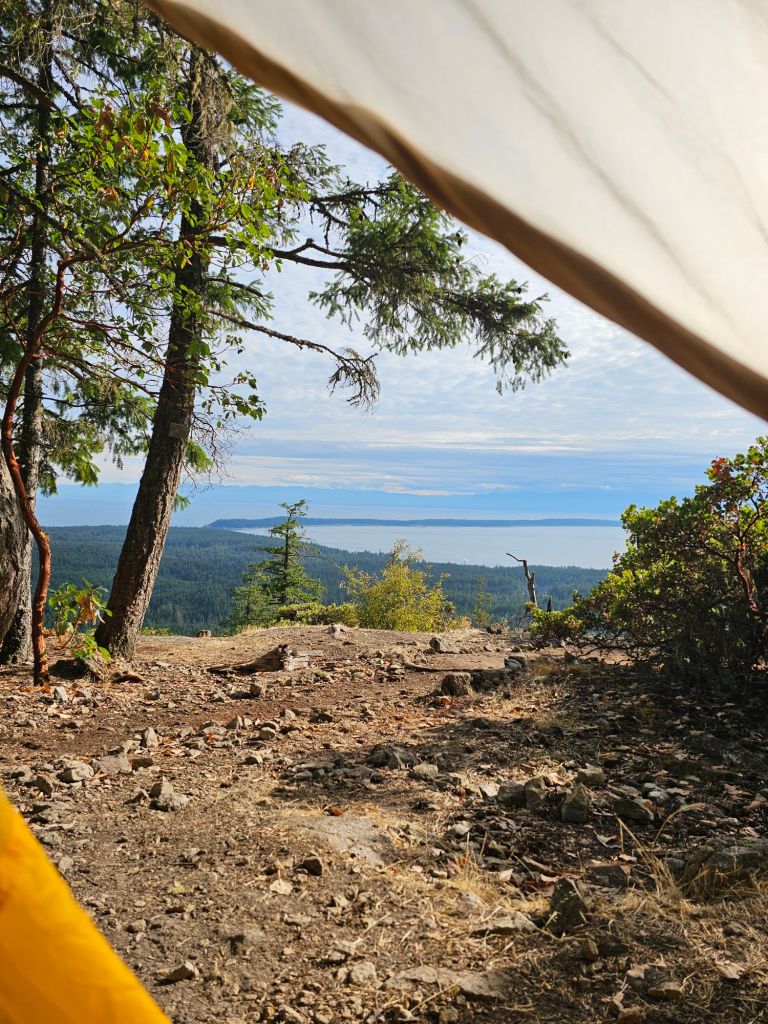
The evening of the 29th, I got a call from Brian, Jody’s husband. My first thought was that Jody was injured and because I didn’t have my Garmin on, she couldn’t reach me. Thankfully, that was not the news. “Hey, did you hear about the earthquake in Russia?” Ah, no. What a weird thing to ask, I thought. “Ya, there’s a Tsunami headed your way. It looks like Jody and Stacey will be okay, just wondering where you ended up,” Brian continued. ‘Um, close to sea level, currently’, was my response. Go figure, I kick out of one thing and into another. Brian then goes onto tell me that it shouldn’t hit Vancouver Island till 11pm or so, so I’ve got time to plan for an egress to higher elevation, if necessary. Once off the phone with him, I frantically search for all things Russia Tsunami related and Vancouver Island. In the back of my mind, I am wondering if all the other RV parks and resorts have been already notified and this particular one has been, well, left out…if ya know what I mean. I finally come upon the Tsunami Evacuation and Inundation map for Vancouver Island. As long as it stays to current mapping, I, Jody and Stacey have no need to worry.

I’m pretty sure, if we had not had our Sunshine Coast Trail hike on the “books” first, I’d venture to guess that we’d have been camping on a beach in Tofino on our Kayak trip. But as it was, we scheduled the hike around our friend Jennifer, who in the end, dropped out at the last minute. Phew. Missed that excitement…just barely.

Back to Powell River – hurry up and wait.

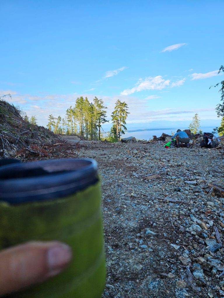
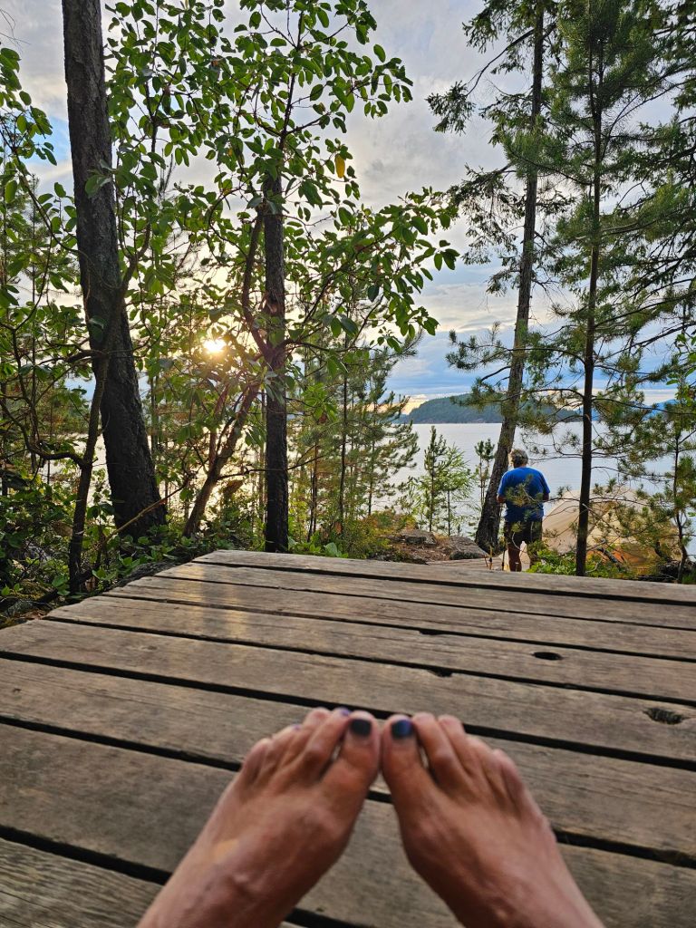
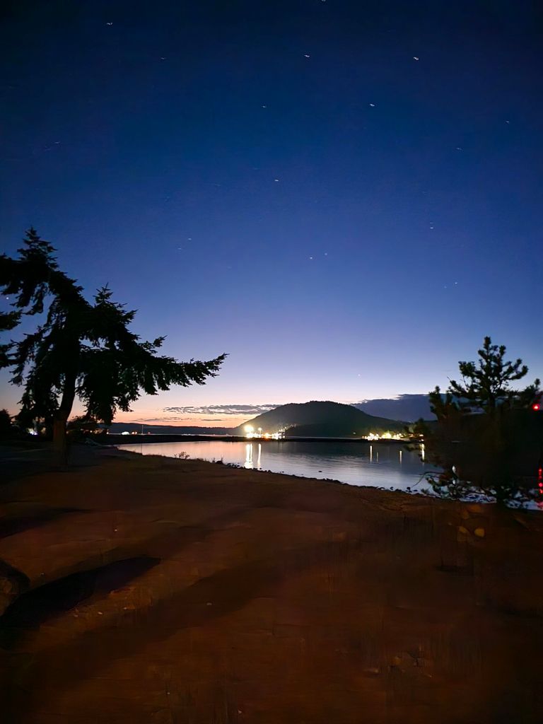
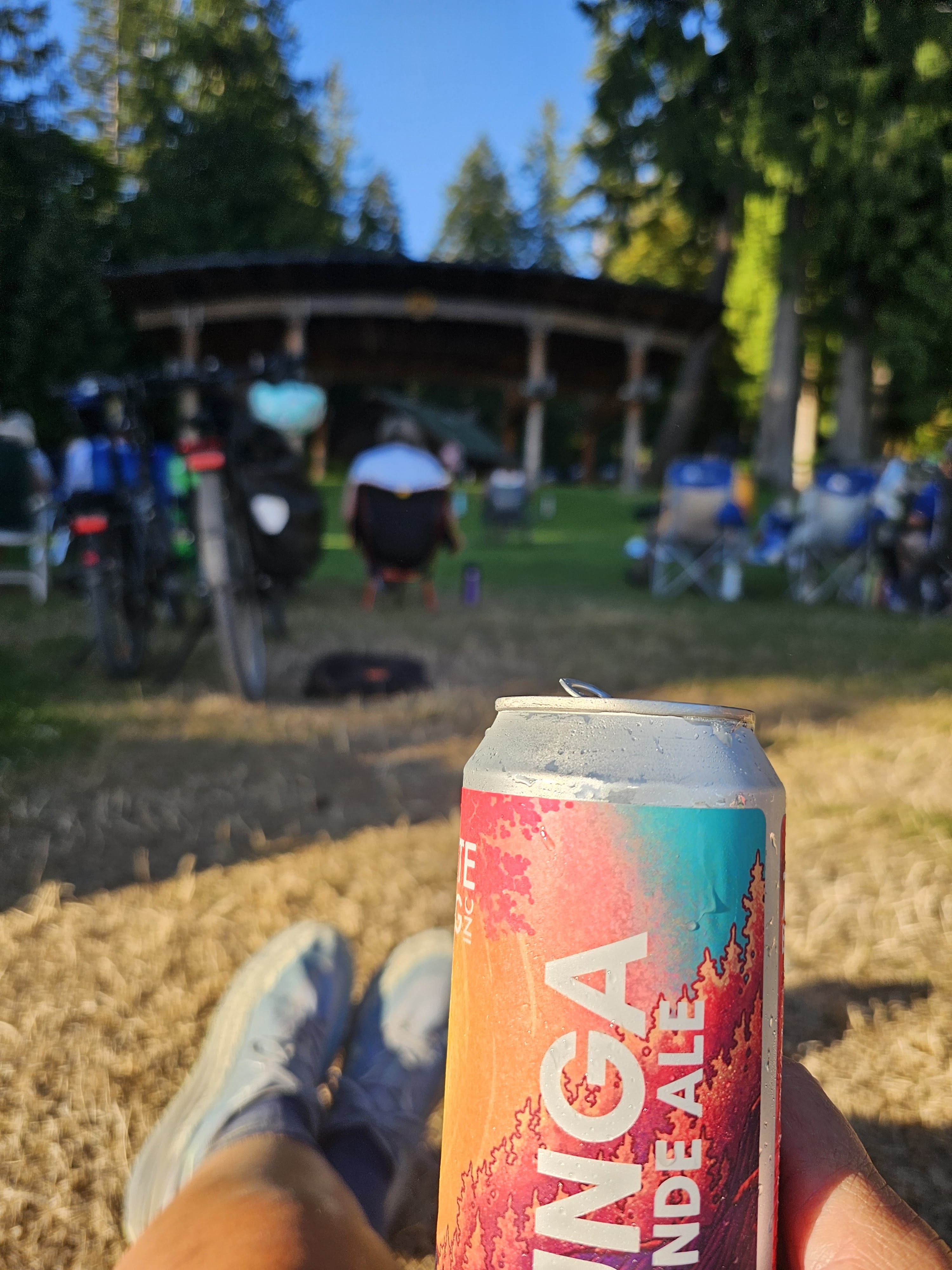
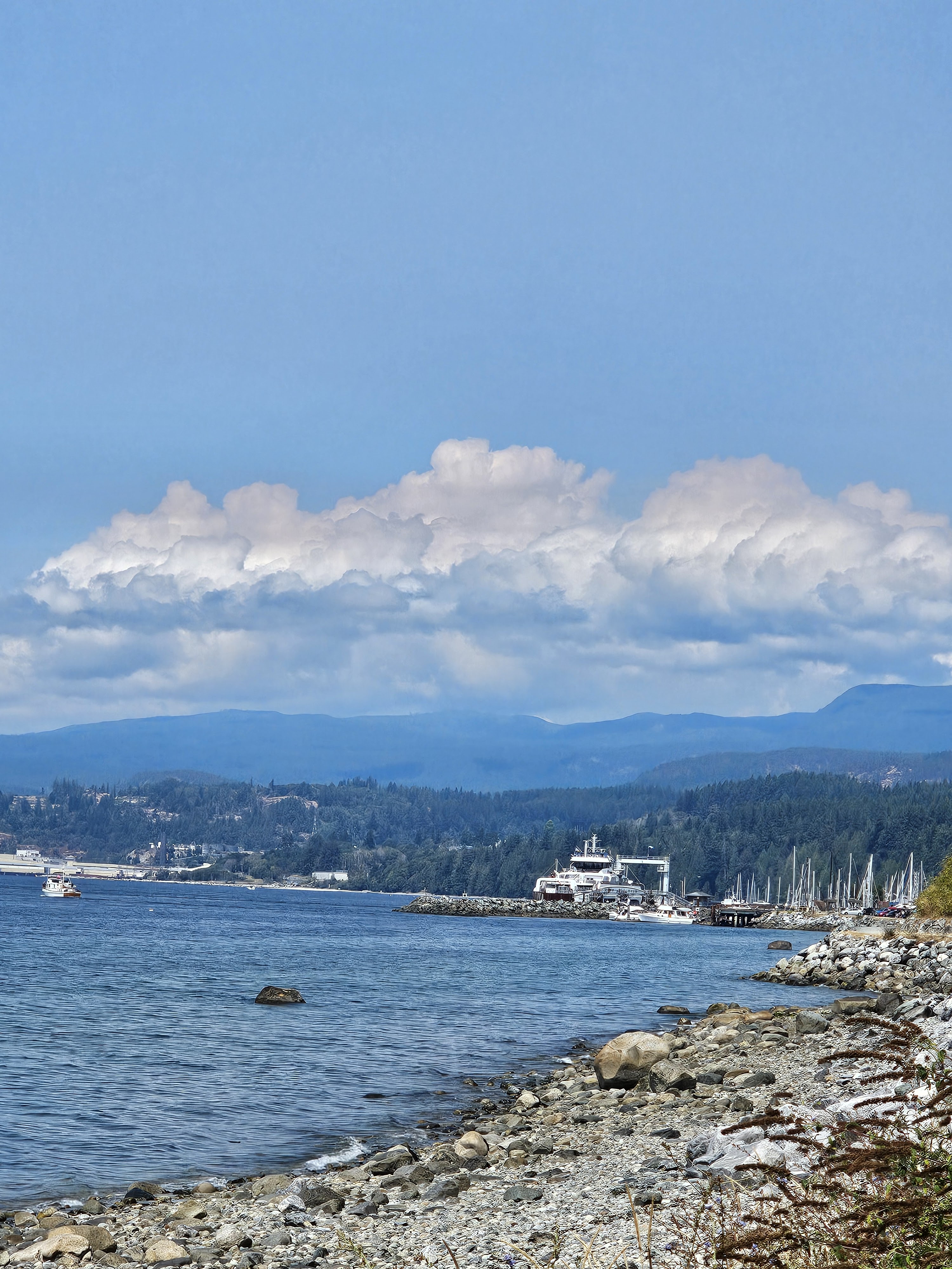
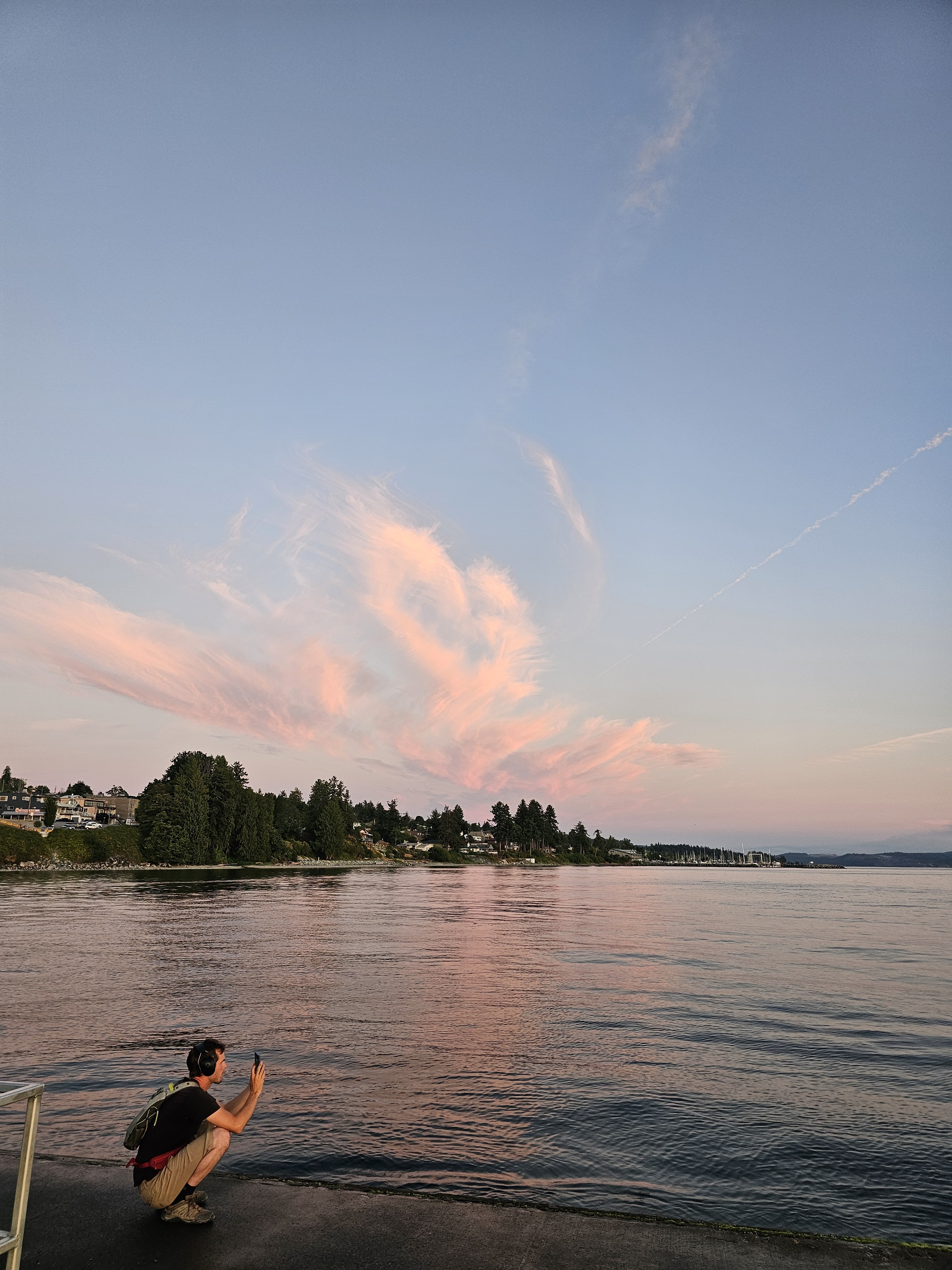
The ferry ride for me and the Beast was NOT cheap, compared to just walking on, but I had no choice. Once back across the Strait of Georgia, I settled in pretty quickly at my assigned campsite. It was a short walk to the shower and laundry facility. Time to really clean up and get to exploring things to do and more importantly, places to stay. The nice thing about the Willingdon Beach Campground is the proximity to the beach, a walking trail, the harbor, shops, a mini-put golf course with an ice cream stand, and the city park. My first night there (Wednesday) I was treated to a concert in the park followed by an amazing sunset.

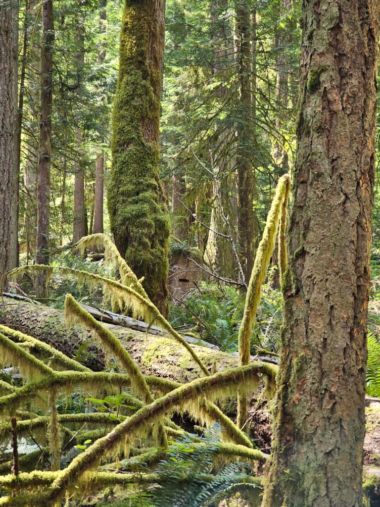
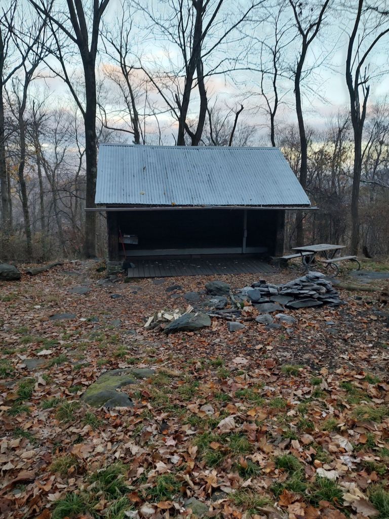
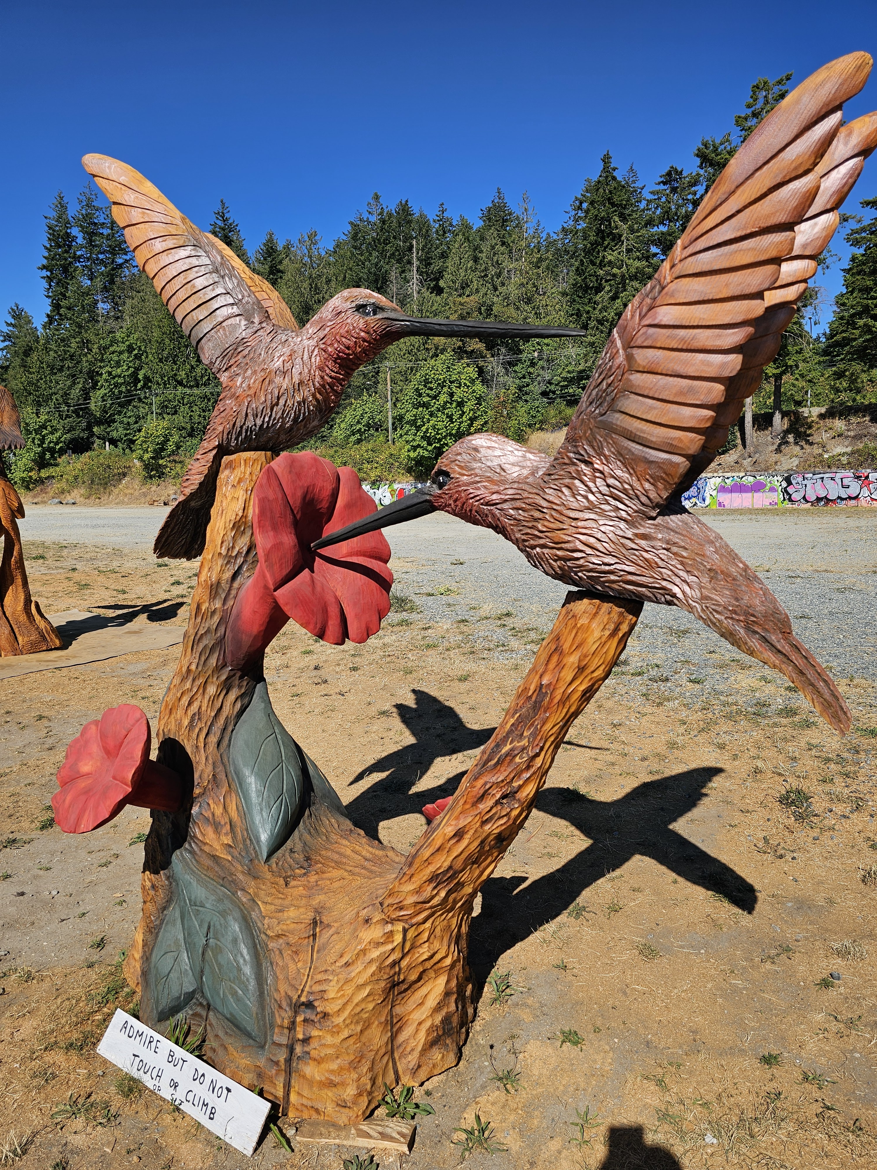
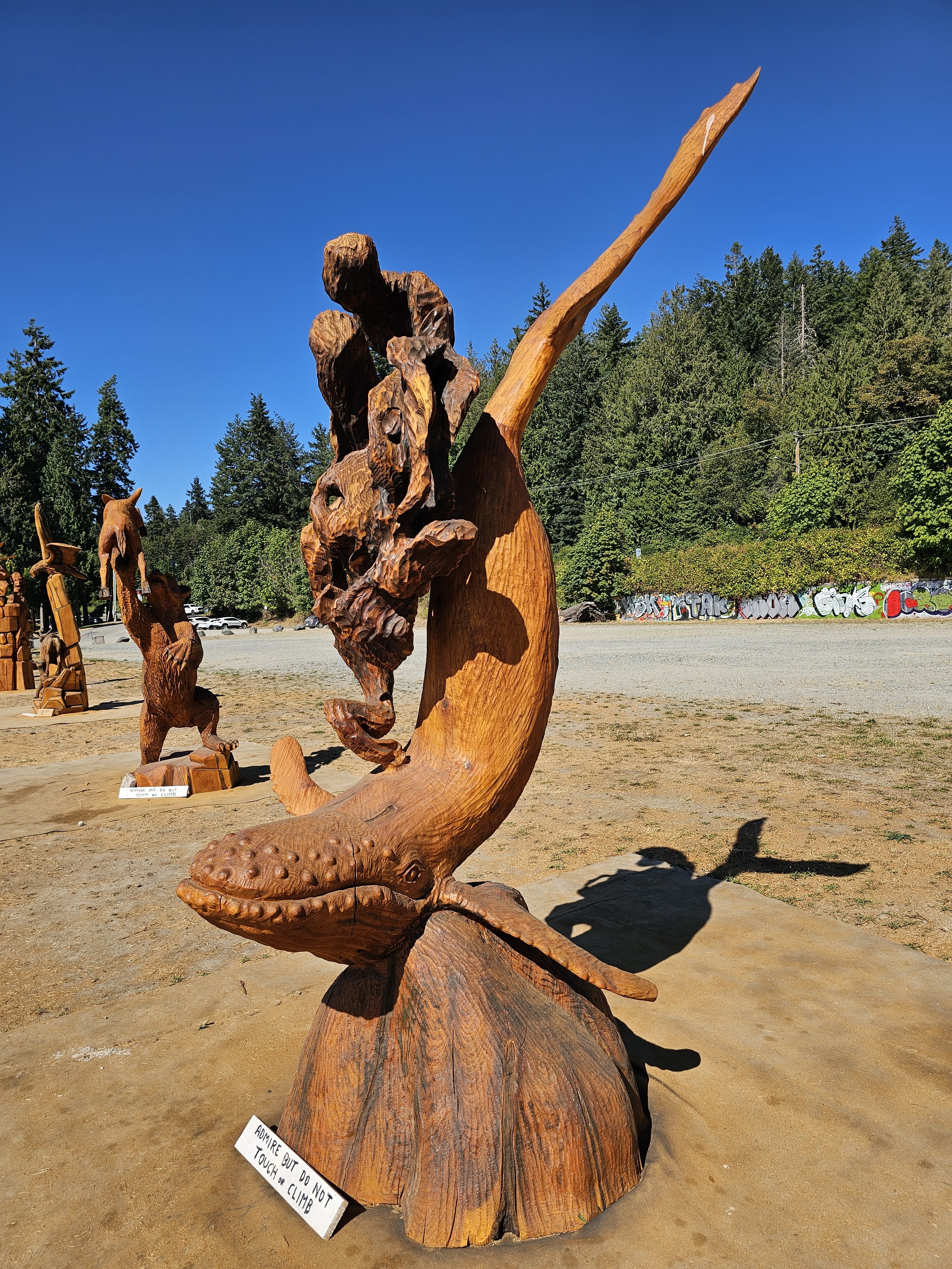
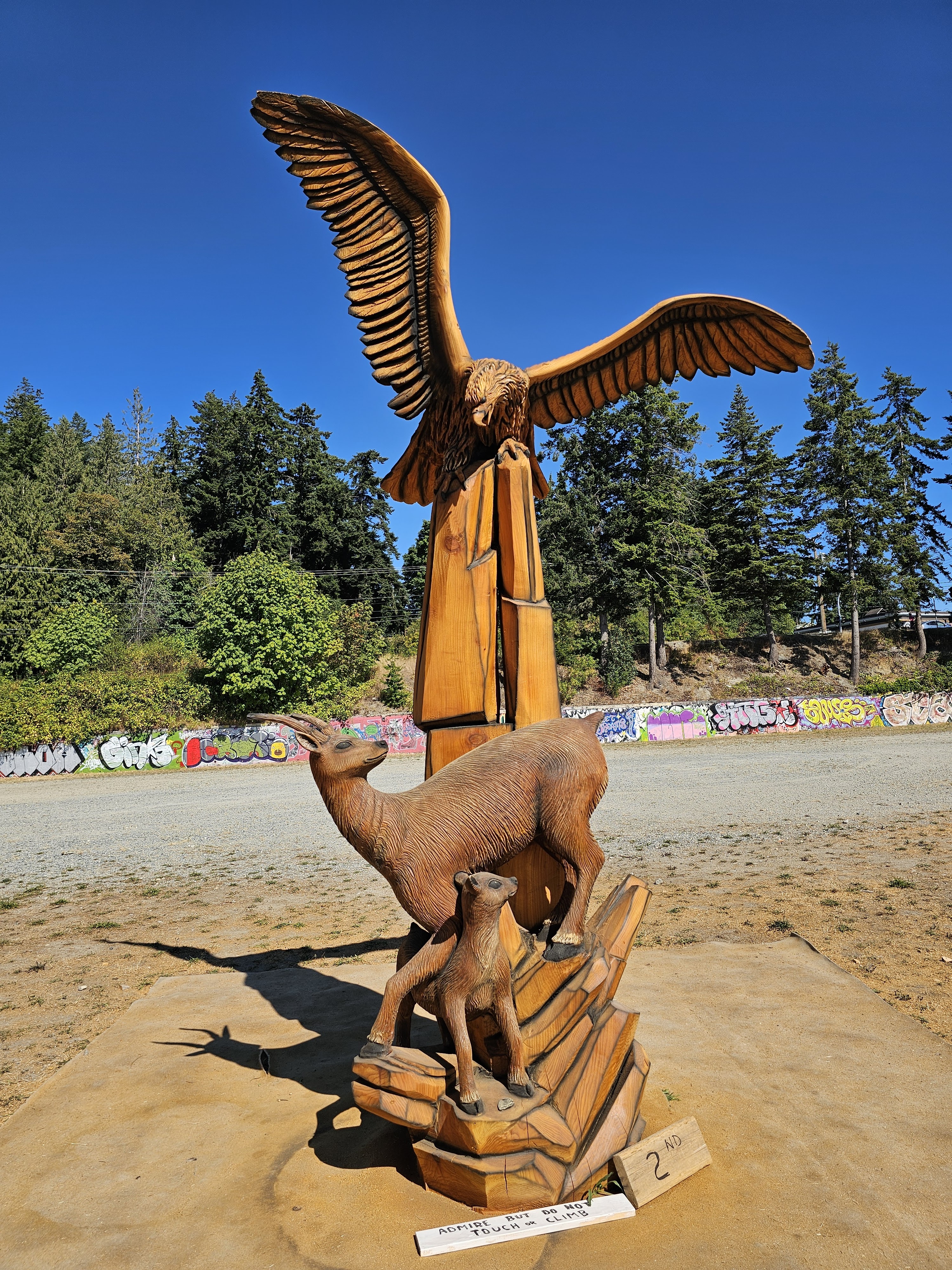
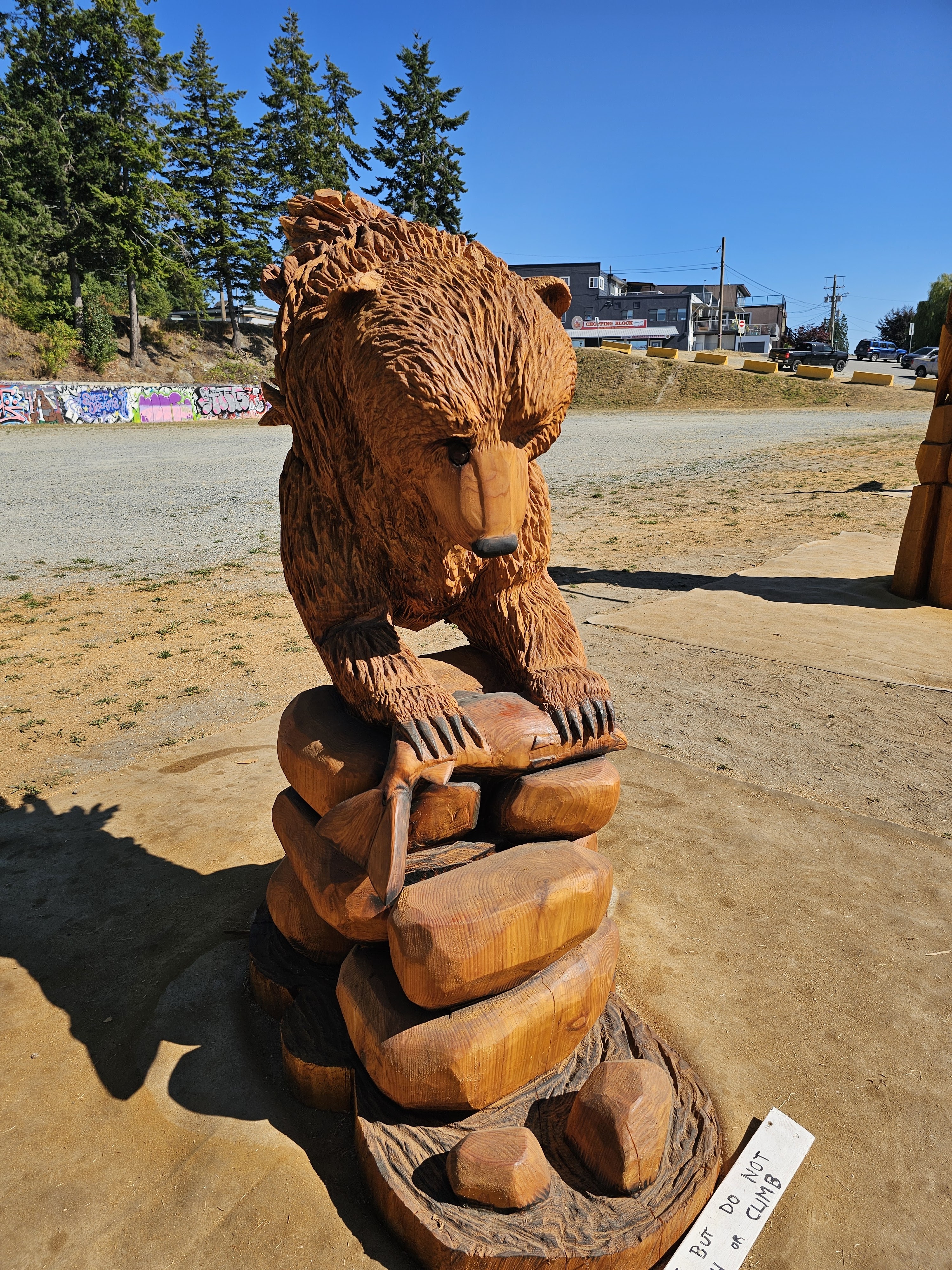
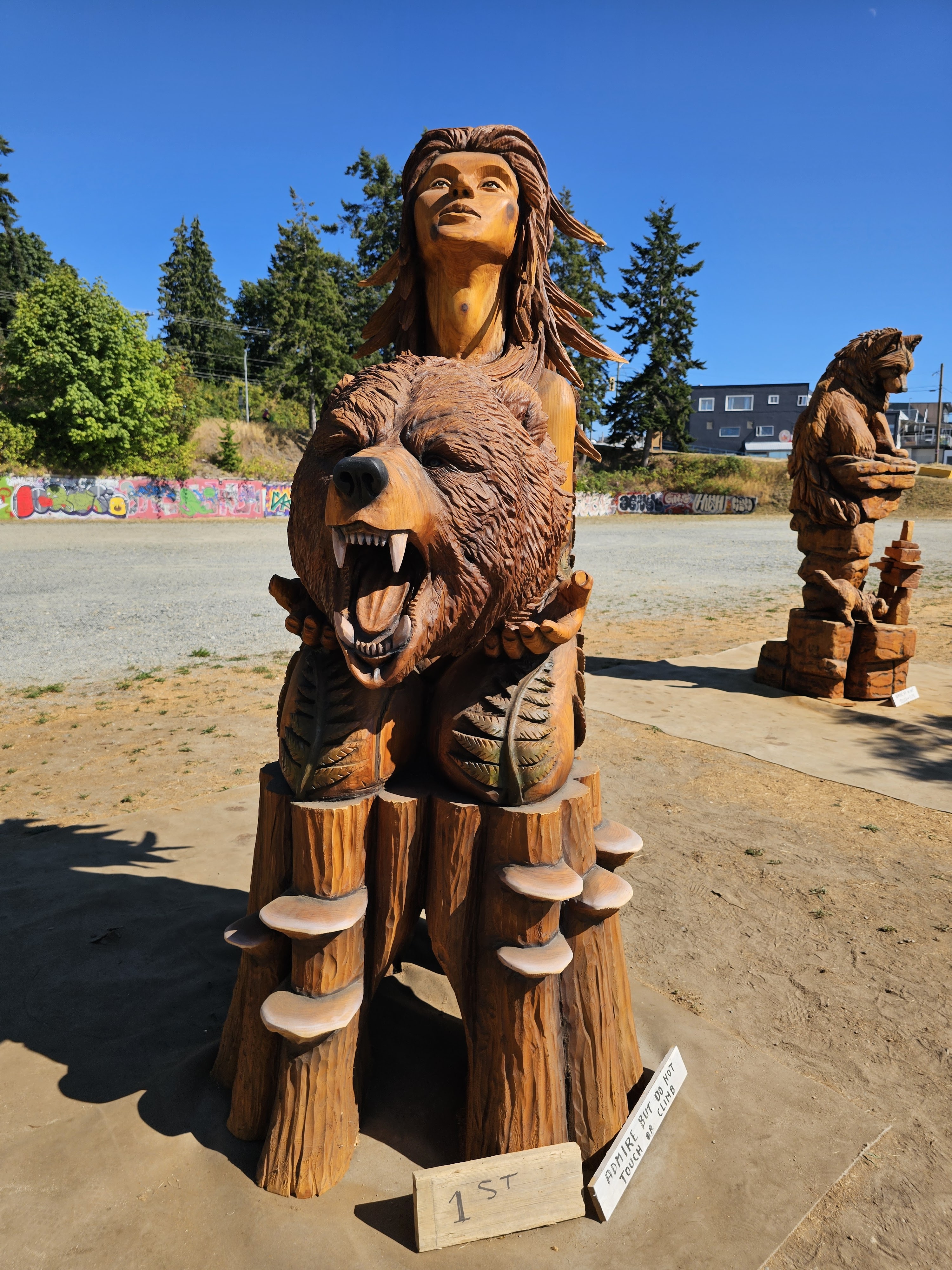
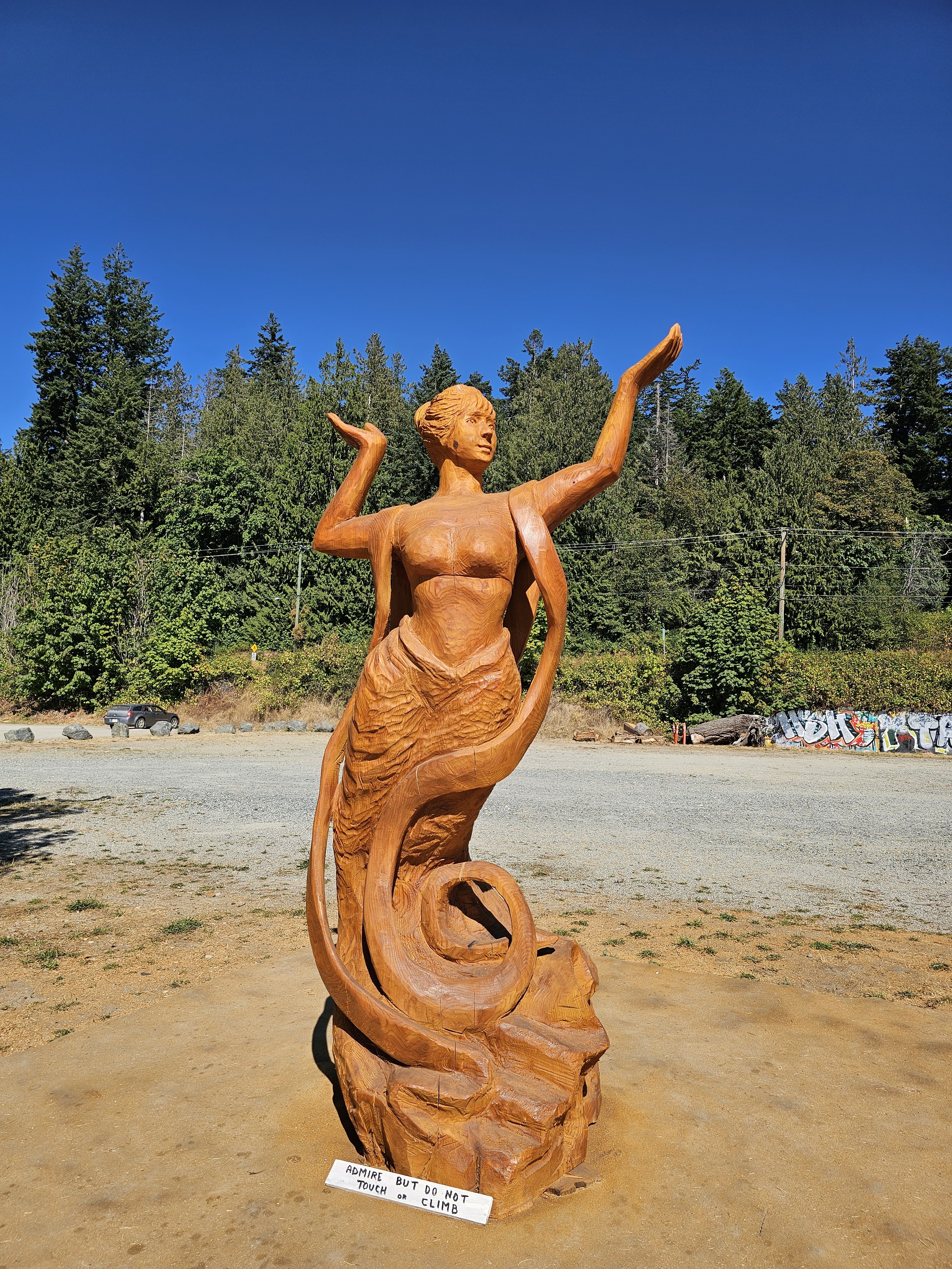
The week before our arrival to start the Sunshine Coast Trail, there had been a lumberjack competition adjacent the waterfront park, and at the edge of the park’s parking lot several chainsaw log carvings were still on display. All were made, each, from one log. The craftsmanship was staggering, with some displays simply mesmerizing.

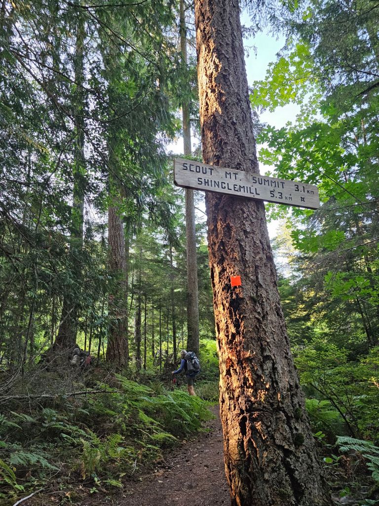
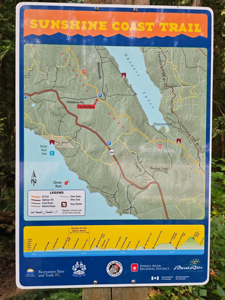
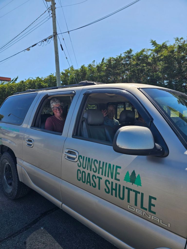
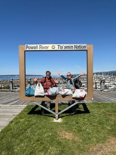
Thursday morning, I headed out to the Shingle Mill pub to drop the 4-day resupply with Justin who was meeting Jody and Stacey that morning at the Fiddlehead Landing. In their resupply, I added a few goodies of fresh food, that I was sure they wouldn’t mind carrying. After dropping off the goods, I made my way to Lund, thinking I might be early enough to find a parking spot for the Beast and maybe take a water taxi over to Savary Island, an outing that everyone has been suggesting. Apparently, I wasn’t the only one with the similar idea. There was not a parking spot to be found, and none of the campgrounds along the way that had any openings. Luckily, Justin had offered to allow me to stay on his property in the event I couldn’t find a place over the holiday weekend. Content with a back-up plan, I headed back to my camp spot at Willingdon Beach. On a whim, just before entering the campground, I checked in at the office and inquired if they had any last-minute cancelations or openings for the weekend and/or into the following week. There was indeed a cancelation, that would allow me to stay in the same place for the next 4 days, but I’d have to move to another site for the night and set up the following day. No problem! And with that, I was secure for the holiday weekend. The following Monday (Aug 4th) I was to pick up the resupply that we had had delivered to the Lang Bay Store and meet Jody and Stacey with it, so they could finish up. Maybe there might be something near Lang Bay by then, was the thinking.

What to do?

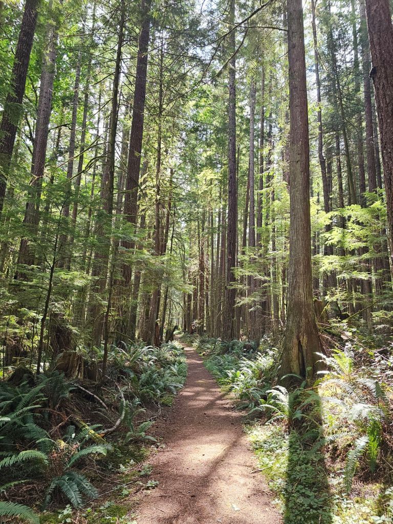
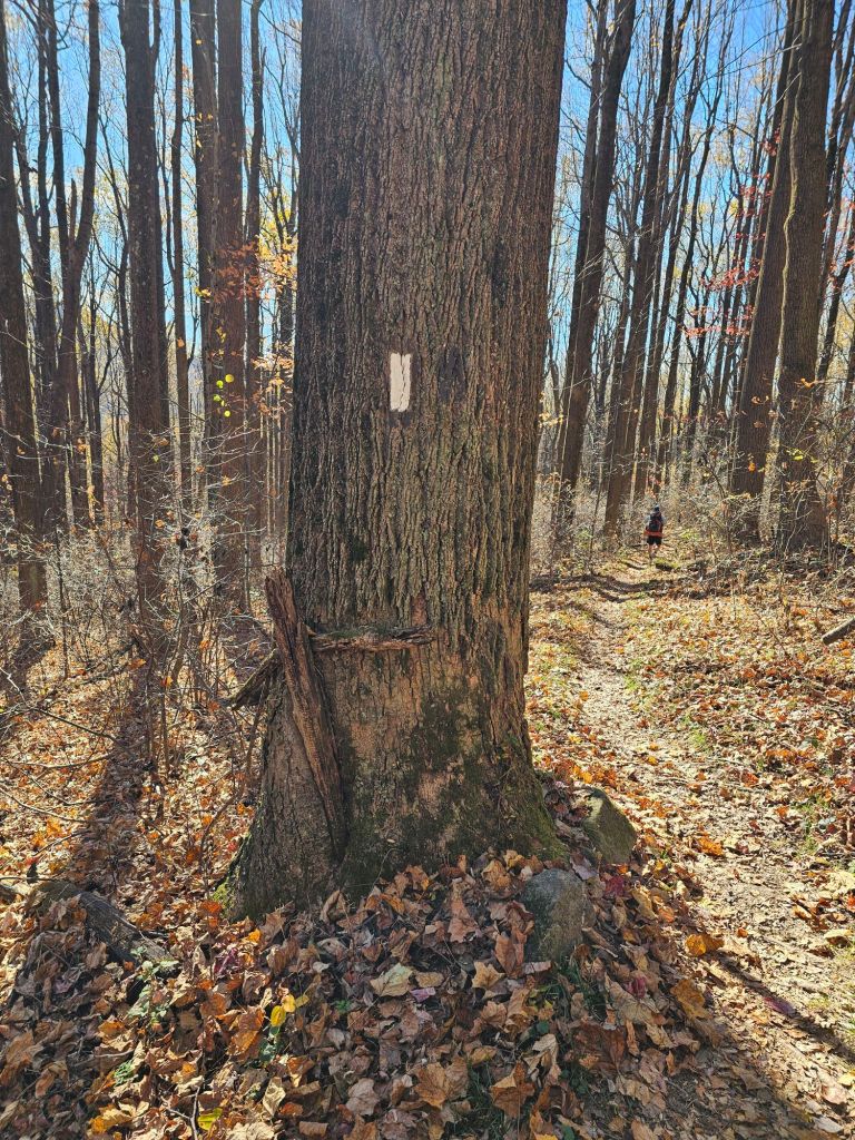
With everything secured and plenty of daylight and time on my hands, I set about exploring my surroundings. The first excursion was to take the scenic route to the Townsite Brewery just north of Powell River. It was a 2-mile walk via the Willingdon Beach Trail with a bit of “route-finding” for the finish. The Willingdon Trail is one of those “rails to trails” situations and has been since the 1920’s. Along the route are strategically placed logging artifacts from a by-gone era.

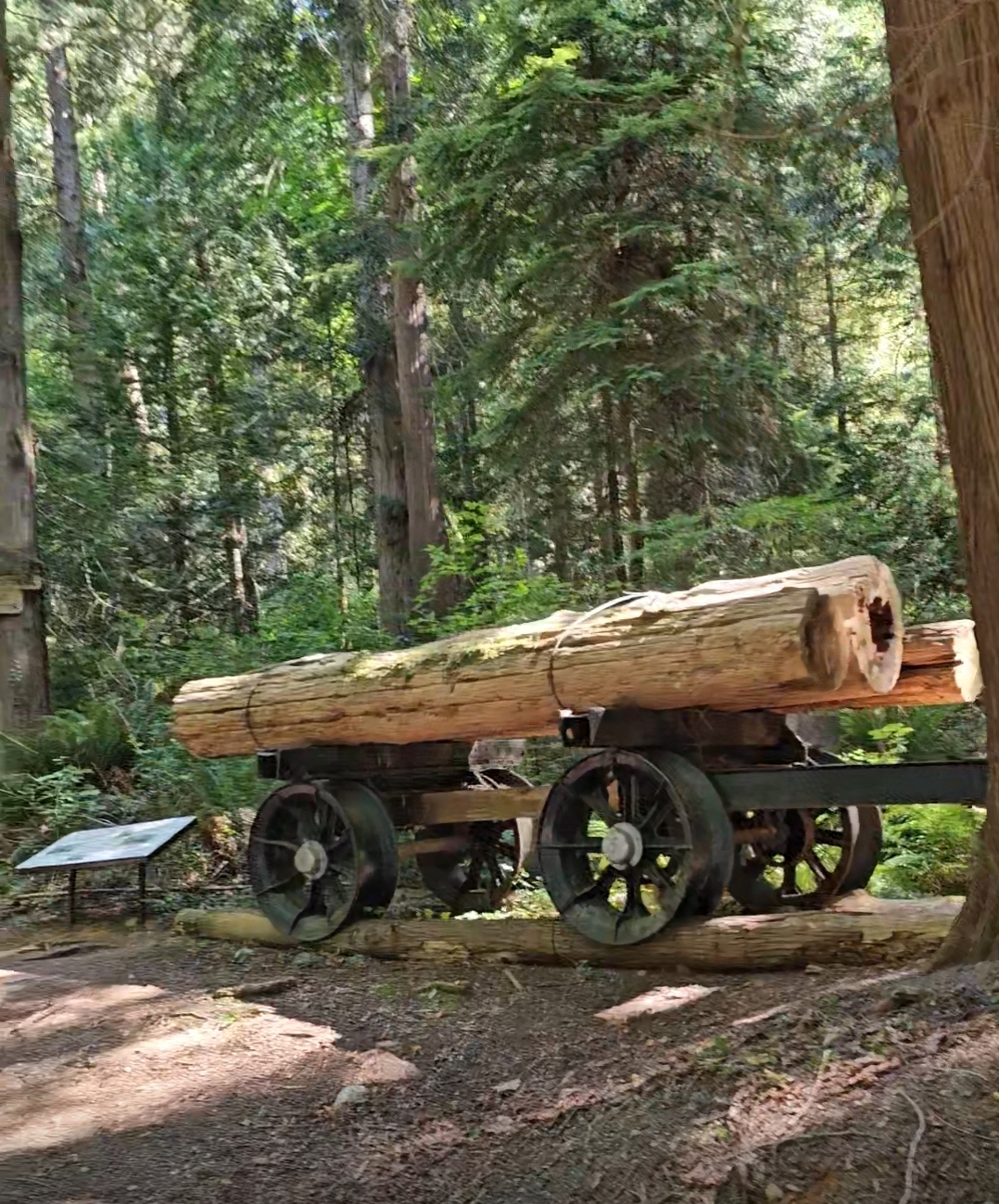
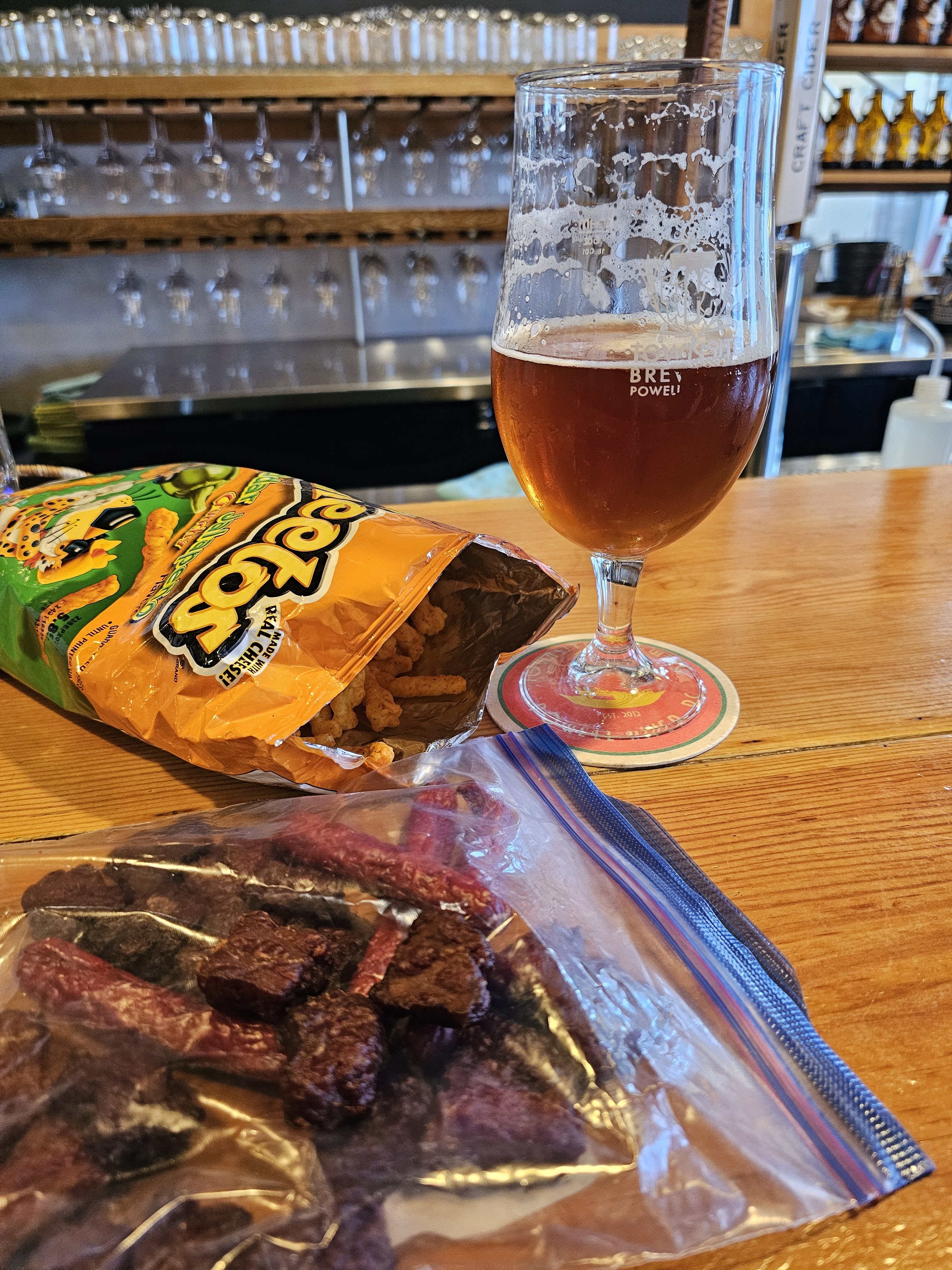
The trail is relatively flat and well maintained and allows an ocean view, with beach access and ends at the cluster of cement ships what once corralled a flotilla of logs used for the now defunct papermill. From there I followed Google Maps via the paved streets to my destination. Townsite Brewery. The airconditioned building and tasty beer was a welcome treat as the days’ heat was well over 90 degrees F. Once sufficiently satiated and stocked with a tasty selection of beer to throw in my beverage cooler at camp, I made my way back toward the campground. But, not before a swim and a nap at a beach I had spied along the way.

The following day, I retraced my steps back to the Brewery for a cool beverage and then over to the movie theatre, for the “premiere” of F1 (Formula One) with Brad Pitt. Turns out this theatre has some history behind it. It happens to be the oldest operating movie theatre in Canada. The Historic Patricia Theatre. In continuous operation since 1913!

Historic Patricia Theatre, Powell River BC

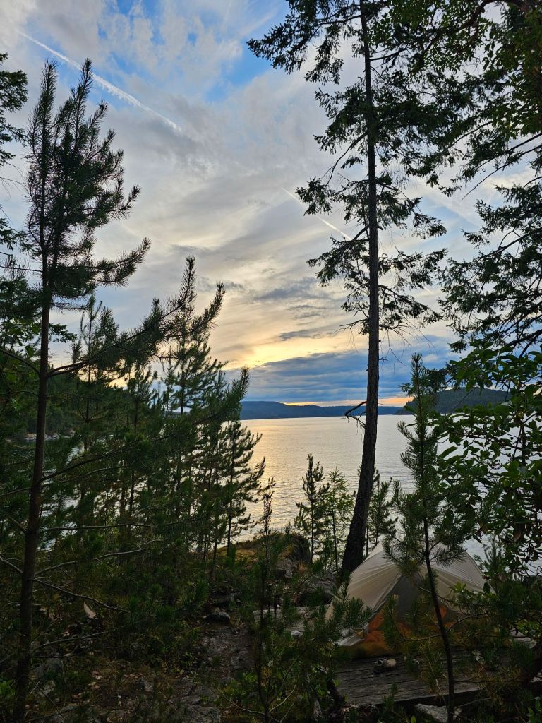
The next two days included, a harbor walk, church, perusal of a farmers’ market, more swims and amazing sunsets.

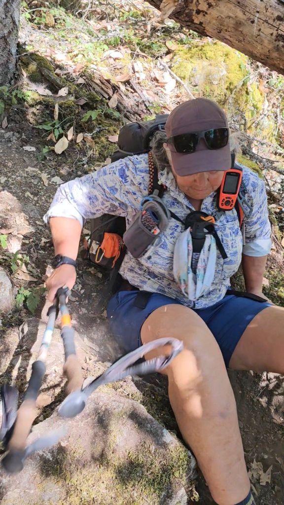
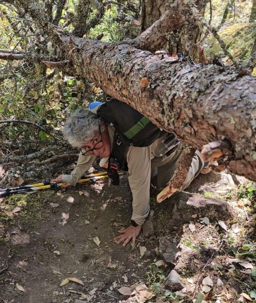
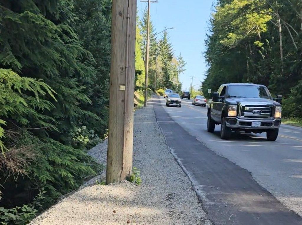
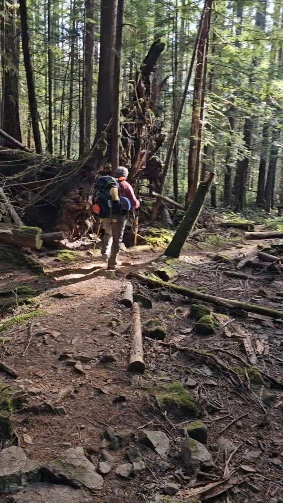
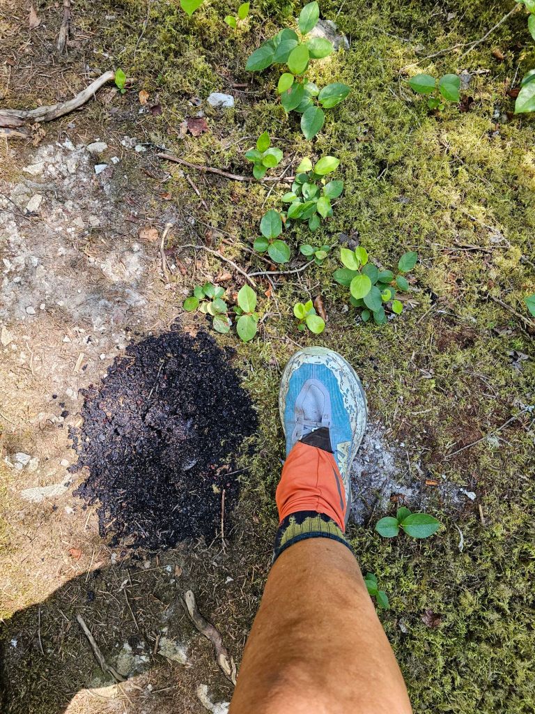
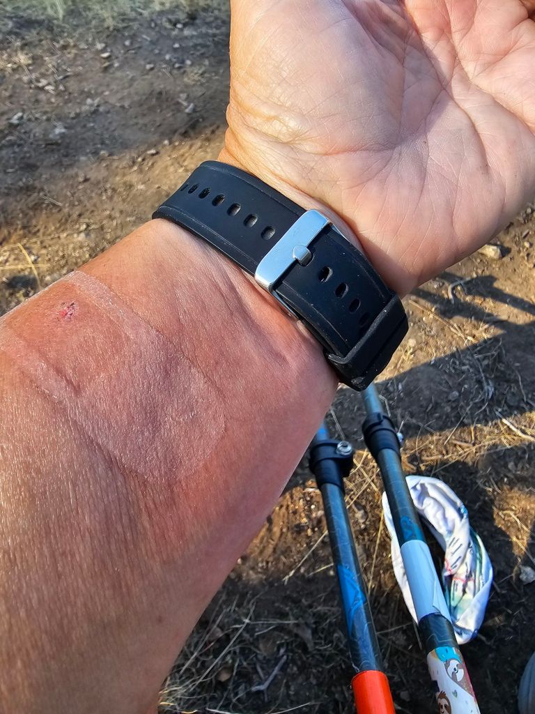
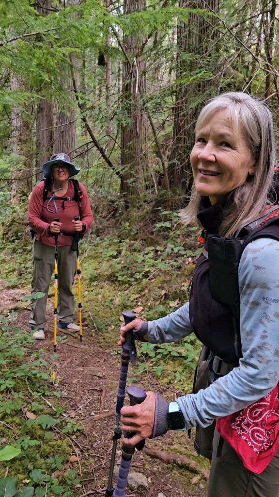
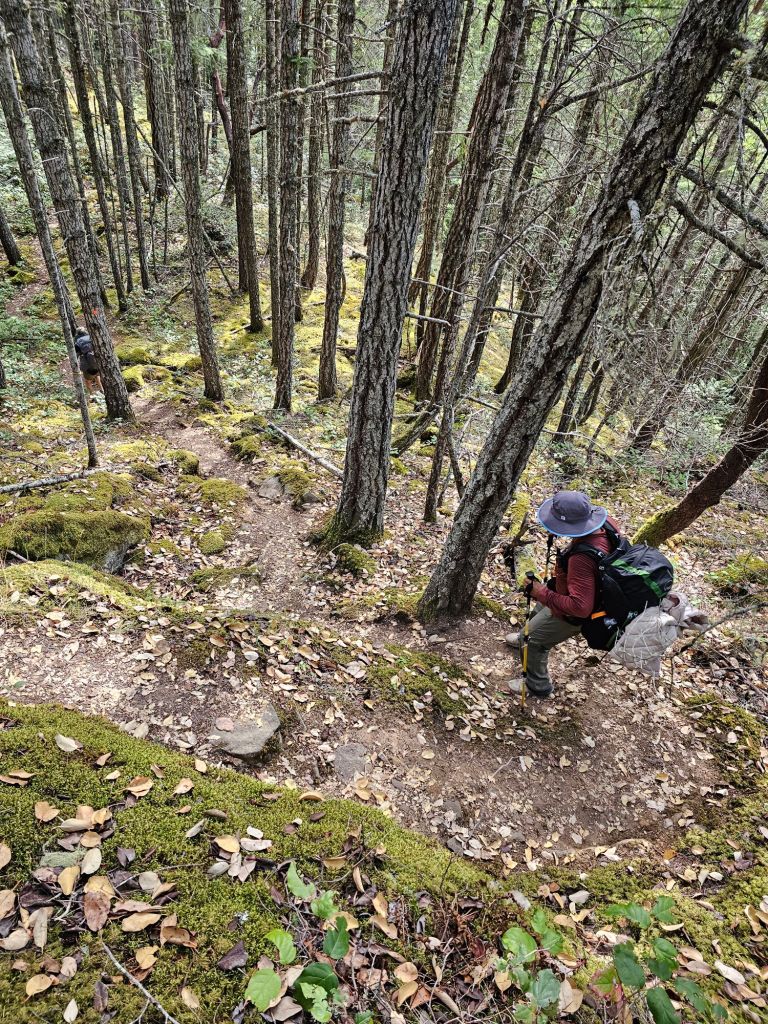
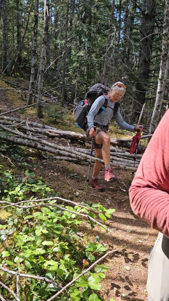
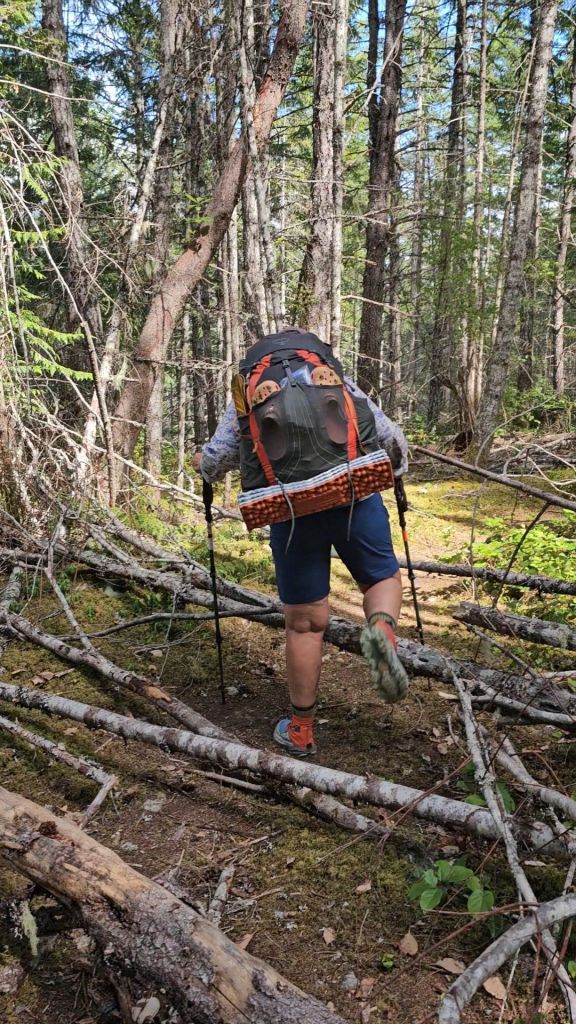
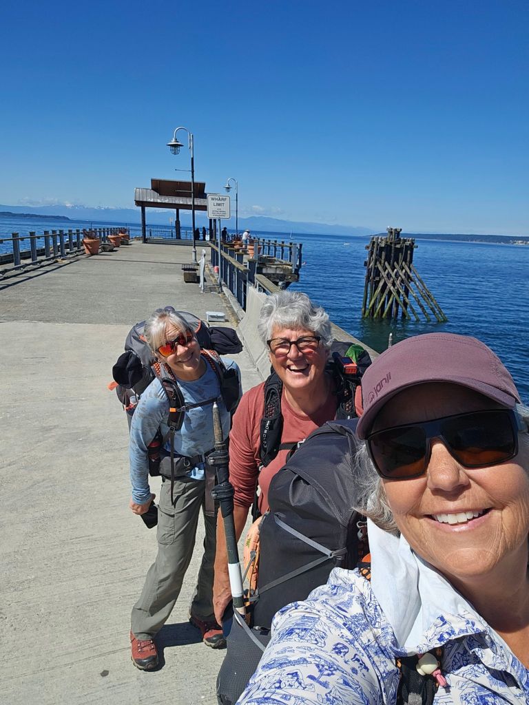
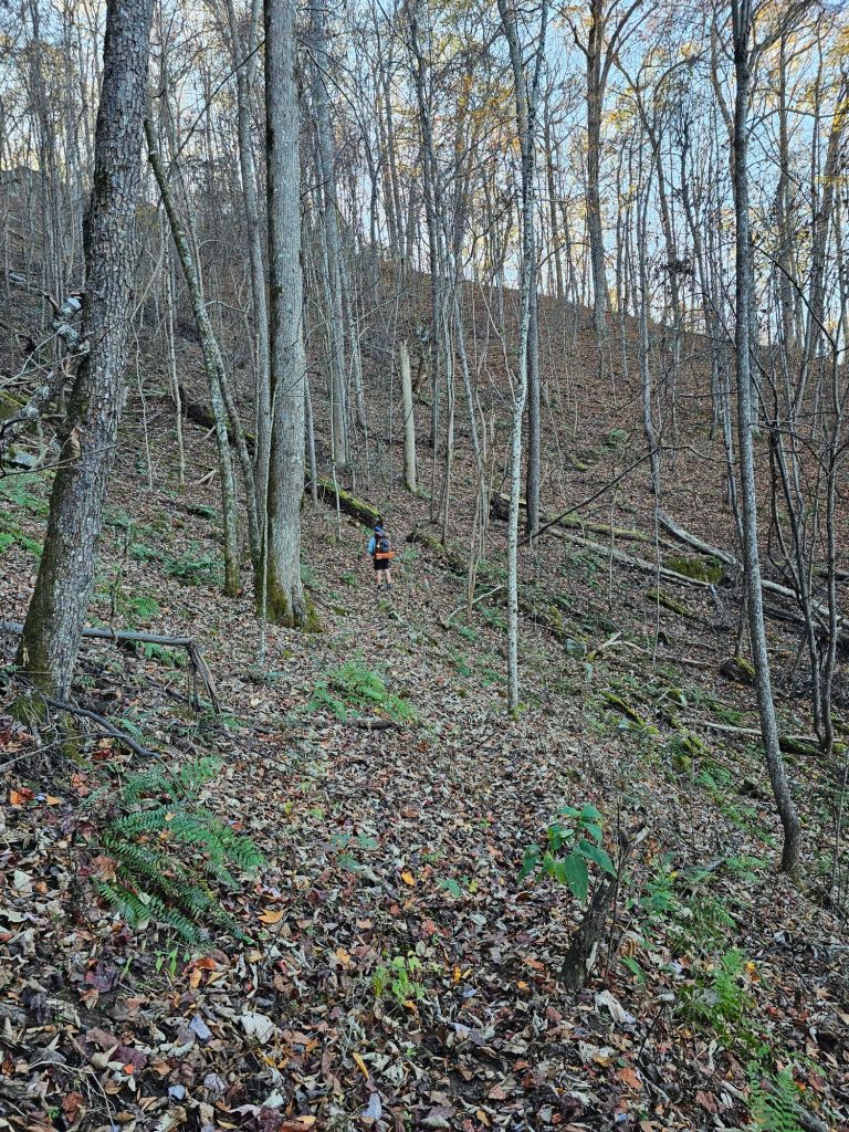
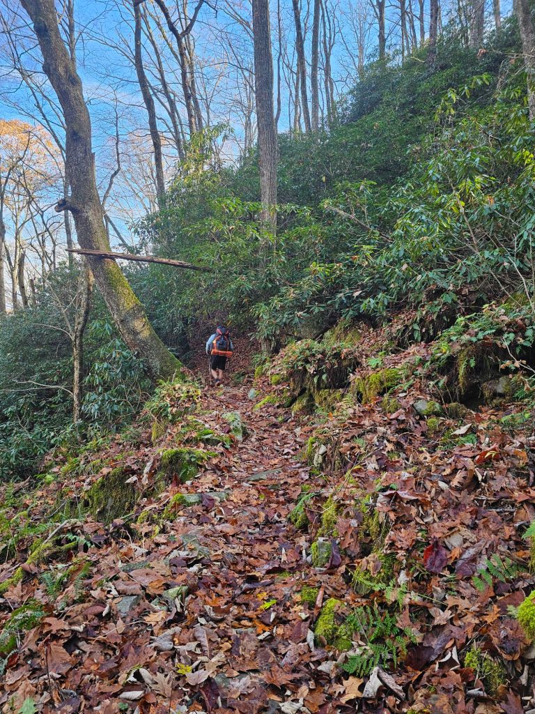
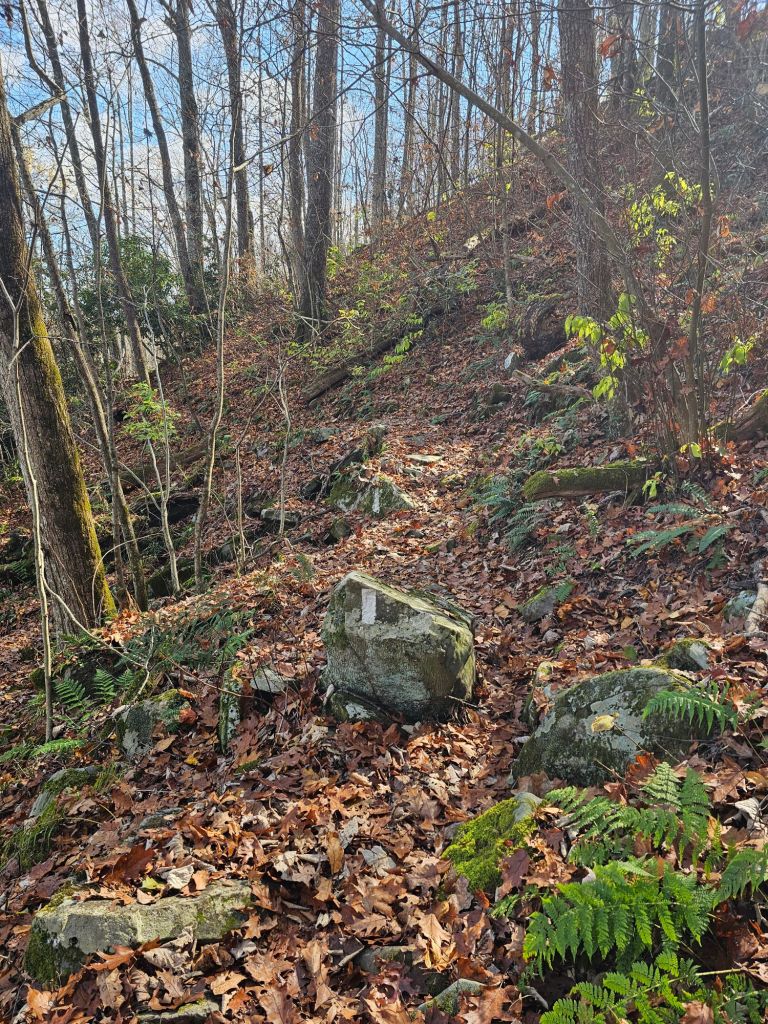
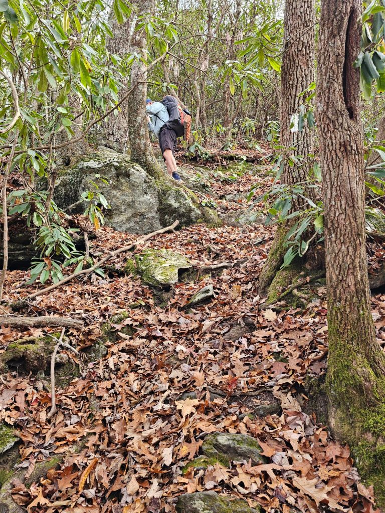
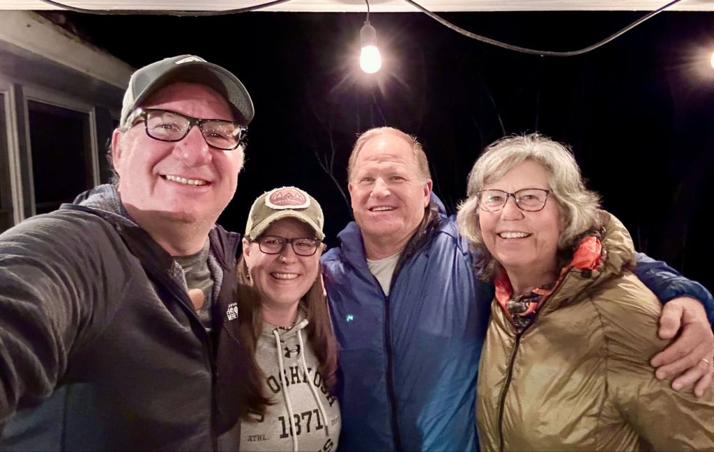
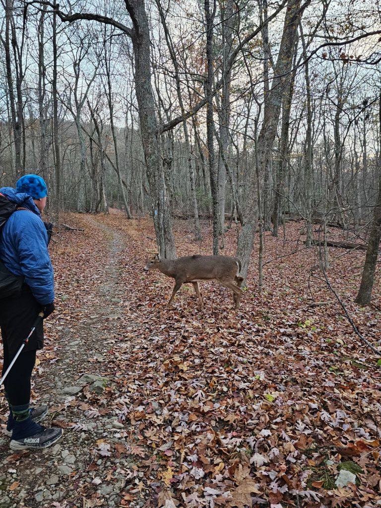
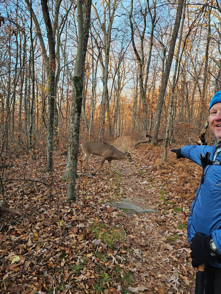
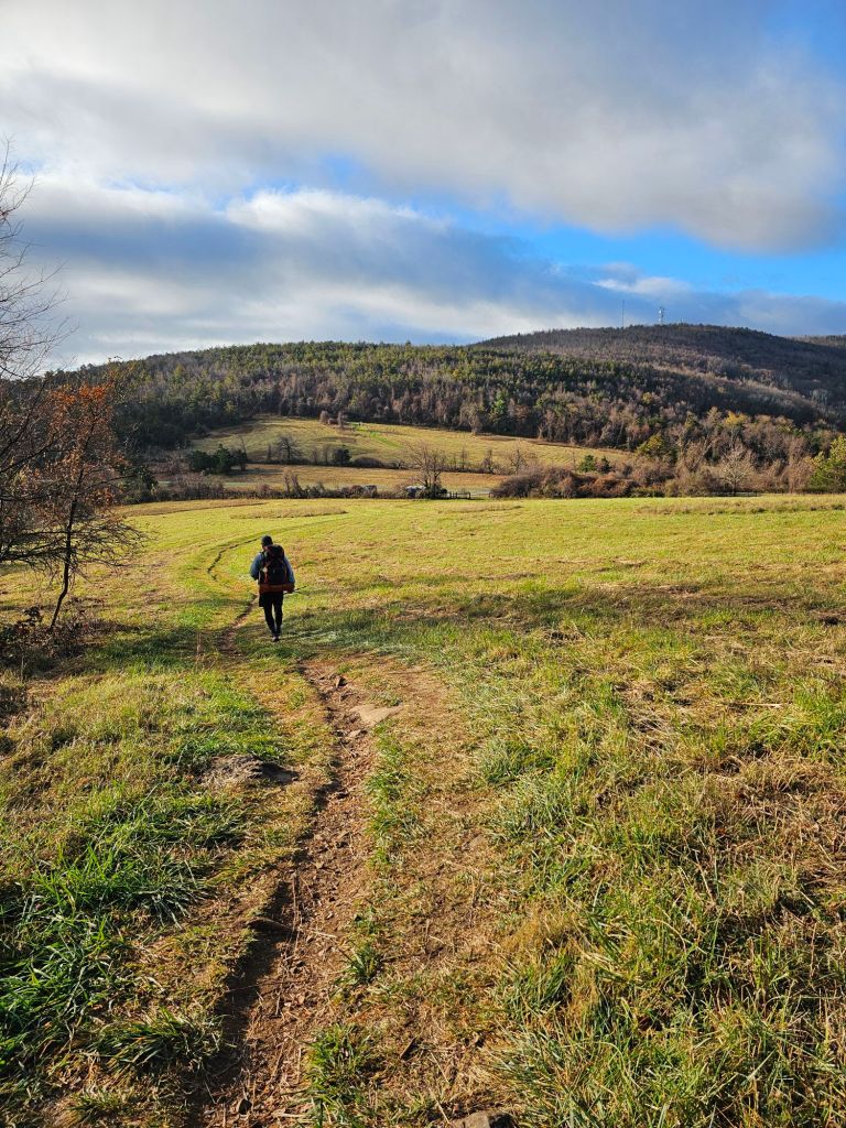
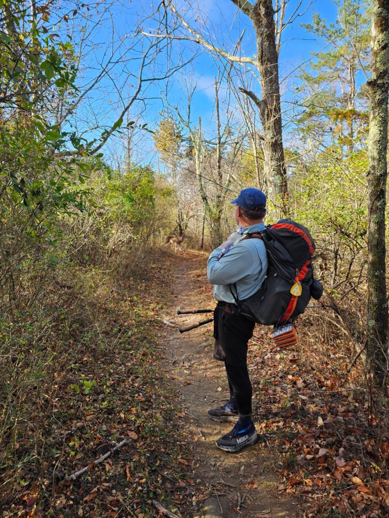
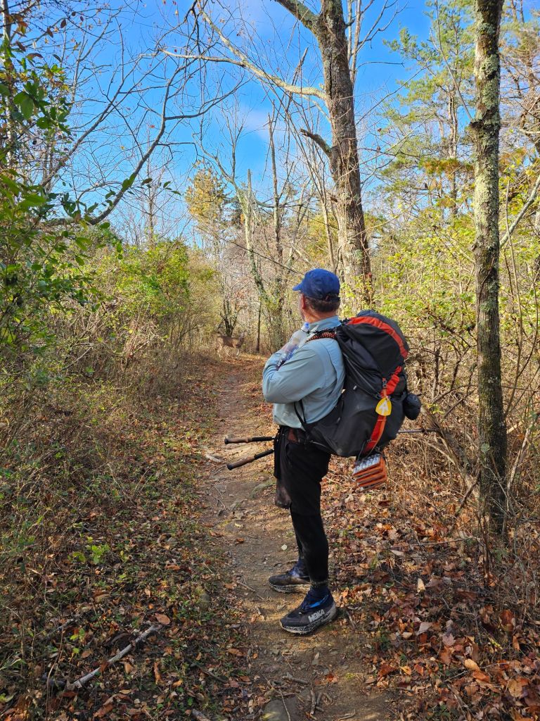
By the time Monday came, I was ready to move on. I had run out of things to do…by myself. I’m not much for sitting around, so when I got the call from Stacey’s husband that Jody had injured herself and that they were going to get off trail at Lang Bay, I was a little more than excited. I missed my friends and hoped Jody’s injury was not catastrophic. At one point, Jody had cell service, and we worked out a plan to meet up. Turns out Jody’s knee was “trashed” due to the significant climbs and descents over the last 4 days. She told me that I had definitely made the right decision by getting off trail when I did. Before leaving the campground, I inquired as to whether they had an open spot for the night, as I was to check out of my current one. They did. And with that I paid for the site, as well as securing additional shower and laundry coins. After a quick stop by the market for icy cold beverages and some KT tape (for Jody), I headed out toward the Lang Bay Market to pick up the resupply packages and then traveled a rugged road to where the trail met the road. I encountered several people hiking the Sunshine Coast Trail and inquired as to whether they had come across my friends. They all had but said that Jody was moving very slowly and were probably a couple hours back. With that, I made the decision to don my smaller 22L pack, load up on some water and make my way toward the two. For the past 4 days, I had been walking 6-8 miles a day with relatively no pain over fairly flat surfaces. Today would be the test of uneven surfaces. Besides, I didn’t feel like waiting by myself in the heat for 4 or more hours. Determined to meet them and relieve Jody of some of her pack weight and assess her knee, I started on trail. After nearly 1.5 miles and remembering reading about the prevalence of bears in the area, I realized I had forgotten my bear spray. Shit. As I did not want to have a story written about my stupidity, I turned around. Let’s hope I make it to the truck with no encounters, I prayed. Once to the truck, I retrieved my bear spray and retraced my steps. Another 1.5 hours and a little over 4 miles of ups and downs, I reached Jody and Stacey. Jody was moving at a snail’s pace, and it was concerning. By that time, I was nearly out of water, as all the water sources that were indicated on the map were dry. They had plenty. After a swap of water, packs and the taping of Jody’s knee, we began the mostly downhill march to the truck.

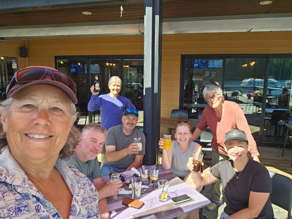
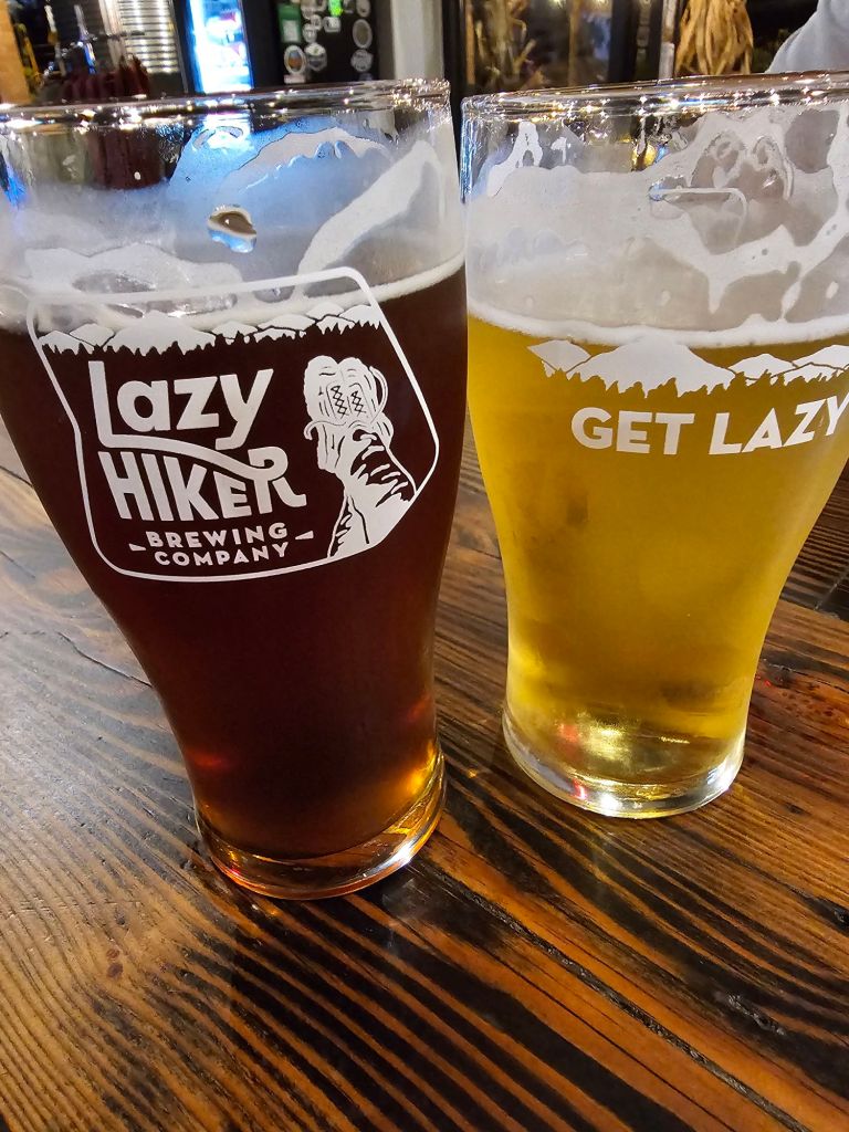
Once we reached the truck, I couldn’t help but notice the relief in Jody and Stacey’s face. They had had enough. I told them that I had secured a campsite for the night and shower and laundry tokens for the both of them. They were delighted, but first, a cold beer at the brewery and then to find an open restaurant, as Monday was the BC Days holiday. Unlike here in the states, where most everything is open, especially in “tourist” towns, most everything in Powell River was closed…go figure.

Once satiated with good food, and a shower (albeit a cold one due to over-use, and a full campground) and clean clothes, we set about to making an exit plan. Do we wander about the coast or head back to Vancouver Island? The plan was to see if we could catch the ferry back to Vancouver Island the next morning. This would get Stacey back to her car (and on her way to visit her mother) and allow Jody and I to meander toward Tofino for the start of our next adventure. But first we’ll have to find a new air mattress for Jody, cause I’m gonna need mine back for the Kayak trip.

Stay tuned for the Tofino Kayak Trip…

Posted in Uncategorized | 1 Comment

Sunshine Coast Trail

Day 5: 6K , 1926′ ⬇️

Little Sliammon – Shingle Mill Pub

Even though the day before was “short”, it wasn’t easy on the feet. I awoke comfortably settled with my decision. We had a nearly 2000′ descent over 3K this morning. But first, we had to get up to Scout Mountain. This was going to suck. But, an end (and beer) was in sight!

After eating the very last of all of our food, we packed up. The trail meandered through a fairly dense forest and started to climb. Once we crested the high point, we were treated to a cool breeze and an amazing view of Powell River.

Here we were treated to a view of “civilization” and cellphone reception. Stacey called her mom, and I decided to check and make sure that the Shingle Mill Pub was open, as it was a Monday.  Typically, these “recreation” towns are open through the weekend and closed either Monday or Tuesday. We were in luck. They were open, but NOT until 11 am. Thus, there was no hurry, which was fine with us.

We wandered and chatted as we walked. Stacey had already been examining the places where I could (possibly) meet them. Stacey, is not a decision-on-the-fly kinda gal, unlike Jody and me.  She is a planner. Of which we were thankful.

We continued climbing to the next Crest and passed the group of four whose packs set aside for the scramble up to Scott’s Mountain. We decided to pass on that vista. Now for the descent. Definitely steep and a bit 4wd mode if you didn’t have trekking poles.

The descent was sans switchbacks for the most part. As Jody says, “the switchbacks needed switchbacks “.

Jody led the way. Her feet slipping out from under her due to little to no tread. “Hey when you’re in town, maybe you can buy me some new shoes and bring them to me,” she chuckled.

Eventually, the trail evened out to a wider and “flatter” track. We passed maple trees, blackberries, and a significant amount of bear poop.

The group of 4 caught up with us near the bottom of the final descent. We walked and talked all the way to the pub. We arrived to the Pub just as they were opening.

Time for fresh food! Adult beverages and charging of electronics.

We ate, chatted and hatched a plan to reduce Jody and Stacey’s food carries to 2 and 4 days. From Shingle Mills they would carry 2 days of food, and from Fiddlehead Landing, they would carry the remaining 4 days.

Where there’s a will, there’s a way.

While scouring the internet and all things Sunshine Coast Trail, I discovered Justin, who operates a water taxi that runs hikers to Fiddlehead Landing. I called and told him our predicament.  He agreed to run Jody and Stacey’s 4day resupply up to them for $100. Total deal. And with that, Stacey and Jody went about parceling out their food supply, and I looked at ferry times back to Comox.

After calling our husbands and letting them know of our updated plans, it was time to get a move on. I had a ferry to make and Stacey and Jody had some miles to crunch.

See ya later…

We parted ways at the Powell River bridge. Stacey and Jody turned left, and I continued along the shoulder of the road. I had 3 miles to walk and 2 hours to catch the 3:30 pm ferry. Totally doable, provided I don’t get hit by a bus. I would have taken public transit, but my app said it was running late. So, walk it is.

Two-thirds of the walk was via a raised sidewalk. The rest was walking on the shoulder facing traffic. I only had to jump off into a ditch once.

I made the ferry with 30 minutes to spare.

To be continued…

Jody Chronicles…

We spent nearly 2 hours at the pub. This would have been sufficient to charge any number of devices. With 30 minutes before our set time to exit the pub, Jody discovered that the outlet she had plugged in all her electronics was dead. Nothing had charged! Her Garmin. Her phone. My tiny light. Her battery packs. Not a single device! Shit! Good thing I was getting off trail. And with that, Jody was now carrying my air mattress, head lamp, and charging block. (I’ll stuff another charged block in their Fiddlehead Landing resupply)

Posted in Uncategorized | Leave a comment

Sunshine Coast Trail

Day 4: 9.1K (900′⬇️ 1968’⬆️)

Rieveley Pond – Little Sliammon Lake

Today was intended to be “short” miles, or in this case kilometers. I feel like a smuck for putting in such low mileage, when I know I’m capable and have hiked waaay more, day after day, for months. However, it was clear that this trail was much harder than expected, and my foot was NOT fully healed. Shit! In a quandary of what to do, we decided that we’d do a “short” day and lay up before the big descent to Shingle Mill Pub and our next resupply. The “flat” and the climbs weren’t so bad, but the descents were painful.

The first part of the day included pleasant forest tread, in a green tunnel of sorts. We stopped for a liter of fresh water from a pooling waterfall (Applewood Falls). A freshly built bridge, built with the surrounding available lumber stretched across the flowing water. I think if it had been later in the day, we would have been motivated to take a dip in the crisp cool water. We had however, a lake swim “scheduled” for midday (Sliammon Lake), and at our final destination for the day, Little Sliammon. We wandered through old-growth Maples and differing terrain that did its best to grow atop underlying granite. Narrow creeks and rivers with waterfalls devoid of their grandeur so late in the season flanked us on our right as we descended (and then climbed and descended again) to Sliammon Lake. We had intended to have lunch and to swim there, but I was itching to be done and off my feet.

With essentially 2 more miles to go, Jody and I took a break at the water’s edge past the campground at Sliammon Lake.  It was hot. I was grumpy and my feet were on fire. I took my shoes and socks off to soak my feet in what I had hoped was cold water. I slipped on what my mind immediately recognized as slick rock, but forgot to tell my legs and feet. I recovered enough to not go for a full swim, but not enough to keep from scraping the back of my calf and ankle on the sharp rocks. The tepid water and slimy rocks doused any thought of an intentional swim. Lunch here would be sufficient.

After a bite to eat, I decided to continue while Stacey and Jody lingered lakeside. As I walked by myself, I asked myself if I was having fun. If it was worth the possibility of becoming immobile again.

While I enjoy the freedom, peace, and challenges of a thru-hike, I wasn’t confident of my current ability for the next section with its 6-day food carry. Sure I could gut it out. But at what price? I pondered this as I walked and stumbled over roots and rocks. Damn! This trail reminds me of the Appalachian Trail.  Same stupid rocks, roots, green tunnel, and now heat. At least there are rewards at regular intervals on this trail. But still. Is it enough? What alternatives do I have?

I passed a massive pile of bear poop and thought, shit. (Pun intended) My foot feels like shit. I am NOT having fun. The thought of continuing and possibly worsening my condition weighed on my mind. If I got off trail, this would also probably mean that we wouldn’t be finishing the last of the now-open miles of the AT that we missed last season from Hurricane Helene.  Paul is going to be highly disappointed. I still have time. It’s a short day. Maybe that’ll be enough to give it a rest. On I march.

Little Sliammon behind me

Just before the last and simply annoying PUD, the trail crested a wide granite slab with an overview of Little Sliammon Lake. The view was comforting. The breeze was refreshing. I sat there pondering my predicament and options. Eventually, Jody and Stacey joined me, but not before a snake slithered through the edge of the bushes. I hate snakes. It was black with a green stripe, so not poisonous as far as I could figure (in this part of North America). But they do swim, so this evening’s swim might be a bit edgy.

Jody and I continued, while Stacey decided to take in the view and have a snack. As we walked, she could see how my foot was affected. She asked me how I was doing. I told her I was considering getting off trail at the Shingle Mill Pub, and giving her my air mattress so she and Stacey could continue.  I told her I was concerned about the possibility of long-term damage. She agreed and told me that she was going to talk to me anyway about getting off the trail. Not because she wanted to use my air mattress,  but because she saw how much discomfort I was in, and didn’t think this trail was worth a further sustained injury. I agreed it was probably best, but I didn’t want to let them down, as the hike was ironically my idea. I still said that I would think about it.

When we arrived at the campground for Little Sliammon Lake, the campsite selection was slim pickings. We knew that the group of 4 was behind us and they would need space for two tents. I dropped my pack and limped around the area looking for and at all the available real estate. Oof. Not much to choose from. The group arrived and we went about trying to parcel out space that would be agreeable to all. Jody and I stuffed our tents into one space and Stacey grabbed a small clearing for her Dursten tent. This left two spaces for the two couples. Everyone was “happy”, including the snakes that kept rustling the bushes from time to time. A group of gals who were ahead of us had arrived an hour before us. Lucky for us they said there was a horde of snakes “everywhere”, (to include having been accompanied by them on their swim from the dock), so they decided to continue hiking the remaining 6K to Shingle Mill Pub and get an Airbnb.

While we were somewhat wary of the snakes, we didn’t see one at any point in or near the water. A big jump off the dock for a swim before dinner was successfully absent of any snakes.

A swim makes everything clearer

At dinner, I informed Jody and Stacey of my decision. I was going to get off trail, and I was going to figure out how to “trail angel” them to make their hike as successful as possible. Somehow, I would figure out how to lessen their 6-day food carry from the Shingle Mill Pub, and/or meet them on trail with my truck/camper where the trail intersects the road(s).

While they were bummed for me, they understood and agreed it would be the best thing for me. We figured once we got to the Shingle Mill Pub at the 50K point, we’d be able to figure out how to proceed from there.

To be continued…

Posted in Uncategorized | 2 Comments

Sunshine Coast Trail

Day 3: 17K (2000′⬆️ 1600’⬇️)

Manzanita Bluffs – Rieveley Pond

Once again, my idea of an early morning start and Jody’s and Stacey’s greatly differ. Most likely because they are both paddlers and live adjacent to the Hood River which is known for its wind. So being awake at 4:30 am is normal for them. And, in Jody’s case, it was more likely because she hadn’t gotten much sleep due to her mattress failing. What I was most looking forward to on this hike (besides the storied views and fellowship) was escaping Paul’s obnoxious 5 am alarm (that is set for most of our thru-hike endeavors). Here I was hoping to wake up “naturally ” with the sun. Oh well, best laid plans…

Stacey, however, reminded me that we had agreed to hike to breakfast. So, my bad.

As I wrestled myself awake, I discovered that my left wrist and forearm had swelled significantly overnight. During our climb to Manzanita, I had been stung twice by hornets on my wrist and bitten once by a horsefly on my calf. These Canadian horseflies and hornets have absolutely NO respect for permethrin or deet!

Still swollen two days after the stings

While I’ve never really had an adverse reaction to bee stings, these hornet jabs were troubling. Swollen and hot to the touch, I’m not sure if it was, or could have become, infected so quickly. (As I write this, a week later, I still have a bit of tenderness and swelling. This is even after a topical antibiotic and steroid)

On our way toward breakfast, we stepped over a shallow and slowly flowing water source, that none of us recalled from the map and guidebook. We briefly considered getting water here, but Jody and Stacey thought the water was too “stagnant” to collect. Compared to the water on the Continental Divide, this was pretty good water. Part of me wanted to grab a liter anyway, just in case the cache was a bust. Considering we each had a little over a liter, with breakfast and a continuous climb coming up I was a bit worried. Against my better judgment, we continued on.

A sharp descent, followed by a gradual climb, eventually brought us to the logging road that we had spied from our evening’s perch at the Manzanita Bluffs.  Breakfast accompanied by much anticipated coffee was consumed as we admired our view.

With the day warming up quickly, we decided to move on and make our way closer to a water source.

Along the way, I was aggressively attacked by a dense thicket of blackberry bushes that flanked us as we climbed. I decided to let it bleed, as it was “just a flesh wound”.

Continuing through the thicket, I was consciously aware of the draw they have for large furry critters. Above me and to my left, I heard the crunch of brush underfoot. I stopped to listen more intently,  not sure of what was approaching. I then saw a black mass meandering down in my direction. I moved for a better look. Yup, a black bear. At that exact moment, he either saw me or smelled me. And then, without hesitation, it turned tail and ran up the hillside, disappearing out of sight. I assume it was originally grazing its way down to the water we had crossed just before breakfast. As I was “point” for the morning, Jody nor Stacey had heard or seen the bear. While they were disappointed,  they couldn’t help but talk “at” the bear, to ensure we wouldn’t cross paths. As we were now well out of, and past the blackberries, I wasn’t too concerned.

We topped off the first climb with a manufactured view, which was beautiful, all the same. And then, just as Stacey was told, there appeared an ice chest with gallons of ice-cold water just before our intersection with Malispina Rd. Somewhat parched, we each took a liter and marched on.

As we hit the road, a sign was posted for the next section. Below it, the trail’s upcoming elevation profile is shown. This should be fun.

Today had to be the most memorable day of all. We passed through an amazing “second-growth” forest that held remnants of towering giants whose bases had been cut out from under them well over a 100 years ago. Springboard notches, where loggers stood opposite each other operating large hand saws scarred their majestic bases. In many ways, it told a story. One of history, innovation, adventure, and resilience. Single-track trail choked with exposed tangled root and rock drained onto repurposed logging roads that now yield to the persistence of nature.

Lush thick moss blanketed fallen limbs and since discarded trunks of Cedar, Doug Fir, and old growth Maples. Ferns and other low-lying vegetation filled in the gaps.

Tokenatch Fir

We stopped for a rest underneath a massive tree (Tokenatch Fir) that is estimated to be over 1,000 years old.

From here the Marathon Trail, which is aptly named, intersects the SCT. It works its way to the Gibraltar Bluff alternate (that we bypassed) and eventually to Rieveley Pond. It is here that I employed the SCT marker-to-marker method of motivating my already dusted self up this “moderate to challenging” 5K. I would hike to a marker. Take a short break and then hike to the next. All the while trying to reduce the nagging pain in my left foot/ankle. Frankly, we were all sucking wind. It was hot, and we just wanted to be done. By the time we were done, we had hiked essentially 10 miles, but it felt like 30. Namely because the last 3K was brutal!

With relief and gratitude we shuffled our way into the Rieveley Pond Hut site. It didn’t take me long to stake out a spot. Stacey and Jody took a bit more time. Once set up, Jody went about working on properly sealing her mattress.  I collected some luke warm frog-riddled pond water for dinner and breakfast. Jody and Stacey said they’d pass. I’d save the nice stream water we had collected at the base of our climb for the next day. Mostly set up, the rest of the Manzanita crew arrived and crammed into the space near the picnic tables and hut. Not sure why they all wanted to “crowd camp”, when there was plenty of real estate in the section Stacey and I had set up.

I downed some pharmaceuticals to reduce the inflammation to my foot and ankle. I even applied my tried and true Arnica salve in hopes of not stiffening up too much in the event I had to crawl out of my tent to pee…which I did.

As I was just beginning to examine the inside of my eyelids, a blood-curdling scream pierced the quiet of the night. WTF?! Instinctively I grabbed my headlamp and bear spray. An eerie quiet followed, upon which I could hear nervous chatter asking, “What was that?” “Is everyone okay?!”. It turns out, thanks to Jody having encountered a sound like this before, declared it was the “scream” of a fox. Not of distress, but just because. Go figure.

Jody chronicles:

Jody was a trooper and offered to show us how NOT to step on/off a minor foot bridge, just after the Tokenatch Fir. She made sure to rip the seat of her pants in the process of re-righting herself whilst retrieving her shoe that the vegetation had swallowed. All this was done literally in slow motion so we could grasp every aspect of the lesson. This way, she would only have to do it once. We are grateful for her thoughtfulness and offered to share our duct tape (that she was out of) to repair the hole in the seat of her pants. She decided to “air” things out and repair it later.

While I offered my sit pad as a backup for the night, Jody declined, believing she had sufficiently sealed the leak in her air mattress. She hadn’t. But at least, she said, “ The ground was much “softer” than the night before, and I was able to get some sleep.”

I dare say, she is handling this much more gracefully than I believe I would by now. Such a trooper!

Posted in Sunshine Coast BC, Uncategorized | 2 Comments

Sunshine Coast Trail

DAY 2: Feather Cove – Manzanita Bluffs (16 K / 9.6 mi.  2100′⬆️ 1300′⬇️

I awoke with a start, as Jody announced, “It’s 5 am.!”, as she passed my platform on the way to the outhouse. WTF, was the first thing that came to mind. Heck, the sun didn’t even appear to be fully awake. And with that, I rolled back over and shut my eyes. Moments later, I heard a more insistent, “It’s after 5 am.” In a haze, I lifted my head and peered out the mesh door of my tent. It was nearly 5:30 am, and Jody appeared to be packing up. I careened my head a little further toward Stacey’s platform. She appeared to be rustling about. Dammit! Time to get packing.

We did, however, say last night that we should get going early. This would enable us to take advantage of the cool morning air, considering the climbs coming up for the day.

It’s weird packing up all by oneself. Paul and I have a rhythm and certain jobs we do to pack up and get hiking. He wasn’t there, so it was ALL up to me. I had stuff spread out all over the inside of my tent…because I could. I hadn’t quite worked out where things should go and in what order to repack. To think, that over two thru-hikes we crammed ourselves into this two-man tent for 5 months at a time seems so odd and frankly, ridiculous. As I lay on my back comfortably in the middle of the tent (Big Agnes Tiger Wall UL2), I honestly don’t know how we did it.

Fully packed and ready to go, I completed my stretches as Jody finished putting on her gaiters.

Our plan was to hike to coffee. Get in a few miles and get closer to a water source.

As per usual, the day started with a climb. Our breakfast stop was at a small (very small) clearing with “easy” access to water at Hinder Lake. To call this a lake was semantics.  It was more pond-ish than a lake. We were glad that we didn’t attempt to “push” to Hinder to camp. Namely, because there was no place to pitch a tent.

The trail wove through a healthy forest of Cedar, Douglas Fir, Ferns and other green growy stuff, that Stacey, who was a landscape architect in her “former” life, was able to easily identify.  It was like being on a guided nature walk. However, don’t expect me to tell you what the vegetation pictured below is, because I’ve already forgotten their scientific names. I just found them interesting, unique, and worth sharing.

Just after we stopped for our breakfast, we passed by the Bliss Portage Hut. Now this would have been nice to have been a destination, but frankly, as water people, you couldn’t beat Feather Cove.

The trail, so far, is wonderfully marked with safety cone orange square markers nailed periodically along the route.  Spoiler Alert. These will prove quite motivational later in this hike. The other nice thing is that they also post each successive KM by number. This way you know exactly how far you’ve gone…or have to go. On this trail, and this terrain, I prefer the Canadian math of kilometers. It makes you feel like you’ve hiked much farther than our mileage translation shows.

Ironically, we had to go down before we climbed up to Wednesday Lake. And then of course, we were also afforded several opportunities to fine-tune our blowdown navigation.

It was hot and a bit muggy as we reached Wednesday Lake. It was just after midday when we arrived. Here, we would take a lengthy break. We had all day, so why not use it…was our motto. From there we would have 4K left till our destination for the day, Manzanita Bluffs…all of which was uphill.

So, to rest up for our final climb of the day, and let the world “cool” down a bit, we went for a swim. Best swim ever! With the exception of a few other places, over the years, this was the first time I had the pleasure of an “alpine” swim without an ice cream headache. The water was the perfect temperature for swimming. We gleefully washed off our salt-crusted bodies (and clothes), had some lunch, and collected 3 liters of water, before it was time to meander.

Wednesday Lake

As we were packing up to head to our final destination, a group of four arrived. Little did we know, at the time, that we would essentially “hike ” with them all the way to the Shingle Mill Pub.

The sign just past the “creek” flowing from the lake did its best to remind you that there would be ABSOLUTELY NO water for the next 7K…in case you weren’t sure.

With 2K left till Manzanita Bluffs, my left foot started “acting up”. I tried to dismiss the signals it was sending and focused on my gait and footfall. In some ways, I wasn’t surprised as this was the longest and most strenuous hiking I have done since returning in painful defeat (puny but true) from the Appalachian Trail last Fall. Ideally, I would have already put in the weight-bearing miles way before starting this hike, but the miserably slow pace of my healing (I hate getting older) did not allow for it. I had also packed on more than 10lbs of “depression” weight, due to my prolonged inactivity and the cortisol-rich environment that running a small business tends to produce. I was however,  very thankful for all my stair work, the paltry miles I was able to put in before this hike, as well as my thru-hiking experience and mentality.

The one thing I’ve noticed so far about this trail is that while it is strenuous (frankly, it would be even if one were in shape…it’d just be more fun), you are regularly rewarded for your effort with breathtaking views and vistas.

Once thankfully arriving at the Manzanita Bluffs Hut and camp area, we each staked out our corner of terra firma. Jody and Stacey however, reminded me of Goldilocks or the Princess and the Pea, as they moved and changed their tent’s location so many times, for just the “right spot”, I decided to take a quick nap before prepping (rehydrating) dinner.

Paul would have been proud of my quick and decisive action in site selection and prompt setup. More importantly,  I was completely gassed and wanted off my feet. I was a bit concerned that getting back up would be a problem.

No sooner than we had set up, the group of four from Wednesday Lake arrived. They were just as “enamored ” by the last 4K as we were. Surely it was longer than 4K, we all surmised. Another hour or so later, a group of gals arrived, equally excited about the climb. As flat spaces were scarce up here, we are glad we arrived first.

Dinner with a view of the Salish Sea, formally known as the Strait of Georgia

Upon finishing our meal, we agreed that we should hike to breakfast again. Stacey mentioned that a “local”, she had come across on the trail, mentioned that Malaspina Rd had a water cache. Cool! We might not have to conserve our water as much as we had planned. That meant coffee with breakfast!

Sleep came quicker than I anticipated.

Jody Chronicles:

Early into the evening and, apparently whilst moving about the inside of her tent, a significant laceration to her air mattress had occurred.  She attempted to repair it with duct tape which only lasted long enough to initially fall asleep. And because she had forgotten her sit-pad, she had no alternate means of “softening” her contact with terra firma. Thus, after a long day, it was an even longer night till daybreak. At least it wasn’t cold.

Posted in Sunshine Coast BC, Uncategorized | Tagged , | Leave a comment

And so it Begins

Sunshine Coast Trail

Day 1: 2.3 K (+ 1mi)

Now it’s Real

Powell River Ferry- Feather Cove

Jody had booked a ride for us to the SOBO start of the Sunshine Coast Trail (SCT) with the Sunshine Coast Shuttle. They were about as “creative” as we were in naming our PCT Shuttle service. At least there’s no confusion about where you’re going.

Mark, our shuttle driver arrived right on time. He was a wealth of information and extremely personable. Good thing, as it was slated to be about a 3-hour ride to our start. We first pulled into the Shingle Mill Pub & Bistro to drop off our 6-day resupply…oof!  Once that was completed, it was onward to our storied destination, but not without a quick detour to Lund, where we got to chronicle mile 0 of Hwy 101!

After the touristy rounds, pavement soon turned to an “improved” dirt road, followed by a locked gate with numbered road markers where Mark (for safety purposes) had to call in via CB radio at each marker, as it is an active narrow logging road, and private property access. This was NOT an improved road. It was a challenging road that I would feel comfortable taking my FJ on…If I had to. Mark, however, comfortably chatted away as he drove, explaining our surroundings, and pointing out where obscenely wealthy people have created a gated community off this treacherous road. Apparently, they fly in.

Upon arriving at our drop-off point, we waited for the dust to settle before unloading. It is here that Mark explained that we would have to walk about a mile to the actual mile zero of the Sunshine Coast Trail at Sarah Point. Hmm, that wasn’t in the brochure or emails. He also made sure to emphasize that we should be VERY careful descending to our start via the dirt “road”. “Take your time and be careful. It’s pretty steep in parts, with loose rocks. We’ve had people injure themselves on the descent, and not be able to hike.” So noted.

Mark was not lying when he told us to be careful. Our careful and tedious descent made us feel (and look) older than we are. I felt like we were tiptoeing through an active minefield.

We had to catch ourselves more than once.

We took a quick breather once we had reached Sarah Point. We explored the hut a bit and took in the view.

From Sarah Point, we meandered and huffed and puffed our way to  Feather Cove, another 2.8 KM (1.68 miles) away. To make it to the Shingle Mill Pub, and more importantly, the next reliable water, we were carrying 4 days of food and 3 liters of water for the day and into the next. This, with no hiker legs to speak of, made for a laborious haul in 80° heat. Did I mention that in addition to “approach,” to Sarah Point, there was yet another “approach” from Sarah Point to the actual, and official start of the SCT? Once again, not in the brochure or videos that any of us had watched. Nonetheless, it was beautiful!

Mile 0 of the SCT

We found it funny that the guide book described the route to Feather Cove as having “occasional rocky outcroppings”. “Occasional ” was an understatement.  And the “gentle climbs” and “descents”, were more vigorous than anticipated. If this was how the trail was truly going to go,  we certainly weren’t looking forward to our 6-day load coming up in 4 days.

Once we arrived at Feather Cove,  not without taking an oopsie detour, we discovered that this site by the water was outfitted with several large wooden platforms scattered about upon which to camp. After careful consideration (I waited with our packs in the shade, whilst Jody and Stacy perused the area for the “perfect” spots) we settled upon an area to set up.

We each chose a platform with a spectacular view. Stacy had an interesting time setting up her Dursten tent on the platforms (another reason to have a free-standing tent).

We dined at the picnic bench located by the bear box and spoke with a sister duo that were camped there on their final day of a 5-day sea kayak trip.

Gotta say, while my watch clocked only 3.97 miles for the day, it felt like 10. The PUDs (pointless ups and downs) coupled with the stifling heat and “heavy” pack on legs/feet that were not fully “climatized” and truly fit for such an excursion was a little disheartening, but frankly expected. Good thing it was beautiful!

Jody Chronicles…

As we went to heat our water for our dinner, Jody discovered that her JetBoil stove (for some unknown reason) did not have a spark button to light the stove. Worse yet, she did NOT have a lighter either. Stacey gave her “child-proof” (and seemingly adult-proof as well) lighter, as her JetBoil had an ignition button…that worked. Later on, as the sun was setting, Jody was unable to find her headlamp, namely because she had forgotten it. I gave her my micro-light from my fanny pack.

First shoes. Now this. This hike is going to be interesting. Stay tuned!

Posted in Sunshine Coast BC, Uncategorized | Leave a comment

Sunshine Coast Trail…A little Adventure among Friends.

So, to pick up from our painful (at least for me) “finish” of the Appalachian Trail last Fall (2024), and what was finally diagnosed as a tendon tear that led to a debilitating case of plantar fasciitis, in my left foot, I am back at. Or, at least, I am going to test things out and see if I’m truly and fully healed. Not back to the Appalachian Trail, but a whole new thru-hike adventure…the 112-mile/178 KM Sunshine Coast Trail in BC, Canada (with my adventure buddies)

In the event this goes well, Paul and I will head back east in September to finish up the bits of the AT that were inaccessible to us due to last year’s hurricane Helene devastation.

The Sunshine Coast Trail was a suggestion from one of our shuttle riders two years ago, and thus, after a bit of research and timing, it has become a reality.

I’ll be hiking it with my friend Jody (aka. Sidekick) and her paddling friend, Stacey. But first, we’ll have to get there. And that’s where the adventure begins.

My father gifted us his massive truck and cab-over camper, as at going on 88 he hasn’t used it much as of late and thought we’d get more use out of it. It’s a beast. But a total SCORE! However, after driving that thing (solo) up to Jody’s and holding my breath, thinking “thin” thoughts whilst driving across the narrow 2-lane Hood River bridge, I was exhausted. So much so that in my brain, I “lost” a day, leading me to panic about getting all our stuff packed and repacked for our dual adventures. You see, we (Jody and I) had overzealously planned two back-to-back BC adventures, beginning with the Sunshine Coast Trail, and then off to Tofino for a week-long kayak/hike trip.

Getting there

July 23, 2025

Not a simple task, getting to the start of the Sunshine Coast Trail.  It started with a 5-hour drive to Port Angeles, where we caught the ferry to Victoria. But even before that, dates had to be ironed out, as well as projected daily hiking mileage, to order up a space on two ferries (one to Victoria, and the other to Powell River), book a camp spot for the day before the Powell River ferry, AND secure a shuttle to the start from the Powell River terminal. I have Jody and Stacey to thank for that amazing coordination and succinct planning. I, as usual, was flying by the seat of my pants. Who knew if my foot would be a willing participant during this adventure.  So, I guess, subconsciously, I didn’t want to get too “invested” in this hike.

“Go Time”

All loaded up for two successive adventures, Jody and I rambled along in the Beast as we followed Stacey (she has to leave after the hike) to Port Angeles, where we boarded the 5 pm ferry to Victoria.  From Victoria, we had another 4-hour drive to the Comox ferry. But that would wait till the next morning, so we set our sights on a campsite Stacey had booked for us, about an hour away from the Comox ferry terminal.

Our site at the Snaw Naw As Campground

July 24, 2025

After a “meh” night’s sleep, due to pre-hike anxiety and Jody’s snoring, we headed to the ferry terminal where we had to figure out how to pay for parking for the next 12 days. You’d think it’d be easy, but our dilemma was how to pay for 12 days in a 14-day max lot that only allowed you to pay for 10 days. This must be some crazy Canadian math. Kinda like converting kilometers to miles and liters to gallons.

As we were pondering this equation, Jody announced that she had failed to bring her proper hiking shoes and would now be hiking in the well-worn, duct tape-worthy Altras currently on her feet. “At least they’re comfortable,” she mused.

True hiker-trash

We haven’t even set foot on the trail, and the hilarity has begun.

After using the Honk app, AND calling the people who “monitor” the long-term parking at the ferry lot, we paid for 10 days. Apparently, we can add time/days through the Honk app…provided (of course) we have service, to add the additional days when the time comes. The gal on the phone said we’d receive an email “reminder” that our time is about to expire. Again… provided we have service. Nothing like rolling the dice when you’re parked in (from what I’ve read) an aggressive tow lot. Aren’t Canadians supposed to be nicer than us?

I’m on A Boat

After securing our vehicles and hefting our packs and food resupply bags, we boarded the ferry to Powell River. At a little over 1.5 hours and calm seas, we finally disembarked at Powell River. But, not before getting “lost” on the ferry trying to find the foot passenger exit level.

As we were a bit early for our shuttle ride to our starting point, we took the obligatory tourist photos.


And now we hurry up and wait…for our shuttle.

Posted in Sunshine Coast BC, Uncategorized | 6 Comments

2 More Miles

So we last left off with us calling our hike for the year in Franklin, North Carolina. But truth be told, we weren’t quite finished, just yet. There were 2 more miles left to walk, before heading home.

We decided, since we were flying out of Atlanta Georgia, and we had two more days before our flight, that we should at least hike a few more miles of the Appalachian Trail,  before putting it to bed for the season. This way, we would have hiked in all of the 14 states (with the exception of Tennessee,  thanks to Hurricane Helene). So, sporting an AWD vehicle, we set off to drive to the trailhead of the Southern Terminus of the Appalachian Trail, and Amicalola Falls State Park to see what all the hype was about.

The drive from North Carolina to Georgia was pleasant and uneventful.  Fall colors were evident, although not as spectacular, as they present in, say, New Hampshire.

We had thought that maybe with having a couple days rest that maybe we’d hike from the Amicalola Falls Appalachian Trail archway to Springer Mountain and back, but the fact that I was still hobbling a bit even without a pack nixed that idea. I wanted still, however, to set foot on Springer Mountain,  just in case my long-distance hiking days were over in the event that my stubbornness had caused permanent damage to my foot/ankle.

We had wondered why anyone would start or end at Amicalola Falls, as it adds an additional 8+ miles to the thru-hike. For those going NOBO, it’s an 8-mile uphill climb! For those finishing SOBO,  it’s another seemingly unnecessary 8+ miles to this already arduous thru-hike. Most shuttles, if not all, prefer to pick up and drop off at Amicalola Falls State Park.  Of this, we had wondered why, until we made the drive to the trailhead for Springer Mountain.

A nicer stretch of the FS road

Let’s just say we were glad we had a rental car. Granted, my Toyota FJ would have been happy to make this drive, but I wouldn’t really want to drive this more than once, and certainly NOT in inclimate weather.

We arrived at the trailhead parking lot and grabbed our packs. They would be mostly empty, of course, as this would be a “quick” out and back. Here in Georgia, the leaves were mostly still on the trees, but those that weren’t made sure to be in the well of the trail. We walked what felt like a brisk but careful pace toward the southern terminus. 

It was uphill, of course, with occasional rocks, some damp from seeping springs alongside the trail. Now if the tread in North Carolina had been this exposed, I may of had a chance to limp my way down here, but as it was this walk to the terminus, and the still present pain in my foot confirmed our decision to “call it” was warranted.

Springer Mtn.

We both thought we’d have been more excited to reach Springer Mountain and the Southern Terminus of the Appalachian Trail,  but all we felt was “meh”. Maybe because it was devoid of vegetation.  Maybe because there was no one to share the moment with us.  Or, maybe because we knew in our heart of hearts that we weren’t done with this trail, and we would have to revisit this place, before we put a true “fork” in the Appalachian Trail and our quest for the Triple Crown.

We took a few photos, feigning joy (again, just in case my thru-hiking days are numbered) and hiked the mile back to our rental car. The trip, in total, was 2 more miles, a fitting end to this season’s intended thru-hike of the Appalachian Trail.

From here, we drove to Amicalola Falls State Park,  where we spent our last night in our tent at the campground. Had my foot felt better, we would have hoofed it into the woods to avoid having to pay the exorbitant campground fee. We ate our last rehydrated meal while the smell of BBQ’d meat wafted through our site.

What started as a wind free evening became near gale force winds in the middle of the night, ripping out a tent state and violently ruffling our vestibule doors all the way into the morning hours. I guess it was worth the $65 to not worry about a tree falling on us.

We finished the last of our camp coffee and breakfast bars and packed up. IKEA in Atlanta, was this morning’s destination. We needed bags to fly our packs in. With the mission accomplished,  we headed to our hotel, hoping for an early check-in. Our hotel obliged us, and with that, we unloaded our gear and went about returning our rental car.

With all our “chores” done, it was a matter of waiting for our early morning flight that would take us home the next day.

We flew into San Diego, and hopped on the San Diego Flyer to the Old Town Transit Center.  As we had time before our train to San Clemente departed, we filled our bellies with the Mexican food we have been craving the last 4 months.

Once on the train, a feeling of relief swept over us. We are truly done. We get to go home. See our kids and our granddaughter. Sleep in OUR bed. Get ice from the freezer. Drink REALLY GOOD coffee, and eat fresh food. The train took us along the coast, that we had been missing, and (besides our granddaughter) delivered the most amazing homecoming gift in the form of a remarkable sunset.

What now?

We have been off trail and home for 3 weeks now. I have to say that this is the first time I have experienced Post Trail Depression. I’m at a loss for what to do. I can’t walk just yet for a workout or run. My shoulder is still a bit jacked from one of my many falls, so swimming is out. I tried the exercise bike at the gym, but that’s not fulfilling.  At least i have wayer aerobic with my daughter. I am pleasantly surprised that I don’t have hiker hunger or even an appetite for that matter. I don’t know what to do with my time or energy. I have no routine or even motivation to create a routine.  Shit. Life is too short to spend time on this “struggle bus.” I am doing my best to disembark. It just won’t stop, and/or the doors won’t open. I hate feeling “Ho-Hum.” At least, I can now truly empathize with those who are or who have struggled with Post Trail Depression. I will say that each day is getting a bit easier. I intentionally start each morning with joy and gratitude for the new day I am given. There are sparks of purpose, and the melancholy is not 24/7. A good part of it, I’m sure it is the uncertainty of the timeline for healing that is casting the shadow on my mood combined with the lack of endorphins I get from sustained physical activity.

Current Prognosis

So, I’ve had an appointment with my doctor regarding my foot. An x-ray revealed a heel spur, and severe plantar fasciitis is the verdict. I have been referred to a podiatrist and have just started physical therapy. Apparently, my arch was weakened from my external/internal ankle roll in Pennsylvania, and I will need to learn how to walk properly, again, as the 300+ miles of pain avoidance walking only made matters worse. I’ve been instructed to walk to “discomfort,” and I have been assigned to the exercise bike for my sweat quotient.

It’s going to be a long road to recovery (pun intended), but I’ll be working toward a backpack trip with my girlfriends come August, and the finishing of our remaining miles of the Appalachian Trail come September. The future is looking better, and the PCT NOBO season will soon be upon us.

Can’t wait to see and get all those happy shining faces to the Southern Terminus of the Pacific Crest Trail. Oh, what an adventure they will have. It ruined our lives…in a good way!

Posted in Uncategorized | 2 Comments

This Dam hike is Over! Mostly.

166.6 miles to Springer Mountain plus 8 more to Amincola Falls State Park, Georgia from Fontana Dam is all that left for this season. Next season, come September,  we’ll return to finish what is available of those areas closed or difficult to access. That was the plan… until it wasn’t.

Fontana Dam is the tallest dam on the East Coast,  measuring 480 ft, and was built in 1942, taking only 36 months to complete. It spills into the Little Tennessee River. The shores of this massive reservoir span 238 miles of shoreline.

Day 131: (Nov 8) 4.4 mi (20230.8 Fontana Dam – 2035.2 Walker Gap)

Greg picked us up around noon from the Enterprise Rental facility and drove us the 1.5-hour route to Fontana Dam over a winding road. It was a beautiful day. Skies were clear, the air warm and the hillsides were colorful. As we drove, we were somewhat surprised, as we hadn’t realized how rugged and steep this next section would be. PUDS till the end, I guess. As such, we expect nothing less from this trail.

We had factored in our late start for the day into our daily mileage projection, making today a planned “nero”. And, after the 4 mile, nearly 2000 foot climb up from the dam to Walker Gap, we were glad we did.

Can anyone pick out the trail?

More leaves than we expected filled the well of the trail as we climbed, causing us to slip more than once from the leaves piled in the recesses of the hidden root and rock steps. We hoped this was a fluke, as the canopy above us was thinned, but nothing like what we had experienced going through the mountains of the Shenandoah in Virginia.

Day 132: (Nov 9) 11.5 mi (2035.2 Walker Gap – 2046.7 Stecoah Gap)

Today was to be a 14.6 mile day, with a finish at the Locust Cove Gap campsite. Somehow, that didn’t happen.

Right out the gate, my foot was NOT happy with the 4 mile climb we did yesterday afternoon.  I thought new shoes would help the next 175 miles go by “easier.” But, what I discovered and knew all along, it was the tread, not the shoes that make the hike enjoyable or NOT.

The tread was still mostly leaf filled, although some portions were tamped down from previous foot travel. Areas where the ground was damp  from seeps and springs quieted the aggressiveness of the leaves. Midway through our hike, we passed two ladies out for a day hike. The one gal had broken her wrist in a fall while hiking on the Appalachian Trail several months earlier and was “mostly” healed. She was chomping at the bit to get back on trail. They figured a day hike of 8 miles would be a good test. We wished each other safe travels and continued, each in the opposite direction.

We went through varied vegetation,  but always shuffling through dry leaves, 6-8 inches deep. Paul did his best to clear leaves from the hidden obstacles that aggravated my foot pain, but it was a daunting task. We painstakingly made our way through a slick rocky section.

Paul actually caught the moment just before…

With one more step to go, my right foot began to slide under a dry leaf atop a tilted slab of rock. While the foot stopped, my body failed and in slow motion my body folded backwards while my leg continued forward. I could feel the strain on my femur in the socket of my hip.  This was going to be bad. And then, it was if I was held up (long enough to let my knee bend) and lowered gently , sustaining a mere scrape on my right knee. Paul stared in disbelief.  “I thought you were going to break your leg”, he said. “I don’t know how you escaped that.” I’m pretty sure it was my guardian angel saving the day once again.

At the top of another PUD, we took a lengthy break. We wondered if this (walking almost blindly) was going to continue to be the status of the trail the rest of they way to Springer. We may not have factored enough time if our pace is going to be less than 2 mph with all this accumulated elevation gain and loss and leafy debris lining the trail. Careful walking is exhausting and time-consuming. We decided that when we got to the NOC (Nantahala Outdoor Center) another 13.8 miles ahead, we’ d reevaluate our plan and maybe skip ahead to Georgia, to buy us some time. As it was, we now had 7 more miles till we could refill water, and the last 3 miles of it would be another steep climb. And while we had “cameled” up and topped off at the last water source, the day was quite warm , so we knew the end of the day might be rough.

Then came the descent to Stecoah Gap. Unbeknownst to us, it included a thing called by the NOBOs, Jacob’s Ladder. 647 ft in .54 miles. While they would ascend it, we would descend it. Blindly.

With the trail completely engulfed in leaves, we poked and slipped our way down to the gap. Paul reached the gap way before me, as the descent was painfully tedious for me, to say the least. We crossed the busy road and made our way to the trailhead parking area and plopped ourselves down on the picnic table. We were parched. The construction in the area made it too difficult to access a spring that was supposed to be nearby. We tried to get the attention of cars that had briefly pulled into the “lot” to Yogi some water, but apparently, we unknowingly had our invisibility cloaks on. Hmm. What to do.

And then came the question. We asked each other if we were having fun. Were we enjoying ourselves? The resounding answer was no. Paul was concerned that if we continued and the trail didn’t improve in its tread, it was only a matter of time before I truly wrecked myself, or he, God forbid, became injured himself. A friend had recently messaged us saying, “Don’t let the AT permanently hurt that foot. There are still so many beautiful trails to hike.” Definitely some sage advice. We spend a good amount of time at that picnic table mulling over our options.  Not “having fun” or being “bored” with the scenery is not sufficient to send us packing. We’re just too goal oriented and stubborn. We are, however, very clear on what situations or events would send us packing.

  • A family emergency/event that required our presence
  • Unsafe conditions and/or a significant weather event that made continuing dangerous.
  • A debilitating injury, or one that will not or can not heal enough to continue without risk of further injury.

I would say that two of the three appeared to have been met for us. It was time to call it. We had already planned to return next September to hike the rest of Virginia, and whatever areas that reopened and were available, so what’s another 100 miles? Provided, I haven’t a permanent injury.

Confident and a tinge remorseful with our decision, we stretch out our thumbs to hitch to wherever anyone will take us.

With the sun starting to set, an older couple who live by the Appalachian Trail comes to our rescue.  They can’t believe we are still out hiking. ” How do you see the trail with all the leaves in it?”, they asked. Exactly why we are done, we tell them. They deliver us to Bryson City, a tourist town, on what is Veteran’s Day Weekend. Could our timing have been anymore expensive?

It’s Saturday night, and we get the last room at the Relax Inn, that is perfectly priced and located near the downtown of this quaint town.

Once settled in, we wandered downtown to the brewery to drown our sorrows and feed our hiker hunger.

We duck into the Mountain Layers Brewing Company, enticed by its live music and food truck out back. While there, we noticed two gals that look strangely familiar. One is guarding her left shoulder/arm as they talk and sip a beer. Ah yes! It is the two ladies (Laurie and Jenny) we talked to earlier in the day. They are equally surprised to see us as well. We ask how their hike went. “Not well,” they reply. Laurie tripped and fell on her left shoulder and now can’t lift her arm above her head. They explained that they were having a hard time seeing the tread, hence the trip and fall. We tell them that we have ended our hike as well due to the dangerous conditions and the unyielding pain in my foot. We spend the evening talking about different trails and hiking in general. It was nice to have an actual conversation with someone other than ourselves.

Day 132: (Nov 10) Zero miles

We elected to spend another day in Bryson City to rest my foot and make our exit plan. We awoke to a rainy, drizzling morning as we hoofed it to coffee, which made us feel even better about our decision.

We walked through town with its Christmas decorations already up and across a bridge over the Tuckasegee River to Mountain Perks for breakfast. There, we noticed that a railroad runs through the town. The Great Smokey Mountains Railroad. A heritage and freight railroad based out of the town. During the fall, before Christmas, they offer a “Polar Express” excursion, as well as other steam-powered excursions through the Nantahala Gorge or beside the Tuckasegee River.

Later that day, we contacted Jen and Greg (Chica & Sunsets) to see if they had an opening at their Airbnb for the next day, before we booked our rental car from Franklin. Once confirmed that they did, we went about making new plans to get home.

Day 133: (Nov 11) To Franklin

The night before, I thought I had successfully booked a Lyft to Franklin from Bryson City to avoid the long out and back for Greg, but no. While Lyft and Uber are “available ” in North Carolina, there apparently were no drivers in this neck of the woods. No worries, our thumbs will do our walking for us.

We set up just outside a gas station on the road that leaves out of Bryson City just after 11 am. Within 20 minutes, we had a ride. While she was originally only going half the distance to Franklin, she offered to take us all the way, as she has friends who have hiked the Appalachian Trail.  We were sure to slip her some cash for her generosity.

We arrived at Chica & Sunsets Airbnb. Jen and Greg welcomed us with open arms. We hadn’t seen them since they rode our shuttle and stayed at CLEEF during their 2024 PCT thru-hike attempt earlier this year. Greg, unfortunately, sustained a trail ending injury some 400 miles into their intended PCT thru-hike. As such, considering our current situation, we completely understand what they went through in making a decision to halt a thru-hike and visa versa. They just have a jump on recovery: mind, body, and soul.

Their Airbnb is an awesome place to chill. It’s decorated in all manner of AT paraphernalia. While doing our laundry, I perused through their adventure picture books. In their AT book, I noticed a picture of a hiker we met on trail this year.

Theory. He was the one who helped slack pack us at the beginning of Pennsylvania. We are constantly amazed at how interconnected or even small the thru-hiking world is. What do they say? Seven degrees of separation? I’d say this was not even two degrees.

In addition to their adventure books, both Jen and Greg are accomplished writers, having bailed on the corporate world and gone what we’d call “responsibly feral”. Click here for their bio.

Our plan was to spend the night and then have Greg drop us off at the Enterprise Rental Car location the next morning after his shuttle runs.

Later that afternoon, and into the evening, we dined and shared stories, drinks, and laughter with Jen and Greg. It’s probably one of the most enjoyable evenings we’ve had in quite a while. We didn’t realize how much we needed this. Thanks guys!

Posted in Uncategorized | 2 Comments

Oh Shenandoah!

A morning start at Compton Gap set the scene for our entry into the Shenandoah National Park. It appears we missed the celebrated Fall colors here as all the leaves appear to be on the ground. Shades of brown and decaying leaves are the norm now. The air is warm, and the gnats are prolific. So much for the bug spray that Paul has been carrying for the last 100 miles. He dropped it this morning in the hiker box at the Baymont Hotel in Front Royal. If it wasn’t for the hood on my Townshirt, I’d be highly annoyed. At least it keeps the little buggers away from my ears. Once again, I ask the question: Would you rather suffer from Tinnitus or the sound of bugs buzzing in your ears? I can disassociate from Tinnitus.  The bugs drive me insane!

We have 107 miles to negotiate of the Shenandoah National Park till Rockfish Gap, and then another 130 miles to Black Horse Gap, before we kick out to Roanoake and then onto Fontana Dam where we’ll hike south to Springer Mountain, Georgia for this year’s finish. Thanks to Hurricane Helene, North Carolina, Tennessee, and parts of Virginia will have to wait.

Day 122 (Oct 30) 16 mi (1230.6 – 1246.6)

We scheduled a ride out of town and back to trail. To save my foot from a sustained 5-mile climb, ladden down with a 4 day food carry, we opted to get dropped off at the Crawford Trailhead inside the park. Looking at the elevation gain/loss of the Appalachian Trail through the Shenandoah National Park on FarOut , there’d still be more than enough climbs and descents to traverse. The day was quite warm, and as a significant portion of the leaves had fallen from the trees, we could actually see the forest through the trees. The canopy was open, and the sun felt good.

We made good miles. However, there was nothing really spectacular to see as the warm air hung lazily on the horizon. Oh, to have been here 2 or 3 weeks ago, I expect we’d be visually drunk with pleasure.

We camped just north of where the Thornton River Trail intersects with the AT, as per recommended on FarOut. We watched as the sun set into a brilliant abyss.

And once the evening darkness closed in, so too did the deer, as if on cue to forage this Ridgeline. We peered put of tent in delight watching another episode of AT TV. The stars weren’t too bad either.

Day 123:(Oct 31) 17mi (1246.6 – 1263.7)

All night, the wind roared like the bellows of a blacksmith stoking the coals of his fire. The building sound of the air being sucked into the bladder of the bellows and then the roar of a white hot fire fueled by the bellows’ expulsion of life giving oxygen. In and out. In and out, the wind had a rolling rhythm to it. Once we realized that we were protected and no limbs were falling, it became almost a lullaby  for sleep, as not a breath of wind disturbed our tent. We were in a bubble of security based on the steepness of the ridge upon which we were camped.

Morning came, and we were treated to an amazing sunrise, in colorful harmony of this All Hallows Eve day.

Big climbs with wonderfully expected views from Mary’s Rock, The Pinnacle and Stone Mountain were on the days “menu” of walking. We were not disappointed.

We ran into a snafu, however, when we reached the Pinnacle Day Use picnic area. All the water was turned off, and no visitors had water to share. With the warmth of the day, 4 miles of climbing still to do and only .25 liters of water left, we hitched to the Skyland Resort for food and beer (of course).

Thanks Tom!

As luck would have it, a local trail angel, Tom Shipp, just happened to be rolling through the day use area and gave us a lift to Skyland. He provided wonderful insight into the history of the making of the Shenandoah National Park and the surrounding area. Over 500 mountain families that had been living for generations in the now SNP were “relocated.” I expect they were not too happy.

Fully satiated and a little tipsy, to be honest, we headed back out to the trail and a campsite for the night before the sun began to lower on the horizon.

Our route, surprisingly, was along a narrowing rock ledge that required extra concentration, considering the liquid carb loading we had just done. Our mission was to traverse safely and call it at the first flat space we could find. Thankfully, that didn’t take too long, once we got the “troll doe” to let us pass.

Once again, the wind roared above us as we huddled inside our sylon bunker, like we were camped next to the runway of a major airport. Yet again, not a breath of wind ruffled  our open vestibules. Sleep came quickly.

Day 124: (Nov 1) 14.7 mi (1263.7 – 1278.4 Bearfence Mtn Hut)

With this day marking 4 months on trail, we were gifted with the absolute BEST sunrise of our whole journey thus far.

The trail wound along steep rock faces and ledges oozing, magically, with life sustaining water. Ledges morphed to literally Big Meadows, where we ducked into the Big Meadows Wayside for lunch and resupply.  From the Wayside, you look across a giant meadow where a CCC camp once thrived during the building of the trails and infrastructure of this National Park.

For the most part, today was a pleasant walk, as my heel was feeling better. However, I can feel the growing lethargy of building malnutrition starting to build. One can not live on carbs and jerky for too long without it taking a toll. Weeks ago, I ran out of my AG1 and Emergen-C packets that filled the nutritional void that thru-hiking tends to foster.

At the Crest of Hazeltop Mountain, we took a lengthy break and watched an “airshow” of ravens playing in the drafts of wind above us. It was delightfully mesmerizing.

We pulled into the Bearfence Mountain Hut, hoping we’d have it all to ourselves. We, in fact, did till near 9 pm when three hikers arrived and then moved on to the campsites. Then, to our suprise,  at 11 pm, a group of ten arrived, obviously thinking they would have the shelter to themselves. After a lengthy/loud conversation and the light of headlamps darting into the open cave of the shelter, they, too, marched on to the surrounding campsites up the hill. As it was a Friday night, we thought, before we went to sleep, that this might become a problem, and we were correct.

Day 126: (Nov 2) 12.3 mi (1278.4 – 1290.7 Hightop Hut)

When we awoke this morning, it was bitter cold. We knew better than to sleep in a shelter in a hollow, but all the surrounding campsites were just too lumpy and sloped. So we lost that extra 10° of warmth we get from our tent. When Paul went to retrieve our food bags from the bear box, he noticed that it was left open all night. We surmised that the people who arrived at 9pm failed to close it all the way, as their cooler was inside the box. Thankfully,  our food was still in there as well, undisturbed.

As we left out of camp, we were surprised by a 10 point buck walking our way oblivious to our presence.  His nose was to the ground, and the “rut” was in full swing for this big boy.

During the rut (mating season for deer), bucks get stupid. Nose down sniffing out the ladies, he wanders not aimlessly, but with narrow focus. The does, on the other hand, play hard to get and lead the buck all over the forest, often doubling back on a previous route. This, I assume, is where the terms “chasing tail” and getting the “run around” originate. This particular buck and several others we would see throughout the morning, paid us no mind. It is the closest we’ve been to this size deer, besides ones displayed on a wall.

The morning’s mission was to get to the Lewis Mountain Campstore for a small resupply and charge our electronics on the store’s porch. We tried to time it with the stores opening of 8 am, only to arrive and learn that it didn’t open till 9 am. Oh well, that gave an hour more for charging. While waiting, two other hikers arrived. We recognized one, All Day, who had been hiking with Recon, who we met earlier in the season near Vermont as they were hiking SOBO.  The other just happened to also go by “OneSpeed.” Both were waiting for their shuttle driver to take them to an airport, as unfortunately, both needed to return to work. We’re retired, so we have no work calling us off trail, just yet.

Most of the day was bitter cold, warming up a bit towards the afternoon.  This was okay, as we had a big climb (1400 ft in 1.5 miles) up to High Top Mountain toward the end of the day. As we walked, I found the trees, their shapes, and display a bit interesting. As daylight was waining, we decided to stay near the High Top Hut.

Day 126: (Nov 3) 14.9 mi (1290.7 – 1305.6)

Another frightfully cold morning again. If the temperature drops much further, we’re gonna have to rethink things a bit. As long as we stay dry, cold mornings and days are not a problem. But, if inclimate wet-weather arrives, things could get dicy.

We marched our way to the last Wayside in the Shenandoah NP, and as it was in its last hours of being open for the season, the pickings are slim. We buy two candy bars and two sodas, and take a hard pass on the only beer available,  pumpkin. Our goal is to get to the 1300 mile mark, which is just outside the Loft Campground (which we are reminded by a passing Park Ranger, is closed for the season). As we set up camp .6 mi outside the campground, just off the AT, a couple passed us on their way to their car and asked us if we picked any apples from the apple trees by the campground. Unfortunately,  we did not, we replied. “No worries,” they tell us. “We picked plenty. We’ll give you some.” And with that, they handed us 4 apples (two red, two green). They were small but immensely flavorful. Dessert!

Day 127:(Nov 4) 19.5 mi (1305.6 – 1325.1 Calf Mtn Shelter)

We awoke to a wet and foggy morning, which proved to silence the leaves underfoot. It was a nice break from the constant krinkle and crunch. Fall has definitely arrived here in the mountains of Virginia.

During a break near a trailhead parking area, we spoke with an older couple who were locals for this area. We talked about the AT and our plans to continue through Virginia to Blackhorse Gap, and then head to Fontana Dam in North Carolina thus avoiding the “not recommended ” areas by the ATC, due to the damage wrought by Hurricane Helene. From there, we’d hike to the Appalachian Trail’s Southern Terminus. They nodded with a head tilt, which we took as a sign they had something to say about this plan. They went on to tell us that “normally” they hike in the National Forest, near their home, but it’s currently black powder season and they feel more comfortable hiking in the National Park, for now. They also warned us that it could snow anytime here in the mountains of Virginia, so “just be prepared”. This gave us some things to think about.

Day 128: (Nov 5) 7.7 mi (1325.1 Calf mtn Shelter – 1332.8 Rockfish Gap)

Calf Mtn Shelter

It’s town day today, and we will be headed to Stanimals Hostel in Waynesboro to resupply and take a rest. We have one snack left, each and just enough water to get to our pick-up spot at Rockfish Gap. For the most part, my foot has been doing okay, as long as I don’t land my heel on a root or rock. The stack of leaves that line the trail more and more each day make that task increasingly more difficult.

We are pleased that the cooling trend has halted somewhat and warms up enough for us to ditch our long John’s early on. As we walk, we spy, actually hear, a buck gone “wild” about 25yds off trail. He is making scrapes and thrashing about the vegetation, marking his territory.  He is a giant, but I can’t get a good view enough to take a picture or video and document this. Paul decides to drive him crazier, huffs, and clacks his trekking poles together. With this, we watch as the buck leaps, huffs, and grunts, as either a warning or a challenge, and then charges through the forest, thankfully away from us.

We climb to a grassy bald accented with does grazing in the open.  They slowly trot off as we approached.

AT goes to where the antenna are to the far right

We descend from the bald toward a meadow where we play an early morning version of Frogger.  Up we climb, again to the next mountain top, this time adorned with numerous radio antenna. 

While at the top, we find the most unique Appalachian Trail “rest stop,” and for the novelty of it, take a quick break.

As we begin to descend from here, a bachelor group of bucks enters the trail in front of us. One pauses briefly, then continues down the trail and then across the hillside following his bros.

We continue making our way down and out of the Shenandoah National Park, but not without a final traverse of Pennsylvania style rocks and another slip and fall due to slick leaves covering an equally slick boulder. This time, my pack does NOT take the full brunt of the landing. Oof.

We can’t help but notice that the depth and concentration of leaves in the trail has been increasing. As of late, nothing has been tramped down by foot traffic of hikers. We are it. The SOBO caboose.

Day 129: (Nov 6) Zero

Stanimals “shoe tree”

While at Stanimals, and after talking with a couple hikers who just finished the section we were about to enter, we formulated a new plan for continuing SOBO on the Appalachian Trail.

The hikers told us they only completed 30 miles of the 140 we had planned on doing before our planned flip down to the Fontana Dam in North Carolina. They thought it was, “boring” and too remote (in that they hadn’t seen a soul hiking for days), and the tread was covered in leaves, which made walking safely, tedious at best. And, with weather coming in, they did not recommend it.

Knowing that there are closed portions of the trail we will NOT be able to complete this season, we then decided to add that section to “next year’s” list. With that, we messaged our friends, Chica & Sunsets, in Franklin, North Carolina, as to their availability to shuttle us to the Fontana Dam, and set about getting a rental car.

With a vehicle secured through Enterprise Rental Cars and a beautiful forecast of 20° warmer weather in North Carolina, it was time to do the math and schedule a flight home from Atlanta, Georgia. With only roughly 175 miles left to Amicalola Falls State Park, we figured we could be headed home by November 26th. This would mean that we’d have to walk at least 10 miles a day. And based on how we had been doing, even with my foot hurting, we were pretty confident that was doable. I could gut out 10 or more miles a day for two weeks or so.

Day 130: (Nov 7) Zero – Drive to Franklin, NC

Our drive from Waynesboro, Virginia, to Franklin,  North Carolina, took around 6 hours. As we headed further south, more leaves appeared on the trees, and color was returning to the mountains.  We took this as a welcome sign that more leaves would be on the trees than in the trail once we started SOBO from Fontana Dam.

The obvious devastation from Hurricane Helene still lingered as we passed into North Carolina and crossed over the French Broad River, whose shores were stacked with all manner of debris. Towards the exit to Franklin, a flashing freeway sign indicated that Hwy 40 to Tennessee was still closed. It was a sad state of affairs. We wondered if we were doing the right thing, but Jen and Greg had assured us that the trail was “clear” from Fontana Dam to Springer Mountain, and the trail communities would be happy to see us.

When we arrived in Franklin, we stopped in at the outfitters, Outdoor 76 for new shoes,  a couple of meals and a new pair of long johns, as mine “decided” to “stay” at Stanimals. A stop at Walmart rounded out the rest of our resupply. Ready for the next day’s count down, we headed over to the Lazy Hiker Brewery for a couple of tasty beers and a sampling of food from the food truck located there.

Tomorrow, we drop our car at Enterprise,  where Greg will pick us up and drive us an hour to Fontana Dam. Not gonna lie. We’re kinda excited about this hike being just about finished. We are pretty worn out, and I’m not sure how much more foot pain I can continue to endure or if I’m creating irreparable damage by still walking on it. I’ve already gone a month and 370 miles since injuring it. What’s another 175?

Posted in Uncategorized | 2 Comments