
Day One Lessons:
1. All downhills have an uphill, but not all uphills have downhills.
2. All trails start with an uphill, and generally end with an uphill.
3. Filtered water out of a green pond full of tadpoles, tastes GREAT!…especially when thirsty.
4. High School Physics is important. When you put slipppy things on top of slipppy things, they still slip.
Our plan was to walk 50 minutes then break for 10 mins, and repeat until we got to our destination, so as not to burn ourselves out on the first day. The intended destination was approximately 13 miles to Watson Lake. We figured it would take us 8 hours or so. Let’s just say we should have stopped there.
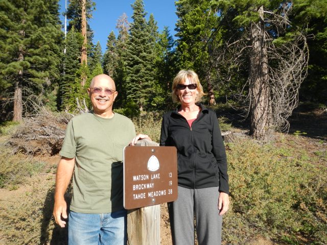
Having started at the Tahoe City trailhead at 0735 am, we literally made it to Brockway Summit at 8pm (12.5 hours later). Having missed a turn in the trail (this would become what one might call a “trend”), we exited the woods onto Hwy 267 where it aligned with the Brockway Summit (Elevation 7,179 ft) sign post. This was not in the plan. With a blister now firmly forming on Paul’s heel, he jettisoned his socks and hiking shoes for his Croc camp shoes and we began the walk down Hwy 267 to the Brockway Summit (section 2) pull out where we had stashed two gallons of water.
Best Neighbors in the Whole World!
The day started full of smiles and nervous energy as our neighbors, Vern and Patrice dropped us off at the Tahoe City trail head. The beginning of the trail started with a steep uphill (of course).


We climbed and climbed most of the morning through shaded and forested areas filled with mosquitoes that would inundate you, like the paparazzi, when you stopped to take a breather. Our 50 min on/ 10 min off plan of walking was quickly altered in favor of walking until we were too tired to care about becoming sucked dry by the swarms of mosquitoes that recognized us for the rookies that we were.
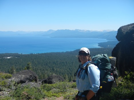
Finally we get a view of Lake Tahoe
As we continued on our way and enjoyed the flora and fauna, it was becoming infinitely clear that while our sense of direction is collectively good, our ability to judge distance traversed was deeply flawed. Every “2 miles” seemed to last six. Having to step aside for mountain bikes, even though we have the right of way, became annoying and added to the misjudgment in distance traversed. Likewise, the TRTA brochure states that this section of trail to Watson Lake is not more that a 10% uphill grade. Of this we beg to differ.
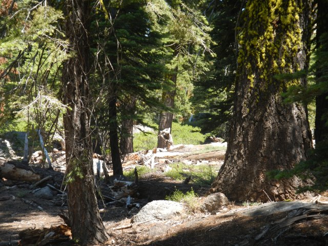
 We arrived at Watson Lake (actually more like a pond) at nearly 4pm. Now 4pm seemed like just too soon to stop, with all that daylight still left in the sky. The bear prints near the water also made us a little uneasy about setting up camp by the lake. So after an hour break, and after having filled Osprey 3 liter bladders with 2 liters of water each… with our Sawyer Squeeze, we began what the map showed to be an “easy” 6 mile hike to the end of this section at Brockway Summit. Nothing about this was “easy” as the trail (for us, having mostly walked and trained on grated fire roads) was rocky and technical for most of the way, which made it difficult to get into a walking groove. When we alighted onto a paved road, the map showed us to have only “2 more miles”…(NOT SO!) and directed us across the paved road and up the narrow TRT. Ironically, had we stayed on said paved road we would have ended up in the same place we did after having wandered through the forest tripping over roots and kicking rocks, and cursing the sharp nosed insects who saw us as their personal food trucks. Instead we traversed through what seemed like the Black Forest, which was dark and a little spooky.
Is that a giant squirrel?
It is a place where sounds of unfamiliar animals, breaking branches, and hordes of mosquitoes dive bomb your every breath. As such, those with an unnaturally fertile imagination (mwaw – yes I know the proper spelling, but it just doesn’t flow writing, moi) can’t help but spin ridiculous stories of bear maulings and serial killers, with oneself as the victim. When we finally emerged onto Hwy 267 it was practically dark. By the time we got our water, and carried it another 1/2 mile up from the Brockway Summit trail head…it was pitch dark! In the darkness, and with the aid of our head lamps, we found what we thought to be a relatively “flat” place to set up our tent (Six Moons Design, Lunar Duo) and cook (actually re-hydrate)our dinner…by that time, dirt clods would have tasted good. No sooner did we get into our tent, did we realize that the spot we picked (in near total darkness) was not as flat as we thought. In fact, it most certainly slanted significantly down hill, as did everything in the immediate area. By then we were so tired that we said “screw it”, and promptly fell asleep in our hiking clothes. As we “slept”, Paul slid closer to me and I slid closer to the tent’s downhill door. It appears that we were experiencing Superlubricity as the coefficient of friction with regard to our mass, the slippy materials and terra firma was nil. The only thing that kept us from continuing to slide down the hill was the hiking pole holding up that side of the tent, which acted as a “brake” of some sort. Curled gently around the hiking pole, we halfway expected to wake up on the trail below us for we were too tired to do anything to rectify the situation, just as we were too tired to do anything about the rustling and sniffing we heard outside our tent door…by our food.
