Starlight and Beer

Before nodding off to sleep, we all agreed to NOT set wake up alarms.  We figured we had earned the right to sleep in.  When we did the PCT, Paul’s alarm would go off at 0530 each morning whether we (I) wanted to get up at that time or not.  I was having none of that this trip.  So guess what time I wake up…on my own no less?  0530!… Whilst Paul continues to softly snore (if that’s a thing).

No matter, Jody and Brian are already up and moving about.  We rally for breakfast and pack up a bit, tossing our packs in our tents for a “quick” 4.62 mile slack pack to Starlight Beach.  We figure it will take us 4 hours (on the long side) to go there and back (9.24 miles in total). On the map it doesn’t look that hard, and the guide says we only gain 666 ft, so we grab some snacks and a liter of water each and head out.

Our plan is to check out Starlight Beach which is at the extreme west end if the island and head back.  Once we get back to Parson’s Landing, we will take an hour break or so, have lunch and the pack up for the 6.5 mile flat road walk back to Two Harbors for our next camp spot. Why would we do this, one might ask?  Well, 16 miles for a day (for us) isn’t that bad, but mostly because this is a popular camping destination with decent shore fishing, so it gets reserved often and fills quickly.  Had we realized that, we would have booked sooner and therefore booked a second night for Parson’s.  Word to the wise, if you plan to do the TCT, book two nights at Parson’s if you plan to go to Starlight, as there is no camping at Starlight Beach, or really anywhere to stealth camp from what we’ve read, and/or what we saw…but it can be done, if you are creative.  But because we had called an audible and were only able to reserve a few days in advance we were out of luck.   As it is, we will have a long day, but we’re not too concerned.

IMG_20160503_072049132 - Copy

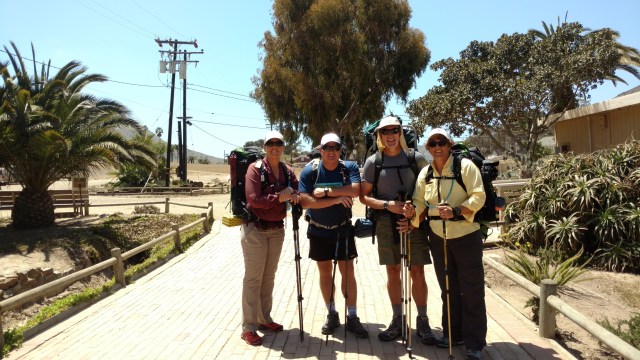
Leaving our campsite and headed across the way and down the coast

We can see that we have a hearty initial climb, but it looks like once we make the climb (around 600ft), the trail will/should hug the coast line then descend down to the beach.  The morning was not as brisk as we would have liked, but the skies were clear and the fresh sea air was invigorating.  A slight breeze wicked away our sweat as we hiked.

Not that “hard” was an understatement. Thank goodness we were slack packing it.  This trail had even more arduous ups and downs than the day’s previous route, which was rated as a Level III trail (Oh to be in  in awesome PCT hiking shape, like we were by Washington)  It wasn’t so much that the trail couldn’t make its mind up whether it was going up or down (only 666 Ft, my ass), but that the tread was exhausting mentally.  Especially when you were descending.  It was like we were on a very slow rickety roller coaster.  You had to concentrate where you put your next foot fall, and you could NOT let your mind or eyes wander (a feat that escapes me with regularity), unless of course you didn’t mind taking a grimy hard slip and fall. With each near fall, came the quickening of the heart rate and a bit of contortion to regain your balance, followed by shortness of breath and either a quick prayer of thanks, or an internal chiding of “See what happens when you lose focus!”…usually accented with a few “colorful” words.

IMG_20160503_091845524 - Copy

Starlight would be the far Cove.  You can see the trail near the upper left.  What you don’t see is a super steep climb to about the elevation you see of the “hill” above the trail in the upper left.  This would mean we “climb” up and then all the way down to the beach and  would back track this and the rest of the route we have already done back to Parson’s Landing…and another 6.5 miles from there.  No thank you.  Not today.

With Starlight Beach in view and one more mile to go, half of which was straight up with the other half straight down and therefore visa versa on the way back (no exaggeration) we figured we were “close enough”… we do live near the beach anyways.  If it were to have been our only trek for the day, I’m positive we would continued all the way to Starlight Beach proper, and not so bothered by the tread.  Around we turned and back to Parson’s we trudged…after a snack and doing our best not to make eye contact with each other secretly hoping none of us would make a “rally cry” and therefor goad each other into completing the trek to Starlight.

By now I had discovered that trying out new footwear was not such a great idea, as the shoes I was wearing had created a bruise on the top of my (right) foot where the forefoot of the shoe flexed.  Each step of the steep downs resulted in sharp pain, similar to that of a stress fracture.  Jody offered to switch shoes with me, but I declined namely because we didn’t have to have two ” broken ” people, and we didn’t have that much further to go.  (She has since earned the trail name of “SideKick”) Once back at our campsite, which took the full 4 hours, we slowly packed up and took a leisurely lunch.  All of us were worked and frankly were dreading the forced march back to Two Harbors.  We all agreed that in hindsight sight we would/should have planned this out better and spent the two nights at Parson’s Landing, allowing for proper recovery from our unique experience to Starlight.  Not to worry.  Brian reminded us there would be BEER when we got to Two Harbors.  With proper motivation, anything is possible!

IMG_20160503_130341190_TOP

Not gonna lie, those 6 miles (as Jody said), “Sucked!”  Road walking, is never really much fun, but add 9 previous miles of seriously challenging terrain, and your feet start talking to you!  Good thing the weather and scenery was superb.

IMG_20160503_130353758

Were it not for the awesome views of secluded coves with bright blue clear water through which you see the bright orange Garibaldi fish (California’s State fish) our feet would have talked us into hitching…which we didn’t tell them was not an option as there is little to no traffic on this road.  Frankly if the road was not so high and there weren’t signs posted for the “Hikers to stay on the Road”, we would have detoured into one of said “private coves” and had ourselves a swim, or at least a foot soaking.

IMG_20160503_132719962

“Hikers Stay On Road”

The closer we got, the louder became the siren call of Ice Cold Beer!  Our pace quickened like horses to the bar…n.  We can see where we want to be, but we must weave in and out of each cove, some deeper than others to reach our intended destination.  My feet are talking loudly to me now.  I have tightened and re-tightened my ill performing footwear several times by now, and am now sensing the infancy of a blister forming on the inside of my left heel.  I know this feeling, and know immediately the cause of the “hot spot”.  The thin siding of the insole has folded every so slightly upon itself and needs to be removed or smoothed over (with duct tape).  As I stop to make the repair in hopes of avoiding the full blossom of a blister, I remark to Paul, ‘I can’t believe these were so poorly designed’, to which he replies, “Are we talking your feet or the shoes?”  ‘Ha, Ha, real funny.  Probably both”, is my reply, as I apply duct-tape to the inside of my left shoe…just in case. We arrive in time for Happy Hour, which for us is aptly named and stay through dinner…at the bar, as we are not confident that if we walked to the campground and set up, that it would be “safe” to boil water and re-hydrate our dinners.

IMG_20160503_194212055

All set up at the Two Harbors Campground

Turns out it was a good idea, as somewhere along the way I lost a sock, and have absolutely no recollection of setting up our tent…even though I was there.  Damn you Brian!

Posted in Mini Adventures, Trans Catalina Trail | Tagged , , , , , , | 2 Comments

Land Ho!

Our 26 mile passage across the sea (Pacific Ocean to be exact) proceeded flawlessly.  The seas were calm and teaming with sea mammals frolicking in the wake of boat.  A pod of over 100 dolphins flanked us as we motored along as well as four blue whales surfacing at intervals to exhale.  Our first stop is Avalon where most of the passenger disembark.

IMG_20160502_110341437

Motoring from Avalon to Two Harbors

From here we will motor around to the west end of the island to Two Harbors.  It appears that we will not be alone on our trek of the Trans Catalina Trail (TCT).  A pod of men dressed in hiking gear…and various pieces of camouflage attire will join us as we overhear talk of Parson’s Landing…our first destination on foot.

IMG_20160502_123537877

The “Before” photo op…OneSpeed, Just Paul, Brian and Jody

We land at Two Harbors (Isthmus Cove) and grab our packs. The original plan was to road walk to Parson’s Landing (7 miles), set up camp and slack pack to Starlight Beach and back (another 8.4 miles round trip). An “easy” day. We, however, didn’t do the “math” before we left and consider the time we would arrive into Two Harbors. Since we didn’t land in Two Harbors until 1130 or so, we had a “brilliant”, but flawed idea to take the TCT trail route (across the isthmus and up from Catalina Harbor) to Parson’s Landing and hike to Starlight in the morning. The concept was sound, but execution was brutal.

We walk across the isthmus and begin our uphill climb (think Goat trail, as the TCT is based on Goat trails turned ” roads”), each ladened with 3 liters of water each in the noon-day sun.  It was brutal.  (Welcome to thru-hiking, Brian and Jody) We laughed about the fact we knew better, but continued anyways. Although it was supposed to be in the 60’s, it was hotter and drier than a Shasta City laundromat in August. We should know better that Catalina is part of the coastal desert, but the fact that it’s an island, one can’t help but think “tropical”… Idiots!

We remark that no couple other than Brian and Jody would accompany us in this lunacy. I think to myself, what a better way to test out my left knee and (currently) my right foot after having not hiked for over 3 months, than with a 3.5 mile 1600 ft practically straight up (remember the goats) followed by a 3.5 mile, 30-45 degree grade down into Parson’s Landing.

Just because my tested IQ says ” genius” doesn’t mean I’m necessarily “smart”. I tend to gravitate to the “hard way” with most of my endeavors. (My college friends are buckled over in laughter now).  I am surprised how well my knee performed without being supported by KT Tape.  The down hill portion of the day would prove a little more taxing though.  We can’t help but think how much fun…and faster…it would have been to make our “descent” in one of those human hamster balls.  Of course you would have to be strapped in like a fighter pilot, but what a ride! While the trek was strenuous like a 5 hour AMRAP (As Many Reps As Possible) of step ups and goblet squats, the views were spectacular! We caught glimpses of the island wildlife as well, and were treated to two island foxes scurry across our path, a solo bison and a deer (doe) trotting through the brush. (Sadly no pictures of the critters…so you’ll just have to use your imagination…or Google)

As we make our final descent into Parson’s Landing (in 4WD mode, always with 3 points of contact due to the plethora of square “marbles”), Paul and I reminisce about our 2012 experience at Parson’s. By this time, we were completely out of water. It had been 90+ degrees for a good part of the day with no shade to speak of. We reached the lockers and inserted the key into the corresponding locker. (At Two Harbors for $20, in addition to the cost of your campsite, you can purchase a “key” to a numbered locker that contains firewood and water. It seems ridiculously expensive, but Parson’s has no running water, nor is there access to drinking water along the 7 mile route whether you take the TCT proper, or road walk.) It would not open! WTF?! A bit of panic set in for two reasons. #1- I was on the verge of heat exhaustion and #2- we had absolutely no cell reception to even call 911 if we needed to. Paul inserted the key into another locker, and another, hoping beyond hope that it would open one of them… until, wait for it…the key gets stuck. Paul and I desperately try to extract the key which of course resulted in the key shearing off in the lock. Shit! The hamster wheels inside our brains start spinning.  Think.  Think. Okay, don’t panic…on our descent to Parson’s we had seen what looked like a “Boy Scout” camp down the road from Parson’s, and formulated a plan. The plan was that we would ask a couple of people who were already set up camping if we could get a liter or two from them, and then we would high tail it to the Boy Scout camp…thinking, they must have water or at least land line phone service. We then rounded the row of porta potties and lockers and discovered a partially used 2.5 gallon jug of water. We were in luck. We looked around, everyone in the campsites appeared to have their water. We each sucked down a liter, and surmised that we would have enough for dinner and the road walk back to Two Harbor…if we did it in the cool of the early morning.  Starlight Beach could wait for another time.  We attributed our find it to Divine Providence, and headed to our campsite.

Here we are 4 years later and we can’t help but wonder if the same thing will happen again…what are the chances, right? Ha, we are in luck! The key works and we grab our untapped 2.5 gallon bottle of water and bundle of firewood from the locker.  IMG_20160502_181405449We survey the beach and find our designated “campsite”. It has a 3 foot tall rock wall that stretches about 10 feet, which is good cause here at Parson’s the West wind howls in the late afternoon. We set up our tents, which without the wind breaks, would have proved quite challenging, prepare our Mountain House dinners, skip the fire and are asleep before the sun sets fully.

IMG_20160502_193831421

“Tucked in” at Parson’s Landing

Posted in Mini Adventures, Trans Catalina Trail | Tagged , , , , , | 5 Comments

Back in the Saddle

In an effort to prep for our Cottonwood Pass approach for our assault of Mt. Whitney in June, we are headed out to the island of Catalina for a “warm-up” backpacking trip.  As stated in our previous post, we have done this trek before, were serious “green horns”, and have since learned a ton.  Our mistake this morning was thinking that things would run smoothly and we would be able to slip out from under Mr. Murphy’s  (of Murphy’s Law) purview and have a mishap free adventure.  We are optimists are heart.  But NO!  No such case.  As luck would have it, we barely made it to the boat in time.  It all began with a backtrack to Brian and Jody’s house for pack covers and rain jackets.  This morning’s forecast now called for rain for our last two days on the island.  WTF?!  This is especially noteworthy as we had delayed this trip from our previous launch date (2 weeks prior) due to what Brian read was to be some serious inclimate weather.  Said weather never materialized.  In fact, it was absolutely gorgeous weather all that week.  All still would have been fine, even with the backtrack, had there not been a semi-truck roll-over at our last exit to the ferry terminal in San Pedro.  We found ourselves less than 2 miles (go figure) from where we need to be.  It was 0830 and the boat leaves at 0900…and we still had to pick up our tickets. (They have not upgraded to bar code E-tickets.)  Thank goodness for Martha (our Google maps direction lady, at least that’s what we call her) and her reroute directions, of which we followed to a “T”. If you don’t, she gets pissed off and sends  you to a dead end. (1.  Because Martha is a bitch, and 2.  She is friends with Mother Nature…Mr. Murphy’s wife) With 12 minutes to spare we pull into the terminal parking lot and have decided to divide and conquer.  Jody and I will go for tickets while Brian and Paul haul the packs to the boat.  As we exit the car, we are greeted by a large group of grade school children.  Shit!  We should have made reservations.  Seeing how the morning is going, we fully expect to be told that the boat is full, as we rush into the terminal lobby and approach the ticket counter winded.  Jody now looks at me forlornly and exclaims, “Shit, I forgot to grab my wallet!”. It appears that “Shit” will be this week’s operative word, and that “Shit” will certainly “happen” no matter how prepared or seasoned we think we are.  Seriously Mr. Murphy, don’t you have other people to follow?  We are not that interesting, really.  Good thing I have mine, and more importantly, enough dinero to cover all our tickets…provided we can still get on the 0900 boat (it’s now 0852).  We are in luck.  The boat is not full and although we are not all of “Senior” pricing age, the gal sells us 4 tickets at the Senior price, and doesn’t even check our ID.
image

What he hell!  It’s bad enough we don’t get carded at the bars anymore, but because we are cheap, we’ll take the discount.  I grab the tickets and we scamper to the gangway where Brian and Paul are actively reassuring the deckhand that the ‘gals with the tickets’ are on their way.  I hand the tickets to the deckhand who examines them (to make sure we are getting on the right boat…there are 2) and we scramble down the gangplank to another deckhand who stores our bags in the Hold. img_20160502_085612133_top.jpg 
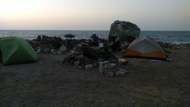
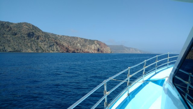
It is 0858.  Just as we find our seats, the massive diesel engines start up and at 0900 we shove off.  Phew!  That was close! Funny thing. We haven’t even begun to hike, but the adventure has begun.

Posted in Mini Adventures, Trans Catalina Trail | Tagged , , , , , , | 1 Comment

Memories of our first “thru-hike” – The Trans Catalina Trail

map_transcatalinatrailSo years ago (circa 2012), we figured it would be a good idea before we actually began major planning for the PCT to see if attempting a thru-hike was really something in our wheelhouse.  Based on its close proximity, we chose the Trans Catalina Trail.  It’s official length is only 37.2 miles, but another blogger who did this trail had his total trekked miles (via his GPS) as a little over 5o miles.  Our theory was that if we could survive nearly 40 miles (split the difference) with very little “experience”, what’s another 2600?  We had purchased backpacks (Paul an Osprey 65 Atmos, me a Gregory 70L Diva), Western Mountaineering 20 degree bags, ExPed Synmat 9 Pump DLX (with an R-Value of 6) sleeping pads and JetBoils for both of us, enough food to survive for over a week, rain gear and a 3P/ 3 Season tent (MoutainHardware Lightwedge 3).  We had already tried out all the items during that previous Fall’s annual mule deer hunt in southern Utah.  All of the gear performed well, especially the tent, sleeping bags and pads, having gotten caught in a lightning storm/snow blizzard  whilst camped at the top of a plateau after having bagged (just before dusk) the big boy that I have mounted (yes mounted) on a wall in my home…at the beach.  So, setting off to walk across the island of Catalina, in the sunshine seemed like a peace ‘o cake.  Silly wabbits!  We had planned to take 4 days to complete this trek, but as Mother Nature would have it, we would have to do it in 3.  A vicious storm raged the night before, and all the next day, which prevented us from making the 26 mile voyage to the island of Catalina.  Part of the planning for this trip required making campsite reservations, which frankly were not cheap ($24/per person…not counting “fees” and taxes)!  Turns out, that the trip/trek was a serious eye-opener.  We used to be premier athletes…emphasis on used to be, and on this (dare I say) “short” jaunt, we realized how out of shape we had gotten.  Actually we were a “shape”, just not the one we wanted, or should have been in.  On this trip we learned about map reading; the importance of water; how to set up a tent in ridiculous wind; what walking downhill on marbles was like; and that frankly that we had waaay too much shit!  This is not to say that the trip was not fun, or the sights were not stunning.  It made us realize that we had to change-up some gear and re-think our training and approach to hiking the PCT, if we were to have any chance at making it, let alone enjoying it.  Fast forward four years, and three “long” trails under our belt (Tahoe Rim TrailPCTThe Camino de Santiago ), we are heading out to revisit and thru-hike the Trans Catalina Trail once more.  This time we will have friends with us (Brian and Jody who took care of our PCT resupply) who are interested in getting into backpacking and possibly thru-hiking a longer trail or two.  We hope that the lessons we have learned over the years (and miles) will make for a fun, if not relaxing outing.  Wouldn’t that be a treat?

We will however, NOT, be carrying the same gear we did on our first outing.  We have embraced the principle and motto of “when the weight goes down, the fun goes up”.  With that said, and because we will be doing “small” daily miles, we are going to switch up and try out a few new gear items to see if they will work for us, and whether said items are even worth carrying in the future.

Paul will be using a smaller volume pack, the Osprey Talon 44, to see if he can get by with a smaller volume bag.  It’s kind of like owning a house with a lot of storage.  The more storage you have, the more stuff you’re inclined to acquire/keep to fill those sad, empty spaces.  I will have my Osprey Exos 58.  I will not be “down-sizing”…I like my “empty” spaces.

As I can not find my REI Flash inflatable pad, I will be reverting back to my ExPed SynMat UL 7 LW (3.1 R-Value) mat as I am too cheap to buy new mat, and it is light enough for this trip.  Besides, I am waiting on in-field  review from Tandem Trekking (PCT thru-hiker) on the ExPed SynMat Hyperlite Duo Sleeping Pad, for our next purchase.  We also will be using our tried and true ExPed Schnozzel Pumpbag for easy inflation.

We will be daring, and will ditch our Western Mountaineering 20 degree bags for our Jacks R Better  Shenandoah 40 degree quilts, as the lows should only be in the 50’s at night. (Seeing that I am a cold sleeper, and the old lady hot flashes are no good to me when I really need them, I will bring my Western Mountaineering “puffy pants” and a SmartWool long sleeve shirt to sleep in, as insurance)

Paul wanted to go the “full Monty” and cowboy camp, with only our MSR E-Wing tarp as back-up.  But considering there is a mild chance of rain toward the end of the week, and meteorologists get paid for being right half of the time, we are bringing a tent!   We will use a 3 season 2P tent (our Big Agnes Angel Springs UL2) that we used on the PCT.  At first we thought we had lost our rain fly, and emailed Big Agnes to see if we could purchase a new rain fly seeing that they don’t sell this particular tent any longer.  They still still had a few in stock and could send us one for $120.  Hmm, $120?  That’s a down payment on a new tent, so we looked really hard and went through ALL of our gear.  We eventually found it, but how it got misplaced, I’ll never know.  But then if you saw our gear room (which should be a guest room) then maybe it would make sense…too much stuff!  As luck would have it, the zipper was broken!  We still considered buying a new one, but ran out of time and figured it could wait…it’s only a “mild” chance of rain.  Maybe we’ll spend that money on a new tent as you can’t have too many, especially when you’re kids like to camp as well.

Our cooking system will remain the same, as we love our JetBoil, even though we have researched other options.  The JetBoil covers all the bases we require in a stove.  It boils water in a relatively short amount of time, in any weather event, and/or altitude.  Paul has built a light-weight “cozy” to carry it in, seeing that I initially dropped it a few times (cause I am the one that carries it) to know that it is pretty darn durable, even after the ruff and tumble treatment we (I) have subjected it to.

We have paired down our food, and will NOT be carrying an extra days worth of food, for “just in case” scenarios.  We are not that far from “civilization”, and we are certainly in no danger of starving or wasting away, for that matter.

Footwear will be significantly different from 4 years prior, as we will not be wearing heavy “traditional” hiking boots, but will sport trail runners as our “kicks”.  I for one will be testing out a new pair of Salomon Wing Pros, to see if they are a good swap from my Salomon XT Wings 3 that have lost their “spunk”.  Paul will do his best to destroy, once and for all his Salomon XA Pro’s that he used during the last leg of the PCT in 2014.  He has tried the Altras Lone Peak (gave him shin splints), and is now back with his worn and tired Salomon XA Pro’s for this trip.

I will forgo my heavy-duty Princeton-tech head lamp, for a lighter /smaller headlamp (Petzel e+LITE) that feels and looks like something you get out of a Cracker Jacks box.   Apparently it’s the latest and greatest, and is supposed to be just as good if not better than what I normally carry…we’ll see.

Four years ago, we used  3L Osprey and/or 3L Camelbak hydration bladders.  We are now going “low-tech” and carrying 3 1liter AquaHydrate bottles.  No more leaking into or onto the pack, or more importantly being surprised when we run out of water.

This trip we will be going out of San Pedro and starting from Two Harbors.  We will in essence go from West to East on the TCT, ending up in Avalon.  From Avalon we will take the ferry home to Dana Point Harbor.

This will be my first lengthy hike in a long time,as both my feet have decided to take turns with separate but equal injuries that have kept me from walking any significant mileage, let alone carrying any weight besides water and snacks.

Here goes nothing!

Posted in Mini Adventures, Trans Catalina Trail | Tagged , , , , , , | Leave a comment

Tahoe Rim Trial -Barker Pass to Tahoe City

Lessons Learned:

  1. A flat mattress weighs more than a patch kit.
  2. If you are smelly and dirty, you become invisible.
  3. Ice Cold Beer is proof God loves us!


Within minutes of bedding down, Paul’s mattress goes flat.  We search in vain for the source of the leak, but without water for which to submerge the mat, we can not find an obvious leak.  We inflate it two more times and apply duct tape to areas we think air is escaping. (We had wrapped a foot or so of duct tape around one of our poles…just in case something needs a fix’n)  We meet with abject failure, and swear that when we do the PCT, we will carry a patch kit, or maybe we’ll just switch to an airless mat like we have seen many a hiker (much younger than us) carry.  Most seem to use a Therm-A-Rest Z Lite SOL (Z-Pad for short) as their night’s padding against the cold and lumpy ground.  Luckily we had taken a full Z-Pad and halved it, giving us each a spacious sit pad to use on our numerous breaks.  Looking back on it and how we carried our halved Z-Pads, many thought we were hardcore ultra-lighters  who had reduced their unnecessary weight and cost by sharing one full mat,and assigning it multiple uses.  We wish this were the case, but we just don’t like sitting on the dirt.  In any event, Paul now had something to put between him and the hard ground, besides the tent floor.  This worked out good, in that Paul had actually been considering dumping his air mattress all together when we do the PCT as a means to reduce pack weight, and just using his over-sized sit pad.  At least he will get an opportunity to try it out.  Fast forward to the morning.  My pad is now flat. Serves me right for snickering at Paul’s predicament, and rafting back to shore through the pongee sticks.  Turns out, Paul’s “good night’s sleep”, was not so good on the Z-Pad.  “I don’t know how they do it”, was Paul’s assessment after slumbering fitfully upon what really amounts to a yellow, light-weight yoga mat.  An air mattress is a must, he surmised, but there has got to be something lighter than what we are carrying (ExPed SYNMAT 9 PUMP DLX)  Later we would discover so many options, it would be overwhelming.  DSCN0867As our last night’s sleep was fitful, we awoke to our first sunrise of the entire trip squeaking through the trees.  Maybe it was good that our mats had gone flat and we were woefully uncomfortable.  We packed up, giddy with excitement and like horses poised for the barn, trotted down the trail.

The down the trail, turned into an up the trail, and then parted with the PCT and back down again, followed by a roller coaster of ups and downs, in brown talcum powder like marble littered dirt, to a meadow and eventually the Truckee River.  How or why we thought it would just descend into Tahoe City, we haven’t a clue.  DSCN0873Oh ya, we had thrown out the “worthless” guide book at Echo Lake, and just had the trail map from the TRT Association having visited their headquarters before we started.  We could have sworn that once we reached the meadow that we had arrived.  We could hear the traffic, and had seen many a day-hiker, but NOOOO.  The heat was exhausting.  Our temperature gauges read 104 degrees.  We stopped and rested against, what we discover too late, a pine tree oozing pitch.  It was like sitting on several freshly discarded wads of Bubblicious bubble gum, with one thrown in your hair just for good measure. DSCN0886.JPG At least we smelled better…people pay good money for that piney fresh smell.  As we sat, Paul spied what looked like a trail sign 100 yards away.  Maybe it could tell us how much further we had to go.  Paul hurried ahead, and upon reaching the sign, began to laugh.
As I approached he covered the sign, and said, “Guess how much further?”.  ‘Let me guess, 2 more miles’, I reply.  “No…THREE”, he laughs and uncovers the sign.  It figures, that it’s the one time when 2 more miles would actually be welcomed.  Once we get to the Truckee River, my face is flushed red and my feet are on fire.  All I can talk about for the last mile is how I am going to walk into the water (with my boots on) to cool my feet once we reach the Truckee River.  We finally reach the river.  Paul drops his pack and heads off to where our car has been left for us by our trail angel neighbors, Vern and Patrice.  As Paul goes for the car, I nestle our packs together, apparently talking loudly and possibly incoherently to myself.  A sustained argument ensues with myself about whether to actually walk into the river with my boots on or to take them off.  Mind you, I haven’t combed my hair, nor showered in over a week.  My shirt is dirty and stained with sweat, and I’m pretty sure that I smell like my son’s hockey bag.  A young couple with a small toddler at the water’s edge, conspicuously scoops up their child and begins to hurriedly collect their belongings as I approach barefoot holding my Crocs, now scolding myself for not keeping my Crocs on till I hit the water as small stickers burrow into the naked soles of my blistered feet.  I see obvious fear in both their faces, and look over my shoulder ready to defend them from danger (as I have training in that sort of stuff).  It is then that I realize, it is me that they are fearful of, and I start to laugh, which in itself does not improve the situation.  I look at the woman and smile as I sit down on the river bank and ease my feet into the water.  She sheepishly smiles as she drags her child up the river bank, and says, “The water feels really nice”, while her husband gives her a look like “don’t encourage the crazy woman”.  I respond, ” I hope so.  I’ve been waiting 165 miles for this!”  With that she pauses.  “A hundred and sixty-five miles?”, she asks.  “Yes”, I reply.  “My husband and I just finished thru-hiking the Tahoe Rim Trail.  He’s off getting our car.”  I now see in her eyes, that she realizes that she has misjudged me, and is a little embarrassed, so she strikes up a conversation as her husband, who has not heard the exchange, due to his scurrying to collect their belongings, stares in horror.  I apologize for my appearance and obvious stench, and she tells me “it’s not that bad”.  LIAR!  She releases her toddler who wanders back toward the water’s edge.  We talk about the trail, and what possessed Paul and I to do such a thing.  I’m asked the obvious questions, “Was it hard?  Did you see any bears?  What was your favorite part?” and so on.  Paul finally arrives and we load up the car.  The couple bids us farewell, and congratulations.  Our first stop is the Tahoe Mountain Brewing Company, for an icy cold beer that we have been pining for, since we started, as our reward for finishing without injuries or serious mishap, which is unusual for us and our adventures.  We pull into the parking lot. We consider changing our shirts, but then Paul reminds me that we have “earned this dirt”, and we swagger into the brew pub.  Seeing as we only want a beer, we saddle up to the bar.  The bartender makes an about-face and moves to the other end of the bar.  We try and catch his attention to order a beer.  With the exception of a lone man “trapped” next to the wall and where we have parked ourselves, everyone “discretely” calls for their bar tab and clears out to the other side of the bar. Either we have become invisible ,or with great stench, comes great power!  We wait patiently for the bartender to notice us and ask us if we would like to order.  As I tell Paul the story of the young couple by the river, I realize that the bartender probably thinks we are vagabonds without money.  I place my cell phone and wallet, pull out a credit card and do my best to get the bartender(s) attention.  Finally Paul has had enough and shouts, “What’s it take to get a beer around here”.  The burlier bartender spins towards us and gives us a look like ‘Can I help you…outta here?’, and asks how he can “help” us.  Paul explains that we have just finished thru-hiking the Tahoe Rim Trail, and are dying for a beer.  The bar collectively sighs, and the bartender announces to all the patrons, “Check it out, these guys just finished the Tahoe Rim Trail!”…nothing to worry about, they wont hurt you (the last part was implied).  A series of congratulations ensue, followed by the “obvious questions”.

We are served our beer and suck it down with reckless abandon.  The bartender asks if we’d like another.  We do, but we have some driving to do before our day is over.  We pay our bill and head back to our car.  Now it is time to change our shirts!  Tonight we will drive to Mammoth Lakes for a shower and a meal at Roberto’s Mexican Cafe .  As we drive I search online for an available room.  We had always thought of Mammoth Lakes as a winter destination, and had never really thought about it being “crowded” during the summer months. Silly us.  We really need to get out more.  We find a “just released” room at the Shilo Inn , park our car and grab a fresh set of clothes…and a heavy duty trash bag to sequester our hiking garb.  An hour and a half later we are squeaky clean, so we think, until we notice that the towels we have dried off with are anything but white.  No matter, we are hungry, and “clean enough”.

*Just a reminder, this was a trip we did July 9-17,2013.  It’s a trip we’d encourage anyone to take, especially if you are training for the PCT or any other long distance trail.

Posted in Tahoe Rim Trail, Uncategorized | Tagged , , , , , , | Leave a comment

Tahoe Rim Trail – Fontanillis Lake to Barker Pass

Lessons Learned:

  1. PCT hikers (by this point) are walking machines!
  2. Often it is easier to get into a lake than out of one.
  3. The Desolation Wilderness is NOT desolate!


DSCN0844We awoke to find, pleasantly, that we had not been consumed nor molested by a bear.  Our food was left untouched, and our feet somehow slid into our boots with very little coaxing.  Ah, the wonders of Ibuprofen, time off the feet, and cold water.

We scooted by several tents with its occupants still deep in slumber as evidenced by their audible snoring.  Just past the lake we entered a marshy area thick with mules ear and mosquitoes.  The trail eventually led to another lake where we came upon several other hikers of the PCT thru-hiker persuasion.  We know this because they barely acknowledged us as we passed, as they hovered over their stoves cooking (and/or re-hydrating) their mid-day meal whilst lounging in the dirt under the available shade.  We, on the other hand choose a sunny spot at one end of the lake and break out our lunch.  It is now that we learn why the seasoned PCT thru-hikers are in the shade.  MEAT BEES!  We retreat to the nearby shade of a lone tree and finish our “lunch” which consists of sweaty string cheese, beef jerky and melted trail mix. As it is hot, and the small lake we are “parked” at beckons our entry, we get a wild idea.  What if we inflate our sleep pads and go for a float on the lake?  Genius, we surmise. And into our packs we dig for our air mattresses. The water is wonderfully refreshing. We float out to the middle thinking we are quite inventive, only to discover that to exit the lake we must walk through deep and soft mud that swallows our camp shoes and leaves scratches on our legs from the numerous submerged pongee sticks.  Fairly relaxed and cleaned up, we pack up and continue onto Barker Pass.  It is still very hot and dry, so we load up on water even after having cameled up, not wanting to revisit our lesson from earlier in the week.

Of course, on our way to Barker Pass, we cross many unmentioned creeks and springs from which we could collect water.  Onward we walk.  Paul walks ahead, as the heat is beginning to get to me and I need to slow my pace.  Two PCT hikers catch up to us, nod “hello” and zoom past us without breaking their awesome stride.  DSCN0861When I catch up to Paul, I find him actively putting out a fire off the side of the trail in a pile of cuttings. (There are many similar piles on both sides of the trail for nearly 1/4 mile.   They are from the Forest Service’s thinning of the trees to improve the health of the forest, and ironically, to reduce available fuel in the event of a wildfire). At first I thought, geez it’s so hot, why in the world would you be setting a fire?  Then it was, who’s the numb-skull that didn’t extinguish their fire fully from the night before?  Paul told me that he had been walking along, looking for a good place to “detour” (off the trail) to do some “paperwork” when he saw an active fire with flames nearly 2 feet high about 10 feet off the trail.  He looked around to see if another hiker was around, and/or if maybe it was a spot of a previous campsite (maybe the fire was the result of a campfire not completely extinguished).  Neither were the case.  Interestingly, I had noticed, just before I had reached Paul, a white truck, on a dirt road some 100 ft below the trial heading rather fast down the road away from the pass.  I figured we were happily nearing the pass.  Now, our “Spidey Senses” were beginning to tingle.  This fire was near a road, in a fairly secluded area with neatly stacked piles of fuel. The air was hot and dry (not a cloud in the sky), and the once still winds were now gusting and beginning to blow with regularity.  We concluded this was highly unusual and sadly all signs pointed to an arson fire, for it was “perfect” wildfire conditions.  As we were finishing putting out the fire, several other hikers passed us without a pause, even though small tendrils of smoke continued to rise from the once red glowing embers and the air distinctly reeked of a forest on fire.(Turns out that when we did the PCT in 2014, we also ended up putting out a growing fire that had been started by a lightning strike)  We considered calling into the Forest Service, but had no idea exactly where we were, and/or how to get a hold of them.  Dialing 911 was out of the question, knowing that the call from our cell phone would first go to the CHP, and frankly the current danger was over.  So, we ambled on.

We wind through a grove of pines sporting shaggy lime green “sweaters” just before we make the final climb to the pass.  When we reached the pass, we see two of the hikers that had passed us before Paul had spied the fire, and asked if they had seen the fire.  “There was a fire?” was their response.   We talked for a bit about where they were from and how they were enjoying the PCT as they set up for the evening, having done a 38 mile day…already!  Feeling completely unworthy, we decided to stumble on another 2 miles and find another place to camp before the sun completely set and darkness coated the trail.  This would be our last night spent on the trail.  And frankly we were ready to be done, as we have been on the move for 8 days straight, hiking between 18-21 miles each day, without a break.  It turns out that Zeros (complete days off) or Neros (most of a day off) are necessary.  Figures that we would have to learn the hard way.  DSCN0865We found a fairly flat place to set up, leaving a “mere” 14 miles to traverse the next day into Tahoe City.  Completely exhausted, we did our best to eat as much of the food we had left so as to not have to carry any “unnecessary” weight into the final stretch.


*Just a reminder, this was a trip we did July 9-17, 2013.  It’s a trip we’d encourage anyone to take, especially if you are training for the PCT or any other long distance trail.

Posted in Tahoe Rim Trail, Uncategorized | Tagged , , , , , , | Leave a comment

Tahoe Rim Trail – Echo Lake to Fontanillis Lake

Lessons Learned:

  1. As long as the scary sounds don’t come in the tent…everything will be fine.
  2. You can get used to icy cold water bathing.
  3. Going up a size and a half in shoe size would have been a better idea, for both of us.

We packed up early, so as not to get intercepted by other hikers or worse yet a “letter of the law” Ranger (we were more “spirit of the law” people…with the exception of a few violations like DUI and littering cigarette butts, to name a few).  My feet were so swollen that I could barely wrestle them into my shoes.  It appears that a one size bigger was just not big enough.  Paul was having a similar problem, but his feet didn’t look so block-ish.  Mine on the other hand resembled a foot long 4×4.  Now try and maneuver that into a mid-cut hiking shoe.  Once we got walking…and the ibuprofen kicked in, it was all good.  Today was a “Beauty and the Beast” kind of day.

The trail tread was the Beast and was brutal on our feet.  The first half of the day was like walking on the jagged rubble that lines train tracks.

DSCN0758

Aloha Lake

For our eyes and frankly our souls, the day was breath-taking and never lacked for Beauty.

I have never seen such pristine lakes under such brilliant blue skies, and vibrant vegetation.  If we weren’t on a timeline, we would have moved even slower through this remarkable tapestry of nature.

We did however, lunch and bathe in a side “pond” of Lake Susie to the odd looks of a few passers-by.  They were probably thinking, how’d those fat old farts get here…before us?  Today was a big climb over Dicks Pass (aptly named, as it was a series of seemingly never ending switch-backs).  Before we reached the pass, we had heard the bass sound of the mountain grouse.  Paul had spied its location and we attempted to corral it near a tree so I could get a good picture.

We were so successful that that bird (which is about the size of a chicken) was lucky we didn’t see him two nights ago, otherwise we would have bonked him on the head and eaten him for dinner!  (Thinking back on it now, we probably looked pretty comical, something out of a Three’s Stooges sketch chasing that bird through and around the trees.)  The views from Dicks Pass were worth all the pain and grumbling.

For once we reached the top, it was like nature’s Vicodin.  A calm settled upon us, and whatever aches and pains we had been experiencing, disappeared.  It was so beautiful, we considered staying the night, but there was too much daylight and not enough food to stretch our hike another day before we reach Tahoe City, so we slowly made our way down the from the top of the pass.  Compared to the rocky terrain on the way up, this tread felt like plush carpet.  We passed Richardson Lake and began to hear interesting and somewhat disquieting noises.  They were, no doubt, animal noises of the big and fury kind.  Definitely that of a bear.  We strained our eyes and ears trying to locate the source of the sounds in an attempt to determine if we were walking toward (or worse yet into) the sounds, or they were heading away from us.  We walked (quickly) until we couldn’t hear them any longer, which was a shame as we had planned on camping at Richardson Lake.

But it turns out that the next lake, Fontanilli Lake, was even more picturesque and to this day is my most favorite lake of the entire trek (to include the PCT).  I wish I had my fly rod as we would have had fresh trout for dinner, and breakfast for that matter.  DSCN0833No sooner had we bedded down for the night, the sounds we had heard earlier were upon us…or felt like they were.  Not wanting to be a bear burrito, I shooed Paul out of the tent with our headlamps on full spotlight mode to investigate. Maybe we shouldn’t have bathed and “washed” (more like rinse) our clothes at Susie Lake.   Upon Paul’s exit, the sounds stopped.  No prints were near our tent, and our food we had stashed away from us was undisturbed.  Now this happened more than once, and we (Paul actually) was beginning to get a bit perturbed.  We pictured a Far Side cartoon, with two bears laughing their fury asses off.  “Watch this Vern…I bet I can make them come out again…and, “What pray tell do they think those little moons will do?”  Eventually we decided not to take the bait, and fell into a fitful sleep filled with visions of becoming a bear chew toy, hoping we still smelled bad enough that they would regret their folly.

*Just a reminder, this was a trip we did July 9-17, 2013.  It’s a trip we’d encourage anyone to take, especially if you are training for the PCT or any other long distance trail.

Posted in Tahoe Rim Trail, Uncategorized | Tagged , , , , , , | 2 Comments

Tahoe Rim Trail – Big Meadows to Echo Lake

Lessons Learned:

  1.  You can walk faster than mosquitoes can fly…but they will eventually catch up
  2.  There is no such thing as “too much” food for one sitting…when thru-hiking.
  3.  Sometimes “rules” can’t help but be broken.

We (Paul) set the alarm for O-dark-early, as the plan was to outsmart the mosquitoes by packing up and getting on the trail before they woke up.  It worked for awhile, until the trail out of Big Meadow began to climb (I don’t know why we were surprised) enough to make us start breathing hard.  It was as if an alarm went off, and an announcement was made…”Hey, they’re getting away…after them!”  We had about 7-15 seconds to pause and catch our breath before we were swarmed, otherwise, amazingly we were able to out walk them.  We found that they particularly liked Paul, while me they did not find so appealing. Maybe I didn’t smell scrumptious enough for them, or MAYBE it was my ExOfficio  bug proof shirt and Ben’s 30% Deet Bug Spray that I had spritzed myself with in strategic areas (Hat, back of head, top of hands) that kept them veering towards Paul.  When we neared Round Lake, I had to resort to my fashionable mosquito netting, as had Paul earlier.

DSCN0706

Also near Round Lake were some remarkable rock structures.  One looked strangely familiar as an art installation piece I had seen someplace, of which I can’t remember now.

Once we reached where the TRT merged with the PCT (7 miles from Big Meadows), and the sun was warm enough to lull the mosquitoes back to “sleep”, we broke for breakfast.  A hearty packet of oatmeal and a cup of “Joe”.  We had planned our next stop for Showers Lake.  Apparently somewhere along the way we unceremoniously passed it and thought nothing of it because from the trail, the lake was on our left, while the map showed it to be on our right.

It was not until we had climbed and waded through waist high lilac when we met another hiker, headed to Mt. Whitney, that we discovered we had passed Showers Lake. GREAT!  With that we plopped ourselves on the trail and took a much needed break, and worked on figuring out where we were, and how far had we gone.  Luckily water was abundant on the trail so missing Showers Lake to camel up was not an issue.  It turned out that we were making better tracks and time than we had thought.  Hunger is a great motivator.  Ah, but this was not to last.  We reached an impasse with a trail marker that read “Hwy 50…4 miles”, “Echo Summit…4 miles”.  Hmmm, both of equal mileage.  They’re essentially the same right? (Little did we know how different those 4 miles could/would be). Which path do we choose?  We thought about it for a bit.  Got out the maps.  Turned on my phone and Halfmile’s PCT trail maps and confirmed that the 4 mile Echo Summit route was the “correct” route…WRONG!  While it was the PCT/TRT, it was 4 miles of the most grueling and exhausting trail we had ever experienced…so far (even more strenuous than the 10,000 ft ascent of Relay Peak).

The good thing, we thought though, was that when we do the PCT next year, we will not have to do this section…ah been there, done that was the thinking.  The formulated plan will be to make the turn to Big Meadows and have someone pick us up for a Zero Day and then start back up at Tahoe City.(We in fact did NOT do this when we hiked the PCT in 2014.  We did however stop and eat at the same place for breakfast).  The pay-off for the grueling miles was Vern and Patrice’s trail magic for us.  For when they met us at the Echo Summit parking lot (next to the ski area), we were met with a BIG JUICY cheese burger (the size of a hubcap), tons of fries, a full salad and a gallon of ice cold Pepsi.  We all but inhaled the mound of food before us, with nary a word spoken besides a cacophony of happy humming.  Midway through our engorgement, we heard Vern chuckling and realized besides the initial thank you’s, we had not said a word.  Patrice then remarked that she was surprised we hadn’t lost any fingers yet.  It was here we paused and told them about our miscalculations during this section .  Once fully satiated,and frankly surprised our pants didn’t burst at the seams, we completed our final re-supplyDSCN0745 (after double checking our numbers and adding just a bit more…for good measure), packed up, and Vern and Patrice drove us to Echo Lake as our feet had had enough.  Before they started driving, they made sure we had our windows down, as apparently we smelled something fierce.  We were hoping to catch the water taxi and avoid walking the 3.2 miles of shoreline, but we got there too late.
As it was now 6pm, the store was closed as well…so no ice cream.  That will have to wait till Tahoe City.

We bid our farewells, and off we walked.  The trail underfoot was sharp and rocky.  Little did we know that this wouldn’t change much until the other side of Dick’s Pass.  As we walked, we noticed signs posted that it is illegal to camp on the PCT/TRT before you get to the Desolation Wilderness boundary, and even then you need a permit (of which we did).  You are supposed to camp your first night in your designated “zone” – the one we reserved (read… arbitrarily picked, as we really had no idea how far we were going to get and where exactly we would camp once we got into Desolation Wilderness) when we got our permit the week prior.  Not only did we NOT make it to our “zone”, we didn’t even make it to the border of the Desolation Wilderness before we called it a night and picked what turned out to be the last “flat” spot along the rocky trail.

DSCN0752

We camped down where Paul is at, with Upper Echo Lake on the horizon

Awesome!  As we set up, we laughed it would be just our luck to get caught.  Headline reads…”Retired Rangers cited for illegal camping on the PCT/TRT”.  It was worth it though!


Posted in Tahoe Rim Trail, Uncategorized | Tagged , , , , , , | 2 Comments

Tahoe Rim Trail – Monument Peak to Big Meadows

Lessons learned.

1.  Higher elevations are definitely cooler.

2.  There is no such thing as having a meadow to yourselves.

3.  Math is important.
While the evening was definitely cooler than we had previously experienced, bedding down on a soft sandy surface that had soaked up the warmth of the sun all day, made up for it.  From our campsite atop Monument Peak, we made good time getting to Star Lake and found many a tent still pitched.

DSCN0674

Star Lake.  Behind us you can see other campers just starting to stir.

Our thoughts of diving in and taking a dip were dashed, as we felt a little too self conscious to strip down into our skivvies and frolic in the icy cold water.  We sauntered up the trail another mile or so and then detoured up to Cold Creek (aptly named) for a quick ice cream headache wash up of clothes, body and hair.  After “freshening up”, we began what the guide book said was to be a “4.5 mile gentle descent” from Star Lake.  The book however, said NOTHING about the rigorous ascent, before the “gentle descent”.  ARGH!  While the descent was “gentle” in regard to the trail’s footing and steepness, it failed to mention that if you tripped or stumbled near the edge, you were a goner as the trail edge  dropped into a deep deep canyon.

As we walked, I hugged the inside wall, while Paul got his kicks (literally) rolling rocks off the edge and listening to when it stopped rolling.  One took several minutes to become silent.  Needless to say, this part, along with the ascent up to Monument Peak was very angst causing for me (it felt as though I were standing/walking on the ledge of the Empire State Building) as I am not very fond of heights, nor am I confident of my footing…thus very few I pictures were taken.

This section too was hot, dry and tedious.  My body and mind were attempting a mutiny, as my knee was acting up, and there was not much that one can do about it, as the ability to ice, elevate and rest it is severely limited when you are at 8500 ft with 25 lbs on your back.  I felt like one (and probably looked and smelled like) one of the Walkers on The Walking Dead.  It took awhile, but the mutiny was successfully averted. DSCN0698 
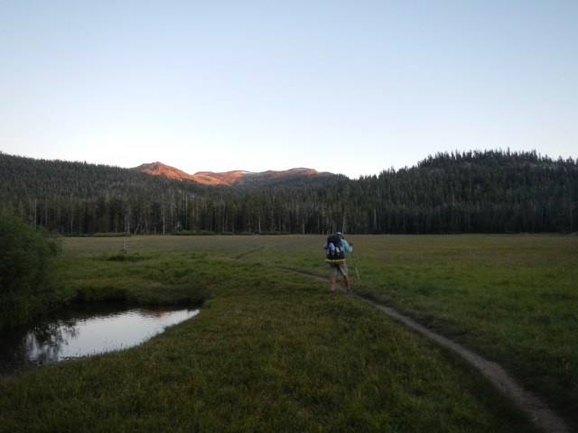
We ended the day at Big Meadow and had it all to ourselves…with the exception of a MILLION mosquitoes.  It was a mad dash to set up our tent without being completely sucked dry.  Thank goodness for mosquito netting.  It was so bad that once we got our tent set up, we threw all of our gear inside and went from there…after of course smooshing the 100 or so that “snuck” in.  Once inside, we discovered as we prepped for dinner that we had seriously under-planned or rather under estimated our caloric consumption and the number of meals needed for this leg.  As we spread out our remaining food and took inventory, we discovered we had the following “food” left:

  • 6oz Freeze dried eggs w/ Bacon (1 packet)DSCN0702
  • 6oz Tuna (1 packet)
  • 4oz Crispy Onions (1 packet)
  • Baby Bell Cheese (1)
  • Parmesan Cheese (2 packets)
  • 4oz dried fruit and nuts
  • Via coffee (2 packets)
  • Oatmeal (2 packets)
  • 1 Tbs Brown Sugar
  • G-2 (1 packet)

We would have to stretch this through dinner, breakfast, lunch and a “snack”.  The next day’s trek  from our current location to Echo Summit would be 19 miles.  As luck would have it, we also had no cell service and had forgotten to text our trial angels our ETA to Echo Summit.  Luckily we had made a tentative plan to meet 3-4pm…ish.
Seeing as we knew there were big and strenuous miles to make the next day, we munched down all of our protein (Tuna, Eggs w/ Parmesan cheese and the crispy onions), exchanging bite for bite until it was all gone as the mosquitoes hovered outside the noseeum netting waiting impatiently to feed upon us.  As the evening’s temperature dropped, the high pitched whirl of the “mosquitoes in waiting” faded into “white noise” and was replaced by the intermittent gurgles of still hungry stomachs.


*Just a reminder, this was a trip we did July 9-17, 2013.  It’s a trip we’d encourage anyone to take, especially if you are training for the PCT or any other long distance trail.

Posted in Tahoe Rim Trail, Uncategorized | Tagged , , , , , , | Leave a comment

Tahoe Rim Trail – South Camp Peak to Monument Peak

DSCN0634

Kingsbury Crossing at the 207

Lesson(s) learned.

  1.  When hands and fingers are not completely sanitary, DO NOT rub your eyes (one, let alone both!).  Thusly I awoke this morning looking like I was the loser in a boxing match…simply FUGLY!  I could barely see.
  2. If a day hiker estimates mileage or time, double it.  However, if they describe the terrain, flip it to the opposite of how they described it. (They are usually telling you how it was for them, coming towards you.)
  3. The opportunity for water, just like the opportunity to pee should never be passed up.

Damn nature sounds at 0430 in the morning.  I know we need to be up and moving by 0530, but Really?  This one (invisible) bird, tweeeet-chirp-tweeet was like Chinese water torture.

Today we learned that we are not the only ones that can’t estimate mileage.  Every time we asked a day-hiker that was coming in the opposite direction how far the trail head was, or where they saw the last water, it was always “not far” or “maybe 2 miles”.  We’d ask them where they came from and how the trail was.  They’d reply, “Star Lake” or “Big Meadows”, “a few ups and downs”…”it’s not bad”.  LIARS!  The only guy who gave us accurate information today (because the guidebook sucks) was a former PCT (2010) hiker, and it was where to find water.  At one point we jokingly considered whether G2 and a few Emergen-Cs  would make it easier to choke down urine…as it was coming to that.  This section is hot and dry.  Luckily before we parted ways with Desk Jockey, who was going to Kingsbury North for resupply, I had grabbed a liter of water from him.

DSCN0637

Where we should have fully “cameled up”

And, as it seemed like a “good idea”, we decided to refill a liter bottle with water from a creek we had crossed that was not on our map, as it was sooo HOT and we weren’t sure how much farther (2 or 6 miles) the creek we had planned on fully cameling up at was, as our mileage indicator was completely FUBAR!  Four miles later and now down to only 2 liters between us, we realized we read the map wrong and the creek we had gotten only 1 liter of water from, was the creek we were supposed to camel up at.  OOOPS!…and so began the brief but pronounced temporary melt-down…and the day started so well, HA! (See lesson 1) We should have known better.  Once we stopped and got out of the sun and regrouped and refueled, things got a little better.  This is when, and by chance (or divine intervention), trail magic occurred.  A local day hiker was trail blazing down a hill beneath which we had plopped ourselves trying to decide whether to go back to the water we knew some 4 miles back, or continue on and see what we find.  We exchanged greetings, and talked about the trail and the fact he had done the PCT in 2010, but had to drop out around Mt. Lassen due to the fires and how he would like to finish it someday.  More importantly though, he gave us accurate information of where to find water (just under “Mott Run” of the Heavenly Ski Area).  He told us that the source is spring fed and flows just enough to fill a bottle.

DSCN0647

This spring was a God send, and guarded by mosquitoes a-plenty!

It was about “2miles” away, and in the direction we were headed.  Yeah!  We can do another 2 miles on 2 liters of water.  It turned out to be 3 1/2 miles, but it was better than back tracking 5 miles!

DSCN0662

Our Monument Peak campsite

Our final destination ended up being Monument Peak, with the day’s total mileage being 18 miles.  The day of course ended as it began, Uphill.  But the sights and vistas seen were spectacular.  We overlooked the Carson Valley, saw the largest Red Fir tree ever (and where the Keebler Elves live…and bake their cookies), experienced the Heavenly Ski Area naked (no snow), and ran into a crazy mountain biker boulder hopping down the steep and narrow trail (with 1000 ft drops) as we were climbing up.

This day was certainly filled with diversity, and mishap.  An additional lesson was learned today.  We can work through a melt down and come out on the positive side…at least we didn’t have to carry all that water uphill for 6 miles!


*Just a reminder, this was a trip we did July 9-17, 2013.  It’s a trip we’d encourage anyone to take, especially if you are training for the PCT or any other long distance trail.

Posted in Tahoe Rim Trail, Uncategorized | Tagged , , , , , , | 2 Comments