
9/27: 17.9 mi (24.8 – 6.9)
The weather that threatened us the day previous finally caught up to us. We awoke to damp ground and a wet rain fly. Turkeys strutted by us, and elk bugled in the distance as we packed up. Today we would descend down to Ghost Ranch, a privately held 21,000 acre collection of multicolored cliffs, deep canyons, mesas, streams and grass lands. The Ranch was part of a 1766 “land grant” given to Pedro Martin Serrano, by the Governor of the New Mexico territory. 170 years later (1936), Arthur Pack, a wealthy naturalist would buy the Ranch and later donate, it to the Presbyterian Church in 1955. In 2018, the Ranch was added to the National Register of Historic Places. An assortment of movies and famous people have accessed and visited this interesting acreage, to include CDT thru-hikers.

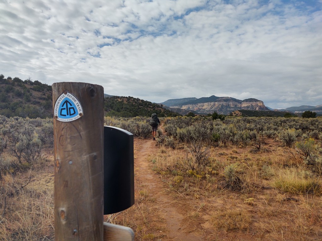
Our Ghost Ranch Alternate began with a dirt road path and devolved into a find and follow the carin adventure. Of course we missed a “turn” and walked a ways in the wrong direction, but then we are on the CDT and getting “lost” is a weekly, if not daily occurrence.

We traversed atop a tree covered mesa and just before our precarious descent into a narrow canyon, we got a view of the colorful cliffs that we were about to be immersed in.
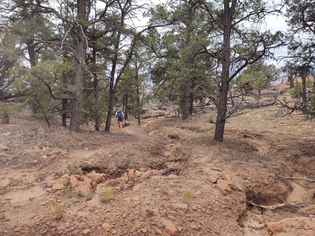
The descent followed an old extremely eroded and rock strewn “road”. We were glad it was NOT raining, and can’t image having to hike this route in the rain, or immediately after a sustained rain event.
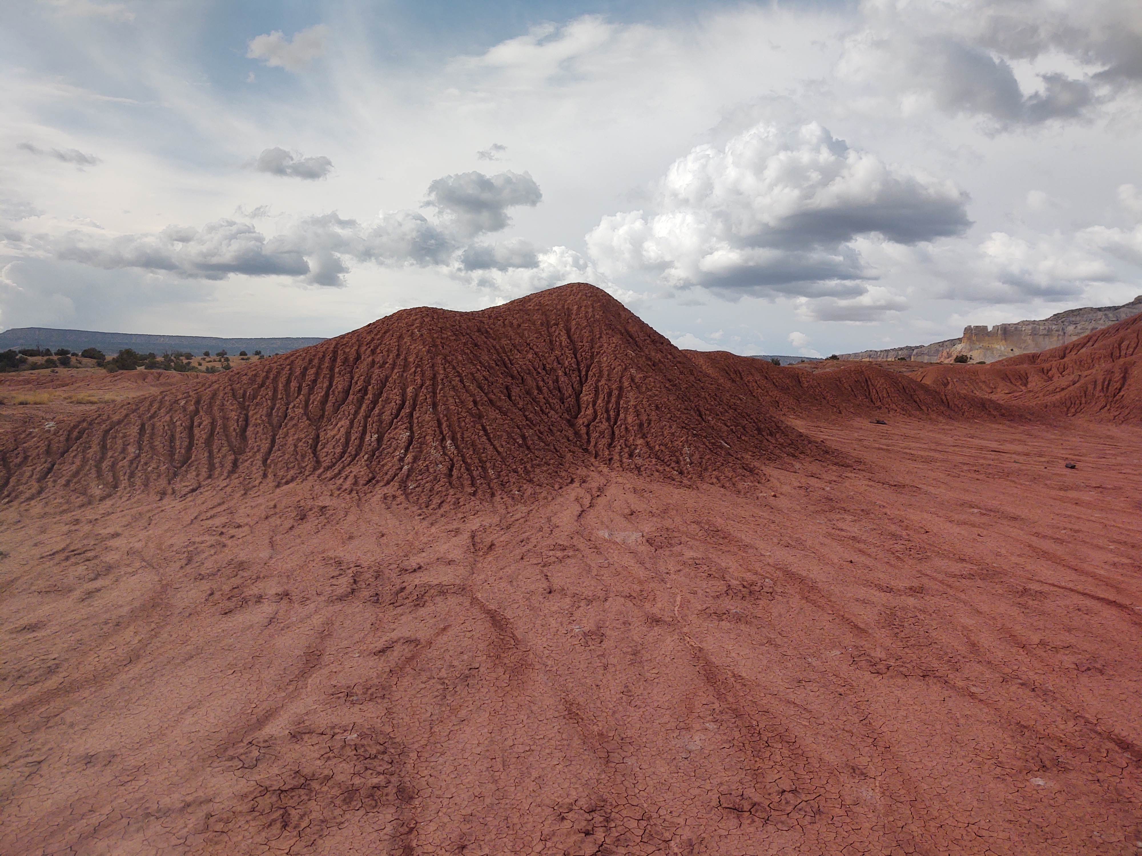
Eventually the terrain morphed into what I (we) had envisioned New Mexico to be like. Colorful striated sandstone layers of rock, sandy tread made up of loose rock, and all manner of pokey plants.


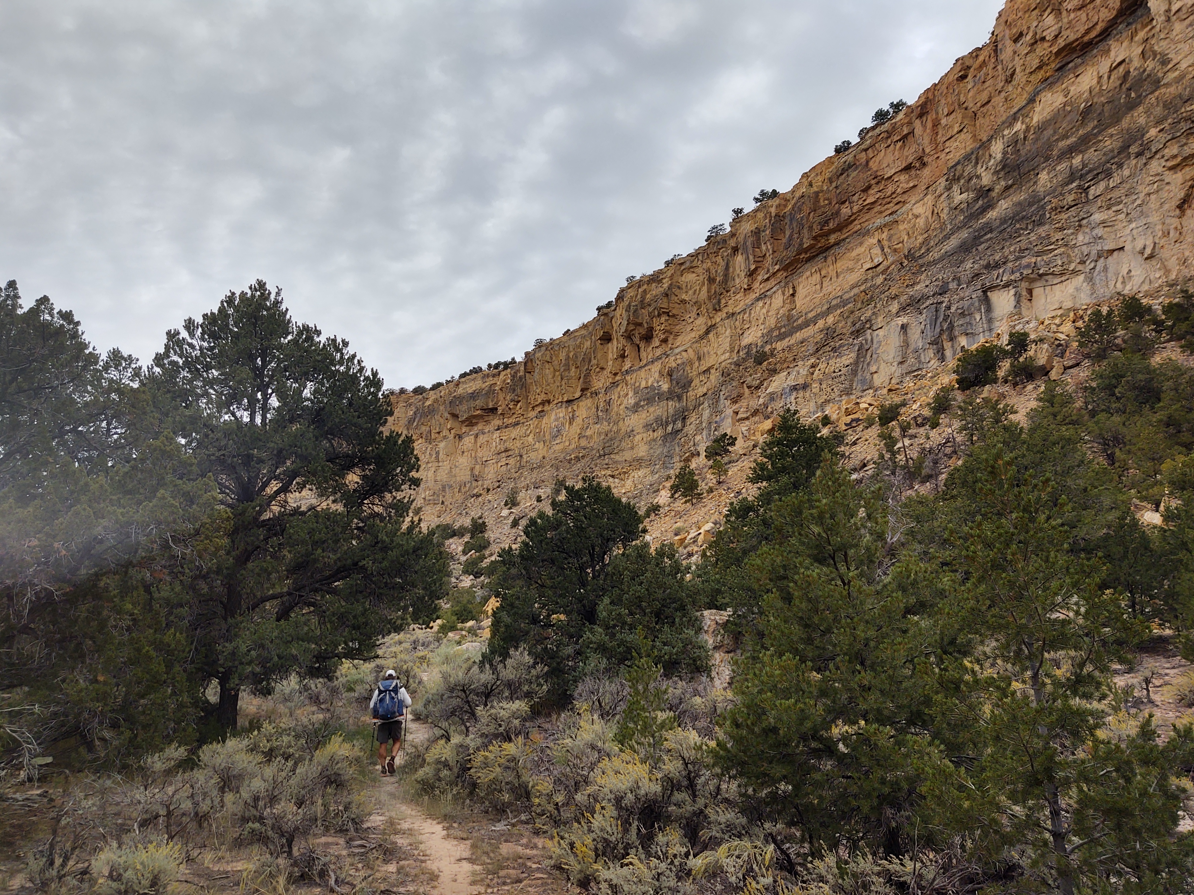
We were surprised by the narrow canyons and clear running water.


Walking into Ghost Ranch was somewhat surreal. A few people, with name tags dangling from their necks, wandered the outskirts of the property. For the most part, they generally paid us no mind, and took pictures of the oddest things. We tried to figure out the why and what of their pictures, but gave up, realizing that they were probably on a “retreat”, and on an “assignment” of sorts.
Because of COVID, and most likely to keep us nasty smelling CDT hikers segregated from the paying customers, the mess hall was not an option, even if you arrived prior to the appropriate meal times.
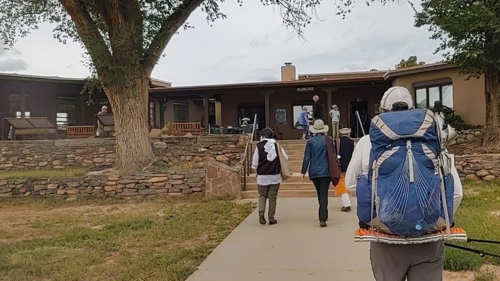
The Ghost Ranch Visitor’s Center, however, had graciously accepted our resupply package at no charge to us, and had plenty of snacks (to include ice cream) for us to munch on. They also allowed us to charge our electronics and refill our water bottles. It was a relaxed environment, and we felt “welcome”. The best part was that we didn’t feel the need to hurry about our “chores”. We talked at length with a recently married couple that had arrived a Ghost Ranch for a friend’s wedding. They had questions about our resupply, cook system, packs, electronics and basically everything related to long distance/multi-day back packing. We talked till it became time to pack up and finish our intended mileage for the day.
The route “out” of Ghost Ranch took us past colorful cliffs enhanced with an electric blue sky punctuated by growing storm clouds.
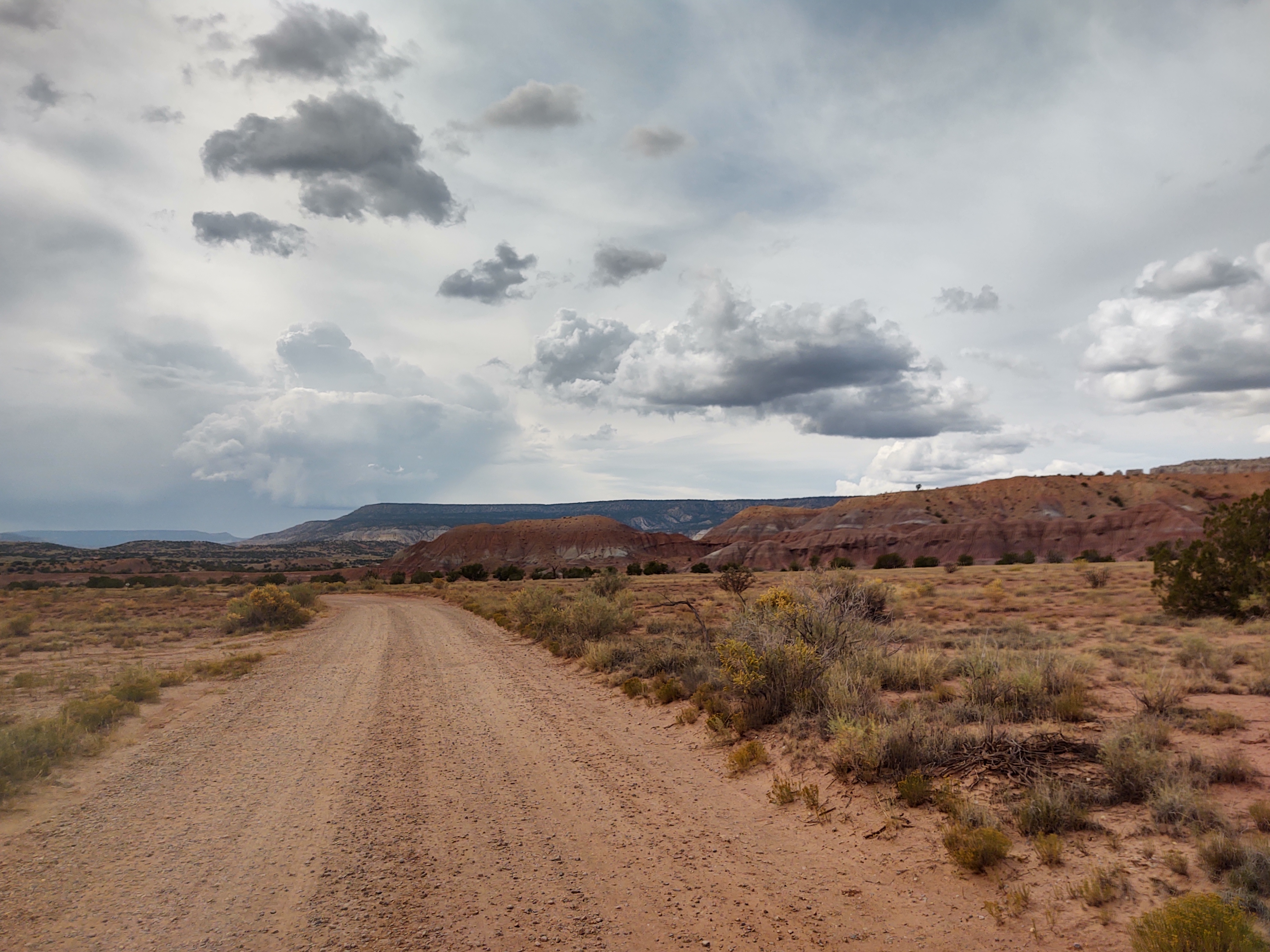


Pokey plants and two gathering storms flanked us as we walked. It was more than apparent that we were caught in the middle of two competing storms that were going to be electric.
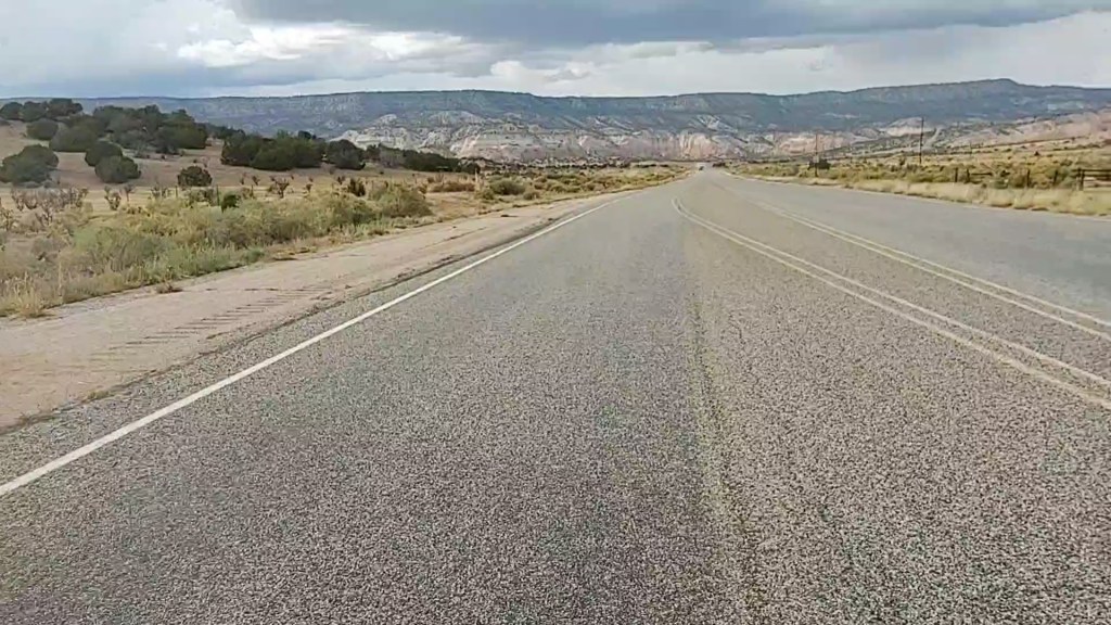
It was a bit of a challenge to find a place to “safely” cross Hwy 84. We could see the paved road, but barbed wire and a maze of fencing and gates was harder than dodging the non-existent traffic.


From there, we hustled our way across and over two tall knolls and down to the improved dirt road (CR 151) that would take us to the Rio Chama, before calling it a day and hastily setting up our tent. While we would have liked to, and could have hiked further, it was time to hunker down and hopefully “ride out” these storms. We expected our Big Agnes TigerWall 2UL to be severely tested. We hoped, above all, to not be struck by lightning.

9/28: 21.7 mi (6.9 – 2315.8 CDT)
As predicted, it rained upon us fiercely. Flashes of lightning lit up the sky. On more than one occasion, the interior of our tent lit up like it was daylight. Streaks of lightning shot both horizontally and vertically in thick bolts all around us. The thunder boomed and shook us to our core. We had no option, but to ride it out and try to get some sleep. It was both exhilarating and exhausting. When our morning alarm went off, it was still raining, so back to sleep we went.

By 7 am the rain had mostly stopped, and by 7:25 we were on the road in full rain gear with covers over our packs. The temperature had dropped dramatically so our rain gear provided an additional layer of warmth/insulation.


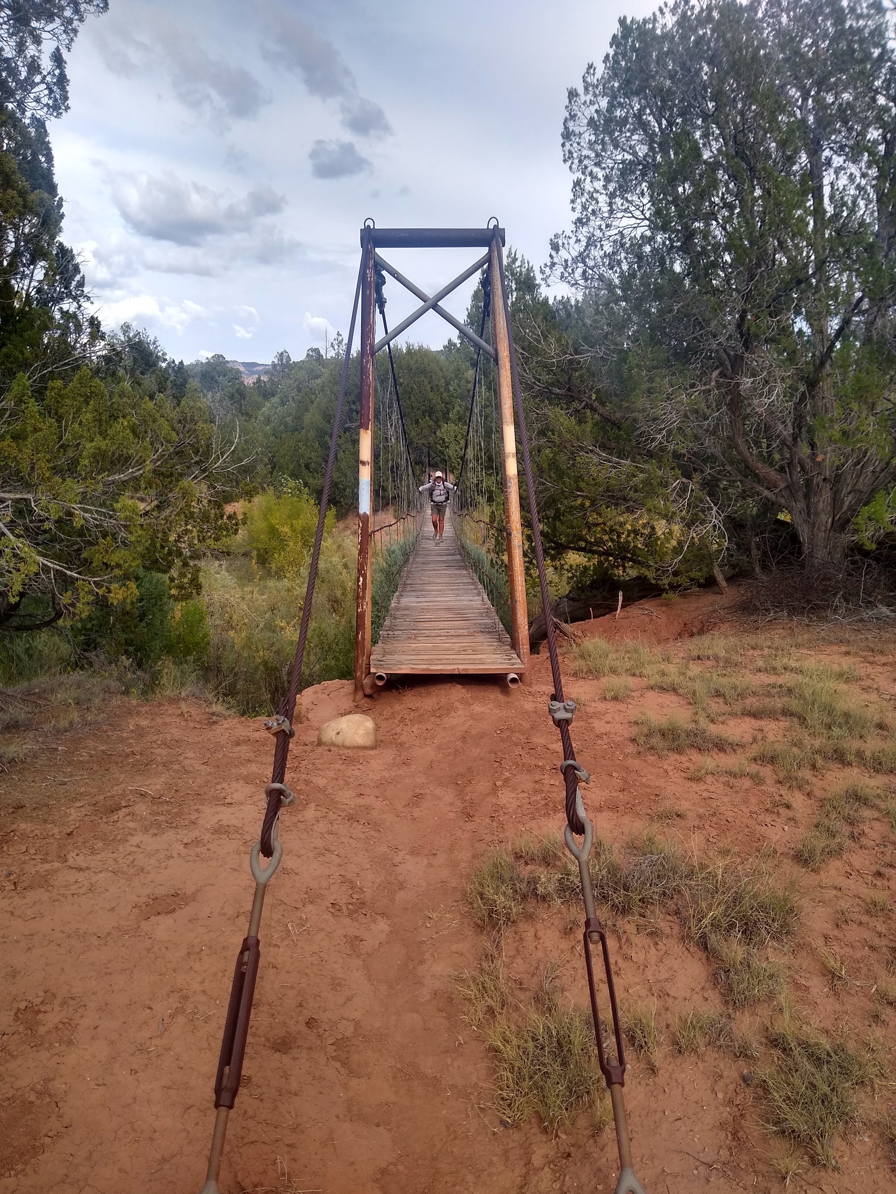
We walked the red dirt road till we reached the bridge over the Rio Chama, and its intersection with the CDT “redline”. The Rio Chama was flowing vigorously from the rain, and was a silty baby-poop green from the storm run-off. Luckily we had enough water, and would be able to make it to a spring along the trail. This meant our water filter would live to see another day.
The trail narrowed into a single track after the crossing of the Rio Chama. It was an easy path to follow. But, because of the rain and the make up of the soil, the bottoms of our shoes (with annoying regularity) became caked with mud. We would scrape it off at every opportunity, as the weight of the mud and its feeling underfoot, felt like we were hiking in high heels.

Along the way we saw fresh mountain lion and bear tracks within the trail. No worries. Our heads were already on a swivel taking in the surrounding beauty, now we’ll add looking for predators.
While on our lunch break, having ascended into forest yet again, we had the pleasure of talking with a US Forest Service Ranger. She was doing a trail maintenance survey (whilst running the trail) for a trail crew that was supposed to be working on the CDT the following week. She told us that we were headed for one of the “jewels” of New Mexico, the Don Pedro Parks Wilderness.
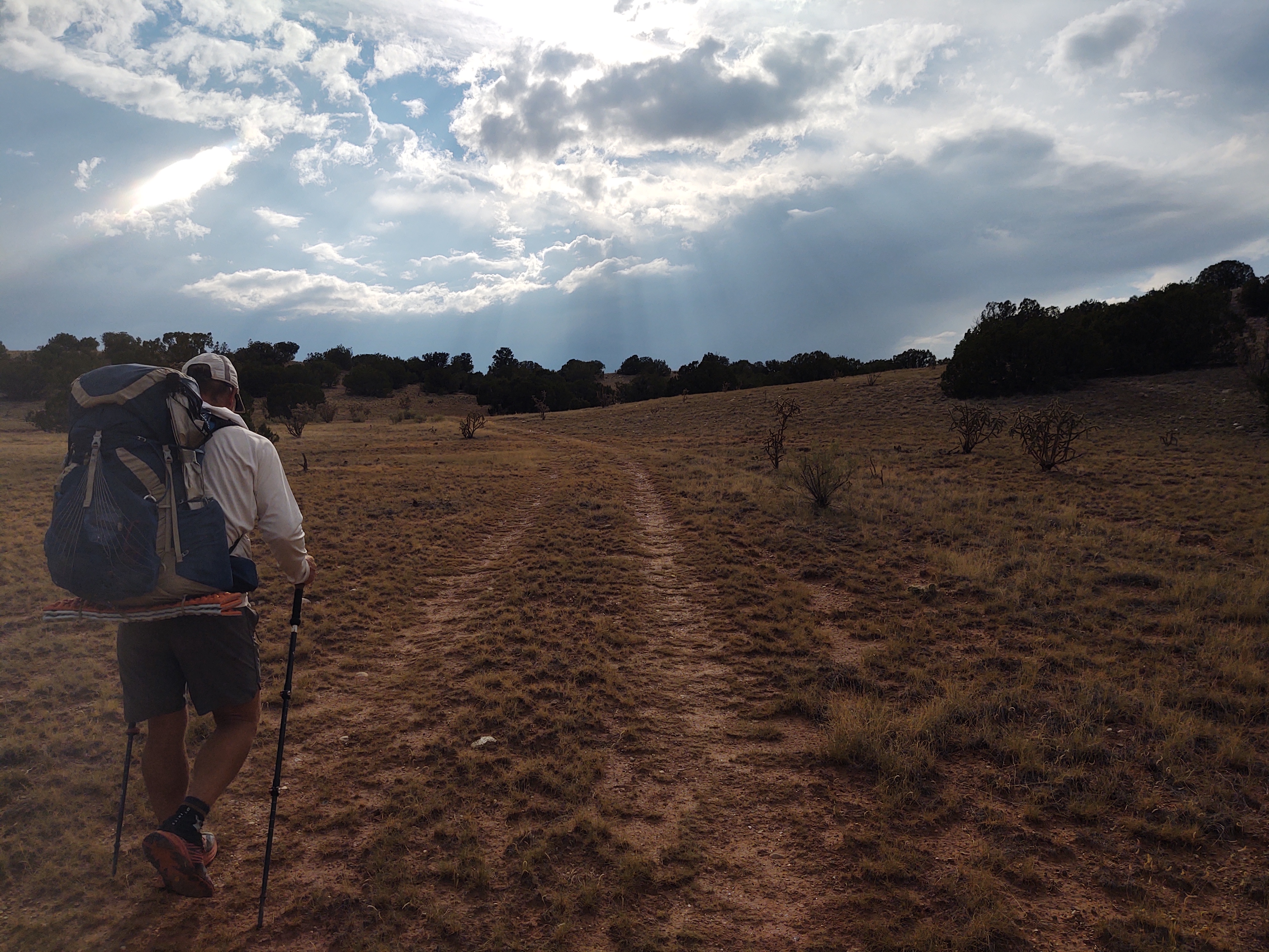
As we continued to climb, up an over 11,000 ft once again, it began to rain. This made our uphill trek quite difficult.

It was highly annoying and often comical as the tread became slick and cakey once again. Many a step would sink unexpectedly into a gooey mess that would threaten to suck our shoes off our feet.

By the time we reached our watering hole, the rain had stopped. Mud still was the norm, but at least we could dry out our tent. While there, elk were bugling nearby.

Once back on trail we attempted to follow the bugling and see if we couldn’t catch a glimpse of the bugler, but to no avail.
As with all trails and days on the CDT, what goes up, must come down. And, unlike most days, our last 2 miles of the day were downhill.

Seriously downhill. Jagged and shifting rocks, and often mud the consistency and slickness of moose snot, was our tread. All this was coupled with dark and foreboding clouds overhead. Just a run of the mill day on the brutiful CDT. After crossing Hwy 96 we climbed briefly, yet again. Just as the light was fading into the darkness of the coming night, we found and cleared a flat place to camp not far from the trail. Barking dogs and yowling coyotes accented the evening as we, sufficiently exhausted, nodded off to sleep.
Earlier in the day we had received a message on our Garmin. Jan (Sheep Goat) was closing in on us. A reunion is in sight. With any luck, it will be tomorrow.

