The thought was to get up early, as we had Piegan Pass, which meant over 2400 ft to climb before making it to the day’s destination, Reynolds campsites, a mere 15.2 miles away.
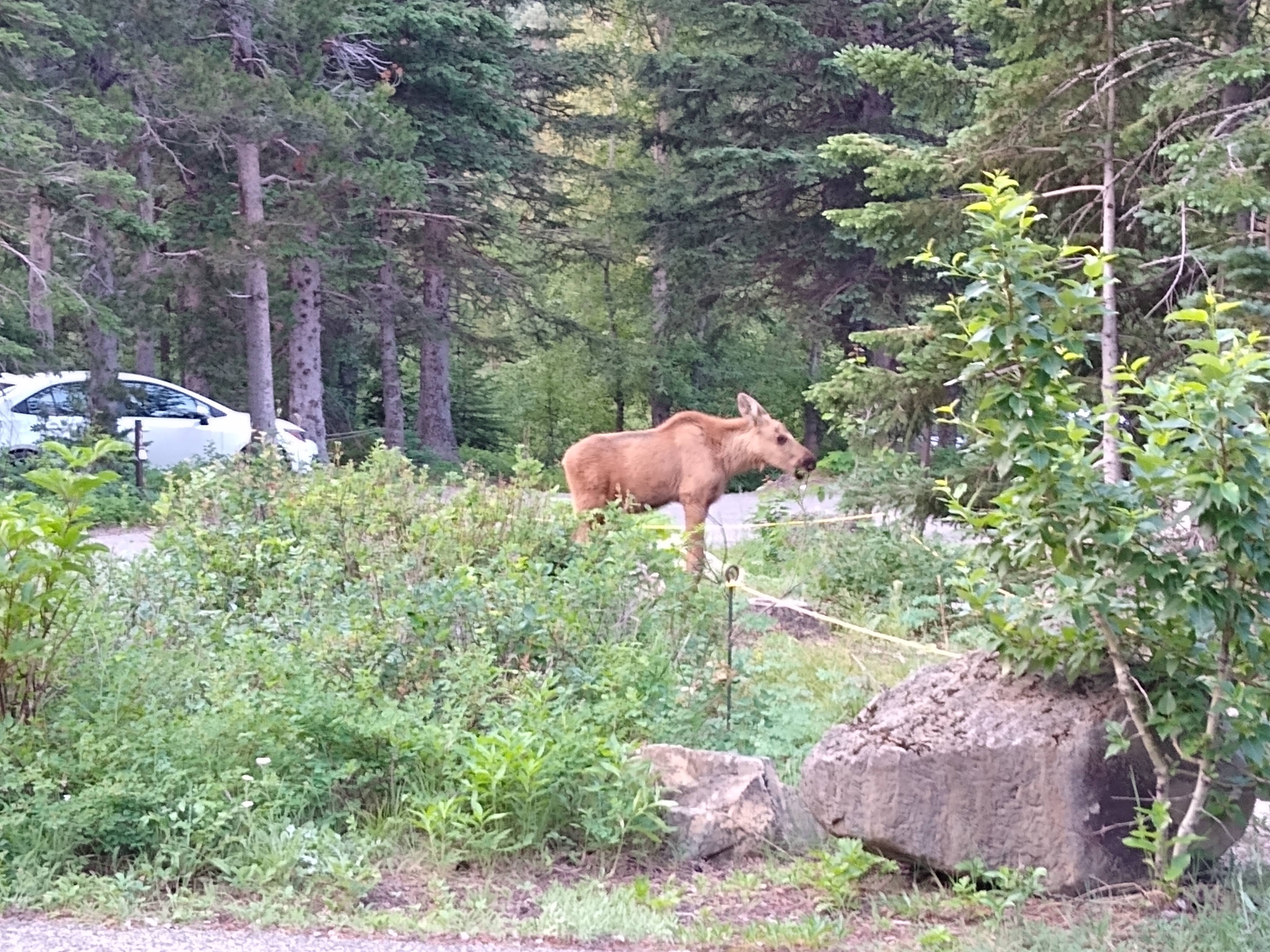
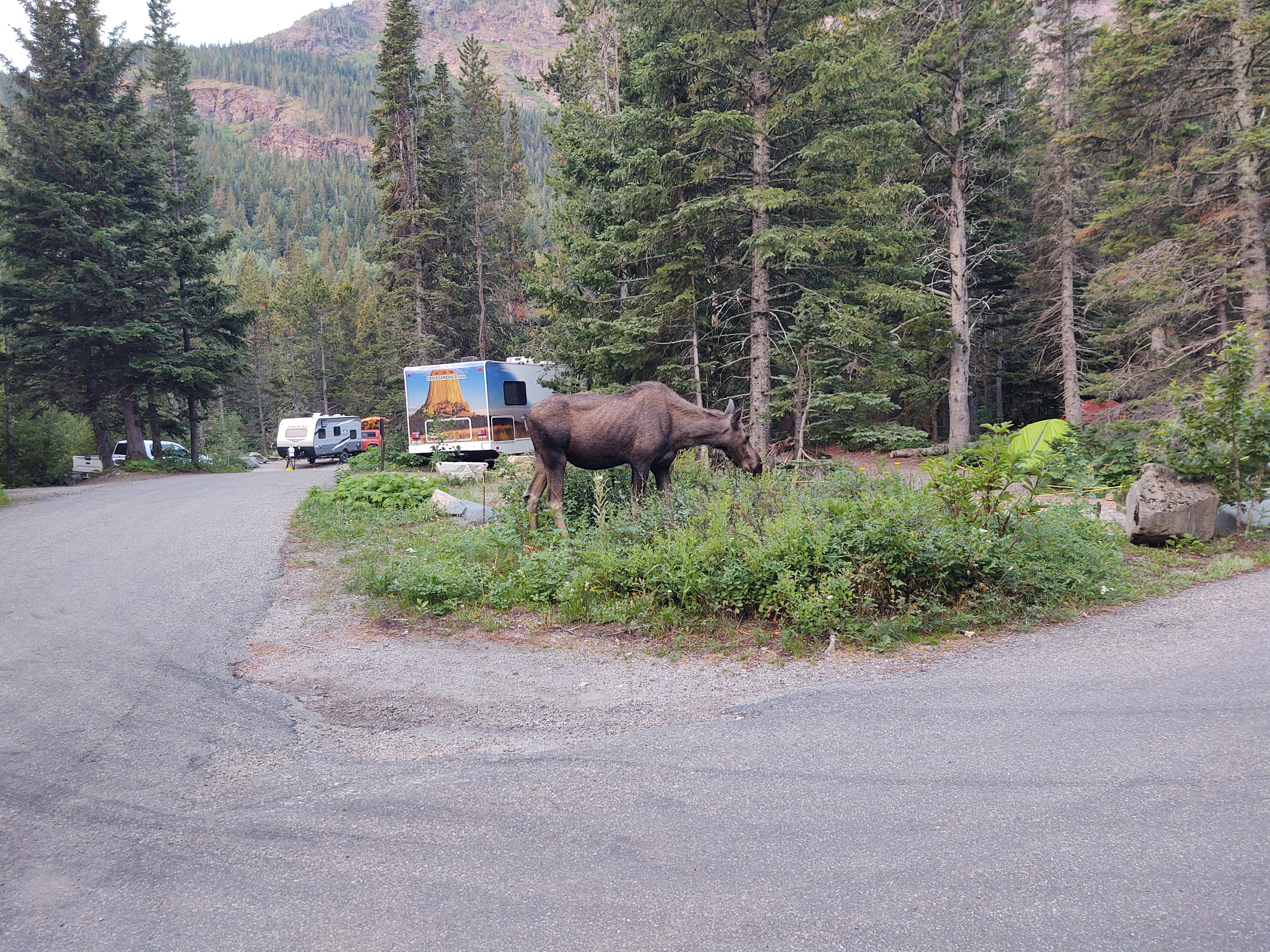
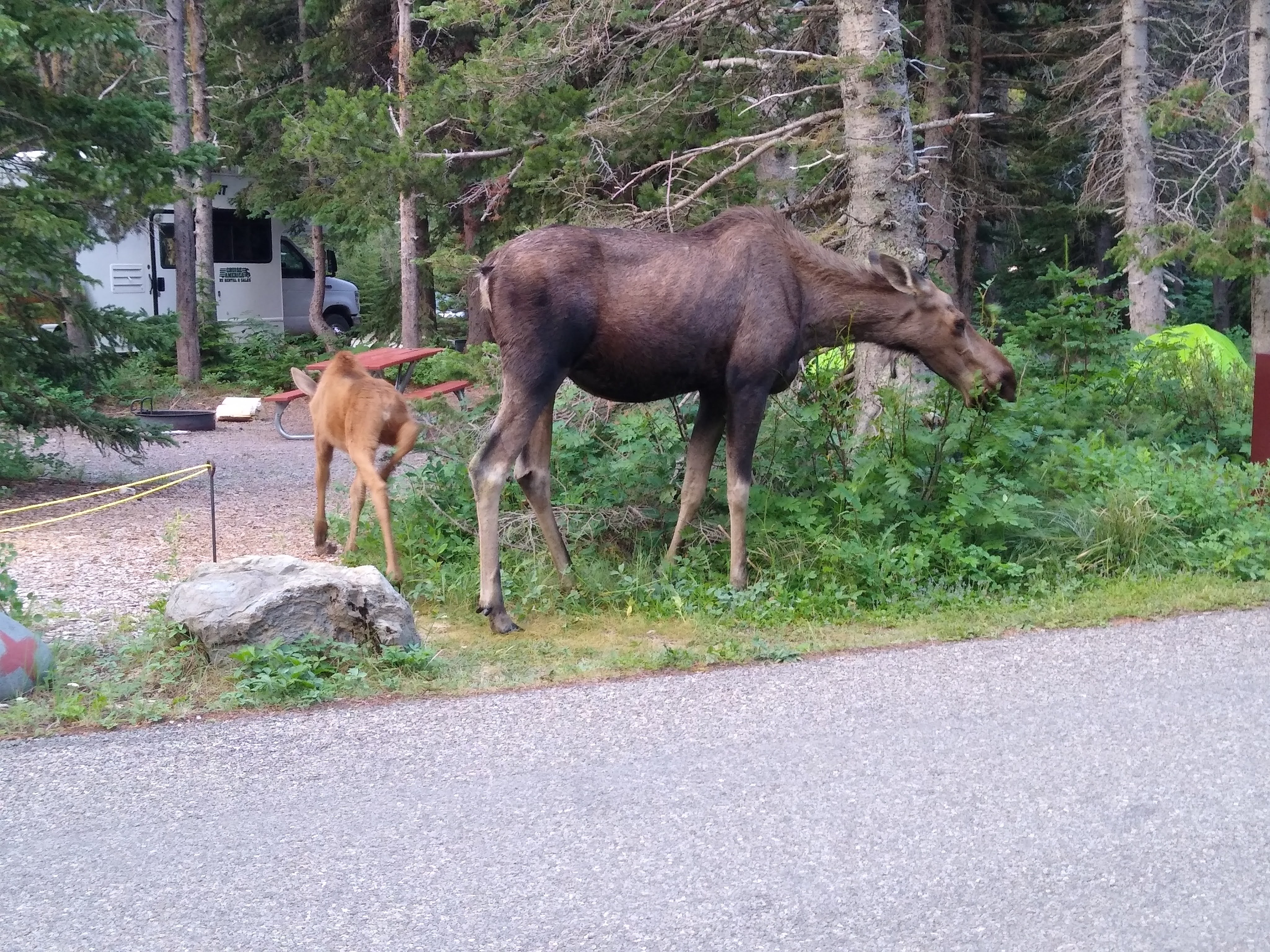
We were up early, but so was the wildlife. As if on que, a cow moose and her calf wandered calmly through the campground munching on the vegetation, directly across from us. Sometimes it pays to get up early.
Walking into a sunrise is equally awesome. We passed several people with large cameras waiting for the sun to hit the magnificent rock face across the lake from the Many Glacier Lodge.
Hobbit acting like a tourist
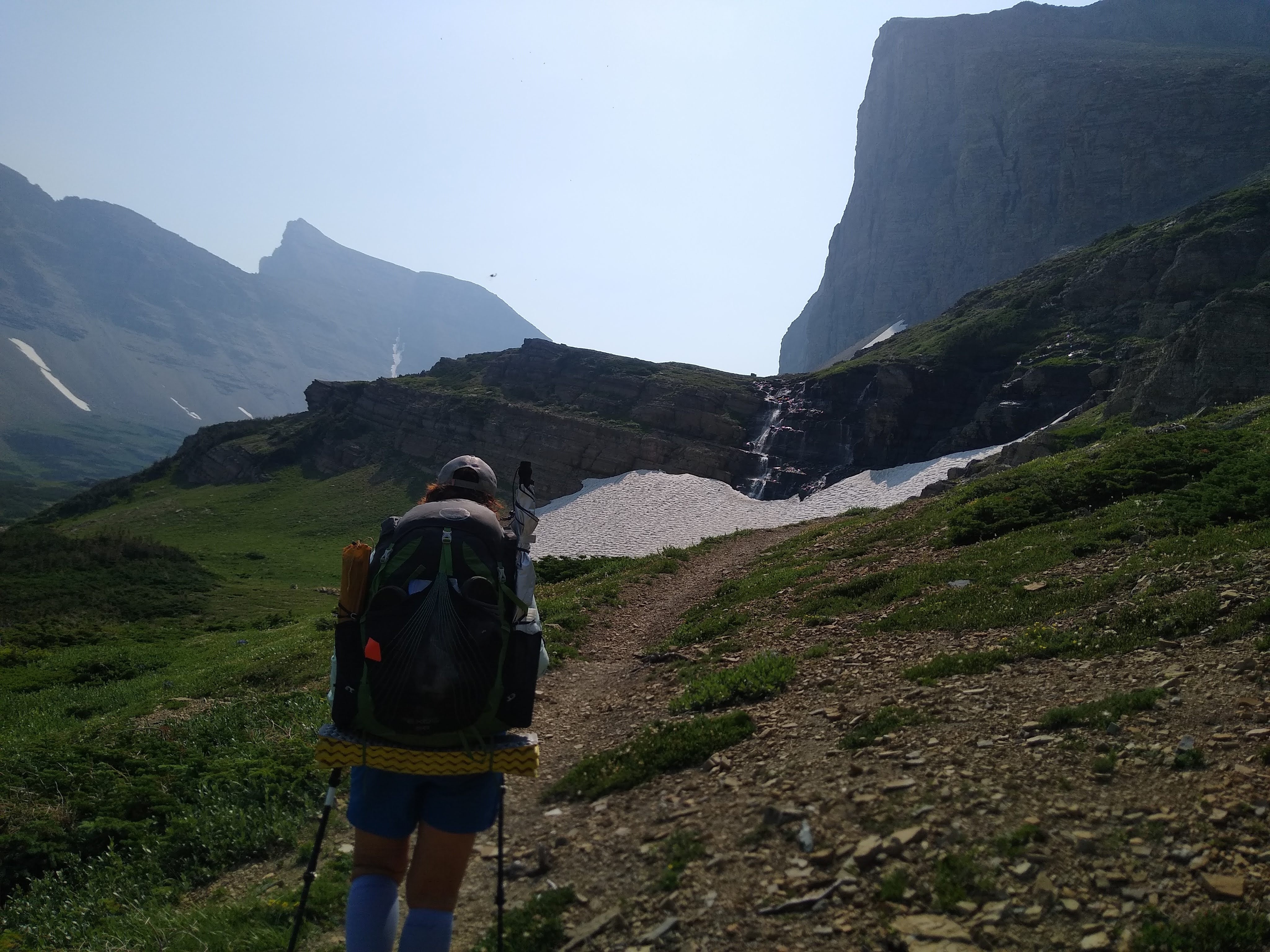
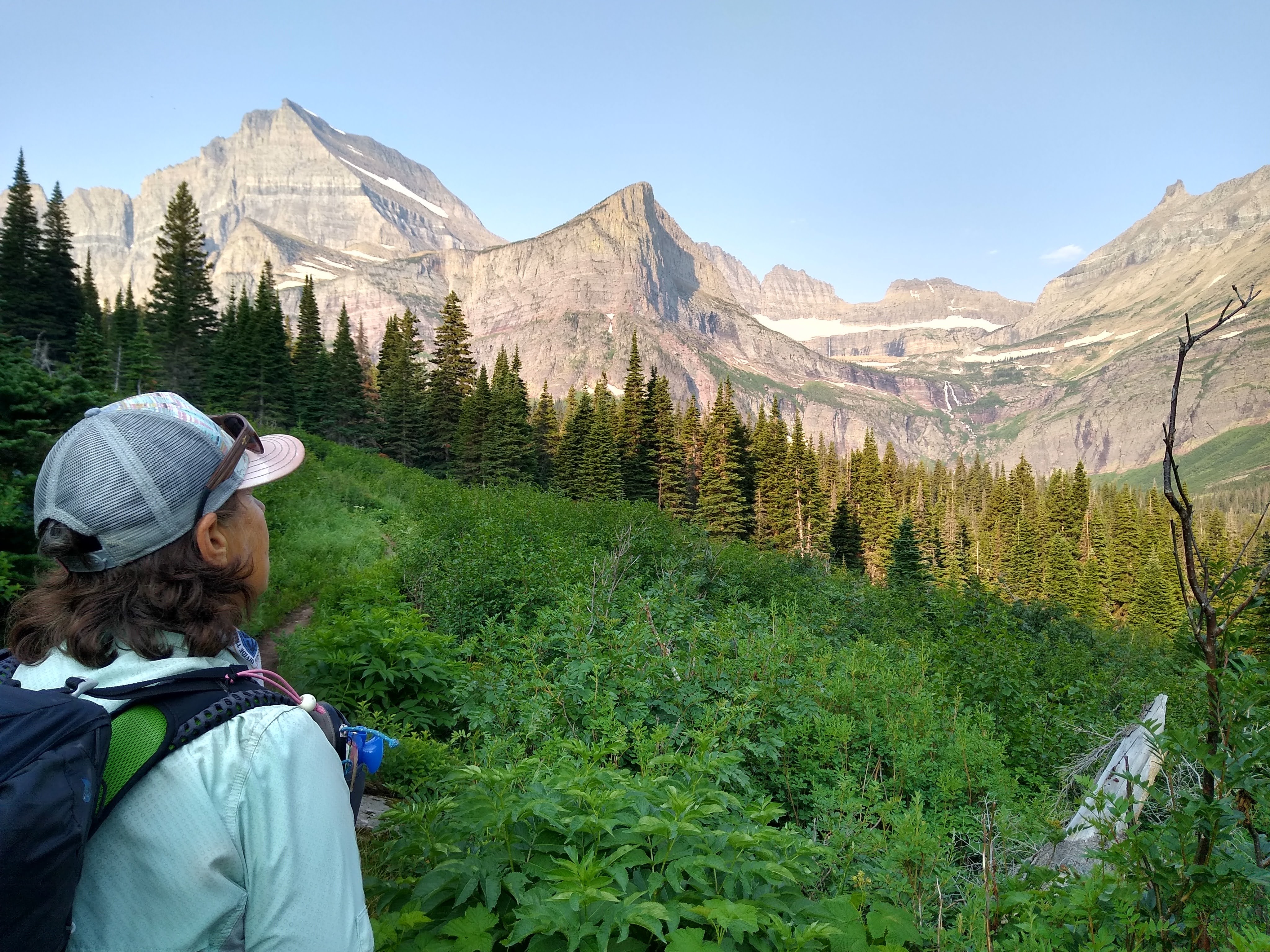
The climb was, well, a climb. Think stairmaster at the gym for over an hour breathing through a straw. Not gonna lie, I was more than out of breath, and my thighs were screaming. Even so, we were so glad we trained as hard as we did. I can’t imagine starting the CDT, going SOBO, without training and/or being in great cardio shape.
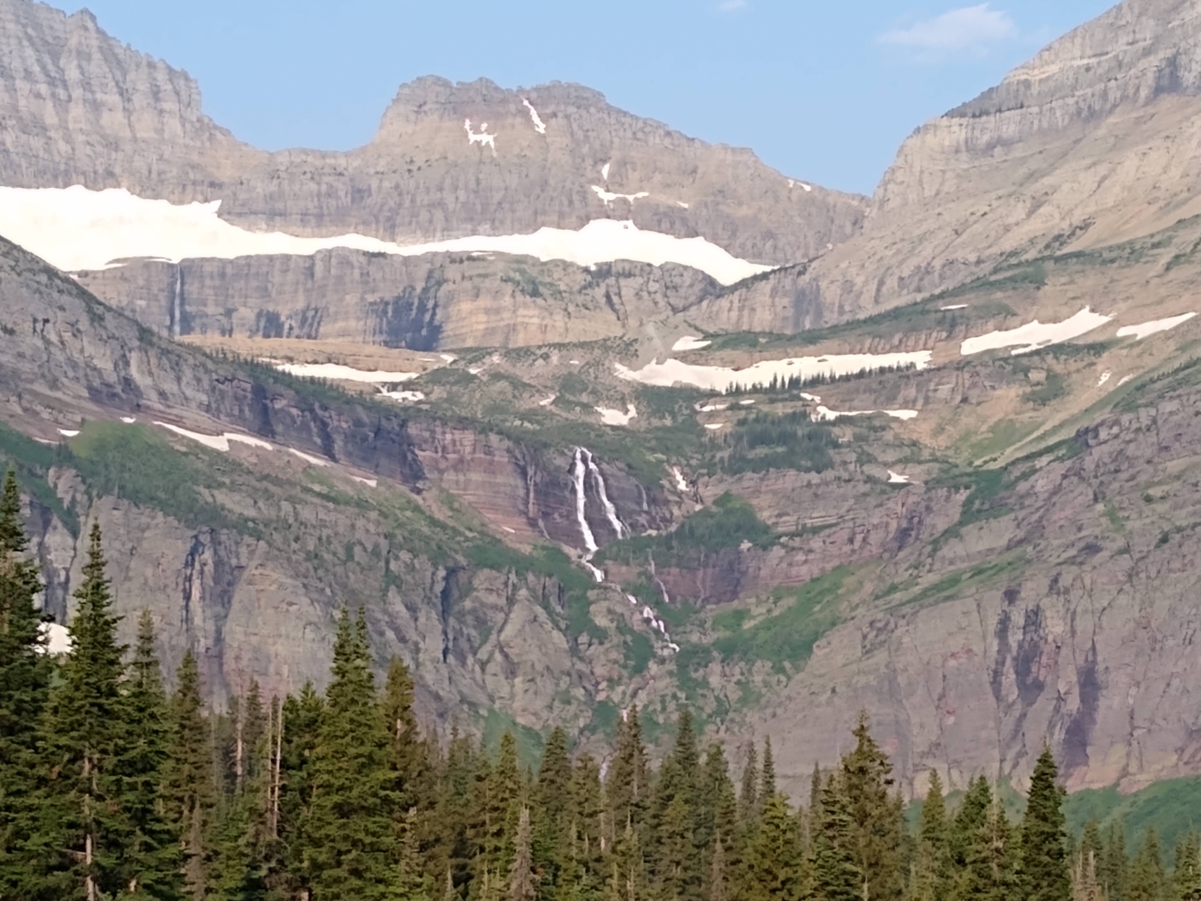
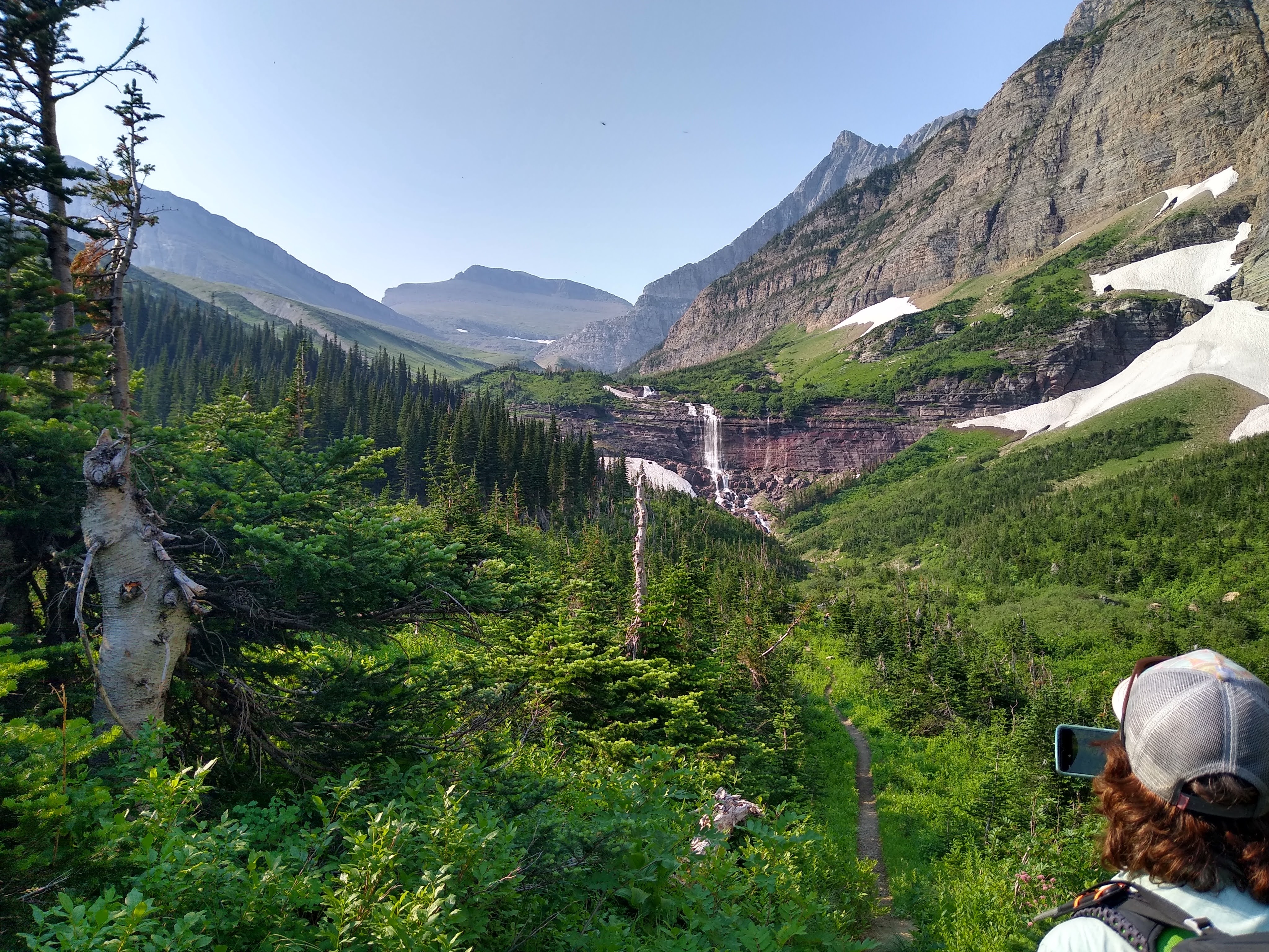
The views however were breathtaking in themselves. Waterfalls nearly everywhere.
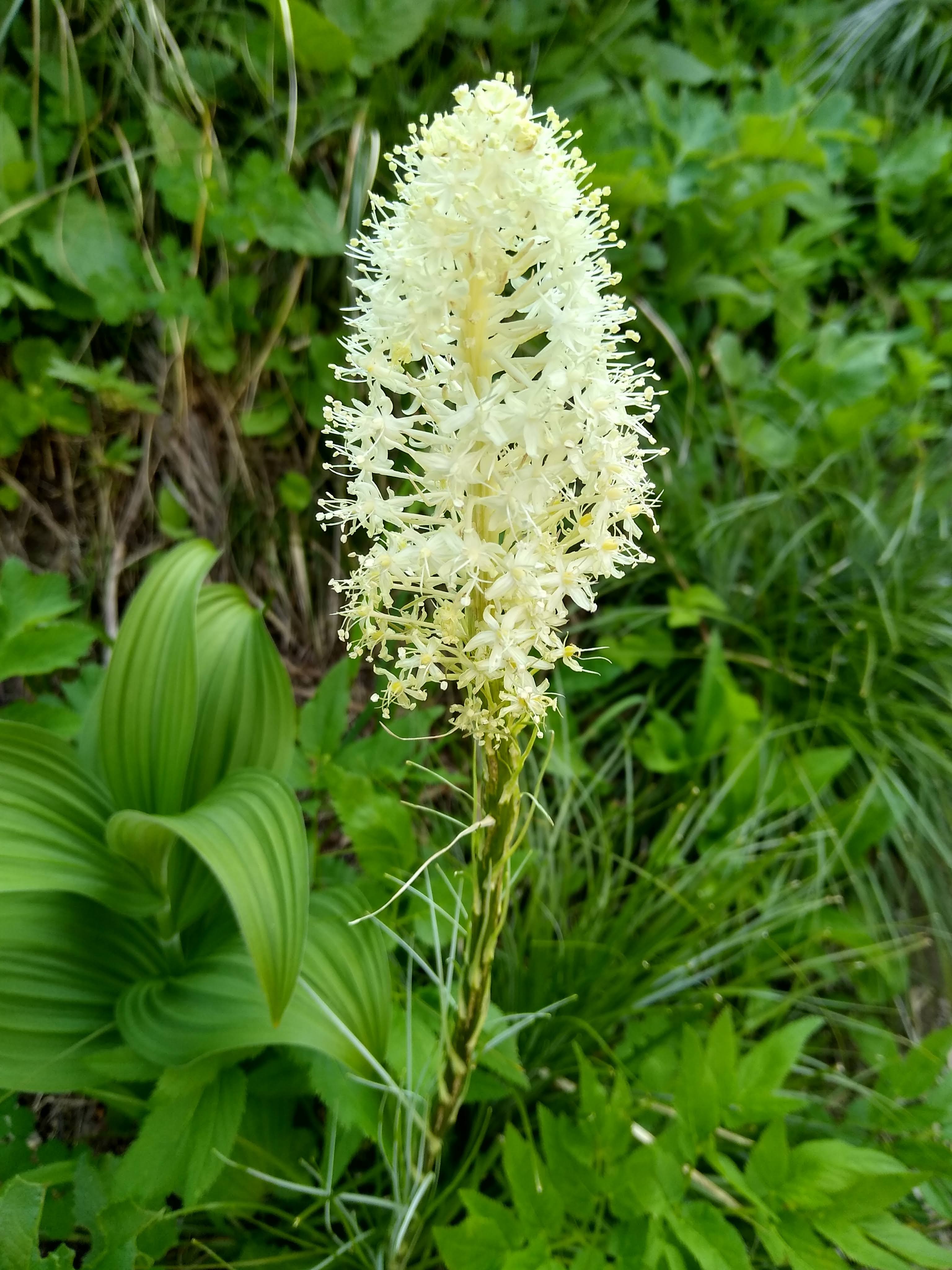
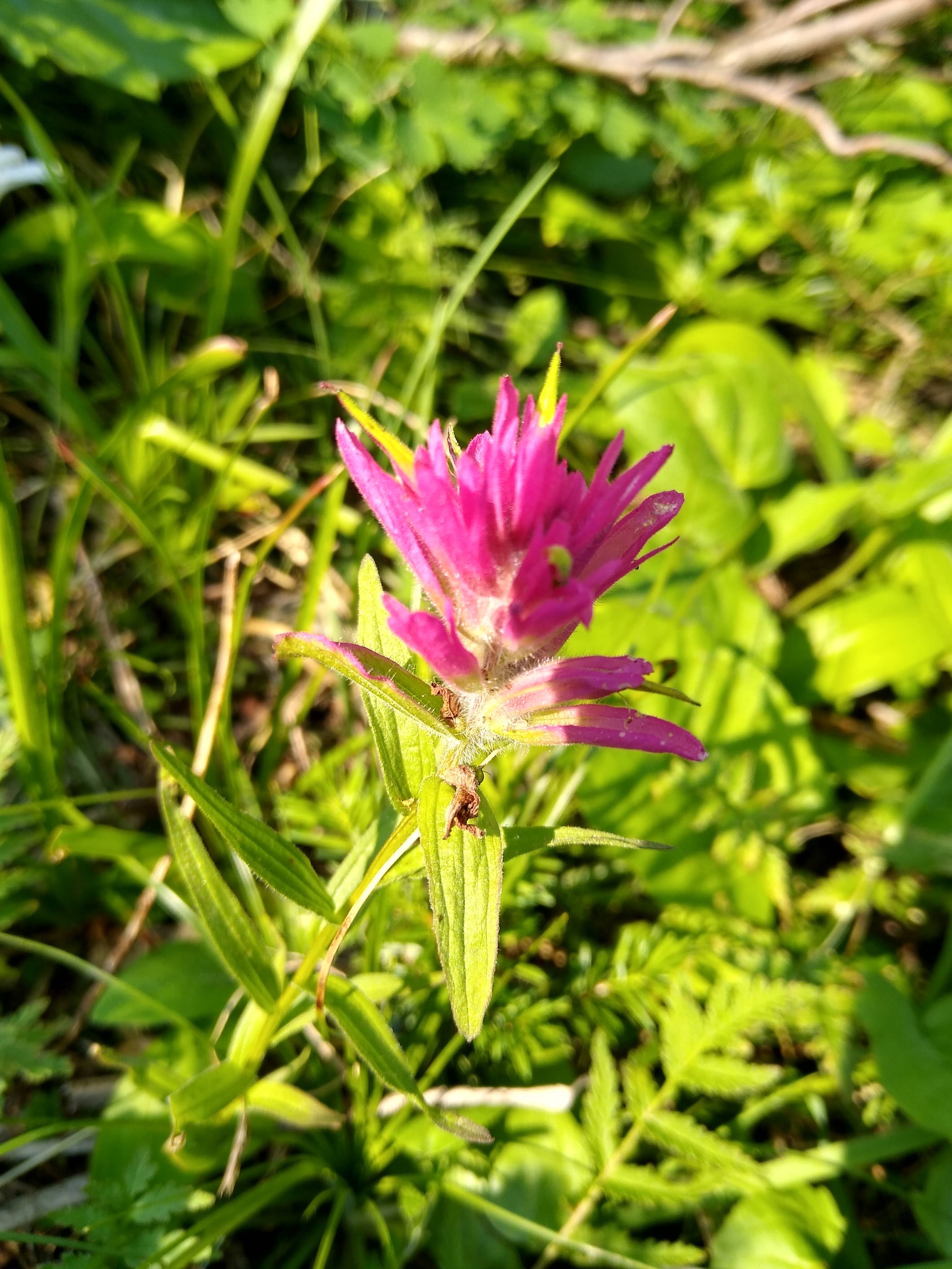
Flora and fauna was abundant on our approach to Piegan Pass.
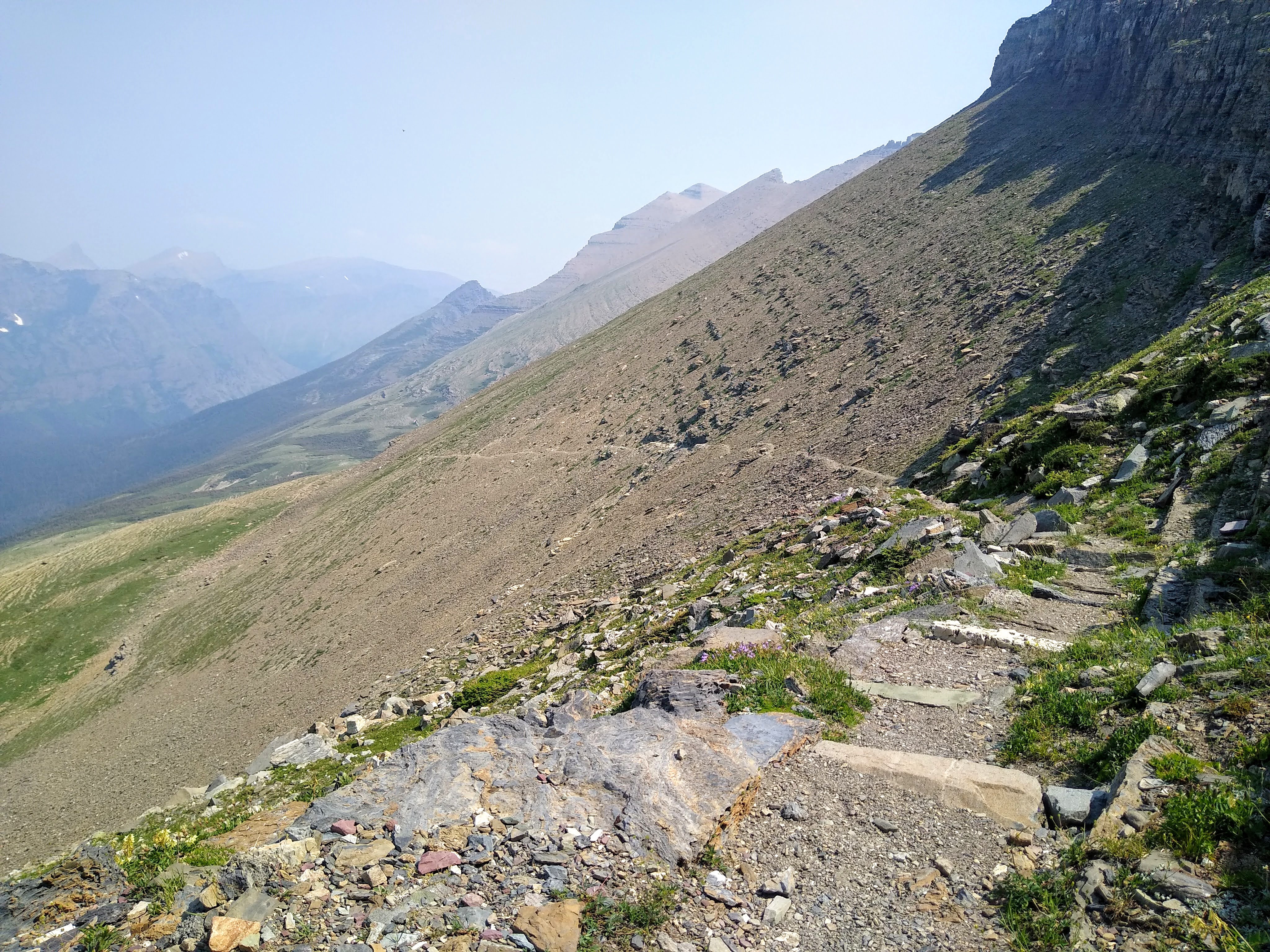
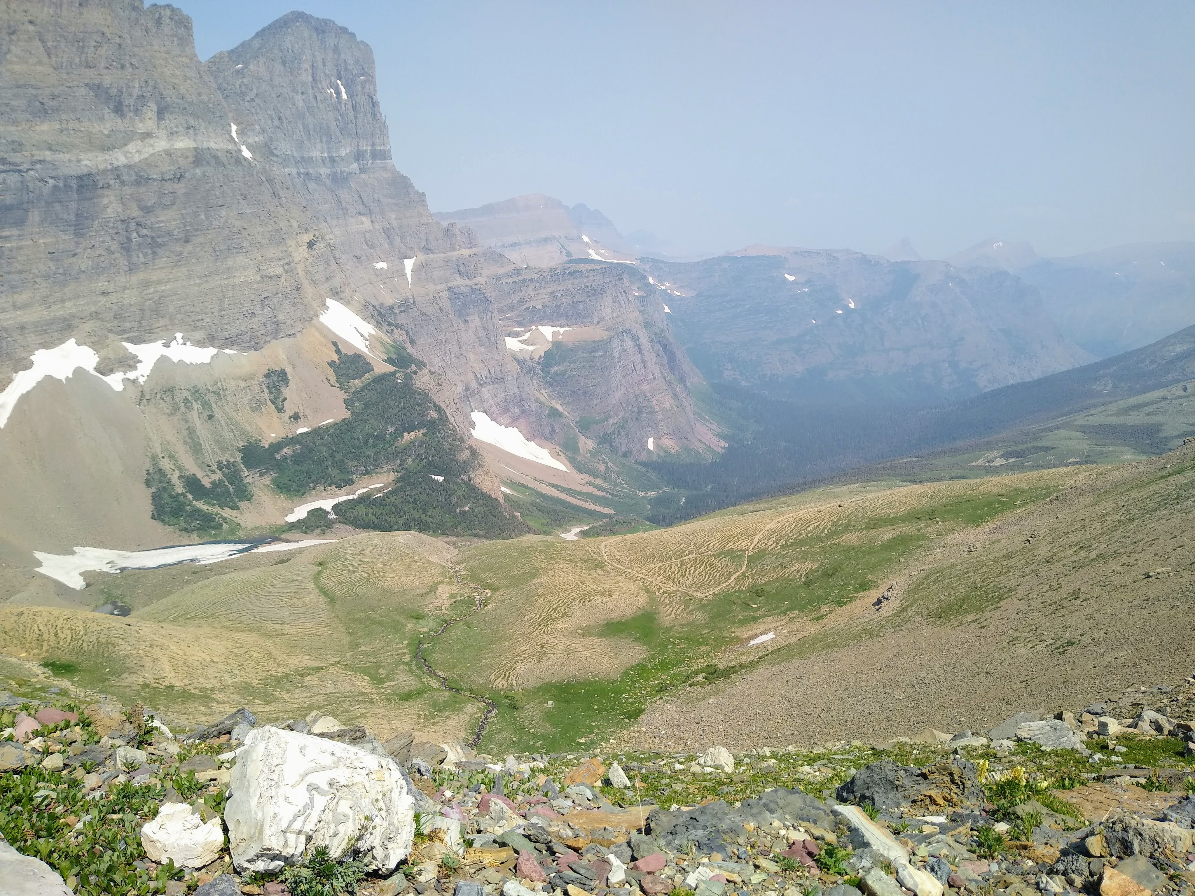
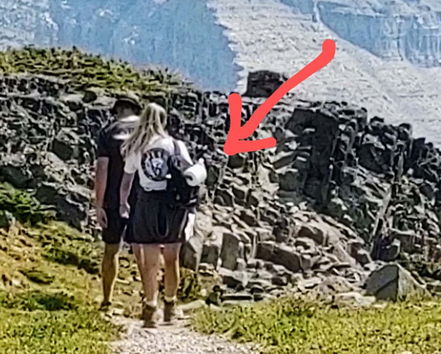
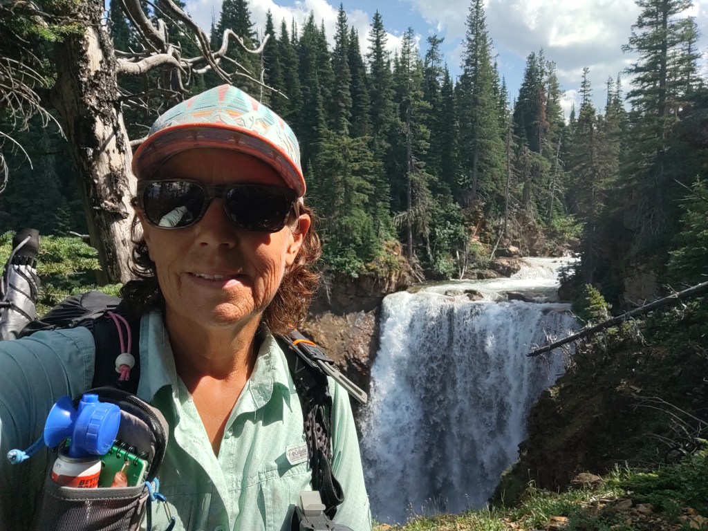
Once to the top of Piegan Pass (7574 ft), we ate lunch and took a well earned nap. I awoke just in time to see one of the most unique methods of TP carry ever.
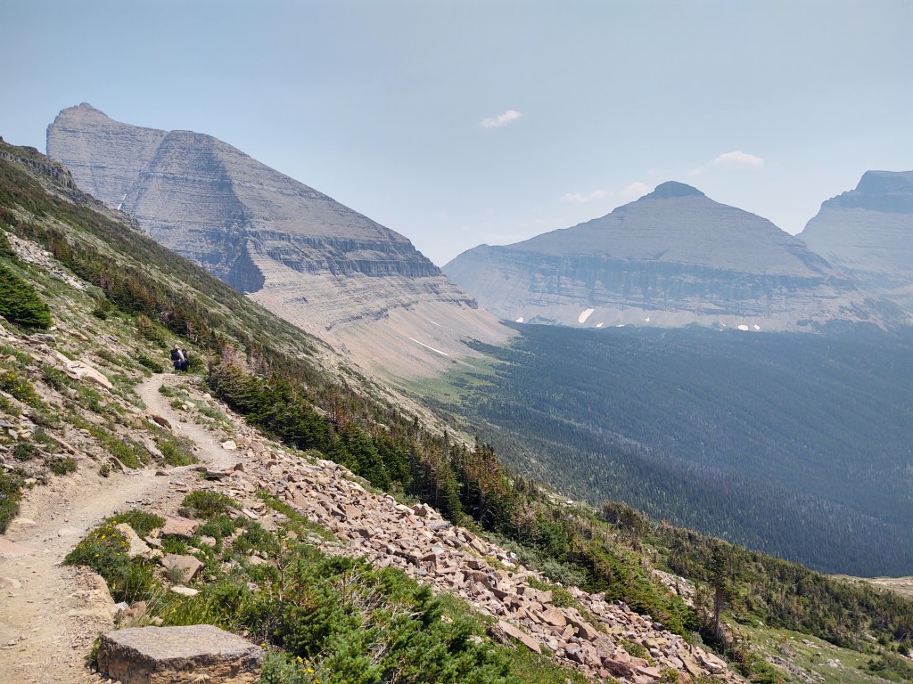
Once we were all packed up, we meandered down the trail.
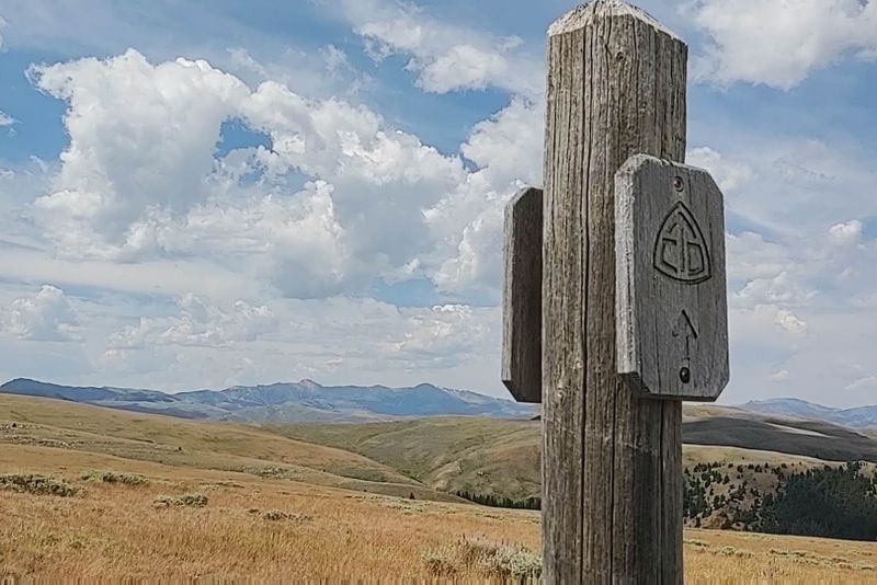
Zoom in on the photo and find the trail
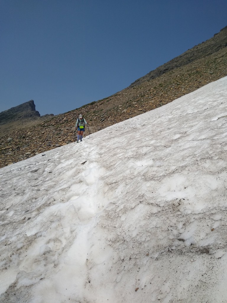
On our descent from the pass and toward the Going to the Sun road, we had our first (and so far only) snowy traverse of the CDT.
We were amazed at the number of people on the trail…day hiking, and the traffic on the Going to the Sun road. I can’t imagine what the crowds would be like WITHOUT the reservation requirement to enter the park.
While taking a break at the trail head to our intended campsite (Reynolds), I discovered that I lost the cap to my Powerade bottle. Highly problematic. Luckily I was able to “yogi” a cap from a day hiker who was headed to his vehicle.
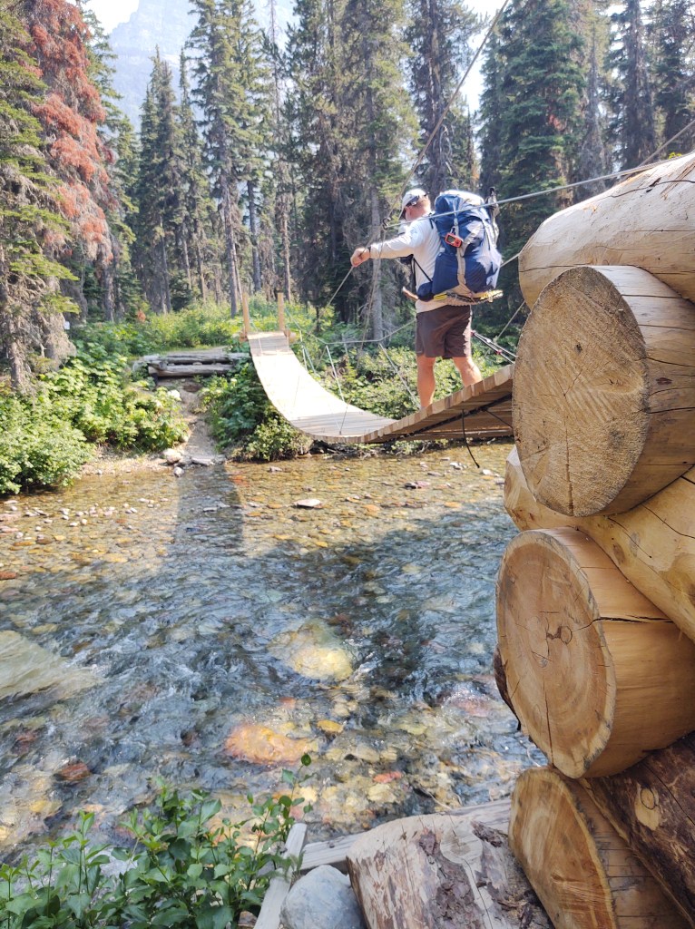
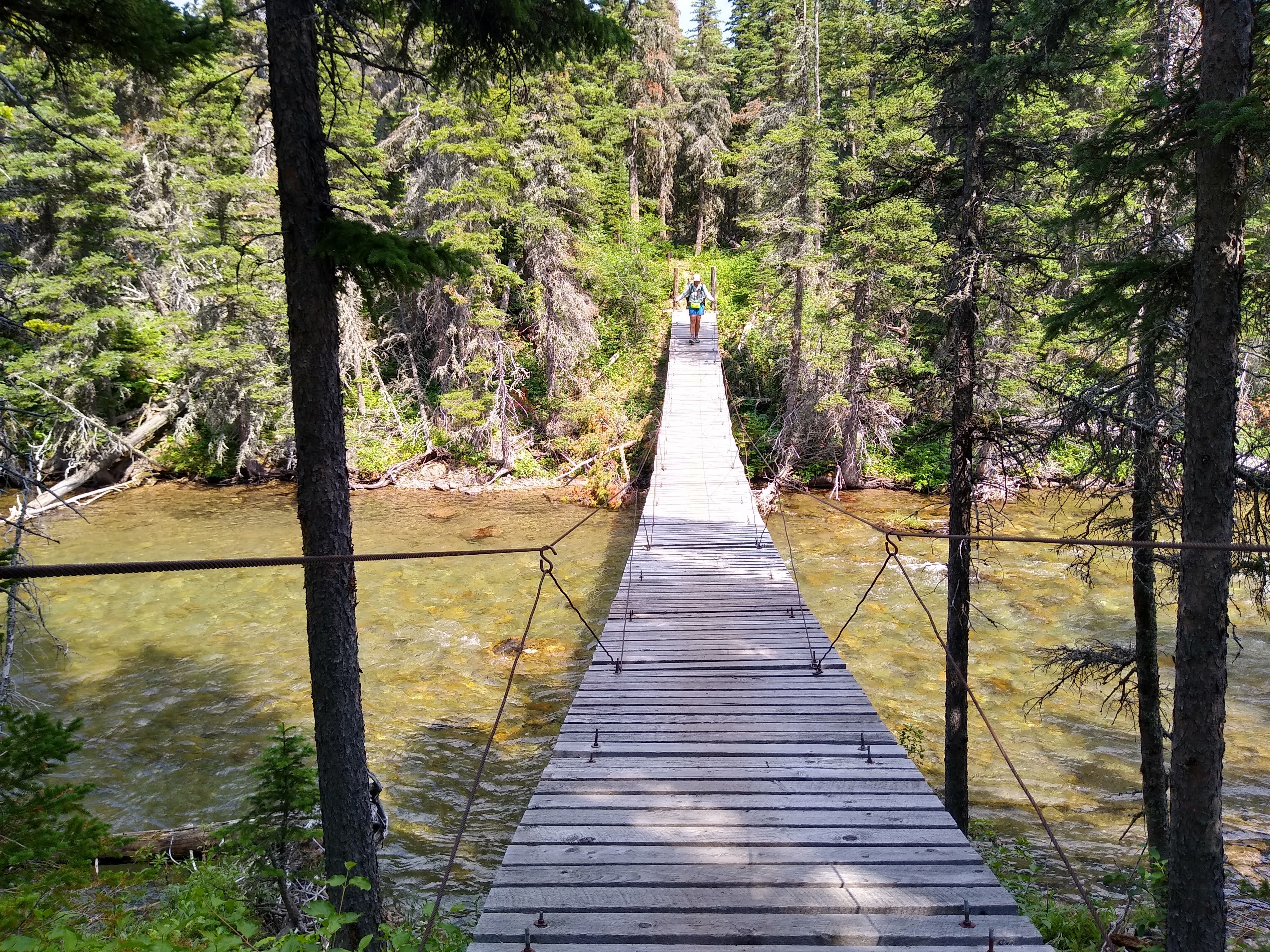
After a wobbly bridge crossing, and a quick rinse in the very chilly, yet invigorating creek/river we called it a day. But, not after a group of six backpackers (not thru-hikers) totally buggered up our food hang lines. We decided that we would NOT be quiet in the morning.
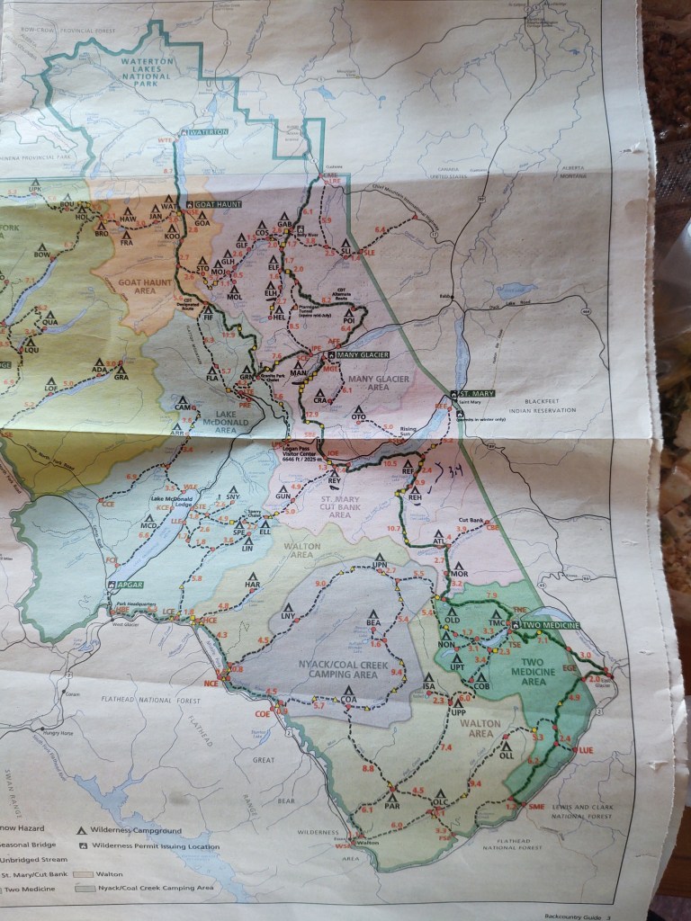
If one wanted to truly slow walk through GNP with “minimal” miles, it can be done. In fact, if we were smarter, and had money to burn, we could have packed for two days and resupplied in Many Glacier (Swiftwater Store) for the three additional days to Two Medicine Campground, and the camp store. We did somewhat of a hybrid…not by design though.
We had a choice for our first evening’s campsite. 6.1 miles to Gable Creek, or 11.1 to the head of Elizabeth Lake. Because we were capable of doing the 11.1 miles, Elizabeth Lake (ELH) was our first night’s campsite.
The following morning we hefted our packs and retraced our steps (1.6 miles) from the “head” of Elizabeth Lake to her “foot”, and back into the CDT (alt.) southbound, giving us our first 3.2 “bonus miles”.
Elizabeth Lake Foot
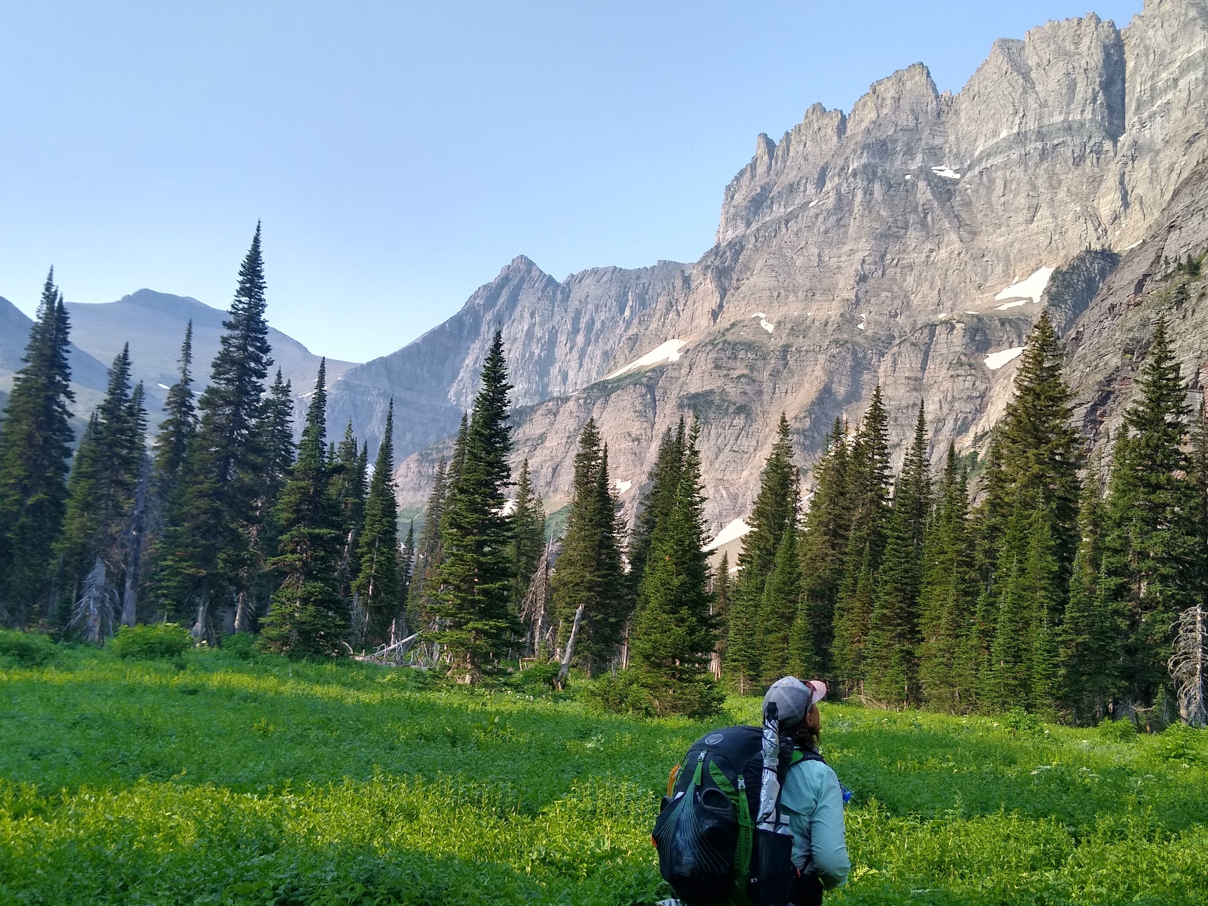
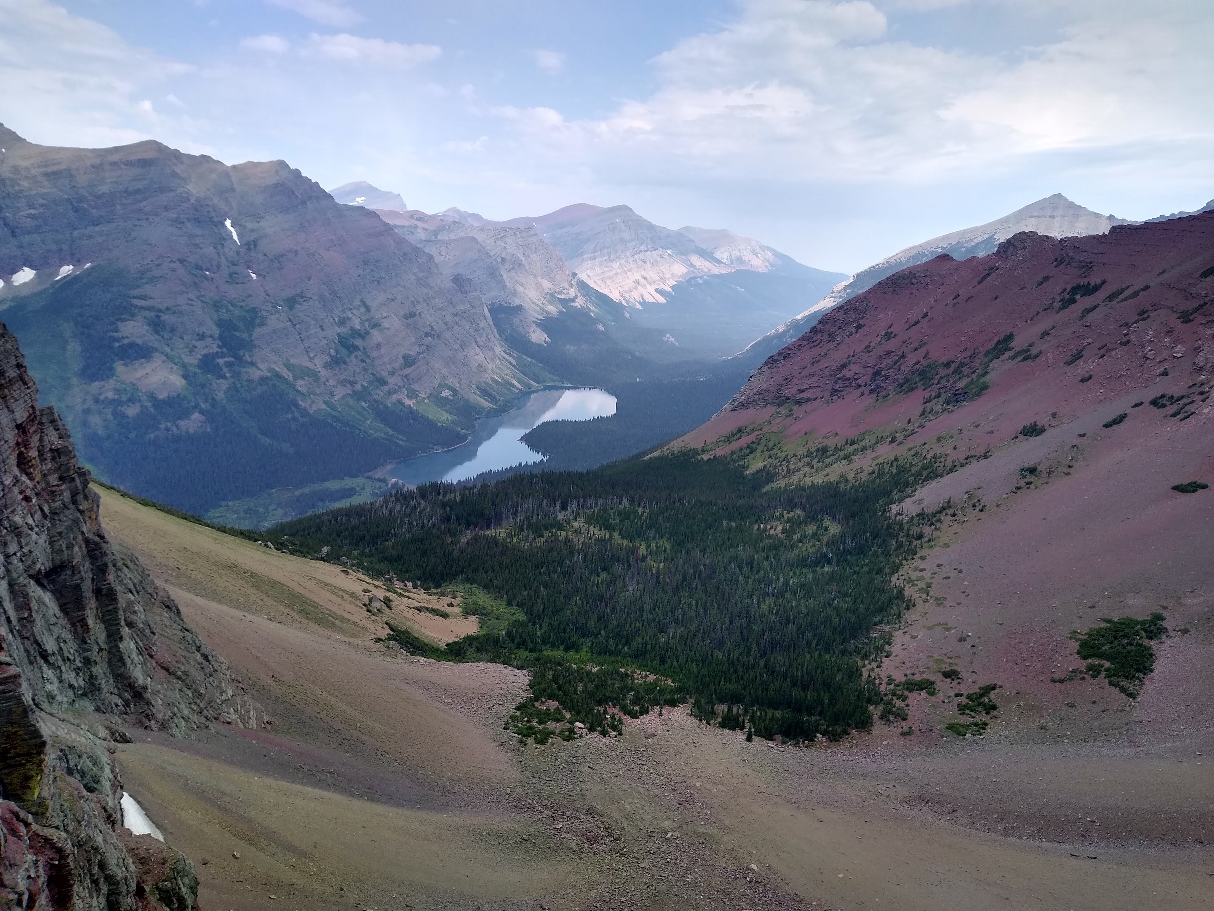
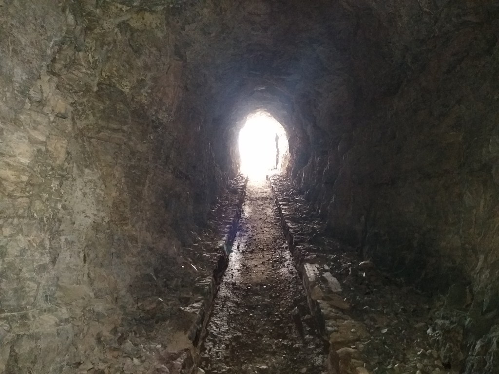
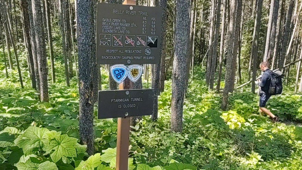
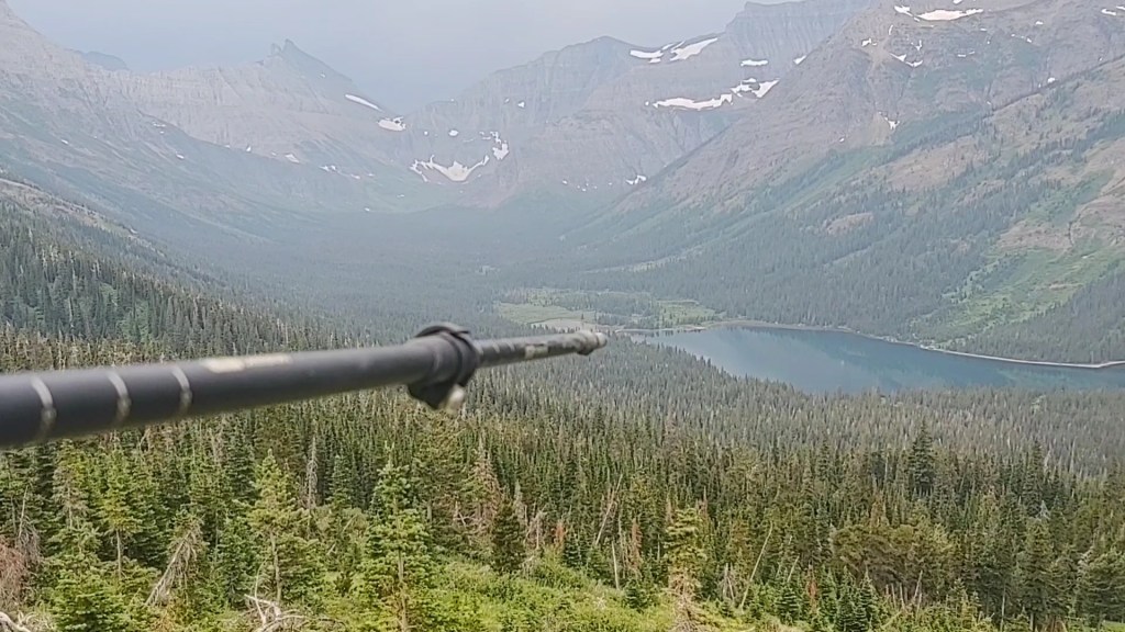
This, our second day’s destination was to the backpacker sites at the Many Glacier campground (59/71), 11.7 miles away, via the Ptarmigan tunnel at 7,200 ft. The tunnel was originally built in 1930 by the CCC (Civilian Conservation Corps) for horse travel and tours. The CDT route from Chief Mountain actually goes through Red Gap pass, which is 6 miles longer. However, from the very beginning, we wanted to take the tunnel…cause well, it’s a tunnel that took jackhammers and dynamite to drill through 240 feet of solid rock in a high mountain, and we were traveling with a Hobbit. The Red Gap Pass route had been closed due to a grizzly bear encounter along that route. A hiker unknowingly came across a bear who was guarding a recent animal kill near the trail. The bear, defending it’s kill, charged the hiker. The hiker then deployed the entirety of his bear spray and ran like hell into two CDT hikers (Meta & Baggins), who then packed up and headed swiftly down to Many Glacier to report the incident…and of course get as far away from the bear as possible. Thus, we got to take the tunnel, but not until after a hearty climb.
The views upon approach were stunning, even with a thin haze muting the brilliant blue skies, from the fires in Oregon and nearby Canada
Once through the tunnel (240 feet), another magnificent view opened, and throngs of day hikers appeared like ants making their way up to the tunnel’s unique perspective.
Anxious to get to camp…and beer, we hustled our way down the busy and definitely crowded trail, but not without a stop at a stream to soak our feet. We couldn’t help but notice that we were the focus of many cameras whilst doing so.
Back upon the trail, we were interrupted by a deer hastily making its way across our path. Further down the trail our path was once again obstructed by a gaggle of (some anxious and some intrigued) people marveling at a very large bleached blonde sow grizzly and her two cubs feeding on vegetation some 40 feet above the trail. The fact that she was slowly making her way down to the trail disturbed only a few (which included us).
Bears are just out of the picture above and to the left
I found it more fun to watch the people as opposed to the bears. Not wanting to witness or capture any carnage, we weaved our way through the crowd and continued to the Many Glacier campground…and store.
PBR, it’s what hikers crave
Once we set up our tents, it was time to peruse the store for libations. Whilst imbibing on the store’s benches, an elderly woman joined our conversation. Turns out that he son swam for a coach I knew from Gilroy. Small world.
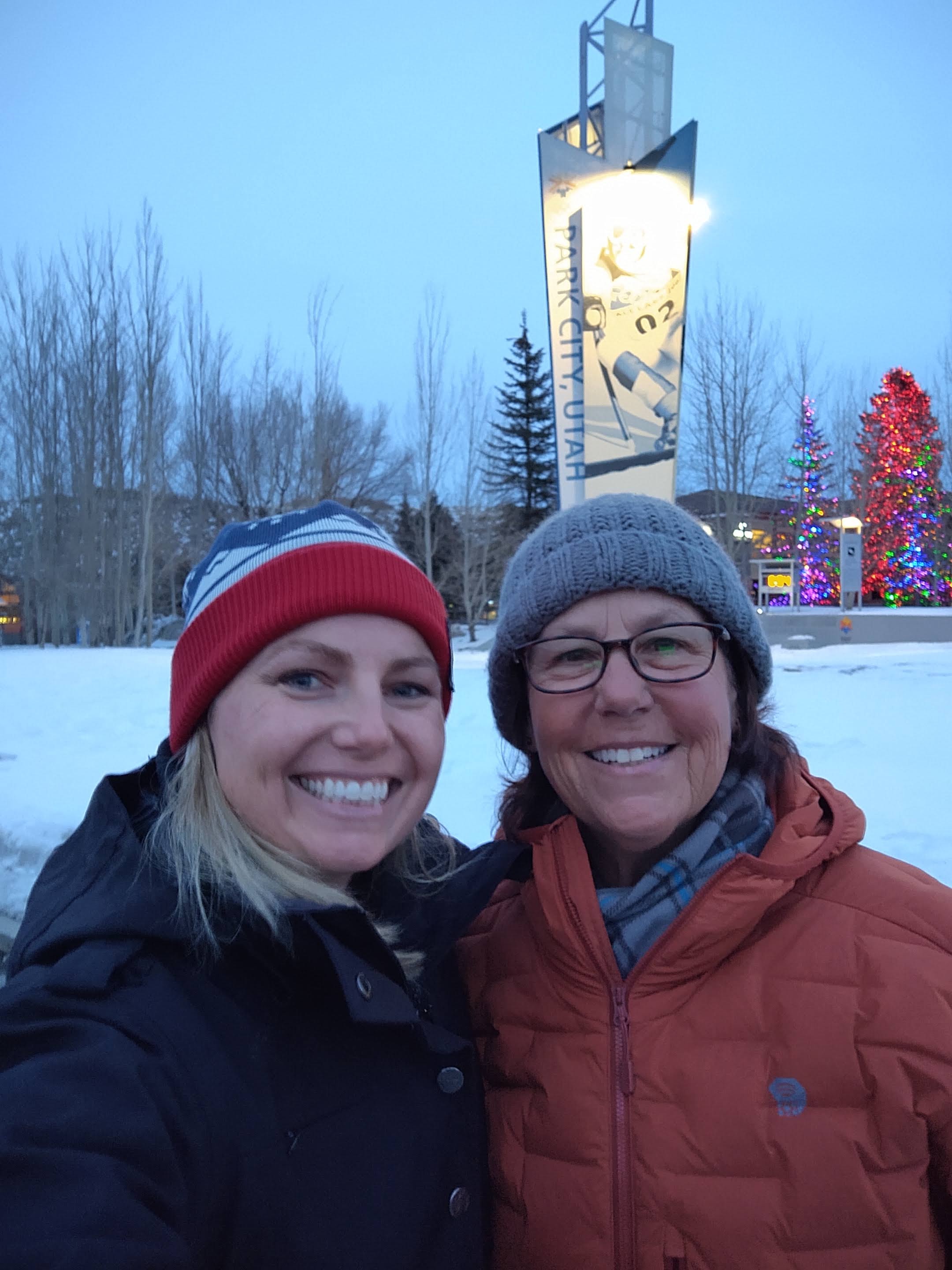
Starting in Glacier National Park at the Canadian border on the 110 mile segment of the CDT seems like cheating a bit. You have “short” miles and magnificent views. You can’t help but say and point, “Oh my gosh, look at that!”… repeatably. It’s like being a kid in a toy store. What makes it even better is sharing it with great people. Just by chance we have started our SOBO CDT hike with, for lack of a better term, a small “trail family”. What do a Chinese Canadian, a Naval Dane and two old retired farts (that would be us) have in common? Serindipity.
We have been hiking together since day One!
A little back story…
On the Facebook CDT 2021 group, a Danish man (Jan) was hoping to hop on a camping permit for Glacier National Park with someone who already had a permit. (You can have up to four people on your camping permit.) I messaged him and told him we would see if we could add him, as it appeared that we all would be staring at the same time. He had been stuck in Mexico (Cancun to be exact), “serving” his 14 day “quarantine”, before he could enter the United States, even though he has been vaccinated. Why he couldn’t fly directly from Denmark, made absolutely NO sense…let alone the “quarantine” in Mexico. He flew into Kalispell, shopped for resupply and the hopped the Amtrak train to East Glacier. He was to arrive after the time we thought we’d have already left for the Canadian border, so we helped him arrange for a ride.
Meanwhile, at the train station, “Hobbit” (real name is He) was looking for someone to share a ride up to the border…and possibly share a permit as well. Hobbit said he just looked for someone getting off the train with a “thru-hiker” pack and approached Jan. Hobbit unofficially became the fourth person on our permit.
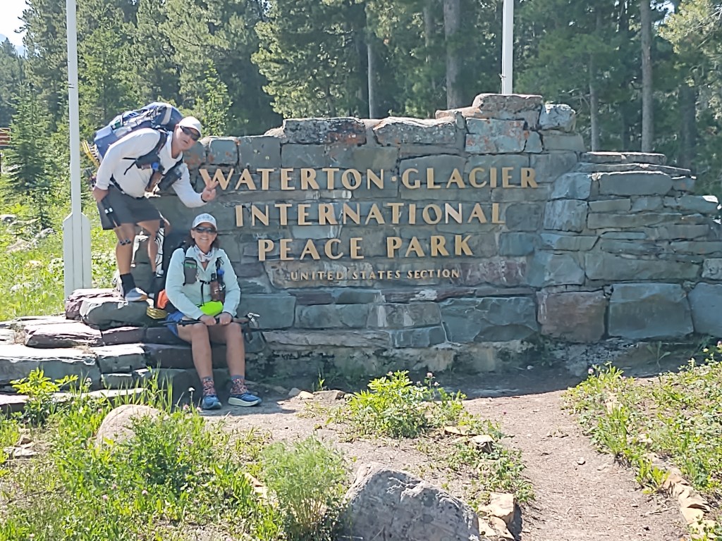
Our dilly dallying for the morning resulted in us getting to the border at Chief Mountain the same time as Jan and Hobbit. This of course was fortuitous, as it laid the ground work for our current crew.
Quick introductions and obligatory photos, and soon we were headed Southbound on the CDT (alternate…as Canada was still closed. Thus, we could not start from Waterton Lake…in Canada)
Because of the high volume of on-line permit applications (over 4500), the Park Service set aside 50% of the Backcountry campsites for walk-up permitting. Arriving at the Two Medicine Ranger office at 5:30 am the previous for an 8 a.m. opening ensured we got a decent itinerary. We either had to do really big miles, or somewhat small miles. Considering it was Glacier National Park, I chose “small” miles for our trek through GNP. Why would one want to hurry through it? Jan and Hobbit were perfectly happy to do “small” miles. It was no less than a dream come true for them. Jan was hiking the CDT as a “gift” to himself for his 50th birthday, and to honor three close friends he lost during deployments in Iraq and Afghanistan. Hobbit had been waiting for two years to be able to begin the final leg of his “Triple Crown”(PCT, AT, CDT).
Day One (0-11.1 miles)
Chief Mountain – Elizabeth Lake Head (ELH)
From the Canadian border we began downhill into a lush green canopy of trees, reminiscent of our finish of the PCT in Washington state. Jan and Hobbit, like two excited kids, raced ahead and soon were out of sight. This was a good thing as within 2 miles I had already tripped and taken a header into the ground. In doing so, I banged up my left knee (the one I normally KT tape) pretty good. Needless to say…it left a mark, whose colors and tenderness evolve with each passing day.
Strong, yet “unstable” suspension bridges were the norm for river/creek crossings.
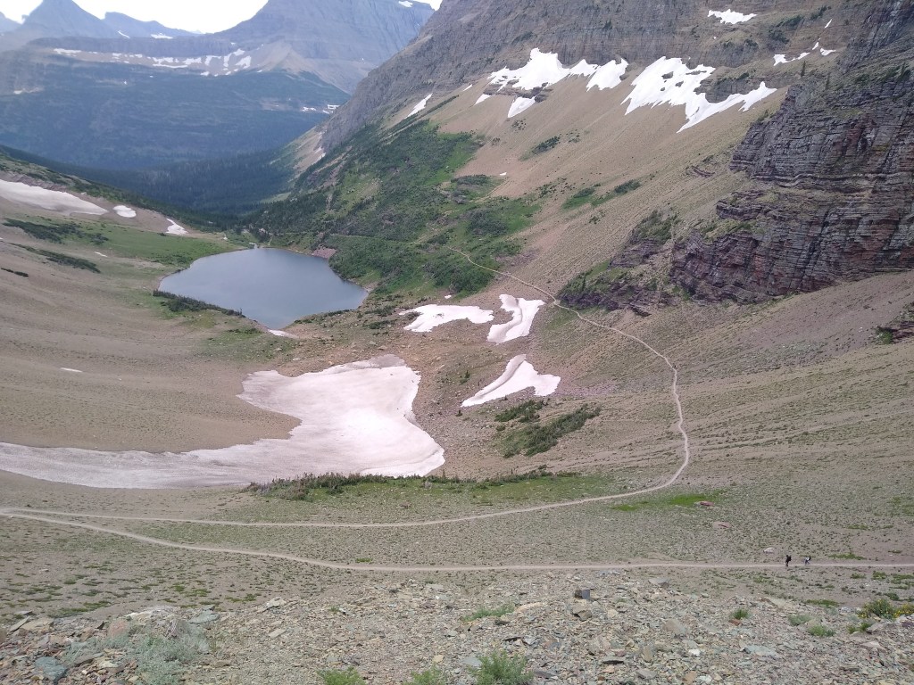
We were glad the miles were “small” for the day, as I don’t think we could have handled anymore beauty. Our mental SIM cards were nearly full. Our first night’s campsite was 1.6 miles off trail at the “head” of Elizabeth Lake. It was somewhat of a jaunt, and once we reached the site, we were greeted by no less that 1000 flies.
Birds eye view of Elizabeth Lake (Head) campsites, on our way up to the Ptarmigan tunnel. The trail continued from it’s “foot” beyond the right of this photo
And let me tell you, these flies, do NOT respect the DEET. Without our head nets, I think we may have been driven mad.
Once the temperature dropped, we were safe to attempt to eat. While at the food prep area, we met a couple who were celebrating their 10th wedding anniversary with a 4 day backpacking trip. “It was her idea”, the husband told me. “I wanted to take her to Hawaii”, he continued. She smiled, nodded and confirmed it was her idea, after which I logically asked if they had been on many backpacking trips. “No, this is our first”, she replied with a chuckle. An unsolved mysteries episode suddenly flashed in my head. Come to think of it, we never saw them make it back to Many Glacier where, like us, they were headed the following morning.
Our itch to complete the Continental Divide Trail (CDT) is about to be scratched. After completing two “marriage testy” projects that took waaay longer than intended, and a “lightning round” of packing, we are all packed up and on our way to where we left off last year. Leadore, Idaho.
From Leadore, we’ll put our truck in storage, and our buddy Mike will pick us up and drive us to Glacier National Park. With any luck during an early morning visit to one of three Glacier National Park backcountry ranger offices, we’ll have a reasonable itinerary that has us starting at the Canadian border (Chief Mountain) and heading fully SOBO on the CDT.
The plan is to hike from Chief Mountain to Leadore, and then drive to Rawlins. (We completed Rawlins to Leadore, NOBO on the CDT in 2020) Once in Rawlins, we’ll put our truck in storage and continue SOBO all the way to the Mexican border, finishing at the monument at Crazy Cook Corner.
God willing our intended adventure will be devoid of Injury; Unpassable Weather and/or Event(s); and more importantly, a Family Emergency. Any one of these would send us home, as was the case last year.
Physically, we feel better prepared than last year. We’ve been training consistently for 12 weeks, increasing distance, pack weight, and adding strenuous hills and stairs. We completely overhauled our diet, and have each lost last year’s average leaving town pack weight (30 lbs). We are curious to see how we will fair being significantly “lighter” on our feet. I can’t say that we really reduced our actual pack weight…but we tried. What can I say, we pack for “Murphy’s Law”, of which our adventures tend to attract.
Most people’s idea of an outdoor adventure is a weekend hike or week long camping trip, ours combines the two and super-sizes them. One of my favorite and most genuine responses, especially from people who aren’t habituated to our idea of fun and relaxation, is “…and you do this on purpose?!” ‘As a mater of fact, yes’, is our reply. This is generally followed by a head wag and a verbal response of, “You people are crazy!”
Why as a matter of fact, I guess we are. If it’s like any of our other adventures, there’s bound to be a “train wreck” or two, and plenty of breathtaking scenery. So buckle up peeps, and break out the popcorn. It’s time for another 2moremiles adventure!
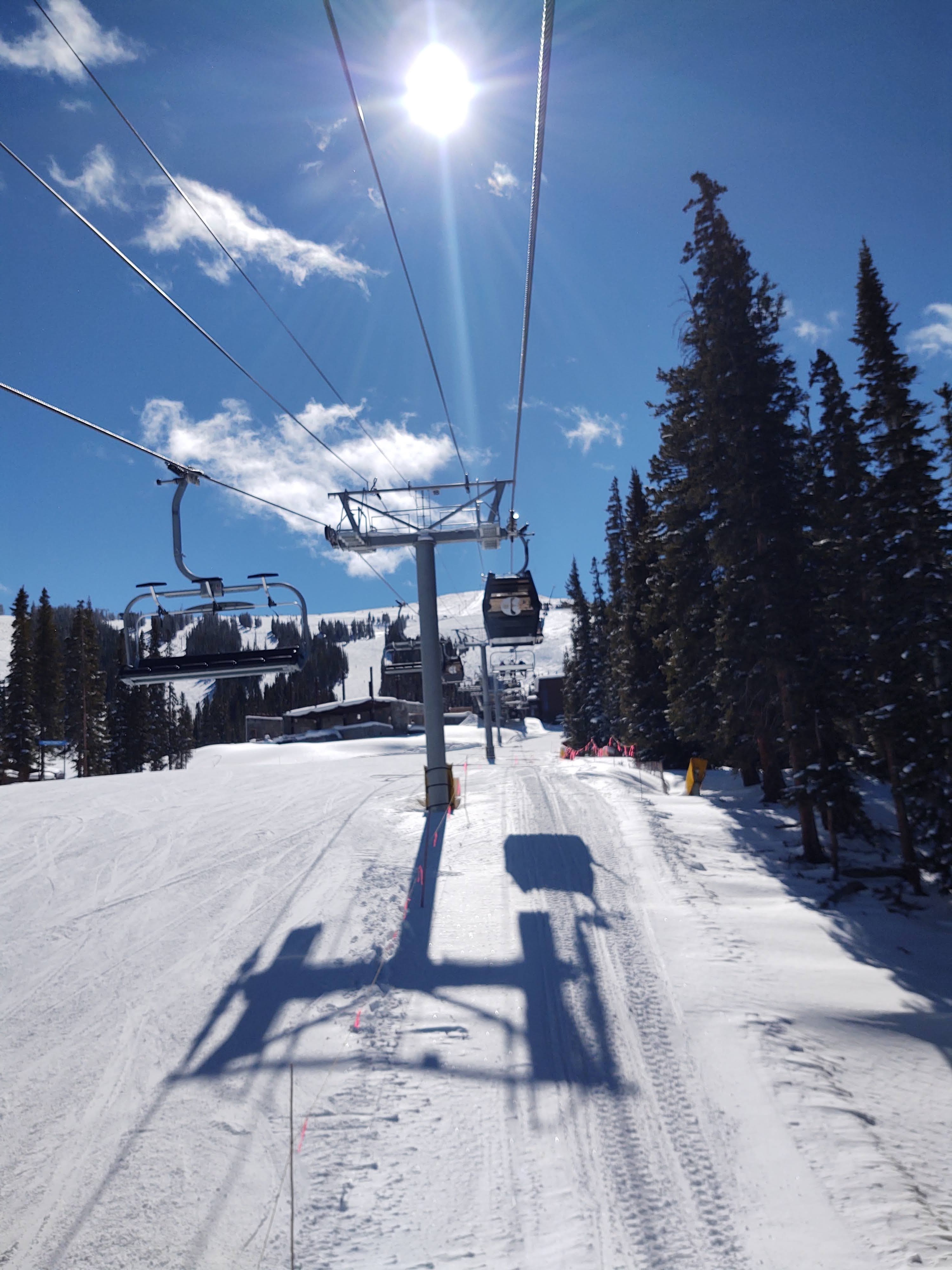
From Steamboat, it’s a relatively short drive to any number of ski areas. Because our friend Kenny was going to be in Breckenridge, we decided that Copper Mountain was calling our names. Copper Mountain congers fond memories for me as well. The resort opened in 1972 and I skied it sometime in the mid 70’s…by myself. I recall, on more than one occasion, being dropped off and skiing all day till my grandmother or Uncle picked me up. It was a reward for helping to “babysit” my younger cousins. It was a different time when you could explore and fly solo as a youngster and the adults didn’t have to worry about being charged with or arrested for “child neglect”.
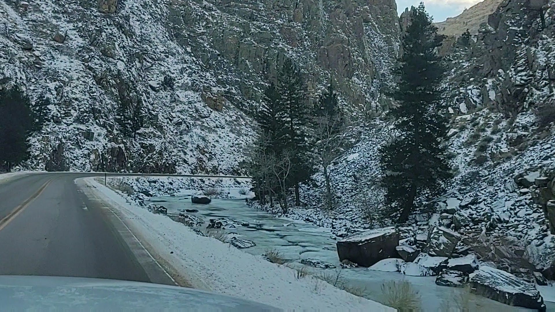
Green Mountain Reservoir
Our biggest challenge was finding a place to stay…for free. While there were plenty of places to stay, hotel wise, campsites and Forrest Service/BLM land was a little challenging. With the exception of one location, all of the numerous Forest Service/BLM campgrounds were closed for winter. We did luck out however and found an opened gate to scarcely visited campground in Heeney (Elliot Creek) on the west side of the Green Mountain Reservoir off the I-9, toward Silverthorne. Nothing on/near the locked open gate to the campground noted that it was closed like all the other campgrounds we had perused. As it turned out, it was only a 45 minute drive Copper Mountain to ski. Piece of cake!
During our exploration of the Green Mountain Reservoir, we were amazed at the number of ice fishermen that littered the frozen mass of water. You gotta LOVE fishing, to do that over a small hole cut in the ice during freezing temps. We were also treated to meandering herd of mule deer and small herd of Big Horn Sheep, beside and on the road that led us to the Elliot Creek campground. We were amazed and intrigued at how the sheep so deftly negotiated the steep rocky cliffs and the narrow and mostly non-existent ledges.
We pleasantly surprised that we had the campground to ourselves, and frankly expected a ranger to come by to finally “lock up”, but that did not happen.
Copper Mountain
Copper Mountain is a unique ski area in that it is essentially and geographically divided into three distinct levels of expertise. They have buses that take you from one of three free parking lots (that this year you had to make “reservations” for) to one of three Villages: West, Center or East. West Village is mainly for those who prefer “Beginner”/”Intermediate” runs. Center Village is dominated by “Intermediate” runs and East Village caters to the “Expert” Black and double Black Diamond aficionados.
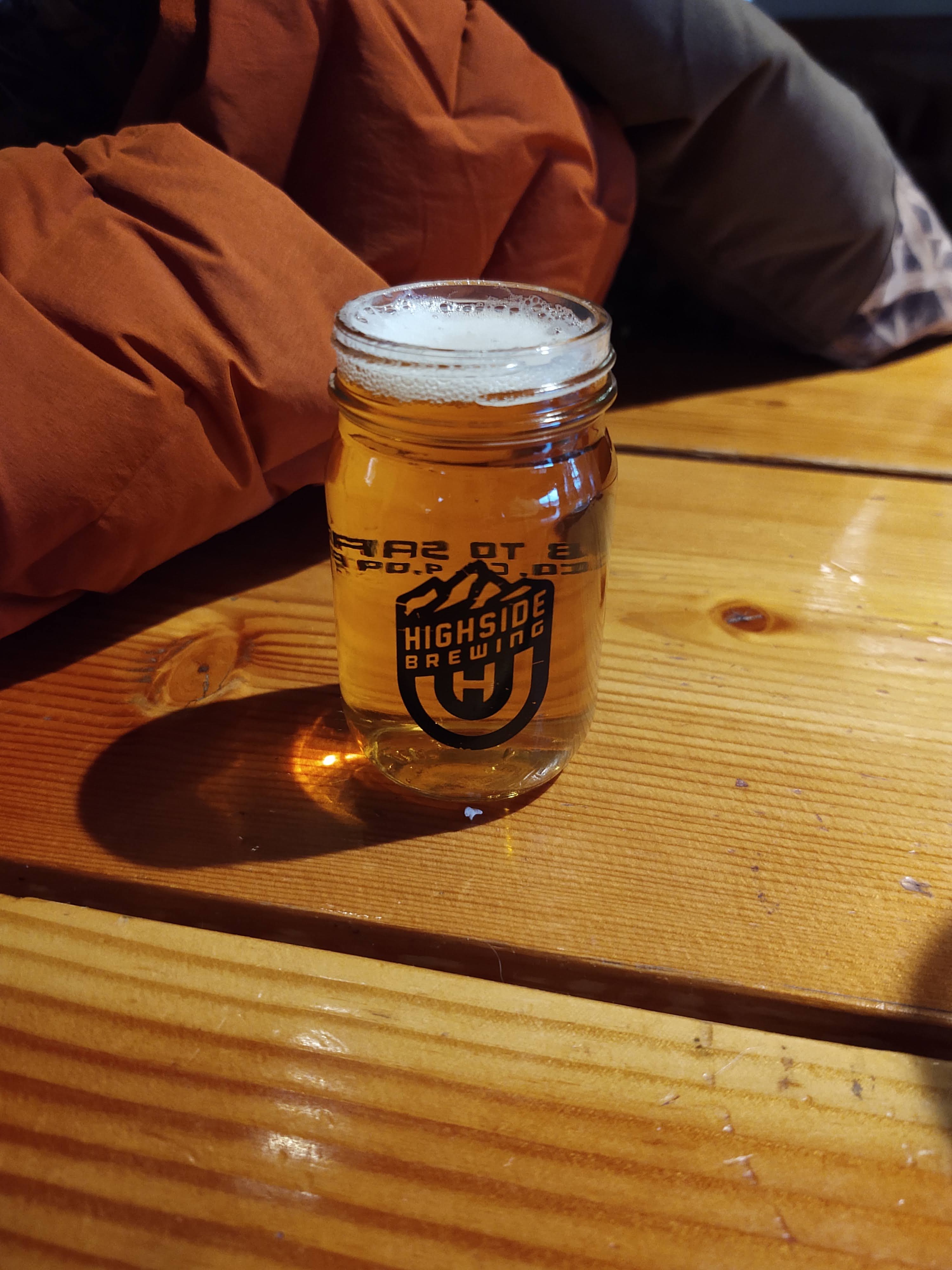
Over three days we skied a good portion of the resort. We highly enjoyed the East Village runs off of their “Super Bee” lift. Because of the wind, we decided not to chance the crusty double black diamond runs on the “bowl” side of the mountain. We’ll save that for next year, and softer snow conditions. Overall the staff for the mountain was great and more importantly, so were the runs. It was everything that I hoped it would be, considering the fond memories that I had. Meeting up with our friend Kenny at Frisco’s Highside Brewing and BBQ for dinner and a sampling of very tasty beer was an added treat.
Another Storm. Another Road Trip
Once again we had to retreat from another storm. This one was supposed to engulf Colorado for a good couple of days. With that we headed south. We had always wanted to ski Taos, but never found ourselves anywhere near that part of New Mexico…in the winter. Taos it was. We left from Copper Mountain, having skied to exhaustion within hours of the coming storm’s arrival. The drive from Copper Mountain to Taos (the town) was supposed to be a 4 hour drive. Snow flurries pelted us as we descended down highway 91 toward Leadville. We decided that Leadville is a “must visit”, for another trip to properly explore this tantalizing frontier town. By the time we hit Leadville, we were clear of the snow. From Leadville, we followed the 91 until it ran into US Route 24.
Fun fact: The United States Highway System originated in 1926. US Route 24 (highlighted in red) was one of the original highways in the country. It stretches from Michigan (Independence Township), and traverses through Ohio, Indiana, Illinois, Missouri, Kansas and into Colorado, as far as Grand Junction.
US Hwy 24 is flanked by the Arkansas River, and from the number of rafting businesses that and recreation centers/campgrounds, this is a popular activity over the summer months. As we traveled south, we gazed upon the mountains to our west, that we would be traversing via the Continental Divide Trail, later this summer. Pretty daunting, but inviting.
We continued on the US 24 until it ran into US Hwy 285. This would take us most of the way toward New Mexico and our turn-off onto US Hwy 64. There is a distinct change in the condition of the road when one passes from Colorado into New Mexico. Fog lines are replaced with pot holes, so one makes sure they stay as close to the center-line as possible. I wish I had known about , The Pueblo Revolt of 1608. It would have brought the route we traveled on the US 285, Hwy 64 and later US Hwy 25 and the towns/pueblos we passed to life. So much history (and sorrow) along these routes.
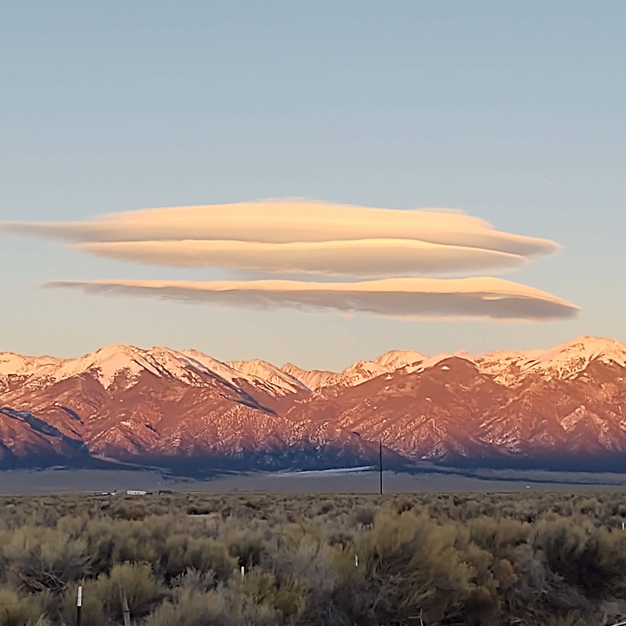
While the route seemed fairly barren, we could not ignore the large barbwire enclosed buildings that wafted the distinct smell of cannabis. Unique cloud formations flanked us as we drove into the waning light. With no moon, we soon were driving in what felt like oblivion, with only our headlights opening a portal to the next realm. Cell service was non-existent. When a horse and buggy (with headlights) passed us from the opposite direction, we thought we might have traveled back in time.
Taos Ski Valley
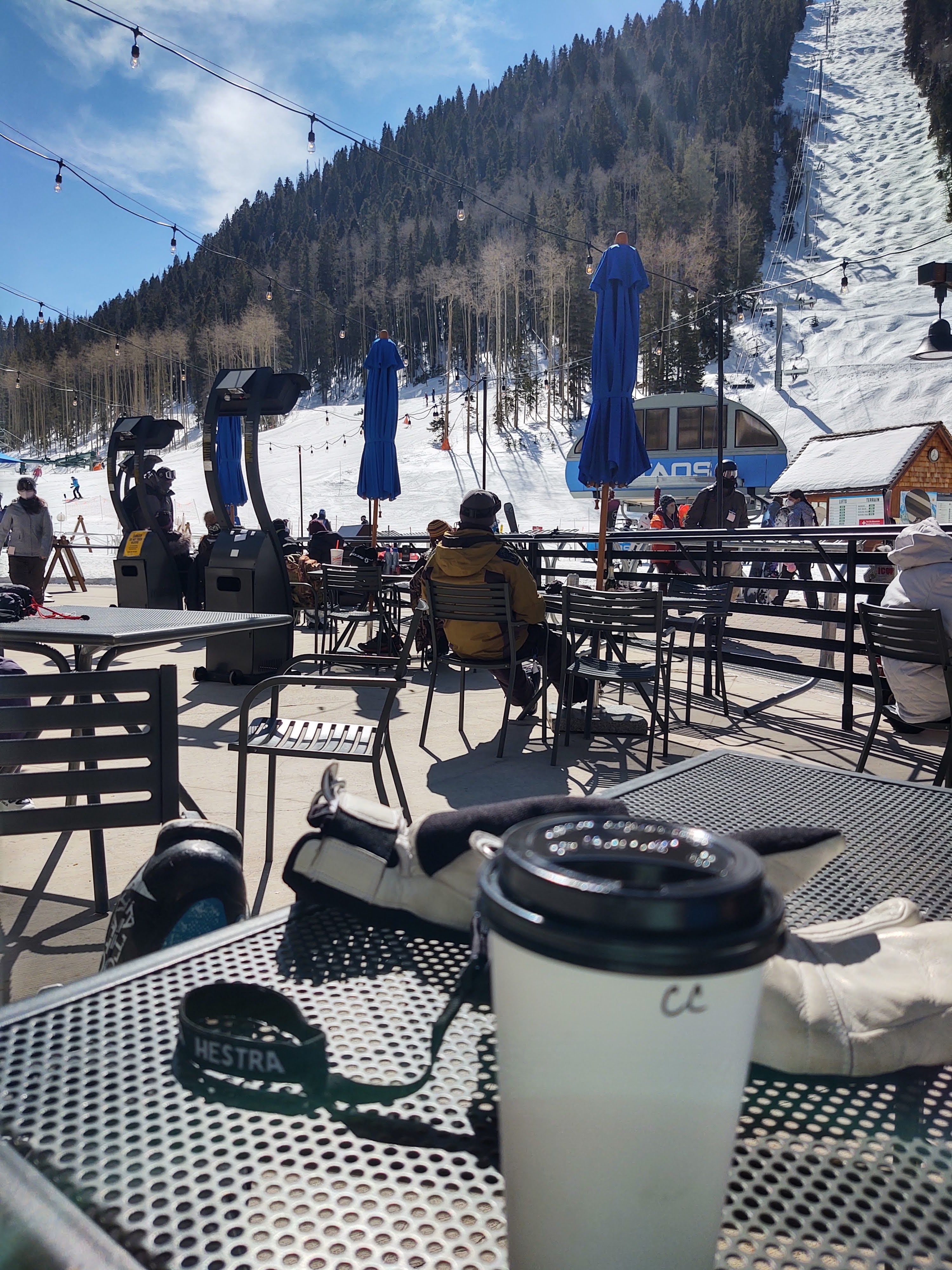
After a circuitous route from US Hwy 64, thanks to “Martha”, we arrived at our lodging for the night in Taos at the Best Western. Morning found us at a local laundromat (our clothes were a bit “gamey”) and the local market (fresh food for the next few days) before we headed to the Taos Ski Resort. Because of Covid and New Mexico’s strict mask and gathering rules, Taos Ski Resort requires that you make a reservation to ski. Had we been paying better attention, we could have made a reservation for the later half of the day and skied an additional day at Taos (live and learn). From the town of Taos, you wind your way via a narrow canyon that leads to a remote alpine village, that is the Taos Ski Resort. The beauty of this resort is that they allow en route camping (fully self-contained) for free. Not only did we travel back in time, but we traveled to another country…somewhere in the Bavarian Alps. (Click on this link and you will discover a unique and endearing story about how this fantastic resort came to be)
Because of COVID restrictions, he resort had limited the capacity to something a little over 3,000 visitors. The moment we drove in, we were more than a little intimidated. Our first glace at the mountain created a “crick” in our necks as our eyes surveyed its face, and a lift that practically goes straight up from its over 9,000 ft base.
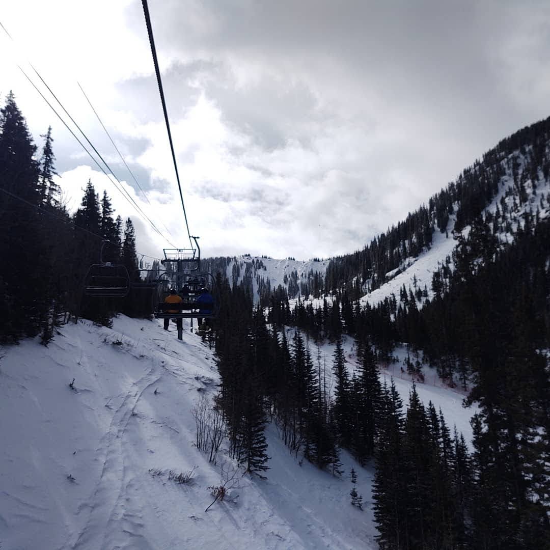
This ski resort is NOT for the faint of heart or beginner, as over 51% of the runs are for those expert/advanced. 14 lifts serve 5 distinct areas: West Basin Ridge – all double black diamond; Highline Ridge – all double black diamond; Backside – 50% black diamond; Upper Front side – mostly advanced/intermediate; Lower Front Side – mostly advanced/intermediate. We were treated to some fresh powder which made the steeps a little less terrifying and certainly easier on the body when you have a “yard sale”. I think we would have had even more fun if we weren’t so worn out from skiing Copper the day before (…and if Paul’s sciatica wasn’t acting up ). The fact that we could easily retreat to our camper for a snack (or lunch) and head back up the mountain made for a nice and relaxing time.
We lucked out and skied two weekdays with nary a crowd, and were thankful that we caught the first lift up the mountain on that Saturday morning. By the time we came down, due to lack of visibility, and the fact that we were just plain gassed, we were surprised to see the massive line for the lift #1, up the mountain. We had initially thought that we would just grab a bite to eat and let the weather on the top pass, but once we surveyed the crowd, we called it and decided to pack it up.
Hugs ALL Around
We considered heading back up to Colorado to access a few more ski areas, but nixed that plan when I called my dad (who lives in southern NM), and he not only told us that he was not only TOTALLY cancer free, but had also had his second COVID shot. Absent COVID I hadn’t seen him or my step-mom for over a year, due to his cancer treatments. With COVID it had been nearly two years since we had been able to talk face to face, let alone go on an adventure. Confident they were in the clear, they invited us over to visit. What a joyous reunion. We were the first people they had had into their house in over a year, and we were able to give them their first hugs in over a year. One should NEVER be starved for/from and/or underestimate the power of human touch.
We had a great visit, and ate entirely too much excellent food. It was here that we realized that it was time to head home and let our legs, and Paul’s back recover a bit in the comfort of our own home, and especially bed.
But Wait There’s MORE
It was a good thing that we headed home when we did, for as we approached the Arizona/California border our brakes became a bit “soft”. We made a mental note to check them as soon as we got home. Holy Guacamole! We were SO lucky that during that remaining stretch we didn’t have to slam on the brakes, for when Paul pulled off the right front wheel to look at the breaks, its caliper was missing. SHIT! Further inspection revealed a small but steady leak to the rear brakes. Between Paul’s YouTube mechanic skills, and my brother’s ACTUAL mechanic skills those repairs, and a few others that surfaced out of those repairs, were completed. Hopefully this will buy us another year or two with our current truck.
On the down side, that kind of ended our ski-cation adventures for 2021. Paul’s contortions whilst completing the repairs to the truck and some other repairs within the camper, didn’t bode well for his back. This also stalled our intended May 3rd CDT thru-hike plans.
Not to worry. Paul has healed up significantly and we are currently back to training for the CDT. We expect to start sometime early/mid July, with a SOBO direction in mind.
So this ski season’s adventure found us sampling snow in four states, and at 5 different ski areas. For the most part we did it on the cheap in our 34 year old Alaskan Cabover camper. We would have extended our ski adventure had it not been for some necessary repairs, namely brakes, (and Paul’s back) that needed to be repaired/replaced.
Mammoth Mountain
Skiing Mammoth is a Family affair
We began this new year (literally) at our home mountain, Mammoth Mountain in Mammoth Lakes California. We were spoiled with blue bird days and wide open runs, devoid of crowds. The coverage was not at its zenith, but it would do as a “warm up” and to break in Paul’s new skis (Rustler 10).
Two Weeks of recovery
With the exception of a “kindling” incident, wherein I nearly severed a significant portion of my thumb, this 8 day thigh burner was excellent.
The St. George “Vortex”
Our plan was to return home, stock up the camper and head for Utah. Numerous and necessary snow storms delayed our leaving till the beginning of February. This timing proved perfect, as by chance, friends from Florida were going to be skiing for a week at Park City the same time we expected to be up there, skiing at Deer Valley. Of course, we had to make it through what we now call the “St. George Vortex”. I swear, eververy time we travel through the St. George Utah area something obscure befalls our vehicle…and always just after the sun has set. It is the Bermuda Triangle of auto repair for us. Last year it was the relay switch for the headlights failing…at dark, in the middle of the Virgin Gorge area. This past Fall, on our way to our Wyoming deer hunt, we had another part failure. This happened while driving on a Forest Service road, looking for a place to camp just as the sun was setting…again, just outside of St. George. This time it was the oil pressure sensor.
Skating our way along
As we drove through St. George, we held our breath. To our great surprise we made it through, unscathed. We wondered if our “luck” had changed. NOPE! In fact, just outside of Provo, as we weaved our way towards Heber City, we had a “close encounter” with a ditch and center divider. As “luck” would have it, and just after the sun had set, it began to snow as we wound our way up highway 189 toward the Deer Creek reservoir.
Cars were racing past us as we meandered at a gingerly 40mph on the now increasingly slick roadway. Suddenly, having just come out of a relatively benign curve, all four tires broke free from any form of traction. We found ourselves drifting toward the center divider. Paul tapped the brakes and turned us ever so slightly away from the divider. Our truck corrected and then reoriented our trajectory towards the mountain bank, which was preferable, until I saw that unless we came to a stop, we were destined to drop off into a 3 foot deep ditch…crushing my side. “NO, Not the ditch!”, I yelled. Paul then yanked the wheel to the left. Phew! No ditch, but now were headed once again directly into the center divider. Our slide’s speed had yet to change, which meant that a head on collision into the center divider was NOT going to be pretty, especially if our impact protruded into the opposite direction’s traffic lanes. Paul tapped the brakes again. This changed our orientation and put us now parallel to the center divider, but now facing oncoming traffic with my door now headed for impact with the center divider. As we (me) braced for impact, the truck miraculously came to halt, a mere two inches from the guard rail of the center divider. We breathed a momentary sigh of relief, only to realize that we were now fully stopped, in the fast lane, facing the WRONG direction!
We already know that for the most part, our guardian angles (we need two…or more) have to work waaay too hard. This time was NO exception. Throughout this “skating” interlude, that played in slow motion for us, not a single car (in either direction) was on the inky dark roadway. Just previous to this event, the road was packed for the most part. No sooner did we pull off to the right (our left now), but traffic repopulated the roadway. Of course they must have been somewhat perplexed seeing a truck on the side of the road with its headlights pointed in the wrong direction. We, on the other hand, were cognizant of the miracle that had just occurred. We gave appropriate thanks and after several minutes, reoriented the truck in the proper direction. So, maybe its not St George. It’s Utah that is our “vortex”.
Overnight Success
Three years ago when we skied Deer Valley, we were able to camp at Jordanelle State Park. That option dried up this year not because of Covid restrictions, but because the year’s previous campers had abused the facilities and it just wasn’t worth to the staff to keep it open anymore for winter en route camping by the boat launch. Not to fear, as there were two private campground/RV parks still available at relatively low rates. We had previously stayed at the Mountain Valley RV park just outside of Heber City, but chose the River’s Edge RV Park and Campground, as it was closer to our destination of Park City. Again our luck carried us through as we got their last site! For $25, we had electricity, with a bathroom (complete with hot showers) nearby. We stayed there for two nights, until we discovered that you can get away with parking overnight at the Park City Walmart. (Shhhhhhh. Be very very quiet.)
Deer Valley
As we expected, skiing at Deer Valley, even in snowy conditions was fabulous. The runs, with a sensuous coating of perfect snow, made for near effortless skiing. The beauty of Deer Valley is the absence of snowboarders, the perfectly groomed runs and the helpful and cheery staff. Here we skied for 2 days with our son and his newly proposed to, fiancé. We also dined and watched the Super Bowl with our friends Josh and April, who were out from Florida. We would have liked to have stayed longer, but Big Sky Montana was calling, and besides we needed to save a couple days at Deer Valley when Josh and April were back in another month with their kids.
Bozeman Montana
Hotel prices and camping during the apex of Winter in Montana, specifically at Big Sky prohibited us from staying specifically in Big Sky. Instead, we met our son and his soon to be bride in the ridiculously cold town of Bozeman Montana. Interestingly enough, it is the “fastest growing Micropolitan Statistical Area in the United States”. This means that for the last three years, people have purposely been moving to Bozeman. With the exception of the cold, I can see why people would move here. You have skiing, hiking, fishing, hunting, river rafting and several National Parks nearby. Everything an outdoorsman craves. On top of that you have a quaint downtown area and one of the best restaurants I have ever eaten at in a long time (and Not because of COvid). Sidewinders American Grill had the atmosphere, the food and libations, all modestly priced. It is a must visit for anyone traveling through/to Bozeman. Where else in the world can you find perfectly cooked bacon wrapped (local beef) meatloaf?
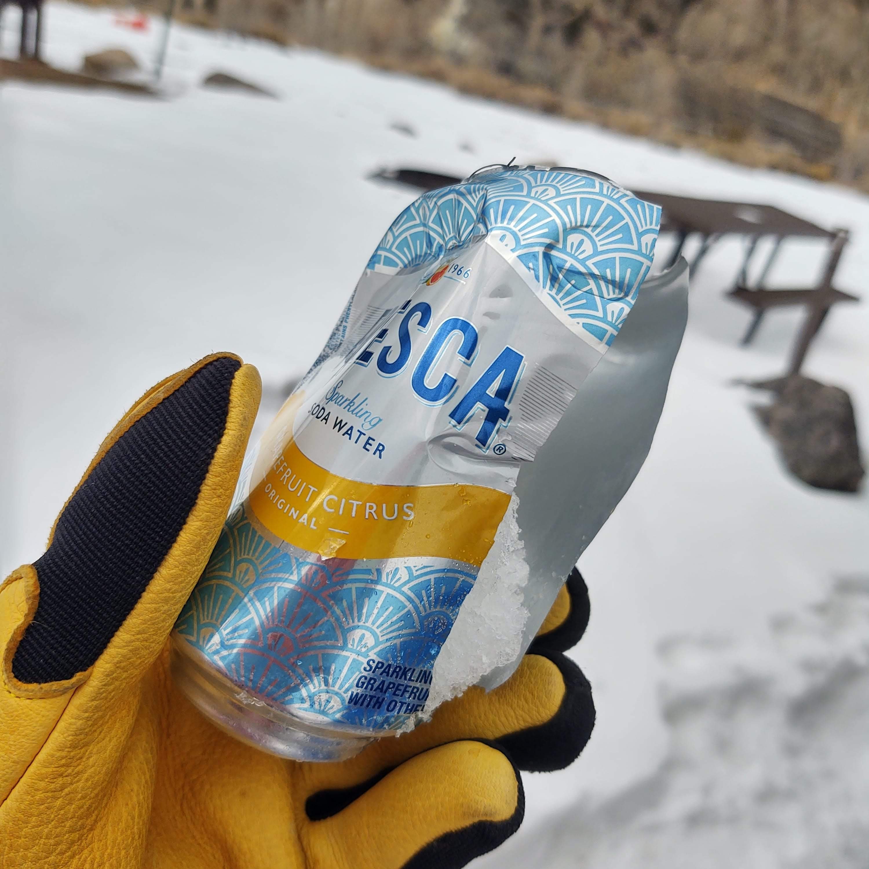
Did I mention how cold this place was? For the four of us, this was the coldest we have ever experienced. One night it got down to -22°. Even the insulation of our Alaskan camper could not protect my coveted Frescas and a stowed bottle of wine from escaping their sealed aluminum and glass containers. (The Frescas exploded and the wine froze into a slushy that forced the cork out of the bottle…and oozed all over the bottom of our pantry)
Our lodging in Bozeman was 45 miles southwest of Big Sky and required a little over an hour daily drive to and from Big Sky via the US 191 (Gallatin Rd.). This two lane, well maintained, road parallels the Gallatin River. With our son driving his 4WD truck, this allowed us to sip our coffee and enjoy the view in its wintery splendor from the comforts of the back seat…provided we didn’t fog up and ice over our passenger windows whilst staring too close to the glass.
Big Sky
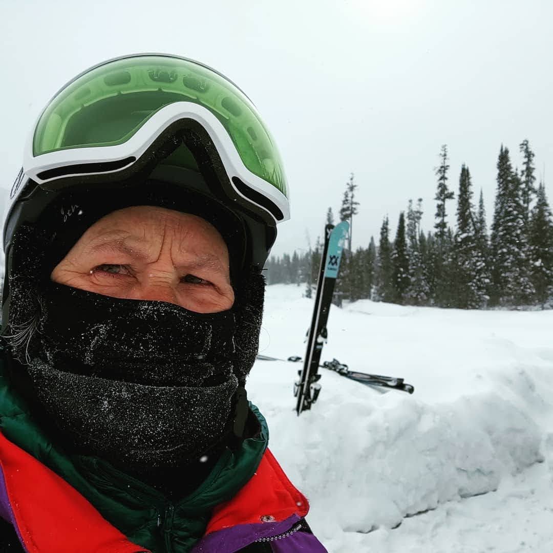
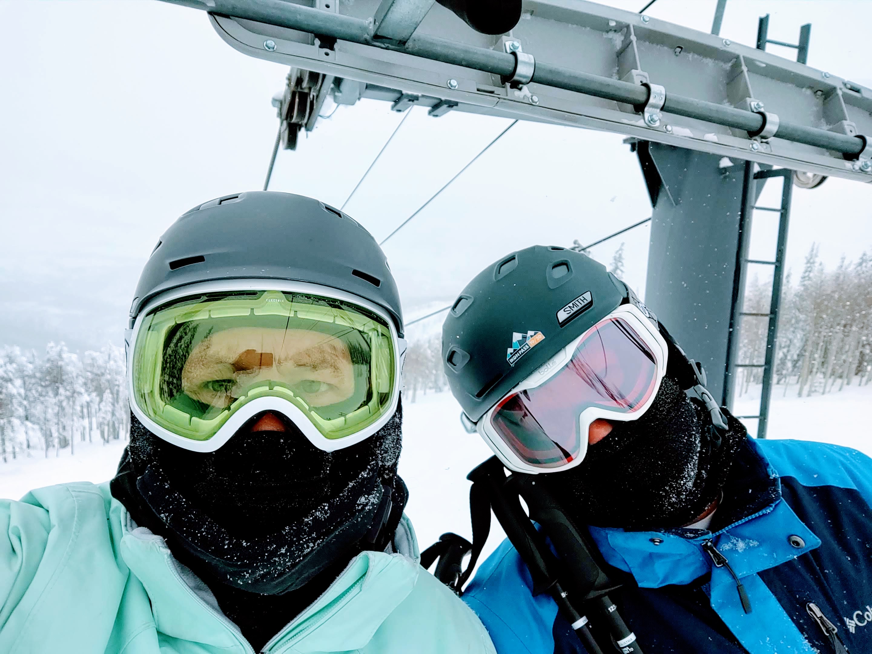
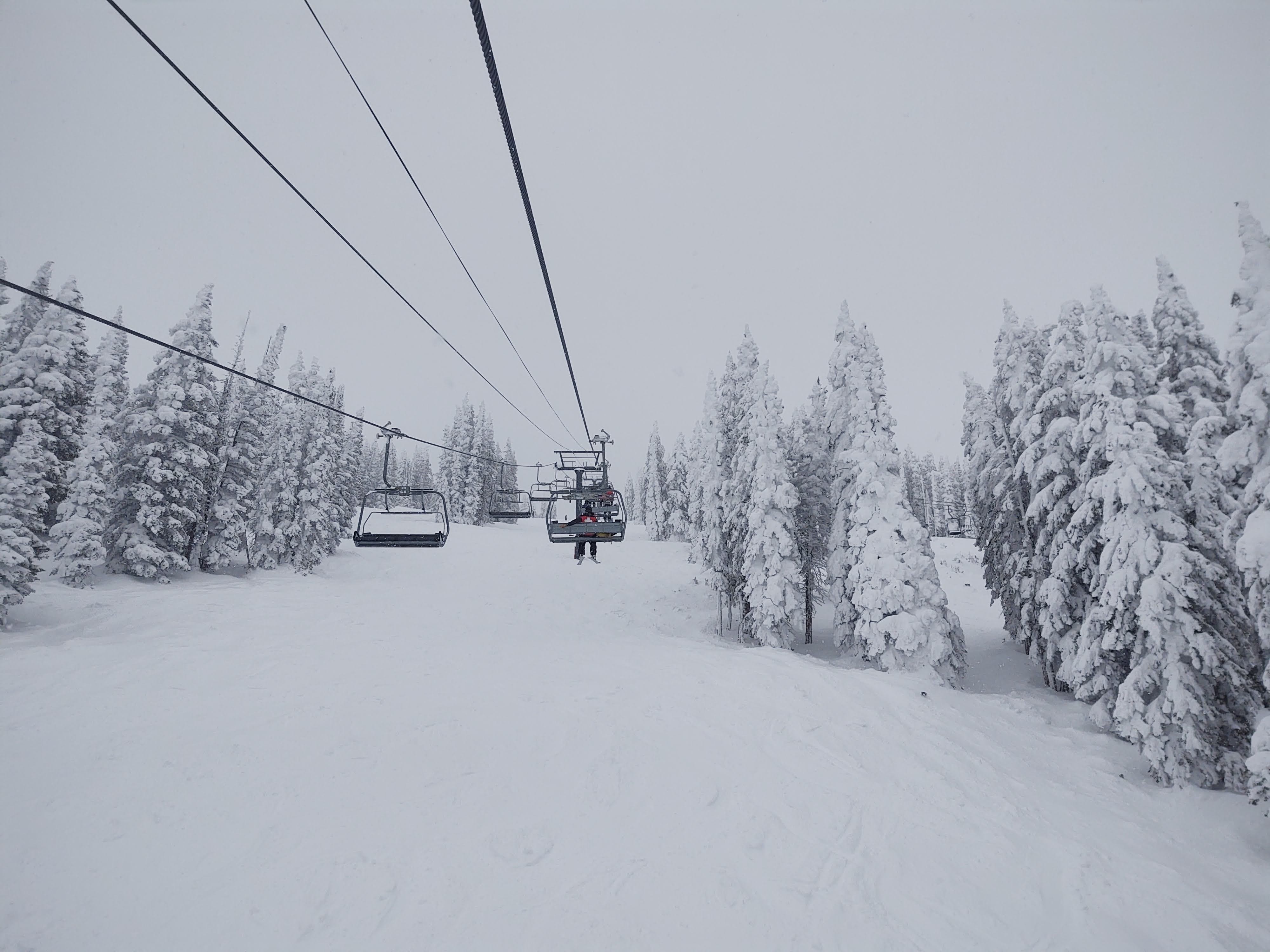
When they say Big Sky, they mean Big Sky. The 250 runs spanned a multitude of crested mountains (three to be exact) within nearly 6,000 skiable acres. The days averaged single digits…but it was beautiful! We lucked out with our first two days of skiing in mostly bluebird conditions. Colder than I ever thought I would willingly tolerate, but probably the best snow and terrain I have EVER skied. The staff at the Big Sky Resort was great, and was the only ski area (this year) that allowed its patrons inside to warm up…masked up, of course. It didn’t hurt that the main high speed lift, the RAMCHARGER, had heated seats, either! We would have stayed longer, but our third day was SO Brutally cold (-11° and that was the “high” for the day…without the wind chill factor), that we, and most everybody only lasted a couple hours before we couldn’t keep ourselves warm enough to enjoy the snow.
Had there not been another polar vortex mega snow storm pegged to arrive the next afternoon, we would have stayed a couple more days to finish out our 5 days of access with our Ikon Base Passes. Ideally we would have liked to have head back to Utah and ski the Cottonwood Canyon areas (Snowbird/Alta/Brighton/Solitude) but the vortex was specifically headed there. Turns out it was a good decision as avalanche conditions did not dissipate for several days following that artic blast.
We, instead escaped to Buffalo Wyoming, and hid from the storm and “cold” for a day and a half. It is here that we also came across a quaint, extremely busy and fantastic coffee shop, appropriately named “The Fix“. If you are ever in/near Buffalo Wyoming, and “jonesing” for good coffee and/or a specialty drink, this is the place to visit. From there we headed to Colorado. Steamboat Springs to be specific.
Martha is a Bitch
For some reason my route mapping app (we “lovingly” call Martha) likes to send us off in obscure and circuitous routes that often portend “white knuckle” adventures while driving. Our “prescribed” route from Buffalo Wyoming to Steamboat Springs was no exception. Martha initially prescribed a very “direct” route. The I-25 South towards Casper with a turn off on State Hwy 257 to State Hwy 220 that intersects with US-287 South, which then takes you to Rawlins. From Rawlins head West on I-80 with a turn onto WY-789 S that becomes CO-13 once you cross the Colorado border, which takes you to the I-40 east and into Steamboat Springs. This was supposed to be a 6 hour drive. 14 hours later, we were NOT in Steamboat Springs.
Everything was flowing smoothly…until we turned off the I-25. State Hwy 257 was two-lane, but well traveled. We expected the same for the WY-220 and the US-287, both of which we have traveled upon before. Problem was, even though the sun was shining brightly, it was winter and the wind was blowing like, well, Wyoming. Within 20 minutes of being on WY-220 patches and stretches of iced over road became more frequent, which resulted in “white knuckle” driving. We had already survived one “skating” adventure, and in this more remote part of the country we did not want a repeat of that, and test our luck…again. With another 2 hours left on this road, we turned around, back to the I-25 and a reroute. Martha was “pissed”. The I-80 West was closed from Cheyenne to Rawlins, because of an accident. Cars were “parked” on the I-80 for miles. When we pulled into the Sinclair in Kaycee to fill up and ask if there was any “work-around” to Rawlins, we were told, “You could take the 220 to the 287, but no one with half a mind takes the 220 this time of the year”. Like I said, Martha is a bitch.
Our only path to Steamboat Springs, now entailed continuing on I-25 to Colorado’s scenic Hwy 14 (Poudre Canyon Rd). This 40 mile twisty-serpentine, scenic canyon drive, while beautiful, was exhausting. Add snow and a setting sun with a max speed of 40mph, and you have a never ending drive. But according to Martha, we would be in Steamboat Springs in less than two hours. Everything was progressing smoothly, with an 8pm arrival to our reserved hotel room in Steamboat Springs, until…it began to snow…ever so lightly.
This was NOT supposed to happen till the next day. WTF! No worries, we were a mere 26 miles to the I-40, that would take us into Steamboat. The snowfall increased, and we found ourselves driving in 6 inches of fresh snow. With the visibility morphing towards a white-out, and the snow getting deeper, once again, we turned around. Another two hours later, we found ourselves in Fort Collins, at a Best Western under renovations, smelling of fresh paint. Did I mention that the heater in our truck had stopped working? Fun times.
Steamboat Springs
From Fort Collins, (even though Martha wanted to route us via the 14-(Poudre Canyon)… again), we took the I-25 to the I-70 that ran us into the I-40. I was an easy and uneventful drive. We were glad to do it during daylight hours, and were glad of our decision to turn around once we saw the snow/ice on the I-40 into Steamboat.
I one thing about Steamboat, is that the ability to “stealth” camp and/or park at their Walmart parking lot, or any lot for that matter with a full-size truck/camper is a non-starter. For one, it is NOT allowed. And two, who wants to drive in the snow? Hence our reservation at the Quality Inn.
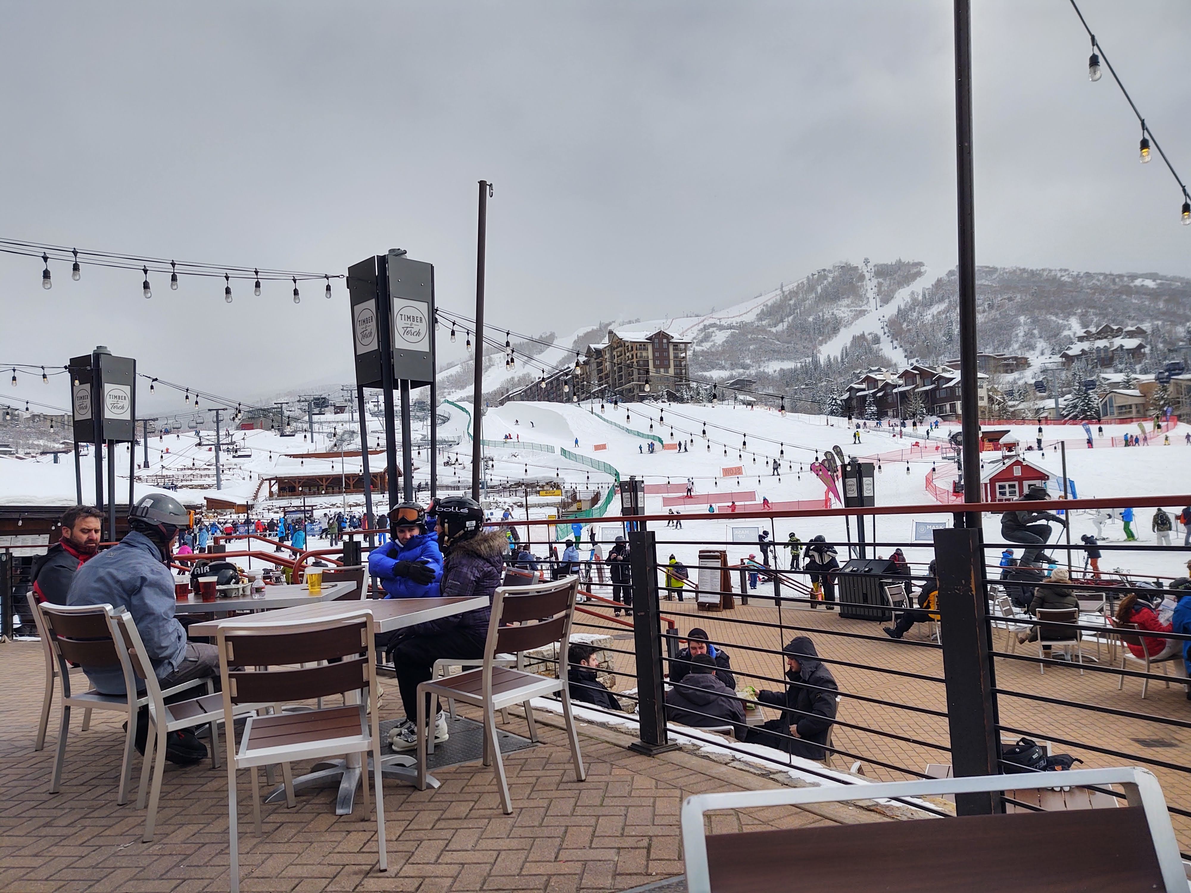
I gotta say, Steamboat Springs is a well oiled machine. They have got public transportation, especially to the mountain, down to a science. Why would anyone ever try and drive up to the resort (proper) and park?
We hit the early bus, that just happened to stop just outside the Quality Inn (of which we were staying) and drop us off at the front steps of the Steamboat Resort. Somehow, however, I thought the mountain would be bigger. Maybe it was because of all the stories of, and pictures I had seen about skiing Steamboat.
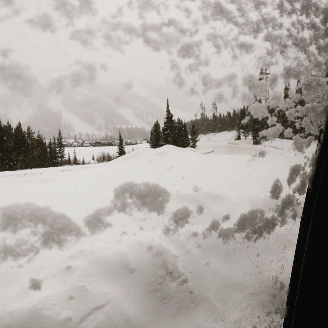
View of Steamboat Ski area from Supermarket parking lot
It felt like we were at Disneyland or something. Color-coded bus stops. People bustling about. Visitors carrying bags filled with Steamboat embolized gear. And CROWDS! Yes. Crowds! One would have thought we had arrived during a holiday or spring break. Nope it was just COVID, and not a single kid was in school, or adult was at work. Unlike Big Sky, Steamboat did not have any place to retreat to warm up. They had even turned off the warm hand dryers in the restrooms…to apparently keep germs from “circulating”. This didn’t dissuade people from storming the mountain to ski though. We were amazed at how many rental skis were on the mountain.
We were glad we hit the mountain early, for as the day progressed, the weather continued to degrade, but the crowds continued to grow. The runs however, were awesome until a cloud descended and made visibility as dangerous as driving in the fog on a busy highway. We skied three days here, and made sure to hit the mountain first thing in the morning. This is unusual for us, in that we normally wait till later in the morning to ski our home mountain (Mammoth) so that those “early birds” can soften up the frozen crust of our “Sierra Cement”.
Not necessary here in wonderful Colorado where the snow is GLORIOUS! Sparkly, champagne, dry and lofty snow. Even though a cloud descended on the mountain each day…and it snowed, we skied each day until we had had “enough”. By the time we were “gassed”, the crowds had gotten to the point of annoyance, and trying to rewarm ourselves had become futile. All in all it was an enjoyable few days.
Along with Big Sky, Steamboat is on our return list for next season. Hopefully everyone will be back at work, and kids will be in school.
Where to Next?
In Colorado we had four other ski areas to choose from with our Ikon Base Pass. Where to ski next was an impossible decision, until we heard that one of our hunting buddies (Kenny) was going to be skiing in Breckenridge for the week. While we weren’t going to ski Breckenridge, we could ski nearby Copper Mountain, and meet up with him for dinner.
*This is from a post I wrote for The Trek on Feb 17th, 2021. I hope you enjoy it as it was a featured link on instagram @thetrek.co
CDT LASH – Highlights
A lot gets packed into 650 miles and 7 weeks spent on trail.
You cover amazing terrain: Beautiful. Challenging. Treacherous.
You meet amazing people: Hikers. Trail Angels. Strangers.
You go through transformations: Internal. External. Ethereal.
Your path is rich in discovery: Nature. Self. Humanity.
Each portion had its challenges, delights and “forever” memories. And while we did not complete as much as we initially intended, our takeaway from this LASH is nothing short of remarkable.
Terrain
While our home state of California has tremendous diversity of terrain, we never really thought of Wyoming, Idaho and Montana as being that diverse. Needless to say we were painstakingly enlightened. These are our highlights and their takeaways.
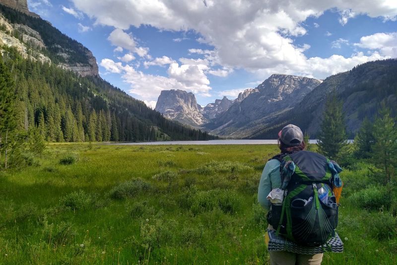
The Wind River Range’s craggy granite mountains, frosted in brilliant white snow against azure blue skies, beckoned us to linger. (Even in the wake of their challenge and treachery.)
Upon our descent of Gunsight Pass (NOBO mile 1835.4), the tree pocked rolling hills, and vast meadows filled with a tapestry of colorful flowers, left us in awe.
Roaring rivers. Frigid and often swift, deep streams. Tranquil lakes and ponds. Magical springs and seeps. They reminded us of the power, necessity, and miracle of this three atom combination…that is water.null
Geothermal “oddities” that boast of an “other” earthly world. “Births” of rivers from trickles of snow melt. A single stream that bifurcates, and flows to either the Pacific or Atlantic Ocean. It was the immenseness of Yellowstone’s natural phenomenon, that overshadowed any “celebration” of human achievement.
Historical routes, sites, and towns. Pivotal passes, such as South Pass, and discoveries that enabled the expansion of the United States…westward. It is here that we most felt the significance of the CDT and what a trek of this magnitude awakens in us.
People
Anyone who has participated in a long trek across amazing terrain will tell you that the people you meet along the way are an integral component of said trek. Like it or not, we are a communal species. Nature alone can not truly satiate the “hunger” within us.
While the pandemic of COVID left the CDT “population” sparser than “normal”, there was no loss of the trail having provided through the kindness and nurturing of, fellow hikers, town’s folk and absolute strangers, who kinship is unquestionable. Following an uphill, from Yellowstone’s Heart Lake, in the heat of the day, having run out of water, a chance “Hello” provided us our most organic trail magic.
A delightful elderly gentleman, “Fred”, trusted us with access to his van, and the beer and water within, while he continued on with his day hike. It was quite the awkward moment when we reached his white van. We wrestled with actually taking him up on his offer, but then decided that to not accept such trail magic would be “inviting” bad karma.
Transformation(s)
Salvatore Ambulando – it is solved by walking. You don’t really have to walk far, you just have to fully immerse yourself in the moment to let the “screaming monkeys” inside your head wear themselves out. It is here that you drill down into your psyche and are able to purge the extraneous bullshit that we all collect. The essence of any thru-hike, or in our case a LASH, is that you have so much time to “think” that you often exhaust your “worry/hurt/disappointment bucket”. You come to the realization that “it is what it is” and there’s no senses wasting finite time and energy on it. Forward is the only option. And so you move…forward with each step in exploration, wonder and peace.
Each time we take a lengthy journey, especially on foot, we find that we re-center our minds, bodies and souls to that which is important and fulfilling. We cast off the unnecessary “weight” (mind/body/soul) we have added to our “packs”. Our ability to practice “mindfulness” becomes evermore so rote. This LASH, was no exception.
Discovery
“It is not death that a man should fear, but he should fear never beginning to live” – Marcus Aurelius
The quest of discovery is what drives all our adventures. We do our best to be open to learning or discovering something new each day. It takes some doing to feed such a drive, that hopefully will never become fully satiated.
While on this 650 mile LASH adventure across Wyoming and the border/spine of Idaho/Montana we were “fed” by the following:
Just outside of Dubois, Liz from the Black Bear Inn, awakened us to the healing power and properties of a prolific yellow flowered plant, Arnica. Remarkably this amazing plant grows alongside the CDT as it winds its way into Yellowstone.
While camped in Yellowstone, several miles outside of Old Faithful Village we discovered the true majesty of a midnight blue sky whose richly lit stars stretched like a warm blanket from horizon to horizon. In all our years we have NEVER seen such a sight.
The threshold of physical pain and mental override were breached and expanded, on more than one occasion. The human body and its ally (and sometimes foe) the mind, is capable of more than one can ever imagine. Having the support of, and responsibility to another, during those times, “eases” and emboldens one during such events.
With the advent of COVID-19, and whilst hiking this section of the CDT, it has become ever so apparent that the true nature of man is found in his capacity and pension for kindness. Not once on this journey were we ever treated with distain or judged for setting out on this LASH. Of course there are always those who believed we should have stayed home, but then we also believe in the principles of Hike Your Own Hike (HYOH).
What’s Next?
The middle (or end) of April we will embark once again on the CDT. Ideally we will set off Northbound from the southern monument at Crazy Cook Corner, at the border between New Mexico and Mexico. Hopefully, we will complete a full blown thru-hike of the CDT. As with last year, things may change or require some adaptations. But what adventure doesn’t.
It seems more and more that vlogs (video “blogs) are the “norm” , and outpacing the written word when chronicling travels and adventures.
Having majored in Communications, with an emphasis on film and video, (many many many moons ago) in college, one would think that would have been my original go-to medium. However, the ability to create travel films or videos some six years ago (when we did the PCT ), let alone two or three years ago, was extremely limiting and supremely daunting.
However, with the advent of the “smart phone” and their ridiculously powerful cameras, and corresponding video production apps, the “ease” and ability to create travel/adventure videos has increased substantially.
While this does not mean that making a meaningful, if not thoughtful, production is a “piece of cake”, it certainly has become significantly less time consuming…unless of course you’re a detail oriented perfectionist…then it takes a more concerted effort.
Here in lies my conundrum. I prefer the written word over video/film for the most part. I find that the written word lends itself to not only conveying more information, but also allows the reader an active role in digesting the information at their own pace. And, maybe even requires them to use a bit of their imagination.
But the lazy part of me, likes the “passive” participation of watching a video/film. I assume that I’m not the only one considering the plethora of videos out there. In fact, a friend of mine recently told me that they are “YouTube” vlog watchers…they don’t have “time” to read.
With that said, we are branching out into the vlogging world. Soon we will be heading out for another extended IKON-ic ski adventure. It is here that we will practice our vlogging. This, however, does NOT mean that I will stop writing. It just means that we (I) will be branching out a bit and adding some short videos as a supplement to the 2moremiles blog.
We have purchased a drone to expand and enhance our footage. We haven’t flown it just yet, as we are watching tutorials so that we have a better chance of NOT destroying it. No doubt we’ll have some mishaps, but then that’s what our Asurion Protection Insurance is for.
Recently, I created a short video about our latest trip to Mammoth Lakes, California over the New Year, with our friend Sandy (aka. “Pole Dancer” from our Half Dome adventure). I did it on a whim, as I figured I better start practicing.
Pleasantly surprised, we scored a room at the Inn. Laundry and a shower were the first orders of business, as I smelled worse than usual. Once that was completed we toddled off to The Depot diner. Here I would attempt to seriously provoke giardia with a full blown chocolate shake. The shake only managed to affect my sinuses, as dairy tends to do. Good. Still no giardia. Once fully over stuffed with food we would never normally eat, except on a thru-hike, we wandered back to the Leadore Inn. Traffic was so sparse, we surmised that we could probably take a nap in the middle of the road.
Once safely in our room, a wild storm battered Leadore. The wind gusted an howled. It oscillated between sheeting rain and pounding hail. Thunder roared and lightning streaked through the sky. We were thankful that I had felt well enough to make it to Bannock Pass, and more importantly that Sam was able to pick us up…and had a room available. We are truly blessed.
Back in Yellowstone we had originally decided that we would go as far as Butte/Anaconda Montana, as we didn’t see Canada or Glacier opening up anytime soon. The plan was to then flip down to Rawlins and head south through Colorado. That got paired down to exiting at Hwy 43, 122miles north of Bannock Pass. From there we would hitch to Salmon Idaho, where we planned a river rafting trip, before heading back to Rawlins. And then when my trekking poles broke, we saw it as a “sign” that maybe we should “put a fork in it”, or at least take a break.
I have to confess, even before we got into Leadore, we had been doing some soul searching. We also knew that given this year’s craziness, there was a high probability that even if we flip-flopped, we still wouldn’t be able to complete the entire CDT in one shot. Before I got sick, we had received information about the trail going forward that wasn’t promising. Some of it was accurate and some was not, as we would later find out. We had been told about multiple 20+ mile water carries, with 4,000 ft climbs. We were told about miles of blow downs that hadn’t been cleared due to late hirings and COVID-19. Blackfeet Nation and East Glacier National Park were still closed, also as a result of COVID19. We also were headed into a predicted heat wave (90-100°+), complete with afternoon lightning storms. The threat of being caught on trail in a fire started by lightning was too real for comfort, especially after having already witnessed two lightning strikes less than 200 yds from our terra firma location.
In any event, we had a decision to make. Do we collect our resupply at the post office and continue the 122 miles to Hwy 43, and then head to Salmon? Or, do we just head to Salmon now?
As there was no way to replace my trekking poles in Leadore. I had one of two choices. Order them online and wait for their delivery…in Leadore. Or, head to Salmon (45 minutes away), play in a river…and get trekking poles there.
As you have probably already surmised, Salmon won out, and so did putting a “fork” in our adventure. We had traversed nearly 650 miles, and frankly we had lost the drive to continue any further. The beach and our comfy beds were calling. We kinda missed our kids as well. As our son told us before we left, “You have nothing to prove. You’ve already completed a full thru-hike. If you only get through some of it, you always have next year. At least you’re doing something.” And so, with that in mind, we decided to pull the plug. In an instant, our proposed thru-hike of the CDT became a LASH (long ass section hike). And we were okay with that. Next season we’ll hit the trail again. This time hopefully at the New Mexico/Mexican border.
Any qualms we had about leaving the trail were quickly quieted when, at breakfast, we scored a hitch from Andrea who owns the Depot and was headed to Salmon around 2pm. Ironically, Andrea is an “expat” from Southern California.
While waiting for our ride to finish her shift, we lounged on the front porch of the Leadore Inn. Seeing that Sam was off picking up more hikers, we decided to continue Sam’s practice of waving to all who drive by the Inn. It was amazing how many waves and smiles we solicited. We would later “experiment” with this in Salmon.
At 2pm, we were on our way. It was a pleasant drive to Salmon. We spoke of the differences between California and Idaho. We spoke of hunting and recreational opportunities in Idaho. We talked of the rich history of this area, specifically regarding the Lewis and Clark expedition, and the Native American people’s that once called this land theirs.
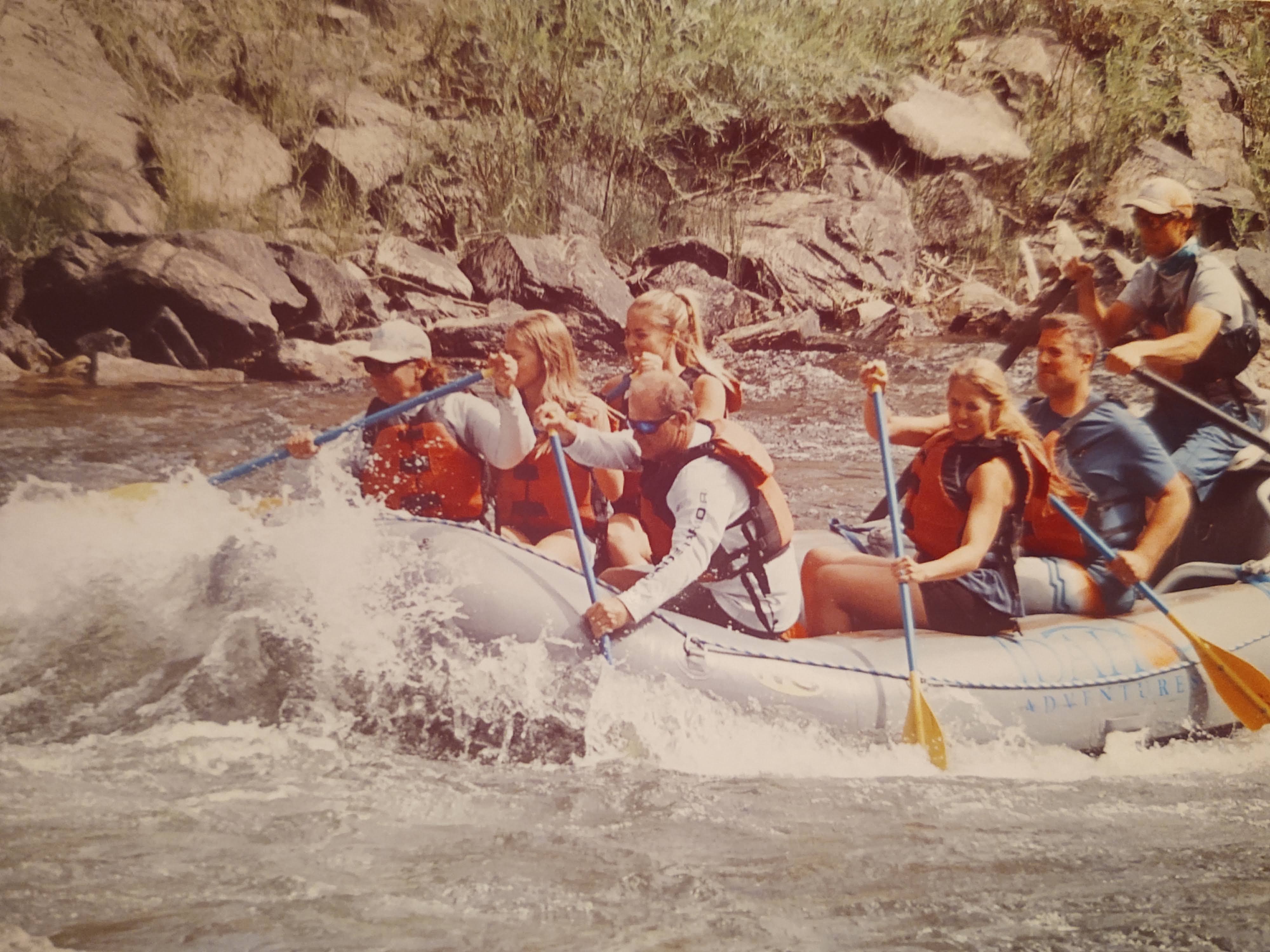
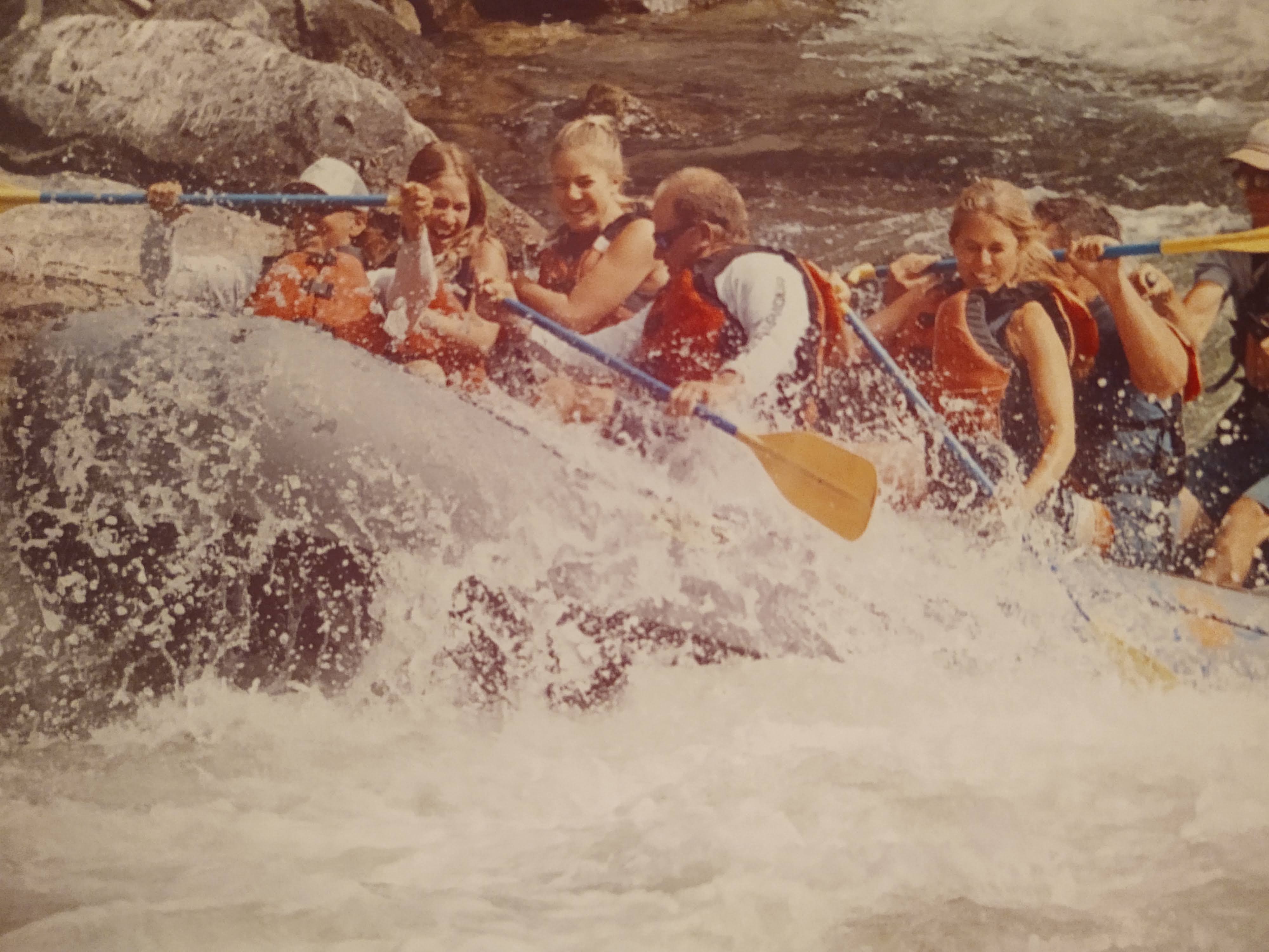
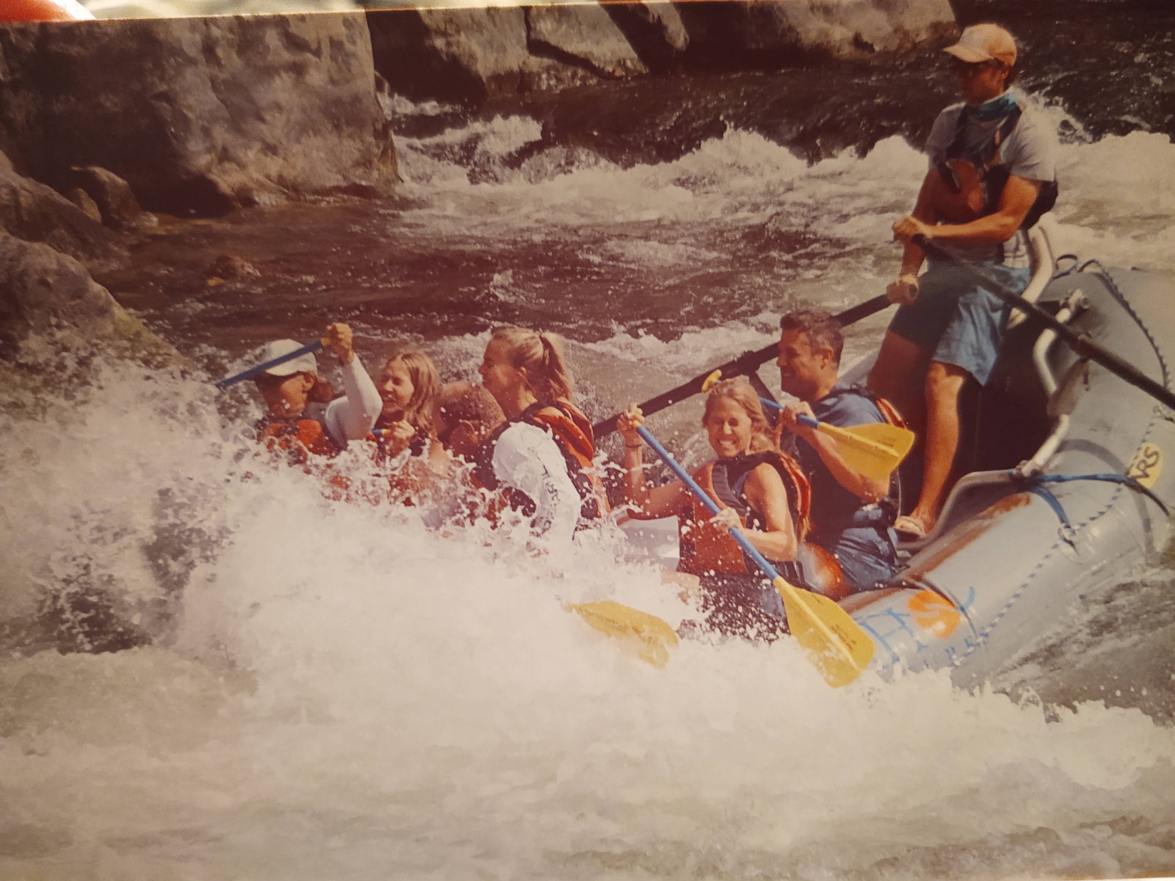
As there was no room at the Super 8, that Amanda’s friend manages, we scored a river side room at the Stagecoach Inn. Here we would spend three nights, and across the street from the Inn we scored a day long rafting trip down the “River to Nowhere”, the Salmon River. From “base camp” at the Inn we explored the fine eateries of Salmon: Junkyard Bistro, The Pork Peddler and Dave’s Pizza. All were very good, but when in Salmon, the Junkyard Bistro and/or The Pork Peddler are highly recommend. In other words, we look forward to eating at both places again, even absent “hiker hunger”.
Considering we rolled into Salmon at the beginning of the weekend, we hadn’t given a thought that rafting trips may be booked for the weekend. For some reason, we assumed that COVID19 would have caused a slow down in business. Nope! Per the Stagecoach Inn, the restaurant servers and the rafting company, they were busier than previous years. What the hell? Turns out that most people coming through Salmon were from out of state. Mostly from California. The citizens in Salmon were thankful for the business, but still a little annoyed with the prospect of the Californians bringing COVID19 along with their money. When we were asked where we were from, and reluctantly told them we were from California, we got stifled scowls. But when we quickly added that we just got off of two months hiking the CDT, the scowls turned to smiles and lots of questions.
The Idaho Adventures rafting company initially told us that they were fully booked, but within the time that we were there, two spots opened up for Saturday’s day trip.
From the Stagecoach Inn, we walked, and explored the entirety of Salmon. We walked to the Sacajawea State Park, and explored the history of the Native Peoples, The Salmon Eaters and the early settlers. Exploring this territory and history brought the book I had been reading, before we left for the CDT, to life.
I gotta say, the Native Peoples really got screwed over by the government in the late 1800’s. Oh hell, lets be honest…they’re still being screwed.
So along came Saturday and off to the river we went. A day long rafting trip was in order. Turns out, the family we joined just happened to be from So Cal. Go figure.
Also turns out that it was the last trip of the season. (Note to self: Book/plan a white water river trip for early June…water is moving waaay faster) It’s a family owned business and the our guide was going back to college, and eventually off to the Alaskan tundra to be a “Bush Pilot”. The good thing though, was we were able to “yogi” a ride from him to Missoula Montana on Sunday morning for our flight back home, the following day.
On a side note, while we were rafting down the “River of No Return”, as the Salmon River is called, we wondered as “water people”, ‘Why in the world we were walking everywhere?’ Maybe we should be drifting the “Rivers of America”. Granted, we plan on finishing the CDT next hiking season, but don’t be surprised if we don’t fit in a “thru-float” of the Mississippi River in the near future. Just say’n.
In total we covered approximately 650 miles over June 18 – August 8, 2020. We had hoped to have completed the entirety of the CDT, but it just wasn’t in the stars for us. By the time we returned home, it became absolutely clear that we had made the right choice to head home. Had we continued, we would been in the middle of a lightning strike fire that started August 11 and later named the “Bear Creek Fire”. Our flip down to Colorado would have been also met with numerous fires as well. Another plus, was the fact that I got really sick…again. It appears that what ever I got on the trail, lingered enough to resurface a couple weeks later, sending me to the hospital, and a months’ long regiment of medication to heal the lining of my stomach and bring my liver enzymes back down to an “acceptable” level. I was tested for everything under the sun (including COVID) to no avail. I am back to full health and training for our next adventures.