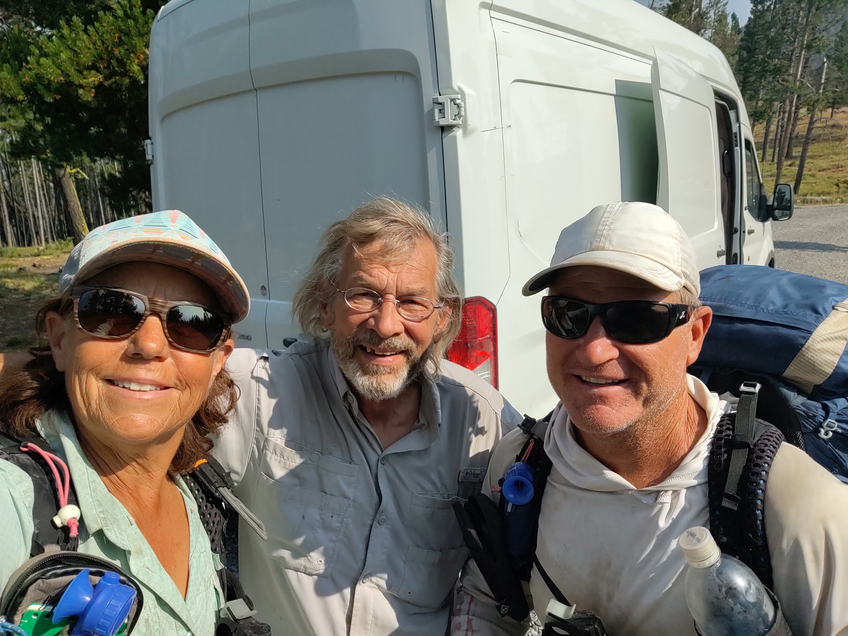
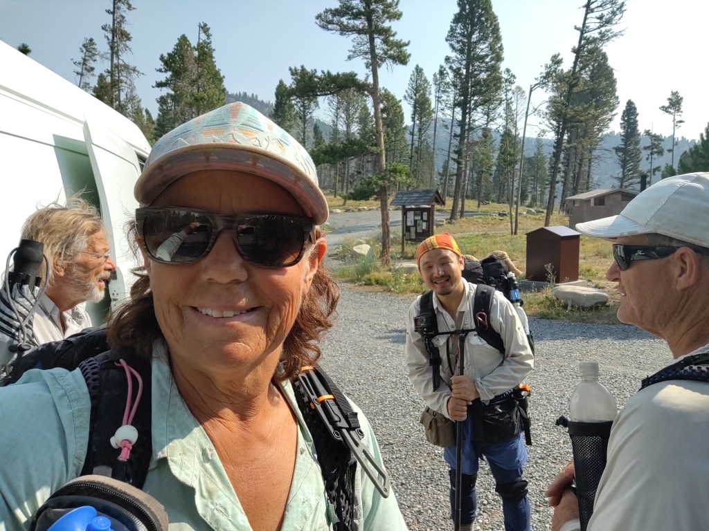
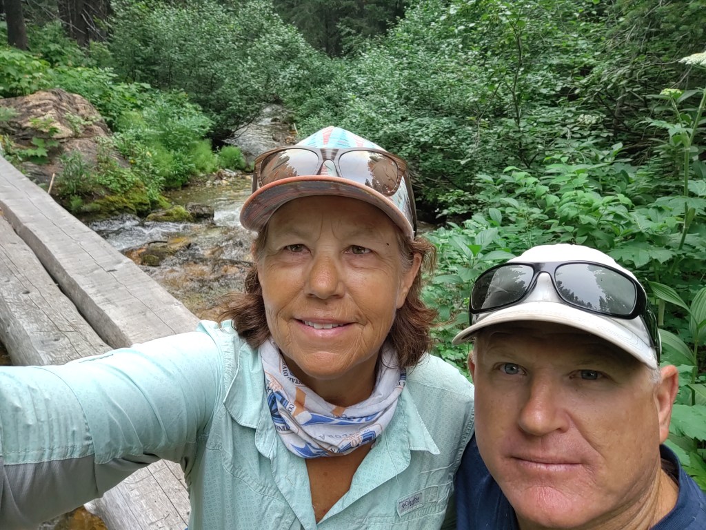
Rather than take two zeros and pay for a third night in Helena, we opted to “Nero” on the third.
We got a ride from Tom of “Helena Wheels” to MacDonald Pass. Leaving out of Helena was also supposed to be a heavy, mostly waterless carry, to start with. Tom however, said he cached a gallon of water for us, so we didn’t have such a heavy carry. Great guy.
Tom picked us up (per our request) around 3:30pm. Skies were smokier than when we had arrived two days prior. It had rained fairly hard the day before. Complete with thunder and lightning. We hoped it wouldn’t lead to more fires.
The rain was welcome though, because it had been stifling hot in town, and sitting outside the laundry mat in rain gear was like being in a sauna…until it rained…and then, at least, we didn’t look so silly.
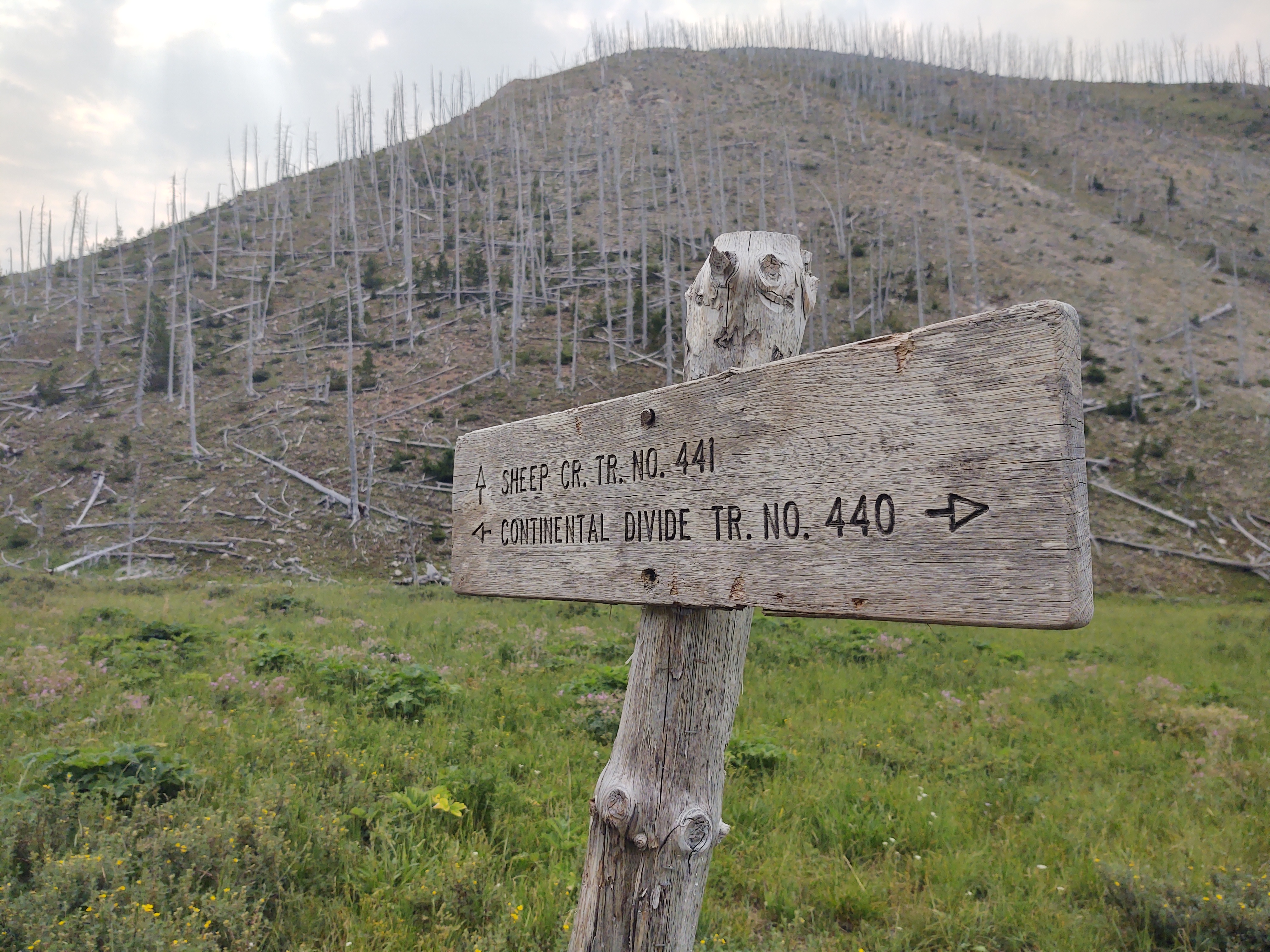
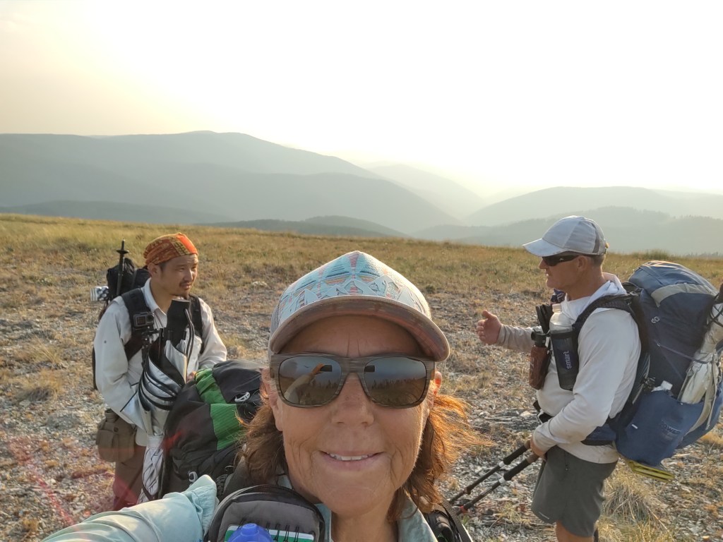
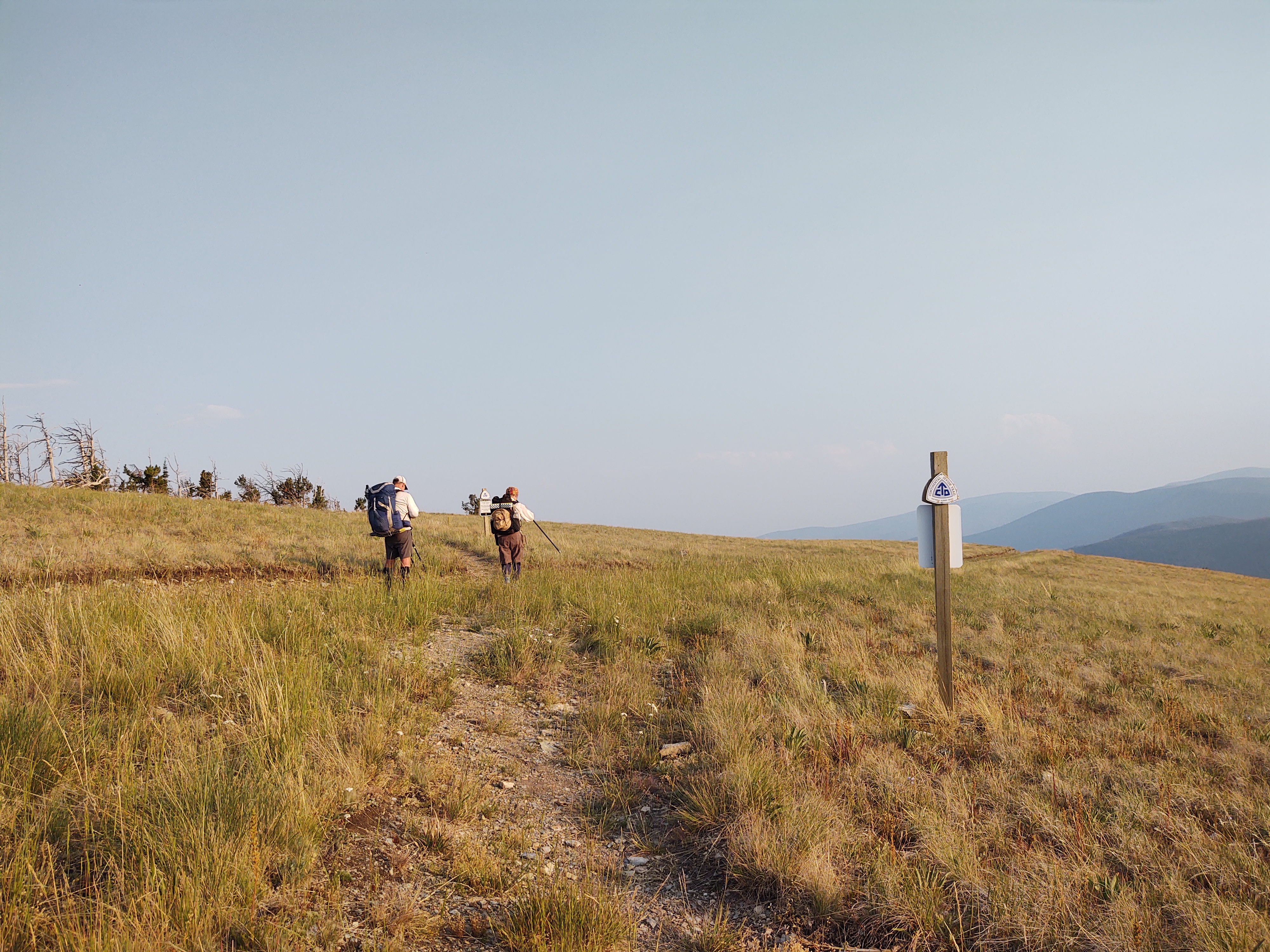
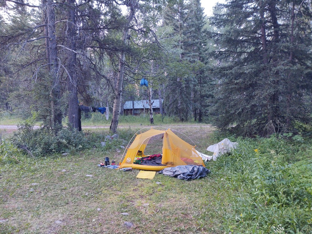
Our plan was to hike a few miles in and call it a day. First we had to get by the mile of blowdowns, and then it was a matter of finding a flat place to camp.
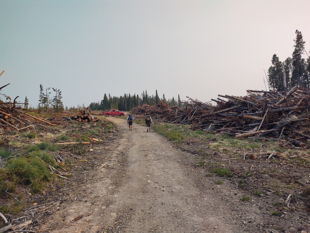
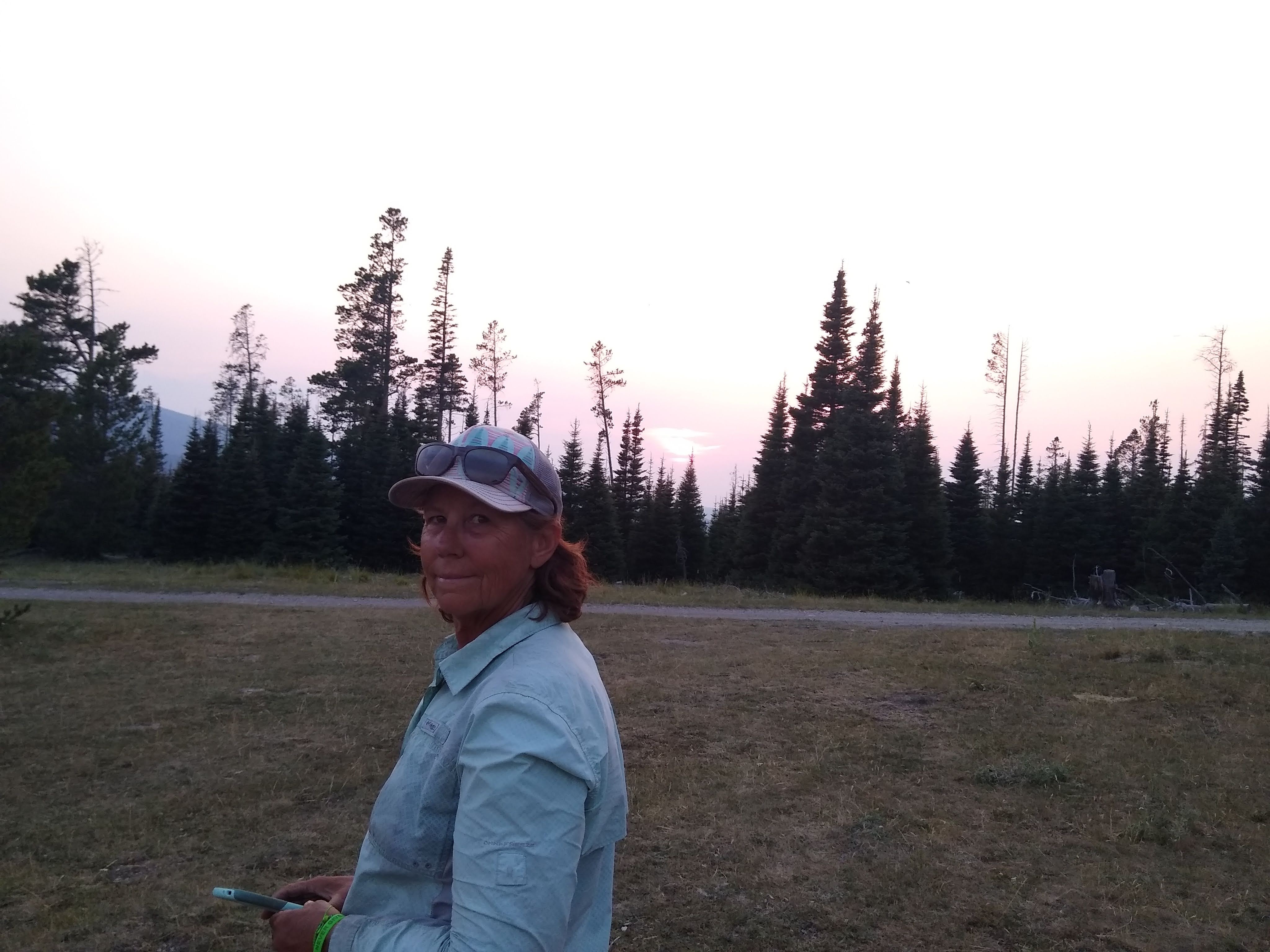
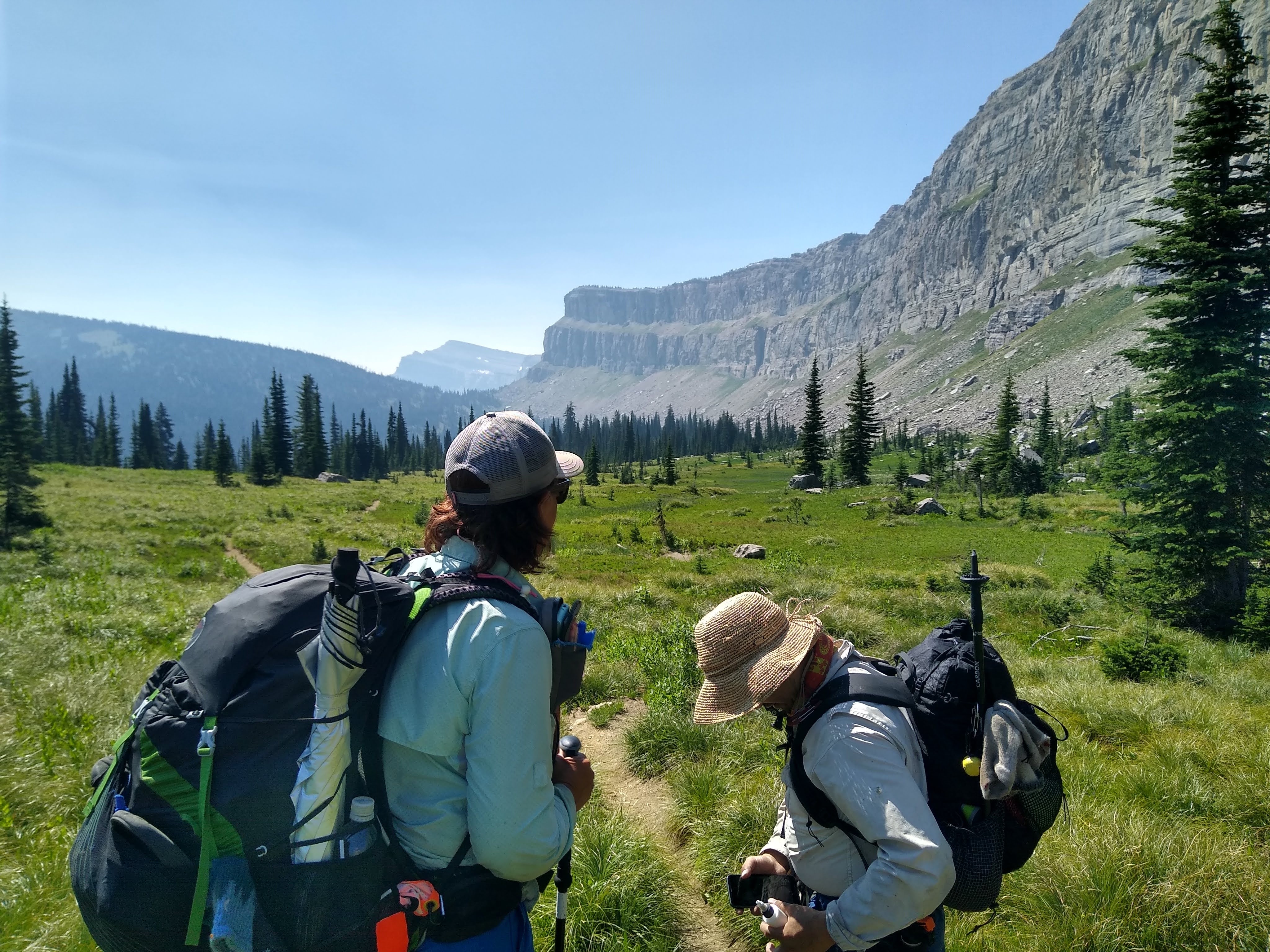
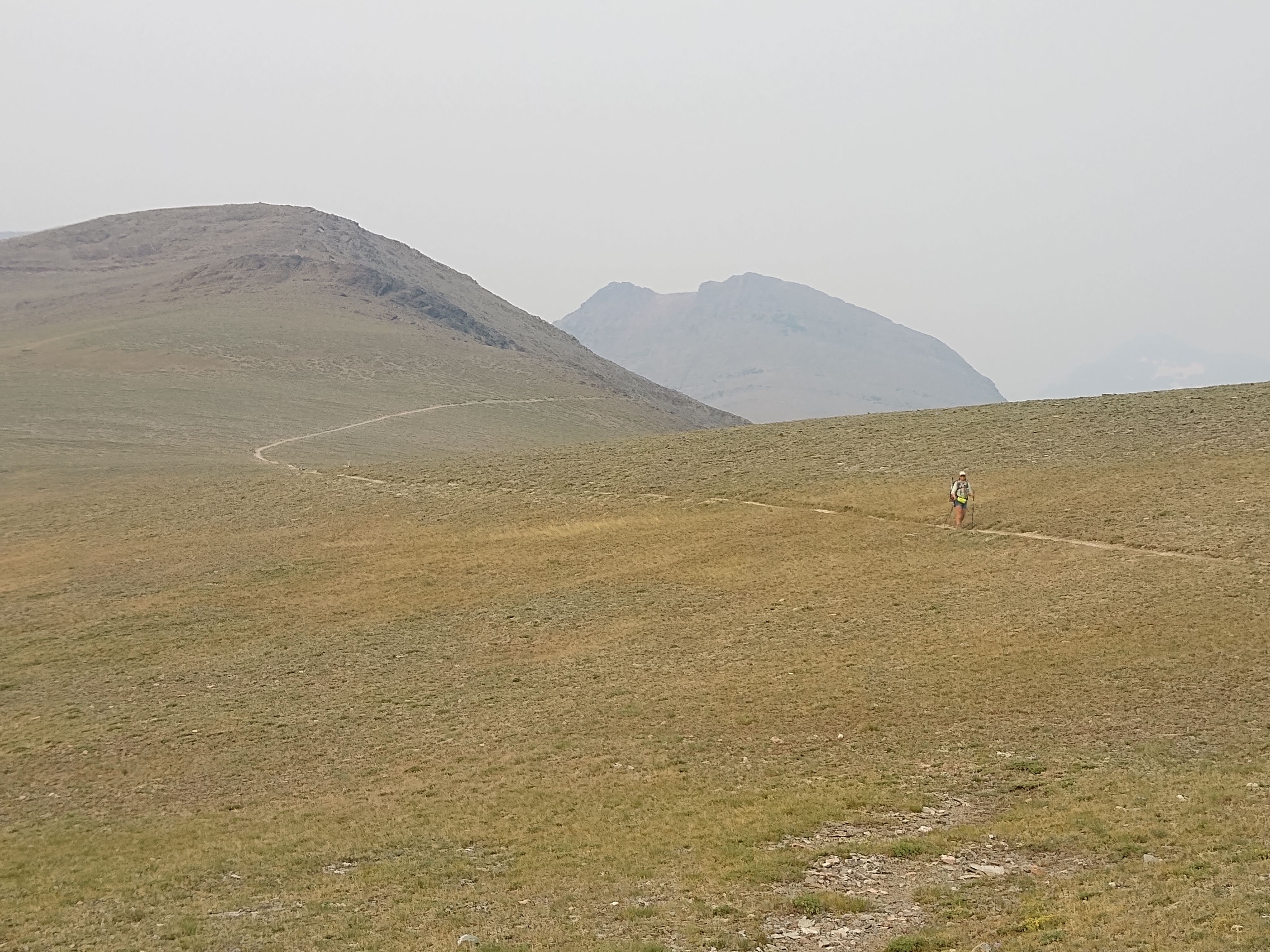
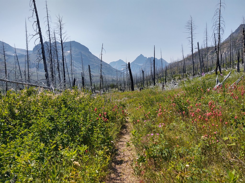
Before that Paul realized that we had reached a collective of 1000 miles on the CDT. Awesome. One third done. Much of the area we were walking through/towards had been logged. Large piles of twisted timber (slash piles) were stacked like hives along the landscape.
At mile 366.4, we came across a red cooler full of trail magic. It appears that a gal who is currently hiking the PCT, suggested to her parents that leave “trail magic” for the CDT hikers. Her parents took that suggestion and now it appears that they regularly stock a cooler full of water, sodas, and oranges. Fresh fruit! Yeah! What a treat!
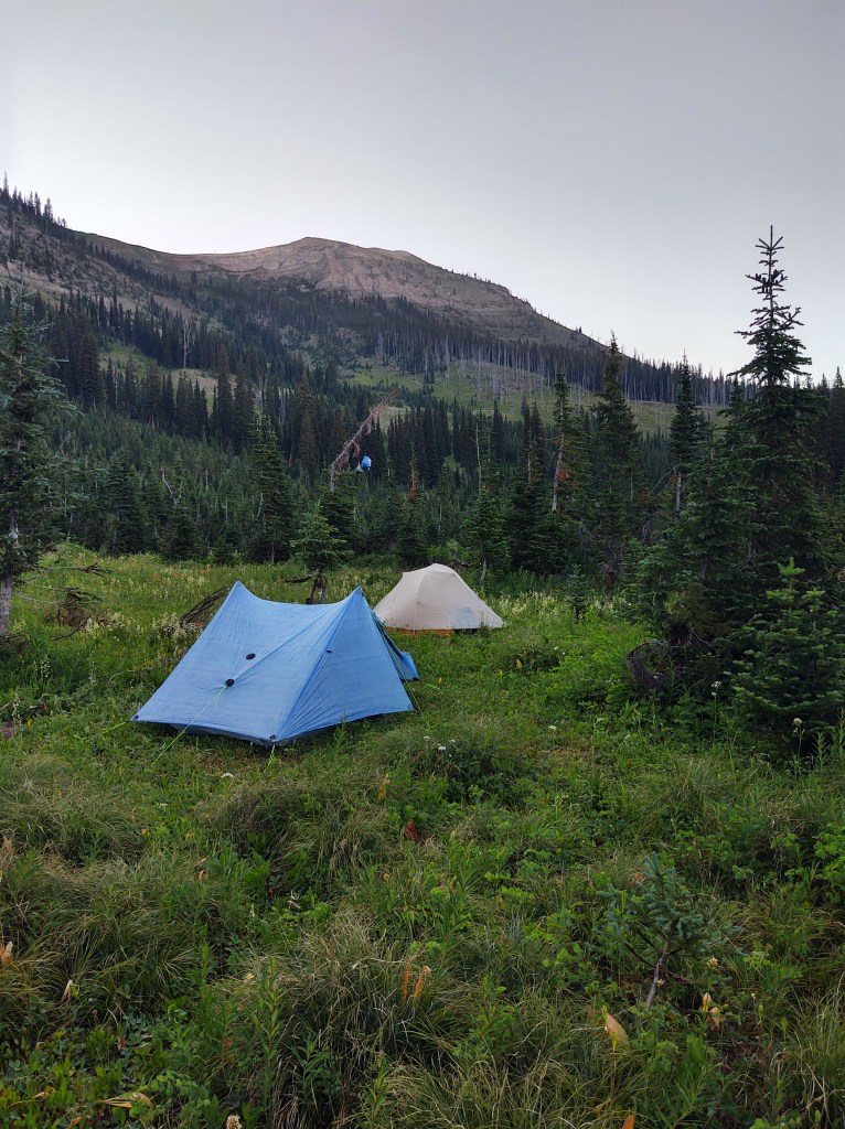
Due to the fact that most of the land was posted private, and we didn’t want to venture any further, we found a flat spot amongst the slash piles and set up. The sunset was a bonus.
8/04: 21.5 mi (366.4 – 387.9)
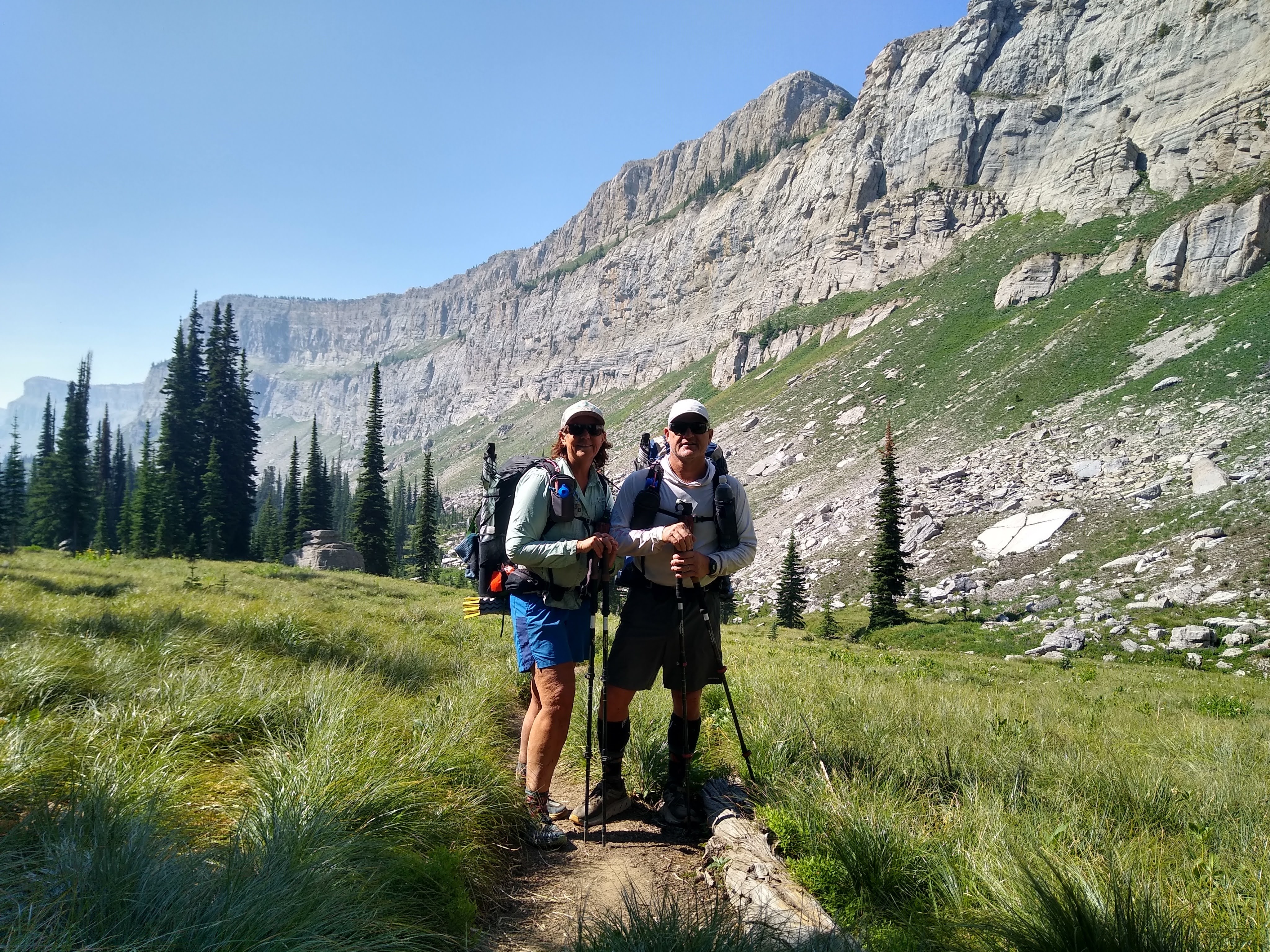
The first part of the day was pretty cruzy. We made 10 miles by 11:30 am. Prior to that, while collecting our water from the cache Tom had left us, we met “Tartan”. He was hiking NOBO and was on his Triple Crown. His son was supporting him so he could slack pack as much as possible (He’s in his 70’s). We remembered having met him in 2014, on the PCT near Kennedy Meadows.
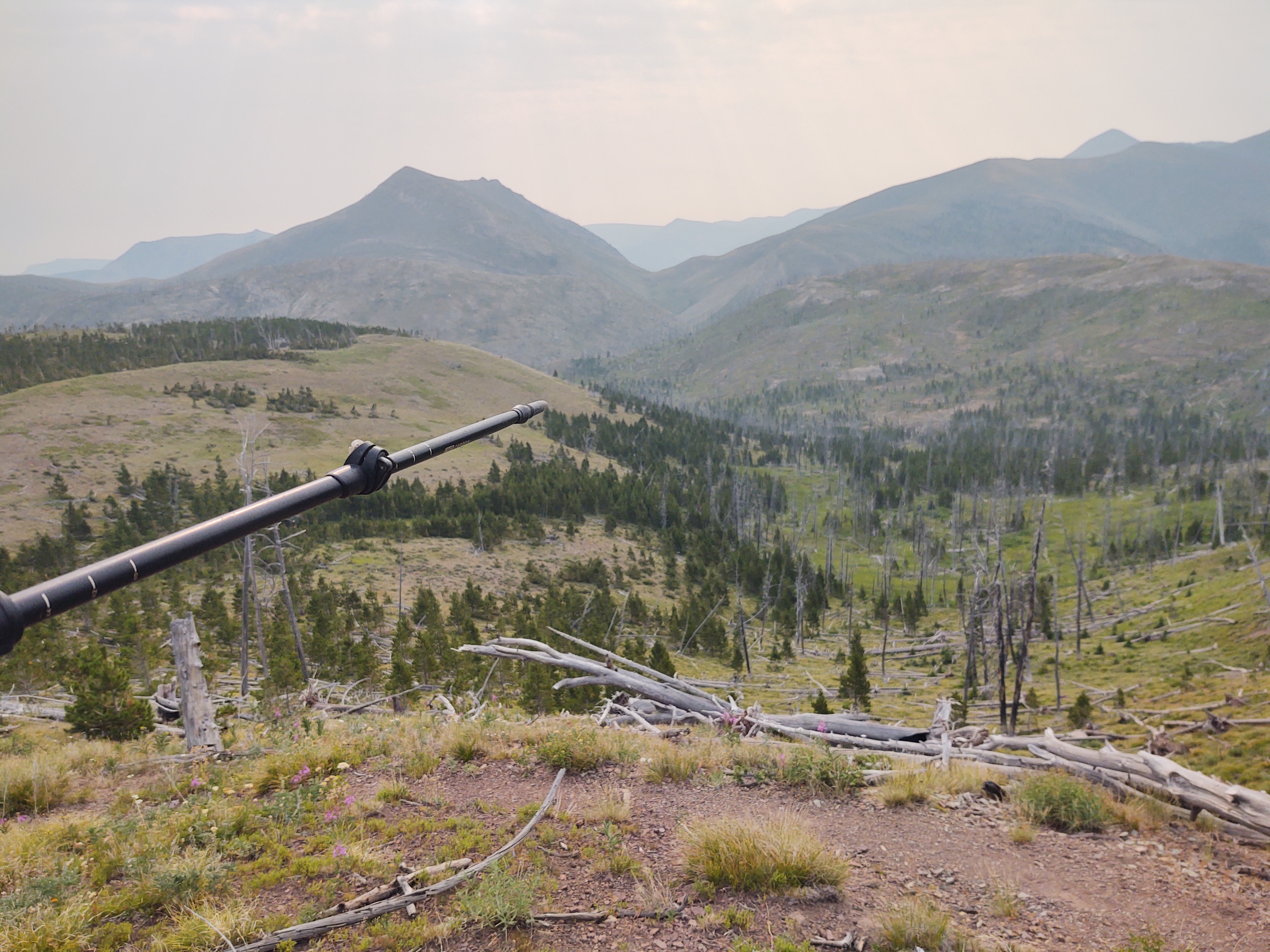
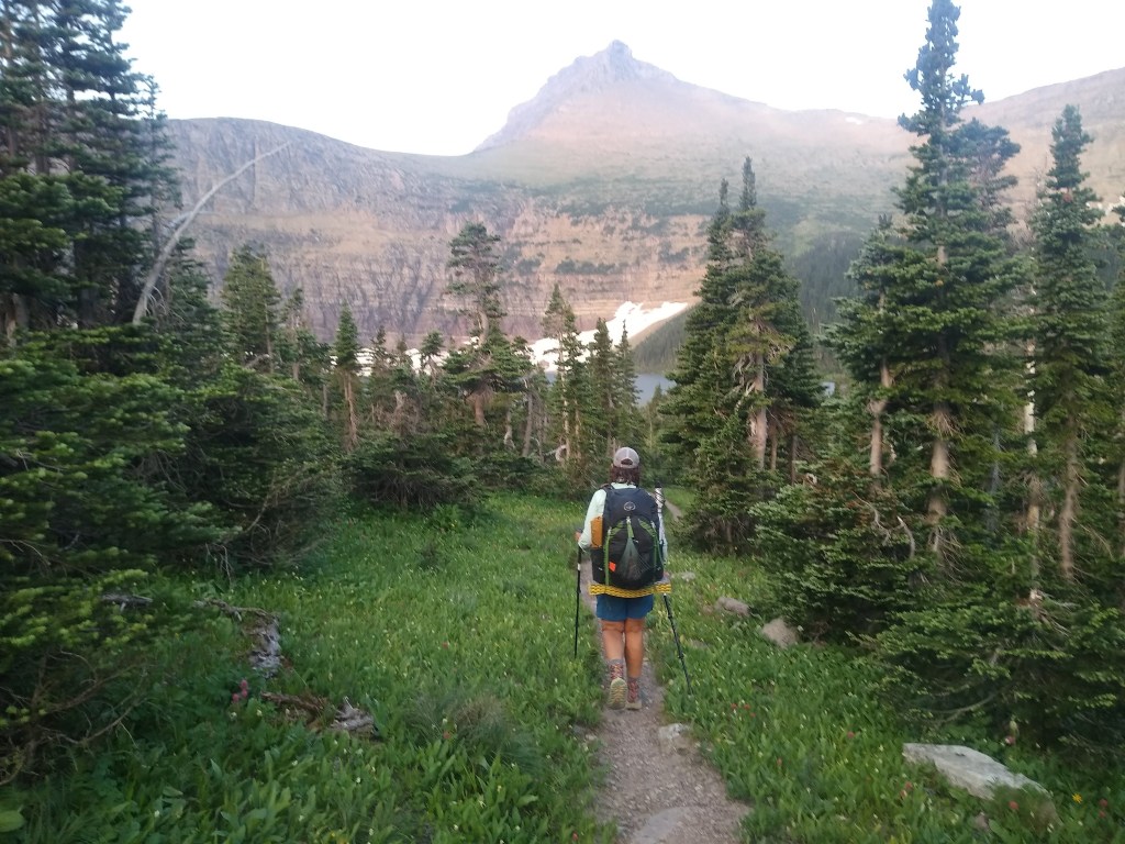
Generally when one part of the day is “easy”, the next part of the day is NOT. The later part of the day was spent climbing Thunderbolt mountain…in the heat. Sadly the views were too hazy to appreciate. We completed our day fully exhausted by what was called a “lake”, but in all reality was a giant meadow with an icy cold (and deep) creek running through it.
We had hoped to see moose or elk at least on the edges of the meadow, but no such luck. It must of been their day off. At 2am however, we were awaken to the most unusual sounds. It was a cross between the howl of a wolf, the cry of an elk calf, and the scream of a mountain lion. We couldn’t quite place the “Marco polo” cadence of calls as it moved from the far end of the lake towards us. Maybe it was Sasquatch, we chuckled and went back to sleep. This went on periodically for nearly two hours.
8/05: 20.6mi (387.9 – 2mi of Anaconda Cut-off)
Best magic of the day.
We were told there was trail magic at the road. We got two roads, one of which included Champion Pass. No such luck. Clouds overhead were moving fast. A storm was coming in and we also were out of water. We knew that there was water 2 miles into the 52 mile Anaconda Cut-off CDT alternate. We beat feet as fast as we could. With our feet on fire, it began to sprinkle. No worries. We have umbrellas. Now we were looking for water AND a place to set up our tents. We found both just as the skies opened up. This being our first real rain event, we panicked and threw up our tent in the driving rain which resulted with every inch of the interior wet as can be, even though we were pretty quick about it . Rookie mistake. We should have ducked into the thicket of trees, and waited out the storminess. As it stood, it only lasted about 20-30 minutes. Then we could have set up at our leisure, and had a dry interior. We’ll not make that same mistake.
The following morning (8/6) we completed the road walk into Anaconda. It was mostly dirt road that weaved through forested areas and then rolling plains of private property. Once we got to Hwy 48, where there was no shoulder upon which to walk safely, we decided to hitch the rest of the way into Anaconda.
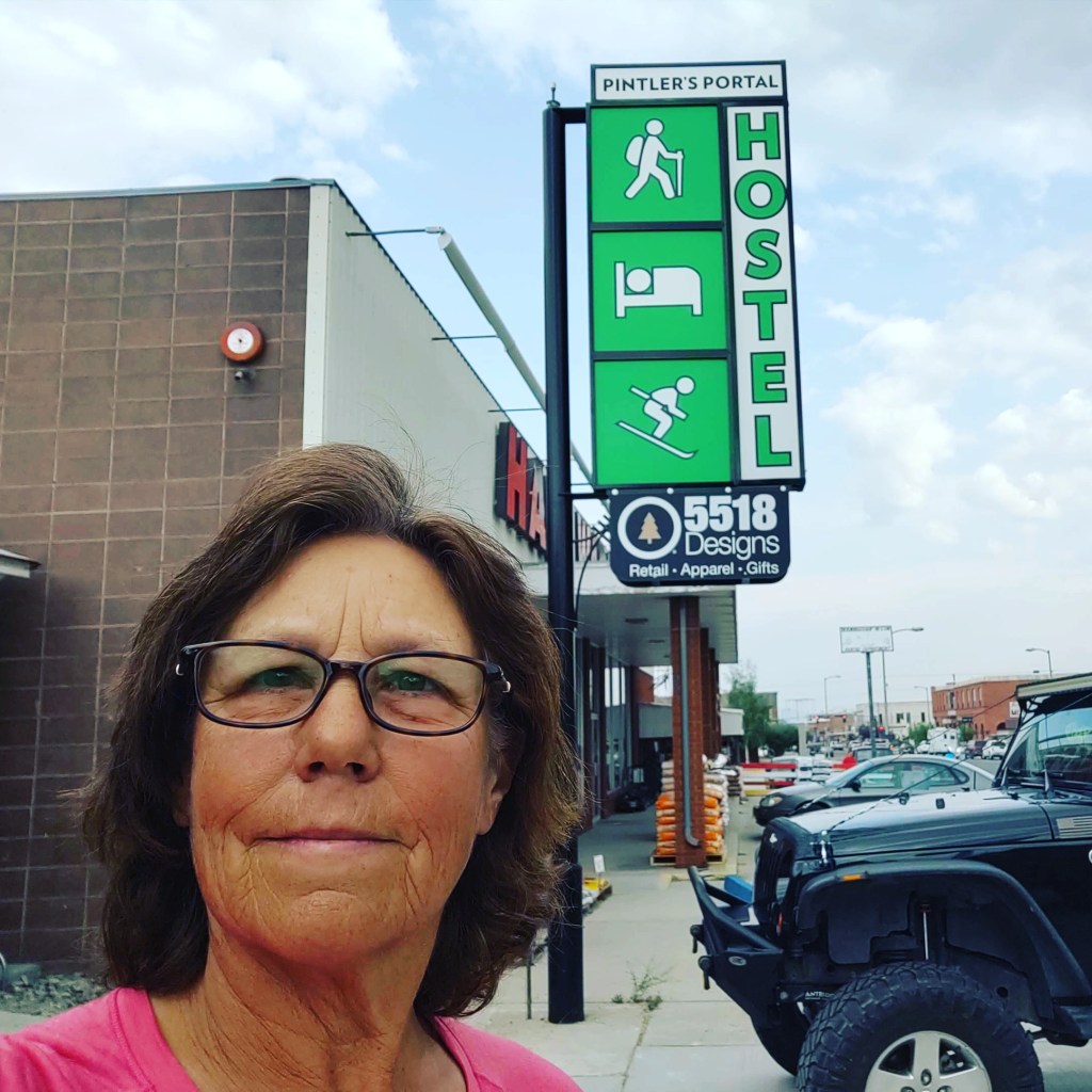
We initially tried to hitch by the Montana State Mental Hospital sign, but that didn’t go so well. A man named Norm, actually turned around from where he was going to give us a ride into town. What a blessing. We were practically out of water and it was blazing hot. At our request, he dropped us on the doorstep of the Printler Hostel.
Turns out we were their first customers. They had just opened that day! Perfect timing.
Now for a much needed zero. And better yet, it looks like we arrived in Anaconda just in time for the Smeltermen’s Brewfest weekend.
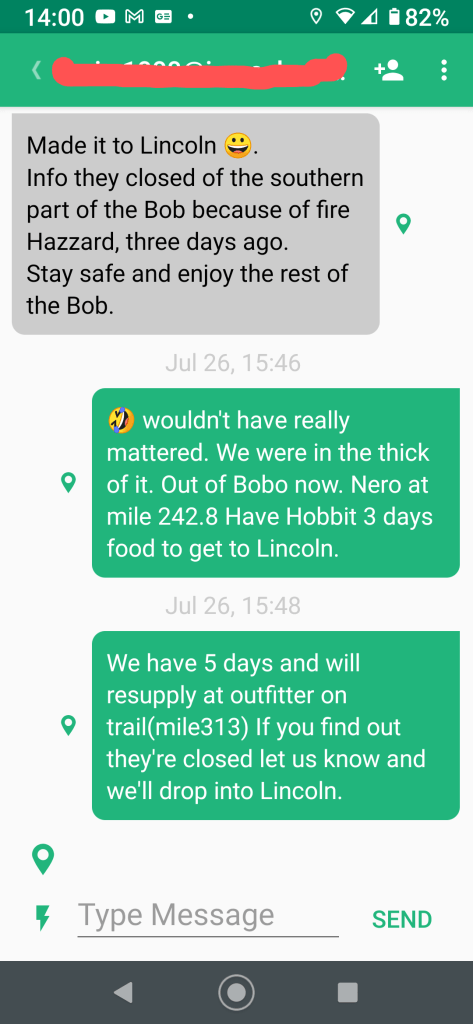
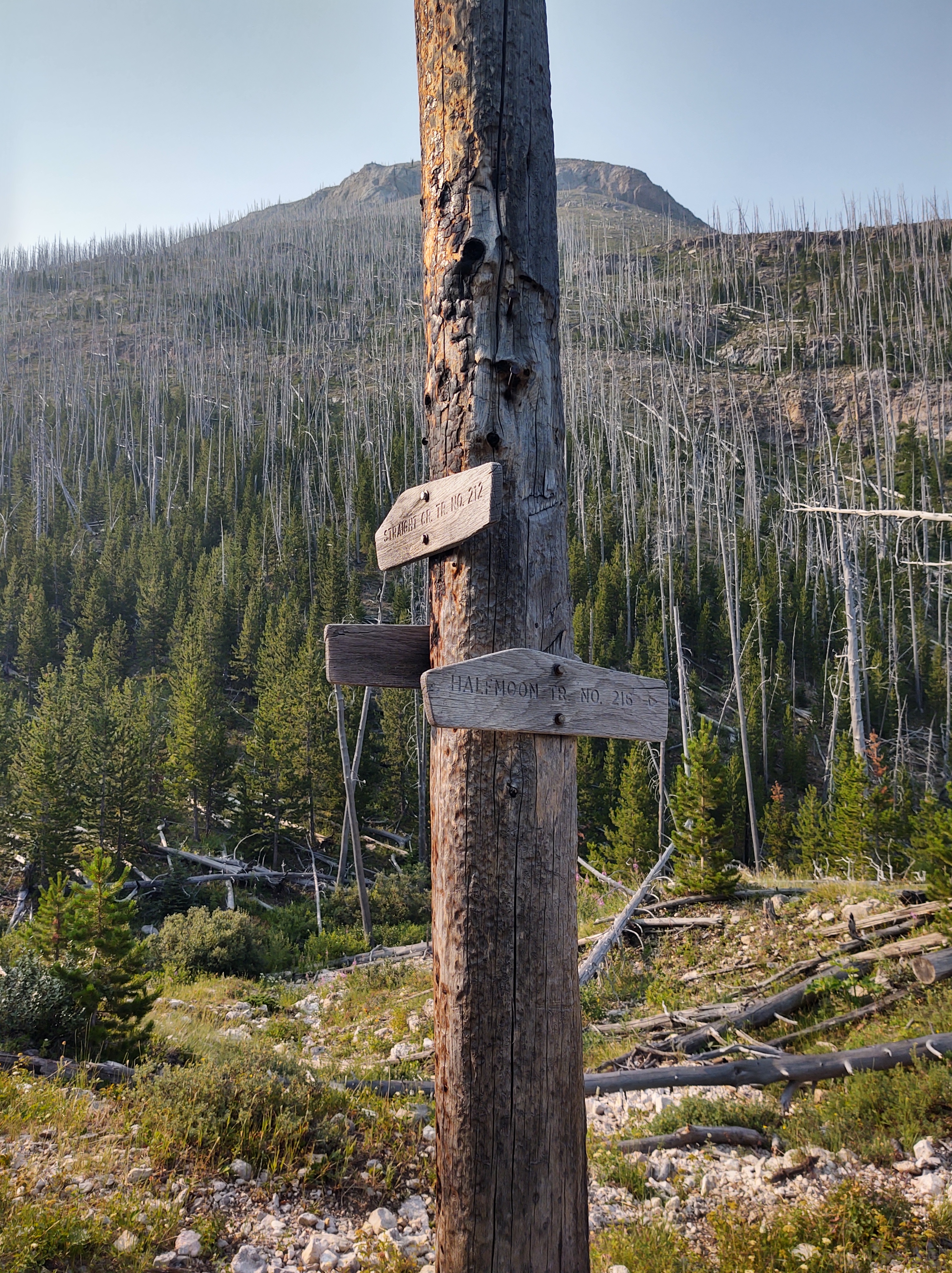
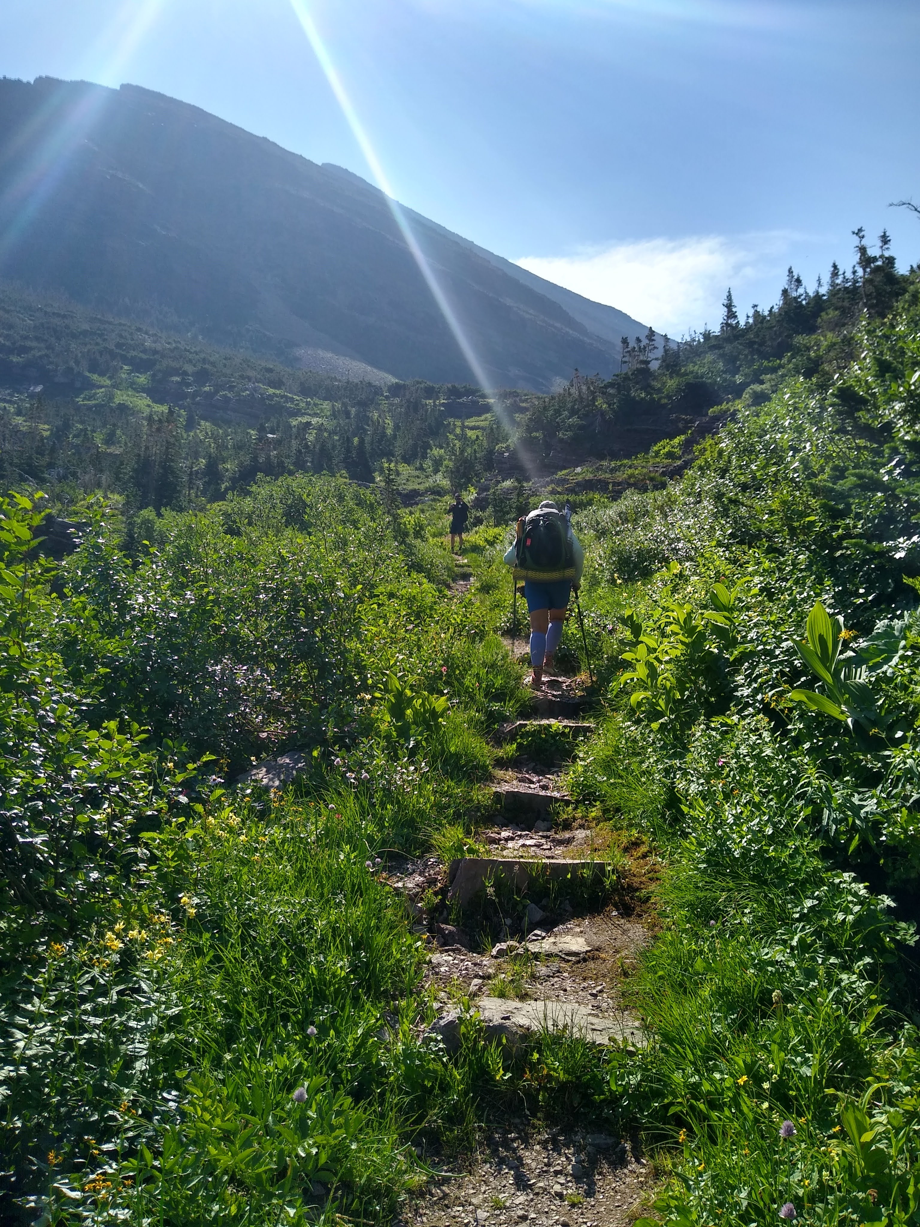
Rather than stay at the Benchmark Ranch another night, we decided to do a “Nero” (“minimal mileage”) on trail. We hiked out of Benchmark via a 1.5 mile road walk past the 6000 ft long, Forest Service air strip, and made a left onto Straight Creek Trail. This would take us directly back to the CDT at mile 242.8. Here is where we would spend our “Nero”…after crossing the Straight River.
As we were leaving Benchmark and fired up our InReach, we got this message from Sheepgoat.
What? The Bob was closed? These things happen when you have zero cell service.
As we approached the Straight River TH, we noticed that once again we would be entering The Bob in order to get to our “Nero” destination. Obviously we were overjoyed.
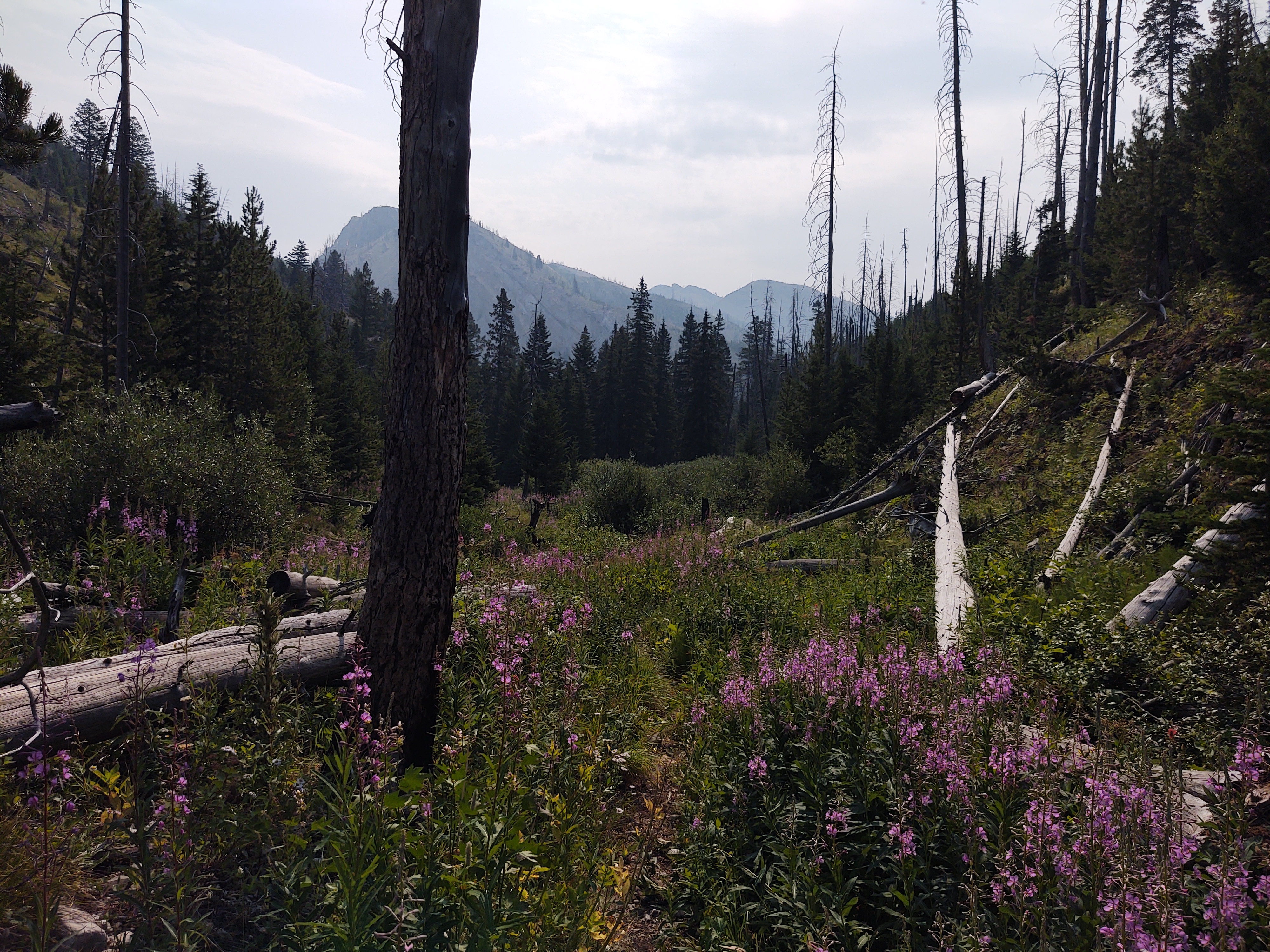
The trail was easy and straight, with the equally Straight River to our right. The trail was also lined with ripe huckle berries that we feasted upon as we meandered down the trail.
The 12 miles went by quickly, and in no time we crossed the river, and set up camp.
We were so glad we camped where we did. After we had set up camp the afternoon, the wind gusted violently the remainder of the day.
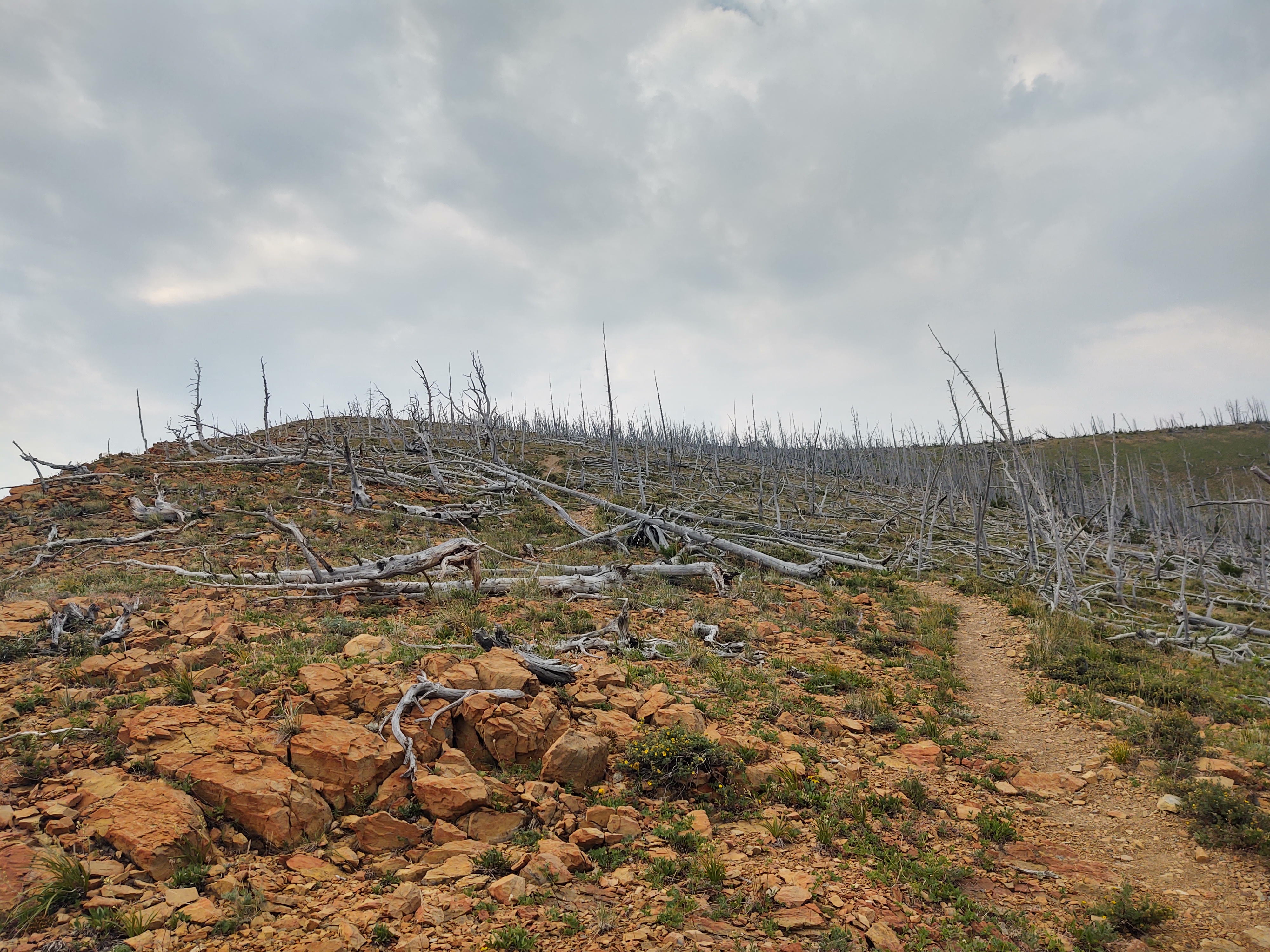
We knew that forward of our campsite lie the skeletal remains of a forest fire some 30 years ago. “Widowmakers” everywhere! We were glad we didn’t have to walk or make camp anywhere near these brittle trees. Oddly enough, while eating our rehydrated dinner, and after the wind had ceased to blow, a tree suddenly collapsed, mid trunk and fell some 50yds from where we were. Tent placement is ever so important in dead fall areas.
July 27: 18.3 mi (242.8-260.5)
Up early…as usual, and a calf deep river crossing. This time we crossed in our Crocs and put on dry socks and shoes. For some reason we had no GPS service on our phones, which meant that our Guthook app did not work. Luckily I had studied the day’s profile and knew we were in for a steady climb for 7miles to approximately 6,800 ft. Not to fear, my Garmin InReach was working just fine, so I Bluetoothed it to my phone and we followed the “red line” via Earthmate, as there were a few trail junctions we did NOT want to miss.
The first 10 miles of the day ran through a stark burn area, that was slowly “recovering”. A good portion of the trail was rocky and tedious. Oh, and did I mention that it was stifling HOT! No cover what so ever! So a heavy water carry was necessary.
Just as we were beginning the final climb, at near 7 miles, one of my shoulder straps decided to break. I knew that my pack was nearing it’s “term”, but had hoped to replace it after completing the CDT.
A quick field fix, that included fashioning a knot to hold the strap to the pack was successful, so we continued on. As long as the other strap doesn’t fail, I may be able to nurse the pack all the way to Mexico.
As hot as the trail was, we were blessed with fairly regular and icy cold streams and springs to quench our thirst and rehydrate appropriately.
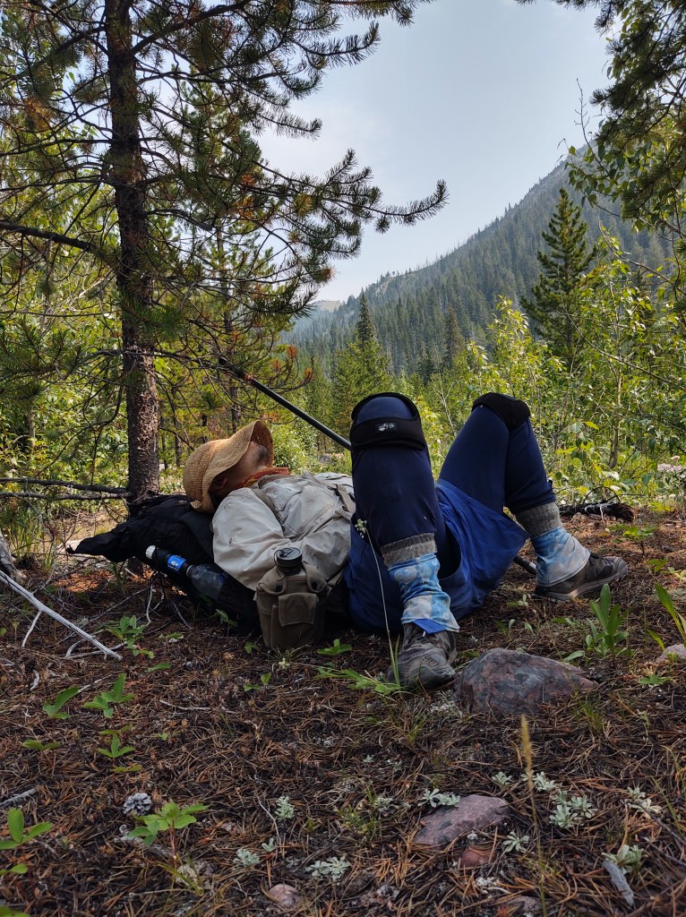
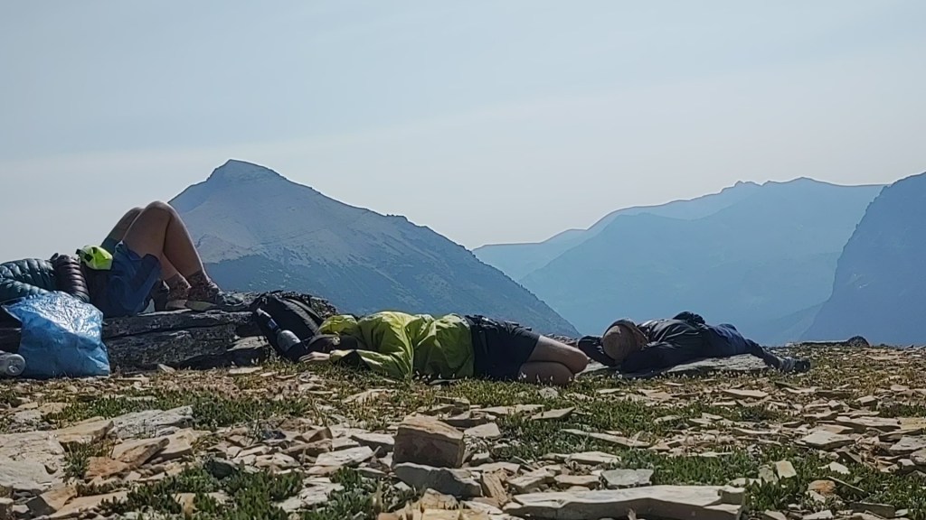
Sometimes napping is just as important as hydrating
By the time we finally reached the Dearborn River, and our intended camp spot, we were trashed. The heat took a lot out of us, and the biting flies were relentless. This however, did not stop or dissuade us from plopping our sweaty hot bodies, fully clothed mind you, in the Dearborn River to cool off. I’m surprised that steam didn’t rise from the river, we were that hot.
Once cooled off, we had to retreat to the confines of our tent till 7pm, in order to escape the ravages of the biting flies before we could prep and eat our dinner.
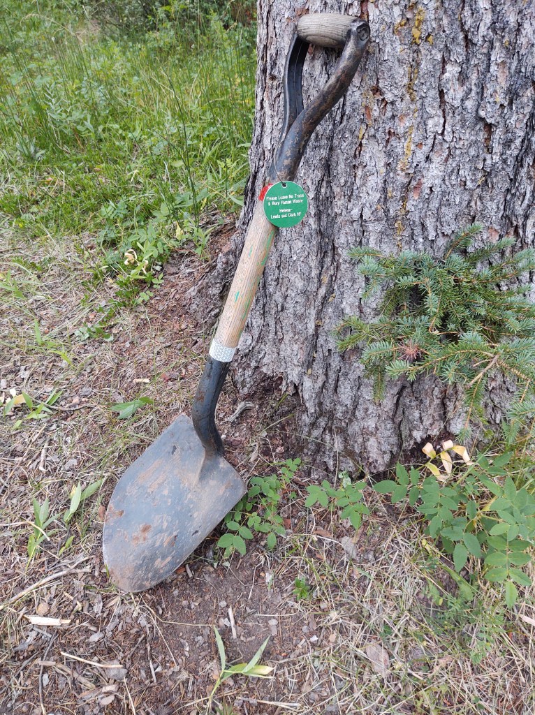
The beauty though, of this camp spot, is that the Forest Service provided a great shovel in which to dig (pre-dig, in this case) the perfect cat hole (personal latrine hole).
We did our best to “camel up” for the evening, as we knew that the next day would include not one, but two massive climbs, with water 10 miles between them.
We finished dinner, just in time for it to start raining on us. I was not looking forward to having to pee.
July 28: 20.3 mi (260.5 – 280.8)
This was a F-ing HARD day! While we are nearly 300 miles in on the CDT, we still haven’t fully developed our hiking legs, or lungs. So, this for us, was brutal. We had a 3000 ft. climb right out of the chute, but not before we walked a half mile on the wrong trail. The fact that it was flat, made us think that something was wrong. Thank goodness, our Guthook app was finally working, and we could “see” our way back to the “red line”.
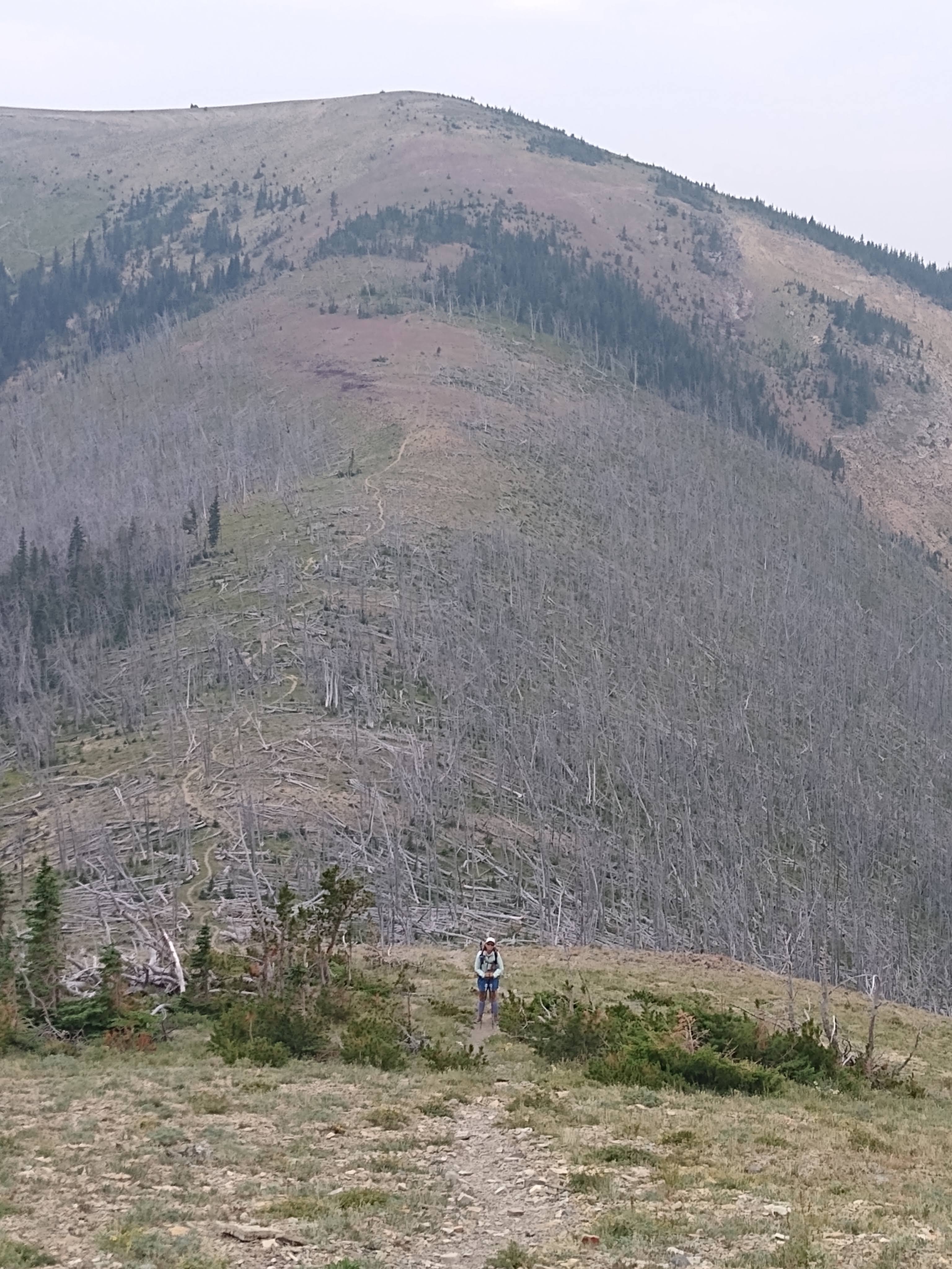
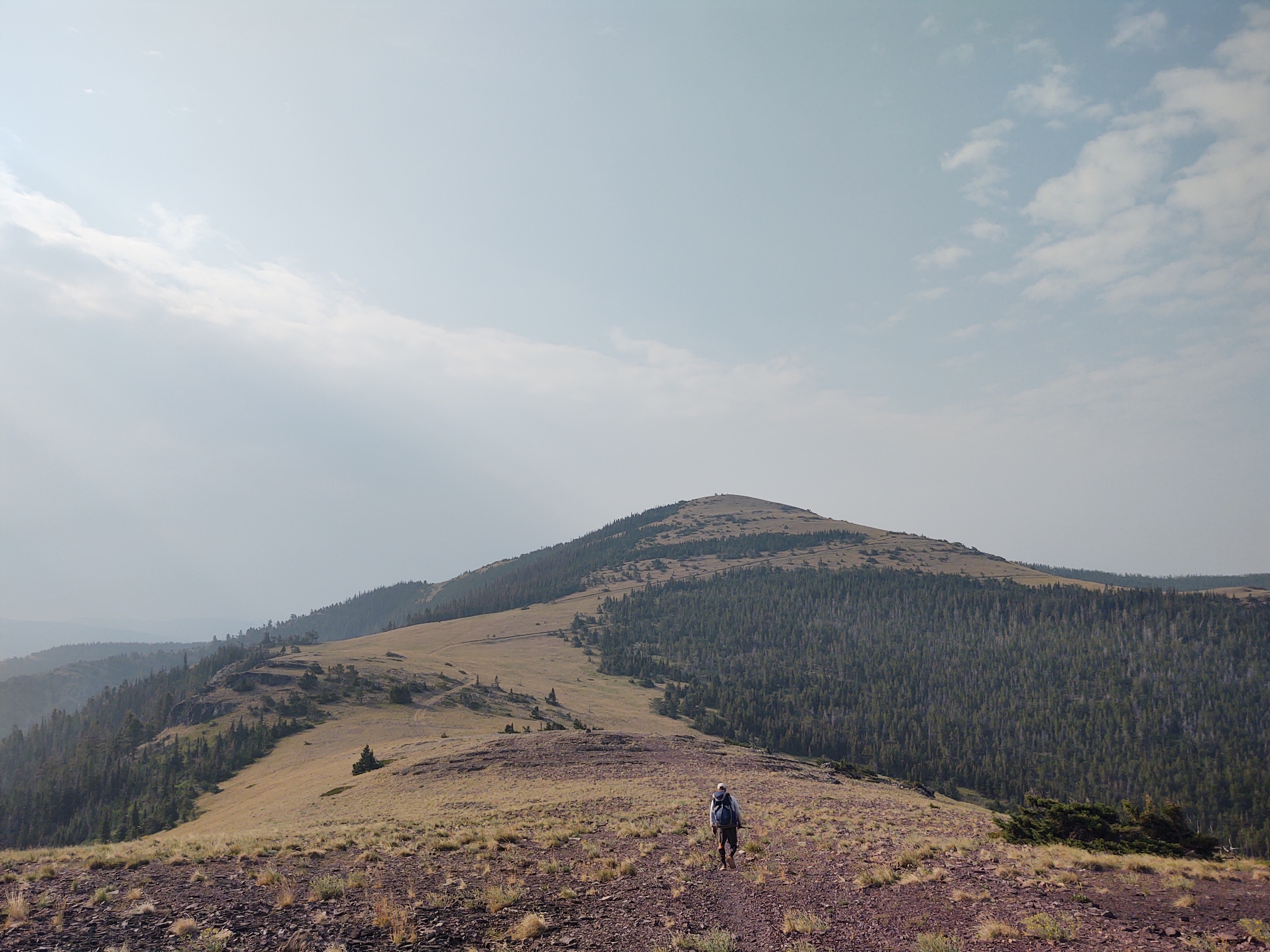
We started way down there
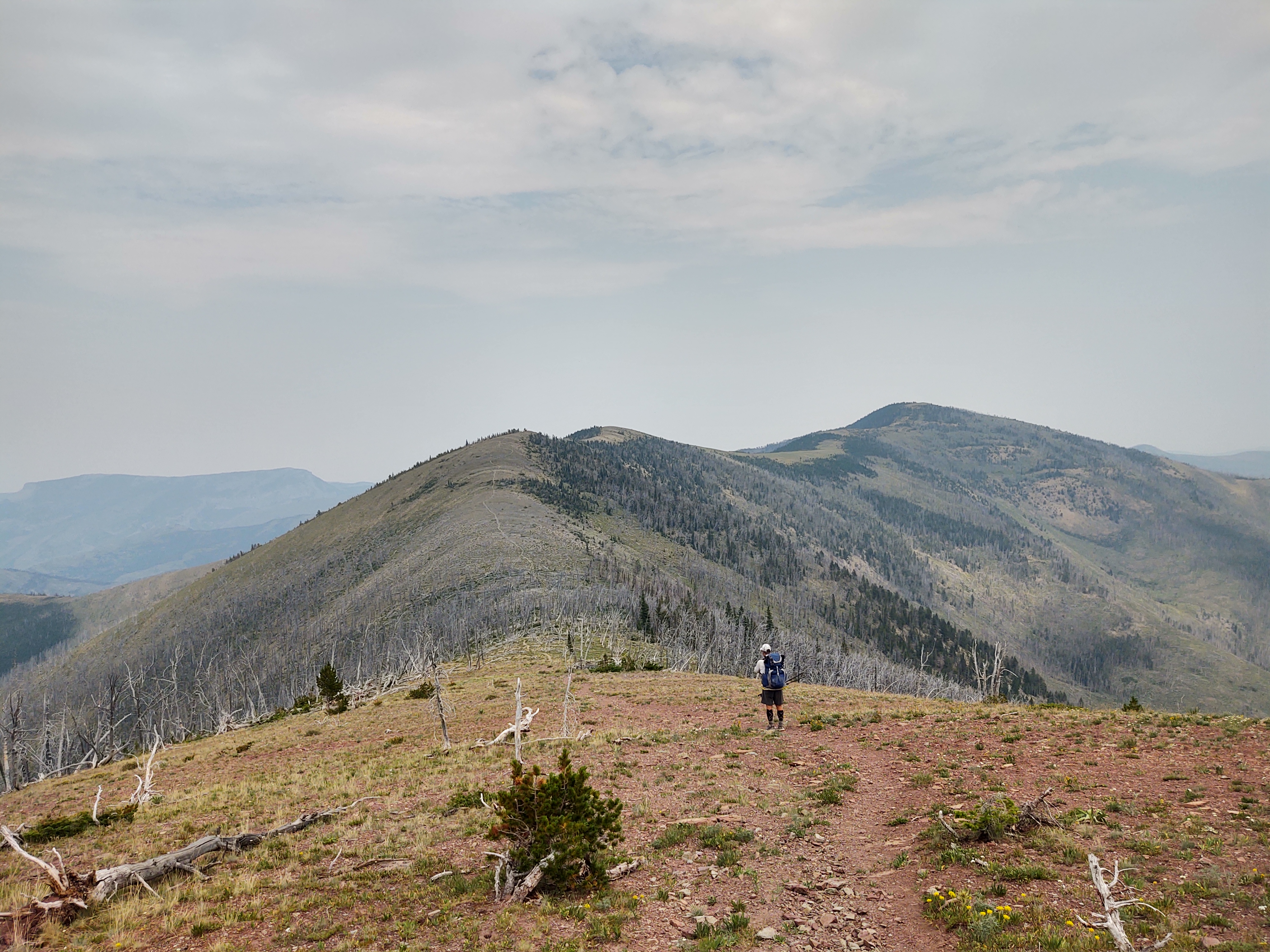
Luckily the day was mostly overcast with a stiff breeze. Our route stair-stepped from one false “summit” to the next.
The climbing was relentless, with mostly vague and/or “non-committal” switchbacks.
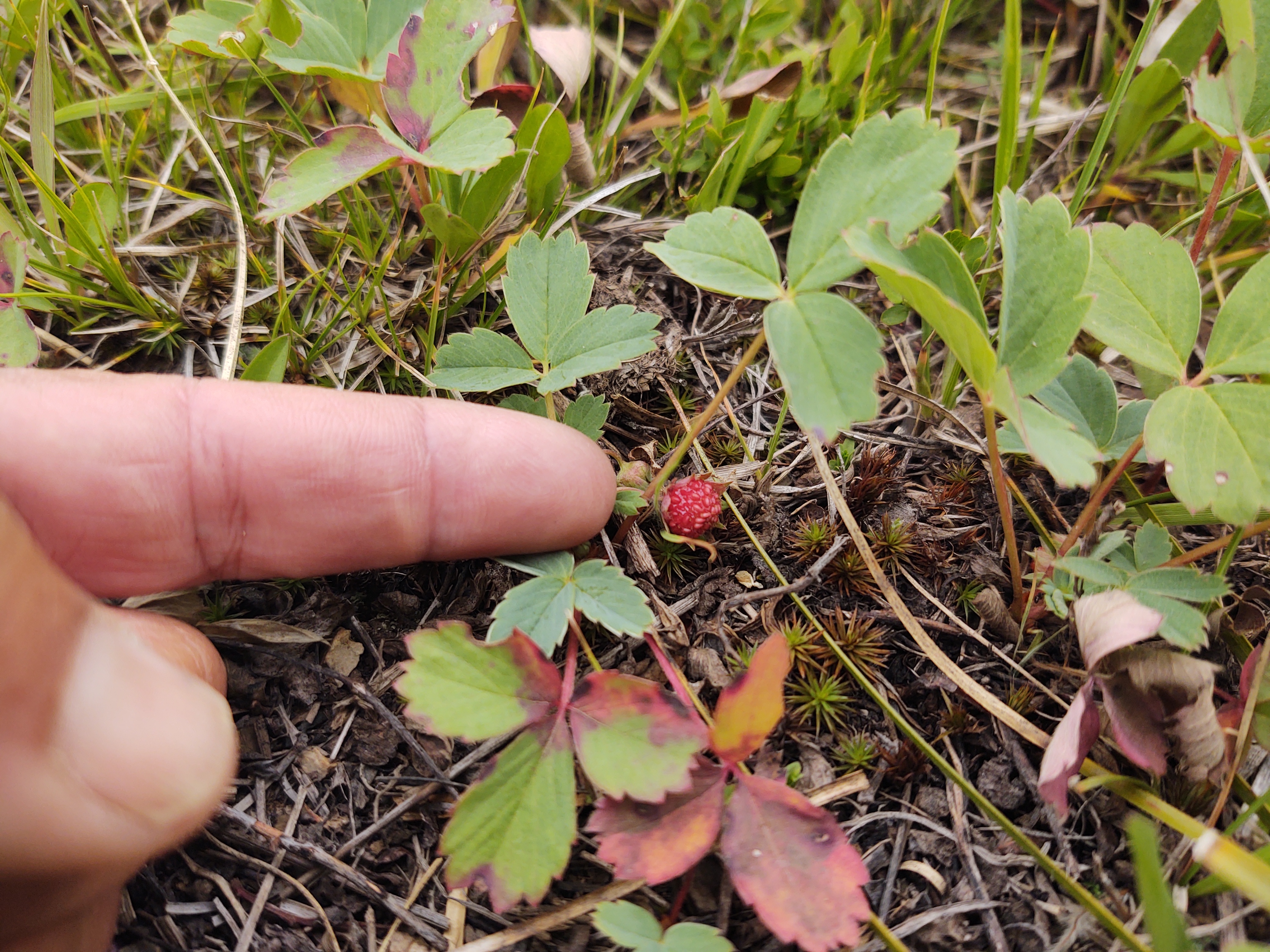
A highlight was finding a field of wild strawberries along the way. Small, but oh so tasty.
At the 10 mile mark, we had to walk 2/10ths of a mile off trail to find a stream to water up.
The next 10 miles and it’s water source was even more challenging.
If we (mainly me) were not so tired, the views would have been more “inspiring”. One false summit after another was NOT communicated well on our Guthook app. It tends to average the difference in climbs and descents. No matter. It has to done.
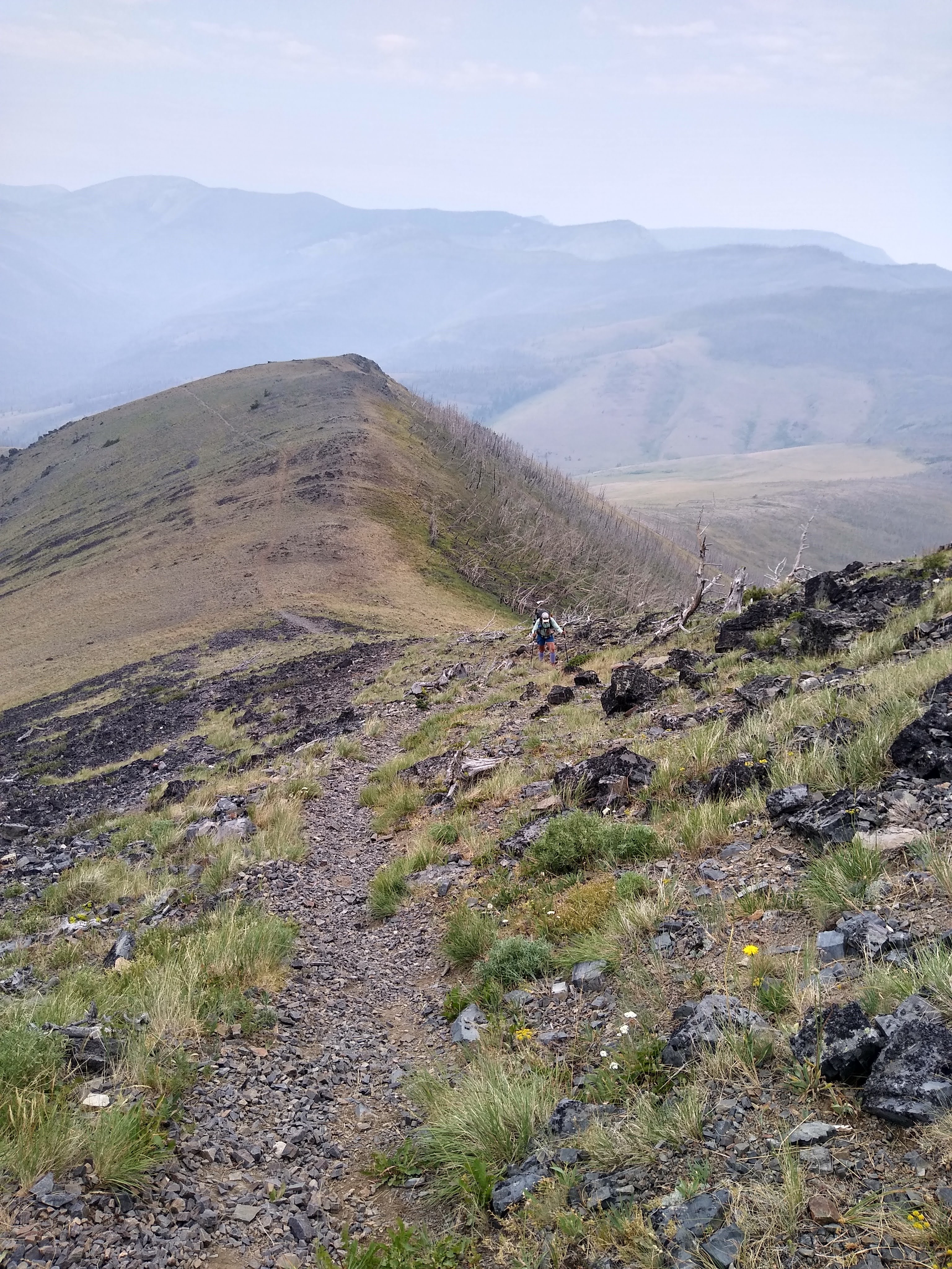
Tip toe through the uneven rocks and boulders
The last half mile, for me, was horrific. Tired legs/feet and uneven rocks makes for painstakingly tedious travel, especially if one is to avoid tripping or rolling an ankle.
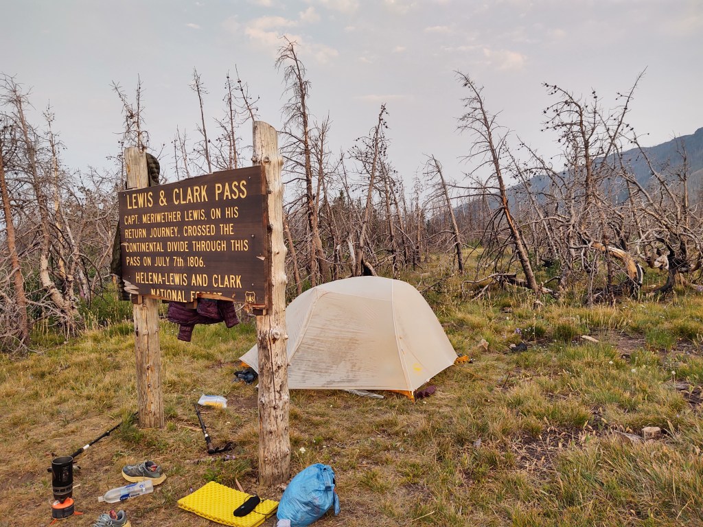
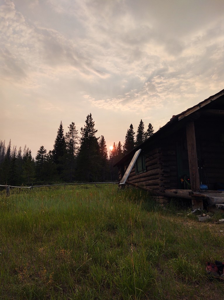
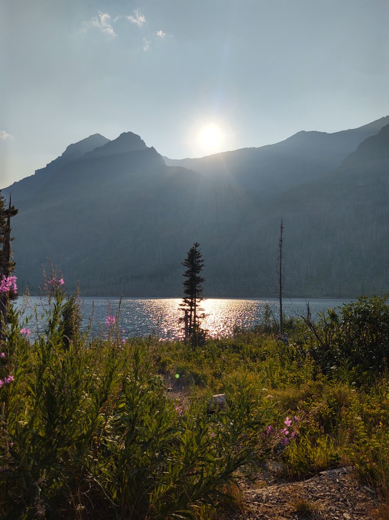
By the time we (I) made it to the Lewis & Clark Pass, it was 8pm. I set up camp, just behind the sign marking the historic spot, while Paul foraged for the reported spring, which he described as “a pain in the ass” to get to, but absolutely necessary. A glowing sunset rounded out our exhausting day.
July 29: 16.6 mi (280.8 – 297.4)
This morning there was no alarm. We needed to “sleep in”. It was hard to get up and going, we were so worked from the previous day’s miles/terrain.
We knew that today would be no different. This day would include Rogers Pass, and another 5-6 liter water carry. But first we had to get to Rogers Pass.
Under slightly overcast skies we trudged our way up, then down, then back up and down to the Pass.
When we arrived at the Pass parking lot, we were treated to some impromptu “trail magic” (a soda and Reese’s cup) from Morgan who was giving “van support” to her husband and his friend who were section hiking/finishing the CDT.
We had 2 miles to climb over proper switchbacks to collect our 5-6 liters of water, for a probable 25 mile waterless stretch.
By now, the sky was devoid of clouds, and the terrain was equally devoid of cover. When the second shoulder strap to my pack broke, just short of our intended mileage, we called it a day at mile 297.4.
Tonight we would be “dry-camping”. We ate most of our remaining snacks, and drank just enough water to be semi-hydrated. I reattached what was left of the second shoulder strap to my pack, and hoped both would hold till we reached Dave’s outfitters store some 20 miles away.
July 30: 22.9 mi (297.4 – 320.3)
So glad we stopped where we did, even though we didn’t really have a choice. There was no way either of us would have been able to make the final climb to our intended campsite (even Paul was worked). Besides, the site was NOT as good as the site we had camped at.
Our mornings intent was to get to Flesher Pass (6miles), and hopefully “yogi” some water, if anyone was parked there. No such luck at the Pass, but when walked into the Forest Service campground to use it’s restroom and take a break for breakfast, we were greeted with TOTAL TRAIL MAGIC! Turns out that “Golden”, was parked there with his van, waiting out the heat, before he got back on trail to finish the CDT, and his Triple Crown.
He cooked us oatmeal. Not the prepackaged kind, but actual pot cooked oatmeal! He offered us berries and honey to add to the oatmeal, as well as fresh, french-press coffee, and a couple beers…all before 9am! A perfect hiker trash morning if there ever was one.
And as if it couldn’t get any better, who should appear, just as we were fully satiated, and preparing to head out back on the trail (after a hour and a half of food and trail talk), but Hobbit! There was no mistaking the jingle of his bear bell, or his stature. We thought we probably would not see him again. From Dearborne River his intent was to skedaddle 28 miles to Rogers Pass and hitch into Lincoln for a zero day to resupply, eat town food, and sleep in a bed. Somehow he did a one day turn around and got dropped off (unintentionally) at Flesher Pass.
Reunited, we set off at a good clip to the next watering (mud) hole. Fairly easy tread with mild temperatures allowed us to make it to Dave’s on trail outfitter store for water and resupply, upon discovering the spring was in fact, a mud hole.
While at Dave’s, who’s located by Stemple Pass (mile 302.5/SOBO), we were treated to a drink (soda or Gatorade) on the house, and a store so well stocked, that it could rival any REI, save for the floor space. Here we bought our resupply that would get us to Helena Montana, and a much needed zero. I also was able to buy a new Osprey Exos58 pack to replace my “fractured” one. Dave even mailed said tired pack back to my home so that when I get back I can “cash in” on Osprey’s magnificent Lifetime guarantee. I didn’t have a week or more to wait to change out said pack through Osprey.
Because of the heat, and our once again, necessary heavy water carry, we ate dinner outside of Dave’s, and hiked out at 6:30 pm for another 4 miles, carrying 4 liters of water each.
July 31: 21.5 mi (320.3 – 341.8)
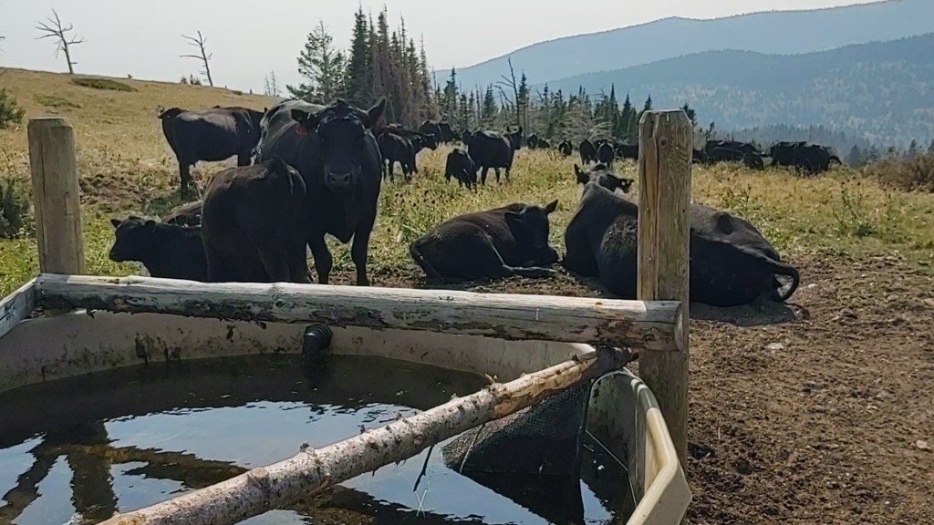
Black Mountain would be our nemesis for the day. Switchbacks were practically non-existent. Climb. Climb. Climb. Granted it was beautiful terrain, so it didn’t hurt “that bad”, but it was daunting. Our goal was a fresh piped spring…into a cow trough some 14 miles away.
When we arrived, Paul quickly shooed the disgruntled cows away. It was our trough now! Ice cream headache cold water spewed from the pipe into the algae crusted trough. It was cold enough that I made myself, two peanut butter/chocolate protein shakes. Absolutely glorious. Shortly after we arrived, an ATV pulled up to collect water as well. They explained that they were hiking the CDT with another couple and were supporting each other through sections as they essentially “hop-scotched” each other Northbound. Because they were mobile, they offered to leave us water at the “power poles”, 7 miles away, so we didn’t have to carry so much water. We gladly accepted their offer. And, because we didn’t have to carry so much water, we decided to march out that 7 miles, while the temperature was cooling.
We expected that they would meet us early that next morning. Yeah! I get to “sleep in”.
We arrived at the power poles (mile 341.8…ish) and set up camp. With 2 bars of cell service, I texted Jennifer and let her know that we made it to the power poles. She replied that Kathie and Jim were on their way with water. Special delivery, now that was awesome!
Just after we set up, we saw a truck driving the nearby dirt roads. We joked to each other, ‘there goes the beer truck’. And wouldn’t ya know it, that truck drove right up the hill upon which we we camped, asked us if we were CDT hikers, and offered us a beer!
Our newly knighted trail angels, Brian and Krista from Marysville gave us more than one beer, and explained that the ground under which we were camped and had walked, were miles of tunnels. Gold mining tunnels. Brian explained that gold had been discovered just across from where we were camped. Thomas J. Cruse, who had discovered it became so rich that in 1905, he donated $25,000 for the land upon which the Catholic Cathedral of St. Helena (in Helena) was built. He described the Cathedral, completed and dedicated in 1914, as being amazing and ornate, built in a European Gothic style. (We voted to visit it, if time allowed us, during our Helena zero.)
While Brian and Krista were providing us an area history lesson, Hobbit, who is NOT a drinker, finished his second beer, and took a White Claw (that he thought was a soda) for breakfast the next morning. We tried to explain, but he was sooo happy.
Shortly after Brian and Krista left, Hobbit crawled into his tent, sans dinner. “Best day Ever!”, we heard him exclaim from his tent.
August 1: 16.3 mi (341.8 – Helena)
The morning after…a bit of a late start
We awoke to a remarkable sunrise silhouetting a bachelor group of giant mule deer bucks. We also watched as Hobbit unwittingly drank a White Claw for breakfast, and thought, this morning keeps getting better. While we would have been feeling no pain after an adult beverage for breakfast, Hobbit on the other hand felt quite dizzy. He toddled behind us for most of the morning, on the mostly road walk trail tread. Mostly to avoid PUDs and to ensure Hobbit wouldn’t puke we found alternate roads to walk our way towards Helena.
We traveled along and sometimes over beautiful rolling hills. We were never at a loss for water. Springs abounded nearly everywhere, in this cattle country.
We took a gamble and rather than climb Green Mountain, we took another dirt road, that led to the I-15 that goes into Helena.
Our gamble paid off, with us getting a ride into town, with locals who were out hunting for huckleberries. Turns out that the gal’s (sorry I forgot to write down your name) best friend from the Navy, was from San Clemente, and she knew the town well. Small world!
They graciously dropped us off at the Blackfoot Brewery, where we drank, ate pizza from next door, and were merry. Hobbit, settled for a Coke.
The night prior we camped on a bench 4 miles from the start of the climb of Switchback Pass. The morning was crisp and the sunrise was gorgeous! It was going to be a great day. How could it not, with such a start?
Who doesn’t like “Dr. Suess” plants
As we passed by Dean Lake a lone buck in velvet sauntered by us. I wish we could have made it to this lake to camp. It was everything a backcountry campsite should be.
Dean Lake in the background
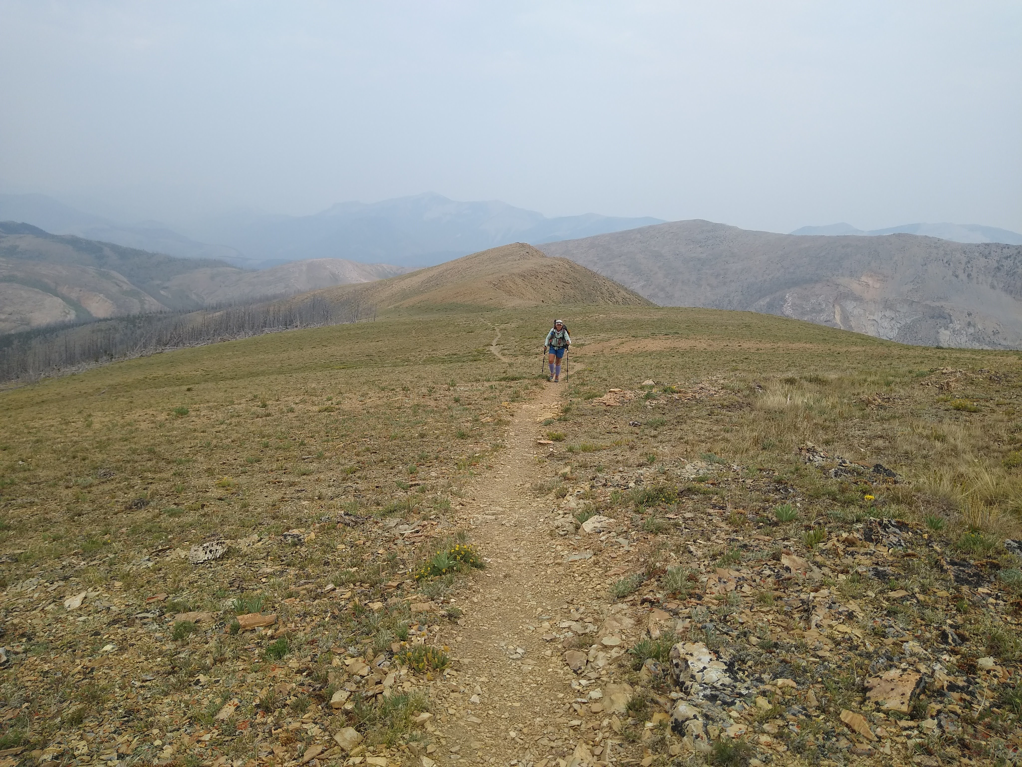
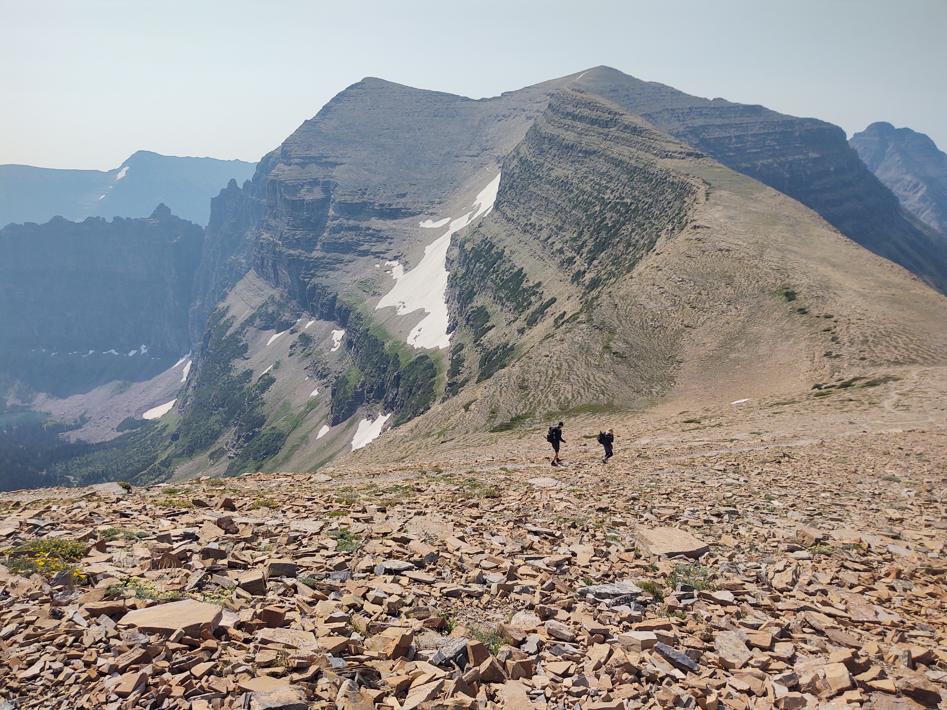
Switchback Pass was exactly just that…switchbacks. one thing about the CDT is sometimes with these passes, you never really know where it’s going to take you. You think you know, but 90% of the time you’re wrong, so you just walk and take what is given to you.
We rested atop the pass and took a gander at the vastness before us. This was the first time we really saw how dense the smoke from the fires was.
Smoke “dusting” the horizon and settling into the lower elevation
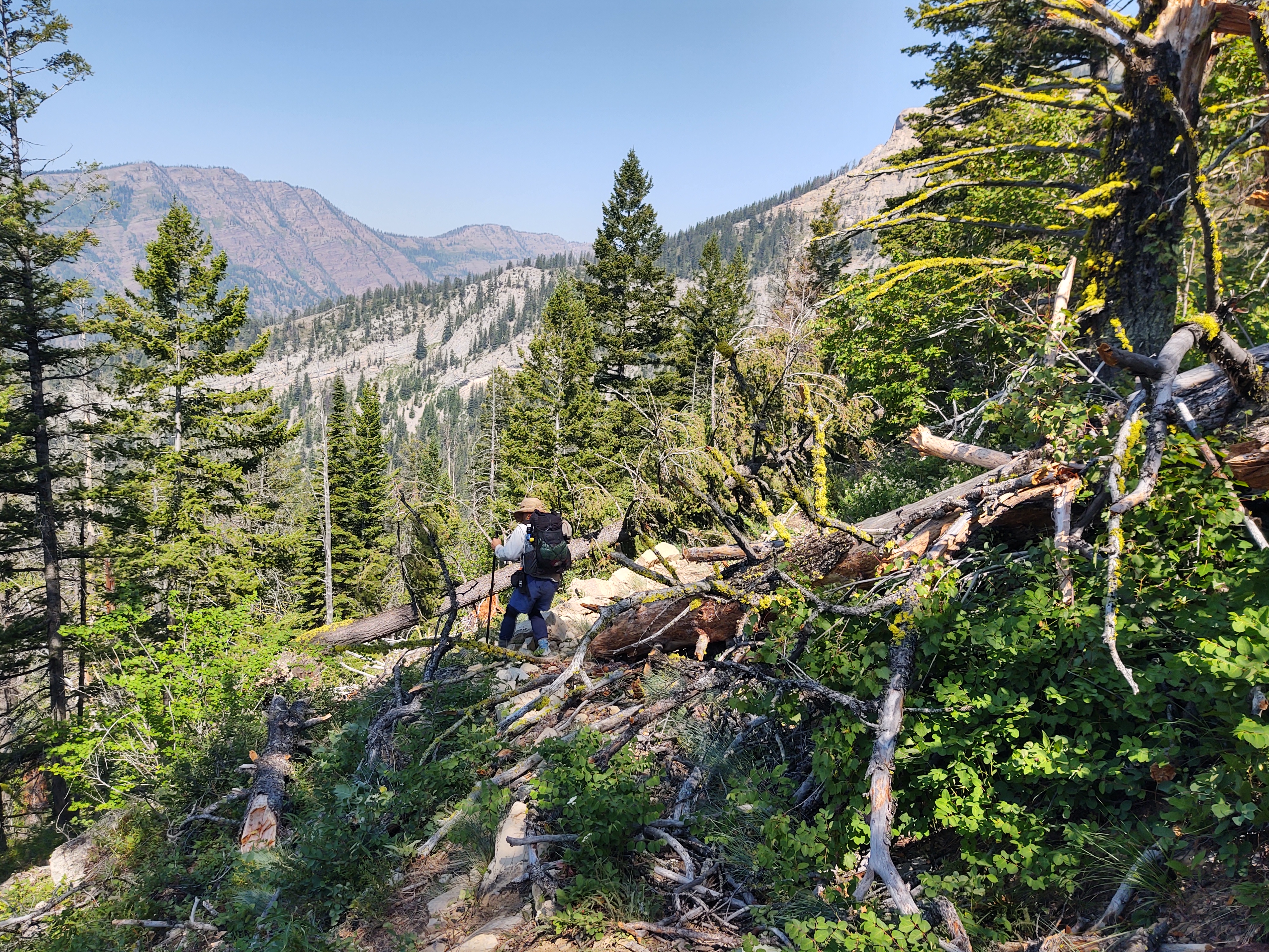
We descended two miles and then the “fun” began. We crawled, climbed, hopped, slid, scampered, scrambled and weaved our way over nearly continuous blowdowns. Luckily most of the work arounds of the blowdowns had been done by early SOBOs. THANK YOU! It was a matter of following their path…sometimes.
We however, were rewarded with, and took our time sampling, a rather dense patch of huckleberries.
Once down to Pentagon Cabin, it stayed mostly clear… for a mile. Gymnastics continued all the way to the last available campsite, where we squeezed two tents into one site with 3 miles left in the alternate.
When we got to camp, we saw that Sheepgoat had sent us a message. We’d been punked. I guess misery loves company. We all had a good laugh.
July 24 (17 miles)
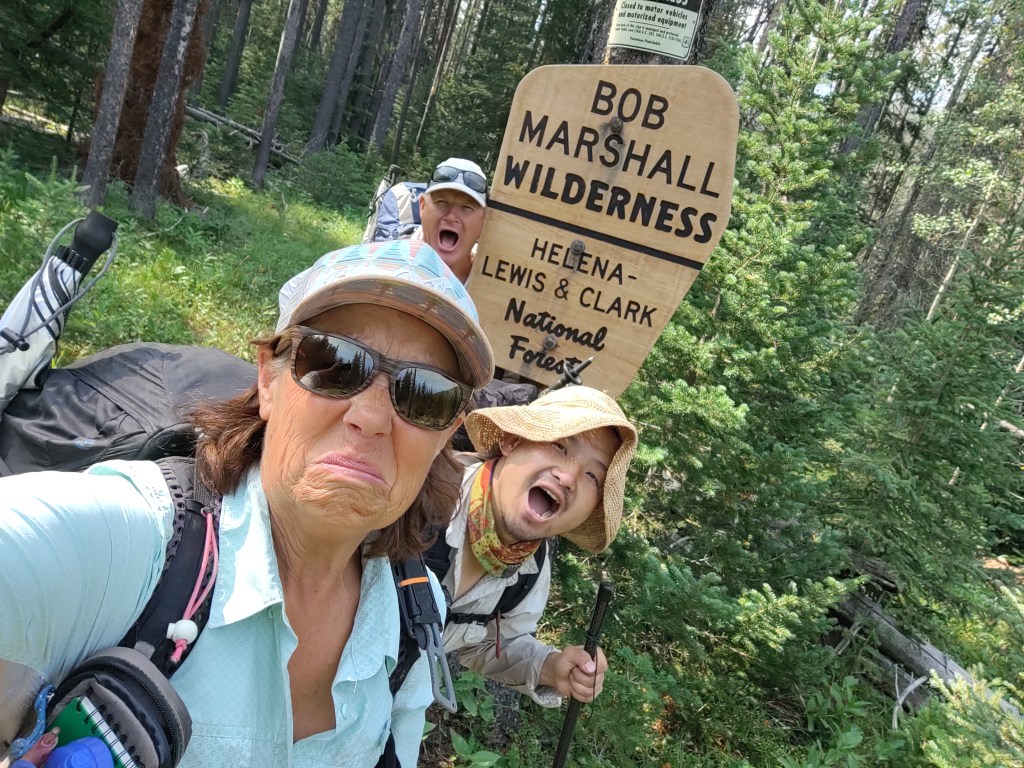
We debated crossing the creek without shoes and then realized we were still essentially in “The Bob” (Bob Marshall Wilderness), but it felt more like “The Robert” (more on that later), so we crossed with our shoes.
OMG! Nothing like frozen wet feet/shoes in the morning to start your day.
Better yet, throw in an additional 3 miles of fresh and pokey, parkour blowdowns, and you have one hell of a workout.
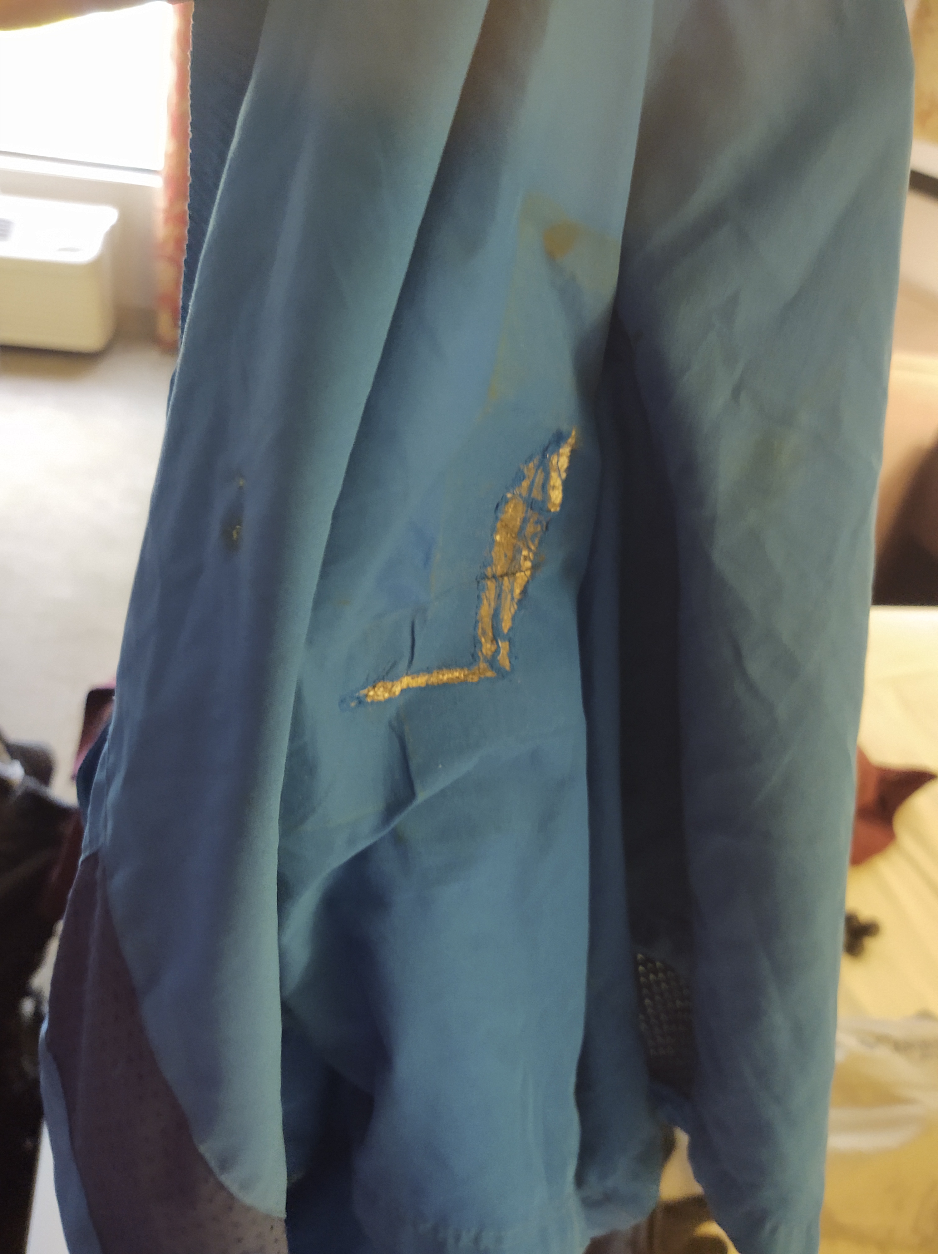
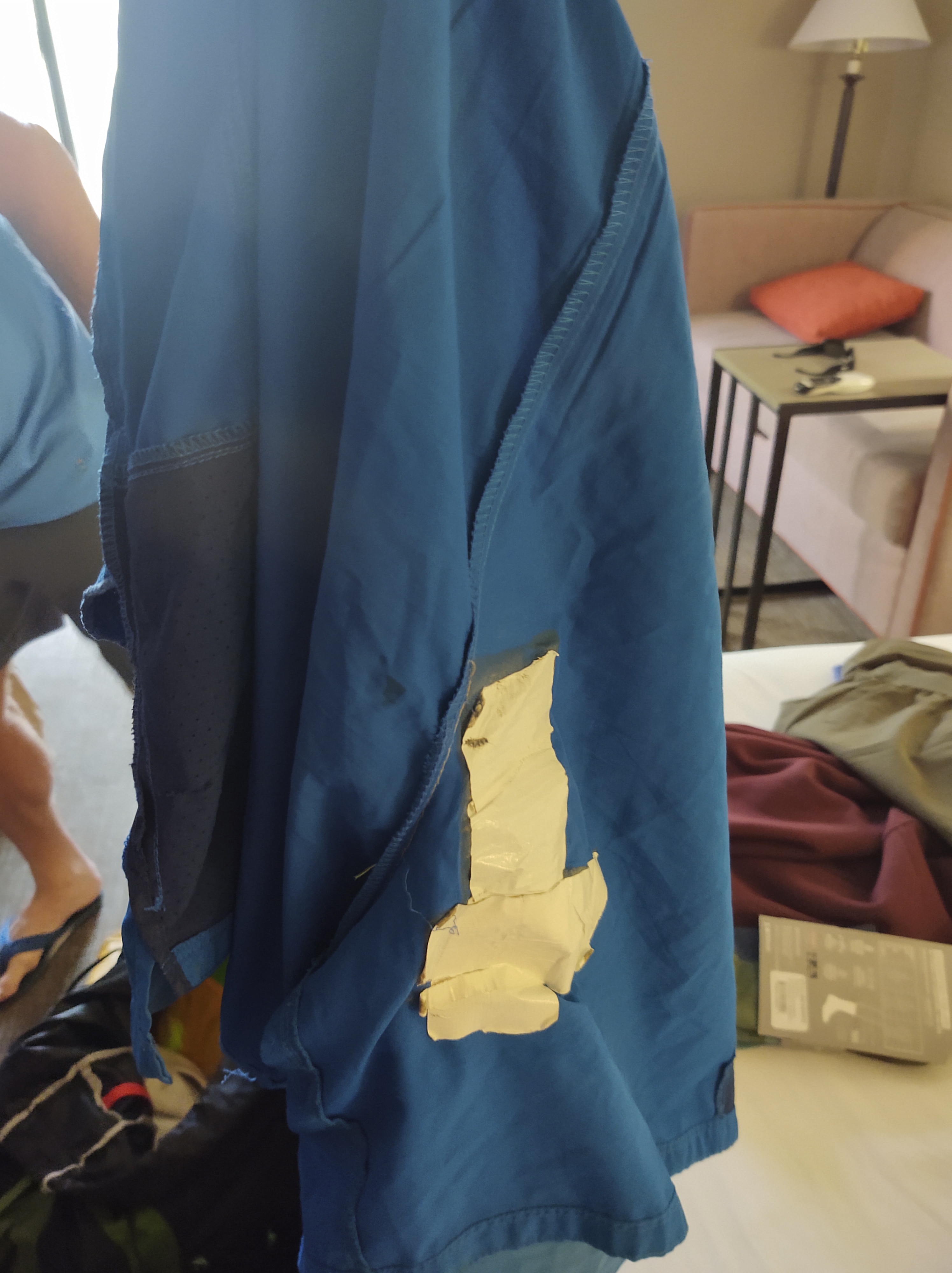
I already had to duct tape the seat of my shorts due to snagging them on blowdowns, and thoroughly expected to have to use more tape by the time we were finished.
Outside/Inside
Where the Spotted Bear meets up again with the CDT “redline” there was one final blowdown…an easy step over, but a blowdown all the same. A final “f-you”, as it were. We laughed and cursed “The Robert”, and hoped that the fun loving “Bob” would be coming up as we approach the “Chinese Wall” section.
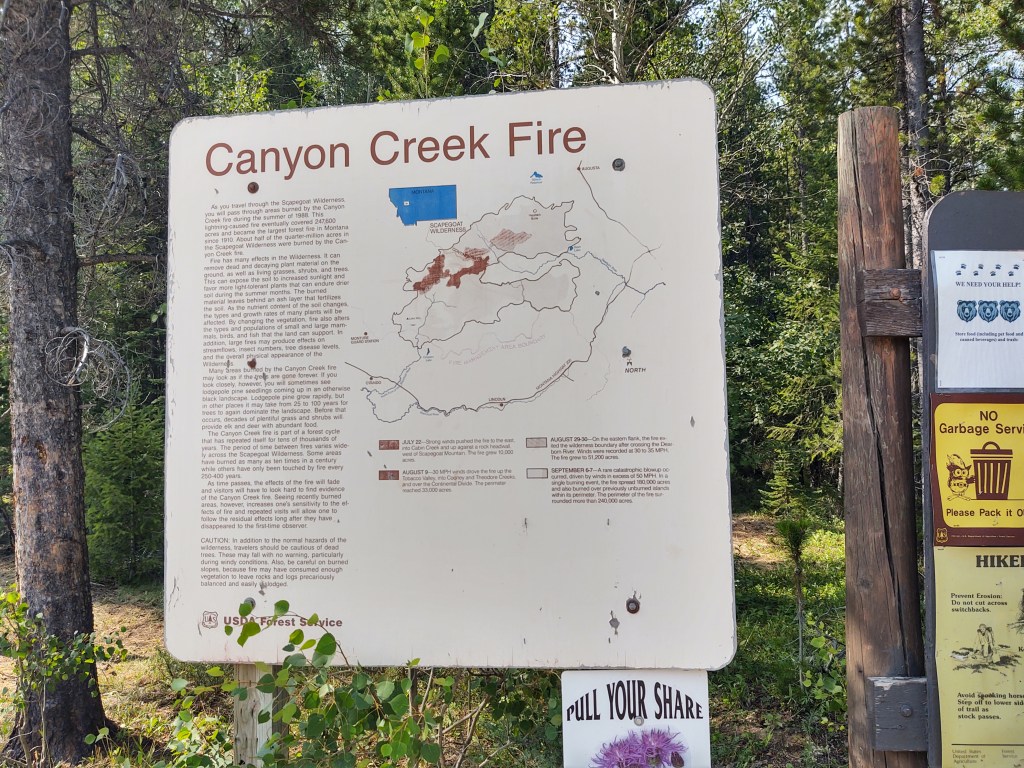
Needless to say, the Spotted Bear Alt, and especially The Bob Marshall Wilderness left a lasting impression on us. We breathed a sigh of relief when from the alternate junction, to and through the “Chinese Wall” section, the trail was clear and easy tread.
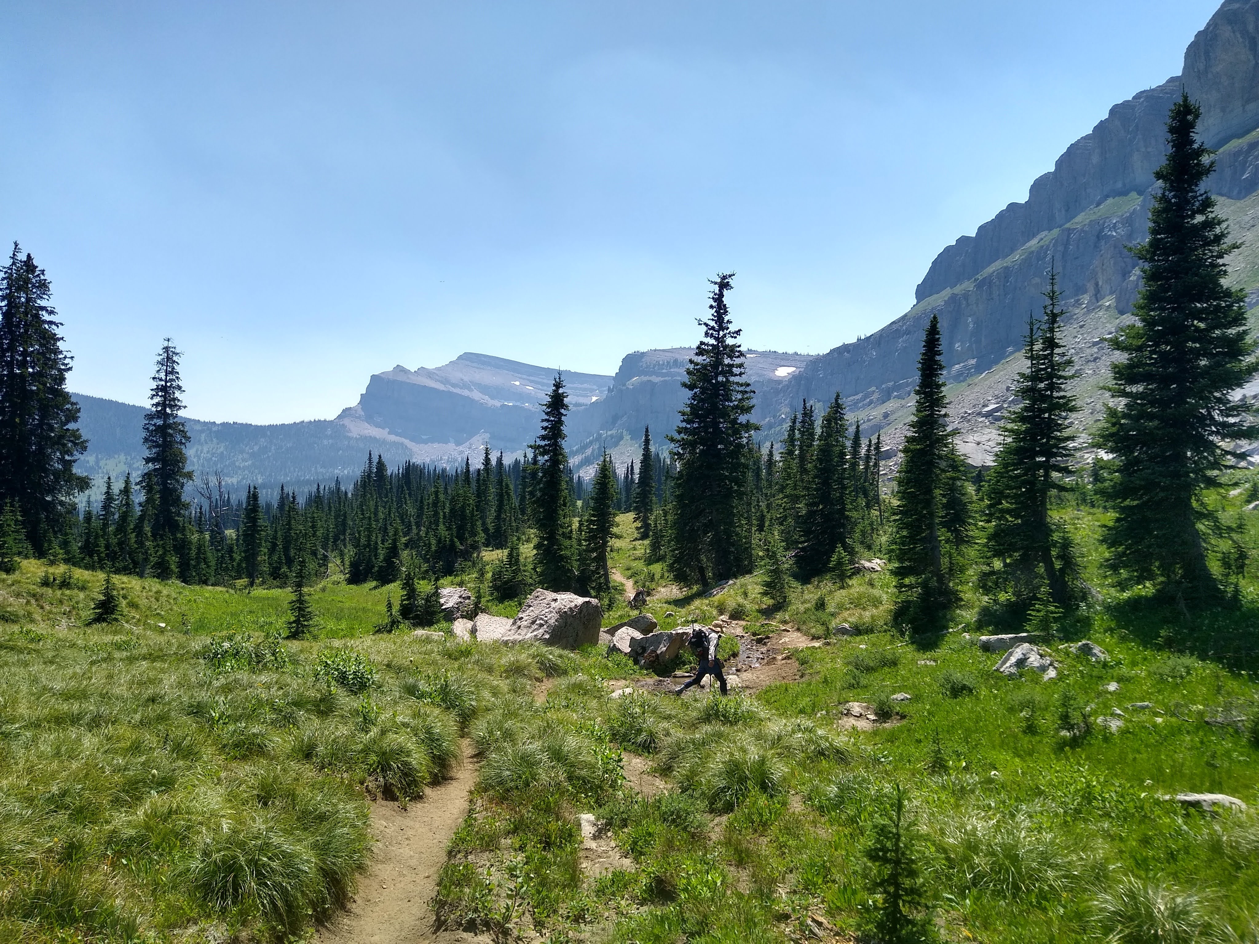
Now we were in the “fabled” Bob. The views were spectacular. The giant geological feature, the “Chinese Wall” towered above us to our right. It’s massive rock face stretched for 12 miles! Every inch of it was fascinating.
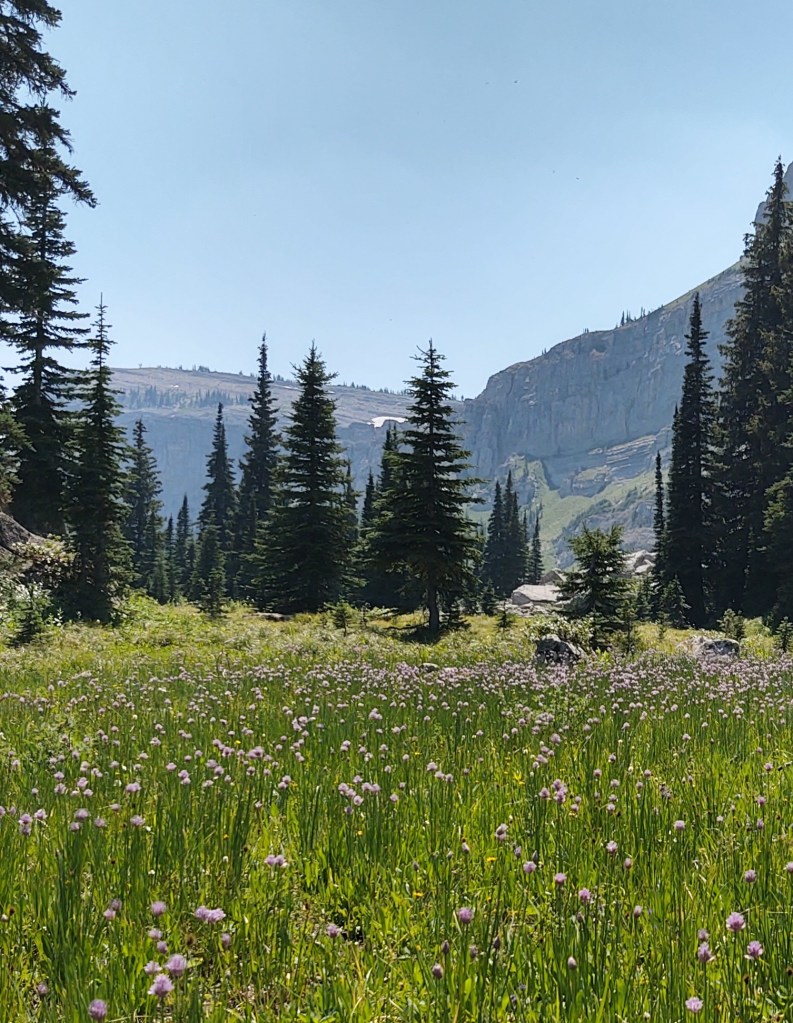
Fields of flowering wild garlic carpeted the base of the Wall. If we didn’t have to make miles, we would have walked even slower. As it was, our pace was more of a stroll, there was so much to see and absorb.
We “called it” at mile 217 (SOBO), exhausted and fulfilled. Bob Marshall, an American Forester and Wilderness activist (for whom the 1 million acre Bob Marshall Wilderness Complex, dedicated in 1964, through which we were traversing), believed that wilderness areas should be preserved not only for their aesthetics, but so that the public who “owns” these lands could experience “adventure”.
No doubt about it, we were served up quite an adventure, and rose to and in fact enjoyed the challenge.
July 25 (14.5 miles)
We got up early, as we were at the end of the contents of our food bags, and hoofed it to the Benchmark Wilderness Ranch to pick up our resupply.
Newly dubbed “trail angels”, Lori & Dave
Miraculously, we were able to “yogi” a ride to the Ranch, from Lori & Dave who had just returned to their car after a several day backpacking trip. This saved us a hot afternoon dusty, waterless, 3+ mile road walk to the Benchmark Wilderness Ranch.
Some required a rub on the nose in order to get to the gate
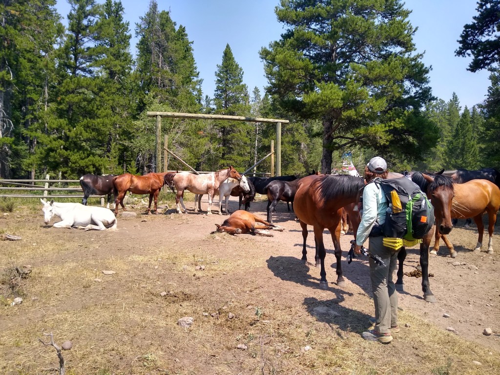
When we arrived at the gate to the Ranch, a herd of horses and mules “greeted” us.
We retrieved our resupply, and for $20 each were able to camp and get a much needed shower.
Little did we know that we still had a few more miles to “The Bob”.
Badger Ranger Station – Spotted Bear Alt (mile 19)
July 22 (13 miles)
From the Badger Ranger Station to Beaver Lake was supposed to be 18 miles. This was to include, for lack of a better term, a PUD (Pointless Up and Down). Thing is, we missed our turn, but didn’t realize it till nearly 3 miles of NOT hiking on the “redline”. We knew it was too easy. This is where having our Garmin InReach and the Earthmate app it uses comes in handy. It seems that we had in fact stumbled onto a perfect short cut (that actually worked with no bad consequences). The Lewis and Clark Trail continued straight, when we were supposed to turn right. What we were left with was, no climb and an easy, relatively flat, walk through super grizzly country. At least that’s what the prints and poop seem to convey. But trading 4 miles for 8, I’d say we made out pretty good. We rejoined the “redline” for the first time WITHOUT having to backtrack. A definite plus for us.
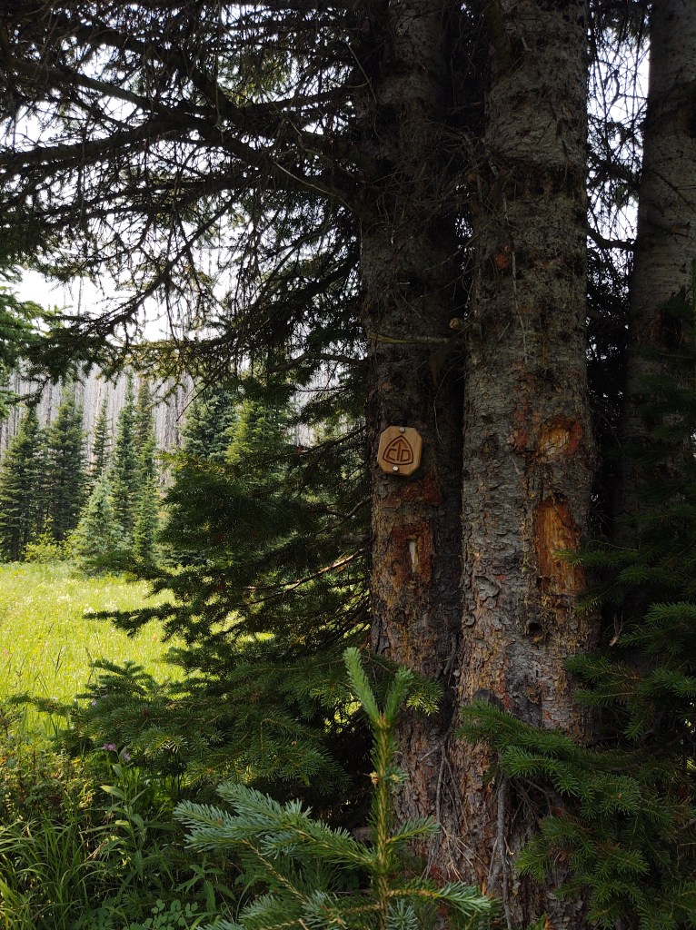
Easy to miss signs like this
About that time we got an InReach message from Sheepgoat that he was continuing on from Beaver Lake, but that Hobbit would be waiting for us there. We arrived there about 2pm, had lunch and deliberated as to whether we should continue another 4-5 miles or just stay put. The winds were supposed to pick up. It was stifling hot, the flies were especially active, and the next several miles were through an exposed burn area. We decided that shade, water and not worrying about a dead tree falling on us in the middle of the night was the better idea. Besides, it would give Sheepgoat a chance to let us know how the Spotted Bear alternate was.
July 23 – Spotted Bear Alt.
Up early to beat the heat, we walked through a burn area reminiscent of a graveyard. Colorful flowers sprouted at the base of many a charred tree. We were glad we stayed at Beaver Lake, even though the bugs were ferocious.
Too many deadfalls and setting up in a BBQ pit of soot would have made us grungier than we already were.
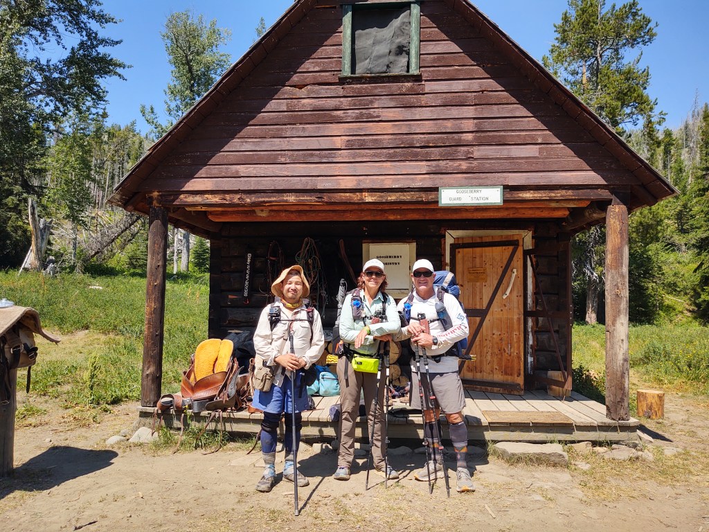
Prior to getting to the Spotted Bear Alt, we got another message from Sheepgoat. He made it to, and stayed at the Gooseberry Ranger Station…which he “highly recommended”. The man is trekking. I believe he clocked some 30 miles for the day.
At the junction of the CDT and the Spotted Bear Alt, we stopped for lunch and a nap…and another update from Sheepgoat.
From where we sat, the alternate looked very inviting. Peaks with views and greenery. The CDT looked like more charred trees and dusty waterless trail. Another message from Sheepgoat. “So far so good. 10 miles on the alternate”. He also told us that we would run into a NOBO “Res Dog” and that he would fill us in.
“Res Dog” told us that the alternate “wasn’t bad”. He’d gone through waay worse in Colorado and the Winds. Most of the blow downs had paths already made for work- arounds and would be “easier” for us going downhill. When asked what the mileage of blowdown we would encounter, he replied, “1.8 miles is bad, but everything else is good”. A crew was working on the trail when he went through.
With that we fully committed to taking the Spotted Bear alternate, even though most of the comments on Guthook and the 2021 CDT Facebook page did NOT recommend it.
The “red line” looked like more burn area and blowdowns to negotiate.
Immediately on the Spotted Bear Alt. we were treated to expansive greenery and soon Goose Berry Ranger Station. Here we talked with the wildlife biologist that studies the grizzly bear and it’s habitat. She filled our water bottles and told us that the grizzly was once down to 200 bears, but the population has grown steadily (almost 1000 now) especially in NW Montana and that the grizzly is soon to be off the endangered list. She sets up trail cams in bear habitat area and was in the process of collecting the footage from the cameras to update her count. We asked her how many grizzlies she has encountered. She replied, “To be honest, I’ve been studying these bears for 12 years and have yet to see one in the wild”. Maybe she should be following us on our hikes. We seem to see them.
Goose Berry Ranger Station
We continued on and walked alongside a flowing river/creek. We tried to keep our feet dry, with all the water that ran across the path…to no avail.
At the end of our day, having walked through a few blowdowns and beautiful terrain that often smelled like blueberry pancakes, we made it to a vast bench with a hazy yet striking view, and communicated with Sheepgoat once more.
We settled in for what we expected would be a cold night, as snow lingered in a few spots above us, giving us glacier cold water.
Only about 8ft off the ground
As there were not many places to hang our food bags “properly”, we half expected them to be gone on the morning. 1-3 miles of blowdowns. No problem. Switchback pass in the morning, now that was going to be a lung buster for us.
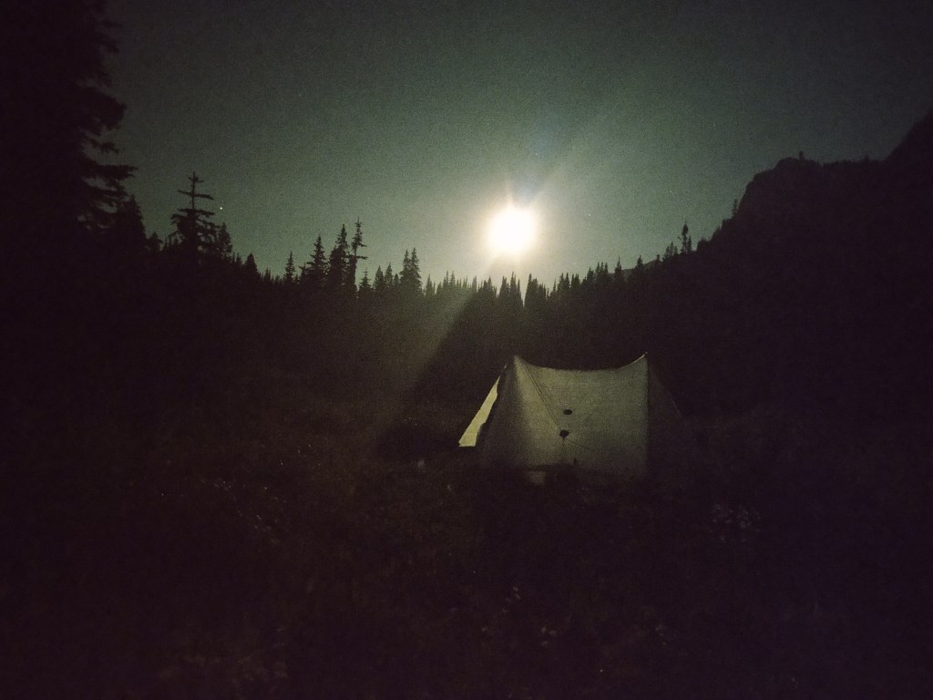
Advantages of having an “old lady” bladder. You capture sights like this. (Hobbit’s tent with full moon rising…no filter)
Pictured w/ “Neon” who also did the PCT in 2014. He was on his “zero” and drove us to the pass
Marias Pass – Badger Ranger Station (15 miles- July 19)
All smiles at the trail head…for now
What does the steeple chase, parkour, Jenga and pick up sticks have in common? It’s the trail out of Marias Pass into the Lewis and Clark National Forest.
We were lulled into pacification with initially soft tread, overgrown shrubbery and freshly cut downed trees that make it a point to fall directly in or across the trail. And then? Well it changed dramatically.
Actually a sign for another side trail, but could have applied here.
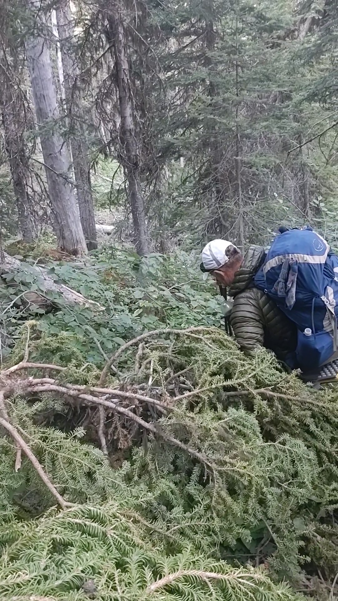
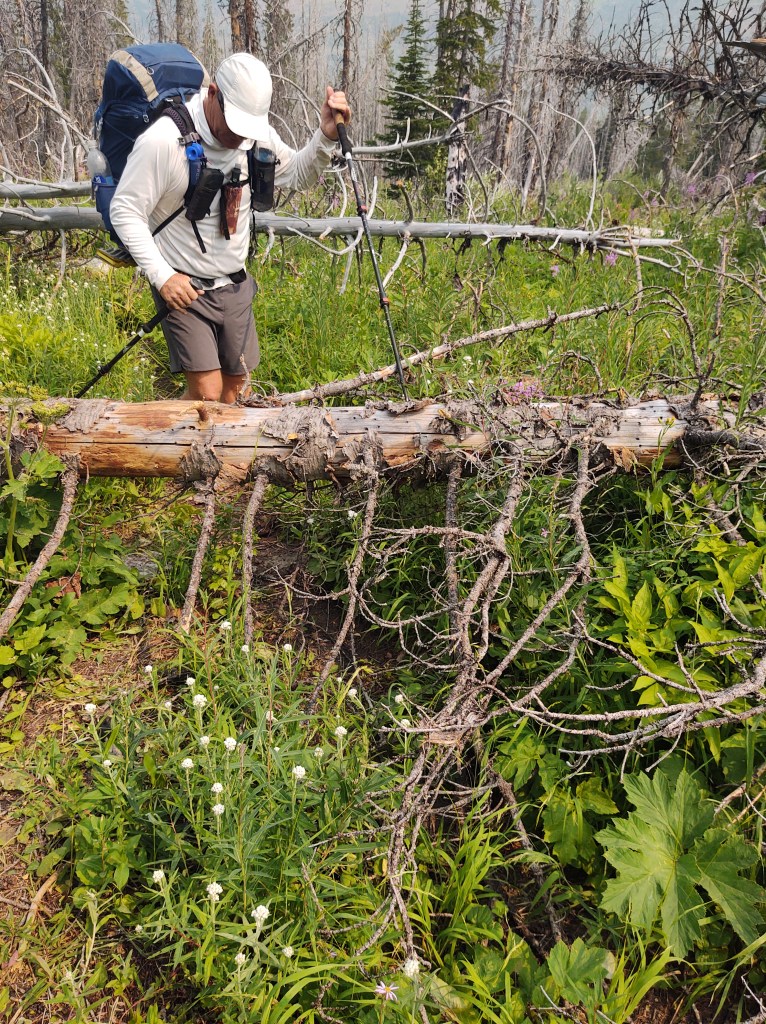
Over two miles of tightly stacked and intertwined blowdowns reduced our pace from almost 3 mph to less than 1mph. It was highly frustrating, exhausting and left our legs looking like we got into a knife fight with a gnome.
That just the front of my legs. This doesn’t include the backs of my legs, thighs or shorts
Thank goodness we got ourselves into better shape than we were last year, otherwise today would have been even more challenging. We aren’t spring chickens anymore, and gymnastics was never one of mine, let alone Paul’s strong suit.
This is a very mild blowdown…step over
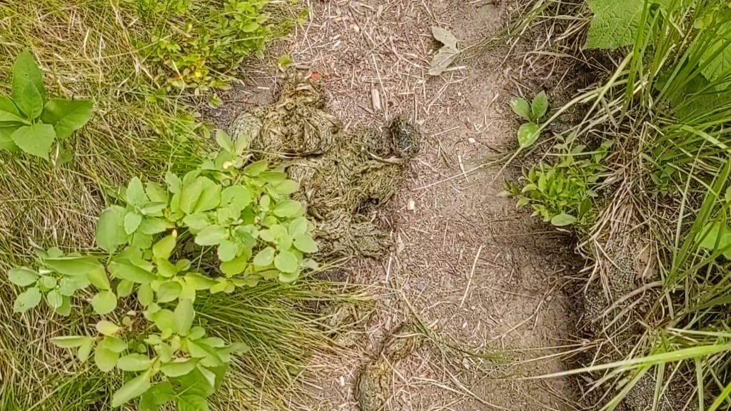
The degree of difficulty was enhanced by the fact we were dogged relentlessly by rabid flies, AND we were still in grizzly country. We couldn’t help but notice the rather large fresh piles of bear shit that punctuated the trail with unsettling regularity. Seeing “fresh”, and equally massive bear prints atop Speedgoat’s and Hobbit’s shoe prints, who were an hour or so ahead of us, ensured we spent several hours hollering “Hey, Bear!” as we trudged forward.
Think large pizza pan. That’s how big this pile of grizzly poop was. Prints to match as well.
I kept repeating to myself, “you chose to do this”, while Paul was chanting to himself, “I’m having fun”.
Eventually the required acrobatics ceased to be necessary, and a simple hopscotch game became the norm. As the blood from the assorted deep scratches scattered across our legs congeeled, ever swarming biting flies took advantage of the open flesh wounds. For most, it became their “last meal”.
The trail opened up even more, and allowed for more of a rhythm to our travel. The viciousness of the flies kept us going. No rest for the weary…unless you want to be driven mad. We didn’t even bother to find a “dry” route during stream crossings. We walked right through, often standing mid stream to cool our ever aching feet.
Our “sign” to go to second spot
At the first campsite, nearly 7miles into the day’s hike, the boys left us a message. Change of plans. We would be stretching our intended 13 miles to 15 miles. The Badger Ranger Station would be the day’s destination.
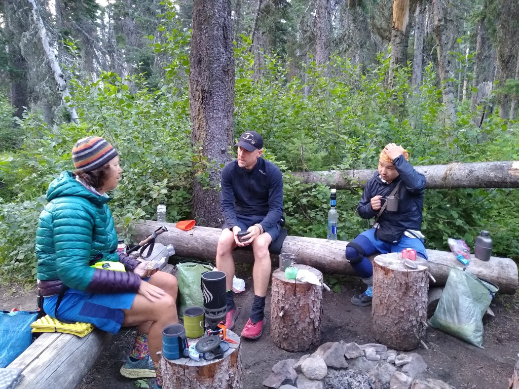
Ironically, when we arrived at the Badger Ranger Station, the flies ceased to follow. We were met by our friends, a picnic table, icy fresh water from a hand pump, and two other local hikers on a 9 day backpacking trip.
The rest of the late afternoon and early evening was spent in pleasant conversation and laughter.
“Rhonda” and “Leslie” were friends that had met while doing trail work for Americorps, and had good information on what we had to look forward to for the next few days.
It appears that we’ve experienced the “worst” of what the Lewis and Clark National Forest had to offer…for now, and should expect smoother travel.
I’ve always wanted to experience slack packing while on a thru-hike. I got my wish. Luna, at the Looking Glass Base Camp suggested that rather than carry a full resupply uphill to Marias Pass, why don’t we get dropped off at Marias Pass and slack pack back to the Looking Glass. She would even drive us, but seeing she is NOT an early riser, it would have to be after 9am.
We all jumped at the idea, and were able to get two other thru-hikers that needed to use the car to go get their camping permits that morning as well. Up early we left with a liter of water and some snacks. The challenge was to get back to The Looking Glass in time to borrow the car and get to the post office before it closed at 3pm. 15 miles. Downhill. No problem.
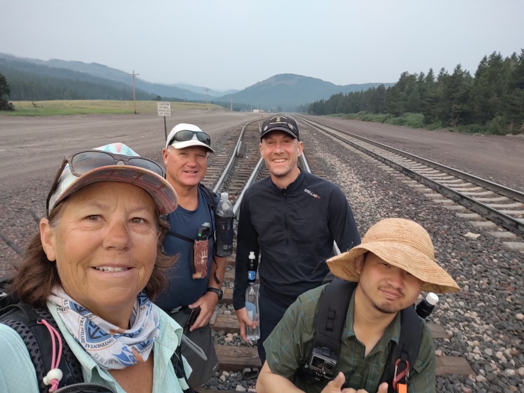
We got dropped off at Marias Pass, near the railroad tracks. Across the tracks and into the woods we trotted.
Hobbit led the way. He of all was most motivated to get to the post office. For a small guy, he can move. For some reason we all followed at a nearly 4mph pace for 6 miles. Paul and I finally realized we’re not spring chickens and slowed our pace.
We lunched at a swift creek atop a log bridge, and then continued on our way.
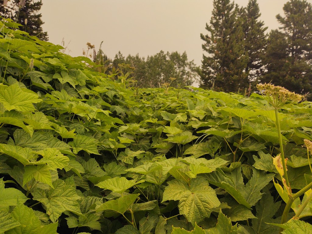
A good portion of the trail was ridiculously overgrown. If you were small in stature the greenery would gobble you up. We pictured Hobbit disappearing completely. Later, we found out that Jan had led the way for fear of losing Hobbit.
This was nearly shoulder height for Paul and I
We would have made it back sooner, had we NOT missed a right turn and continued over a mile down a steep two track. The steep down should have been a clue. We tried to bushwhack back to the trail, but then realized that we were following an active bear trail. And we were so close! Once we backtracked and trudged our way back up the mosquito infested trail it was smooth sailing all the way back to The Looking Glass.
The Red line is where we were supposed to be, and eventually got back to. Another reason to have an InReach
On the way we found a bear bell, that we attached to Jan’s pack. (It has since been relocated to Hobbit’s pack, who actually likes it…go figure)
Not only did we slack pack 15 miles in 6 hours, we also got invited to dinner with Jan and Hobbit to Pete’s (the guy who gave Jan and Hobbit a ride to the border.
Turns out that Pete makes his own wine, and pies! He prepared us waaay too much food, but we couldn’t be rude, so we ate it all. Indian fry bread taco salad with Rhubarb and huckleberry pie. He gave us the pie the remaining pie(s) for breakfast the next morning.
All in all an excellent end to a marvelous week. Now comes the hard part.
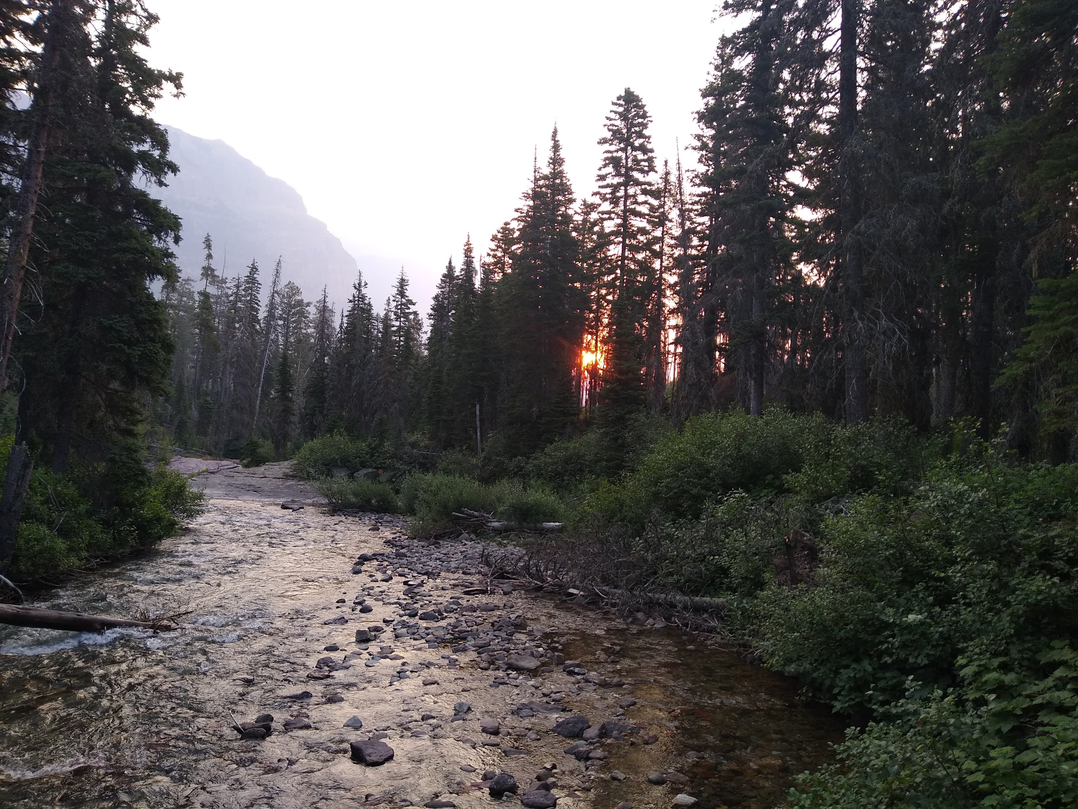
We awoke to smokey skies and more than hazy views. The morning’s sunrise had a distinct red hue to it. The air had an unpleasant taste to it reminiscent of the less than healthy air quality of my youth. Nevertheless, we had a “hill” to climb and 10 miles back to East Glacier, and the air-conditioning of Looking Glass Base Camp for the afternoon/evening.
We marched “silently” through the campground and prepped our breakfasts at the picnic area near the Two Medicine backcountry ranger office.
This day included little conversation, with the exception of marveling of how lucky we were to have caught Dawson Pass before the smoke invaded the Two Medicine area.
We did however manage to miss a turn of the “redline” and walk down…and then back up again an extra mile. A perfect end to a perfect jaunt through Glacier National Park, and the start of our SOBO adventure on the CDT.
We ate through the rest of our food bags, and thus were motivated to get to the Two Medicine Camp Store before they closed. There we would need to buy our lunch and dinner, as well as breakfast and a couple snacks for the 10 mile trek from Two Medicine to East Glacier.
On our way to Pitamaken Pass
Because the skies were still remarkably clear, Hobbit came up with an alternate route from Pitamaken Pass (7623 ft.).
Above and to the left is Pitamaken Pass…to the right and the little “dip” is Dawson Pass
Supposedly it would cut off two miles of our 12 mile hike for the day. (let’s say it didn’t feel like it did).
Not only would we climb up this pass, but we would continue to Dawson Pass (7800 ft.)
“other side” of Dawson Pass
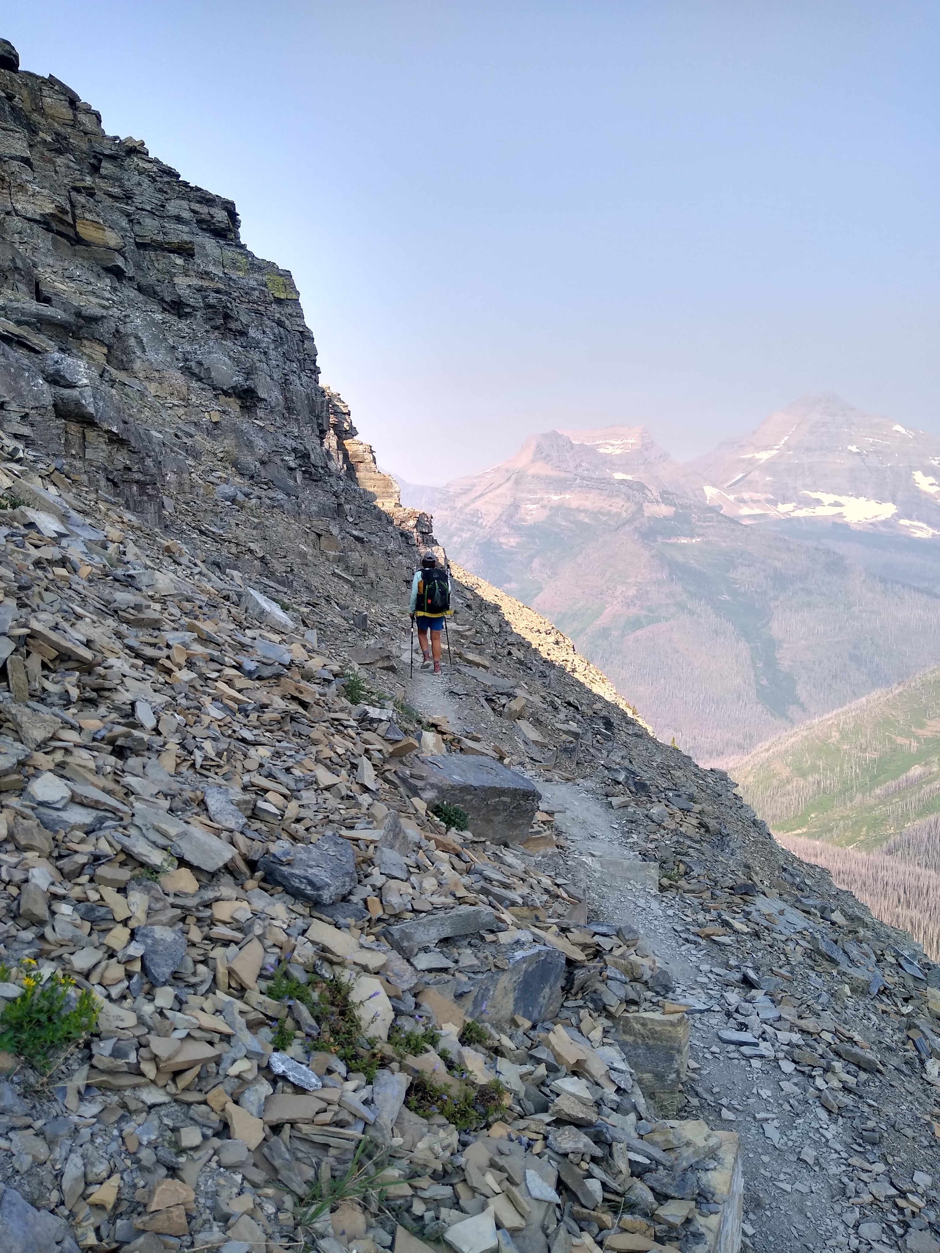
This would lead to a precarious ridge walk with a fierce headwind.
Just prior to cresting the pass, Paul and I would drool over some of the largest trophy rams we have ever seen.
Once again the binos that “weigh hardly anything” came in handy. Our phone’s camera could NOT do them justice.
Prior to our hasty descent, namely because we were food/beer motivated, but after the fabulous ridge walk, we had our last snacks and took a nap to the chagrin of day hikers who had come up from Two Medicine Lake.
Zzzzzzzzzz
Once we made it down to the far end of Medicine Lake, had we paid better attention to the map, we would have forded a narrow portion of the lake (shoes and all) to not have to walk the mile from the backpacker sites to the store. (*Actually, Paul and I somehow were able to “yogi” a ride to the store.) $70 later we ate our fill, drank a few beers, and packed up our food for the evening and next day. We were not so lucky on our trek back to the backpacker’s site.
Much to our surprise we found the backpacker campsites quite small and near capacity. We and another late arriving pair, however, were the only CDT thru-hikers.
After set up at camp, we took advantage of the shallow end of the lake, had a swim and lounged on the “beach”.
One of “two” backpacker sites at TMC
Upon return, we ate our second store sandwich and retired for the evening, lulled to sleep by the musings of two girls trying to impress two guys, who were trying to impress two girls, all while overusing the word “like”.
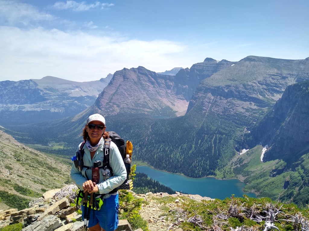
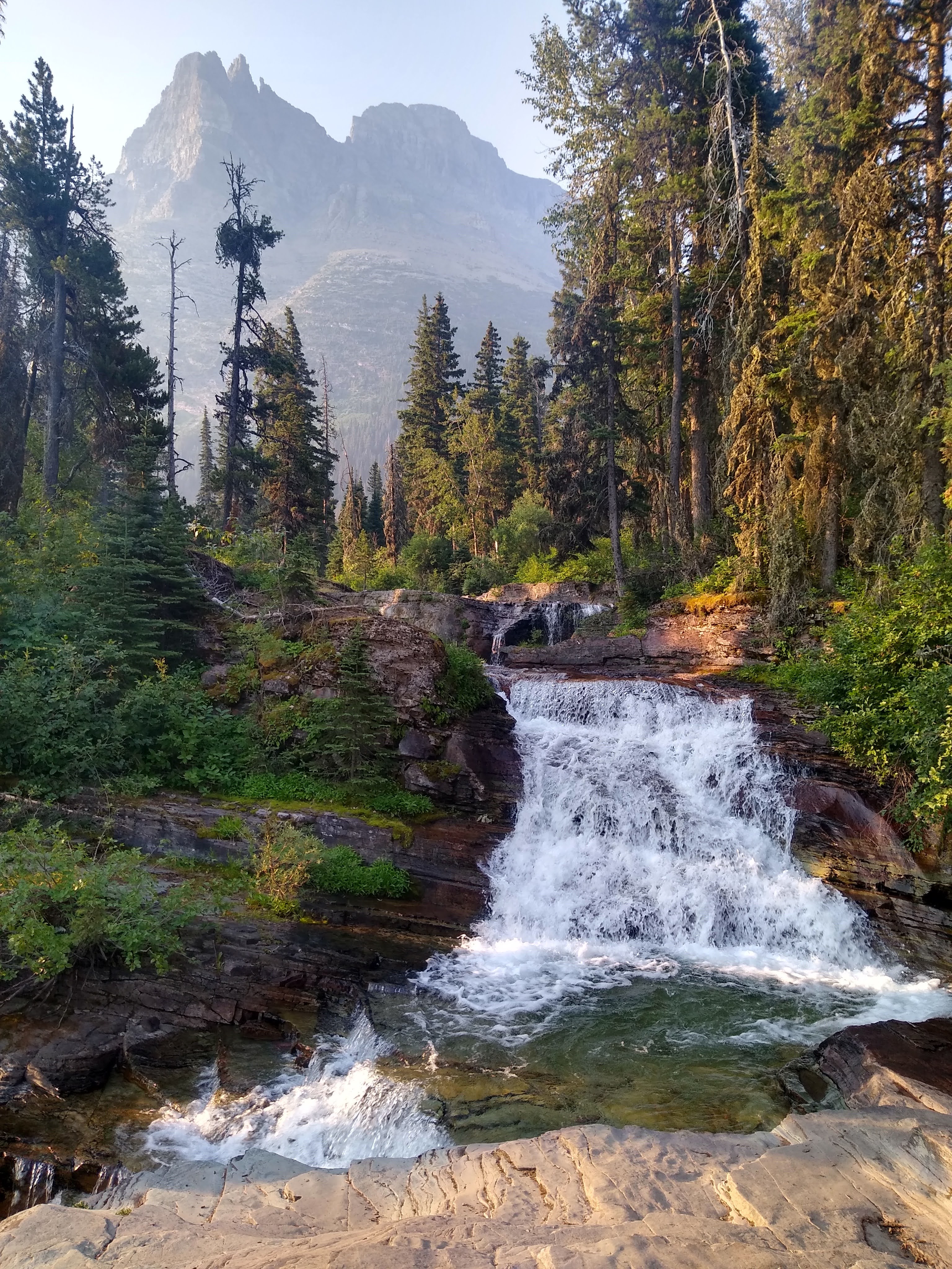
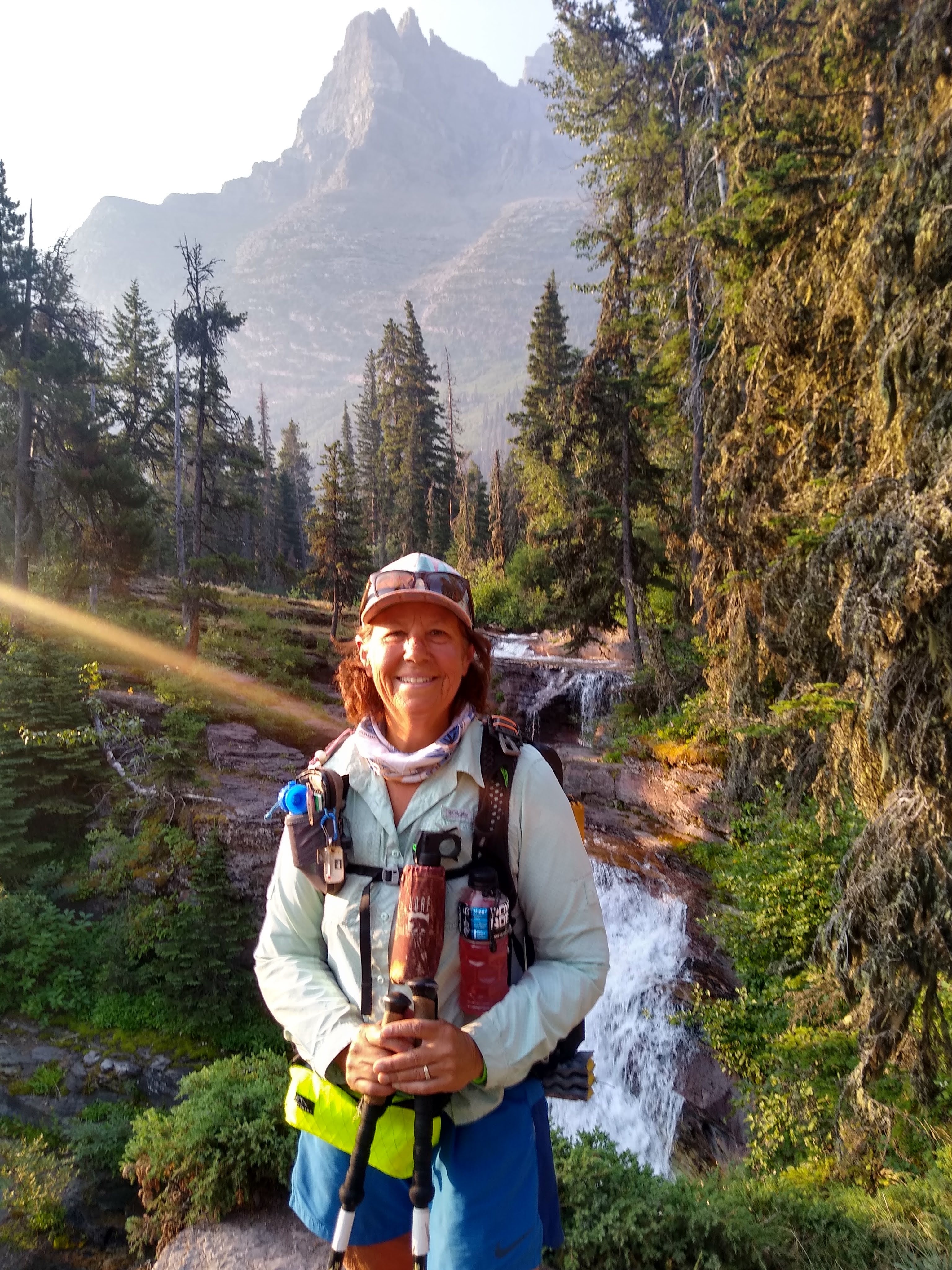
Big climb on the menu this day. 3 miles and 3080 ft elevation gain, with a 2080 descent to Morning Star campground via Triple Divide Pass. This pass is considered a hydrological apex wherein melt off from this pass flows to three separate oceans: Pacific, Atlantic and Artic Ocean (sort of)
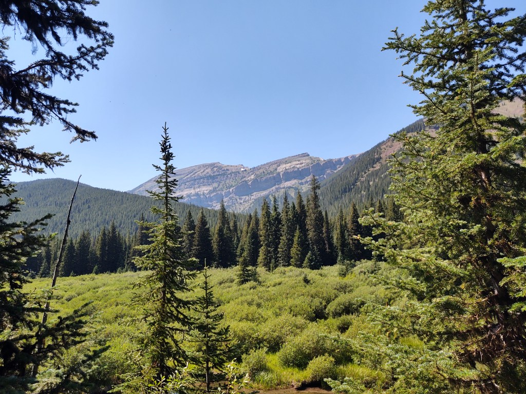
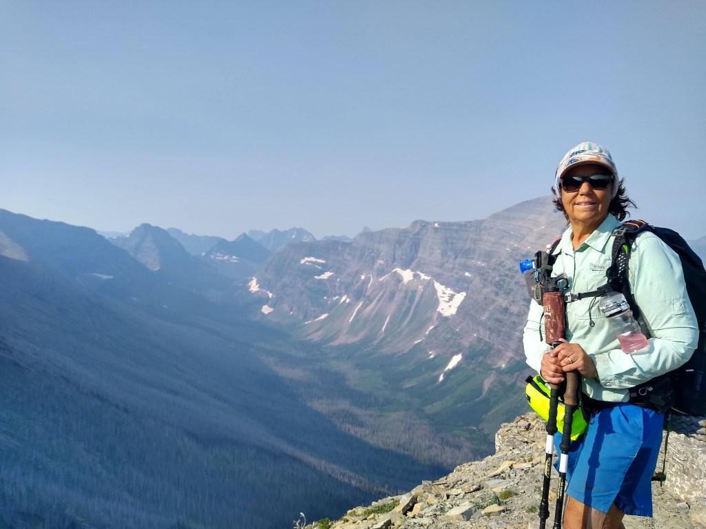
We tread through a lush forest and watch as the striking jagged grey peaks loom ever closer. We take our time. We have all day to make 14.7 miles. The sky was still remarkably “clear” considering the volume of fires that are burning west and southwest of our location.
During our approach to the pass, we ran into our first CDT thru-hiker. “Pop Tart” was walking to the border and then back to East Glacier where he’d continue his SOBO trek of the CDT. We mentioned that he could always get a ride back from the border, but dismissed the notion, saying that he had “nothing but time”, and ‘who wouldn’t want to spend two weeks in GNP’.
Two thirds up the pass, we spied a herd of sheep frolicking in the remaining snow drifts. Nearby were several massive rams under the shade of a rock pile watching with indifference.
It was here that Jan earned his trail name, Sheepgoat. The man is part sheep, AND goat. Denmark’s highest elevation is 400 ft, and yet Jan climbs with little to no effort…compared to us. Granted he’s at least 10 years younger, but the man is a machine. He also can’t tell the difference between a sheep and a goat…hence Sheepgoat.
We could have stayed atop the pass much longer but what goes up, must come down. In this case all the way down to the Morningstar Lake campground.
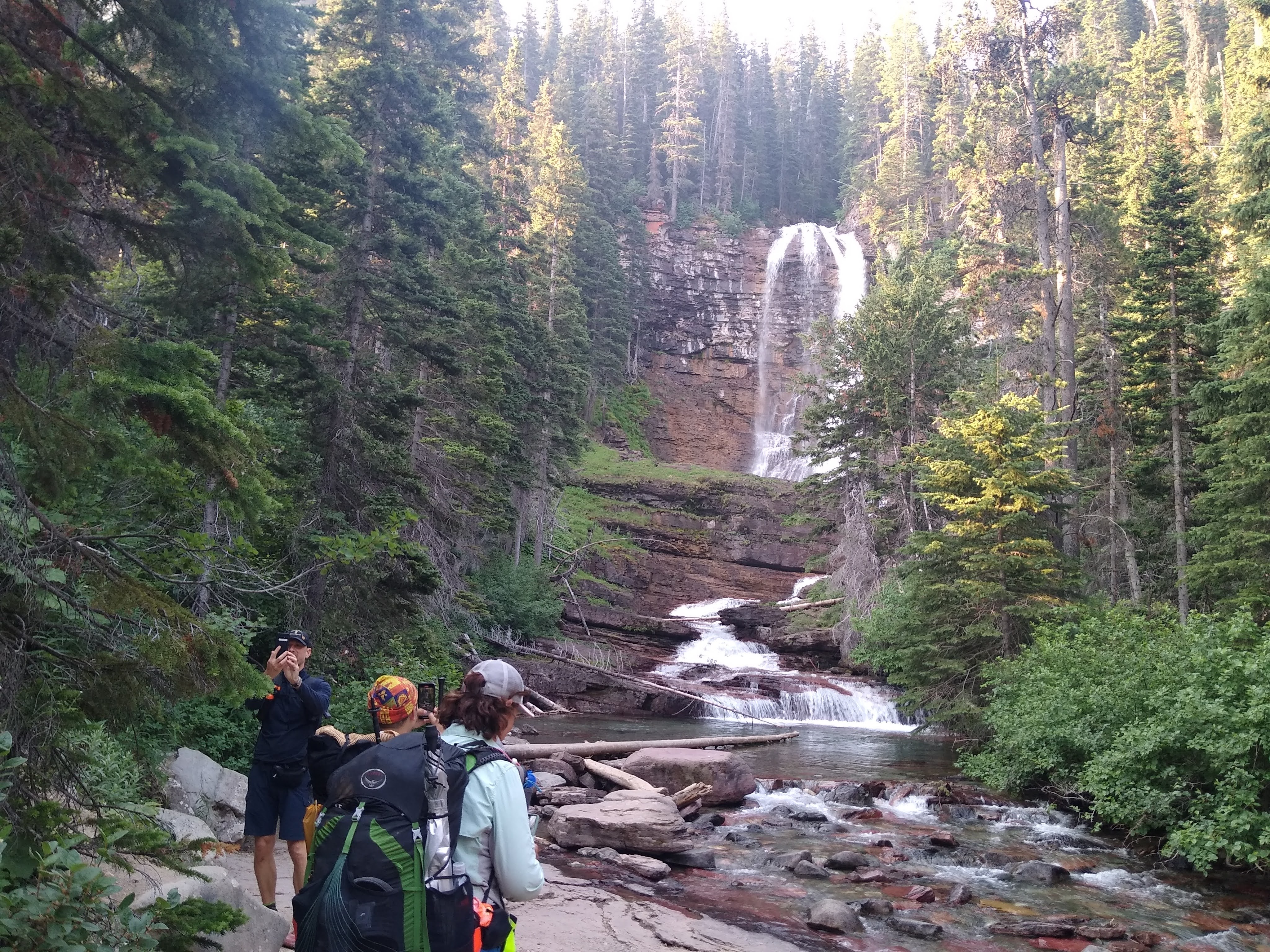
Hobbit and Sheepgoat taking a snooze. “Unimpressed” by the powerful waterfall behind them.
After a short nap on a bridge we continued to the campground with visions of taking a swim, but we were greeted by a fastidious horde of mosquitoes. At least they respect the DEET.
Sometimes you have to able walk on water…to get water
The campground was mostly full, so we squeezed into a space not far from the privy.
We dined with some nice young couples at the food prep area, and were entertained by their repeated attempts to launch their food lines over the bear hang pole.
After awhile, we clued them into using a weighted bag to get the carabineer and line over the pole.
Sheepgoat got treated to his first trail magic, as another couple had extra ‘ground hog’ tent stakes. Now he didn’t have to use his big plastic yellow ones that he got at a convenience store.
No effort was made to be quiet the following morning. It was that we were trying to be rude, it’s just that we didn’t care enough to be quiet. Jumbo Honey Buns and coffee was the morning fare. Jumbo Honey Buns are our “go-to” breakfast when backpacking as they provide over 600 calories per bun. We expect to burn that off in a couple hours. The fat content is marvelous compared to oatmeal, and it’s sinful goodness provides for a longer satiation period. That’s important when you have limited room and are comparing calories per gram (weight).
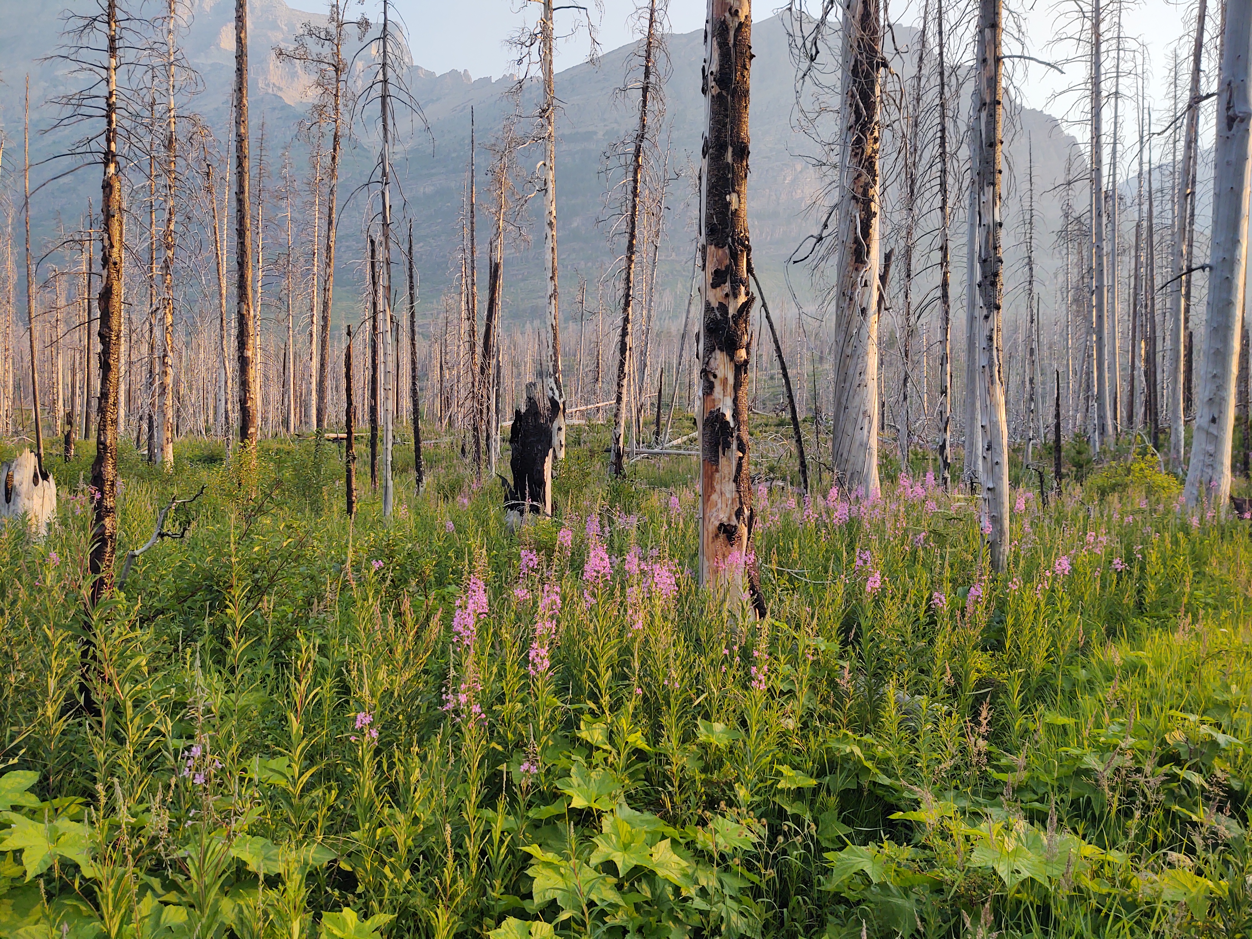
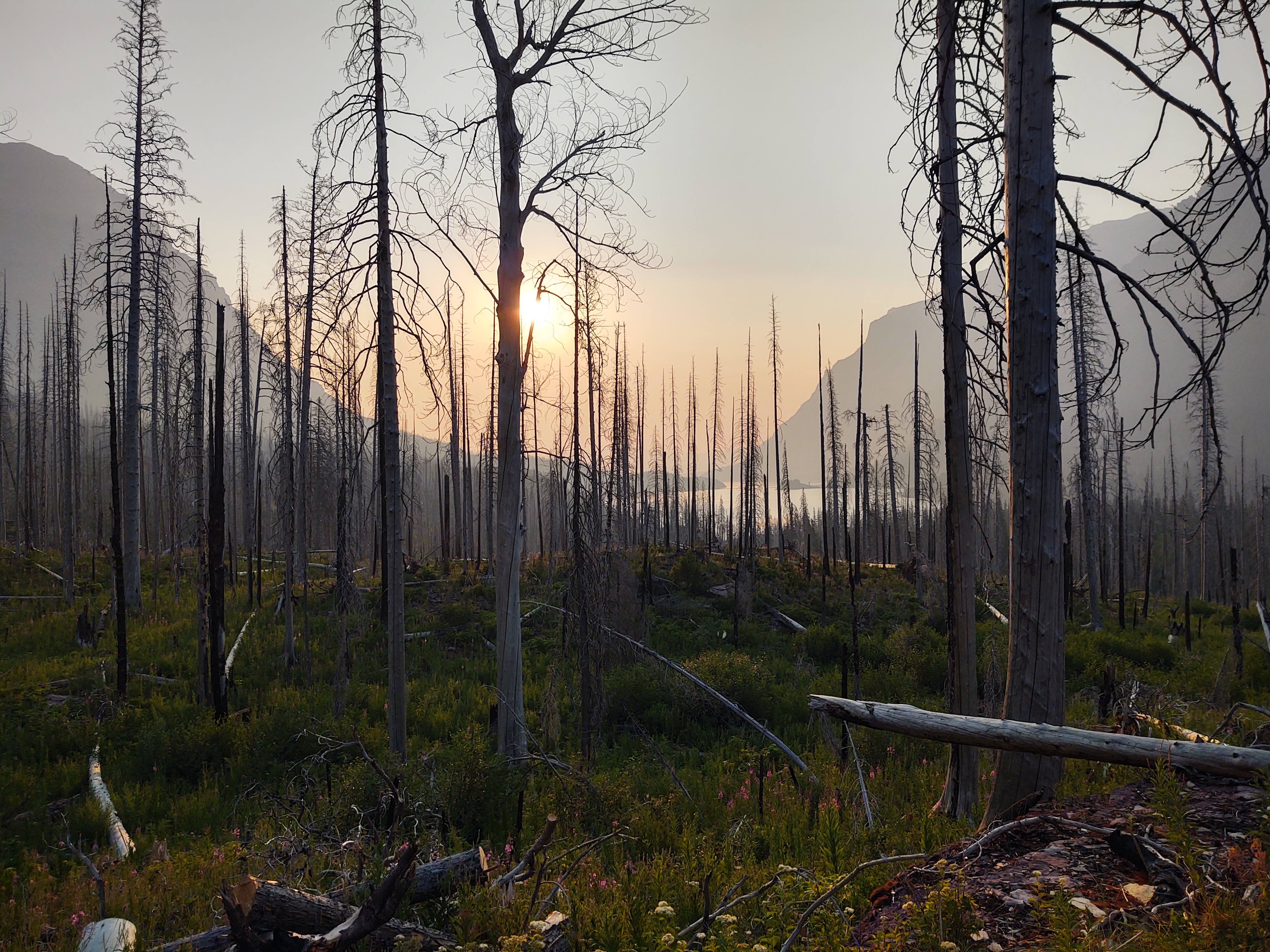
So enough about “food” and onto the trail. The morning’s sunrise was accompanied by a now noticable haze and a faint odor of smoke in the air.
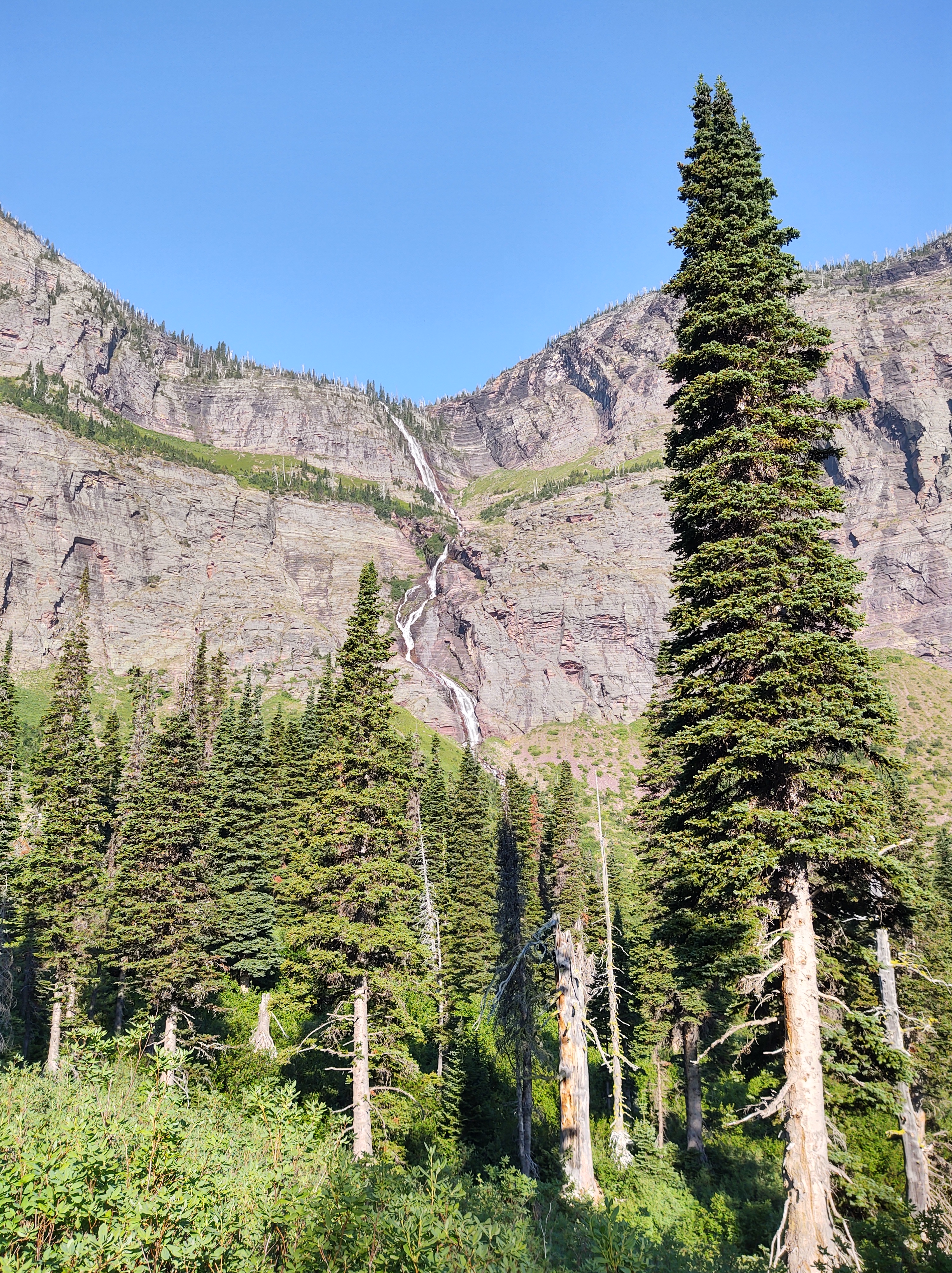
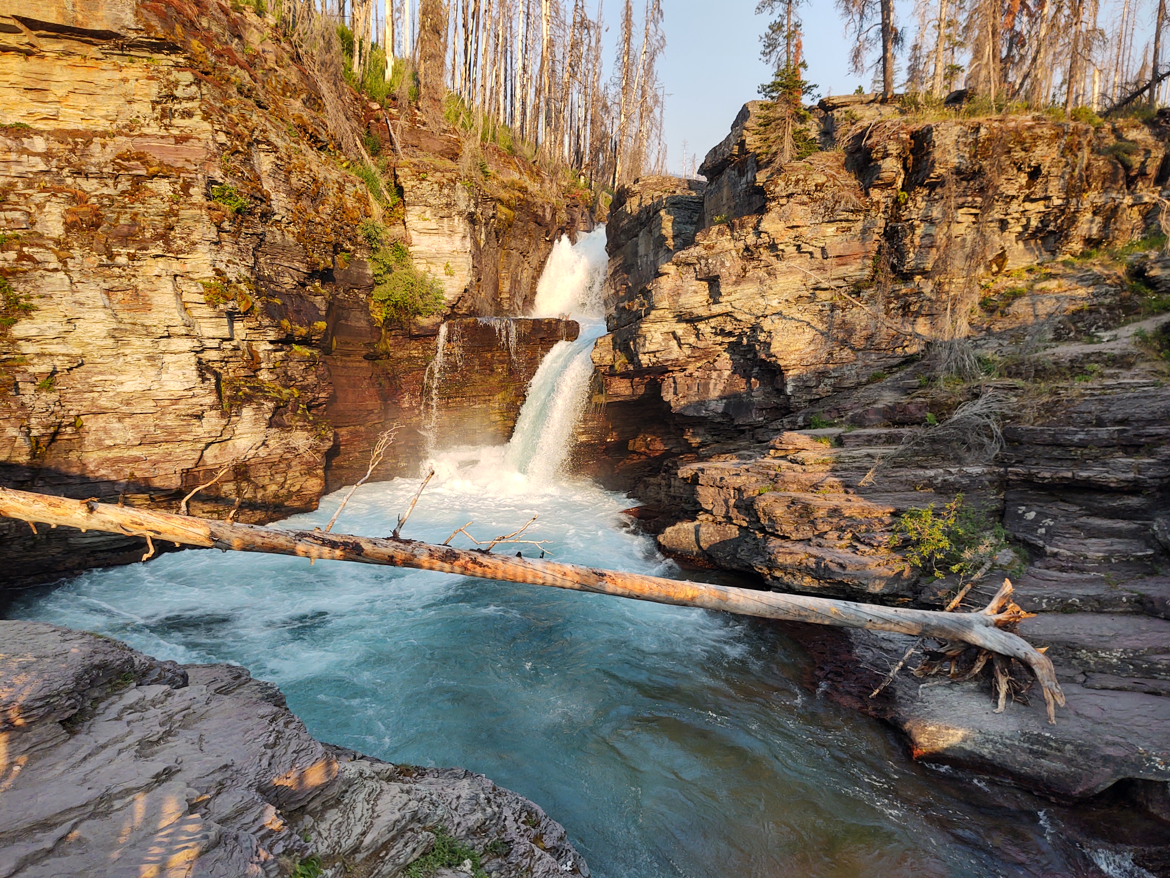
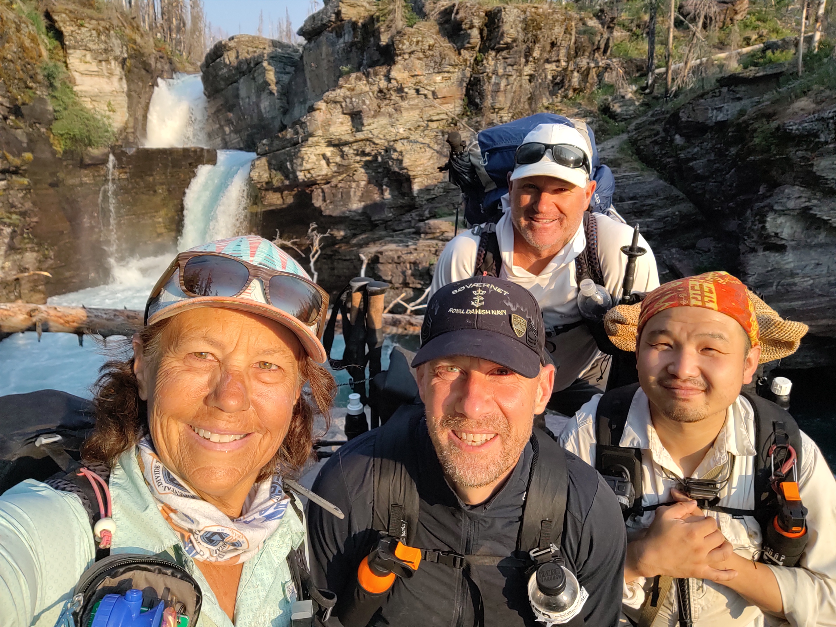
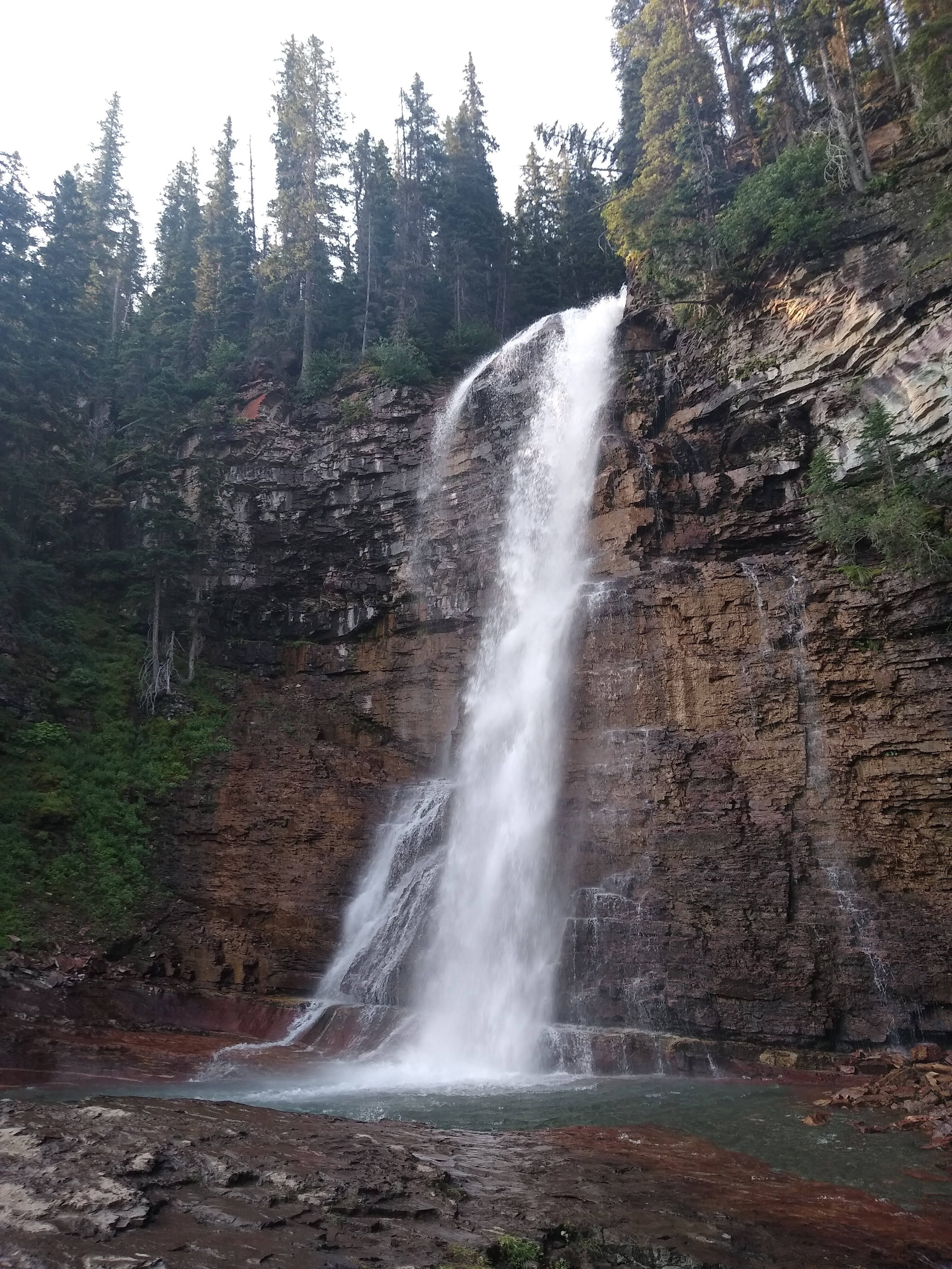
Our stench, however was beginning to become quite noticable, as well. We were definitely looking forward to the day’s end at Red Eagle Lake (foot), and a full blown swim. 14.3 miles and a difference of 100 feet of elevation gain/loss was on the menu. And more importantly, WATERFALLS!
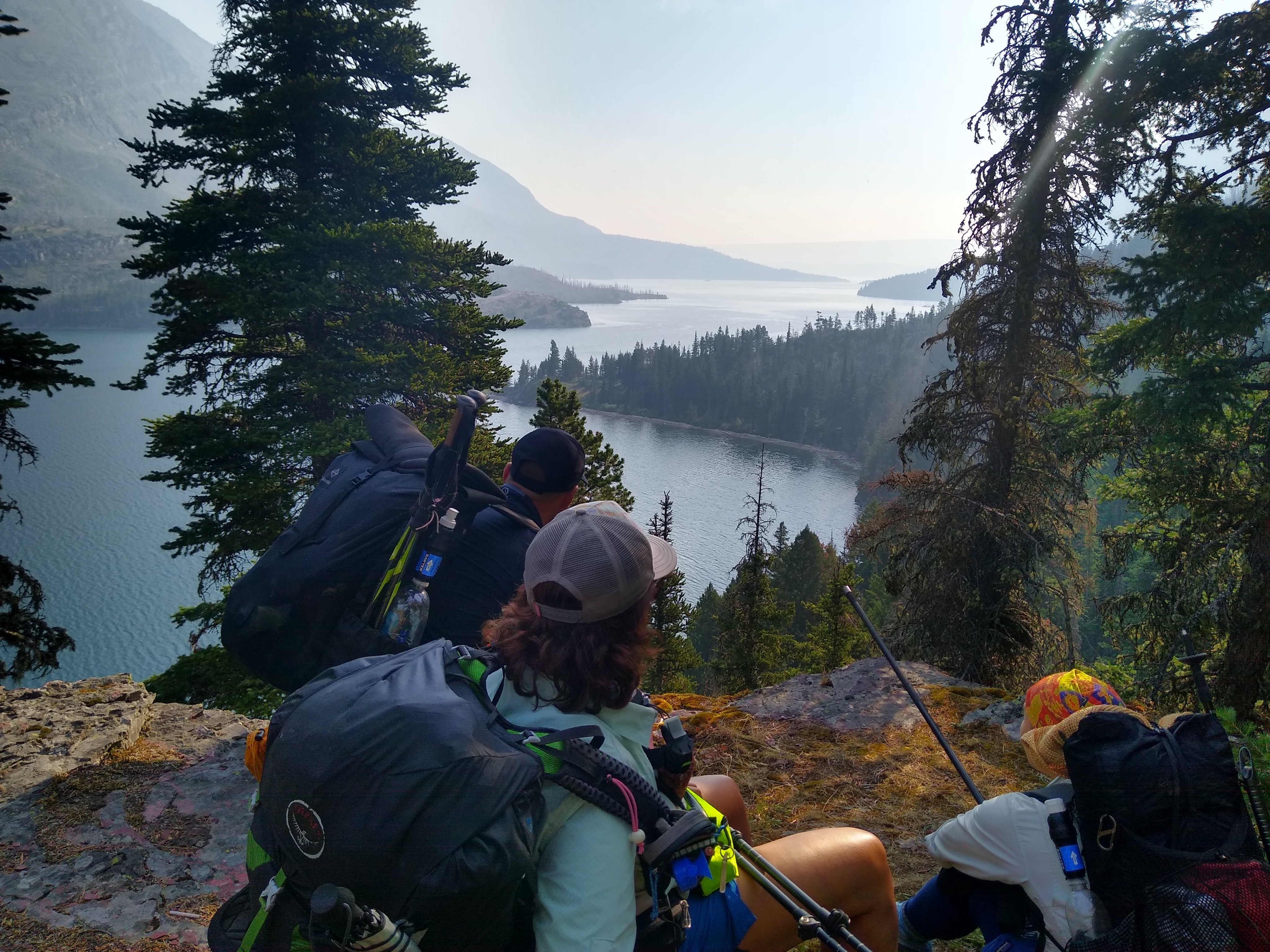
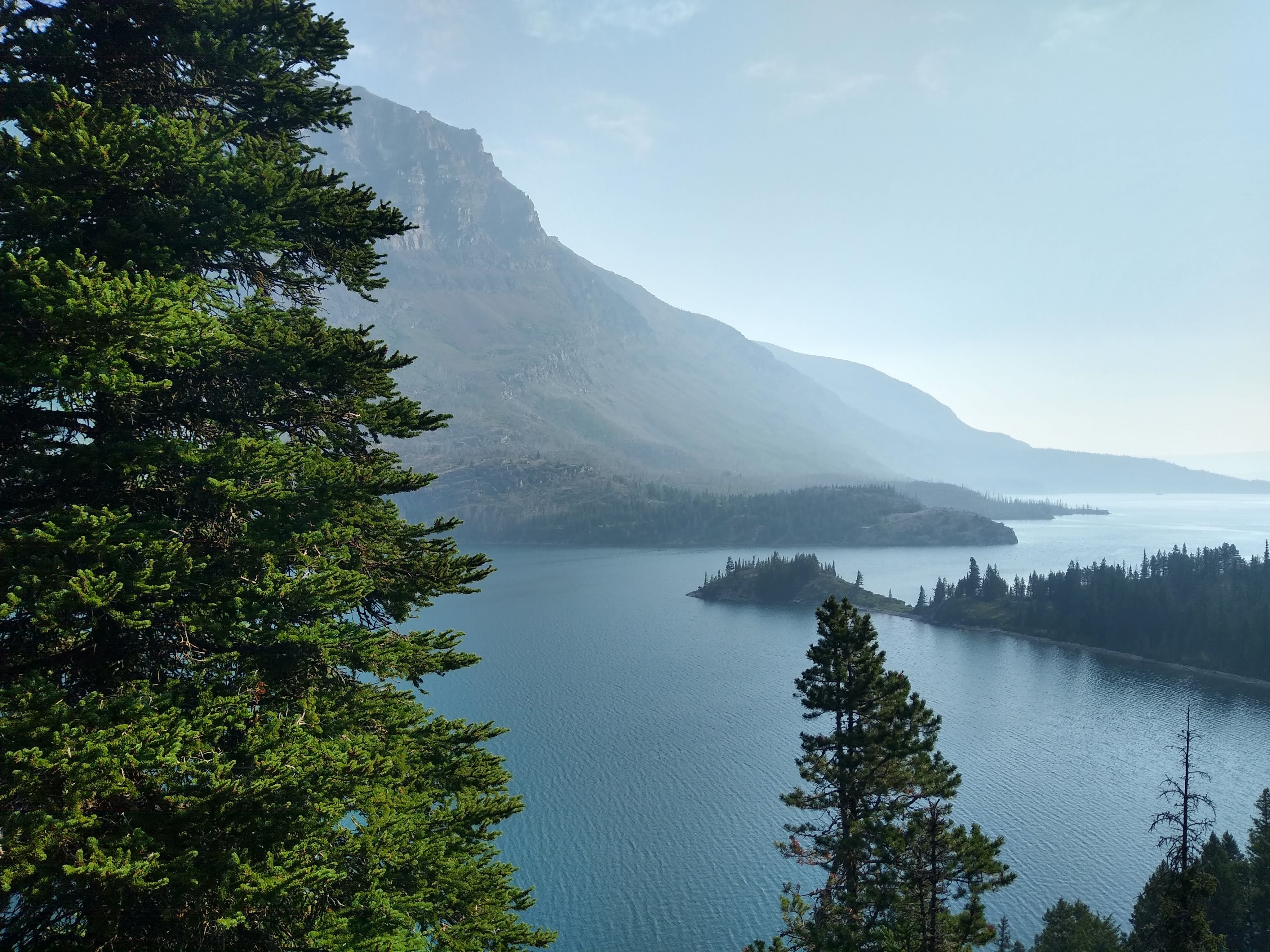
Yup. Burnt forest, waterfalls and a walk around/above St. Mary Lake, (that, by the way is ENORMOUS!) was the norm for this day.
We went by so many waterfalls, that we came up with a rating system 1-5. To earn a “5” it had to be tall, loud, create wind, and throw a lot of mist. Needless to say there were many a “5”.
We took our time and strolled along the trail marveling at the early morning beauty of St. Mary Lake, the second largest lake in GNP, measuring a whopping 7 miles in length and 300 feet in depth. The Going-to-the-Sun-Road runs her North side, while we walked 30meters above her Southern shoreline.
Eventually we broke from the pull of the lake’s edge and weaved our way through the skeletal remains of a forest thinned by fire. This, however allowed us to have expansive views of how expansive the park we were walking through. Interestingly enough, when all is said and done we will have only walked upon 101.1 miles of the 734 miles of trail, and will have stayed in nearly half of it’s 13 campgrounds.
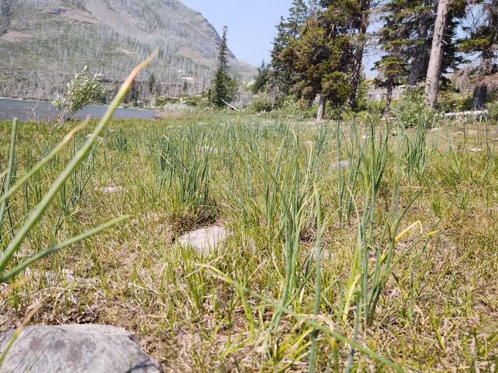
No matter how hard we tried to “milk” the miles, we made it to Reynolds Lake by 3:30pm. Hotter than hot (high 90’s) we all had a swim…fully clothed, while Hobbit (who can’t swim) decided it was a good idea to test his bear spray…in the warm wind. And yes, what one would expect to happen in such conditions did. Hobbit’s response, when we asked him how it felt, “It is very spicey”, with his eyes still watering and barely open. We all had a good laugh as we lounged on the lake’s shore rummaging through our snacks, and sampling the wild onion that sprouted upon it’s shore.
It was such an easy day, we actually saw the sun set.