A “Terrorific” Day…Part Three

Once safely back at the Trail Crest junction,  Jody met us with, “Did you all make it?”  Yup, was the resounding answer.  (However, we all agreed that Jody still had made the better choice, and was the smart one out of all of us.)  In our haste this morning we had neglected to eat heartily and apply appropriate sunscreen, thus we returned from the summit red faced and starving.  Once at the trail junction I wedged myself into a “corner” far from the trail’s edge…exhausted and relieved I had made it back to relative “safety”.  Thinking out loud, I said,”That was the most terrifying experience I have ever had!”.  Trevor turned to me and started to laugh.  “I was just thinking the same thing “, he said…and this is from a guy who rock climbs.  We all knew that we weren’t done just yet.  Paul had overheard from a mountaineering guy, who was climbing Whitney with his wife and 11 year old daughter, that the switchbacks were closed, and we would have to heel step or glissade (slide on our butts through the snow) to get to Trail Camp.  The guy also said something about walking in the foot prints of the others who had gone down before us.  This supposively wouldn’t be that “hard” as the snow had softened quite a bit from this morning.  The prospect of post holing 1800 feet, however, did not seem inviting.  We donned our packs and began another climb, of sorts (still wearing our micro spikes), over the crest and to where the 99 switchbacks were supposed to have started.  We could make out a bit of the trail down to Trail Camp, but the vast majority of it was completely encased in snow.  The only way down was via a steep snow chute (skiers would rate it at least a double black diamond run), which by the way was the only way to access Mt. Whitney for those coming from Whitney Portal.  At this point I recall a conversation that Paul, Jody, Jan and I had with two young men, just 6 days prior.  They were headed down from having successfully summited Whitney as we were doing our first acclimation hike to Lone Pine Lake from Whitney Portal.  They were oozing joy and accomplishment.  We asked them how they did.  They replied that it was one of the most amazing and terrifying things they have ever done.  We of course, asked why.  They said that rather than walk down (which we assumed meant the switchbacks) they decided to glissade the 1800 feet.  They said once they started they realized they had made a “big mistake” as they immediately started sliding down the chute “out of control”, and that it took them nearly 100 yards to be able to slow themselves down and come to a stop.  They thought they were going to die, and were amazed that they hadn’t.  They were glad they made it the rest of the way down safely.  Their words rolled through my head and I wondered if anyone else recalled this conversation, as we sat on the “wide” lip of the snow chute.

After Whitney 473

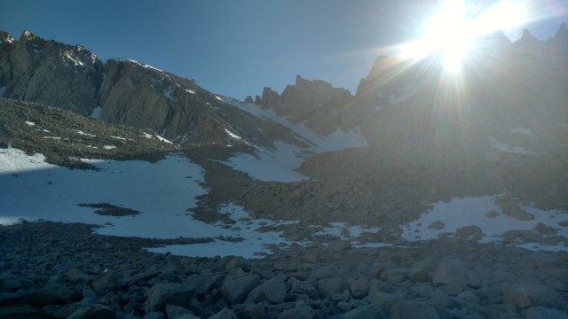
Somehow we were supposed to get to the bottom where you see it start to “flatten” out and walk a mile or so to the right, to Trail Camp located next to the “small” lake in the middle

We watched as Mountaineering guy and his family slid down the snow chute, ice axes in hand.  We watched as another high stepped it down the chute.  We weren’t gonna get any closer to the bottom standing there, and the switchbacks weren’t going to melt sufficiently in an hour, so one way or another we were going to have to step or slide (or combination thereof) down this snow filled, double black diamond, chute.  Scout watched for a moment and literally jumped in feet first, heel stepping down the mountain’s face.  Jan switched out of her hiking skirt and into a pair of FrogToggs for “warmth”, even though Mountain guy said he would “pay” to see her glissade in a skirt.

Whitney 0616 484

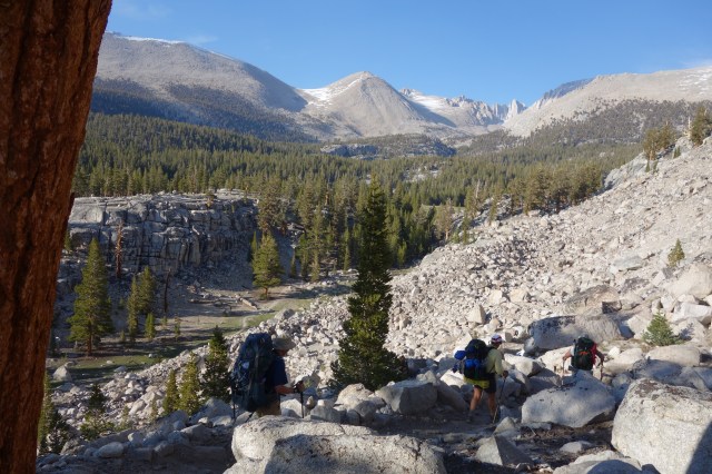
If you look closely, and to the right, you can see Jody sliding down sideways

We did the best to “batten down the hatches” of loose items on our packs.  Some fared better than others.  I initially tried to heel step down, but found my feet kept sliding out from under me.  Ironically once I stepped off the lip and started down, I was not scared at all.  The snow was soft and forgiving, therefore I decided that if I was going to slide, I may as well glissade, and took off my micro spikes and shrunk my poles down.  I gave Trevor, April and Jody a quick “tutorial” on how to hold and use your trekking poles like an ice axe to “slow” yourself down, and the admonition that above all do NOT dig your heels in to stop yourself or your heels may catch and launch you head over heels down the mountain.  Trevor and April gave me a nod, like “here goes nothing” and started to glissade with a hoot and a holler.  I am not completely sure if they were sounds of joy or terror. Whitney 0616 489Whitney 0616 491 Jan, who was the most prepared, with an ice axe, and actual training, stayed seated on the wide lip of the chute.  Jody had started to walk down and was doing okay until she lost her balance and began to slide and roll doing her best to “swim” uphill with a pole in each hand in a futile attempt to stop her uncontrolled descent.  Soon it was just Jan and I.  Not wanting to be the last one down the “hill”, off I pushed.  There actually was no need to push, as gravity and a low coefficient of friction were co-pilots for my descent.  I would have preferred a snow board or pair of skis, but in this case my butt would have to do.  I slid for a good 50 yards before the build up of snow between my legs, and my pole tips, slowed me down to a stop.  I needed to take inventory before I started again, as I watched an empty water bottle skip down the the steep slope ahead of me, and make sure that I wouldn’t lose anything else.  I also needed to move over about 50 feet to my right if I were too miss the jagged rocks below.  As I was doing this, Jody took another tumble.  When she came to a stop, I asked her if she was okay.  She was, but she had lost one of her microspikes that she had taken off and was holding in her hands.  She was too far down to climb back up to get it, so she did her best to slide further down on her butt, which morphed into her leaning heavily on her side clinging onto her trekking poles for dear life. At this point I realized that there was no way I could, or was going to leave (my) SideKick alone, and did my best to coax her over to me before she reached the patch of rocks directly in her current path.  Meanwhile Jan was still at the top, and April and the boys had made it to the “bottom” 1800 ft below (cutting off 2 miles of walking switchbacks…were there any to walk).  The temporary silence on the mountain was quickly shattered as Jan could be heard screaming, “Oh shiiiiiiiiiiit”, whereupon I looked uphill to see her tumbling head over heels which then turned into something resembling a corkscrew, as she fought to grab a hold of the snow drenched mountain and slow her descent.  I called to her to ‘self-arrest’ and dig in her ice axe, to which she cried “I can’t!…I don’t have it!”  It took me a little while to register what she had said, and then it became apparent that ice axe, while it held firm, had ripped out of her hands, and she had slid right past it.  Not wanting to kick step back up to retrieve the axe, she reset her poles, put her micro spikes back on, and did her best to “walk” down the remaining portion of the chute.  At this point I was still waiting for Jody to shimmy over towards me.  My legs, feet, butt and gloves were now soaking wet.  I felt like I was taking an ice bath of sorts.  I did my best to be encouraging to Jody as I felt the beginning of frost nip on my finger tips, upon which my directions and encouragement toward her became more terse and direct.  She responded by another near uncontrollable slide which thankfully came to a stop inches from the rocks, wherein she lost all her remaining water bottles, and her sit pad.  After that, I figured frost nip is survivable but yelling at your friend to essentially “suck it up” and slide to the bottom may result in unfavorable results.  I sat in the snow and watched as she inched her way down at a speed she felt “comfortable” with.  Once she was nearly down to the bottom, I let loose and started my glissade.  Everything was going well until I found myself in another person’s glissade track and it felt like I switched into “warp speed”.  Soon the last of my water bottles were gone and I was sliding much faster than I was comfortable.  Eventually I  was able to slow myself down and come to a stop, and move myself out of the glissade track.  While doing so another guy slid up next to me and asked, “How do you use your poles to slow down?”  I looked over at him and he had two long curvy poles that I thought were downhill ski racing poles (the type that wrap around your body).  They seemed like an odd thing to be using, and then I realized that they were in fact trekking poles, that were now misshapen.  I showed him how I held my poles and used them like I was steering a canoe.  He looked at my poles and then his and said, “Hmm, I guess I should have shortened them before I started, it’s a little too late now”.  I told him he may get his best results by digging in with his handles, so he flipped them around and continued to slide down the rest of the chute.  By this time everyone in our group had made it to the bottom and were heel stepping across another snow field, the last mile to Trail Camp.  Paul and Trevor, however, waited at the bottom for me…and Jody.  When Jody finally reached the bottom, she was more than slightly disheveled.  She had had a “yard sale”.  Her pack was on cock-eyed, as was her hat and glasses.  Both poles were broken and dangling from her wrists.  Her water bottles were gone.  She no longer had her sit pad, and was now without both micro spikes.  She had literally left a debris field in her wake whilst sliding on the edge of complete chaos down the first snow slope she has ever been on.  I had completely forgotten that while she has snow shoed, she has never skied or snowboarded, and has little to no experience with snow.  Considering that, I’d say she did pretty darn good.

IMG_20160607_155250921

It doesn’t look so daunting once you’re at the bottom

IMG_20160607_165449176_TOP

With the chute behind us, we walk the rest of the way to camp atop ever softening snow

While her methodology of getting down the chute wasn’t pretty, she was alive and unharmed, so she had that going for her.  It was everything she could do to stay upright now.  Paul gave her his micro spikes and trekking poles so she could more easily walk the final mile to camp…or at least off the snow field.  When we finally got to the ice/snow free switchbacks that start just past Trail Camp, the trail literally contained a raging river.  It was late in the day and the snow melt was seeking the easiest path, which in this case was the trail.  We were already wet and cold, so what’s another 10 minutes of walking in icy cold water.  Down we stomped to camp.  I tried to keep my feet “dry”, but at that point Jody didn’t care and just wanted to get her pack off and take a seat for a while.  Originally we mistakenly thought we would be able to march all the way down to Whitney Portal for beer and Pizza.  NOT!  It was all we could do to set up our tents, get out of our wet clothes and boil water to re-hydrate our meals.  We had been up since 330 in the morning.  Hiked 10 miles on a rocky trail filled with snow and ice.  Gained over 4,000 feet in elevation.  Summitted the tallest Mountain in the lower 48.  Glissaded down over  1800 feet, and not one of us got injured.  While we had enough daylight, it would have been foolish (as if what we had already done wasn’t foolish enough) to try and make the remaining 7.6 or so miles to Whitney Portal considering how gassed we all were.  Trevor wanted to rally, but we had no real trouble talking him into setting up camp.

Besides we haven’t had the opportunity to use our WAG Bags yet.  We wondered where the origin of the term, “Wag Bag” came from.  I assumed they are called Wag Bags, based on the fact you use a bag to pick up dog poop. The “wag” is a reference to a dog.  Or maybe it because when you tie a used bag to a pack ( I’m pretty sure this is something you don’t want inside your pack), it “wags” back and forth as you walk down the trail.  Jan of course discovered the real origin of the name, it being a military  acronym (the military loves their acronyms) for Waste Alleviation and Gelling.  The Forest Service issues Wag Bags with your Whitney permit.  Some people use them in keeping with the LNT (Leave No Trace) principles.  Others completely ignore it and dig cat holes or “hold it” till they get down to Whitney Portal.  I can only imagine how “shitty” Trail Camp would be if this method of solid waste collection was not employed.  Being good citizens, and in keeping with our sense of adventure, most all of us broke out our Wag Bags and made a “deposit”…or two, careful not to make over three, as apparently they are only rated for three uses.  Luckily we did not have push the ratings envelope.  It, along with each others’s recollection of the day’s events were this evening’s topics of conversation.  Laughter and giddiness prevailed, as we were punch drunk with exhaustion, and shear joy that we miraculously were all alive.  We had all decided that it was good that we took the “long route”, for if we had come up via Whitney Portal and saw that we would have had to kick step up 1800 feet to get to the Trail Crest Junction,and another 2 miles from there to the summit, we would have turned around and gone home.  This day was nothing that we expected or envisioned, nor was it something that we would/could ever forget.

After Whitney 475.jpg

Looking back from whence we came…what a day!

Posted in Mini Adventures, Mt. Whitney, Uncategorized | Tagged , , , , , | 5 Comments

Felt like 20 miles

It was a restful nights sleep and a much warmer night (41 degrees) than spent at Horseshoe Meadows.  Somehow the frogs sounding off came to a complete halt all at once. I guess even frogs have to sleep, but I thought the sound of their ribbeting would fade in cascading numbers rather than turn off like a light switch.  Talk about being in sync!  All rested and full of vigor, with no lingering signs of altitude sickness or fatigue, we were off.

This was of course after Steve, who has now earned the trail name “Scout” surveyed the area for the best and quickest possible route back to the trail…which of course was the way we came in.   Initially the goal was to make an easy 10 miles and camp just past Guyot Creek somewhere on the Guyot Flats, which would set us up for a 7-9 mile hike to Guitar Lake the next day, depending on how far into Guyot Flats we camped.

This plan, as with all plans, was merely a guideline and as such, can change dramatically. Today we crossed paths with many PCT hikers (20+).  They step swiftly and effortlessly.  I remember those days, but certainly do not resemble them now.  We were once well-oiled machines (by this part of the trail), efficient in our movement, packing and chores.  Now we feel like a car not firing on all cylinders…a little out of tune.  Even so, it feels good to be back on the trail.  For this trip I have decided to try out my new HOKA ONE/ONE shoes.  They are light and comfortable, and so far at the end of the day and the next morning, my are not as swollen and feet do not hurt.  We will see how they do in the event I have to attach Microspikes to them.  Today our crew has its first creek crossing, Lower Rock Creek.  It is flowing similar to when we crossed it in 2014.  All cross with relative ease, with the water nearly thigh level.

The icy cool of the water serves to quell the swelling of our feet, and give some relief to the heat of the day. From Lower Rock Creek, we will climb 1360 feet in 2.8 miles to Guyot Pass (10,880 ft) and then water up at Guyot Creek and walk as far as we can through the Flats before finding a place to camp, having set a goal of 10 miles for the day.  This trek, unlike our PCT thru-hike isn’t about crushing miles, but more about the enjoyment of the terrain, in that we do not feel so “hurried” with regard to the number of miles we must progress each day to reach our end destination.  After doing our best to reduce the weight of our Bear Canisters (and to get me to open the Maui Onion BBQ Chip bag…it was still safely swollen), we saddle up for the sharp climb to Guyot Pass.  Jody (SideKick) and I trail behind the others, using the “shade to shade” method of attacking the elevation gain and numerous switchbacks.


In 2014 I had the pleasure of meeting and hiking a bit with Teddy Boston, the first female to solo hike the PCT.  She is in her 80’s now and was finishing a portion that was not there when she did  the trail.  She told me a secret.  “Walk slowly through the shady spots and quickly through the sunny ones.”  Today SideKick and I will employ that sage advice, as it is hot and the air is still.  When we reach Guyot Creek, it is practically a trickle.  Luckily Steve (Scout) is carrying a Katadyn pump water filter.  This method of water retrieval and filtering is much more efficient than our Sawyer Squeeze, and has proven to be a helpful, and certainly more efficient method in which to collect 14 liters of water for our group of 7.  Halfway through, Scout, having looked at our Topo map of the area believes he sees another water source further up the trail.  Rather than carry 2 liters each, the plan now is to filter enough water at the creek to get us to this next possible source, and camp just past there…further reducing the miles for tomorrow’s trek to Guitar Lake.  It appears promising, considering all the current snow melt .  If he is wrong, however, then we will have to hike another 2 miles to Crabtree Meadow, the next sure site for water.  From that point we kick it into “high gear”, as the trail is flat and the tread is soft under our feet.  I knew the area that Scout was looking at, and it seemed probable that there would be water, but I vaguely recall us thinking that 2 years ago, and ending up at a damp stream bed, having to hike on to Crabtree Meadow for reliable water.  One never knows.  Well…The stream bed was bone dry, so 2 more miles it was.  It always seems to be 2 more miles.

Whitney 0616 171

As we descend, you can see Mt. Whitney in the background (Photo courtesy of BeeKeeper)


In short order, we descend into Crabtree Meadow.  I do not have fond memories of this particular section of the trail. When we did this I was extremely tired, rolled my ankle, and my knee was sore.  Flash forward two years, it’s like deja vu…I am extremely tired, my knee is sore and I miraculously roll my ankle in the same place that I did two years ago.  What is it about this stretch?  The day finishes with a log crossing of Whitney Creek.  Everyone but me practically skips across the wet and slippery logs.  I hate log crossings, for fear of slipping and falling, but Scout is there to lend a hand, just as I feel my balance go .

We set up camp in the same place we did two years ago.  It is just as we remembered it…a lush green meadow, a babbling brook teaming with golden trout, deer grazing in the near distance, marmots vying for your attention and the spire of Mt. Whitney poking at the horizon.  We throw down our bags, exhausted.   It may have only been 13 miles, but it felt just like 20 to us, yet no one complains.  This is truly a Magnificent 7.  Our only solace is that it leaves us with a “short” hike (4.7 miles) tomorrow to Guitar Lake, and thus plenty of time to rest, recuperate and recharge for our assault on Mt. Whitney the day after next.  Sadly my chip experiment has come to an end, for the bag is not longer taut like a Mylar balloon.  It has lost its perfect seal.  “Does that mean we can eat them now?”, asks April.  I suspect however, foul play and bring up the topic with the group.  All stoically deny having touched the sacred chip bag, yet all are eager to sample its contents.  Alas, I will never know the exact cause of the failure of the bag’s seal.  Was it foul play, the heat of the day, or the constant pressure it was under that broke the seal?  We were hoping for a loud pop, better yet, an explosion of chips, but all we got was the equivalent of a silent fart, and now something more to mix into our tortilla “wraps of wonder”.

We prep our dinners, and as with the night before, we are treated to another tale of John Muir, who in this story left the cover of a perfectly good house with a roof to climb a tall Spruce in the midst of a thunder storm to experience the full force of nature.  I am beginning to think, that although he was a great visionary with regard to preserving our open space, that he may have been just a little bonkers.  But then maybe so are we.

Posted in Mini Adventures, Mt. Whitney, Uncategorized | Tagged , , , , | 5 Comments

Cottonwood Pass

Before we bedded down for the night we had set 9am as our “launch” time.  We were close. Last minute packing and repacking occurred, as well as a thorough search of our vehicles to ensure that no fragrant things or food items were left in the car (as I write this sitting in Crabtree Meadows, it occurred to me that we may have left our car freshener thingy in the air vent.  My only hope is that a bear has not gotten into our car and pooped in the front seat…shit!)  Before heading out we have a “safety” meeting.  After Whitney 343
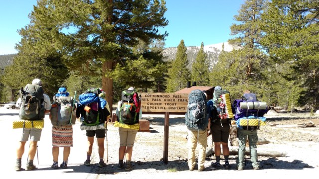
We talk about pacing, staying hydrated, the fact that Jan has asthma that is altitude and exertion induced, signs and symptoms of altitude sickness, and how to use our Delorme InReach SE in the event we have an emergency that requires outside help. Once everyone is on the same “page”, we head to the trailhead.  At the trailhead, we talk some hikers who have to finished their weeks hike to take our “before” picture, and then we are off.

After Whitney 346After Whitney 347

Most of our packs are heavier than we would like them to be, but the weather forecast was so uncertain, and the fact that it was 33° again last night made it hard to discard the some of the heavier clothing items.  The approach to, and the beginning of the climb to the pass and entry to the Golden Trout Wilderness was a relatively flat and easy hike across crushed granite.  Soon the climb began.  We would gain 1260 ft in 2 miles over many switchbacks.  Somehow I remember this being easier.

An hour into our climb, an impromptu break with the removal of shoes and the breaking out of food occurred.  Umm, if we are to get anywhere, these kind of breaks can’t happen hourly even if we are only going 8 miles. (As a side note, I have been carrying bag of Maui Onion BBQ chips, to which Steve finds fascinating, and April wishes to sample.  I have decided though that said chips will only be enjoyed when, and if, the vacuum seal of the bag fails due to the altitude, which I hope is 14,000 ft…or so.)

After Whitney 356

It was great to have our son join us on this adventure

After Whitney 358

The Magnificent 7!

At long last we reach the apex of Cottonwood Pass (11,180 ft) and are greeted with patches of snow stubbornly staying put.
image

We examine the chip bag. It appears that it has swollen to maximum capacity and may “blow” at any moment, but it hasn’t. After the obligatory photo ops, we are onto Chicken Spring Lake via the Pacific Crest Trail (PCT).  Before we left Horseshoe Meadows, “Reject” had told us that she and a few other PCT thru-hikers were meeting Ned Tibbets for a “snow” class, that would take them all the way to Forrester Pass.

When we arrived at Chicken Spring Lake, to water up and take a break, there was “Reject”, as well as “NightCap” and “CottonBall”.  We visited for a bit, and then took a long “shortcut” around the lake and back up to the trail fully loaded with 3-4 liters of water each (to drink for the remaining 4 miles, dinner, breakfast and water till the next watering hole).

The views were as amazing as I remembered, however our collective group was gassed by the third mile, and a few were feeling the effects of their altitude gains, so we called it.  It was apparent that faint signs of altitude sickness was rearing its ugly head. April and Trevor had a headache and Jan seemingly took ill (she looked absolutely grey) and retired immediately to the confines of her one man tent to “sleep it off”. Altitude, and exertion at altitude affects everybody differently. I know I need extra time to acclimate, and take medication for quick assents. We chose this route to climb Mt. Whitney to minimize the affects of, or possibility of, altitude sickness by acclimating over these next three days. Altitude sickness is nothing to ignore, as it has already claimed two lives of seasoned climbers at Everest this year. We shall see what the morning brings. Hopefully we will all be able to continue. The ironic thing is that the majority of our fatigue was caused by the 3 liters of water we carried from Chicken Spring Lake, and as it turned out, there was running water (not the faucet kind) where we camped… runoff from the snow cornices overhead on the steep granite walls that curved around us. We were greeted by cascading (and continual) “ribbets” of thousands of frogs stealthily hidden, as we set up and dined on various MountainHouse meals. The frog chorus continued and was soon joined by growing waves of snoring, creating a unique nighttime harmony.

This “campsite”, or the water source was NOT on the map or Halfmile’s app, but was a welcome and timely find.  We even witnessed an avalanche, of the rock variety.  Pretty cool…as long as you are not in its path that is.  As it was a pretty strenuous way to start a backpacking trip, most were in bed early, but not until after a reading from Steve, of “Tales from John Muir”.  Me thinks this will be a nightly occurrence.

After Whitney 368

Posted in Mini Adventures, Mt. Whitney, Uncategorized | Tagged , , , , , , | 6 Comments

One More Day

Last night it was ridiculously cold.  Jan said her digital thermometer read 33°.  Yikes!  We have one more day of acclimation before we start our circuitous route to Mt. Whitney.  This evening April, Steve and Trevor are to arrive.  This morning we will do a short hike out of camp via “Trail Pass” towards Mulkey Creek to warm up the legs and test my body’s (in particular my head’s) response to activity at 10,000 ft and above.  After that we plan on heading back down into Lone Pine for a $5 shower (it doesn’t hurt to start out fresh) at the Whitney Portal Store & Hostel , and some last minute emails and updates for our respective blogs.  While at Horseshoe Meadows (one of the many Inyo National Forest campgrounds that sports 18 “walk-in” campsites at $6 a site via an Iron Ranger), we’ve been watching as the PCT hikers trickle in to do their resupplies, most not realizing how far out of the way Horseshoe Meadows is from “civilization”.  It is 19 miles to town on a road that is sparsely traveled, which makes for a hard hitch and an even longer road walk.  On our way back in from our morning hike we meet a young couple (NightCap and CottonBall) hiking the PCT.  They ask if we are heading into town.  We tell them we will be…after lunch, and invite them for lunch.  They decline our offer, saying they will stay put in hopes of getting a ride sooner, but if they haven’t gotten a ride before we leave, they will gladly go down with us.
image

Back at our campsite we meet another PCT hiker, “Reject” (cause she has rejected every trail name that people have tried to pin on her). She is taking a sabbatical from her job as a U.S. Forest Service Fire Crew Chief (I hope I haven’t unintentionally demoted her). She got caught in the big snow storm that happened two weeks ago, and is now enrolled in Ned Tibbet’s PCT mountaineering class that is scheduled to meet at Chicken Spring Lake tomorrow. We talked a bit about how her hike has been going and things to be sure not to miss along the way. We compare “notes” on the terrain she has already covered, and her experiences to date. We share our mistakes, in hopes that at least someone can learn from them. She is having in the time of her life and it shows. This is the first time she has been “free” to do whatever she wants (within reason…being a responsible adult, with a job to get back to in September). We part ways and wish her good luck and safe travels…maybe we’ll see her tomorrow at Chicken Spring Lake. As we head into town, we do a “drive-by” the trail head to see if NightCap and CottonBall still need a ride. They are gone, and no other hikers are there, so we head back down the hill into town. After Whitney 337
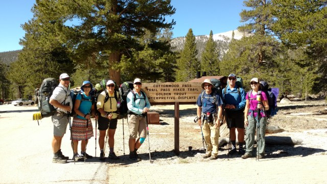
This road was closed until recently due to some house size boulders blocking the road.  It is without guard rails and is treacherous, but with awesome bird’s eye views of the valley and Hwy 395 below. Showered, shopped and connected, it’s time to head back up the hill. Who should we see trying to get a hitch back up to Horseshoe Meadows, but NightCap and CottonBall.

image

NightCap in the very back and CottonBall on the left

We stuff them into our car (luckily they are small of stature) and head up the hill back to Horseshoe Meadows.
image

Back at our campsite were share some food, beers and stories, with any luck they’ll run into Jan (BeeKeeper) handing out “trail magic” further north.
Via our Delorme InReach SE, as there is no cell service up here, we are able to text April for their ETA. Per her reply they (April, Steve and Trevor) should arrive by 1030pm. Luckily we have only 8 miles planned for tomorrow, so a little sleeping in will be acceptable.

Posted in Mini Adventures, Mt. Whitney, Uncategorized | Tagged , , , , | 4 Comments

Getting Acclimated

We awake to a quickly warming sun and the sounds of a babbling Creek nearby.  We spent our first night at the Lone Pine Campground (6000 ft) (campsites best by reserved via http://www.Recreation.gov).  This campground is just outside of town, past the Alabama Hills rocks, just off the Whitney Portal road.  For the adventurous (overachievers) one can start their summit of Mt. Whitney from this campground via the National Recreation Trail to Whitney Portal and the Whitney Trail.  We are far from being overachievers and plan on driving up to Whitney Portal for further acclimatization.  They are currently doing road repair/construction on the road often resulting in significant delays, both going up and coming down.  We packed up and all piled into our car with our day packs, water and a few snacks.  When we reached the flagman at the “bottom”, he said we were in “luck” as our wait would only be about 10 minutes.  Sometimes there are delays of up to two hours.  As we waited I had three “minders” telling me to drink more water, as we were unsure how the “quick” elevation gain was going to affect me. 

image

In no time we were trailing the pilot car as we meandered up the “hill” to Whitney Portal.  I could feel my ears “pop” and a slight headache, but nothing like I’ve experienced before when I’ve had altitude problems.  I guess the medication is working.  When we reach the parking lot at Whitney Portal (8365 ft.) We watched in awe as JMT’rs (John Muir Trail) and would be Whitney summiteers unload their packs from their Subaru wagons.  Ice axes, beefy crampon and helmet’s hung from their over-laden packs (at least they appeared to be over-laden to us).  We help take pictures of those just heading up at the Mt. Whitney trail sign.  One young man from San Diego (Kyle) is all smiles as his mom drops him off for his solo trek of the JMT.  He weighs his pack and excitedly exclaims, “70.7 pounds!”  OMG we whisper, that’s two of our packs together.  He tells us he’s carrying 10 days worth of food. Okay, that accounts for 20 lbs plus 3 liters of water, that’s another 6, so that’s nearly 30 lbs of the 70 accounted for.  Good thing he is young and strong!  Off he climbs as we talk a bit with his mom, who is happy and excited he is doing this trip.  Our plan is to hike about 3 miles up the trail…or as far as my head will let me climb.  It is painfully obvious we are NOT at sea level anymore.  Our lungs scream “slow down” as we at a snail’s pace begin our ascent to Lone Pine Lake.  Ever so often my head feels like it has been shoved into a vice and my teeth begin to hurt.  We stop. I drink more water.  The pain subsides and we continue on.  So far so good.  Our pace is painfully slow. Jody, Jan and Paul (cause he has to be) are good sports and wait patiently as I acclimate.  We cross a few flowing creeks and practice avoiding soakers (when you slip and get our feet fully wet anyways).  We mostly succeed.  As we (I) rest periodically, we spot Kyle above us on the trail and wonder if we’ll catch up to him.  We chat with several hikers on their way down from Whitney and ask about the conditions.  Some made it, but most did not either because of the conditions or altitude issues.  One woman is in tears.  My concerns of whether I will make it to Trail Pass at 13,400 feet rears its ugly head.  Eventually we light upon Lone Pine Lake.

image

It is tucked away amoungst tall pines and is rung by a sandy crushed granite beach. 

image

image

Kyle is there (taking a break and soaking in the peaceful beauty) and so are fish a plenty.  I curse myself for not bringing a rod and reel as a 10 inch lunker launches himself out of the icy water giving us his best “fish porn” shot with full exposure to the light of day.  The lake sits at a little over 10,000 feet, which is good as we will be heading to Horseshoe Meadows this afternoon, and I am feeling good.  This may work out after all!  We head back down at a considerably quicker pace and reach our car.  From here we will head into town and finally pick up our permit.  We wonder aloud if “Tim” will be issuing our permit and whether his demeanor will be better.  We joke that maybe we should bring him a Snickers… just in case.  We are lucky, we get Julie, she’s a peach and super helpful.  Best of all she is not annoyed in the least by the fact that I don’t have my permit or reservation number for her to look up our permit.  She was actually glad it was a challenge to locate our permit,, saying “Ya learn something new everyday. This is cool.  Now I know”.  We grab our permit and “wag bags” (bags to poop in while at Whitney proper).  We noticed how of all things no instruction was given on the use of the wag bags with the exception of Julie telling us they could be used “up to three times”.  While we realise they should be self explanatory, we look on the packaging …no instructions, not even a picture.  The ‘up to three times’ part got is thinking.  Who decided “three” was the magic number for going #2?  What would happen if you needed it a fourth time?  Was it a matter of volume or weight?  “Shit if I know”, laughed Paul.  I guess we’ll find out soon enough, and when the time comes, it should be nothing less than interesting.  After a quick stop in town to pick up Jan’s car, grab some supplies at the market and refuel our cars, up we head to Horseshoe Meadows for our next night of acclimatization, this time at 10,000 ft.

Posted in Uncategorized | 4 Comments

Road Trip’n

As all best laid plans go, they are mere suggestions.  In our ernest to get outta dodge by 1000, it turned into noon, and could have been later had we just not said “screw it”, let’s go.  “Short” trips are the hardest to plan for.  What to take, what to wear.  How to organize it.  Did we forget something?  Do we have too much? (The obvious answer is “yes” to both questions). 

Finally on the road, and in no time we were driving northbound on the 395 past the non-descript road to Kennedy Meadows where thick dark smoke appeared to be billowing from.  A quick check of the Internet, showed it was the “Walker Fire” (a 25 acre fire in the Walker Basin area that after two days was only 30% contained).  Fire season has begun!  [As of today, the fire has been renamed the Chimney Fire, and has closed the PCT from Walker Pass to Kennedy Meadows.  A major bummer for the PCT hikers]. Our goal was to get to the Eastern Sierra Interagency Visitor Center, that issues permits for Inyo National Forest areas, and pick up our permit and a bear canister for Trevor.  We rolled into the Easter Sierra Interagency Visitor Center, which is located just south of the Lone Pine city limits, all excited and ready to document the receipt of our permits for this pending adventure.  Our excitement was quickly, and summarily, dashed by “Tim” who told us with no exception we could not pick up our permits until “2 days” before it is to start.  2 1/2 days out will not work…no exceptions!  “It’s all in your confirmation email”(which I can’t find…and may have deleted), explained “Tim”, like he was talking to a moron. (Ok, I know I’ve just opened the door for snarky comments from my friends…bring it…enjoy) Neither can we park a vehicle at the Whitney Portal if our trip does not start from there.  “There is a list of shuttle services on that table over there”, “Tim” snarkily told us as he half-heartily pointed in the general direction of the table.  He did give us a “hot tip”, that we should not come at 8, 11 or 2 as this is when the “walk-in” lottery for Whitney permits are held.  Good to know.  (These times are also published and widely known on the Internet). Maybe he thinks we don’t know how to use the Internet.  Or, maybe he worked the holiday weekend and is on overload.  I’ll give him the benefit of the doubt.  We’ve all been there.  We walked out of the office with our tails between our legs with a “honey do list” of things to do before everyone else arrived.  Our first stop however, was the The Museum of Western Film History , until recently known as the “Lone Pine Beverly and Jim Rogers Film History Museum”.
image

For at least two decades we have driven past this place and either thought little of it, or thought that some day we should take the time to check this place out, however “cheesy” it appears.  Today was the day…for two reasons: 1 – They have long term parking for hikers to leave their vehicles, and 2 – (best of all) Jody’s friend’s mother (Katherine Kravitz) is the curator of the museum…so we had that going for us.  We walked through door and were greeted by nearly 20,000 square feet of amazing artifacts and displays expertly arranged, chronicling over 400 movies (from 1919 to present) that were filmed in Lone Pine, (generally in the Alabama Hills rock formations), or the nearby town of Bishop.  Did you know parts of Django, Iron man, Tremors, Star Wars (the scene with the Ewoks – that were 8 year olds from the local elementary school, who had been paid a mere $25 a day for their work as “stand-ins”), Gunga din, Hop Along Cassidy, and my favorite…The Lone Ranger, to name a few were all filmed in the Lone Pine area.  
image

image

image

image

Awesome!  Kravitz described the purpose and significance of each display, the difference of “3” or “6” sheets film posters, and how the film industry evolved especially with Westerns’ in their portrayal of women.  Before WWII, women wore bland “everyday”clothing – never in pants, playing submissive roles while the men wore flashy chaps, massive hats and rode on silvery saddles.  This all changed after WWII.  Women in stronger roles…more breasts and now wearing pants… tight pants.  Stronger roles would have been sufficient.  One thing with our planning, we found out just a little too late that we should have planned around the Museum’s annual fund raiser… “Concerts in the Rocks”, at the Lone Ranger (my hero) Canyon, which this year is on June 4th.  Argh!  A day early and a beer short!  

As we were finishing dinner, Jan arrived and we headed out to the Lone Pine Campground which sits at an elevation of 6000 ft.  After many a story, we bedded down under a stary night and a soft warm breeze.  . Tomorrow we’ll see head to Whitney Portal for more acclimatization.

Posted in Mini Adventures, Mt. Whitney, Uncategorized | Tagged , , | Leave a comment

It’s a matter of Altitude

image

So off we set on another adventure, to summit Mt. Whitney…the tallest mountain in the lower 48.  While the trip will a “short” one, (a “mere” 40.7 miles or so) the significance of this particular adventure will combine two of my most consistent nemeses; Altitude sickness and frankly…Altitude, as in heights.  Those of you who have read my previous adventure posts of the PCT and of the TRT most likely are already aware of my distinct aversion to heights, be it a ladder, a 10 story building or a narrow trail that hugs the side of a ridiculously steep mountain.  Add to it, the fact that I live at practically sea level, my body’s ability to acclimate to significant elevation gains is specifically challenged and has been so for most of my life.  Paul on the other hand has no such issues with altitude gains or heights in general.  My son on the other hand is somewhat of a hybrid.   He loves heights, but is susceptible to altitude sickness.  We both will be taking medication (Acetazolamide) at least two days before we get on the road toward Whitney, and each day thereafter (twice a day) till we descend.  Additionally,  to better acclimate, we will be taking the “longer” route to summit Whitney, and make our approach from the West side, starting at Horseshoe Meadows (via the Cottonwood Pass Trail), and exiting at Whitney Portal.  We will take 5 days in total.  Three days on the approach, summit Whitney (14,505 ft) then descend to Trail Camp or Outpost Camp (10,360 ft.) the 4th day, and exit via Whitney Portal (8,365 ft) on the 5th day.   The “rub” will be if we (meaning I…I think our son will be fine) have issues and cannot summit, let alone get up to the pass where the John Muir Trail and the Whitney Trail (13,480 ft) intersect.  In that case, I will have to back track and exit back out at Cottonwood Pass (11,180 ft).  If that is the case, I won’t take 4 days to get back to Horseshoe Meadows (9,920 ft), but probably 2 at the most, seeing we are only doing 8-12 miles a day the first 3 days.   If need be, I will crank out 20+ (Paul will join me…it’s in the marriage contract).  We are pretty confident that I will be able to get over Cottonwood Pass, as I had no problems skiing Mammoth this Spring, and inadvertently “summited” Mammoth Mountain (11,039 ft.) when I followed my “friends” into the Gondola at the Mammoth Mountain Ski resort to ski down from the top of the mountain not even considering the quick elevation gain via the Gondola…oops!
image

This adventure will be a group effort, with a total of 7 hikers.  Myself, Paul, our son, my friend Jody (aka. SideKick), our neighbor April (whose husband is currently deployed…she will summit Whitney before him, and is pretty excited about it…as is he actually), my college friend’s husband Steve (Sandy has a broken ankle that is still healing), and BeeKeeper of Jan’s Jaunts and Jabberings.  This will be quite an eclectic group, but they should all meld quite well.

When we did the PCT in 2014, I was not able to take the side trip to summit when we reached CrabTree Meadows as my knee was “trashed” (I didn’t want to put any unnecessary stress on it), and I already was having issues with altitude and I was more concerned about getting over Forrester Pass, and if not, being able to have enough food to get around and to a lower elevation. Worst case scenario, we figured we could do Whitney another time, as we live relatively “close”. Hence this current adventure. Back in 2014, as we waited for our tent to arrive at Kennedy Meadows, we were hit with a 3 day snow storm.  It was fairly “early” (May 21, 2014) as far as entry into the Sierra’s.  Late to mid June is the “recommended” time period.  (But then when do we do anything “recommended”… in full)  As we waited, the storm dropped 8-11 ft of snow above 10,000 ft.  We had no concept at the time what that would mean for us, except that the passes would have snow on them…especially Forrester Pass (13,500 ft).  We had been to the ADZPCTKO (Annual Day Zero PCT Kick Off) held at Lake Morena in San Diego County a few times, in preparation for doing the PCT and had heard Ned Tibbits talk about the Sierras and dealing with snow.  The best part, was not to be “afraid” of snow covering the trail.  You don’t have to follow the trail, just take a bearing and walk across the snow.  Of course this is best done with micro-spikes or crampons (better traction), and in the morning before the snow starts to soften, otherwise you will spend a significant amount of time and energy post holing (sinking deep into the snow, often one full leg at a time).  Cool, we thought!  We hate switchbacks, and walking on rocks.  We entered the Sierra’s from Kennedy Meadows and walked on, near , or around snow for over 300 miles!  It was the best and most memorable, and dare I say most beautiful section of our PCT thru-hike.  This year appears to be no different, as the snow fall and levels appear to be “similar” to 2014.  Those that are currently hiking the PCT are doing near acrobatic route maneuvers trying to avoid the snow.  I say embrace it!…unless you are going “stupid light” (not carrying warm enough gear and/or ways to keep and/or get yourself warm/dry,  micro-spikes, trekking poles, and calorie dense food).  With that in mind, we will be carrying more than we “need”…unless things go to crap, then we will be just fine.

Paul, Jody and I will head up “early” to Lone Pine to get acclimated for two days and pick up our permit and another bear canister for my son from the Forest Service office in Lone Pine.  For some silly reason, we thought we could stuff 4 days of food for three people in two large canisters.  We failed miserably.  Our son, and Steve and April will head up Friday night and meet us at Horseshoe Meadows.  Jan will meet us in Lone Pine for the vehicle shuffle…at least that is the plan.  We are mostly packed.  Delorme has been tested, and maps in hand.  Here goes nothing!

Posted in Mini Adventures, Uncategorized | Tagged , , , , , | 3 Comments

Home Stretch

* Apologies for delay in the final post for this trip.  Home life sorta gets in the way and things get complicated…hence the draw for hiking long trails.

At 0615am Paul’s phone rings.  What?  Why is his phone ringing?  I thought it was off.  Paul answers, fearing the worst that it is one of our kids or my parents announcing some horrible incident.  Turns out that it is just SideKick.  What a relief!  “Are you guys up yet?” ‘Sure? Ah, we are now’.  Actually we were kind of awake and were quietly discussing the late arrival of our new “neighbors” in the next campsite around midnight.  Normally when one arrives late (especially several hours after “hiker midnight”) one sets up quietly.  That unfortunately was not the case.  Last night, a couple arrived into camp at nearly midnight and stomped around loudly until they found a place to set up…40 ft from us.  They then proceeded to talk loudly as they prepared their meal atop their site’s picnic table (I confirmed this when I got up to pee).  When I emerged from our tent they blinded me with their headlamps.  I responded with a welcoming gesture and then stepped off into the darkness to pee.  I am sure they were shocked that I had not waddled off to the porta potties to do my business, but why?  Before the phone call, we had heard SideKick and Mule Train talking and figured, as they are early risers, that they were up and in the process of preparing their breakfast.  While still inside our tent we begin to pack up.  No sense it going outside as we have been in this rodeo before.  Stay as dry as you can for as long as you can.  Nearly packed up, we peak outside.  No immediate threat of rain, but no SideKick or Mule Train.  Did they leave and get an early start?  We know they were looking forward to a hot shower and margaritas at Avalon.  We now notice that their tent is still up.  Turns out, they are still inside their tent. WTF?  I guess they have learned that there is no use in getting up and about, if we aren’t up and about. (I tend to, no matter what, be the last one ready to go)  Today is our final stretch of the TCT.  From Black Jack to Avalon, a 14 miler, which of course ends in beer and/or margaritas, and a late afternoon ferry ride home for a hot shower and soak in our Jacuzzi.  Although the opportunity to shower has presented itself at Two Harbors, Little Harbor (cold) and now Avalon, I refuse to shower until I get home.  For me a shower signifies the end of an adventure and/or is like a “reward”.  While it is not raining, the skies are grey and the clouds black with moisture.  We eat our remaining breakfast items and throw down a cup of “Joe”.  Nothing better than a hot cup of coffee to get the body moving…in more ways than one.  As it is a little chilly, I don my jacket, a hat and my gloves, knowing full well that all these items will be stripped off in short order.  Today I will require the use of my audio heroin (IPod), as the blister on the inside of my left heel (while drained) is sore and so is the top of my right foot.  It is a perfect distraction to get me through this trek.  Just as we start off, Paul hears the growl of plane’s engine approaching, and points in its direction.  We have just enough time to look overhead and see a light plane skimming above the tree tops, pull up abruptly and bank to the left, which was a good thing as the BlackJack mountain peak was clouded in on the right.  Phew!  That was close!  We can only assume that the pilot had just dropped below the cloud cover to land at the airport and discovered he dropped in just a little too soon.  I imagine if he has a change of pants, he will be using them after he lands.

Onward we march and in two miles it is time for me to strip off the jacket, hat and gloves, and put it all away.  So far, so good…no rain.  Another 2 miles, and big fat drops of liquid sunshine begin to tap us on the head.  It looks like the clouds are moving quickly, like a film on fast-forward.  We figure this should be a quick dousing and decide to leave our umbrellas safely tucked under our pack covers.  The dousing is “quick”, and in short order we are soaked to the bone. Luckily it is not cold, even though there is a slight breeze.   We march on as the Southern California red clay sticks to the bottom of our shoes.  Layer upon layer builds, creating slick uneven platforms of what feels like cement on the bottoms of our shoes.  With each rock that is big and pointy enough, we do our best to slough off the build-up of gunk.  It is almost like a dance.  Step, step, step, side-step, scrape, scrape, scrape, scrape.  Step, step, step, side-step, scrape, scrape, scrape, scrape, scrape.  For the next 2 hours, it rains continually upon us.  I finally break out my umbrella, cause I just can’t take it anymore.  I am soaked through and through and I am getting cold.  It’s time to use the umbrella to at least walk myself dry…sort of.  The audio-heroin can only do so much.  The deployment of the umbrella works, and I am able to re-warm myself, and my attitude for that matter.  For those of you who know me, I hate getting wet, which seems funny seeing most of my athletic life was/is water sport related.  As a result of the rain, our photo inventory for the day is limited to the beginning and later part of our day’s trek.

The views are amazing and our descent into Avalon is memorable.  We take the trail down into the Hermit Gulch campground as we are told by thru-hikers coming up from Hermit gulch that the remaining 3 miles of trail is closed for a downhill skateboard contest…darn!  We lunch in a park complete with a playground and take the time to dry ourselves out the rest of the way.  I’m not sure if Avalon seems bigger or smaller looking at it from above.  There is a wide firebreak that is terraced and rings around the outskirts of Avalon.  It looks like it could be made into an “X-Games” version of golf.  You would play from the bottom up, “chip” (with a driver) up onto the next terrace “green” all the way up to the look-out, and then back down again.  The balls would have to be neon or have tracking devices on them, cause I bet you would go through quite a few of them.  It would also have to be “speed” golf too, without carts, and you have to carry your own bag.

Once we get to the lookout we begin the 1.7 mile 1206 ft descent.  This reeks havoc on my “special” knee.  I know at some point it is going to “give”, and I am hoping that when it does, it will not include cactus.  About 2/3 of the way down the trail, my knee buckles and I go down in a heap.  Luckily I was able to kick my other leg out and land in the trail on my butt with a thud.  The other option was to fall forward to the outside of the trail…lined with cactus “K-Rail”.  A “thud” and a trip to my chiropractor was the better option.  I finally make it down to the bottom, and we regroup at the outskirts of the Herman Gulch campground.  The Ranger there asks if we plan on camping.  We tell him, ‘no’ that we are have just finished the TCT and are heading home on the next ferry.  He tells us “congratulations”, and that $1 tacos and “Happy Hour” is starting “early” at the Sand Trap (a 2 minute walk down the road).  We’re ON IT!  Two tacos and a beer later, it’s time to make our way to the ferry so we can store our packs.  SideKick and Mule Train will shower and go to their old favorite Antonio’s Pizzeria & Cabaret for pasta and a beer (or two).  We settle into El Galleon Restaurant for  some rock’n strong margaritas and nachos.    We catch up with SideKick and Mule Train, who are refreshed and nice smelling (unlike us) and share a beer.

Their next stop is Big Olaf’s for an ice cream.  I am now entertaining a serious case of the nods and go for a coffee before we board the ferry.  As it is Friday evening, the streets of Avalon are “crowded” with people wandering about.

Some are just starting their weekend getaway.  It is an eclectic crowd.  A wedding party.  A bachelor party crew. More than one bachelorette parties.  Lovers on a weekend getaway.  “Yachties” in town for dinner and drinks, and best of all a mess of Rugby players (Masters) for a what looks like the Master’s World event, as there are teams from all over the world.  There is going to be some serious drinking this weekend.  I reflect on my college water polo days and when our Santa Barbara tournament coincided with a college Rugby tournament. I think to myself, if Lori was here, could she still out-chug the rugby boys?  We watch as “old-er” rugby boys try and re-live their younger days.  They’re gonna hurt in the morning.  Finally it is time to board the ferry home.  It has been a great trip. It was nice sharing it with our good friends, SideKick and Mule Train. With the exception of snow, I think we had every type of weather.  Such is the way with playing outside for an extended amount of time.  Paul and I had wondered how hard it would be to slide back into backpacking, as The Camino de Santiago trip was really not a pack trip per se.  Not that hard really.  It was like riding a bike.  You’re a little wobbly at first, but muscle memory kicks in and soon you feel like a “Pro”.

Now it is time to get ready for Mount Whitney!

Posted in Mini Adventures, Trans Catalina Trail, Uncategorized | Tagged , , , , , , | 2 Comments

Tatonka

During the night it rained, and rained hard, but when we awake the only real evidence that it even rained was the large droplets of water resting on our rain flies.  Since Southern California has been plagued by drought, the predominantly parched earth just soaked it up like a crusty dry sponge. For the most part, the island of Catalina that has few natural springs, and most of the fresh water is from a desalination plant and piped across the island.  Today we were headed for a pit stop at the Catalina Airport for Buffalo Burgers and then onto our last night on Catalina, the Black Jack Campground located in a grove of pine trees which is unusual for this island desert.

From Little Harbor campground we begin our upward ascent to lunch.  It is a bit overcast and muggy. We have donned our pack covers as “insurance” from what looks like possible rain.  The trail is wide and has a “gentle” incline compared to our three previous days on the Trans Catalina Trail.  By now the grey skies have lifted and we are treated to crystal clear view of the middle of the island.

On our right as we climb, we spy a small but thriving vineyard.  It is the Santa Catalina Island Vineyard.  It is part of the Rusack Winery based in Santa Barbara County.  What makes this Catalina Island vineyard special is the fact that their vines are direct descendants from remnants of a once thriving pre-prohibition era winery’s vineyard, once located on Santa Cruz Island, which is now part of the Channel Islands National Park. It seems that the National Parks System could/would not reconcile the revival of an 1800’s cultural heritage with the restoration of the natural flora and fauna of  Santa Cruz island , but luckily the Rusack Vineyards will at least be able to bottle a bit of that cultural heritage.  As we continue toward the airport we can see doe tracks across the trail, and several buffalo grazing on the side of a hill to our left.  We know that the buffalo roam “freely” on this part of the island and are a great draw for the Island Safari buses.  They are not native to the island, but 14 were brought over in 1924 for the shooting of the silent film, “The Vanishing American“, of which you can view on the Turner Classic Movies (TCM), this coming July 5,2016 at 8am!  After the shooting of the film, they left the buffalo on the island and their herd grew to around 600.  The herd has since been reduced to 150-200.  As of late, a number of female buffalo have now been “vaccinated” with a contraceptive of Porcine Zona Pellucida (PZP) to help further reduce the herd to maintain a manageable size for the health of the island and the buffalo themselves.  They say that the “Island Buffalo” are “significantly smaller than mainland” buffalo, but I don’t see it…unless of course the “mainland” buffalo are the size of a FedEx delivery van.  As it is, these creatures are about the size of a VW bus…with pointy horns!  We are happy to see them at a distance, and will be happy to keep it that way.  With the trail’s treadmill on full-tilt, we pause as a small white pick-up with the island Ranger passes us going in the opposite direction, no doubt making his daily rounds.  The boys are way ahead of SideKick and I,which is fine by us.  We have told them to not wait for us, but to order us a burger and beer when they get to the airport diner.  We get to a plateau and find the boys stopped.  ‘We told you not to wait for us’, we huff, catching our breath.  “We’re not”, replies Paul.  ‘Huh’?  Paul then places his hands with his index fingers extended to the side of his head…”Tatonka”, he says and motions to the road ahead of us.  In the middle of the road about 50 yards away stands a very large buffalo fully equipped with horns, obviously challenging us to a game of “chicken”.  We have firmly established that we are the “chickens”, so we wait.  Eventually the massive creature who appears to be wearing a snorkel (turns out there is a branch caught in his tangled coat of warm brown fur), exits our intended path and begins a slow stroll up the next hill.

We seize our chance and scramble off the trail a bit and down the hill (thinking that he may be slower running downhill than up…in the event he changes his mind and direction), to be as clear of the beast as possible.  He ambles out of sight and over the knoll, as a Safari Bus loaded with eager sight-seers approaches.  The driver stops and asks, “Have you seen any Buffalo?”.  “One is just over the next hill, about to start his shift”, replies SideKick, “matter of factly”.  The driver and a few of the occupants laugh heartily.  A few look perplexed, wondering if the buffalo aren’t as “wild” as the brochure describes them as.  We laugh and continue on, happy that the skies are still somewhat overcast, thus shading us from what could be a sweltering situation.  We reach the airport, and luxuriate in the modern bathroom facilities while our burgers cook.  IMG_20160505_113531002Soap, running water and toilets that don’t have evidence of prior use are bonuses to the tasty beers and burgers that are served daily at this location.  Eventually it is time for us to finish the last 2 miles of the day’s trek to the Black Jack campground.

We descend from desert like conditions surrounding the airport (and most of the island for that matter) into a riparian wonderland of lush green vegetation and with its own buffalo grazing within feet of the single track trail at the bottom of the dry creek bed.

We hold our breath and sneak around the the seemingly content animal, trading places with each other as we each try and keep someone other than ourselves between us and the buffalo.  Out of the creek bed fissure we climb once more, crest a saddle just below the peak of Black Jack (home of a giant cell phone tower and radio repeaters) and make our way to the campground located in a dense grove of conifers.

We locate our campsite (#8).  It appears to be a group site, and we are somewhat confused as to where we should pitch our tents, wondering if we are actually infringing on what most likely will be late arriving campers (as it is supposed to be fully booked tonight).  The weather report says to expect heavy rains replete with thunder and lightning.  IMG_20160505_181227536A ginormous metal table resides in the middle of our campsite.  This should be interesting.  We pick our spots and set up.  It is actually nice to get to a destination with time to spare, before the nightly rituals of, set up, eat, pee and pass out (all generally within an hour of stopping).  This afternoon, like yesterday, we have plenty of time to lounge about, and even take a nap!  I burrow into my quilt and drift between napping and pecking away at the blog.  It feels so good to be horizontal…and warm.  We sort through our food and make sure to eat the heaviest items that are left, seeing tomorrow will be a 14 mile day…most likely in the rain.  As there is a “sink hole” of sorts in our site from a broken and exposed PVC pipe, we move the picnic table (not the ginormous metal one) over the top of it to avoid the tripping hazard.  We congratulate each other on our forethought and ingenuity, as we move the table and take our seats.  We muse however, that we should not be surprised if/when the “safely” covered hole  evolves into a “black hole”.  This means that all things we drop will gravitate to said hole.  We do our best not to prove our hypothesis, and fail miserably.  Said hole nearly swallowed two spoons, several dice and game pieces, a knife, clippers, a sandal and wayward food wrappers.  It made for great contortions and “quick” reactions.  As we played our nightly dice game, our “neighbors” in the next campsite return from their day hiking the Cottonwood Trail.  “Brutal”, but “Beautiful” was their description.  They will be taking the TCT to the airport and then road walking to Two Harbors for their ferry ride home to Long Beach tomorrow.  Several other thru-hikers arrive as well, having started in Avalon.  They arrive triumphant and relieved that the 14 (mostly up) miles, and first leg of their trek is completed.  They ask how the rest of the way will be for them.  ‘Much of the same’, we tell them, but shorter mileage from here on out.  So, pretty easy when you look at it that way.  Of course we did this whole thing backwards to most every other hiker we’ve met, but then what’s new?  Eventually the skies overhead darken and it becomes time to batten down the hatches and prepare for the worst.  The temperature drops.  A sure sign that precipitation is on the way.  We are spritzed a bit, but nothing that we would call “rain” befalls us prior to bedding down.  Paul and I fully expect our vestibule to fail if the rains, are as heavy as predicted seeing that it is held “closed” with two small pieces of Velcro.  We bring everything we want to stay dry into our tent, and are fully prepared to eat our breakfast and pack up in the comfort of our tent, in the event we awake to a downpour.  It is colder than the last 3 nights and I am happy I have brought my puffy pants and wool hat.  I am even more happy that I have brought my “travel pillow”, as normally my clothes bag wrapped in my jacket would serve as a “pillow”(which makes for a sparse pillow).  Of all the new items and changes I have made to my gear choices, this one has made the cut.  The weight is negligible to the comfort and good nights rest it achieves.  It’s a keeper.  On the other hand, the Petzl e+lite did not make the cut, and I will replace it with my tried and true Petzl Tikka XP.  The e+lite did not have enough lumens for me, it felt funny wearing it, and the ease and availability of finding replacement batteries is more  difficult than it needs to be.  Upon our return, my Salomon Wings Pro will be re-assigned to the pile of goods that will be headed to the Salvation Army, and our quilts will be traded out for our Western Mountaineering Alpinlite 20 degree bags for our Mt. Whitney trek in a couple weeks.  MountainHouse still rules, but candy-bars for “energy” will be traded out.  I found that since I have essentially been off processed foods and especially sugar, that each time I munched down a Snickers, a Twix or any high fructose sugary snack, I felt sick to my stomach.  Not so with my homemade trail mix and/or the LaraBars.  Additionally, I have discovered a new flavor of Kettle Chips…Jalapeno Cheddar!  Sorry Salt N Vinegar, you’ve been replaced!   I make these mental notes as I slowly nod off.

Posted in Mini Adventures, Trans Catalina Trail | Tagged , , , , , , | Leave a comment

A little trek to Little Harbor

Not  surprisingly we slept in till nearly 7am and were greeted to the sound of cooing pigeons that were waiting impatiently for us to exit our tents and drop food on the ground.  Once up, we did not disappoint them.  Several cups of coffee later, we were packed up and on our way (by 9ish).

IMG_20160504_100544751

Gates to keep the buffalo “in”

Today was to be a “short” day, both in mileage and collective time on our feet.  The map and sign said so…4.5 miles.   Mostly up of course, followed by a sharp and steep down!  It was a perfect morning for hiking though, as the air was cool and the skies were overcast.  We passed several other thru-hikers heading in the opposite direction and exchanged information on each other’s routes.  Just as we thought…uphill both ways, followed by corresponding downhills only a goat could love.  Yea for us.  This is not how we wanted to introduce our friends to “long trail” thru-hiking, but what can you do.  My friend Jody is a great friend, with one exception, she continually fails to talk me out of hair brained adventures, and tends to join me no questions asked.  (A marathon in Victoria – because they served beer at the halfway mark; a 3 day fly-fishing adventure in Bend Oregon – during the Bend BeerFest; Floating on inner-tubes (with fins) along the shoreline of Lake Shasta;  Master’s Water Polo;  Krav-Maga; and assorted other endeavors to include supporting us on the PCT)  Now this, and in June Whitney via Cottonwood Pass is next. Hence, “SideKick” as she coins herself is a great trail name for her.  (From now on she shall be referred to as “SideKick” .IMG_20160504_113120379Today’s views made you feel like you were soaring above the island in a small plane.  Shear rugged cliffs of soapstone and quartz stretched near vertical from the ocean’s floor.  Dense fog toward the extreme West end of the island filled the deep coves like cotton batting, leaving the tops of each ridge exposed like tiny Islands floating in the sky.

As we made our way eastwards towards Little Harbor we follow the contours of the ridge line like a slow moving Chinese dragon in a parade.  We take a snack break at a perfectly placed “hiker couch” (aka. Picnic table) and wait for a couple of hikers to finish their climb up the single track ridge route to our location, before we make our descent from whence they came. IMG_20160504_113442008

We make sure to step carefully, and go into 4WD mode with our trekking poles, as a slip or fall here would prove disastrous.  The trail is steep, flanked by pokey cactus, and the tread is filled with loose rocks that give way at the most inopportune times.  SideKick, who is very sure footed slipped once and luckily landed on her butt… in the trail.  I make it down unscathed, but can feel that a full blown blister has managed to form on the inside of my left heel despite my efforts to dissuade it from prospering.

IMG_20160504_130809398_HDR

Our days trek ended as we dropped into the campground at Little Harbor, complete with its own (for the most part), secluded beach.  We set up camp and set out to explore, after first soaking our feet in the clear cool ocean water.

We watched as a marine biology survey team completed transect studies of the reefs exposed by the low tide in the neighboring cove.  As we walk the beach, we find that we had to be careful to avoid globs of tar that littered the beach, most likely having slowly bubbled up from the ocean bottom and washed ashore.  A petrified seal lies on the rocks and we joke, ‘Seal Jerky anyone’?  IMG_20160504_153400936

As we had finished “early”, the afternoon became a lounge fest that included a undeclared game of “musical chairs”.  Brian and SideKick had each brought the new Helinox Chair One Mini pack chairs (Made by Big Agnes and they weigh a little over 1 pound), while we had our Z-pads.  When anyone would get up to either get something to eat, walk on the beach, take a shower, whatever, it was ” move your meat…lose your seat”.  Of course SideKick initially offered her seat up to me, as long as I wrote “nice things” about her in the blog.  I was going to do that in the first place, but then those seats are sooo much more comfortable than the picnic table or my Z-pad to peck away on the blog, so I took her up on her offer.  And Brian, not wanting to get bad reviews, then allowed SideKick to sit in his chair.  Brian was of the opinion that if you didn’t carry it, you didn’t get to use it, which we were fine with considering we did give him some crap for bringing his own chair, and a backpack that was twice the size of Paul’s.  When we started, we asked him if he weighed his pack.  His reply was, “Don’t know.  Don’t care! Does it really matter, cause I’m gonna bring the stuff I’m gonna bring and it weighs what it weighs”.  Massive packs with lots of stuff, is not new for Brian who should be named “Mule Train”.  Mainly, he has been known to double as a mule for another friend of ours who has perfected the art of “Glam-packing” (refusing to go without the creature comforts of fabulously prepared food no matter how far from “civilization” you plan to roam) to a whole new gourmet level the likes of which few have had the culinary pleasure of sampling.  We however, were not Glam-packing this trip.

So, after piping hot Mountain House dinners and a shot or three of Scotch, courtesy of Brian, who brought a quart…and following more than a few rousing games of dice (if we were playing for money, I’d have enough to pay for the ferry ride home Friday), we crept off to our respective sylon castles and drifted off to sleep only to be awoken by a torrential downpour that was not supposed to happen till Friday night.  Awesome!

Posted in Mini Adventures, Trans Catalina Trail | Tagged , , , | 3 Comments