
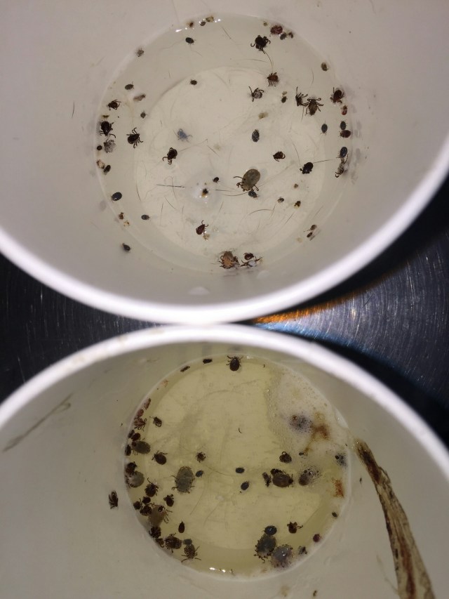
So we’ve managed to squeeze in a mini adventure. In planning for the Grand Enchantment Trail we had to obtain a permit to traverse Aravaipa Canyon. These permits are hard to get especially this time of year. In doing so , we had purchased and reserved two dates, this past Monday (April 24th) and Thursday (April 27th). It is a 12 mile traverse with limited permits (50 total) per day, and we were not sure exactly when we would arrive at the West entrance. Much to my surprise, I had purchased permits to enter from the East Trail head. This explains why it was so easy less than a month out. The West Trailhead is fairly easy to get to, accessible by 2WD and relatively close to Phoenix and Tucson. At this entrance they issue 30 permits/day. The East Trail head is a completely different story! The East Trail head is allotted 20 permit/day for those brave and adventurous souls with plenty of time on their hands…and a good 4WD vehicle. Thus said, we clearly fit the bill for the East entrance. Our plan was to thru-hike the 12.8 miles of Aravaipa Canyon, from east to west, camp at the campsite by the Brandenburg Ranger station, and then spend the next two days walking one of the alternate routes listed by Brett Tucker on the GET FaceBook page. We did however call “Heidi” the Ranger for the Aravaipa Canyon to see if there were any “easier” routes back to our vehicle on the East end, and/or if she knew of any cancellations for Wednesday or Friday, in hopes of just doing a yo-yo (up and back the same way) of the canyon. Unfortunately we were out of luck. She, however, told us that we should check the recreation.gov website again to see if something opened up. The bad thing is that unless someone actually goes back into the Recreation.gov site and cancels their reservation or calls “Heidi”, or the BLM station for that area directly, they would never know if people decided not to use their permit and “ate” the fee as you have to cancel two weeks in advance to receive a refund. Being conscientious people, we made sure to cancel our Monday reservation as soon as we were sure we wouldn’t be able to get out there by that date, which by that time, of course, was not within the 2 week period. So out to Arizona we drive Tuesday afternoon. Our plan was to get as far as we could toward Safford, where the BLM HQ was in order to get some better maps for our trek back to our car (from the West entrance)…and to get a better ideaof what the water situation would be for said trek. We made it as far as Gila Bend, AZ and stopped at Sophia’s Mexican Resturant. It is a non-descript building just off the 8 interstate hwy, a place that only “locals” would gravitate to. When we arrived it was full of “locals”, so we knew we were in the right place and the food had to be good. Paul had a burrito and I had carne asada soft tacos with a tamale. We were not disappointed . As we were adjacent to BLM land, our thought was to take a side road and set up our camper and “homestead” for the evening, then we thought better of it, considering it was pitch dark, and frankly we were in Maricopa County close to the border. As luck would have it, there was a KOA in Gila Bend 2 miles from where we were. Our better judgement won out over adventure.
The next morning after an okay night’s sleep (it seems that every KOA we stay is located near freight train tracks), and a hot shower, off to Safford we headed. We made it to Safford in the early afternoon and spoke with “George” at the BLM Office. She had limited knowledge of the route wanted to take, but was able to find the appropriate maps and more importantly was able to rustle up an authority on the area. After a long discussion of our intended return route (doubtful of water) and the fact that (for us) the navigation would be a little dicey, but doable, we were given permission to Yo-yo the Aravaipa canyon, even though all permits had been reserved for that Friday, and that we essentially had already paid for the additional day in the Canyon. After a stop at the local supermarket (Thriftee Food & Drug) for ice and a few vittles for dinner, we were off to the East entrance.


Nearly 3 hours later over mostly graded dirt road (70.1 miles to be exact) and a stop at the Salazar Family Church (an adobe building, that is a functioning Catholic Church) we made it to the East Trail Head, where a sign said we could drive to and camp at Turkey Creek on BLM land (1.5 miles away). This last 1.5 miles definitely required 4WD. We parked at the trail head and set up camp. With an hour or so of daylight left we took an impromptu hike down Turkey Creek (that was essentially dry) following a 4WD dirt road with several fairly good size campsites lining the route. We passed by one site that looked like the occupants had moved in and had no intention of leaving for quite some time. Back at our camper we readied for our next morning’s foray into the Canyon proper.
This is essentially what our 3 hour drive looked like.
**More to come, next week, but first a girl’s ski trip to Mammoth #ForceOfNature #Springskiing
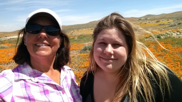
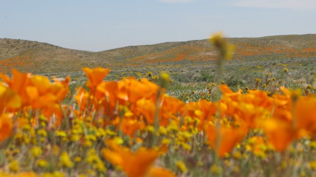
 This place is a definite treasure, if not for it’s preservation as an extraordinary natural resource, but for it’s design and accessibility that allows visitors to take a relatively easy walk amongst our state’s flower, the golden poppy (Eschscholzia californica).
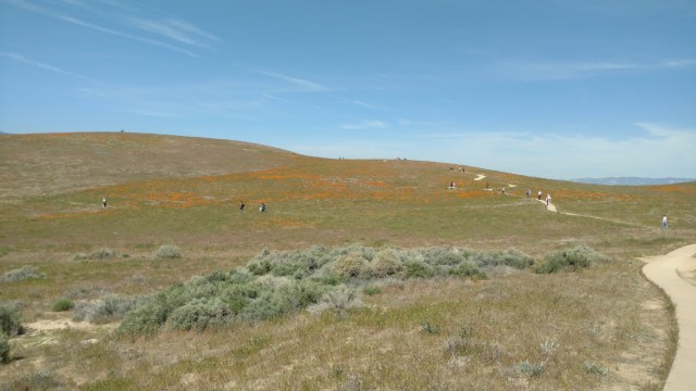


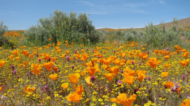
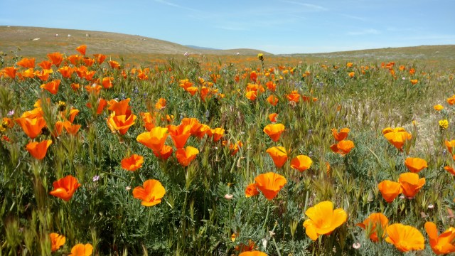
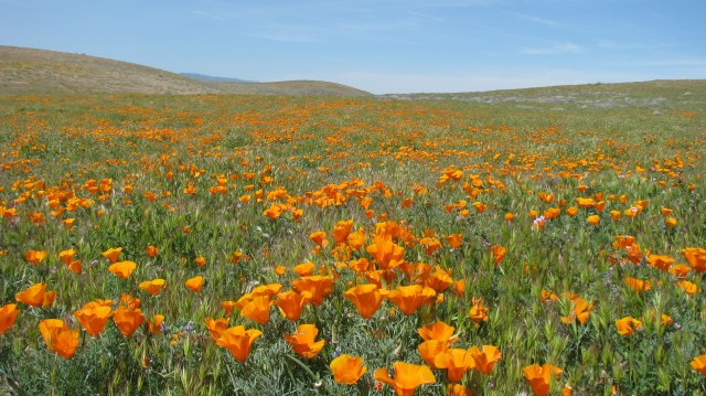
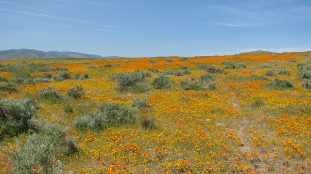 From here you will be treated to a rich flowing sea of color, that pictures can not aptly capture nor words dutifully describe. Continue as you see fit. Make sure you have sufficient fuel (for you and your vehicle), as well as water. We had some cell service with Verizon, but don’t count on it to bail you out if you get yourself into trouble. Stay on the hard pack and go slow as there are some soft pockets and significant dips in the road.
 ust outside of Albuquerque New Mexico. The trail includes portions of the


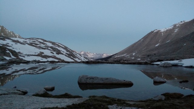
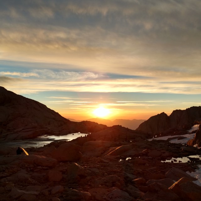 The three of us basked in the peaceful brilliance until daylight had fully awakened. Soon more heads began to emerge from tents scattered in-between this boulder strewn landscape. We would be headed down, while other’s adventures were just beginning. As we sipped our coffees and ate what little breakfasts we had left, we watched as pods of would be summiteers, some boldly and others tentatively, shuffled across the snow field to setup for their 1800 ft climb of the snow chute. It still being early in morning, the sun had not yet reached the face of the chute, and as such it’s face would be stiff and icy. A miss step would bring certain regression to ones starting place, if one were not careful. Some stood at the apex of snow and what should have been the beginning of the 99 switchbacks, bewildered and uneasy. Others searched unsuccessfully for even faint traces of the switchbacks hoping beyond hope that they could avoid the arduous climb up the steep wall of icy snow.
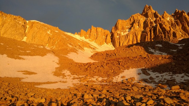
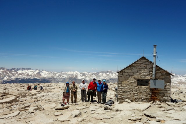
 A final farewell to the mountain we conquered, and then down we march, single file, toward Whitney Portal.
 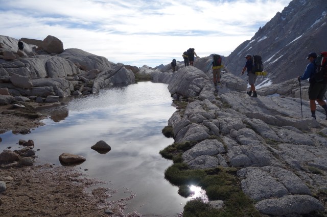 It’s only 7.6 miles, and downhill all the way, surely we will be to Whitney Portal by 11am we think, and to the Alabama Hills Cafe by noon. Ha Ha Ha, silly hikers. As with this entire trip, nothing is at it seems.


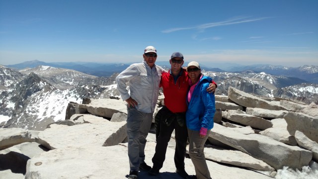
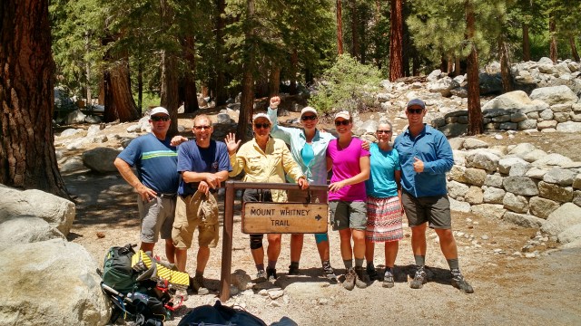 Once “business” is taken care of we quickly take a “team” picture, as we have no time to lose if we are to “Yogi” a ride down into Lone Pine 13 miles below. It is 1230 in the afternoon, and one or two cars appear to be heading back down. We waste little time, cajoling a ride for three of us (JAN, Trevor and Scout) into town. Paul, April, Jody and I have a bit longer to wait. We are turned down more than once. I guess picking up stinky strangers with backpacks is just too risky for some. Eventually we are graciously given a ride by two young men in separate cars who were hoping to drop one of their cars at the Portal to reclaim once they completed their 3 week hike of the John Muir Trail (JMT). We told them we ran into the same issues, hence our hitching into town. They figured it would be “good karma” for them to pick us up, as they too will need the kindness of complete “strangers” when they finish. They drop us at the Hostel in Lone Pine where we shower and wait for Jan, Trevor and Scout who had made a great decision to collect our two remaining cars at Horseshoe Meadow while they waited for us to Yogi a hitch into town. Our end goal was to dine at the Alabama Hills Cafe before they close at 2pm. It is 1:50 when they pull to the curb. We tentatively pull open the door to the cafe. “I know it’s almost 2 pm, but any chance you can feed some hungry hikers? We’ll understand if you are about to close and can’t”, Jan pleads in her most upbeat voice. ‘Come on in’, the waitress beckons. Faces glowing red and freshly sunburnt, crisp new t-shirts exclaiming we climbed Mt. Whitney, and hair still wet from a quick and glorious rinse we plop ourselves down and drool over the menu. The portions are hearty, as is our hunger, for “hiker hunger” had just arrived on our pallet’s door. We all but practically lick our plates clean. Fully satiated it is time to part ways and head back to each other’s respective “reality” that awaits our return. This has been a glorious trip. Who would have thought that such an eclectic group would fare so well on such an adventure. Might there be another adventure in store for the Magnificent 7?
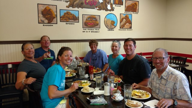
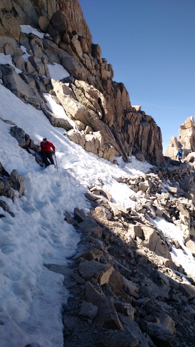
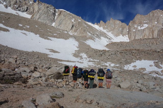
 We still have to make it safely back over all the sketchy parts we willed ourselves over and through in quickly softening snow and melting ice. As you can see Jan and Scout had no problem “scampering” down the trial.
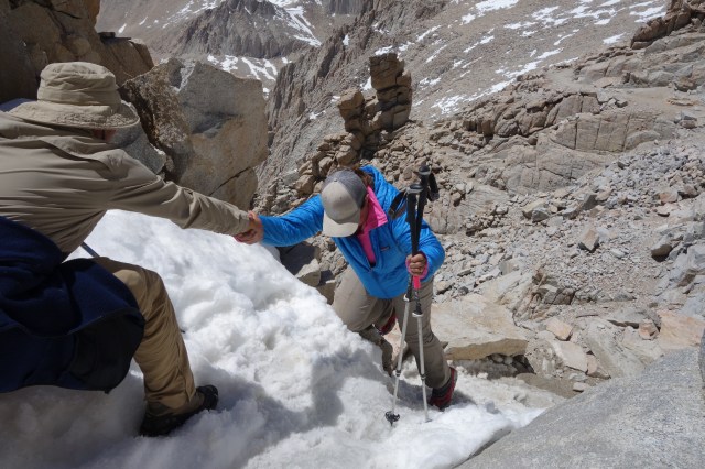


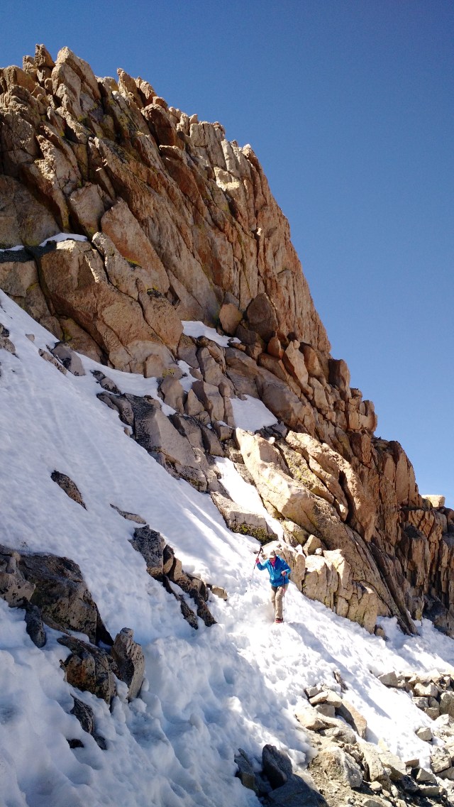
 As we reached our first water collection opportunity, it was time to utilize our Microspikes as several stretches of now crisp snow fields lie ahead hiding the trail from our view. Better to walk up and over the snow and in the general direction of the trail than to wander about looking for each twist and turn.


 We were told by many a PCTer that the rest of the way was “easy” and not as “sketchy” as it was coming up to this point. And the funny thing, is that we believed them! Had we known what we know now we would have stayed in Lone Pine and bought a post card, Googled photos from the internet, or turned around a went back from whence we came, but no we had to be adventurous. Goal #1 reached. Now to Goal #2.
 Once we had all breakfasted, taken care of “business” and packed, we set off at a leisurely pace. Steve, who has earned the trail name of “Scout” went ahead a bit earlier to commune with nature.
  When we caught up with him we found him up a tree, seemingly reenacting a scene from last night’s reading of stories from John Muir wherein Muir thought it prudent to climb a tree to better experience a weather event. We marched along single file huffing and puffing with each rise in elevation. The day was already warm, so Jody(aka. SideKick) and I decided to walk from shady spot to shady spot, and to drink at every other one. Remembering that we should walk slowly through the shady spots and fast through the sunny ones, we applied Teddy’s sage advice again. While that put us at the back of the “herd” we were happier and not so winded.


 When we lighted upon Guitar Lake, thin islands of ice covered the water’s surface. A lone hiker stood at the water’s edge willing herself to go in. Several thru-hikers had just returned from summiting Whitney and we’re packing up to reconnect with the PCT. Others had just arrived too, and were in the process of setting up for an early morning call to Mt. Whitney. Marmots scurried about using a distract and strike method of engaging those already set up as a means to steal their food or lick/chew the salty sweat from their gear. One PCT thru-hiker told us that one of his friends had the cork handles of his trekking poles eaten. Another had his pack’s shoulder strap nearly chewed through. Upon hearing these harrowing stories, we wondered aloud how a marmot would taste (like chicken?), as we determined that would be the fate of any that dared nibble on our gear… provided we caught the cheeky bastard(s). We were told that it is possible to camp at the Tarins (smaller lakes above Guitar Lake), but had conflicting information from hikers heading down as to whether it was possible or even a good idea considering the current sogginess of the soil. “Scout” volunteered to cross the creek that feeds into Guitar Lake, and see if he (Jan and April) could find a marmot free-ish place to camp, and were highly successful. As we set up camp, we peered in earnest through Scout’s small set of binoculars (yes, he brought them… This man is prepared for just about anything, hence the trail name of “Scout”) to catch a glimpse of tomorrow’s route.
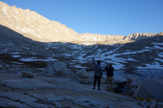
 Thus, after collecting enough water for our assault on Mt. Whitney, and watching in amazement at Trevor swimming (actually swimming in an ice filled lake)
 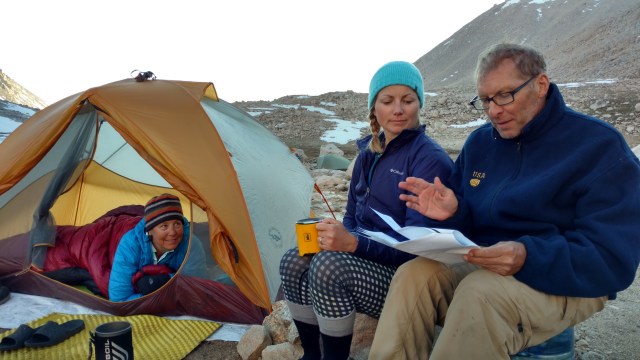 This evening ended as all evenings have ended so far on this trip with a bedtime story about John Muir from “Scout”. Based on the crazy things Muir did and how he describes the things he sees, smells and hears, I’m seriously beginning to wonder if he was tripp’n on acid. The man had no regard for his safety and was enthralled and obviously most comfortable playing/staying outside. He was a man way ahead of his time, with some amazing foresight to push for the preservation of these types of lands for the enjoyment and rejuvenation of/for generation upon generation. While I often curse Muir loudly and under my breath when trekking up some massive mountain or climbing over and through fallen logs or squishing another blood engorged mosquito, I thank visionaries like Muir and Presidents: Lincoln, Grant, Roosevelt, Taft, Wilson, Truman, Kennedy, Johnson, Carter, Reagan, Clinton, George W. Bush, and Obama for the foresight to champion the preservation of these and other significant and unique National treasures, whose very existence allows for opportunities of pure joy, peace, reflection, rejuvenation…and frankly, a truer connection with ones Creator. There is a reason we call playing outside, recreation, for it truly is the re-creation of the mind, body and soul.
