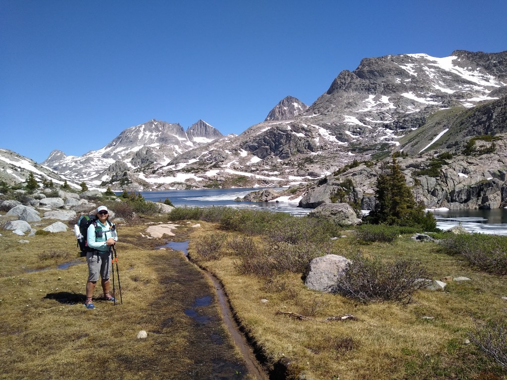
July 13: Day 25 (1872.4 – Dubois, Wyoming) 12.1 miles
After sleeping with my ankle taped, elevated and with the compression sock on, I awoke to no pain. Careful, slow walking was the day’s “first course”. But the slow walking allowed us to happen upon two bull moose feeding at a distance we were all comfortable with. We did our best to capture the sight with our phone.
Two Bull Moose
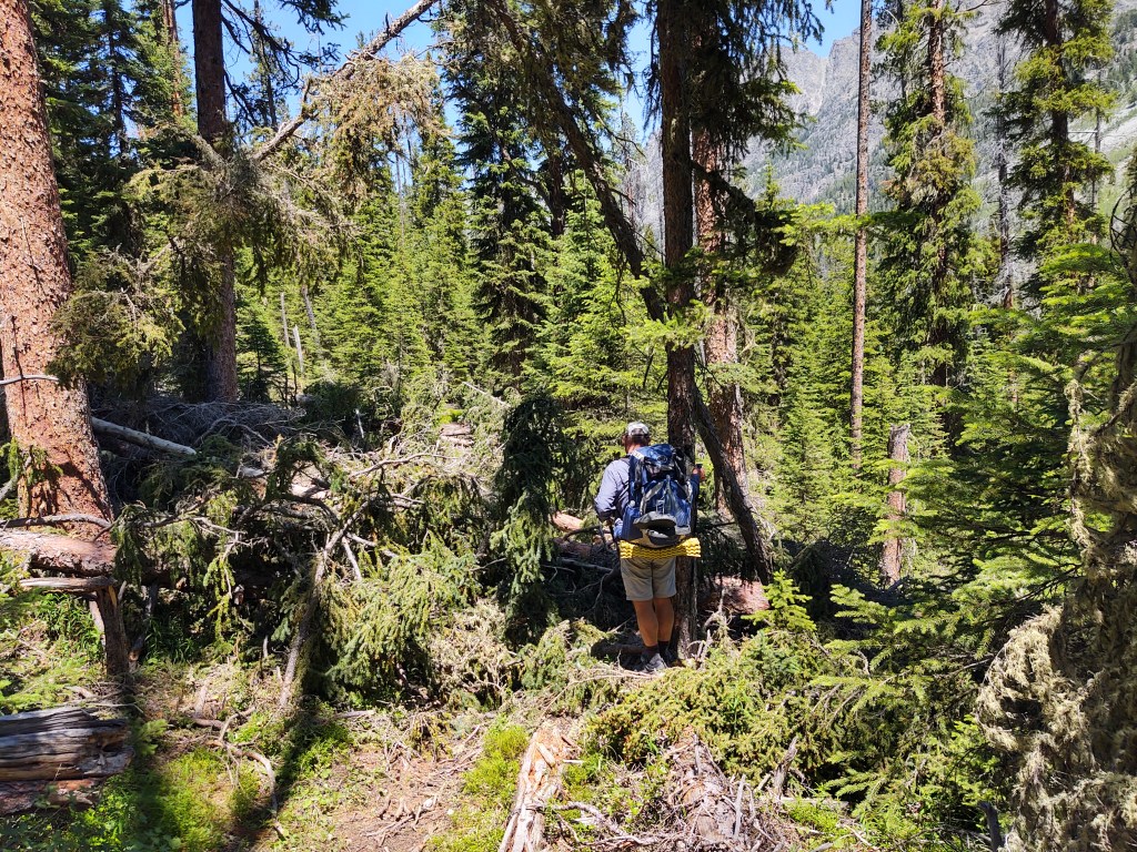
As the trail continued through increasingly jumbled terrain, we took to calling the trail the “Elk Highway”.
It was trampled and pocked with recessed hoof prints in the boggy mud, and semi dried portions of the trail. It was like trying to roller skate on a dirt road. Frustrating.
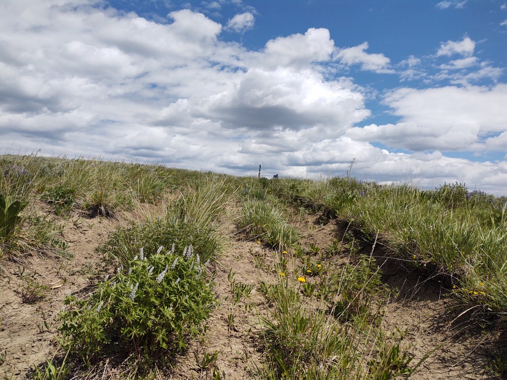
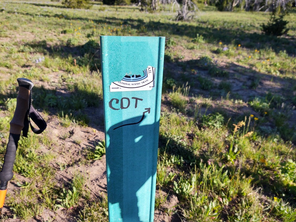
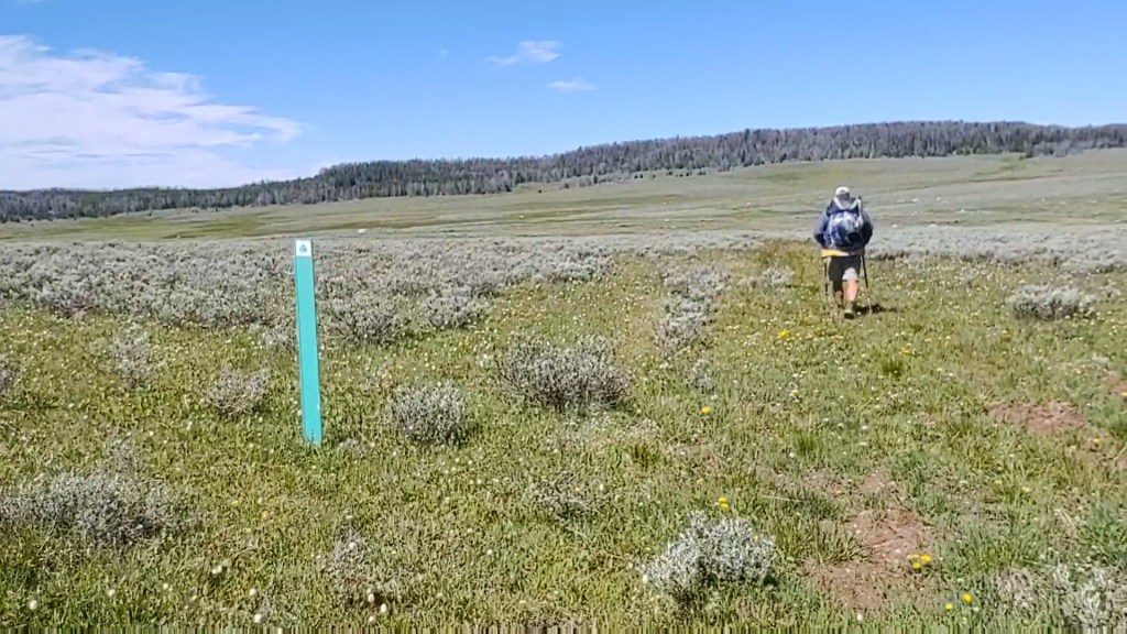
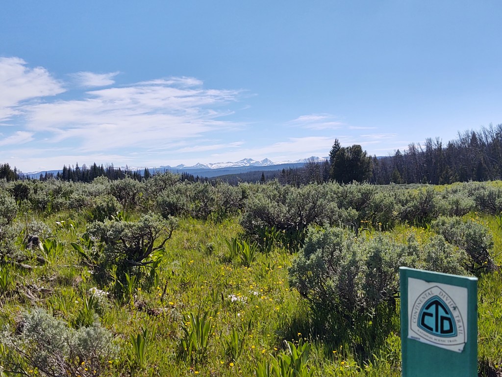
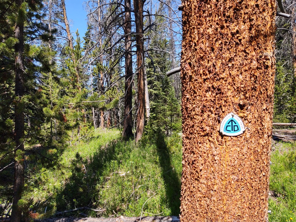
Eventually the terrain opened up and we were back to the “Where’s Waldo” of CDT markers.
This year also debuted the new reroute of the CDT, which we took, now being totally devoted to staying on the “red line”.
Unfortunately, the rerouted trail has not been fully etched in the dirt. Trail crews, due to COVID-19, at the time we walked by had only completed 2 miles.
Orange tape and CDT trail signs tacked to trees mostly linked the new reroute together.
We we’re lucky enough to be the first ones to walk upon a newly completed bridge and two additional miles of perfectly groomed trail.
The trail crews from Idaho and Montana (didn’t quite understand that) were cutting trail from one end and working toward each other, to the middle of the, I believe, 5 mile section they were building. This meant the “middle” was mostly a bushwack. But, cut logs helped with trail discernment.
The newly built trail certainly helped reduce the time it took us to get to Hwy 26.
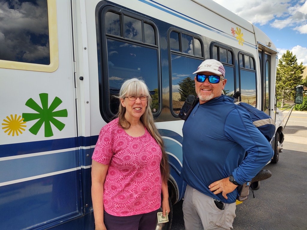
Once there we set about to hitching to Dubois. As luck would have it, we were able to Yogi a ride from Pastor Mike on a Bike ministries.
Actually Pastor Mike’s wife gave us the ride in their motorhome, while Pastor Mike rode his bike into Dubois.
We checked into The Black Bear Inn, and got their last available room. The owner, Liz, was so excited. We were her first CDT hikers. By the time we left Dubois, we weren’t the only ones in town.
Our first order of business, seeing as we had exhausted our food supply was food, and what else, but the elixir of thru-hikers.
Considering how our day started and ended, it’s a miracle that we even covered 15 miles.
Up with the sun we tugged on our wonderfully dry shoes and trotted off down the trail. It was a beautiful Sunday morning that deserved some good ol gospel music. Music blaring we descended down a perfectly kept trail. After, of course, negotiating a tremendous tangle of intertwined blow downs.
Undaunted, we continued down the trail, which we noticed had a stream not listed on Guthook. We remarked to each other how thankful we were to NOT have to make this climb. Oh, the poor SOBOs (south bound CDT hikers) we thought. And then it hit us.
Aren’t we supposed to be on a moderate climb by now, with little water available?
Did we miss a turn?
Is this the wrong trail?
The resounding answer to all three questions…YES! Dammit! We were now a solid 3/10ths of a mile off the CDT.
Do we walk halfway back up and then bushwack the remaining distance up the side of the hill back to the trail?
Does this trail we are on intersect the CDT further down?
What trail is this anyways?
Per my Earthmate mapping on our Garmin InReach Explorer +, this trail was ironically named, the “Devil’s Basement”.
We had been headed to the “basement”
Begrudgingly, we made an about-face and trudged back up the 3/10ths of a mile (we were initially glad that we didn’t have to do), to the turn we missed. When we got to the missed turn, we saw that someone had placed a tree limb in the trail we had taken to keep us from taking the wrong path. We had deftly stepped around it. And, there was a sea foam green CDT marker we had passed, but the CDT sticker was absent. Not wanting anyone to make the same mistake we did, we fortified the debris across the inviting, but “wrong” (Devil’s Basement) trail and “refreshed” the CDT marker, absent having a new sticker.
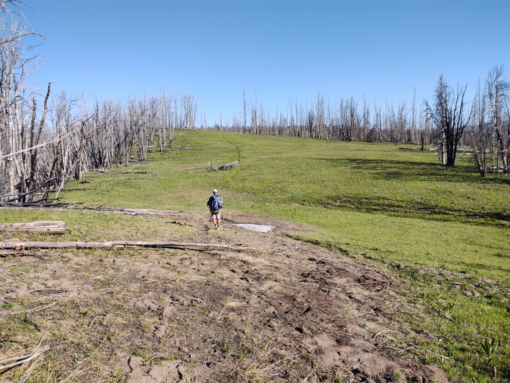
Once back on the proper route, we rolled up and down across meadows and through fire ravaged stands of trees. The trees eeriely resembled tombstones. Many leaning upon one another, as if in mourning.
And, as these monochromatic, seemingly lifeless, logs swayed to and fro with the wind, their trunks and limbs rubbed together mimicking the sound of people in whispered conversation.
The CDT trail through this section, was obviously a favorite for the resident elk. In fact herds of elk. Hilltops trampled and stripped of vegetation, and hoofprints baked into a once muddy trail made for tedious walking.
At one of our last breaks, we filtered water from a very shallow spring, guarded by frogs. We couldn’t understand why it was called “Pipe Spring”. “Frog Spring” would have been more appropriate. The fact there was no pipe should have been a clue, for after we had collected water and had a lengthy break, we walked a bit further only to find perfectly good (frogless) water flowing freely from an extended pipe…. geeze.
As it was cloudless and hot, we looked on the Guthook app to see what our water situation would be. No real mention of “reliable” water made for a long water carry. This didn’t make sense to us as the topo map showed the trail traversing down through a narrow draw in which it appeared a creek flowed. The topo was correct, and there was plenty of water. I guess when water is obviously abundant, there’s no need to “list” it.
At mile 1864.9 we came across a big Cat print in the mud. This inspired us to be a bit more vigilant about looking over our shoulder and behind us from time to time.
As we continued to descend, the trail was swallowed up by the surrounding vegetation. We ended up using our Guthook app like a devining rod, to point us in the right direction.
Trail swallowed up completely.
Continuous uneven, ankle turning, terrain gives my right ankle fits. I have a history of rolling it, and a previous spiral fracture of my fibula. At the base of the fibula a ligament is still held in place with a titanium screw. The ligament is so stretched out that it sometimes “slips” over the “wrong side” of my fibula, which is excruciatingly painful, and takes anywhere from 5-20 minutes to “slip” back into place on its own. This happened during the final steep descent toward the Pole Creek Trail into Pinedale two weeks prior. As we were “on a mission” to get into town, I didn’t necessarily allow the ligament to slip back into place on its own. I kinda “hurried” it. With my ankle currently feeling like my foot was on backwards, I think my previous haste has finally caught up with me. As we just gotten down to an old flat abandoned road, that was now the CDT, it became impossibly painful to put any weight on my right foot. Each attempted step caused me to buckle to the ground due to its fierce searing pain. In many ways I was thankful that the ankle “waited” till we hit “level” ground.
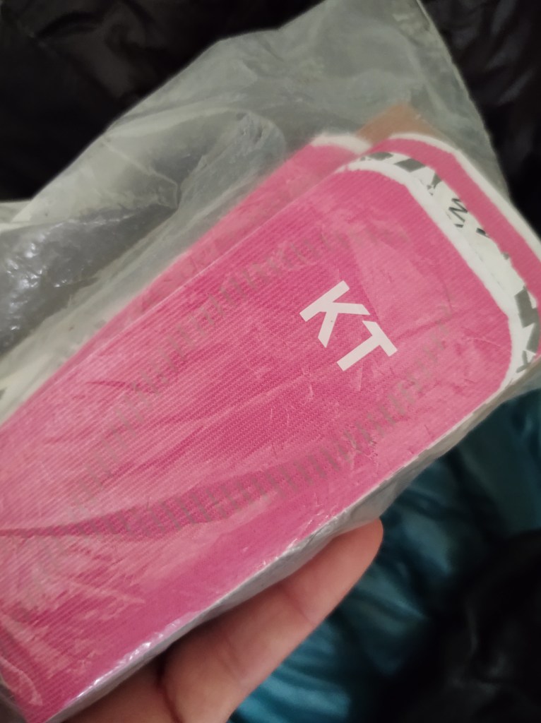
With all hikes I carry a supply of KT Tape, namely to keep my left knee “together” and supported. Our only chance to be able to continue, vs throw up the tent and call it a day, was to see if I could immobilize my ankle enough with my KT Tape to reduce the movement and corresponding pain. We had not planned on going into the town of Dubois, as we had a resupply package waiting for us at Brooks Lake Lodge, but it was apparent that this ankle required some attention. A prayer, some tape, 800mg of Ibuprofen, and a knee high compression sock did the trick. (My college athletic trainer days have served me well) I was able to gut out another 6 miles, much slower than my normal “slow” pace.
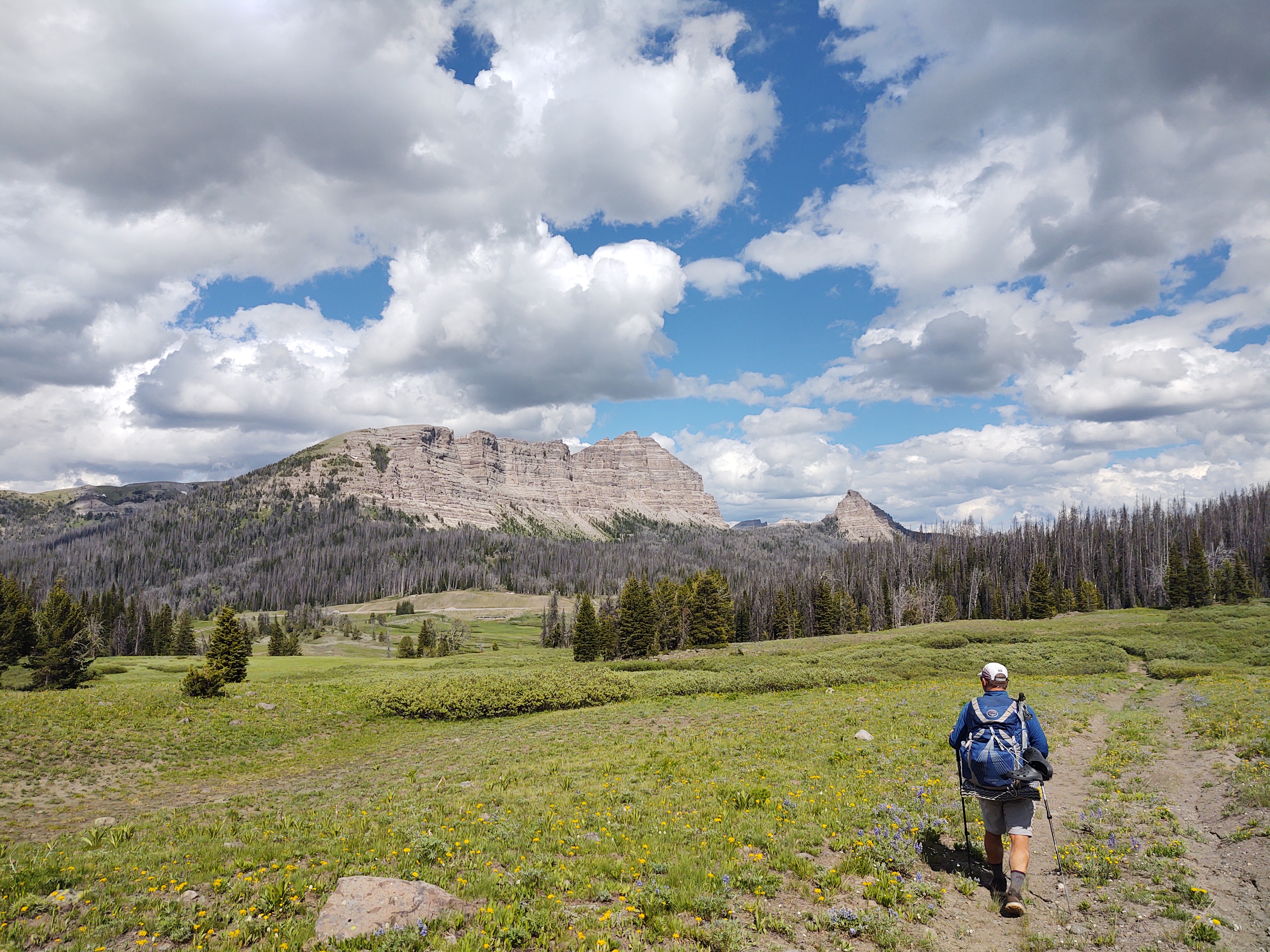
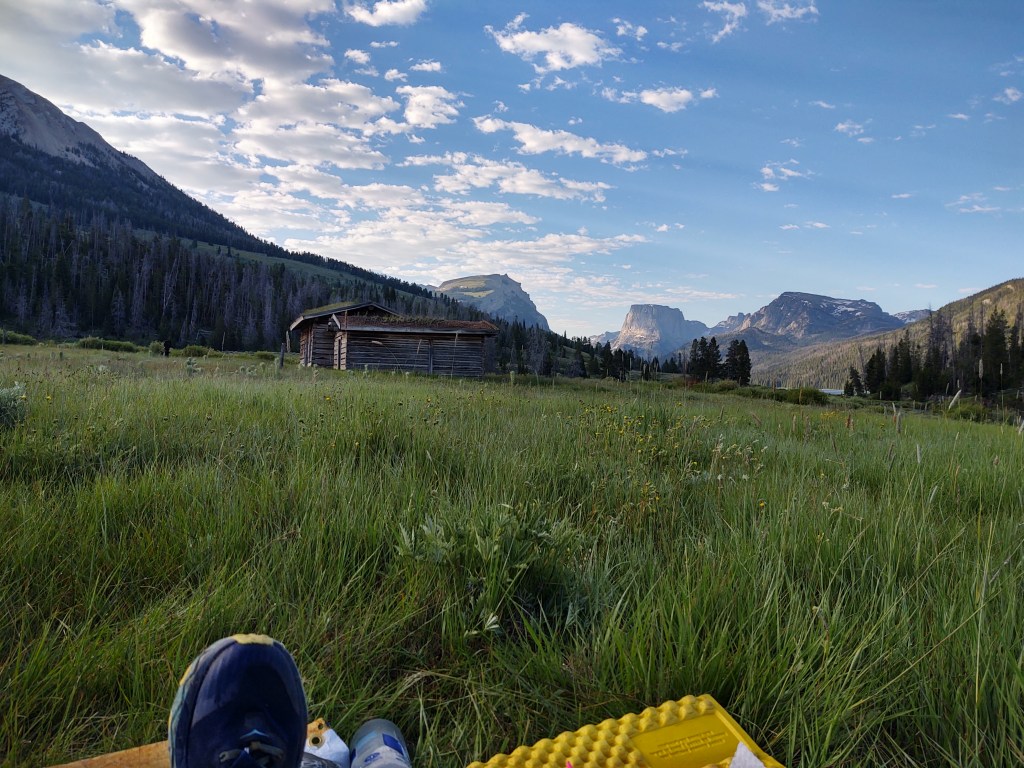
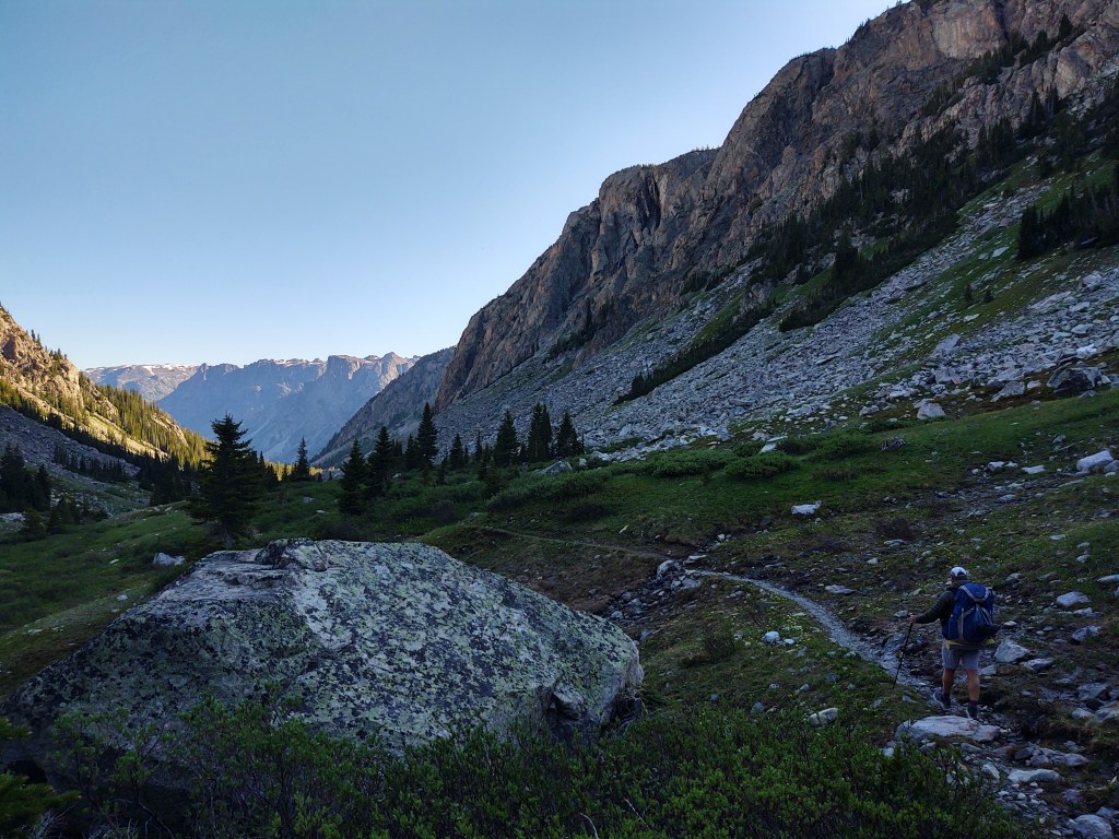
North Breccia Cliffs near Brooks Lake Lodge and Togwotee Pass
This left us with 12 miles to highway 26 and Togwotee Pass We had one day of food left. We hoped that morning would find my ankle in better “condition”, and/or my tolerance to pain at “record” level.
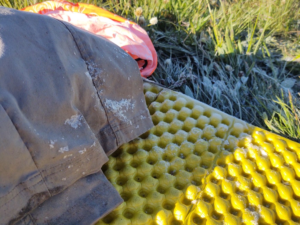
We knew we were fairly close to the river, so we expected heavy condensation and everything to be wet in the morning, but we never expected to be fully frosted.
Left my pants outside as they were still a bit wet from creek crossing the evening before
Rather than water droplets on our fly, there was a sheet of frost and fairly good sized ice crystals. Our water bottles were partially frozen and our shoes and socks…fully frozen. Funny, we don’t remember it being cold last night.
Frost coated the tall grass all around us. Birds were already busy chirping and moving about. The sky was largely clear of any evidence of potential growing cloud cover. The morning was crisp, but all signs indicated that it was going to be a gorgeous day.
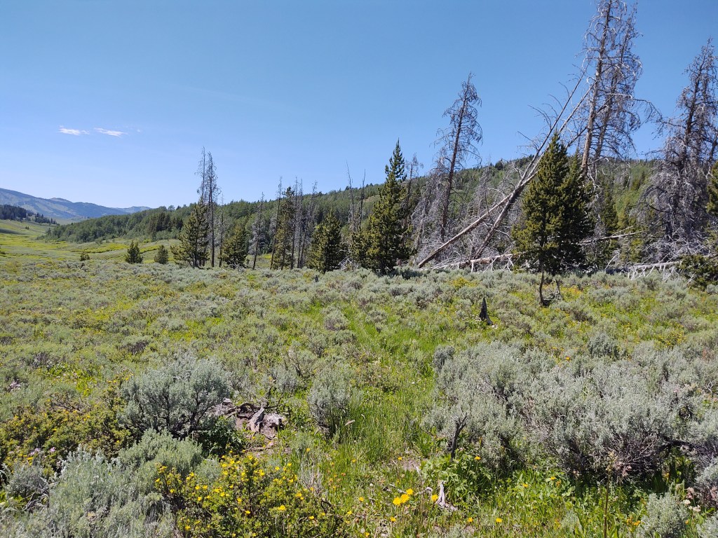
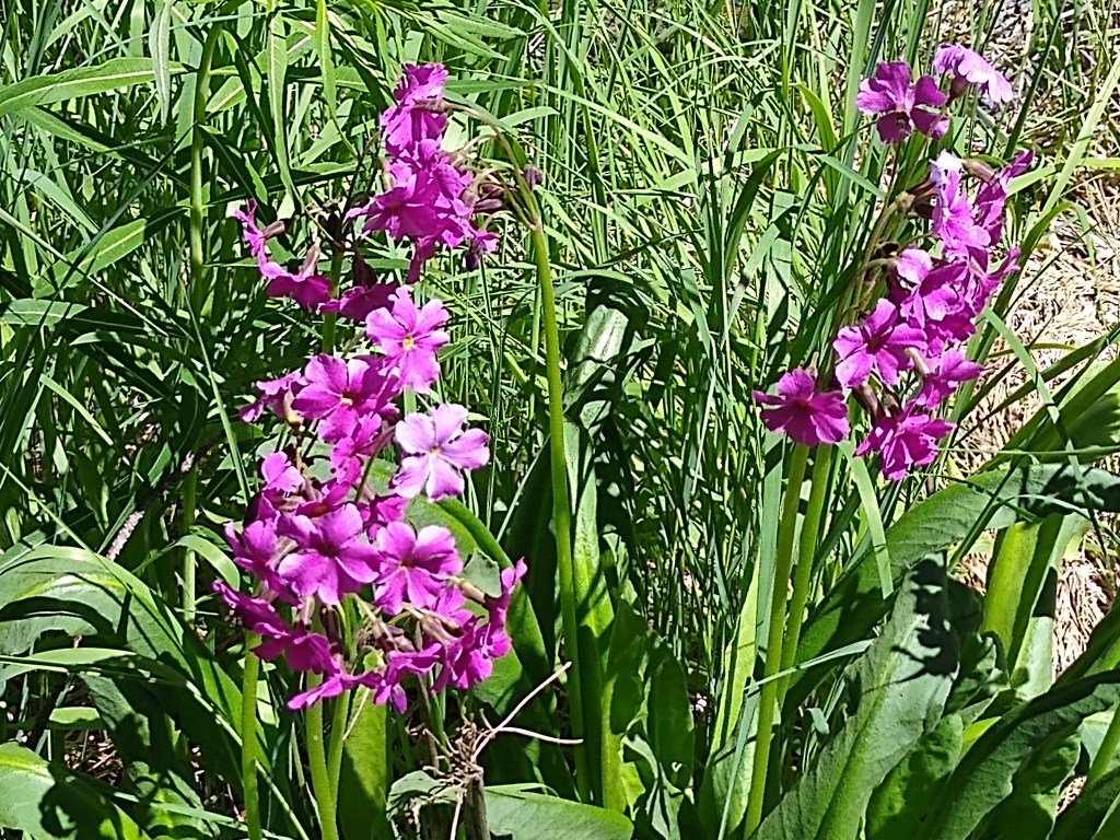
Rolling fields of brightly colored wild flowers stretched as far as the eye could see. The “Sound of Music” played in my head. Paul quickly became annoyed at me stopping to capture each flowering distraction. “Next time we go on a hike, I’m gonna make sure there are NO flowers!”, he chided me. So here is what we saw. If you can identify them,please let me know.
Lake of the Woods
We wove our way through chaparral and forested areas that eventually led around the shore of a seemingly never ending Lake of the Woods, whose “leaky” shoreline created an oozy bog for us to dance through.
The trail fed into a Jeep road where we eventually had our obligatory missed turn back onto the find and seek CDT path.
Brown fiberglass slats with CDT stickers changed without warning to green fiberglass slats, with and without CDT stickers.
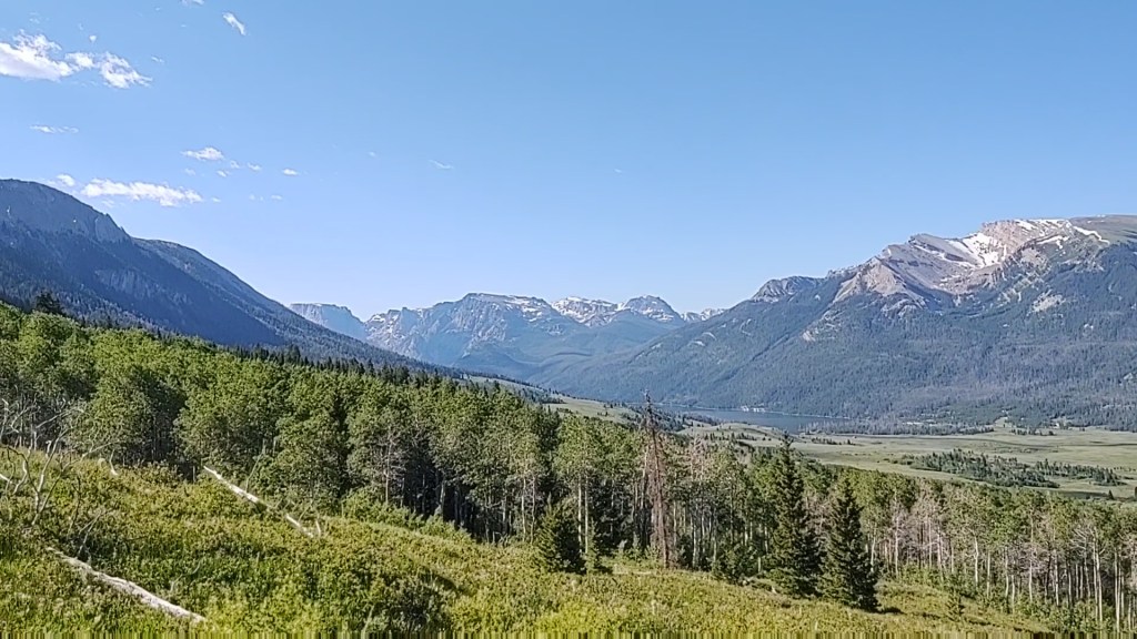
Prior to a cross country find and seek jaunt across the belly of a wide meadow and afternoon climb, we had a million dollar view lunch break. While reclined on a gentle hill beside a barely 2 foot wide bubbling brook, we feasted on tuna, chips, and “fun size” candy bars, all washed down with freshly made icy cold lemonade, while gazing across a flower accented meadow and the sharp rise of what we believe we’re the snow capped Grand Tetons.
The sky and air were crisp and clear. Our pack’s “exploded” contents basked in the sun all around us, like we owned the place, simultaneously drying and airing out their stench as best the sun and slight breeze could do. We would have stayed here for hours and napped, but miles beckoned.
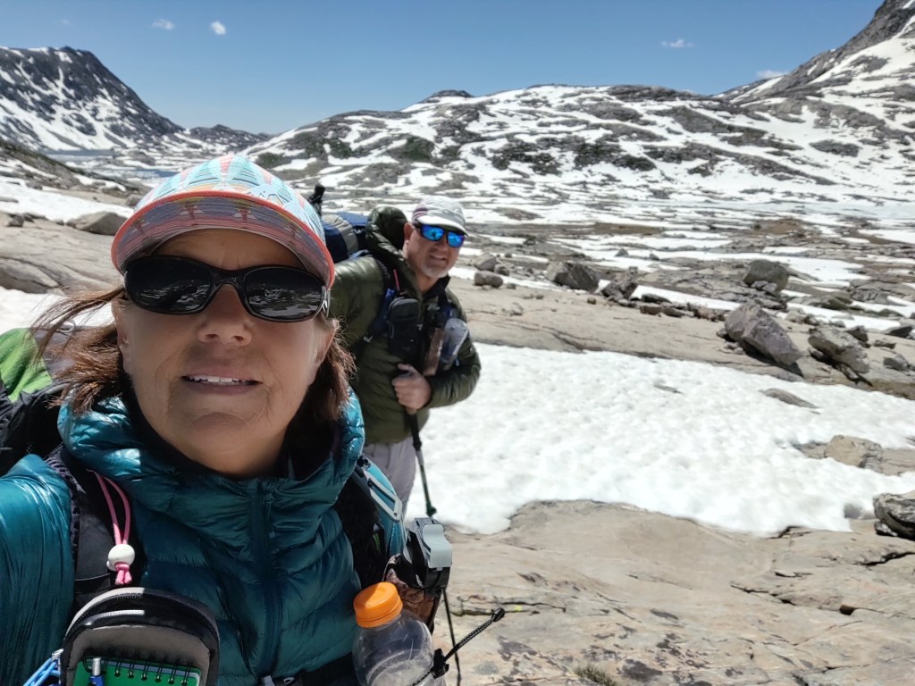
All packed up, we began another chapter of “Hand Me the Binos” (of which we don’t have), spotting and traversing from sea foam green CDT marker to CDT marker, trying to pick the best footing to each.
The trail crawled around the edges of now growing hills with seeps and springs nestled within the folds. With the wind in our face we came around a bend and caught our first glimpse of a small herd of elk. We watched and eased closer to them as quietly as we could in hopes of capturing the moment digitally. Not a chance, as they caught onto us and deftly walked up and into the trees and disappeared.
Having finally gotten our wildlife viewing “fix”, we called it a day and set up for the evening. Additionally triumphant that our shoes, although dusty, were actually dry.
It’s the “little” things that one begins to appreciate on a hike such as this.
We thought we let ourselves “sleep in”, but nope, we still woke up with the sun. Not setting an alarm to get up and moving is great, but waking up at the same time we usually set an alarm is just WRONG, so we lingered a bit over breakfast. This hike was supposed to be “organic”, a no push miles, set loose goals (with food supply in mind of course) kind of thru-hike.
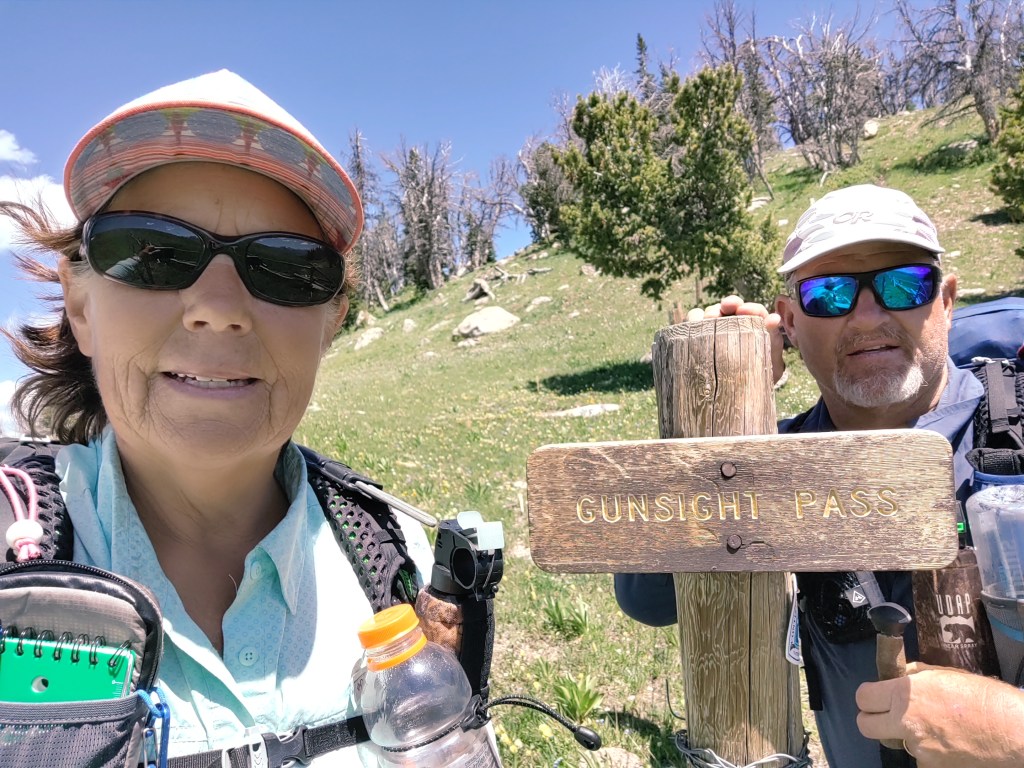
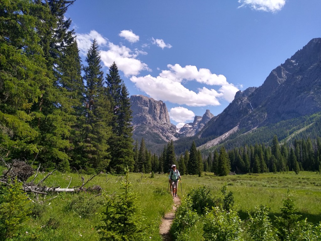
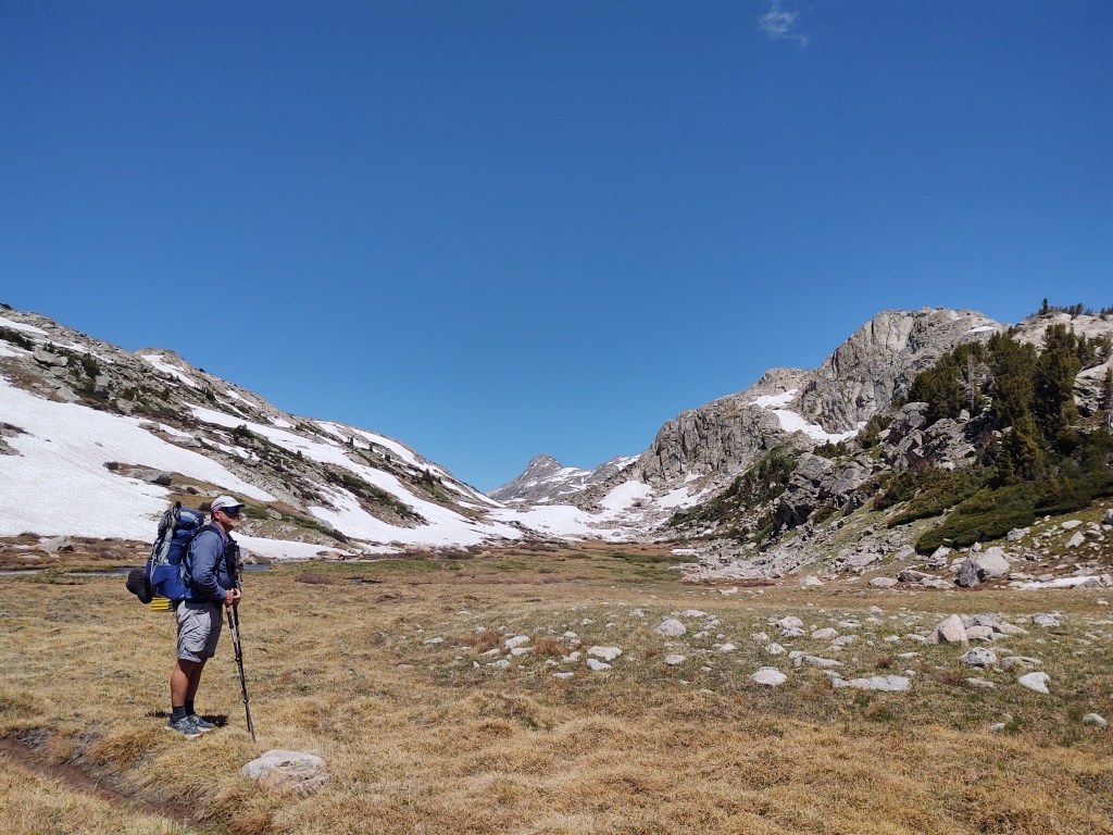
Our one and only goal today was get up and over Gun Sight Pass (10,158 ft.).
The moment we left where we camped, the slope ran uphill. But then every morning begins with an uphill. This one just happened to be a prolonged, 8 mile ascent, which isn’t so bad when you have lush flowering greenery and wildlife to keep you pleasantly distracted from your body’s “assignment”…climb.
Much more colorful than “captured”…you kinda have to be there to get the full effect
We suprised a few deer and pronghorn with our presence. This caused them to pick another route to their morning sun. The trail climbed “gently” for the most part.
I wish Jan were here, she’d know what these are. I just know they’re pretty.
First through low sage brush and flowering wildflowers, then through inlets of dense pines and groves of *familial Aspens.
*Fun Fact: Aspen groves are connected by one root system. Their roots only go as deep as 12 inches, and extend outward whereupon, suckers (actual name) shoot off from the roots and emerge as new saplings, growing into full Aspens. A tapestry of interconnection.
Some recent trail work had been done to remove blow downs and repair boggy trail parts.
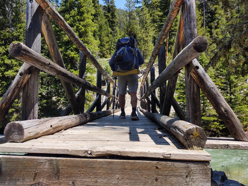
A sturdy bridge stretched over a robust creek. I crossed first and then Paul. As I looked back I noticed a CDT marker nailed to a tree on my right. I hadn’t noticed one when I had been facing (what we thought was) down trail.
This led us to check our Guthook app. Yup, after the bridge hard, I mean really hard, left. We would have missed it, as the trail seemed to continue straight. It did, but it wasn’t the CDT.
For most of the morning the trail essentially meandered up in elevation with occasional long switchbacks. However, when we were within 3-4/10ths of a mile from the pass the switchbacks disappeared.
Top of the pass is to the left where the cloud touches. See if you can find Paul in this photo.
It was a straight shot to the crest…in the mid-day sun. We should have studied elevation chart a little better, and maybe NOT “lingered” at breakfast. Even with our calves and lungs burning, the view from our “rest stops” was incredible.
We could see where we had been earlier that morning, and it seemed like a lifetime ago.
A touch windy at the top
Over the other side of the pass opened a whole new chapter in our hike.
Rock strewn tread became soft and dusty. Our feet were dry, and if we wanted them wet, we’d have to arrange to get them wet. At our lunch break, we did just that. We rinsed our stiff, dust choked, socks in the creek as we soaked our hot and chaffed feet in the swirl of icy healing. Our tent, it’s fly and our sleeping bags were all spread out to dry in the bright sun.
The rest of the day was pleasant for the feet, calves and eyes. Although my left foot/calf were still “grumbling” to me about the climb. The colorful carpet of flowers, swaths of color, and “mindless” tread helped quiet the grumbling.
Half the size of a shoe print next to it.
Here we would see our first wolf print. Better a print in the mud than a furry sharp toothed muzzle.
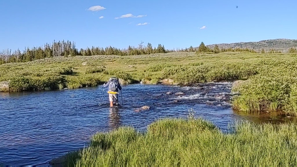
And to think we almost made it a WHOLE day without getting our shoes wet!
After crossing a creek we pulled off the trail. Tamped down the tall grass, and called it a day.
Oh ya. And one more thing. First toenail casualty.
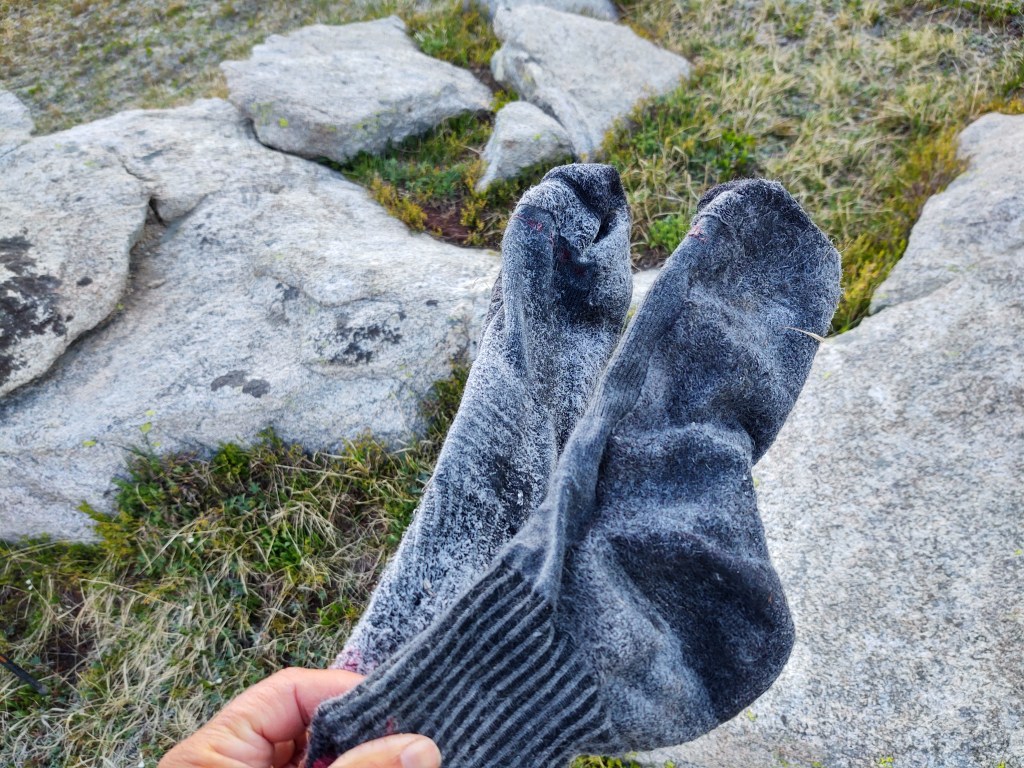
Something about a hard day makes you sleep so soundly. It must have pretty cold during the night as well, because our socks and shoes were frozen solid when we awoke.
Not stiff because they are dirty…this time.
Luckily there were large boulders nearby so we could pound our shoes out enough to squeeze our swollen feet into them.
Today was all about going downhill. Rock cluttered trail soon turned into easy wooded trail, which became the norm for the day. In fact, at mile 1812.6 we walked on the most perfect trail for about 30 yards. Perfectly flat and cushy, like walking on carpet.
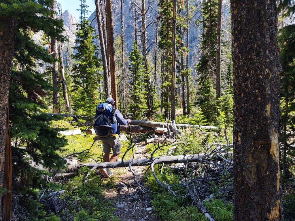
Some of the “easier” blow downs to navigate
As we were nearly to the Green River Valley floor, we were besotted by blow downs galore.
Hmmm. How to breach this?
Not just one or two trees, but “flocks” of them at a time. This made for ridiculous impromptu “parkour” reroutes. This went on for 3-4 miles.
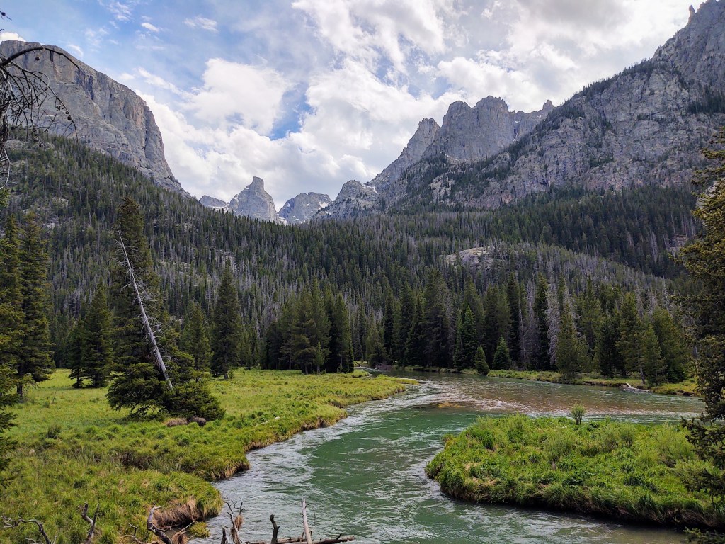
Once we hit the valley floor, we were in awe of the narrow valley of which the aptly named Green River ran through.
If we didn’t know any better we’d thought we were in Yosemite Valley
It was if we were walking in a “mini” Yosemite Valley.
View looking toward Lower Green River Lake
Beautiful green meadows with massive granite walls and towering peaks.
Green River
We crossed side tributaries of the Green River several times until a hearty bridge put us on one side of the Green River that led to Lower Green River Lake.
* Interesting side note: The Green River Lakes are major tributaries to the Colorado River system that empties into the Sea of Cortez.
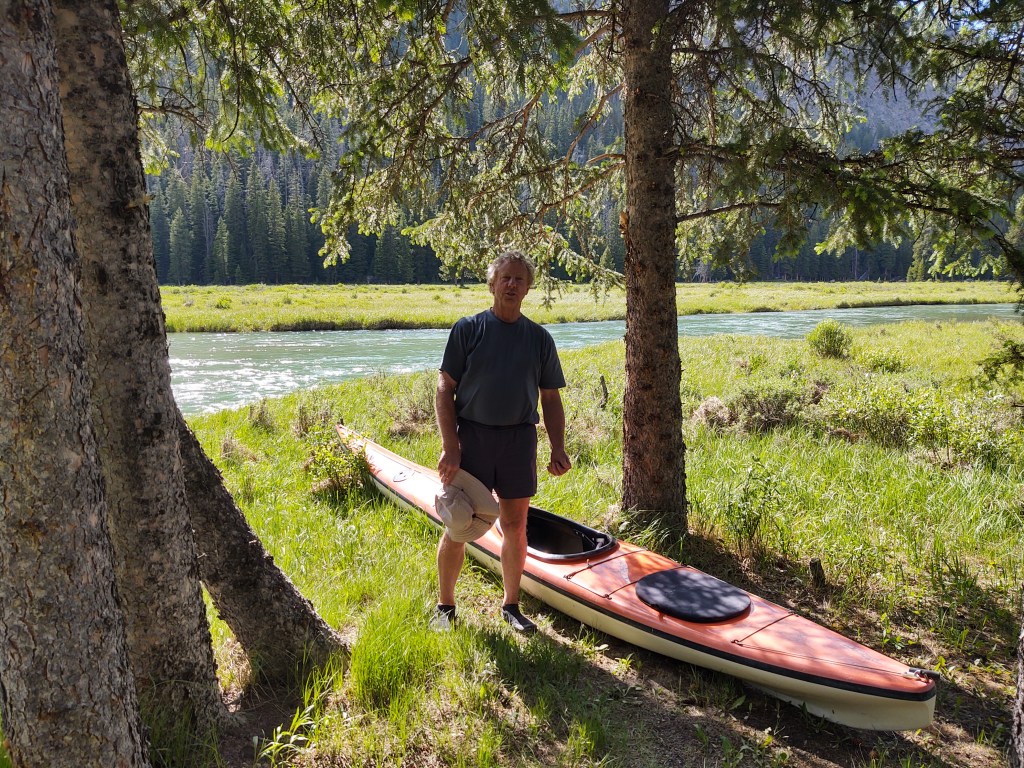
We walked along side the river and came upon a man lounging on its bank.
We struck up a conversation with the man (Rick) and it turns out that he had hiked the Pacific Crest Trail in 1975. He had great stories and we compared town stops. Funny how things trailside stay the same over the years. He walked and talked with us for several miles, as he was returning to his kayak to paddle back to Upper Green River Lake where he was camped.
Once we departed from Rick’s company, we thought we got a great idea. We’d cross over to the other side of Upper Green River Lake and walk to the campground and see if we could Yogi a beer or soda from some campers. Dumb idea. Nobody was really out and about their campers as we went through. We had to settle for water at the spigot. From there we crossed the bridge back onto the CDT, where we came across another CDT hiker, “Lunar” who was fishing. He and his wife “Luna” were flip flop “self-supporting” sections of the CDT. We would see them two other times.
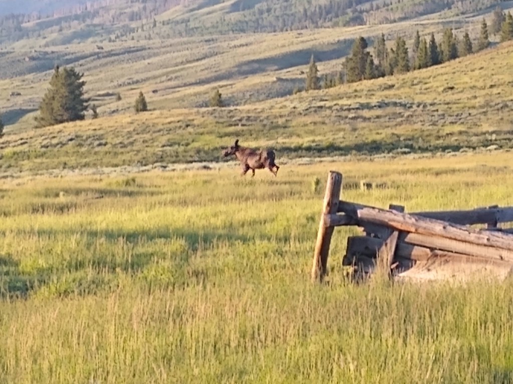
We ended up setting up camp near the river and next to an old now abandoned cabin. Here we would see and have our first wildlife encounter, with a cow moose who trotted by us while we heated water for dinner.
After having fallen asleep to the sound of the “jet engine” creek, the night before, we awoke to frost on the grass and ice in our water bottles. This was totally unexpected and should have been an omen for the day’s progress.
We had the Fremont creek to cross in 2 miles, and from the sound of it, we hoped there was a bridge.
We were pleased to find a bridge when we turned the final switch back down the the “creek”, which ran more like a river.
Fremont Creek
Just after we crossed over the bridge, we spied a hiker headed our way. His attire and pack screamed “thru-hiker”. We were correct, as it was “Feral” (as in cat) and he was doing a flip-flop section thru-hike of the CDT. He too had started in Rawlins. His phone was his only means of mapping, and communicating, and he was low on battery. He had lost his USB-C cord to charge his phone with his extra battery.
“Feral” and “Just Paul”
We lent him our cord and shared stories and trail information as he charged his phone. His predicament, further justified our choice to buy the Garmin (formerly Delorme) inReach Explorer +, as opposed to the smaller and lighter Garmin Mini. Both devices can link to your phone display via the Earthmate app, but with the Explorer+, you have an additional screen option to view routes and trails in the event your phone dies, is lost or damaged. Back up plans and some redundancy are crucial, we believe, when hiking such a remote and brutal trail like the CDT.
Feral gave us some “good” intel about what lay before us. ” You got a little bit of uphill coming up here after Lower Jean Lake, with some snow, but it’s not bad. There’s only one place I could have used microspikes, but I worked around it.”
Now Feral seemed credible enough. We just wished he used a few more adjectives, nouns and even verbs when he “reported” to us, what to “expect”. He, was correct, in what he told us. There was uphill. There was snow. There was a point where microspikes would have been helpful. And we “worked” around, and literally through it all. But it took ALL DAY!
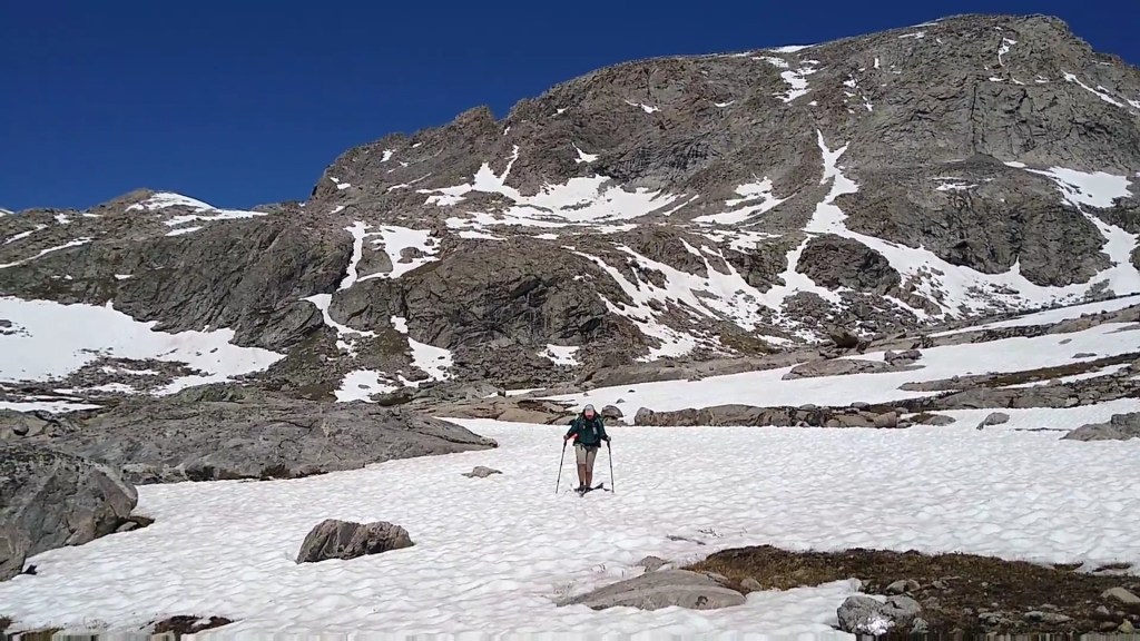
I am NOT fleet of feet on dry land, and even less on snow (unless of course I have skis attached to my feet). This meant we often were moving at the snail’s pace of one MPH. It was a crazy hard day! Let me “walk” you through it… visually.
Just a “small” patch of snow before Lower Jean Lake
It all started once we began our approach to Lower Jean Lake.
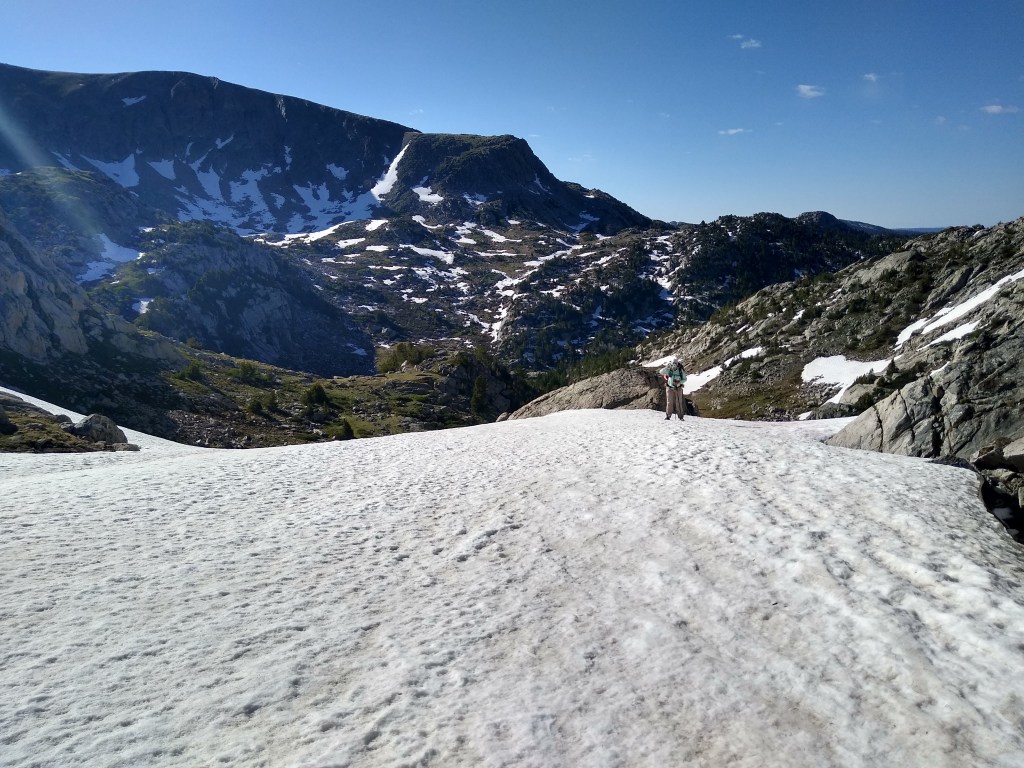
“South” end of Lower Jean Lake 10,646 ft
By the time we passed the “north” end of Lower Jean Lake, we had climbed to 10,722 ft. Now we had to cross the “beginnings” of Fremont Creek no less than THREE times!
The water was breathtakingly cold!
A giant snow drift, complete with its own cornice covered the trail that normally weaved beside Fremont creek. We climbed up and sideways along the face of a snow free “hill” to avoid the cornice. (Too sketchy for a photo in the moment)
Down the other side we picked our way back to the waterlogged trail.
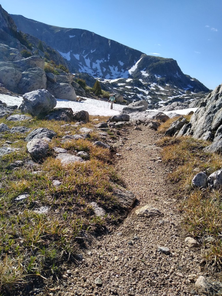
From here we tromped through soggy “grass cups” toward Upper Jean Lake (10,801 ft), but not before walking on a stretch of snow beginning to soften.
Luckily the snow was pretty compacted…so no real post-holing hereUpper Jean Lake (10,801 ft)
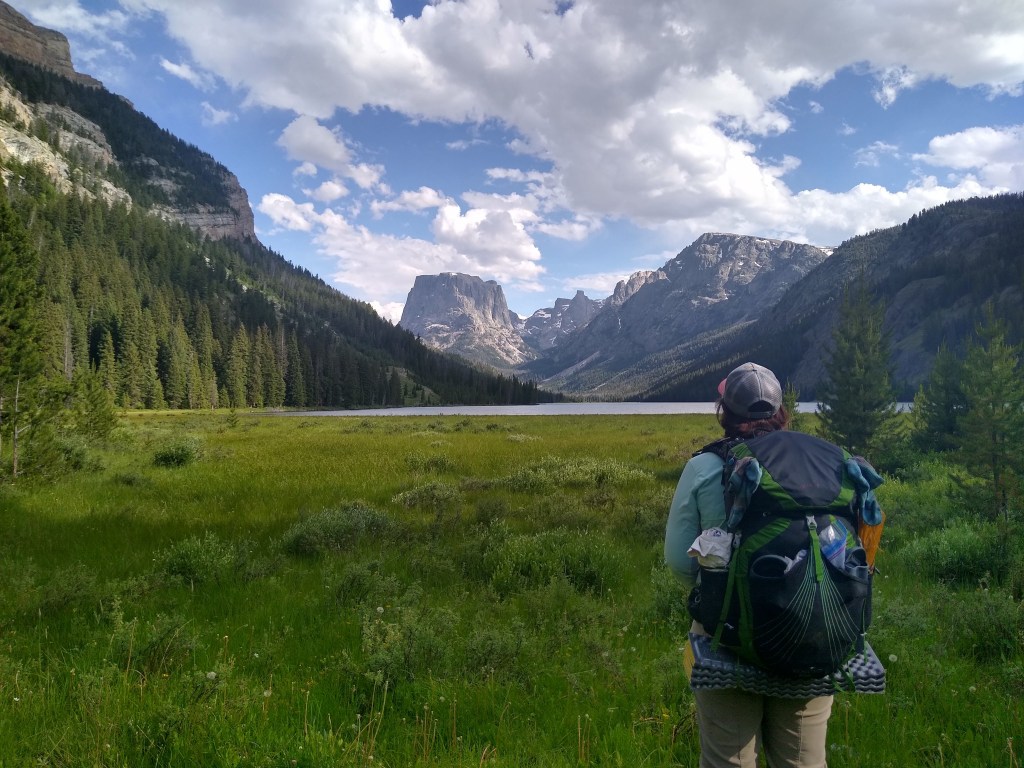
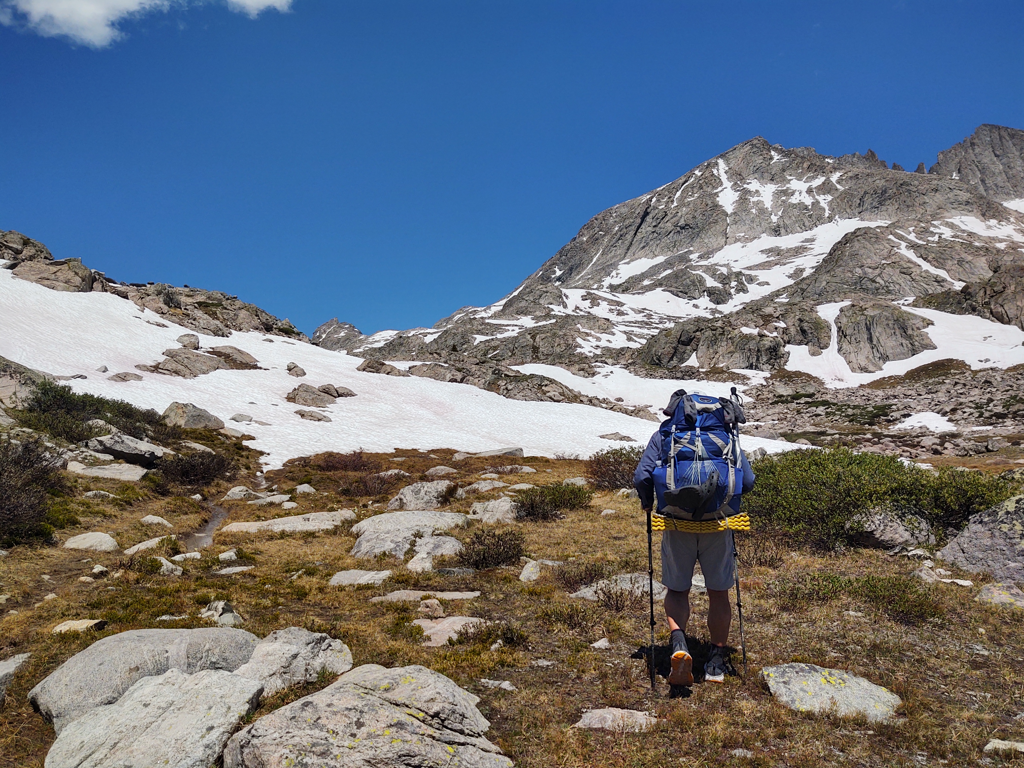
Once past Upper Jean Lake, we have one more pass to breach. The pass tops out at 11,722 ft.
Just past here was nothing but snow. Our travel method consisted of a combination of shuffle, slide, and post hole. I was tense the entire time. It’s like winding up a Jack in the Box (not the fast food place). You never know when it will “pop”, or when you will post hole. It is physically and mentally draining.
11,722 ft
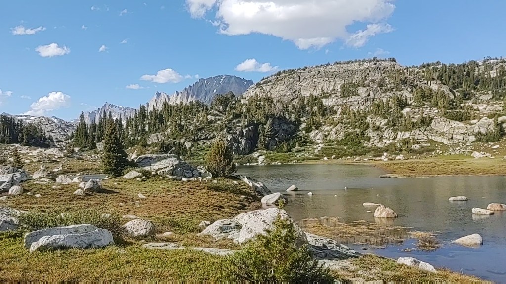
We reached the apex of the pass and the wind chill factor had to have dropped the temperature to the low 30’s. From here you follow the trail and then make a “U-turn” of sorts and drop into another snow laden bowl that empties into Elbow Lake, where two guys were fly fishing.
Elbow Lake to the left and behind my hat
Rather than worry about walking the trail, we cut a beeline through the snow, past Elbow Lake, to a visible portion of the trail. Sometimes snow works to your advantage.
As we dropped in elevation the snow disappeared. We reached a lookout point of sorts that gave us Verizon 4G cell coverage for a few minutes.
Down we wound till we reached Summit Lake. We had hoped for at least a 15 mile day, but settled for just shy of 11 miles.
The day was both exhausting and exhilarating. The trail was brutal. The views were enchanting and overwhelmingly beautiful!
Simply put. It was a Brutiful day we will always remember.
July 7, Day19: Elkhart Trail head – 1800.1 ( 12.7 miles, 10,600 ft elevation)
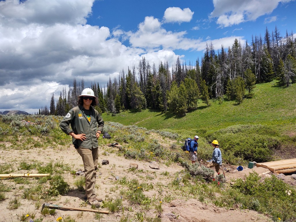
8 am was our scheduled “shuttle”. Stetson picked us up in his Nissan Pathfinder and drove us to the trail head. By 9am we were huffing our way uphill back into the Wind River Range. Along the way we thanked a trail crew that was fixing the damage that horses had done to the trail during a “rainy” period.
There are three ways to return to the actual CDT from the Elkhart trail head.
Pole Creek Trail (10.5 miles) – CDT mile 1795.5
Seneca Lake Trail (10.3 miles) – CDT mile 1799.5
Lost Lake Trail (12-17 miles?) – CDT mile 1801.9 at Freemont Creek crossing
We chose the Seneca Lake Trail for three reasons.
We didn’t want to revisit the Pole Creek Trail.
It was 2/10ths “shorter”
It bypassed Lester Pass, and I was a little “shy” about descending another pass. This one was at 11,115 ft.
We were still laden down with a six day food carry, which if we were younger and faster could be a four day food carry. But we’re NOT getting any younger, or faster for that matter. We are however, getting a bit lighter and stronger though. We’re hoping that the weight we have been losing, stays “lost”.
In any event, we didn’t have to worry about added weight from water carries. The Wind River Range is replete with so much available water, that you don’t have to carry much.
Trying to keep my feet dry as long as possible
It is practically everywhere! So much so that the by the time we had to walk around Little Seneca and Seneca Lake, it must have been “high tide”.
Not worth trying to “rock hop”
The trail was completely submerged. So much for maintaining dry feet.
As it was all “new” sights and terrain to see, the 10+ mile climb was not as daunting as it could have been. Granted, it was ALL uphill, and breathing was at a premium, but the trail was actually pleasant.
From here we would descend to 10,600 ft and make camp
We had planned to make it a “short” mile day and put our goal at just getting back to the CDT. Somehow or other, we were moving pretty good, and squeezed in 2 more miles after we rejoined the CDT, and decided against the Knapsack Col alternative.
I set up our tent while Paul collected water, and rinsed our socks, from his own private island.
We dined on Subway sandwiches we had packed out from Pinedale with a million dollar view.
Little did we know that we would “pay” dearly for our “short cut”.
And to think that we could have been cursing the blood sucking swarms of mosquitos on the 4th. We are blessed to have inadvertently timed our resupply in Pinedale for the 4th of July! Especially a town with actual 4th of July festivities, and fireworks!
Nothing like good music, good ol’ folk enjoying themselves, little kids dancing to their own rhythm, cold beer and BBQ. America, that’s right!
The “clumps” of people were families. Everyone was practicing “proper” social distancing. So it’s possible to have a celebratory gathering in an outdoor setting.
Despite all the fracture going on in this country and the world, for that matter, this is truly the most special AND beautiful country in the world. If you don’t think so, just walk it and find out. Just like our freedoms, the views don’t come cheap. They are earned every step of the way.
When you travel by foot, you truly see this country for what it is. Beautiful land. Beautiful people. Whether you’re in jeans or shorts. Boots, sneaker or sandals. Cowboy hat, ball cap, or no cap. Don’t be fooled. The true heart of America is kind, especially to strangers. And because of that, I LOVE this country.
Pinedale Wyoming is an awesome little town. They have everything you need. All within walking distance, which is good because our only travel option was by foot. We walked everywhere, and nearly 5 miles a day, especially because our hotel happened to be at one end of the town, and most of the “shopping” was in the “middle” or at the opposite end of town.
As far as how the town was dealing with COVID-19, it was mixed. Most establishments were not concerned with their patrons wearing masks. However, we would ask each establishment, or look for a sign that said it required a mask, as to whether we donned a mask or not. For the most part, mask or not, everyone practiced social distancing. If keeping ones distance looked impossible, we’d avoid the store/area and/or return at another time. I actually like the social distancing, as I have never enjoyed being anywhere crowded with people.
We hit the Dollar Store, across from our hotel. We hit the Wind River Brewery, midway into town. We hit Los Cabos Mexican food (a must if you want good Mexican food).
Dave’s Last Stand, for an awesome burger. The full sized grocery store (across from Dave’s). Verizon for a new phone screen. A beauty salon, so Paul could get his haircut. The Great Outdoor Shop for a new filter for our Katadyn Hiker Pro, and a new ball cap for me.
Monday was the post office, both for receiving our resupply package and for mailing off resupply packages for our next three stops. We also had to secure a ride back to the trail head. The guys at the Great Outdoor Shop gave us a service to call, GOTCO. This would end up costing us $75. It didn’t matter how many people. It was $75. Reluctantly we scheduled the ride, as the thought of hitching back to the trail, on a Tuesday didn’t seem that appealing.
Four days off trail, left us a little tentative about starting up again. Uphill, with a full resupply is never fun. But when we think about it, most of what we’ve hiked so far seemed all uphill anyways. So, what’s the difference?
So the night before, in going over the mileage and terrain, we discovered that in addition to having to take the Pole Creek trail (10.5 miles), our first 5 miles of the morning involved not one, but three additional passes. Each pass was snow covered and over 10,000 ft.
Front side of pass #1
Pass number one. Success.
Backside and down pass #1
Pass number two.
A little dicey, as the snow was starting to get soft…on the way down.
Pass number three.
Approaching pass #3
The approach was tricky, as post-holing was beginning to be a “thing”, but the final edge of the descent almost resulted in the use of our Delorme SOS button. We were trying to move as quickly and safely as we could through the passes, that were all covered in snow. By the time we were halfway through the descent of the third Pass we were more than sick of snow.
Working my way to edge and down where there was no snow…but lots of loose rock and mud.
I was working my way around a snow patch and suddenly the ground slipped underneath me. I found my left foot and knee sliding behind my torso, heading in an unnatural direction (I am as flexible as a 2×4). This instinctively caused me to throw myself forward and “break-fall” (like in martial arts) face/chest first onto the snow covered boulder patch. The only thing about “break-falls” is that normally the “landing” is on one’s side or back. This thud of a landing was face/chest first and resulted in a good cry, while my body took “inventory” of its parts. Paul who had seen the “thud”, worked his way over to me with concern written all over his face.
No blood. Check.
No feeling or sound of a “break”. Check
No searing pain… currently. Check
All parts move “properly”, without much pain. Check
Once the internal checklist was complete, Paul helped me get my pack off, while still face down. While doing “inventory”, all I could think of is that we’ll never get to town now. No way in hell do I want to be “that person” that has to hit the SOS button. No way in hell do I want to be done.(No matter how much I complain about the CDT). Slowly I sat up and moved about some more. I was sopping wet and covered in mud. Great. It’s what caused the fall and probably what saved me, as well. Go figure. After about 15 minutes, everything seemed to be working, at least as it did before. Sadly no miracle improvements here. I reattached my pack and slowly worked the rest of the way down this final pass and to the water logged valley and CDT trail that would take us to Pole Creek trail, and down to the Elkhart trail head and parking lot.
While we kind of knew what to expect, thanks to comments from Guthook, we did not expect the Pole Creek Trail to be as daunting as it was. You really have to want to get to town really bad to do the Pole Creek trail. Especially this time of year. This trail was worse than what most of the CDT has been so far. We spent most of our fractured descent/ascent with our feet (up to our calves sometimes) slogging through muddy bogs, or sluggy snow still laying within and blocking the trail. Add the fact that we were dogged by mosquitos and an occasional biting fly a good portion of the time, and you have true town motivation.
Pole Creek crossing
The actual crossing of the wide, cold and fast moving Pole Creek was extra fun. I can see where someone of smaller stature would have a difficult time… anytime of the day. It was deeper than we expected, and moved faster as you got halfway across. This is significant as with such a wide and deep crossing you’re already cold and even more tentative. The good thing was that most, if not all, of the mud we had acquired was washed away. We didn’t smell all that “swampy” now.
As we continued down (direction and slope) the trail we were passed by at least 20+ people heading out for a weekend backpack trip. Most were equipped with fishing poles.
When we arrived at the parking lot, we were able to get a ride almost immediately from a great guy name Brian, who ironically hailed from Northern California.
He’s a peak bagger and has climbed and hiked all over the world. He drove us to Pinedale, gave us the “run down” of what’s where in the town and dropped us at our hotel (Best Western). Quickly we changed into our rain gear and started our laundry. No one wants to smell that (us) any longer than one has to. A quick walk for two large pizzas and a 6-pack of beer to go, we were back in time to put everything in the dryer. Now for a shower and to get off our feet for a couple of days.
We would spend the next 4 days in Pinedale, as everything was closed for the most part due to the 4th of July weekend. Hmmm, that explains all the backpackers headed to the “hills”.
Not to worry, as we needed the rest, and we were in a small town for the 4th of July. This was going to be fun!