
July 12: Day 24 (1857.2 -1872.4) 15.2 miles
Considering how our day started and ended, it’s a miracle that we even covered 15 miles.
Up with the sun we tugged on our wonderfully dry shoes and trotted off down the trail. It was a beautiful Sunday morning that deserved some good ol gospel music. Music blaring we descended down a perfectly kept trail. After, of course, negotiating a tremendous tangle of intertwined blow downs.
Undaunted, we continued down the trail, which we noticed had a stream not listed on Guthook. We remarked to each other how thankful we were to NOT have to make this climb. Oh, the poor SOBOs (south bound CDT hikers) we thought. And then it hit us.
- Aren’t we supposed to be on a moderate climb by now, with little water available?
- Did we miss a turn?
- Is this the wrong trail?
The resounding answer to all three questions…YES! Dammit! We were now a solid 3/10ths of a mile off the CDT.
- Do we walk halfway back up and then bushwack the remaining distance up the side of the hill back to the trail?
- Does this trail we are on intersect the CDT further down?
- What trail is this anyways?
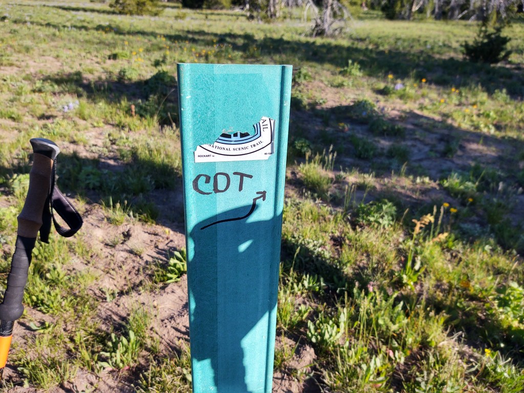
Per my Earthmate mapping on our Garmin InReach Explorer +, this trail was ironically named, the “Devil’s Basement”.

Begrudgingly, we made an about-face and trudged back up the 3/10ths of a mile (we were initially glad that we didn’t have to do), to the turn we missed. When we got to the missed turn, we saw that someone had placed a tree limb in the trail we had taken to keep us from taking the wrong path. We had deftly stepped around it. And, there was a sea foam green CDT marker we had passed, but the CDT sticker was absent. Not wanting anyone to make the same mistake we did, we fortified the debris across the inviting, but “wrong” (Devil’s Basement) trail and “refreshed” the CDT marker, absent having a new sticker.
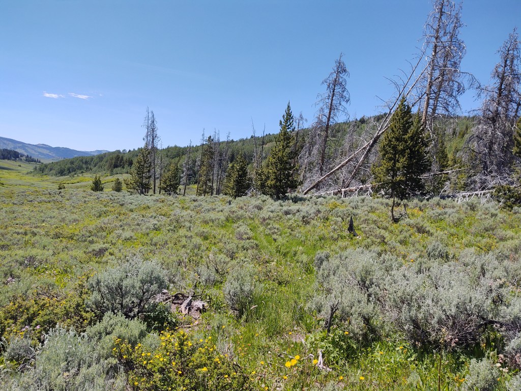
Once back on the proper route, we rolled up and down across meadows and through fire ravaged stands of trees. The trees eeriely resembled tombstones. Many leaning upon one another, as if in mourning.

And, as these monochromatic, seemingly lifeless, logs swayed to and fro with the wind, their trunks and limbs rubbed together mimicking the sound of people in whispered conversation.
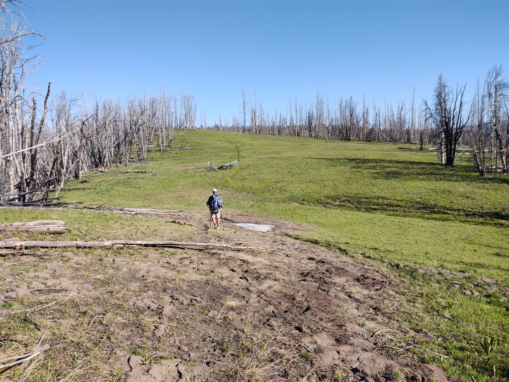
The CDT trail through this section, was obviously a favorite for the resident elk. In fact herds of elk. Hilltops trampled and stripped of vegetation, and hoofprints baked into a once muddy trail made for tedious walking.
At one of our last breaks, we filtered water from a very shallow spring, guarded by frogs. We couldn’t understand why it was called “Pipe Spring”. “Frog Spring” would have been more appropriate. The fact there was no pipe should have been a clue, for after we had collected water and had a lengthy break, we walked a bit further only to find perfectly good (frogless) water flowing freely from an extended pipe…. geeze.
As it was cloudless and hot, we looked on the Guthook app to see what our water situation would be. No real mention of “reliable” water made for a long water carry. This didn’t make sense to us as the topo map showed the trail traversing down through a narrow draw in which it appeared a creek flowed. The topo was correct, and there was plenty of water. I guess when water is obviously abundant, there’s no need to “list” it.

At mile 1864.9 we came across a big Cat print in the mud. This inspired us to be a bit more vigilant about looking over our shoulder and behind us from time to time.

As we continued to descend, the trail was swallowed up by the surrounding vegetation. We ended up using our Guthook app like a devining rod, to point us in the right direction.
Continuous uneven, ankle turning, terrain gives my right ankle fits. I have a history of rolling it, and a previous spiral fracture of my fibula. At the base of the fibula a ligament is still held in place with a titanium screw. The ligament is so stretched out that it sometimes “slips” over the “wrong side” of my fibula, which is excruciatingly painful, and takes anywhere from 5-20 minutes to “slip” back into place on its own. This happened during the final steep descent toward the Pole Creek Trail into Pinedale two weeks prior. As we were “on a mission” to get into town, I didn’t necessarily allow the ligament to slip back into place on its own. I kinda “hurried” it. With my ankle currently feeling like my foot was on backwards, I think my previous haste has finally caught up with me. As we just gotten down to an old flat abandoned road, that was now the CDT, it became impossibly painful to put any weight on my right foot. Each attempted step caused me to buckle to the ground due to its fierce searing pain. In many ways I was thankful that the ankle “waited” till we hit “level” ground.
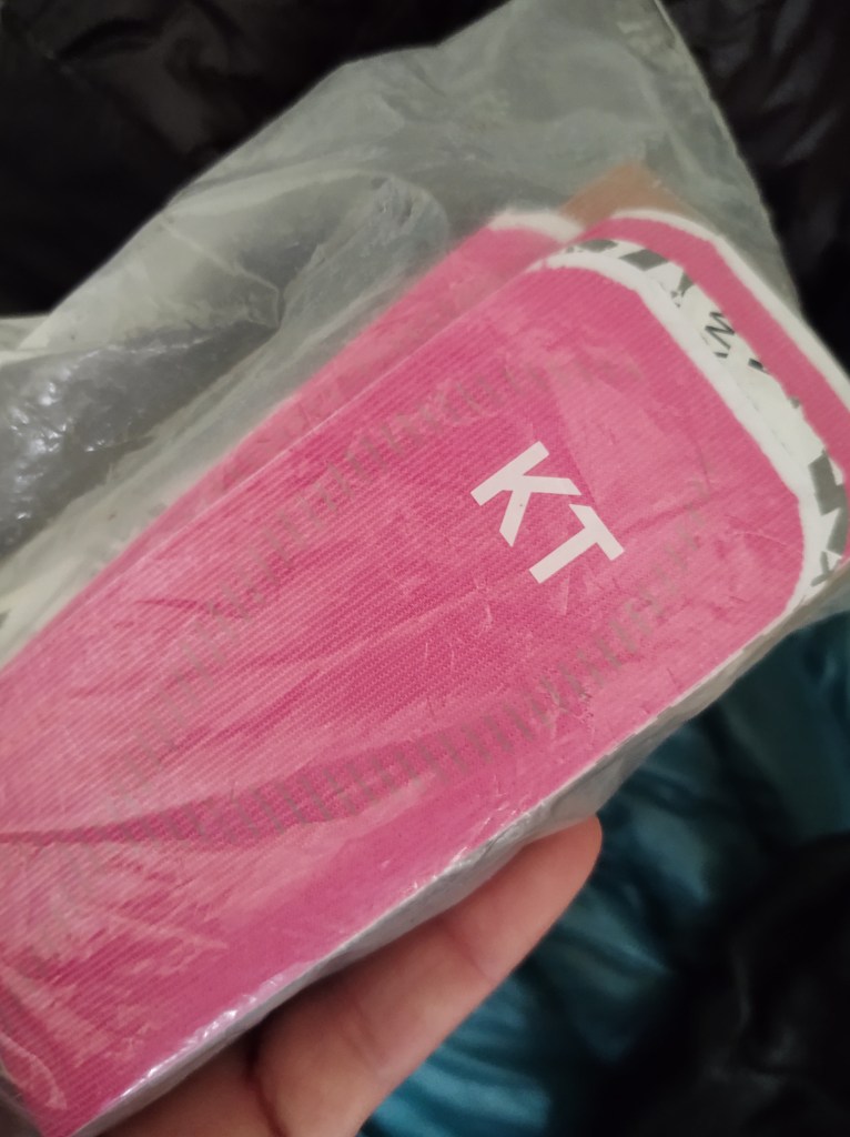
With all hikes I carry a supply of KT Tape, namely to keep my left knee “together” and supported. Our only chance to be able to continue, vs throw up the tent and call it a day, was to see if I could immobilize my ankle enough with my KT Tape to reduce the movement and corresponding pain. We had not planned on going into the town of Dubois, as we had a resupply package waiting for us at Brooks Lake Lodge, but it was apparent that this ankle required some attention. A prayer, some tape, 800mg of Ibuprofen, and a knee high compression sock did the trick. (My college athletic trainer days have served me well) I was able to gut out another 6 miles, much slower than my normal “slow” pace.

This left us with 12 miles to highway 26 and Togwotee Pass We had one day of food left. We hoped that morning would find my ankle in better “condition”, and/or my tolerance to pain at “record” level.

Hi, my friend is going to walk the PCT trail in a few weeks from Mexico to the top! I suggested he blog like you guys do. Is this a blog thing you subscribe to or is this your own design (I noticed word press at the bottom). LMK. Thanks so much and I really do enjoy your correspondence.
Sorry, just saw this question. It’s a blog site hosted by WordPress. You pay an annual fee for its use and domain name