
As promised, our late September mini-adventure has finallly made it to “press”.
What was supposed to be fishing trip to the Green River near the Wyoming/Utah border has been put aside for next year. Apparently we needed to plan ahead in order to get the guide and the river boat float/fishing session we wanted. Who’d a thought they’d be booked for the whole month already. But as we are fluid adventurers and refuse to waste an opportunity to recreate outdoors, we are on a 10 day road trip with my dad in his tricked out cab-over camper. This trip will be a road trip “wander” of the four corners area of the Southwest…mostly New Mexico. As my dad is quite the outdoorsman (and a consummate fish “whisperer”, hence why we normally do fishing trips), I have inherited his love of the outdoors “gene”, to include his love of maps. To Paul’s dismay, it appears I also have my father’s engineering traits which often surfaces in the form of over-planning, or more specifically, over packing. I believe it’s genetic marker is 1-OVRPKR. As such, I have the innate urge to be prepared for every variable. Luckily my mom carried the “Oh well, shit happens” and the “Why worry, it will all work out” genes that allows me to be comfortable with spontaneity and flying by the seat of my pants, when “over-ruled” on “contingency” packing items, even when said items would have been beneficial, albeit extra weight.
So, on this adventure we will “rough it” just a bit, but this mostly will be a glamping session interspersed with plenty of exploration.
Northwestern New Mexico will be first on the menu of exploration. Today we are headed to Bandelier National Monument of archeological significance, which is just outside of Los Alamos, the “Atomic” or “Secret” City, of immense scientific and world historical significance.
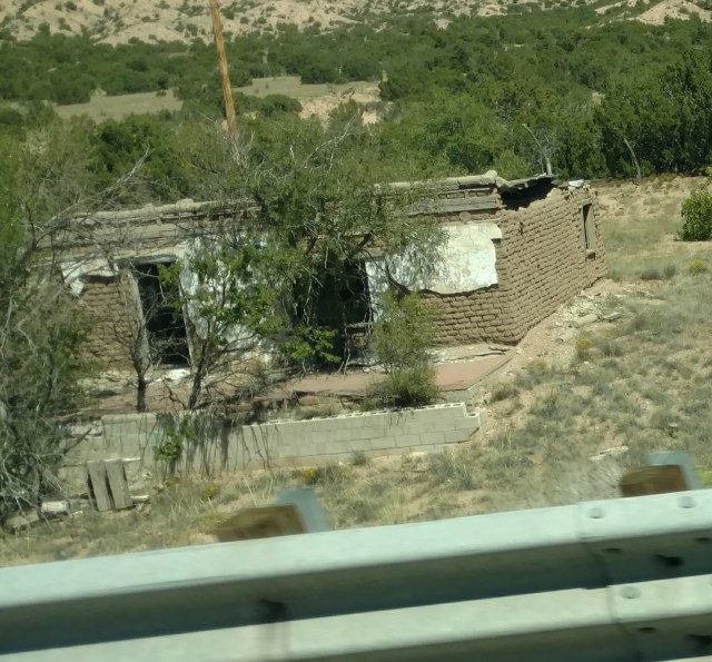
As we travel the I-25 from Las Cruces toward Santa Fe, small towns preceeded by ancient Adobe structures in various degrees of decay can be seen along the highway.

Vast swaths of rich green vegetation carve color into a mostly muted landscape. This area of New Mexico is much greener than we ever imagined, and certainly naturally greener than my neck of the woods, in So Cal. We pass an exit that points out a still drive-able portion of historic Route 66. It appears to follow alongside the Rio Grande river which feeds the greenery that is flanked on either side by what one can only describe as “classic” Western film scenery of sand and sage brush. At a rest stop, interpretive signs tell us about early discoveries of Gold and Turquoise.


Flat, arid plains of land carved by deep washes from monsoonal rains become pimpled with rising hills, and soon San Gabriel-esq (it’s a SoCal thing) mountains appear to our right.

Thunder clouds form on our horizon, as we are in the tail end of monsoon season.
We take the 550 around Santa Fe to the 84/285 exit toward Bandelier National Monument and Los Alamos. Once again the scenery changes dramatically into lumpy hills covered in mesquite. Pueblo style homes are discreetly tucked into, behind, and between the clusters of hills. Some blend in so well, you almost miss them, while others scream, “Look at Me!”. As we continue to gain in elevation, Ponderosa and Pinyon pines replace the mesquite.


We climb in elevation to near 7500 feet. From the 502 highway we have two options to get to Bandelier. Left, on the 4 hwy through White Rock, or stay on the 502 right through Los Alamos. We initially go left, but abort that route when we see a sign that says “Shuttle only to Bandelier”…oops.(Turns out we could have driven that way). We make our way toward Los Alamos on Hwy 502 which which comes to an abrupt halt at a heavily fortified guard gate, and becomes the NM501, which then becomes the 502 upon exiting another guarded gate, also referred to as Vehicle Access Portals (VAP). One can access these portals if one has a valid ID and/or a Federal/DOE badge. A point of great importance is that when accessing these portals, NO cameras, firearms, alcohol or illegal drugs are allowed in this area. Vehicles are also subject to search. Since we had alcohol, we decided to take the long-er way around. Not to worry, as “Martha”, my GPS gave me a work around, and after a jog around the gated area, we join back up with the 502. We wind through what looks like an Alpine Forest, with the entrance to the Pajarito Mountain ski area on our right, and a continuous string of chain link fencing, topped with barbed wire, on our left, that delineates the perimeter of the 34.7 square miles of DOE property in which the 13.5 acre Los Alamos National Laboratory, affectionately referred to as “The Lab”, is housed. The 502 comes to an end at Hwy 4, where we are to turn left. It is obvious that this intersection was once the guarded perimeter for Los Alamos, evidenced by an abandoned, yet fortified guard house, still property of DOE (Department of Energy).


It has a “Cold War” feel. On our right as we near Bandelier is Ponderosa Pine, Juniper trees, Pinyon Pine and other bushy green vegetation, all part of the Santa Fe National Forest and/or Bandelier. To our left, the same vegetation, but enclosed with barbed wire fencing adorned prominently with sign that read, “No Trespassing”, “Video Surveillance” and “Danger, High Explosives” (As in what? Hydrogen Bomb?) . WTF?! Part of me would have like to have “tested” the signs, but the smarter part of me thought better of it.

Juniper Campground – Coyote Loop , site #52
After a better part of a day driving, we finally pull into Bandelier National Monument, and find a “first come first served” camp spot in the Juniper Campground. After setting up, Paul and I walk back to the “Iron Ranger” to pay our camping fee. Since my father has a “Golden Eagle” pass, our camp fee is cut in half to a whopping $6/night. We will be staying two nights, but of course we forgot that, and paid for only one night, after seemingly re-creating that scene in Zoolander, where Derek and Hansel try and “break into” the computer.
The Iron Ranger is a hearty debit/credit card machine that directly faces the afternoon sun, so when wearing polarized sunglasses you can’t read the screen, and when you take off said prescription polarized sunglasses you can barely make out the faded small print, directing you on which of the four searing hot metal buttons to push to advance to the point of inserting your method of payment, and finally spitting out a valid campsite receipt. Add to that, we forgot what campsite we were in, so in exsaperation, we made an educated guess based on the posted campground map. We were relieved when we returned to our campsite that we had guessed correctly, but our triumph was quickly dashed when my dad reminded us that we were to have paid for two nights. Shit! About face we turn, this time beer in hand, and back to do battle and feel like a complete moron…with said machine. After several minutes of pounding on buttons, pushing “cancel” and pounding some more, it becomes clear that it is impossible to pay for the next night, once we’ve already paid and registered for our particular campsite. The earliest we would be able to do this would be 11am the next day. Grrr! We will be hiking well before that. I miss the “olden days” of live people and/or envelopes. Defeated we wander back to our campsite. Upon arrival we are now asked if we want a campfire, we should get some firewood. About face again. This time we are joined by my father who offers to help carry the wood, (located next to the Iron Ranger), back to the campsite. The wood is stacked high in single pieces, with a posted recommended donation of $1 a piece. Of course here, the donation is to be paid in cash to a metal lock box, not the pay machine. You guessed it, we had no cash on us…back to the campsite we trudge…wood in hand of course, to fetch some cash. Before heading back, we took a gander at the shuttle bus schedule, located nearby and found out that we could also take the 2mile 500ft descent, Frey Trail, down to the bottom of Frijoles Canyon where the Bandelier Visitor Center and the archeological sites are located.
All this unplanned walking (it was still 85+ degrees out), although frustrating, turned out to be a good way to acclimate to our 6670ft elevation (compared to sea level that we normally function at), and stretch our legs after our day long drive. As we sat around our picnic table, swatting at the plethera of flies (some ankle biters), in the still warm 80° evening, the camphost motored by in her motorized golf cart to advise/remind us of the evening’s highly recommended Ranger talk, “Dark Skies”. We told her about our failure to pre-pay for a second night and asked how/when we should do that. She laughed, “That happens all the time. As long as you leave something in the campsite and pay by 7pm tomorrow, it’s all good.”. We thanked her for her information and let out a sigh of relief as we had already planned to be down in the canyon well before the 11am posted payment “deadline”.
7:30 pm rolled around and although we were fairly gassed from the day’s travel, we wandered over to the amphitheater for the evening’s Ranger talk. Here we learned from (“ding”…sound of a bell, provided by Ranger Derek), an avowed “Astro-Geek” (Ranger Derek) about the birth and life of stars, and about how “small” our sun actually is compared to the rest of The Galaxy in which our tiny blue planet resides. After the “show” we were invited to peer through several telescopes that had been set up in the parking lot in which to view Saturn (and her rings), Jupiter (and its moons), Mars and the face of our prominently glowing half-moon. Bandelier National Monument is in the process of becoming “certified” as a “Dark Sky Park ” which in the star gazing Astro-Geek world is a pretty big deal. Unfortunately, the moon was a little too brite to get the full effect of a truly “dark sky”, but to see these planets “up close” was pretty cool, and to be able to identify their location in the sky, even better. Sadly, we also learn that all those pretty, dramatic and brilliant colors that we thought the above listed planets were supposed to look like is merely marketing by NASA. There is color, but it is impossible for our eyes to pick up the wave lengths of light, it’s more like shades of black and white. White being the “color”, as black is the absense of light/color. The high point for me was learning how to determine (by naked eye) between a planet and a star, and being able to identify where we landed on the moon. “Apparently the flag has fallen down”, joked the Ranger, obviously referring to the latest “Apollo” movie.
Having had enough enrichment for the day, we wandered back to our campsite for a solid night’s sleep, having decided that, in the morning, Paul and I would hike the Frey Trail down into Bandelier…proper.

So cool that we both made it to Los Alamos and Bandelier this year. I was so confused by the road block and weirded out by the red gates, huge satellite dishes and warning signs. Seeing the red slashing on my map showing the National Lab boundary was a reality check. I felt like Big Brother was watching while out on my backpack trip.
I wouldn’t be surprised. This isn’t the only place in the country “secret squirrel” stuff is going on, though.