
For several years we have heard about how amazing the hike up McGee creek is, as it is a portal to several lakes and can intersect (14.7 miles) with the PCT/JMT and several other trails that lead to Mammoth Lakes. It also offers several route options into the John Muir Wilderness / Sierra National Forest once you reach McGee Pass (11,895 ft). There are two maps that are my “go-to” maps when planning hikes, and hiking in the Mammoth area. They are Tom Harrison Maps: Mammoth High Country Trail Map and Mono Divide High Country Trail Map. I also have the Yosemite High Country Trail Map as well, but that’s a story for this upcoming August. All are “Waterproof & Tear Resistant Plastic”. So far they are indestructible, and so much better than pulling out ones phone, or piecing together 8×10 printed, ink fading, paper maps, enclosed in a ziplock bag. Looking at our map, the uphill appeared to be fairly gradual and followed alongside McGee Creek. Prior to setting out, we had given ourselves only a 4 hour window in which to hike and explore this route. This was because Russell (Brian’s dog) was still not feeling so well, and we didn’t want to leave him alone in the trailer for too long. From the Mammoth RV park, it’s a relatively short drive to the McGee Creek trailhead. Traveling south on the 395 from Mammoth’s 203 turn off, you take the McGee Creek exit and continue straight. You’ll pass the Mc Gee Creek campground run by the USFS on your left and continue past the McGee Creek Pack Station to a medium size parking lot with a restroom.
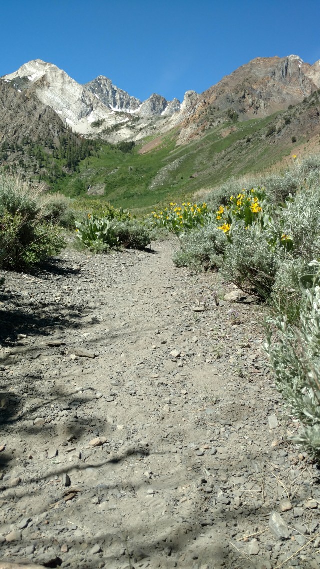
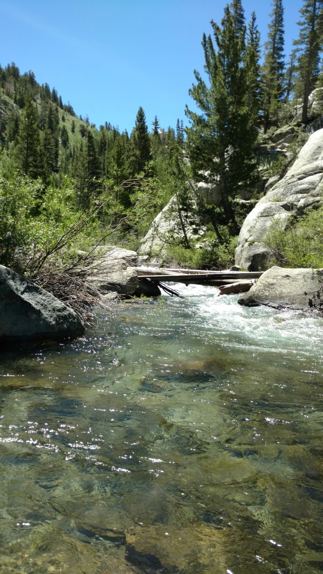
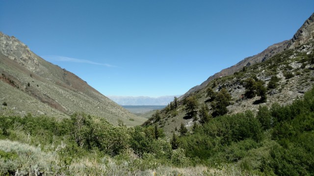
From there you hit a well worn and established trail, that climbs gradually as you work your way up the colorful valley with McGee Creek to your far left.
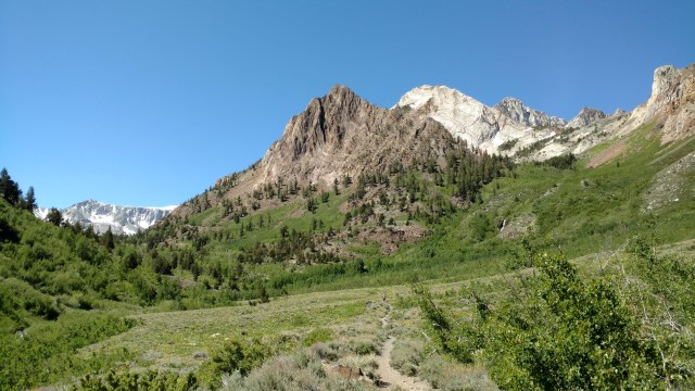
A waterfall beckons in the distance on your right. Initially this is a fairly exposed route, until you get to the pockets of Aspens and pine fed by seeps, springs and creek-lets nourished by the quickly melting snow of the abundant mountains in near distance. Steep, sharp, rocky peaks flank you on either side. As you continue to gain elevation, the valley begins to narrow as it funnels you up to McGee Pass.
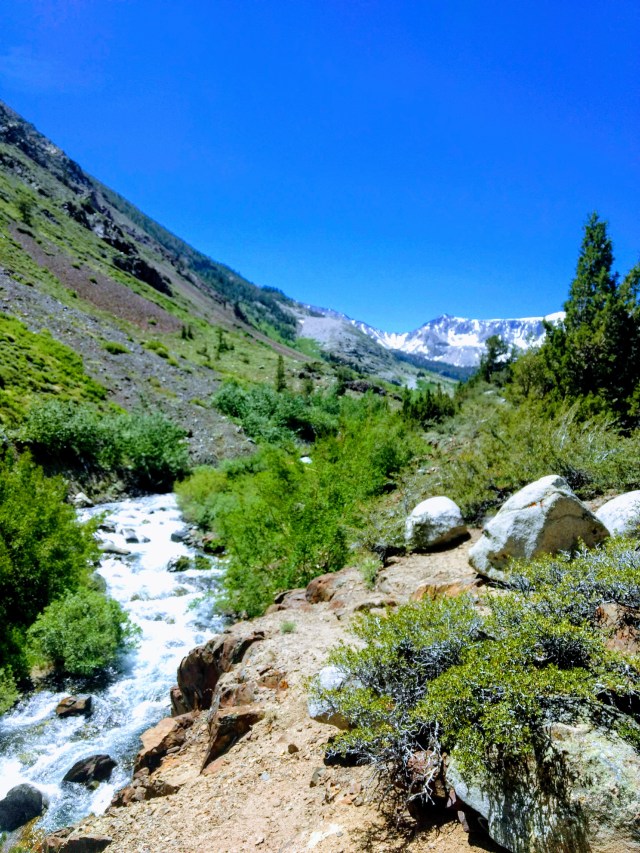
In the fast moving creek beside us, we look in earnest for any sign of fish, this is in hopes that we may be able to drop a line in, at a later date, as the creek is mostly white-water and/or flowing way too fast.

A log crossing and a scramble up a tall crumbling bank of the creek is the only challenge so far on this hike. However, it seemed that this creek crossing was the demarcation line for the mosquitos, for once we stopped to take a breather, they began attacking with reckless abandon, until we “surrendered” and fogged ourselves with Deep Woods 30% Deet spray. We had been told that there was a beaver pond along the way. What we came across was not a beaver pond, but a beaver lake! These waterproof, buck-toothed, lumberjacks made some fine work of some hearty trees.
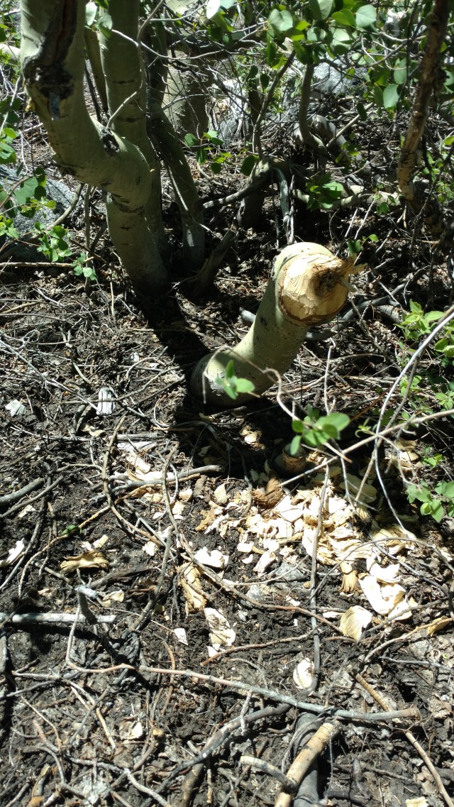
Shavings from their handiwork, or should I say “dental-work”, and the remaining 4-8 inch in diameter stumps scattered the banks of the “pond”. The beaver’s dwelling lay high and dry in the middle of what was a wide and quietly flowing shallow body of water. As time was of the essence, we wandered up the trail another 15 minutes in the off chance that we might at least get to the side trail that takes one to Grass Lake and Steelhead Lake, but to no avail.
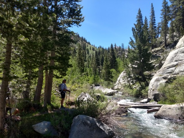
We had to console ourselves with a perfectly shaded grassy creek bank beside a slow moving, side pool of water (still way too cold for a dip), to have a bit of lunch before turning around and heading back to the truck.
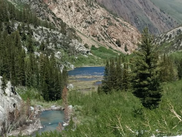
As we descended, we got another look at how big the “beaver pond” was and were treated to a peek-a-boo view of Crowley Lake.
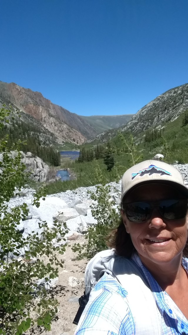
Our total mileage for our 4 hour trek was an easy 8 miles, making our average speed (wait for it…) 2miles/hour, and we finished before the day’s heat became any warmer. After we returned to the RV park and released Russell from his 27′ “kennel”, it was time for a treasure hunt.
Awhile back, Brian had been up on a fishing trip with some of our other friends. Whilst out exploring, they came upon a “midden site”, circa 1900 – 1930’s. Here they found a plethora of discarded and often intact glass bottles and cans whose graphics were still legible. We decided to see if we could find the site and see what “treasures” we could find. After a bit of wandering over dirt roads just outside of Mammoth Lakes, we came across the site, whose “treasures” lay in scattered piles of rusted nostalgia.
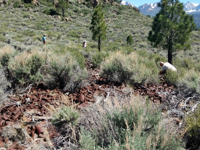
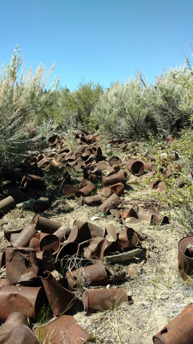
Sadly most of the glass bottles we found we broken, and the tin cans of what appeared to once contain beer or oil were in the later stages of oxidation. As we surveyed the area, that stretched across both sides of the dirt road, we wondered aloud as to how “old” these “artifacts” were and from whence they came to be discarded here.
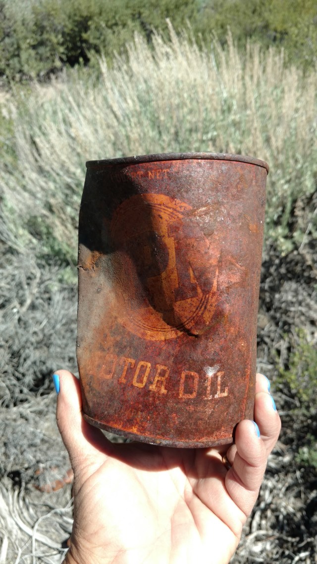
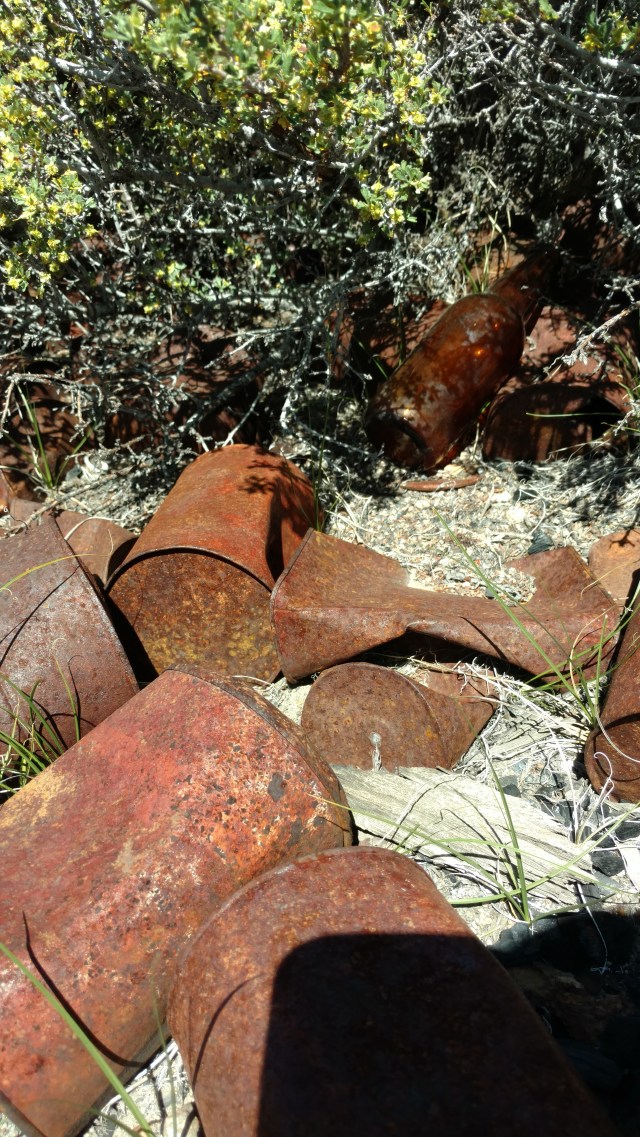
This spent oil can dates to pre-WWII because it is fully metal. After the 1940’s and the advent of WWII, a metal shortage necessitated quart sized oil cans to switch to cardboard cylinders with metal tops. Based on my “after-find” research, this can was made/distributed by the Standard Oil company 1930-1940, with its label reading RPM Motor Oil. This can was originally white, with the lettering and “seal” in the background being bright red in color.
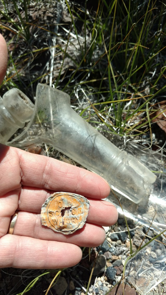
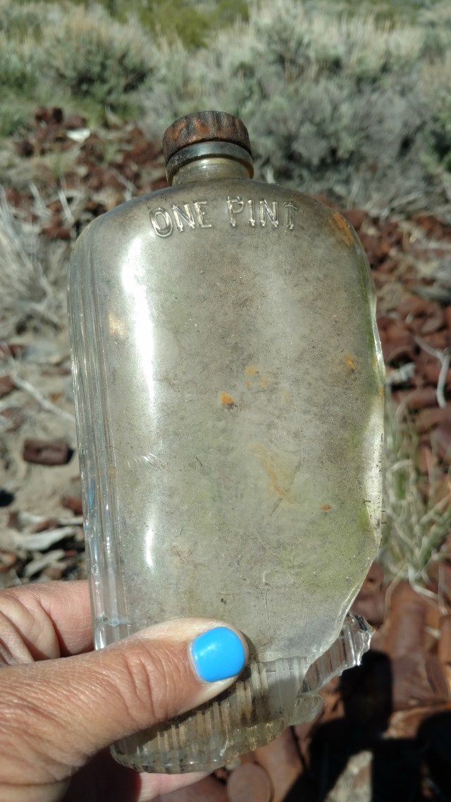
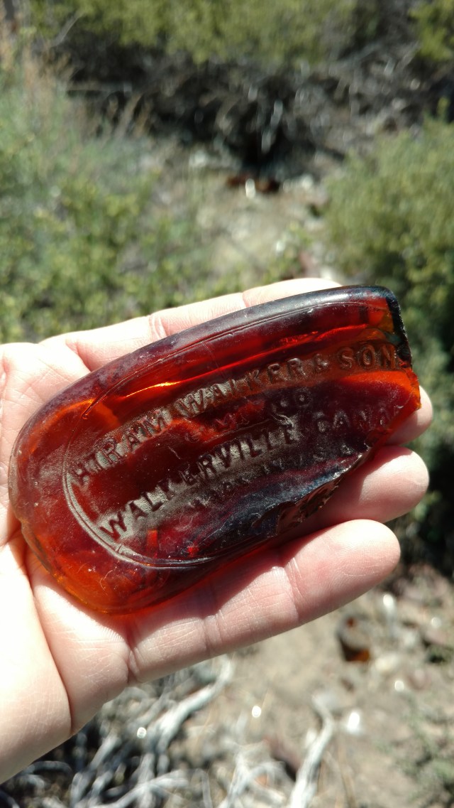
As nothing had a “born on” stamp visible, we surmised based on the thickness of the glass, the broken bottle tops, size, shape and puncture holes at the tops of the cans, piles of bottle caps and a few odd sheets of metal and appliances, and the pieces we were able to find history of on the internet, that this had to have been a favorite dumping spot for a late 1930’s, early 1940’s service station.
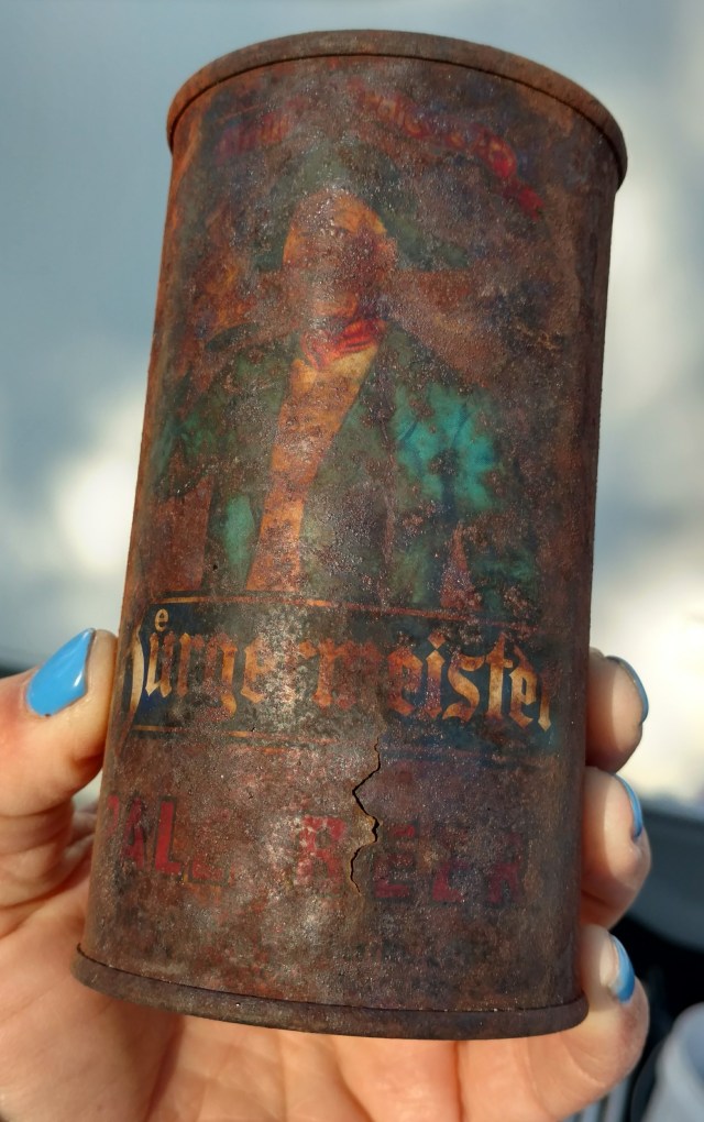
A Google search of the graphic on one semi-legible beer can Jody recovered from the site, confirmed our summation. The Burgermeister label is circa 1930’s, produced by the San Francisco Brewing Company until 1961, when it was sold to Schlitz. This particular can dates anywhere from the 1930’s to the 1950’s, however based upon all surrounding items, I would place it around the late 1930’s. We could have “dug” around this site all day, and even wondered what other “treasures” might lie beneath the surface debris. Ones imagination can’t help but wander. Now we understand the draw for people who become archeologists. The story is in the “stuff”, as it is a touchstone of time. An era and existence, similar, yet different from our own to be examined and compared. What “advances” have been made? What has stayed the “same”? What has changed? Are things better or worse? Does it matter? One wonders what our discarded stuff, and “midden sites” will say about us. Will future generations be just as intrigued or ecstatic about finding our “trash”? What stories will they concoct to fill in the “blanks” of understanding. Will they be compelled to figure out the what, and why of how this “stuff” was used, and by whom? Time will tell.

You are such a good story teller you need to get these in a book or ebook
Thank you. As soon as I collect enough pennies I will be able to get my own laptop, and will be doing just that.
Nice hike, beautiful photos Dee. I appreciate the history reflected in the old cans and bottles. You did your research (as usual!)
Thank you…It’s the nerd in me that compels said research
Majestic scenery and challenging trails draw in hikers, mountain bikers and equestrian enthusiasts. The McGee Creek Trailhead, a popular trail for hiking and horseback riding into the McGee Canyon area of the John Muir Wilderness, lies just two miles from the campground. The eastern Sierras are known for exceptional trout fishing. McGee Creek and nearby Crowley Lake have some of the best fishing in the area. The area s interesting geology also makes it popular for rock hounding.