We woke up with a start thinking we had slept through breakfast, which would be a shame, as the Hampton Inn serves a pretty awesome “All you can eat” spread of breakfast foods. Their coffee is pretty stellar, too. Luckily, they serve till 10 am. So another hot shower, without having to scrub off dirt, was in order, just because we could, and then off to the buffet. We couldn’t help but notice how wonderful our timing into town has been. It poured all night, and it was scheduled to continue raining till 11 am, which conveniently is also check out time. All that’s left is a quick hitch back to trail.
Our hitch back to trail took a whopping 10 minutes. We were beginning to wonder if hitching is not a thing back east. We got picked up by a couple who had completed the Vermont portion of the Long Trail, so they tuned us up on what we should expect moving forward…mild climbs with MUD, seeing how it rained all night.
We had initially decided that today would be a NERO style hike, as it was supposed to rain hard around 2 p.m., and at noon, we were just getting back on trail. Up to the first shelter, 2 miles up the trail, and with cell service, it told us the rain wouldn’t arrive now till 9 pm. Hmm.
We were feeling good, so we figured as most of the day was straight uphill, flowed by straight down, we should probably do that sans rain.
Walked up a run in the fog. No views to be had at the top
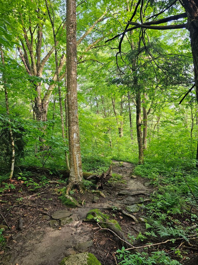
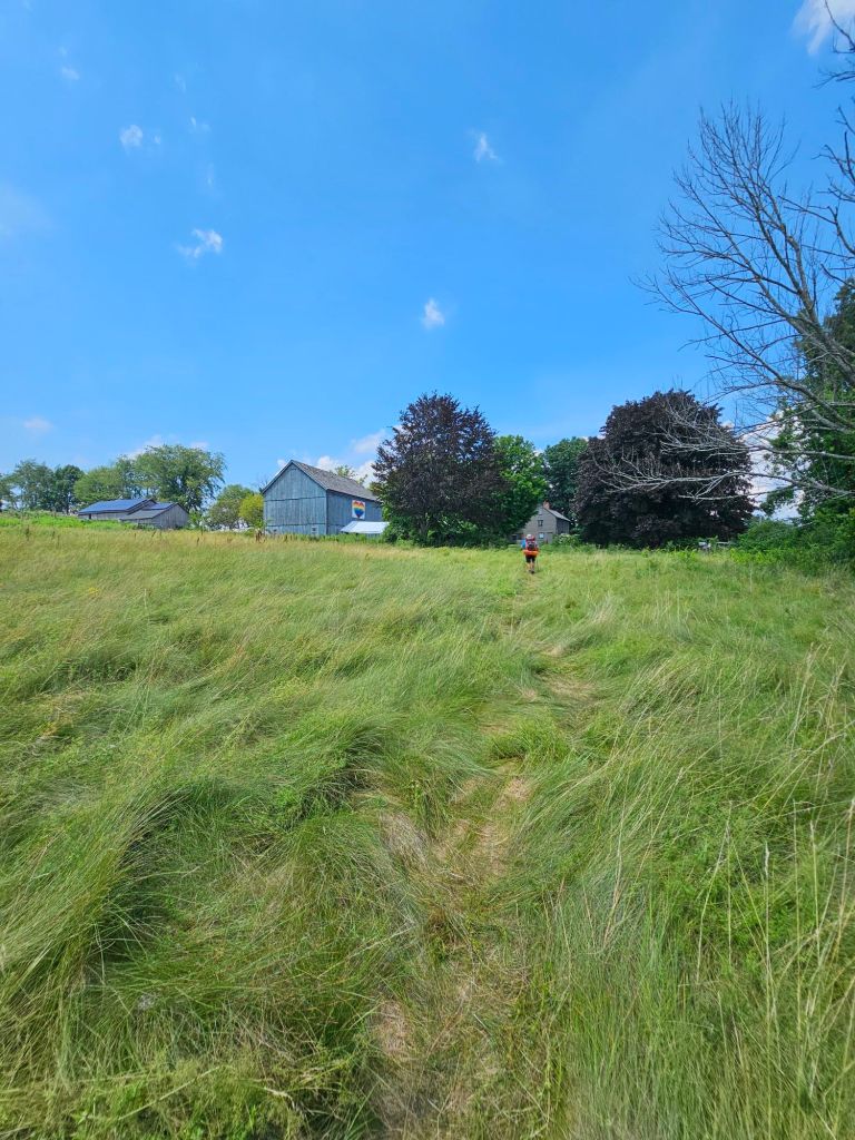
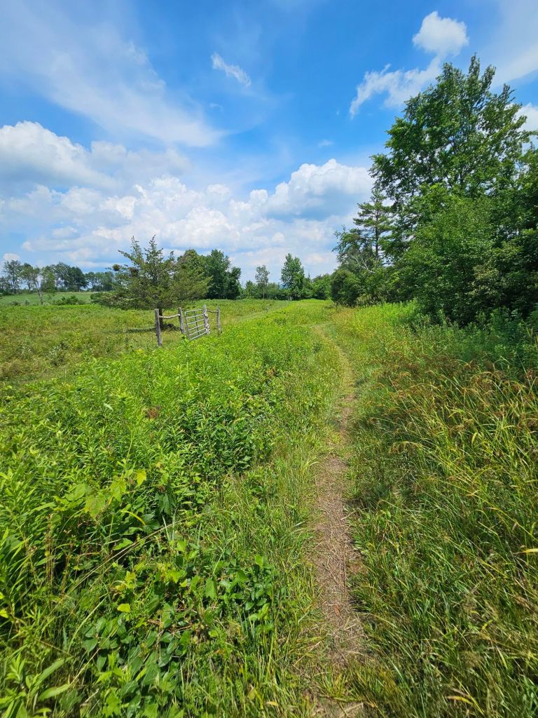
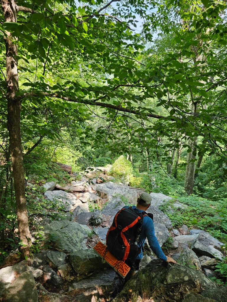
Up we climbed to the peak of the Bromley ski area. Then, down, we slid and sloshed through thick black mud. Then back up over slick wet rocks and roots, and then back down, carefully a top tall rocks, exposed wet roots, and more mud. At times, we think we are actually just hiking a 10-mile loop circle and haven’t really gone anywhere…it all looks and feels the same. Miserable. We’ve decided that we’re going to produce a YouTube video about what it’s really like thru-hiking. Most YouTube bloggers are lying about how wonderful each day is because it is not. It’s hard and monotonous, with moments of joy and fondness. Why do we continue? We haven’t quite figured it out yet. Maybe once we have, we’ll be done with thru-hiking. Until then, we march on.
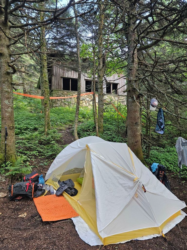
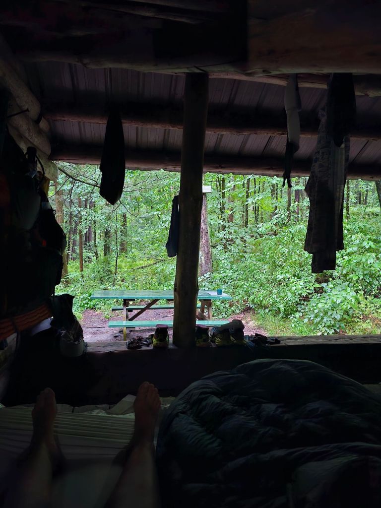
No room in the shelter so tenting it was. Trying to “dry” clothes inside the tent is futile
We slog ourselves to the Peru Peak Shelter. As expected, it is full, and so are most of the limited campsites, but we squeeze into one and call it a day. 10 miles was not the NERO we had planned on.
Day 24: 9.7 mi. (1668.2 – 1677.9)
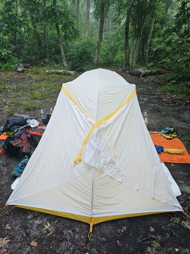
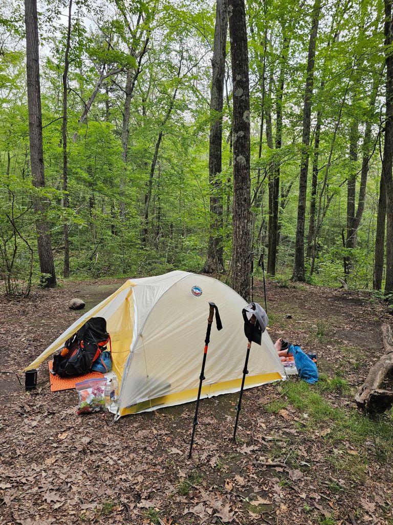
Something about rain falling atop ones tent makes for good sleeping. It also makes for puddling under ones tent as well. Our tent performed well this night. We finally are satisfied with our decision to switch to the 3-man Big Agnes Tiger Wall tent from the 2-man. The 3-man allowed us to pull all our gear (packs) inside and still have room to sleep comfortably and keep everything dry. (That is still dry) Success!
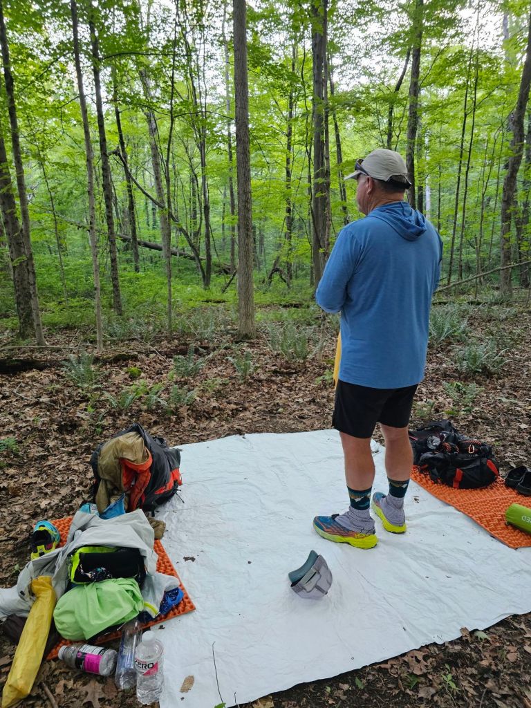
The trail was 50/50. Some good. Some awful. The awful part was NOT good for my already inflamed foot. We managed to take regular breaks to manage the pain and had our first breath of sustained sunshine and a “yard sale” to dry out a sopping wet tent and ground cloth.
Little Rock Pond
We wanted to push another three miles, but we thought better of it with regard to my foot and called it at 3pm when we reached the Little Rock Pond Shelter, and experienced our first set up on a wooden platform. We are now fans, that’s for sure.
Super fans of platform camping
It rained that night. But, before it rained, we were treated to a light show. Flashes of light lit up the night sky in a pulsating rhythm we first noticed from the nylon veil of our tent. We both peaked our heads out saw the most peculiar light show with stars shining bright above us. To our amazement, no one else seemed to notice.
Day 25: 13.6 mi (1677.9 – 1691.5)
Today’s tread was fairly pleasant. It felt like “home” in that we could develop a rhythm to walking and look around for a bit rather than watch our feet constantly. To accommodate my foot, we took regular breaks on the hour. It seemed to work. All was good until the last 3 miles to camp. We were on a 2mph pace u til we weren’t. One slip and fall, and all the wind came out of my sails. I purposely took a route to avoid the mud covering a steep and slick rock face that had an obvious slip and fall mark from the previous victim. Within a foot of making it to “dry/flat” terrain, and to my and Paul’s suprise, both feet suddenly are out from under me, launching me violently backward. Instinctively, I contorted myself into a “breakfall” of sorts. My pack absorbed the brunt of the impact, almost knocking the wind out of me. I wrenched my right shoulder a bit, but not significantly. After that, it felt a bit wobbly, which made for a slow slog to camp. It didn’t help that the last mile was uphill to the Claredon Shelter following a stupidly dangerous scramble for one with no trail legs, or goat feet, and maybe a slight concussion. Tonight is a night for Advil…mainly because I have no whiskey.
Day 26: 10.4 mi (1691.5 – 1701.9)
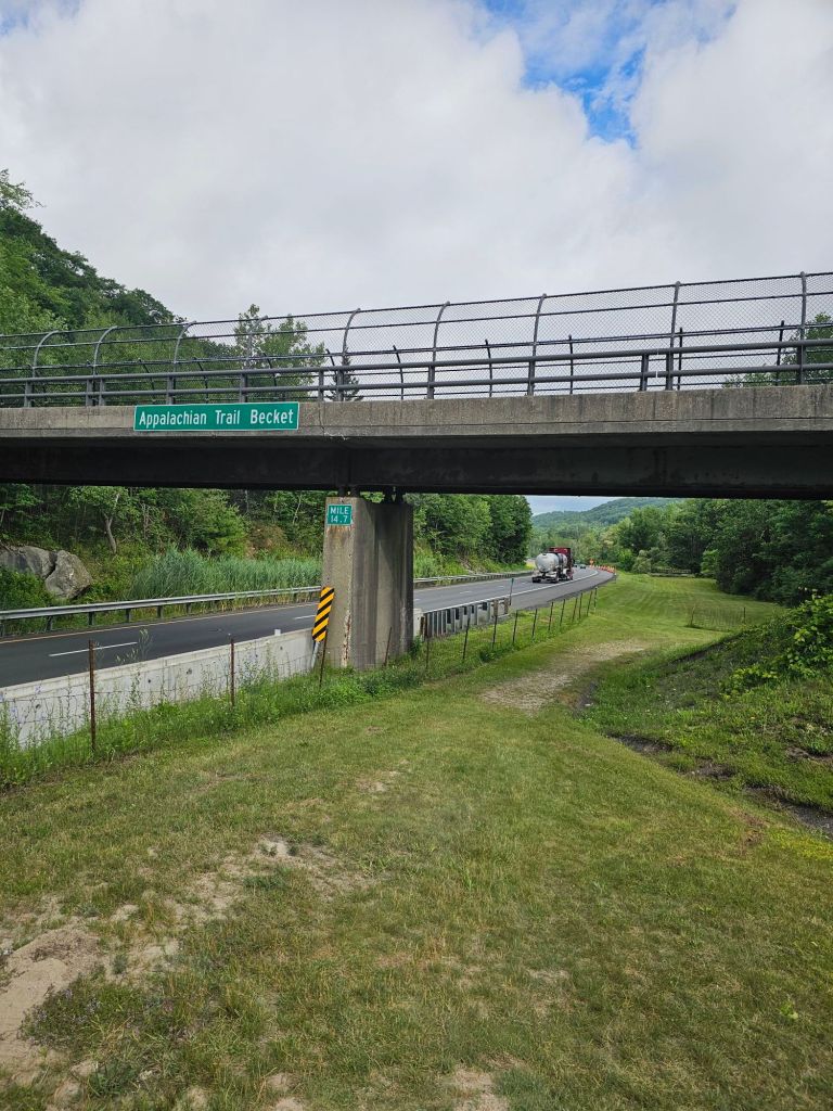
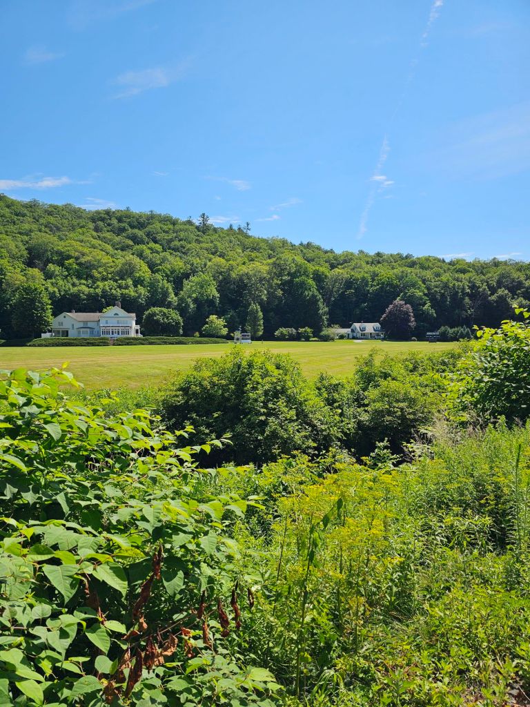
500 miles till Katahdin, easy water and lush vegetation for 2/3 of the way.
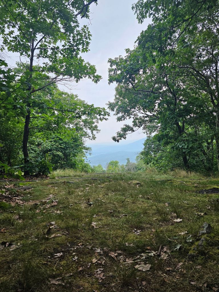
Amazingly, we felt pretty good after our near 14-mile day. Looking at the elevation for the day, we knew that the first 2/3 of the day should be pretty “easy,” and it was. We hit a comfortable,near 2 mph pace. We even crossed the 500 miles till Katahdin mark. We were actually looking forward to the climb up to the Killington mountain and top of the ski area. This is the highest elevation point in Vermont at 4,229 ft. The only problem, was the final climb to what we thought was the top (like Bromley, and the “ski hut”) was total shit. Not a view of any part of the mountain, and the trail was sluffing off the hillside, which required carefully picking ones way across tenuous terrain. I can’t even imagine trying to negotiate this route in inclement weather. You’d be a fool! Maybe if we were younger, it would have been exhilarating. For us, it was just plain stupid and a waste of our time and limited energy. My foot was screaming by the end.
The “Lodge” behind us
Now for the down. Breakfast and new shoes…hopefully.
Short miles, but it’s all Paul could muster after leaving from a leisurely morning. It rained last night, so we figured we let everything dry out. The next two afternoons are supposed to be “extreme” thunderstorms, so it would be nice to have all “dry” stuff. The day was uphill ALL the WAY. We took little bites at a time as Paul was still not 100% with regard to energy.
Giddy-Up
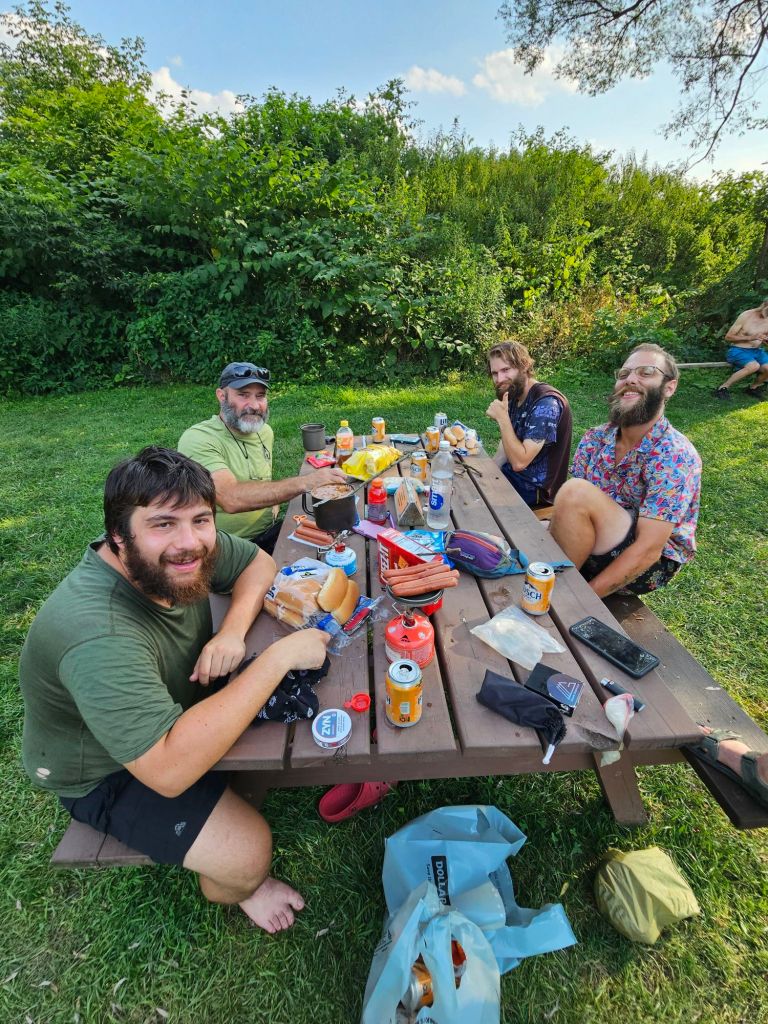
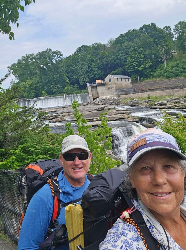
We ran into Giddy-Up again. He’s been slack packing most of the trail he’s spent his life. For the last 4 days, he, too, has been having stomach problems. Something going around? We hope not. We arrived around noon at the Mark Noepel Shelter, and toyed with the idea of maybe going all the way to Greylock, but then that idea was quickly dashed after Paul layed down in one of the bunks and went to sleep. Nope, we’ll stay. Later that afternoon, just as the skies were darkening, two other NOBO hikers arrived. They quickly filtered water and were betting on their trail legs to get them the next 3 miles to Mt. Greylock before the skies opened. We wished them luck. Shortly thereafter, two other hikers arrived, Sweat Potato (he’s a software engineer from Idaho) and Unicorn (who is totally Keto for this hike. Watched him eat a brick of cheese and a 5lbs summer sausage). Both wondered aloud whether the two that had ducked in for water would make it. Neither were confident, when suddenly and right on time as predicted by our weather app, the wind blew fiercely and then the sky spigot was turned on FULL!
Curtain of rain pouring from roof
We all watched in awe as the deluge came down. The air roared, and the sky blinked. It was an angry storm for sure, and we were glad to be in the shelter. Some time later, another hiker dressed in a thick yellow slicker that covered he, and his pack showed up. Sasquatch was his moniker. He was a SOBO and had gotten caught on his way down from Mt. Greylock. He joyfully emerged from his slicker, “That was NUTS!”, he exclaimed. We all looked at each other in agreement. Sasquatch was full of, what I suspected was nervous energy, having hiked through a deluge of an electrical storm. Can’t say I blame him. Needless to say, he kept us pretty entertained into the evening, especially when he exited the shelter in the driving rain to set up his tarp for his hammock. What?! We reminded him that there was room inside the shelter to set up his hammock, but he declined, saying, “I snore pretty badly.” Alright, no argument there.
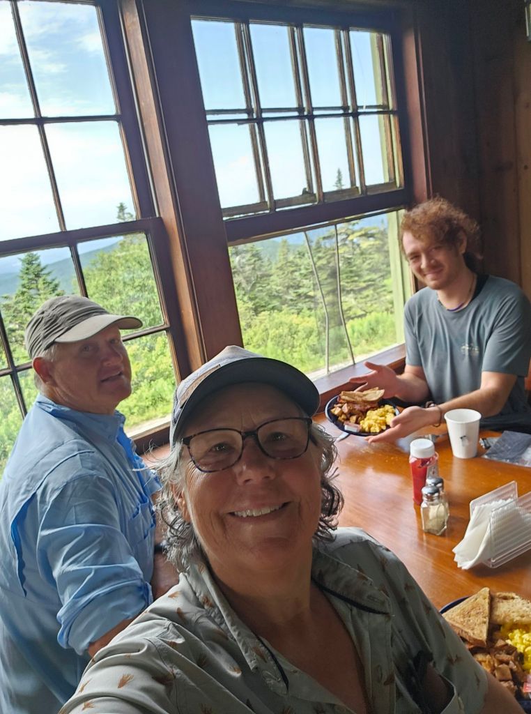
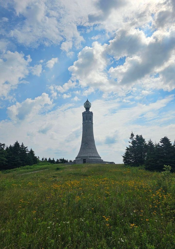
Our plan for the morning was to get up early and try and make breakfast at the lodge on Greylock. Sweat Potato was down for that, as well. Ascending Mt. Greylock would find us at the highest point (3,489 ft.) in Massachusetts, where in the 1930’s they built a war memorial to honor those who fought in the “war to end all wars”, WWI. Too bad we didn’t learn from that war.
Day 17: 9.6 mi. (1590 – 1599.6)
Up and early we had a cooler morning than we’ve experienced thus far. It was refreshing and felt “normal”. Granted it would have liked to have eaten something, but Paul was feeling good and ready to go. And that was a relief. We wound our way uphill to Greylock and arrived just in time for breakfast at the Bascome Lodge.
Breakfast at Bascome with Sweat Potato
Bascome Lodge is one of the many buildings built by the Civilian Conservation Core (CCC) in the 1930’s.
Mt Greylock War Memorial
After breakfast, we examined the lighthouse style monument and climbed the spiral staircase to the top for its stunning view.
Boy we have a ways to go!
We didn’t tarry long as we knew another storm was scheduled for the early afternoon. Our job was to get into Williamstown before it broke.
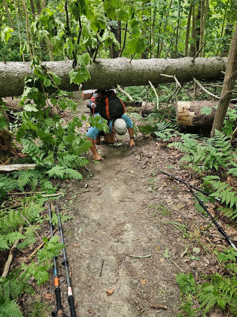
A couple of blow downs from the. Ight before, created a slow down for us
We were so close to making it to the motel dry, but no, soaked to the bone it was. Rocky from the Williamstown Motel picked us up at Hwy 2 and graciously drove us to his motel, where we were able to secure their last room. At least that timing was good. Once we arrived at the motel, we had two problems. 1. We had no dry town clothes, and they didn’t have loaners. 2. Paul’s phone wasn’t working. It was telling him that he was mow missing his SIM card. How does that happen. Likewise, my phone wouldn’t charge due to moisture “detected ” in the charging port. Great. Thankfully, there was a hair dyer in the bathroom, so I got to drying the essentials, our shorts. Our sleep shirts, rain jackets, and Crocs would get us around. Hopefully, the Verizon store in North Adams would be able to help us. First, we had to get there. Rocky pointed us to the free municipal bus, as it would take us to exactly where we needed to go. He said he’d come pick us up if the bus stopped running by the time we were ready to come back.
The bus dropped us exactly where we needed to be. John at the Verizon store treated us well, and soon Paul had a working phone, and as bonus, we had a lower bill. Trail magic?
View while waiting for bus back to Williamstown
Day 18: 11.5 mi. (1599.2 – 1619.7)
It poured ALL night long. We are so glad we made the decision to motel it last night. I’m pretty sure we would have been wetted out and fairly miserable. It was a bit of a late start, as one can’t pass up a continental breakfast or a ride back to trail. Not to mention, I awoke to looking like a Unicorn. Apparently, a mosquito got me smack dab in the upper forehead. This is gonna make pulling down my hat brim a little uncomfortable.
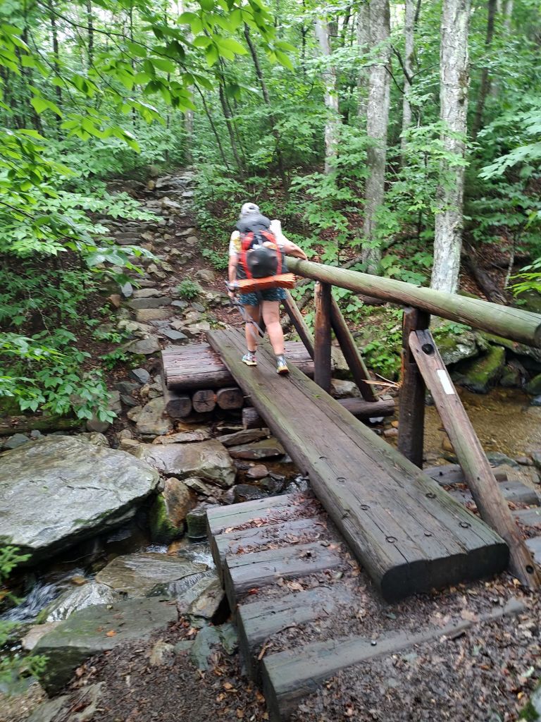
As we started the trail, a beautiful stream sauntered beside us as we climbed. It appeared that Massachusetts was going to usher us out as we came in. A bubling stream and a rolling climb. Today, we would finish our second state on the Appalachian Trail, and enter Vermont.
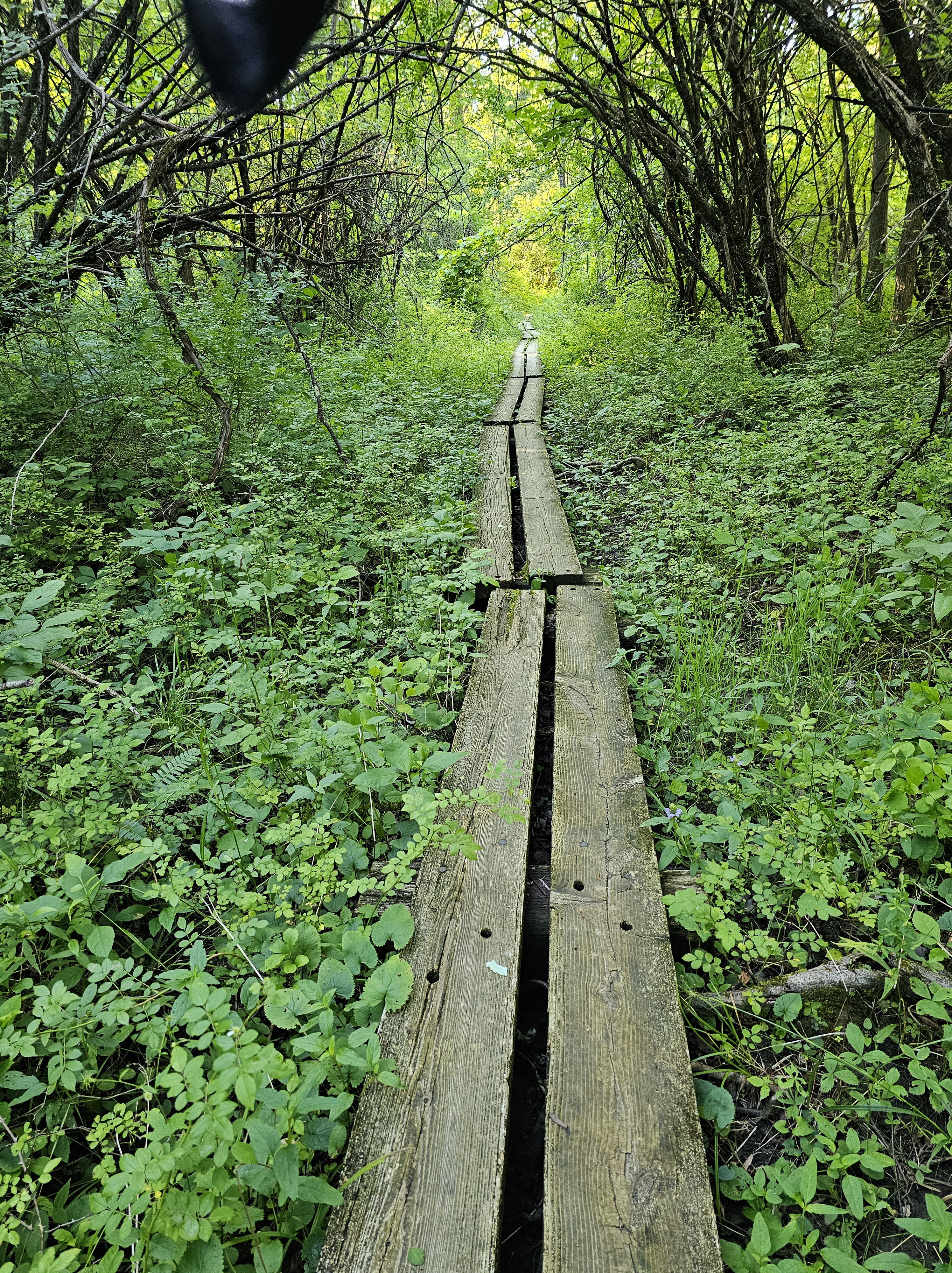
Vermont welcomed us gently and then turned on us. ‘Oh, you thought Connecticut and Massachusetts were bad with roots, rocks, and climbs? We have those too, but we’ve added MUD to the mix.’ Squishy black, shoe swallowing, mud. Nice.
If it weren’t for these strategically positioned rocks we’d be more muddy than we already have gotten
We now understand why they call it Vermud. The mud has a way of hiding hazards. The edge of my left foot caught one and caused some serious discomfort. So, our planned 14-mile day, reduced to 11.
Seth Warner Shelter
This left us by ourselves in a relatively new shelter ( Seth Warner). Darn. Tomorrow, we duck into Bennington for a quick resupply.
Day 19: 8.9 mi. (1610.7 – 1619.6)
So we had the shelter to ourselves for the night, which made for a casual morning. We knew it would be a short mileage day, as we have to duck into Bennington for a 4 day resupply. We have yet to figure out our eating verses mileage formula for this trail. I do know that we are getting hungrier. The problem is that healthy food carries are so much heavier.
It appears that it won’t be the treacherous parts of the trail that will do me in, but the easy, cruisey parts. Once again, on the “pleasant” side of Harmon Hill, I violently rolled my right ankle yet again. The soft dirt broke my fall, and the ankle roll nearly broke my spirit, as Paul exclaimed, “It’s perfectly flat. How does that happen?” I have no answer, only that if it weren’t for the fact that this ankle is so loose as it is, I’d be done.
Back on my feet, I didn’t even bother to dust myself off. What’s the point. We snacked at Harmon Hill and called Maria to shuttle us to the Bennington Walmart. She’d meet us at the Hwy in a black Jeep. Our final descent to Hwy 9 was rigorous in the fact that it appears that short people, or people with impaired knees, do NOT build steps or are at least not consulted. Oh, to have trail legs. We made it to our ride with several minutes to spare with our proposed estimated arrival.
A quick resupply at Walmart, and Maria picked us up again and drove us back to trail. In speaking with her, we discovered that her daughter is currently hiking the PCT. In fact, her daughter rode with us AND stayed at Camp Lockett (CLEEF). Paul quickly pulled up her picture from our campfire program. Maria smiled in affirmation, “That’s her.” Who’d a thunk that the mother of YouTube sensation, “The Hiking Dancer” would be our shuttle driver on the Appalachian Trail. The world continues to shrink.
Four days of food, and up the hill (1357′) we walked for another 1.6 miles and to round out the day.
Day 20: 12.8 mi. (16+9.6 – 1632.4)
It was not a good day. AT ALL! It wasn’t that muddy, but my foot was still sore which made for a bad attitude, which became amplified when Paul thought it a “good idea” to help me be “more efficient ” in using my trekking poles. He tried to be “helpful” like that 10 years ago on the PCT, with similar results. In any event, we were able to stomp out nearly 13 miles, before we called it at the Kid Gore Shelter.
Day 21: 14.4 mi. (1632.4 – 1650.9) via blue route
Good thing we arrived at the Kid Gore Shelter when we did and got a campsite because this place was packed! The kids were up till late, yapping loudly and up early again for the sunrise that presents itself at this particular shelter. With the exception of the first night on trail, we both have yet to sleep well, or at least soundly and awake rested. We are, however, having wild dreams. What’s weird is that the content is completely unrelated to hiking or anyone/thing we know. Completely bizarre how our brains can generate things we have no conscious experience with. On the other hand, our feet are feeling better each morning, which is encouraging.
But, what a difference a day and a clean pair of underwear makes. It’s town day, and with a much better attitude, we hit the trail. Our first stop will be the purported best spring water on trail by the Story Spring Shelter. The reports on FarOut are NOT wrong. The water is glorious. While there snacking and drinking, we watch as “Mowgli” pulls out a sticker (ours) and places it on his phone cover. Paul asks him, “Hey. Where’d you get that sticker?” “Not sure, but it’s cool, “Mowgli replies. After some discussion, we narrow it down to the cabin at Goose Pond, where we left a litter of stickers. Paul tells him and the others resting at the shelter about our business, and we pass out a few more stickers, and glean information from them as to what we have to look forward to when we flip.
Because my foot was still a bit tender, we opted to take an alternate that would keep us from a big climb and descent. This would shave off 4 miles, but possibly save us from a zero or more once we made it to Manchester. Even so, we still stomped out just under 15 miles, our best day so far. We can’t seem to trek much over 2 mph. Our average is 1.5 – 2, so far. Without trail legs and goat feet, anything averaging 2mph will be impossible with the tread of this trail. With tired feet, and just after a flowing stream, we found a stealth site to camp. There is no way we were going to make that last 1.4 mi to the shelter.
Day 22: 7.2 mi (1650.9 – 1658.1)
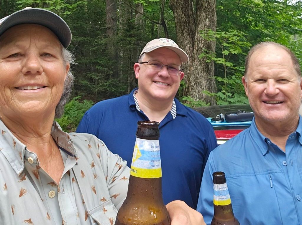
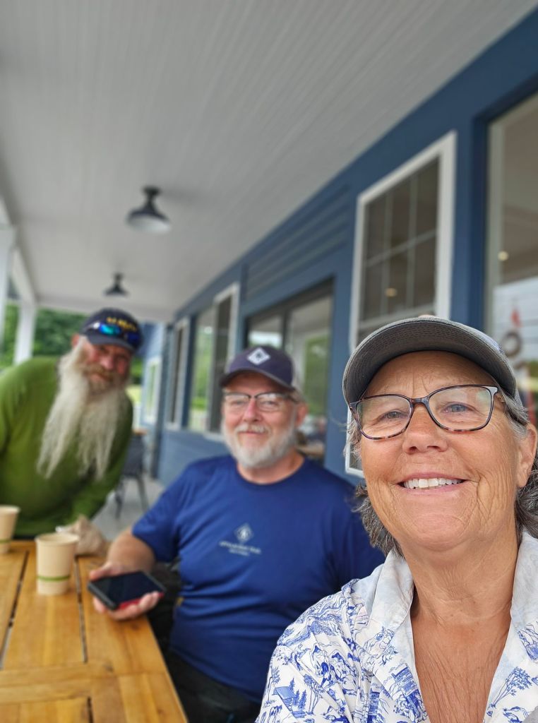
TOWN Day!! Best night’s sleep so far. Stealth camping agrees with us. Motivated by town, we moved rather “quickly,” or rather the trail “allowed” us to… until it didn’t. Needless to say, the last 3 miles were not as easy as the first 4. When we got to the highway, we crossed the road into the trailside parking lot and we’re greeted with amazing trail magic. By the time we had downed a beer and some treats, a car arrived, dropping off another thru-hiker. He announced, “I’m headed back to town. Does anyone need a ride?” Yup!
Michael zipped us into town and gave a tour of the town of Manchester, which included the Orvis corporate headquarters, outlet, and fishing school. I so wanted to get out and take a look, but I knew better. Eventually, he dropped us at the Hampton Inn, where we used our points and got a room. From there, we hooked it to the outfitters, for some food, a new filter cartridge, and a pair of shorts that hopefully will dry faster on/for me. Next was Shaws (like Vons or Albertsons) for the remainder of our resupply, fresh food/dinner, and a couple of beers.
Appetizer
One thing Manchester does not have, are any phone stores or repair places. Since leaving Williamstown, I have not been able to charge my phone. It keeps telling me that the charging port is wet…but it’s not, anymore. Our “waterproof ” phone carriers on our pack are no longer waterproof. It appears that we’ve worn them out or that it’s too darn wet all the time for them to even keep up. I was finally able to call a Verizon tech and just like taking your car to a mechanic to tell them about a noise, and the noise goes away. Somehow, it began to charge, but intermittently. The tech was able to walk me through a way to reset my phone (without losing anything) and allow it to charge via the charging port. When we get into Rutland, I’ll go to the Verizon store there and get a wireless fast charger so I won’t have to use the charging port to charge my phone. Duct tape and a zip lock bag should keep it safe till then.
Because we could, we hit the jacuzzi for a good soak before bed. With laundry done and bags packed, we watched a movie as it poured buckets of rain outside our window.
Dalton seems like a sleepy town, with not much going on, but did you know that this is where the paper for our US dollars and several other foreign currencies is made?Crane and Co., a Massachusetts-based company, here in Dalton has been providing the U.S. Bureau of Engraving and Printing with paper for U.S. currency since 1879! What?! And that’s what you get from talking to locals.
Two days in an Airbnb in Dalton, and we are ready to get back on trail. Feet and knees are feeling recovered, and the heat rash is almost healed.
We almost made it with Zero miles for Sunday. However, the bus wasn’t running, and hitchhiking is not real popular here, it appears. Dan, our Airbnb host, graciously dropped us at Walmart to begin out resupply. We figured it would be an easy hitch back. Nope! We definitely needed a sign. We also blew it when we didn’t take our empty packs to carry our goods. So, farmer’s carry it was, for 3 miles, with hefty Walmart bags filled with assorted other store items from the grocery store and Dick’s Sporting Goods in each hand. In veiled optimism , we rested at each shady spot and stuck out our thumbs, to no avail. By the time we got back to the Airbnb, 3 hours had elapsed.
Of course that included our stop at Zinky’s to cool off in the AC and drink an ice cold beer, as well as stop at Angelina’s sub shop for a sharable Philly Cheessteak sandwich. A little nap, followed by a little packing, and all we needed was morning to come.
That’s the thing. Morning. We’re not sure when or where it happened, but Paul ate something bad. Considering the only thing I didn’t eat the same was a stick of sweaty string cheese from Walmart, we feel that is the culprit. He was up all night in misery, while I slept soundly. Go figure.
On a side note. An interesting thing occurred while in Dick’s Sporting Goods. While reaching for the permethrin spray, I noticed a single dime on the floor at the edge of the display. What an odd place to find and/or see a dime on the ground.
And then I thought, KENNY! Dude, you are with us on this trail! Our friends Matt, Bob, Brian, and Kenny’s wife would understand. I picked up the dime and walked over to show Paul. He looked at the dime in my hand, I pointed to where I found it, and he chuckled and said, “Kenny”. So, in fact, Kenny is now traveling with us. I got to say, he’s brilliant. A dime is so much lighter than carrying a scane of his ashes on this constantly damp trail. He would have been mud by the end. He now rides zipped securely in my right front short pocket. It is the only change I will carry this trip. All other change from cash purchases will go into a tip jar.
Cheshire, Massachusetts
So now, on Day 15, we find ourselves in Chesire Massachusetts set up at the Father Tom AT campsite…a mere 8.8 miles from Dalton, waiting for Paul’s plumbing to settle fully before we march out more miles toward Katahdin. Another day of rash healing won’t hurt either. Mt Greylock is hopefully on the hiking menu for tomorrow…or the next day. At this point, it is now health dependent rather than weather dependent.
Father Tom Campground
While Paul was reclining in misery at the campground, I and another hiker Popeye took the campground bikes for a spin.
Now if it wasn’t for Paul’s temporary illness, I wouldn’t of had the opportunity to cycle the former rail line (now mutli-use trail) the length of the Chesire reservoir. Miles are miles right?
Chesire Reservoir
But also, in my wandering, I discovered that one of the towns former inhabitants John Leland, was pivotal and certainly influential (his autobiographers say) in the radification of the US Constitution and the creation of our Bill of Rights, particularly with regard to freedom of religion.
Replica cheese press in the background
It appears that early on, the Anglicans didn’t much care for the emerging Baptists. And once upon a time, tithes were compulsory to the state run Anglican church. Thus Leland, a Baptist Preacher, and a free man, thought that each individual should be able to worship their God as they wished “without being prohibited, directed or controlled therein by human law, either in time, place or manner.” In other words, government stay out of my business, or anyone’s for that matter. Hence, the push for freedom of practice of religion.
But wait, there’s more! Old Leland wasn’t satisfied with just the ratification of the Constitution and the penning of the Bill of Rights. He, for some reason, in 1802, thought it a good idea for the citizens of Chesire to create and present to President Jefferson a “Mammoth Wheel O’ Cheese”. Somehow, he inticed every member of his congregation, who owned a cow, to bring all the milk produced that day to a cider mill and see what would happen. It made three wheels of cheese, one of which weighed 1,235 lbs. That’s the one they sent to the President. It took over three weeks to get to the President. Once there, Jefferson cut the cheese, and it lingered for two years in the White House.
The things one discovers on a walkabout, and you have time to truly wander.
Either our legs are getting stronger and our endurance is getting better, or the trail is getting easier and our packs are getting lighter. Probably both.
Day 10: 12 mi. (1528 – 1540)
Up until today, I have been plagued with a nasty case of blistering heat rash that even Vagisil could not conquer. And the rash is not in the nether region, but at my bra-line, and is extremely painful. Hot and wet from sweat 24/7 and a constantly damp bra makes for a more than uncomfortable situation. Luckily, I found the ultimate in cure and protection during our resupply shopping.
This stuff is the best I’ve ever found, and from now on, sorry, Vagisil, you’ve been replaced. However, the rash is pretty bad, so if this doesn’t work by the time we get to Dalton, it’ll be time for Urgent Care.
Right on time, Pokey picked us up from McDonald’s. The morning was, and the day looked to be much cooler than the previous week, but it was still unmistakably muggy. We knew the day would include lots of climbing, and we hydrated ourselves appropriately the night before, but one never can tell based upon the humidity and terrain, how bad it will actually be. We have grown a bit wary of heat exhaustion and don’t want to get anywhere near that situation again. Even though it appeared a bit overcast, we could tell that the humidity was even worse than the day before. We were going to be close with our water calculations and the available water sources. Four miles per liter will NOT cut it here. Today is going to be more like 1.5 miles per liter.
The first half of the morning included a pleasant walk on the edges of farmland and head-high cornfields.
We crossed over the Housatonic River. Passed Haley Pond that looked more like a placid lake. By this time, it was 10am, and we were soaked through and through, as if we had been swimming fully clothed. Our 2+ miles/hour rate of walking dropped to 1.5 mph. By the time we reached the South Wilcox Shelter, it was 6 pm, and we had had enough. There was no 2 more miles push to the North Wilcox Shelter left in us.
Day 11: 16.2 mi (1540 – 1555.7 +.5)
Because it was supposed to rain, and there were reports of a “problem bear” in the area, rather than pitch our tent, we decided to stay inside the shelter for the night. The shelter was designed to hold quite a few people with several bunks and a loft. Thinking other hikers would arrive later in the evening, we squeezed into a double bed size bunk. It was like sleeping in our old two man Big Agnes Tiger Wall tent. After a fitfull night’s sleep, we’ve decided that we’d rather just set up our tent (three man Big Agnes Tiger Wall). And of our concern for additional hikers arriving and a supposed problem bear. Neither happened.
Once again, we started the day in musty damp clothing. We are beginning to smell like our son’s hockey bag when he was younger. While it evokes fond memories, the smell is still nauseating.
This day’s terrain was much nicer and easier to traverse. A comment on our FarOut app inspired us to seek out a spring just up a road from where the trail crossed over it.
It was simply marvelous. Icy cold, and refreshing water flowed into a large cast-iron pot. It was certainly worth the side trip. While we sat there taking a break, eating our lunch, we noticed that that road (Jerusalem Rd) marries up again with the Appalachian Trail. Considering the fact that my knee was swelling slightly, we thought a flat road walk was in order.
Of course, it led uphill, but we were treated to open views of farmland and amazing colonial architecture. As we returned to the AT, we stopped at the “AT Stand” and purchased an ice cream sandwich.
For the most part, the day was much cooler, and the humidity seemed much lower.
We moved with much more ease across boardwalk lined swamps and pine forest. I made the mistake of letting my mind wander from watching my feet on the trail and suddenly found myself hitting the ground hard upon rolling my left ankle. After a bit of whimpering and inventory, my hike was not over. I was going to be able to walk it off…mostly. By 6pm we were mostly ready to quit. The only problem there was no place to camp, so we pushed on to the Upper Goose Pond Cabin.
Day 12: 11.3 mi. (1555.7 +.5 – 15566.5)
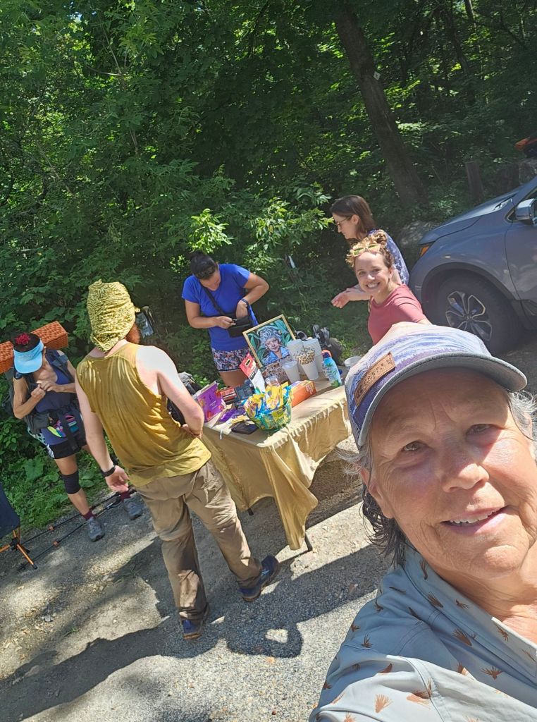
Best cure for a sore ankle and feet? Pancakes! Yup, at the Upper Goose Pond Cabin, volunteers serve coffee and pancakes every morning. The cabin is owned by NPS but is staffed and maintained by Massachusetts AT volunteers. It’s a nice way to meet and share stories with other hikers. There were even a few we recognized from Salisbury. As we drank our coffee and ate our pancakes, we talked and laughed with the likes of Jupiter, Day One, Flix, MGD, Rabbi and Squeeze Cheese.
This week’s volunteers
While my ankle felt a little stiff, it was not discolored, so that was a relief.
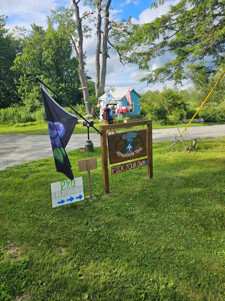
Our plan was, at minimum, get to the October Mtn Shelter, but if we felt good, we’d keep going all the way to the “Cookie Lady’s ” house on Blueberry Hill, where we would camp for the night.
In the sweltering heat, over more boardwalk marshes and with thanks to frosty cold trail magic by Mike, we made it. We had been talking about how cool it is to have a “Cookie Lady”, who has fresh cookies waiting for you up the trail, but wouldn’t it be even better to have “Beer Lady”, waiting for you with an icy cold beer…or two? Well, that’s what Mike was. He decided that in the sweltering heat, someone ought to look after the hikers, and that’s what he did.
He posted a sign just before the county road crossing. Had a shaded place secure from bugs. Seats upon which to sit. A battery pack to charge your electronics. All manner of trail snacks. AND frosty cold drinks, to include beer! Hmm. Gatorade or beer? We have never been one’s to pass up beer, on trail, regardless of the time of day. So, to Mike’s amazement, we cracked a beer and sat in the bug-free shade and chatted with this amazing trail angel Mike before heading on.
We made to the Cookie Lady’s house, nearly melted and feet on fire. An ice-cold jar of iced tea, a homemade cookie and cool green grass was our welcome. While you can work for your dinner by collecting blueberries on their property, we opted for what we had. We were worked, and had no work to trade.
It rained hard that night with the night sky erupting in flashes of lightning. The air was electric and sticky which made it hard to sleep.
Day 13: 9.6 mi. (1566.5 – 1576.1) and a NERO!
Utter stickiness. It can drive a person crazy. The only thing keeping us sane (depending on your definition of sanity) is that we have an opportunity for a shower, a bed, AC, and clean, dry clothing in Dalton. We secured the room at Daniel’s in Dalton for the night, and we’re hopeful to secure it for another night and a proper ZERO.
After a leisurely morning and gleening trail information from SOBO hiker “Fun Fact” we headed out. Fun Fact let us know we were in for a “stupid climb” and then a “needless steep descent” just before we reached the town of Dalton. We were hardly surprised, as PUDs (pointless ups and downs are the norm, so far, on this trail).
Halfway through our morning hike, and to our utter amazement, another road crossing found us treated to another session of pop-up trail magic. Our angels were two self-proclaimed SASHERs (Short Ass Section Hikers), who were out doing trail magic for the day. They had fresh veggies, hummus, and fruit, along with iced coffee and all other manner of hiker treats.
We are beginning to admire and appreciate the vegetation
Seems like heat waves, weekends, and road crossings are the key ingredients for trail magic. We’ll file that recipe away for the future.
Once into Dalton, it was time for a shower and laundry. Food can wait. I will say though, that the magic didn’t stop there. Just before we dropped down into Dalton, a group of local hikers asked us where we were headed. Dalton, we said. “Be sure to eat at Zinky’s”, they told us. “Best food in town. You won’t be disappointed!” We’ll, I can tell you, we followed their advice and we’re definitely NOT disappointed. In fact, unbeknownst to us, as we were talking with a nice couple at the bar, having finished several thousand calories of deliciousness (solid and liquid), and we’re just about to call for our check, they advised us that they had taken care of our check. What?! No way! Not gonna lie, I teared up with gratitude. It was so unexpected.
Massachusetts, you and your people are growing on us.
This week, we are once again immersed in humidity that even lifting a cold beer to your lips would cause you to sweat. While there is a heat advisory for the “muggles”, who aptly heed the warning and stay inside, we, on the other hand march along over root and rock thankful for the frequent streams and the green tunnel of shade. Otherwise, I’m pretty certain we would “stroke out.” Heat stroke, that is.
Day 8: 10.6 mi (1507.5 – 1517.8 +.2)
How our day began
So today, we finished the state of Connecticut and climbed three mountains, each with its own challenging descent. One of which landed us in Massachusetts.
Lion’s Head
Lion’s Head (1,714 ft.) had no resemblence to a lion, as far as we could see.
Bear Mountain
Bear Mountain (2,312 ft), was literally a bear climbing down. We found ourselves on more than one occasion scooting on our butts. Four points of contact was required at all times. So glad it hadn’t rained the night before!
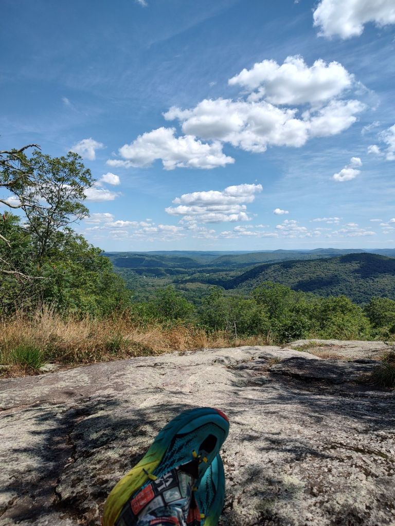
Mount Race, where we chose to lunch in the shade.
Mount Race (2,361 ft), which was preceded by the Mt. Race Ledges, which involved skirting across rocky ledges that provided wide vista views of Massachusetts below.
I’ve got to say, we didn’t realize how happy we were to be done with Connecticut until after our descent from Bear Mountain, when we found ourselves in an old growth Hemlock forest. It was magical. The trail followed the edge of one of the most picturesque streams (Sawmill Brook), of which normally I would be scouting for fish. Not this place.
One of many waterfalls and swimming holes
The beauty was overwhelming and begged for us to stay and just dwell in it for a while. Unfortunately, with all thru-hikes, there generally isn’t that kind of time. So we took as much time as we could while filtering water and watched as two girls wandered along the trail in slow, graceful motion searching out mushrooms. While soaking my feet, after Paul had filtered our water, of course, we were treated to our first “on trail,” trail magic.
A local man “Pokey” was distributing Gatorades to hikers as he walked the trail. He told us in excited detail what we would soon come across. He also gave us his phone number in case we needed a ride into Great Barrington when we reached Hwy 7.
Our hero “Pokey”
Pokey was not wrong when he described Race’s Ledges. It WAS a walk along stone Ledges, with amazing views, where one would be careful not to miss-step.
Race’s Ledges
Our trek for the day ended at the Race Brook Falls campsite, where the treetops rustled in the breeze as if whispering to us goodnight.
Day 9: 10 mi. (1517.8 [+.2] – 1528)
Today was brutal. The high was stated as being 92°, with 90% humidity, which I think calculates to feeling like 120°. Of this, we would not deny.
Mt Everet, where there once was a fire tower.
Our major climb was first thing in the morning, up to Mt. Everet (2602 ft.). While the ups were not so bad, the downs were difficult on the knees. Most of the trail was not difficult, but the heat and humidity was draining. If it wasn’t for coming upon the April Hill Conservation Center, home of the Greenagers, I’m pretty sure we would have succumbed to heat stroke. We knew we were approaching heat exhaustion with our excessive sweating and unmistakable nausea, even though we were downing water and electrolytes. It’s just that we were starting to lose the battle. And as we approached a road crossing, what to our wandering eyes should appear, but a group of kids in gum boots lined up like little ducklings following the leader from the direction of a giant blue barn with a rainbow heart painted on its face. We asked their leader if he knew where the closest water was. He directed us to the barn, where we could sit in the shade and refill our dwindling water bottles. Originally, we had been racing to a road crossing where we were told they serve cheese burgers and sodas, but only till 3pm. While we had enough time to make it there, we knew we didn’t have enough water and/or energy to make it there alive. Thus, the pivot to the rainbow heart barn.
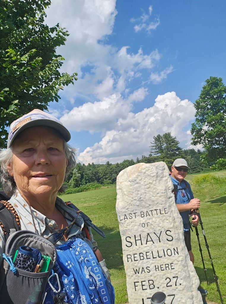
Timing is everything sometimes with thru-hiking, for as we pulled up under the shade of a large tree between the barn and several buildings, and we’re greeted with, “Sit anywhere you like. You can get water from the hose or inside. Would you like a popsicle?” All’s I can say is God is good…All the time. This was way better than a cheese burger. Who knows what we would have done if those kids hadn’t passed by. Most likely, we would have approached a house and asked for water or perused our FarOut app a little more thoroughly. Once sufficiently cooled down and watered up, we continued down trail upon raised boardwalk across a swampy area. We traversed through the location of the historic “battle” of Shay’s Rebellion and eventually reached Hwy 7.
Just as we reached Hwy 7, we spied a cache of ice cold sodas supplied by trail angel “Steady Stream”, and then called Pokey. Pokey picked us up and dropped us at the Monument Mountain Motel in Great Barrington, after having given us a tour of where to go for resupply and dining options. Before he left us, he offered to pick us up the following morning at the McDonald’s and take us back to trail. We gladly accepted. What a day!
The shelter worked out pretty good. Wearing earplugs in a downpour with a metal roof…even better. One thing for sure is it was DARK last night. So dark that when I woke in the middle of the night I couldn’t see my hand in front of my face, and then I wondered, was I really awake? So I deliberately opened and used my eyes and waved my hand just to be sure. Yep. It was that dark.
Morning was leisurely, as we all were waiting for the rain to stop. When it did, it was time to put on wet clothes…again, and start walking uphill, so we could go downhill into town. We were hoping to Zero in Salisbury, CT, so we could recharge, as this week was brutal for us. Between the heat, the humidity, and the lack of trail legs, we were a bit trashed. But first, we had to make that climb back up to the trail.
Just before we hit the road, we ran into a family of locals and asked them about Salisbury. They showered us with great Intel and even offered to take us in for the night if there wasn’t room at Maria’s (she and her grandson run a hiker hostel in town). When we got to the road, we called Maria’s and booked our spots.
We also ran into Julia, an AT Trail Maintainer for Connecticut, that we had met the day before. We also were immediately treated to trail magic (water and banana) by another family that pulled up to offer trail magic and pray over hikers…if they wanted. We said, “Sure, we need all the prayers we can get.” When they finished praying over us, we made the sign of the cross. This is when Julia leaned over and quietly asked, “Are you Catholic?” “Yes we are,” I replied. She then told us she goes to Saturday evening mass and wanted to know if we wanted to go. Absolutely! And with that, we walked into Salisbury for some fresh food at Le Bonnes Market (it’s like a small Whole Foods) before heading over to Maria’s to check and get a shower and laundry before Julia came to pick us up.
Julia reminded us of Maureen from our time on the Camino de Santiago. We called her the “pop-up queen”. Julia actually lives in Florida, but “summers” in Connecticut as a volunteer Trail Maintainer. She’s a retired engineer, and needed something interesting and purposeful to do.
Church was followed by resupply shopping and an ice cream from McDonald’s. It was the only way Julia would let us repay her for helping us out so much.
Julia and ice cream
Back at Maria’s, we discovered from Ed (Maria’s grandson) that Maria recently died (1 month ago) and that he is trying to carry on her legacy. We thanked him for working to continue her legacy and offered our condolences.
Now earlier, I had posted on Instagram that our battery packs had failed us. Turns out, one of the people who follows us lives in Connecticut and offered to help. She said she had two power packs she could bring us, as she was familiar and had stayed at Maria’s several times while hiking the Appalachian Trail. Ellie, is quite the accomplished hiker, and to be honest, over the years, we’ve gleaned plenty of hiking and gear Intel from her website, ( http://www.averagehiker.com ) It was great to finally meet in person, and especially share hiking stories, and her tips and knowledge of the AT.
AT water isn’t as crystal clear as it appears!
After Saturday’s nero and Sunday’s Zero, we were ready to get back on trail. Our water filter was cleaner, and our clothes were clean, smelling, and dry (for now). We replenished our bodies with healthy food. Changed out our long sleeve shirts for short sleeves, courtesy of Ellie, and mailed home nearly 5 pounds of gear/stuff we don’t need for this trail, at least not yet. The weather, or rather the humidity, is supposed to lighten up. Things are looking up! Time to get walking.
We wake with the sun…again, but still haven’t gotten into a rhythm of packing quickly and/or efficiently, which one would think we’d be highly adept at by now. Nope.
If it wasn’t for the uphills there’d be no downhill, and boy were there plenty today. Straight uphill, followed by straight down hill in humidity like we’ve never experienced. One could get heat exhaustion, if not heat stroke, if they’re not careful. Luckily, the water is as plentiful as the rocks and roots on this trail.
The uphill rock crawl climbs allow you to “mountain step” yourself up, but these downhill are something else on these old knees. I keep telling myself, ‘it’ll get better…you’re in hell week(s)…you’ve this before.’ In some ways thru-hiking is like child birth. You’re so excited for the run up to actually popping out that child, but when it comes right down to it, it’s hard and painful as hell, but you push through it because you have no choice. And then time passes and you think, let’s have another one, forgetting (actually downplaying and justifying) the discomfort you went through to get that beautiful child/thru-hike. Yup, we’re in “labor”. So, we watch our feet and pray for no “complications”, like a trip and fall.
From time to time, we are treated to a bit of flat, views, and colorful vegetation.
Towards the tail end of the day and our I tended mileage, as we are trying to heed our own advice, we came upon a douzy of a decent (500 ft in .5 miles) just past the St. John’s Ledges’ viewpoint.
Not sure what it’s called, but WTF comes to mind. Who designed this? I’m thinking that they wound this trail uphill (which was a beautiful rolling walk) and couldn’t figure out how to gracefully wind it down to the Housatonic River and make it home in time for dinner. I imagine the conversation going a little like this,
‘Hey don’t you think we should start heading back? I only brought snacks, and I don’t want to spend another night out here. The bugs are driving me crazy, and I’m almost out of paint. We won’t be able to get back before dark, if we back track.’
‘Maybe we can shimmy down this rock fall.’
‘I don’t know. It’s pretty steep.’
‘Oh don’t be a baby! The rocks look pretty stable, and if you squint your eyes, they almost look like steps. We can even slap what’s left of the white paint periodically on a couple of rocks on our way down and call it a day. Well, what’s it gonna be? We’re burning daylight here.’
‘Let’s go, I’m starving!’
To be honest, this route would have been much easier earlier in the day, certainly sans pack, and/or with trail legs and, more importantly, without a near crippling fear of heights. But what’s an adventure without nausea and challenges. I’m pretty sure that half mile descent took close to an hour and certainly dashed all hopes of adding another 3 miles to our day. Frankly, we were pleasantly surprised we didn’t die.
Once down to more stable terra firma, we were rewarded with a shaded and absolutely flat dirt road walk beside the Housatonic River to our now intended campsite at Stony Brook. Completely gased, we set up our tent minus the rain fly and were treated to a firefly light show as we drifted off to sleep.
Day 4: 10.4 mi (1480.8 – 1490.4)
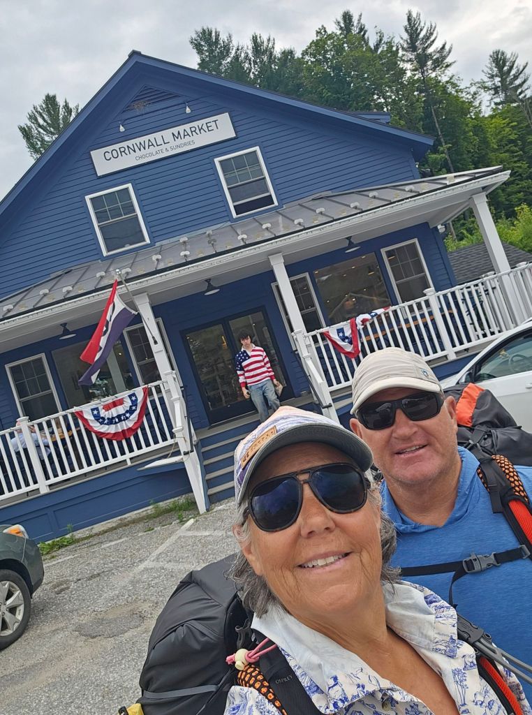
Today was supposed to be a “Nero”, where we would walk a couple miles, duck into “town”, for a 2 day resupply, and see if anything was afoot for the 4th of July. None of that came to fruition. We did get a pricey but delicious breakfast burrito, cookies for resupply breakfast, charge our phones, and chat with two NOBO hikers, “Let it Be” and “River Runner” at the Cornwall Market. With no real hint of 4th of July festivities and a few more provisions from the CitGo gas station, we moezied back to trail.
Southern California does nothing to help one prepare for humidity, let alone walking with a pack on in it. I feel like a four year old. I’m sticky 24/7. Wipes can’t even keep up with this humidity. We have found the air to be so moist that nothing is ever dry. In the morning, our clothes are just as damp as when we rang them out the night before. With the wet comes the critters like the Ref Eft who tend to park themselves in the middle of the trail. Good thing they’re highly visible!
By the time we got to our “nero” campsite, it began to rain. Rather than set up, we sat it out for nearly two hours. It was warm, and we pretended we were in Hawaii. Somewhat rested and still as damp as when we stopped, we decided to push ahead to the Pine Swamp Shelter, as we weren’t in jeopardy of getting any wetter, whether in rained or not.
We cross slow flowing creek and then find ourselves in a part of the trail they call “the Squeeze”. Knowing what we know now, we should have trained on a stairmaster while in a sauna. And, seeing that it was going to rain overnight…all night, we should have just cowboy camped in the shelter. For some reason, we just can’t bring ourselves to that just yet. I will say that the pond water (and taste) brought back memories of the CDT.
Day 5: 13.1 mi (1490.4 – 1503.1 + .4 to Limestone Spring Shelter)
It rained hard overnight. So much so that water bounced off the ground and back into the tent. And once again, we had the pleasure of donning wet clothes for the day’s hike. Not gonna lie, but I’m getting a little concerned about what the efficacy of our permethrin treated gear/clothing will be. If it is wet daily, does that count as a washing? If so, we’ve got to get to town soon and retreat our gear.
Eventually we walked ourselves damp (as opposed to drenched) and took a side trip into the Mountain Cafe, for some real food (read healthy), and to charge our phones. Our Anker battery packs are obviously too old to keep a healthy charge, and we’ll have to figure out a way to get some newer technology portable battery packs…sooner than later.
Our plan was to see if we could get to Salisbury by the end of the day, as a thunder shower was on the forecast. Needless to say, that didn’t happen. Salisbury, but not the thunderstorm. It appears that when the weather people back east here say it will rain a 4pm, they mean it will rain at 4pm. And their rain is not California drizzle. It’s turn on the fire hose rain. We did however, pass by the iconic Great Falls of Amesville and Giant’s Thumb before we climbed up to Mt Prospect (1448 ft), and it started to rain.
Mt. Prospect view
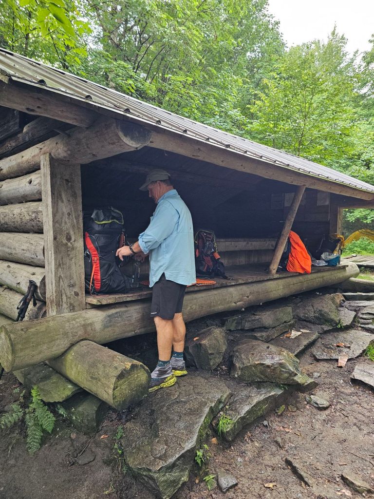
Shit! 4pm on the dot! While we saw plenty of places to camp, none were/are legal in the state of Connecticut. Here, you may only camp in official campsites. Thus, our only choice was to make it to the Limestone Spring Shelter/Camping, which was read to be a harrowing .5 mile descent off trail. The first .2 lulls you into complacency, as it really wasn’t that bad. In fact, we chocked the FarOut comments up to fear mongering, until the rain became a deluge and the thunder and lightning became synced. Nothing like working one’s way down precariously situated rocks as a river flows under your feet, praying to God that you are grounded in the event of a lightning strike. Highly motivated, we made to the shelter completely drenched and still alive, surprising its sole occupant, “Little Engine”. We are no longer hesitant to cowboy camp in shelters. We are ready for a Zero!
On the train to Pawling there were three other thru-hikers…or at least they were dressed like thru-hikers. A head nod on the train, resulted in a head nod once off the train, where we all went our separate ways…literally. We had food to mail forward, water bottles to fill, and phones to charge. Once all that was done, it was time to trudge out of town to Tony’s Deli for a sandwich to go. While normally we would have hitched to Tony’s, it appears that’s one illegal activity here in New York that is enforced and will actually get you into trouble.
Have sandwich, will Travel
Having not eaten anything but the cookies Hannah baked, an over-priced airport coffee and a few jerky pieces we dug out of our resupply box before boarding the flight from Chicago to LaGuardia, we were famished. Tony’s deli did not disappoint. The hoagies were stacked with delicousness. Before he handed us our sandwiches, he made a point to tell us in the thickest Boston (or maybe it was Maine) accent that he “loaded them up” for us. This was very much appreciated!
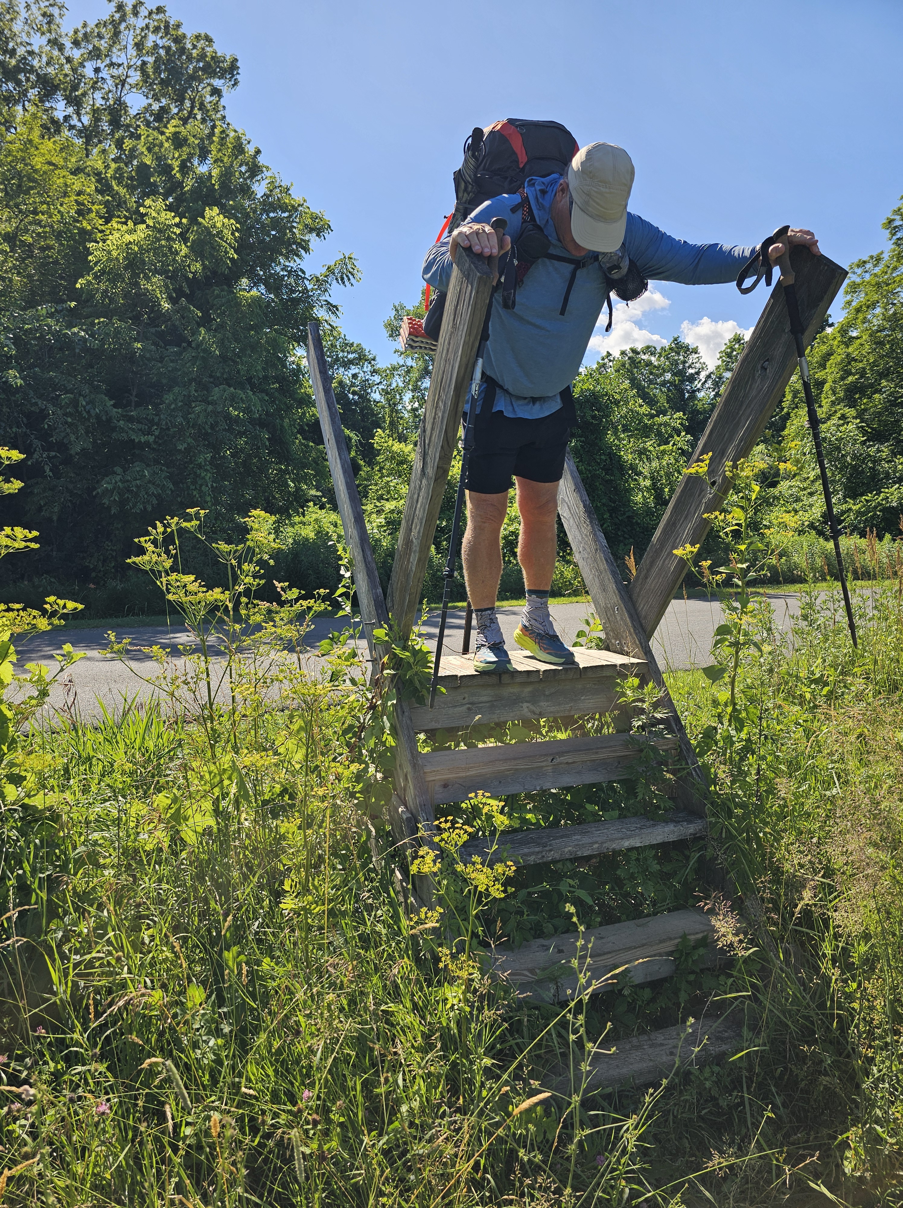
After devouring only half of the sandwich, which believe me, was more than enough, we packed away the other half and hit the road for our final mileage to our start of the Appalachian Trail. Of course, the start to the trail began with an uphill. Havent hiked a trail, so far, that doesn’t. The trail followed a mowed path and over wooden ladder fences. It was still a bit warm and somewhat humid, but not difficult. We had 2 liters of water with us to drink, but in hindsight, were pretty certain we not fully hydrated as we should have been to start.
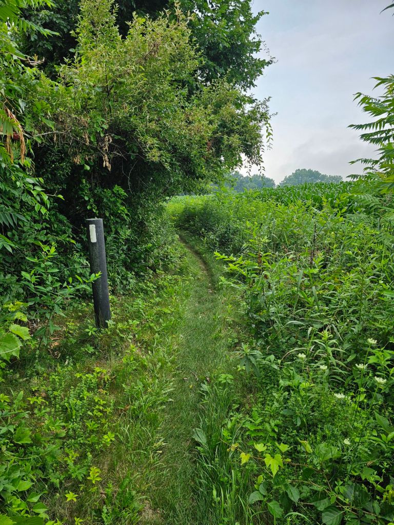
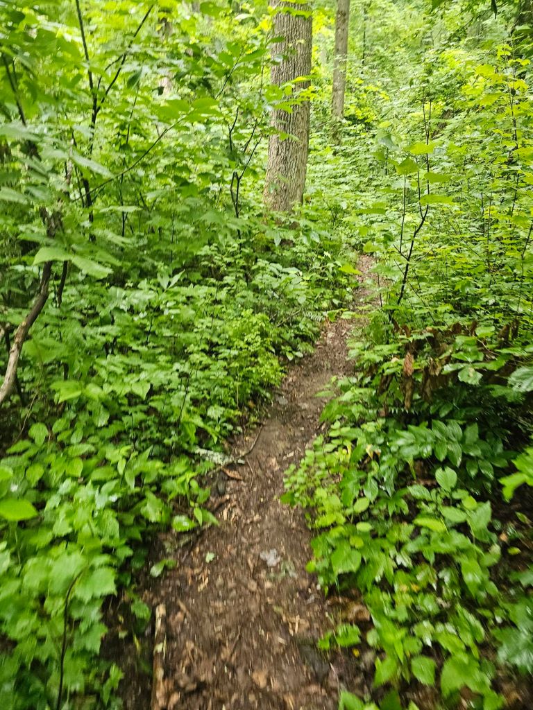
We traversed a field, where yellow finches took flight in droves of cascading waves as we passed. Our climb soon entered a green tunnel of overgrown vegetation. I do believe we are ahead of the “bubble”. Overgrowth turned to a series of wooden boardwalk paths atop muddy and marshy terrain, then back to dry roots and rocks.
After having been up for over 33 hours straight with our prep and travel, we decided to call it 3 miles into the trek around 7pm. It was actually the first open spot in which to set up our tent we found (and we had been looking…we were so tired). We considered the fact that water would be 2 miles further and a shelter another 1.5 after that, but we were too gased, and somewhat delirious to safely continue any further. Up went the tent. Down went the remaining half of sandwich. And out went the lights, the moment our heads touched our sleeping mats. The traffic noise from of a nearby road and a sounding train whistle, became muted, instantly.
Day 2: 12.8 miles (1457.8 – 1470)
Here we go!
When we awoke this morning, we both remarked that it was the best night’s sleep we’ve had in quite awhile. We are hoping that will continue.
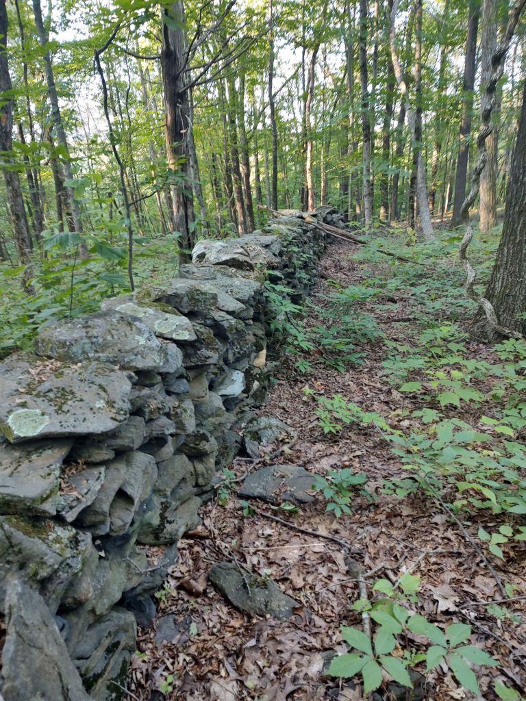
These hand stacked rock walls (used as property boundaries) are found all throughout this trail. Wish we knew the history behind them.
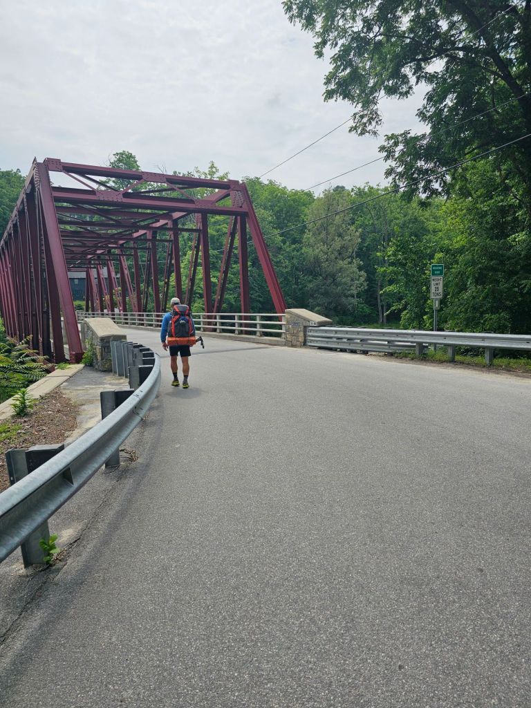
The morning walk took us past storied rock walls in various stages of decline, as we traveled through the lush greenery, and then dropped down to water, before it climbed to the Wiley shelter, where we spoke briefly to a NOBO hiker, “Catch-Up”, who had started in April. We carried on our way, and then in no time were passed, as we expected. Oh to have hiking legs. We made fairly good time, and took a nice break around 1030 a.m. at the 10 mile bridge. We apparently missed the memo that you’re not supposed to drink from that river. Oh well.
So far, we are fairly bug free. Not sure if it’s the permethrin or it’s just not that bad. After the bridge, we had a lot of climbing that would have been sooo much better if we would had completed our normal 12-week training program. That gives us 8 weeks to get in shape (on trail) before Katahdin. We got this!
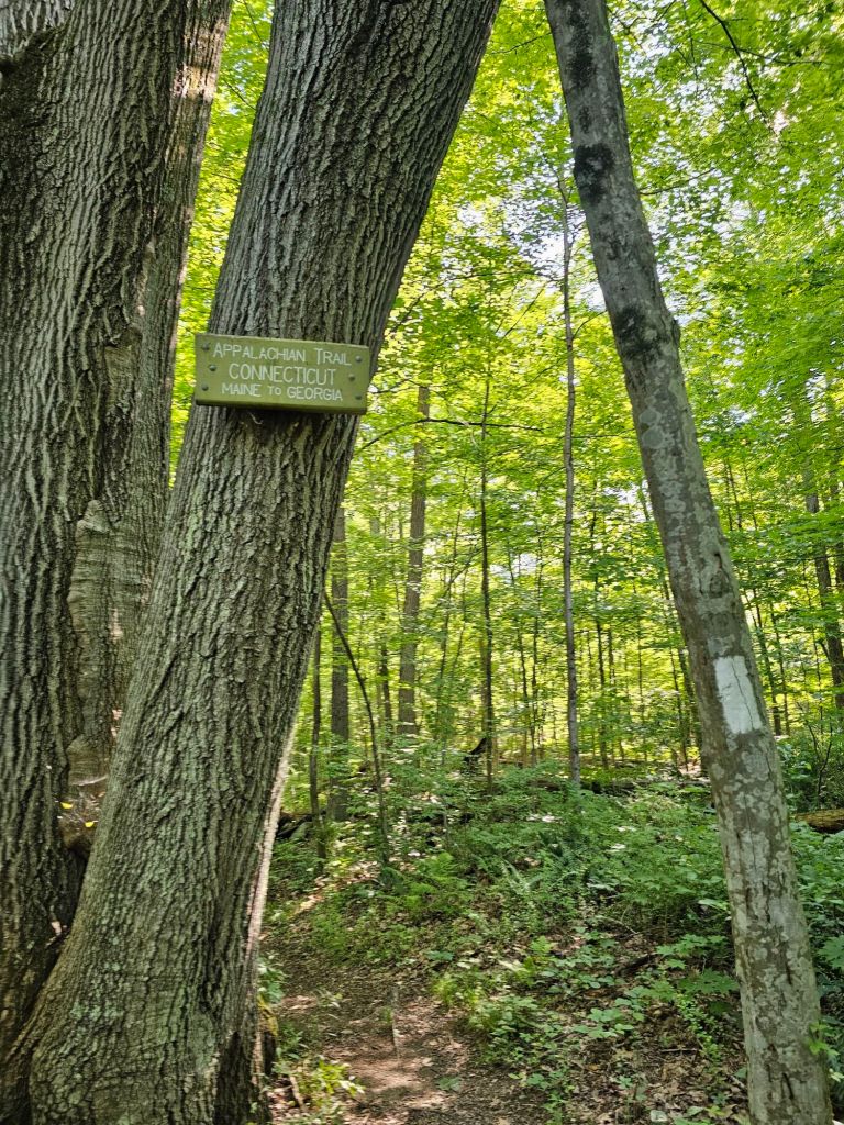
Connecticut!
As we have actually now passed into Connecticut, there is NO dispersed camping allowed. Thus, one has to time their day’s mileage with shelters or approved campsites (privy, bear box, adjacent water). Most of the day is spent climbing with nary of view, with one exception.
A much needed break!
By 5 pm, we are toast. While there’s a lot of daylight still left, there is no gas in the tank, especially to get to the next shelter or campsite. And looking at the elevation profile for the next day, we’d best be getting to resting.
“Civilization”
The campsite we go to has several large sites, a bear box and a privy with a view. We set up. Change out to our sleep clothes, and get ready for a dehydrated meal. Thinking we have the campground to ourselves, we drop our packs into the bear box. No sooner do we do that, but two other hikers, “Coyote” and “Catch-Up” (true to her name) shuffle in. Time to retrieve the packs and just leave the food bags. We won’t make that mistake again. Sleep comes easy once again.
Pre-trail jitters left us wanting for a good night’s sleep. So many last minute chores to tie up loose ends before leaving the house for 5 months. It’s not our first rodeo, but that final step out the door is quite an undertaking. With only a month to really finalize our plans, make travel arrangements and train (we are 8 weeks behind), we are going to have to rely on experience and determination to get this adventure fully underway. In the months leading up to our departure, we aquired not only a “trail daughter” (more on that next paragraph), but a granddaughter! She’s a keeper, that’s for sure, and perfect motivation to knock this trail out before the holidays.
Now, onto the “adoption”. During the third season of operation of our PCT Southern Terminus Shuttle business, we aquired a “trail daughter”. And a fine one at that. We didn’t even have to go through the teenage years!
Hannah with her “Adoption” certificate…that she designed
For the past three months, we’ve had the pleasure of hosting Hannah, from the UK. She sustained an injury to her back on her travel over from the UK, so much so, that she was unable to set foot on trail with her best friend. 4 years of planning halted by what was later determined to be a severe bulging disc, whose pain and slow healing has kept her off trail, and unable to tolerate sitting long enough to travel home. As such, we have taken her in while she rehabs her back. (We would hope someone would help our daughter in a similar situation) In fact, she and our daughter have become fast friends. Hannah, who is so very polite, keeps apologizing for her lengthy stay, but she is a delight, and quite the baker.
In appreciation for taking her in, and to share a bit of culture, she prepared an English Tea Party for us, with all the fixings, before we left for the trail. And rhis morning, she baked us cookies for our travel to trail. Truth be told, that 10 pounds I was hoping to shed before trail, never happened. In fact, I think I gained 10! I’m hoping that 5 months and 2190+ miles will shed a few of those pounds.
It’s Never easy!
Shelby and Hannah snicker as we pack and repack. One would think that we’ve never done this before. We get a notice from Amtrack that our train will be delayed. Perfect! More time to putter, so much so that we forget 3 crucial items that we had planned on taking. A head lamp. My umbrella. And Kenny. Of all things, I can’t believe we forgot Kenny. Maybe he didn’t really want to go. He always thought we were crazy for the thru-hiking we did. (Kenny is our good friend and hunting buddy who died, way too soon, from pancreatic cancer this past year. He was the healthiest of us all and was supposed to be the one speaking at our funerals) We had intended to bring Kenny (his ashes) with us on our hike, but as we can’t mail him to us (something about it being illegal), it will have to be in spirit. I’m sure he’d prefer a hunting trip anyways.
Out the door…finally!
Our daughter(s) dropped us at the train station in San Juan Capistrano, where we took the train to the San Diego Old Town Transit Center…a place we have become intimately familiar with as of late. It was weird traveling by rail adjacent to the beaches we have spent so much time on/at. We cant help but feel we are missing the best part of where we live, to travel to the east coast and walk. Go figure. And then theres that beautiful little grand baby, June.
From the transit center, we take the free San Diego Flyer to the airport…where we wait. Flights are delayed due to severe thunder storms back east. New York, to be specific.
It’s gonna be tight making our connecting flight from Chicago to LaGuardia. While we have no choice, we have faith that all will work out as it should.
All in all our flight out of San Diego ends up only being delayed 2 hours. That still gives us plenty of time to make our connecting flight out of Chicago to LaGuardia. Any longer and we’d be out of all the cookies Hannah sent us off with…lol.
Upon arrival to Chicago Midway, it’s nap time while we wait for our flight to LaGuardia.
New York. New York.
Pleasantly surprised that our bags arrived with us at LaGuardia, it was time to hit the free Q70 to the subway, where we’d catch the F line to the Manhattan REI. A quick shop at REI for fuel and bug spray (just in case), and then back to the F line and Grand Central Station, where we’d board a train to Pawling. Gotta say, New York, for us, is just like the movies, but the flight into LaGuardia was spectacular.
Never knew the Statue of Liberty was so small, and downtown looked like a giant Lego build…amazing!
We had intended grabbing breakfast while in Manhattan, but Hannah’s cookies would suffice till we got to Pawling.
It’s been 10 years since we spiraled down the rabbit hole of long distance hiking. The Pacific Crest Trail (PCT) proved to be infectious. Since then we’ve embarked on quite a few lengthy walking adventures. It is now time to fire back up the long distance hiking legs and finish the last leg of what is called the Triple Crown of hiking. Having completed the PCT in 2014, the CDT in 2021, we are now set to thru-hike the Appalachian Trail (AT) this summer in a flip-flop fashion.
Since finishing the CDT in 2021, we’ve been pretty busy. We’ve (Dee and friends actually) have taken several “short” backpacking trips, our son got married, and we started a seasonal hiker business in 2022 (PCT Southern Terminus Shuttle) that has allowed us to keep our finger on the pulse of the thru-hiking world. In 2023 we had intended to hike the AT SOBO after our PCT Shuttle season (March – May), but a plethora of catastrophic events and reasons created a “failure to launch”. As of this writing, we are finally set to leave for the east coast, and begin this long awaited adventure.
I have not decided as to whether I’ll post daily or weekly. I suspect it will be weekly for the blog and daily for Instagram posts and stories…so stay tuned. (If you don’t already follow our Instagram, it’s @2moremilesadventures .
As we are several weeks behind in our training for this trail, we are going to do our best to adhere to our own advice, as to beginning mileage. Hence, the flip-flop as opposed to a straight SOBO from Katahdin. We are hoping by starting in Pawling New York and heading north, our true hiker legs will have arrived by the time we ascend Katahdin. After which, we should be able to push the daily miles in order to finish at Springer Mountain, Georgia, by November. We’ll see. We do however have excellent incentive, in the fact that we have our first grand baby to get back to. She should be “on the move” by the time we get back…just in time for the holidays.
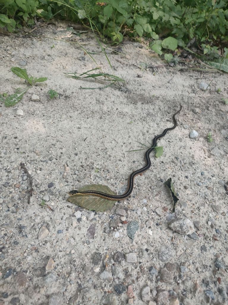
As this will be our first time hiking east of the Rocky Mountains, we hear we’ve got some tough terrain ahead of us, in that the AT is devoid of switchbacks. The footing will be challenging. They have more than one kind of poisonous snake to be wary of. Numerous biting bugs, to include ticks (of which we have mitigated agaist with permethrin). Black bears who want our food, and a literal angry bird, that will attack us if we happen to traverse that section of trail during their nesting season. While it may be the “shortest” (2190 miles) of the Triple Crown of hiking, it may be the hardest.