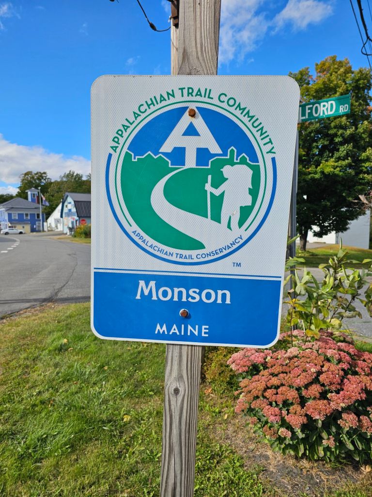
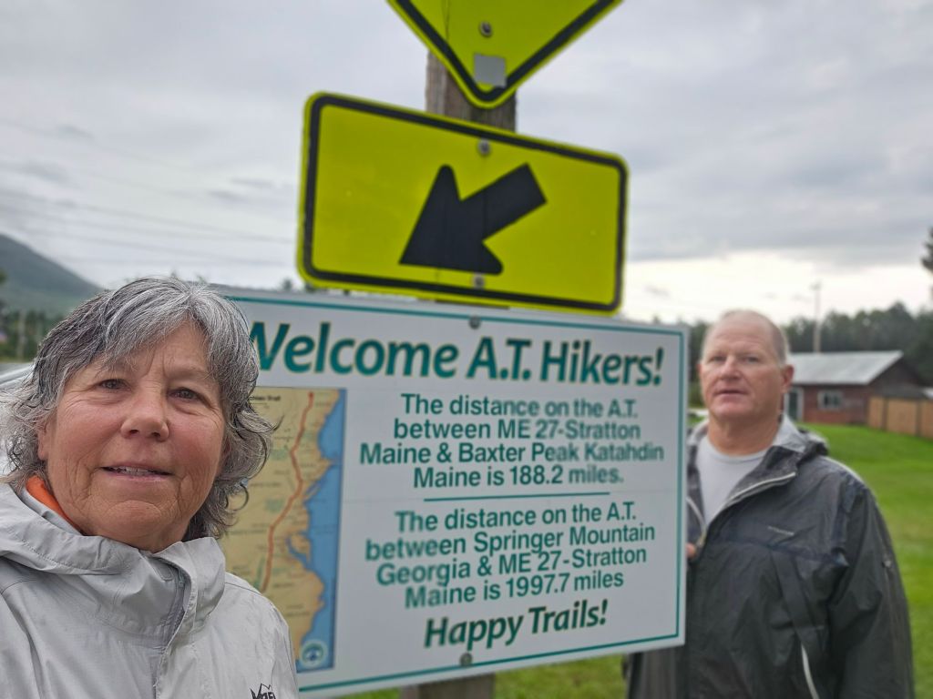
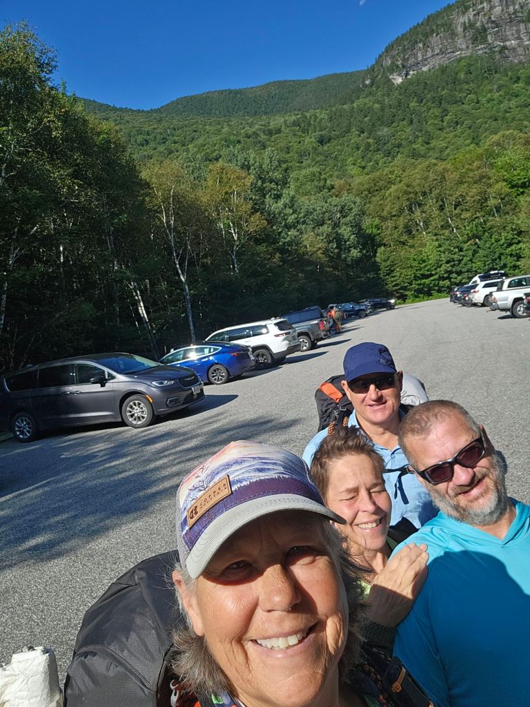
Day 69: (Sept 7) 16.4 mi (2066.4 – Monson)Day 70: (Sept 8) Zero
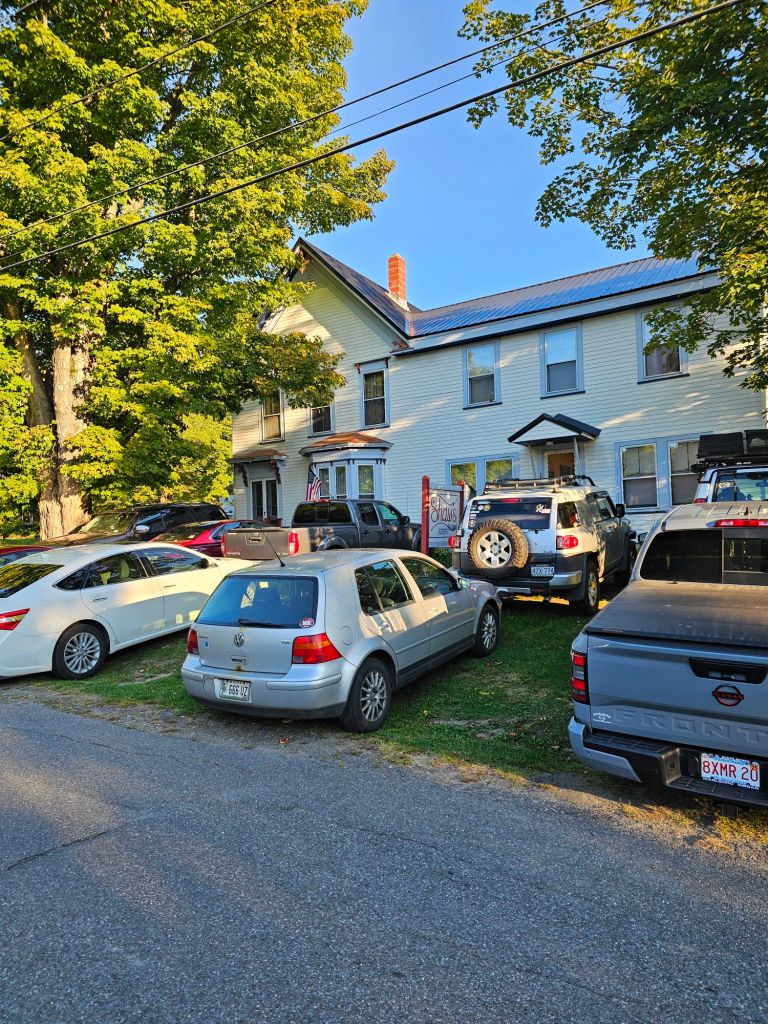
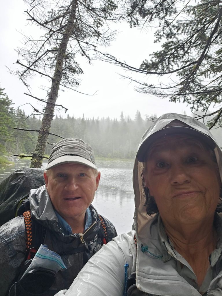
Our goal for the day was to get into Monson and hope that there was room at the infamous Shaw’s Hiker Hostel. We were successful on both accounts.
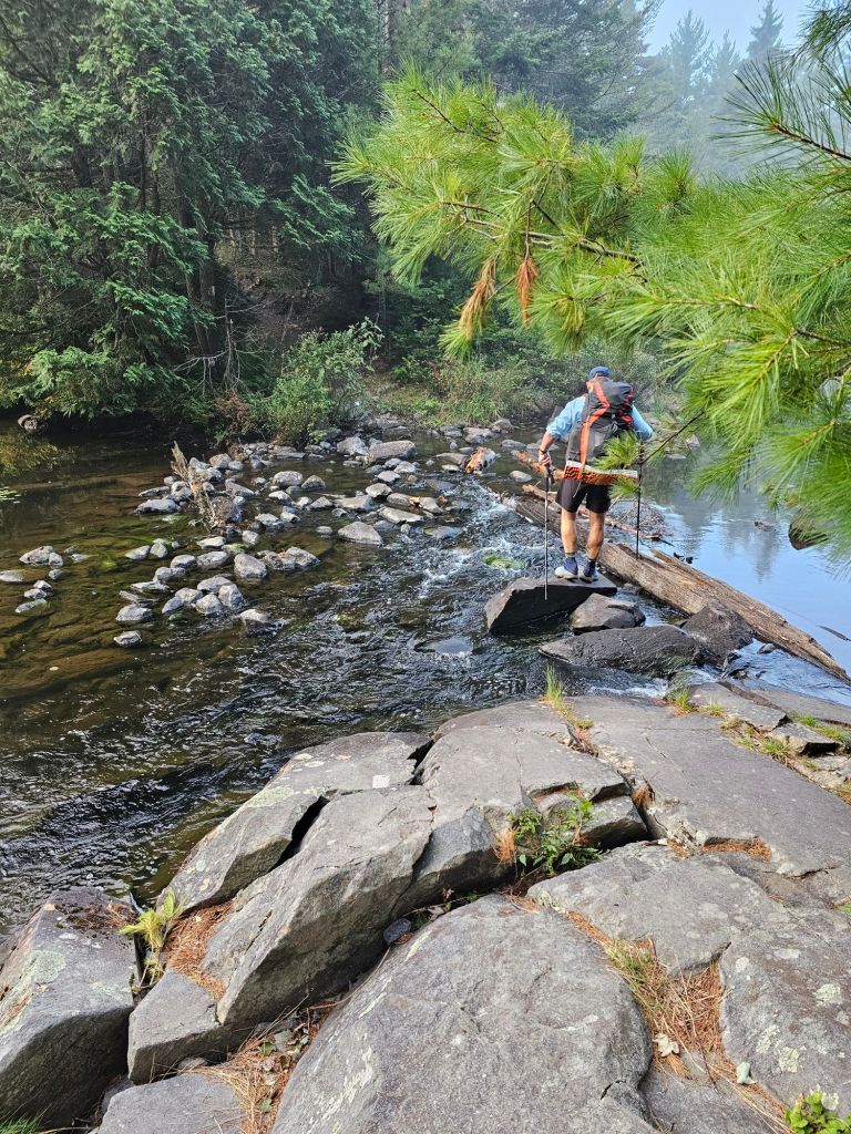
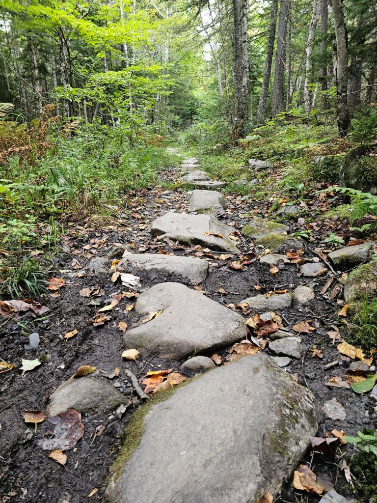
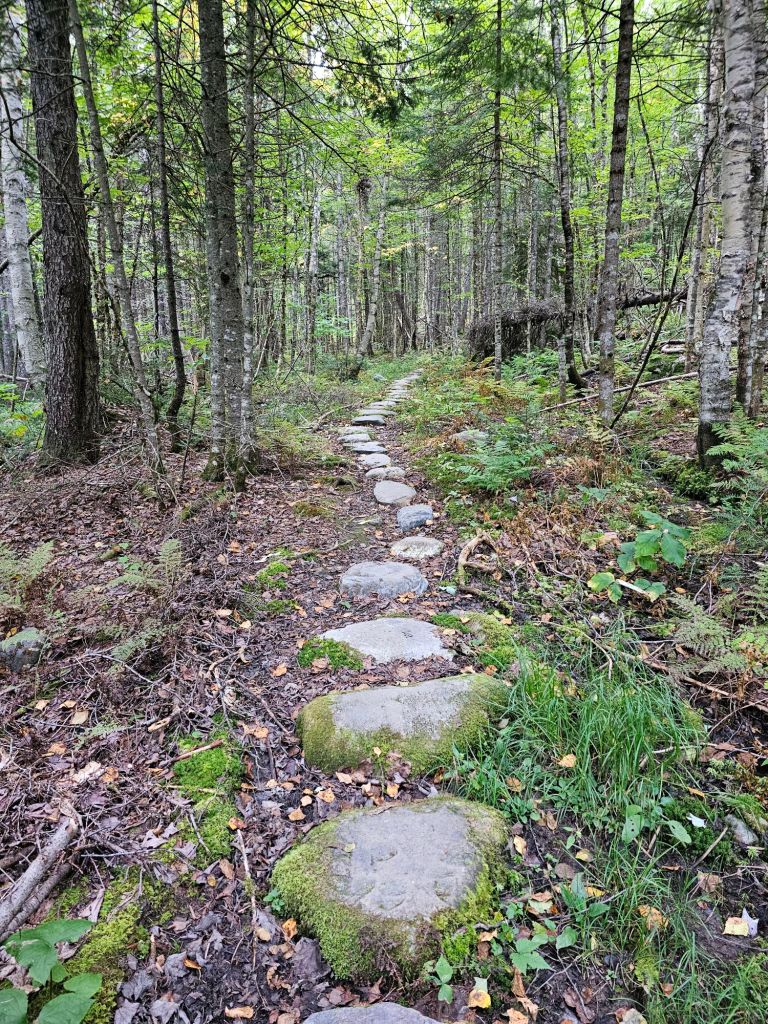
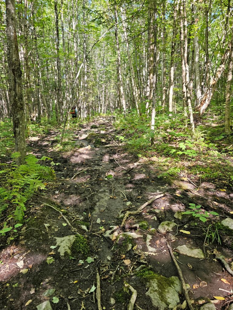
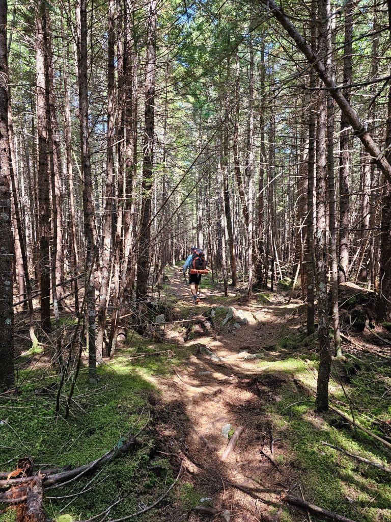
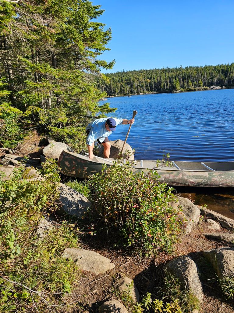
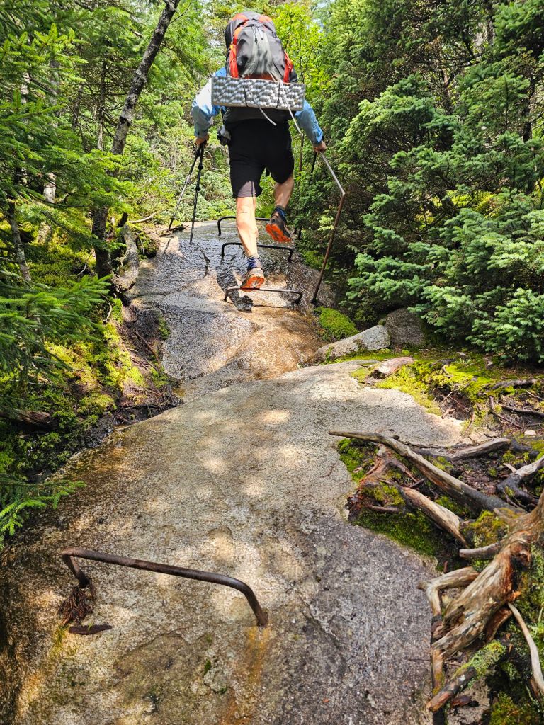
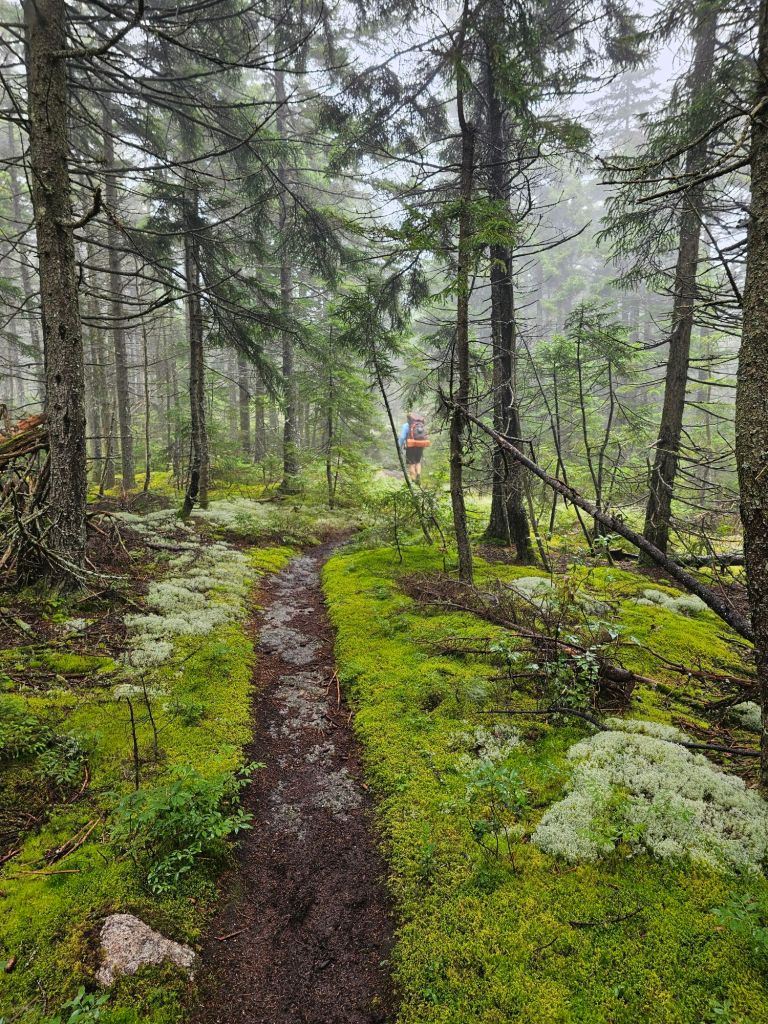
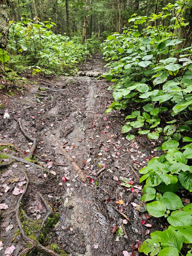
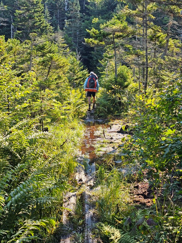
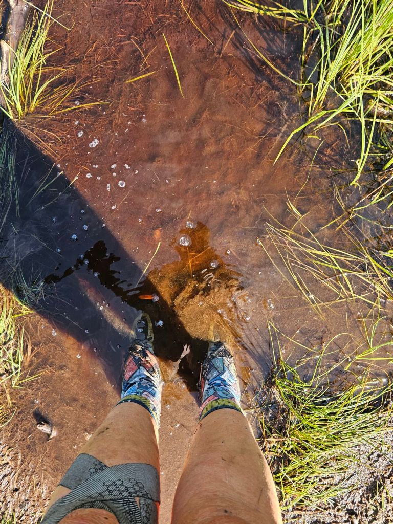
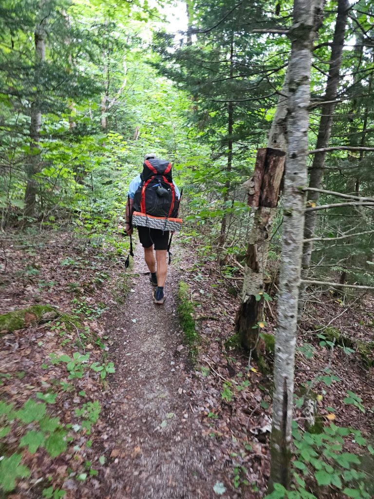
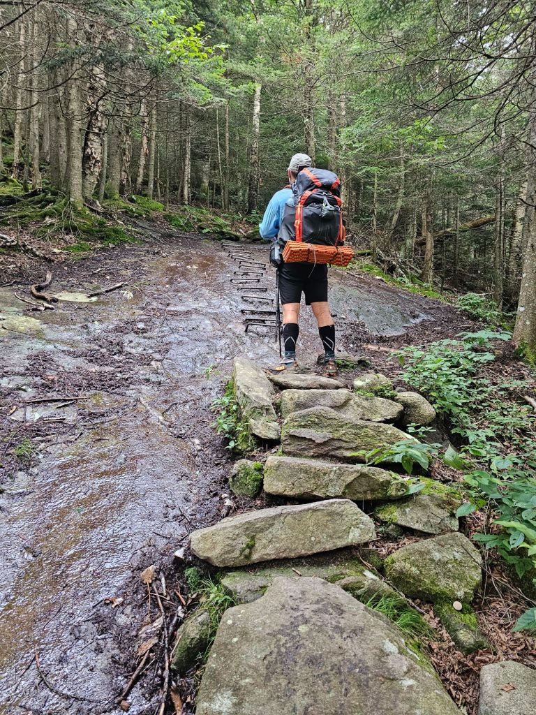
The tread was accommodating, at first, providing us with mile upon mile of perfectly lined stepping stones, indicative of how waterlogged and muddy this section normally is. We felt blessed to have caught this section on an “abby-normal” day. This didn’t mean that we didn’t get away “un-wet.” While the forecast was good, the actual weather for this area was a bit “undecided,” requiring us to break out our rain jackets and pack covers. My knee was becoming a bit unhappy with the “stroll” along a winding stream and the continual mud encased rock hopping, so we explored and pieced together an alternate. As with all creative alternates, there was a price to be paid. In this case, it was the crossing of a deep stream where a bridge had been washed out. We bushwhacked through thick shrubbery (pretty sure it was accented with poison ivy) and down a steep Ravine, followed by a precarious crossing that led to a “walk em dry” situation. With that completed, it was all a matter of finishing the miles into town.
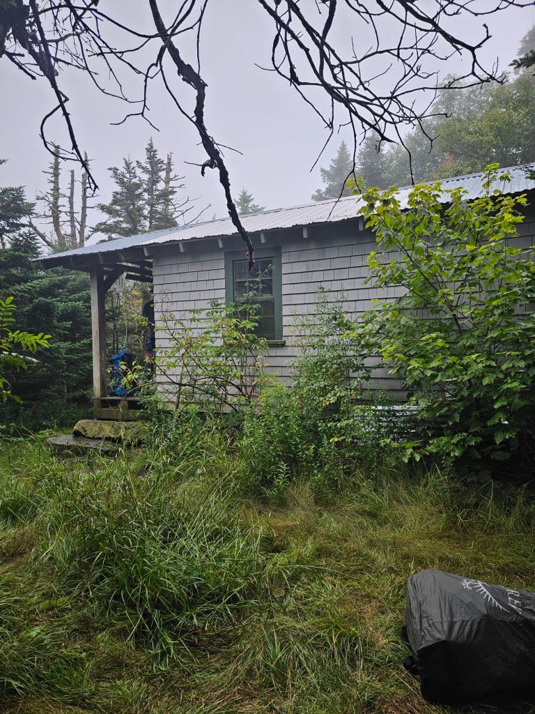
Our first stop was the Monson Appalachian Trail visitors center. It was time to finally get our AT hang tag and be externally recognized as AT hikers. In classic fashion, it was closed. The tag would have to wait. Our next destination was Shaw’s and hope that they had bunk space, as we were now in the midst of a thru-hiker bubble.
Actually busier than pictured here
With two bunks secured, we set off in search of food…and our tags. At the AT visitor center, the long-time volunteer gave us our tags and explained the logistics of summiting Katahdin and all the reliable cell service places. One was the corner of a particular privy.
One of the interesting things about Shaw’s is Poets Gear Emporium. It reminded us of Dave’s at Stemple Pass on the CDT. Everything a hiker needs, including beer. When you check into Shaw’s, you are given the choice of a beer (PBR) or a soda. We, of course, chose the beer. Shaw’s also offers a breakfast of coffee, fresh squeezed orange juice, 3 eggs, 3 strips of bacon, home fried potatoes, and “all you can eat” blueberry pancakes, for $11. A thru-hikers’ dream.
That mornings leftovers
Shaw’s also offered a resupply drop option for a significant fee, of course, as a way to reduce pack weight during our last several climbs through the 100-mile Wilderness. We expected our march through the 100-mile Wilderness would take 8 days. And because of where the climbs were located, we bit the bullet and secured two drops. One for 2 days of food at the Katadin Ironworks Rd (KI) and the remaining 4 days at Jo Mary Rd, 60 miles into the 100-mile Wilderness. Each drop, which was secured in a 5 gallon bucket, cost $80/ea. It’s a little pricey, but in the end, you always pay for weight reduction, be it gear or services. This math would put us into Baxter State Park on the 17th, with us summiting Katahdin the morning of the 18th. As we were planning thus out, who should appear but our trio of trail friends…Rolling Stone, Scout and later on Sweat Potato, and even Collosus.
Looking at the front yard, you’d think nobody walked here…but most did.
To say Shaw’s was packed would be an understatement. It was full to the gills, with even Leaping Lena’s Hiker Hostel, across the street, found itself nearly full. While at Shaw’s, we finally got to talk with all the other hikers we had been leap frogging with. We even caught up to “Little Bit”, who we had met back at the Abracadabra Coffee shop in Vermont.
With a plan in place to finish this section of trail and flip back to Pawling NY and complete the remaining 1400 miles or so SOBO, we took a zero to relax a bit before the big push to Katahdin. Sweat Potato and Collosus both wanted to summit with us on the 18th. Rolling Stone and Scout didn’t want to chance rolling the dice on the weather for the next 9 days, and purchased the next 3 days of camping at Baxter so they could “choose” the best weather day. Their plan, once having summited, was to head SOBO all the way to Caratunk from whence they flipped. They tried to entice us to join them, but we were secure in our 10-day weather window, so we opted to continue our Northbound march to Katahdin. With nothing more to fret about, it was time to eat.
A hot shower. Rinsed out socks. Hot meal. A toilet, and a bed. Simple pleasures on trail, if only briefly, as yesterday was a nero. Hot coffee and a breakfast sandwich at the gas station in Stratton, we made quick work of getting a hitch back to trail. In no time, we were negotiating roots and now mud for another morning climb of South Horn (3831 ft.) and West Peak (4145 ft.).
Today would be a nero as well, in that we weren’t really sure how the terrain would be, and frankly, we weren’t that motivated after having crushed miles the day before.
By the time we reached West Peak, it was late afternoon, and the wind had picked up significantly. The air was definitely crisp and biting. Avery Peak would have to wait till the morning.
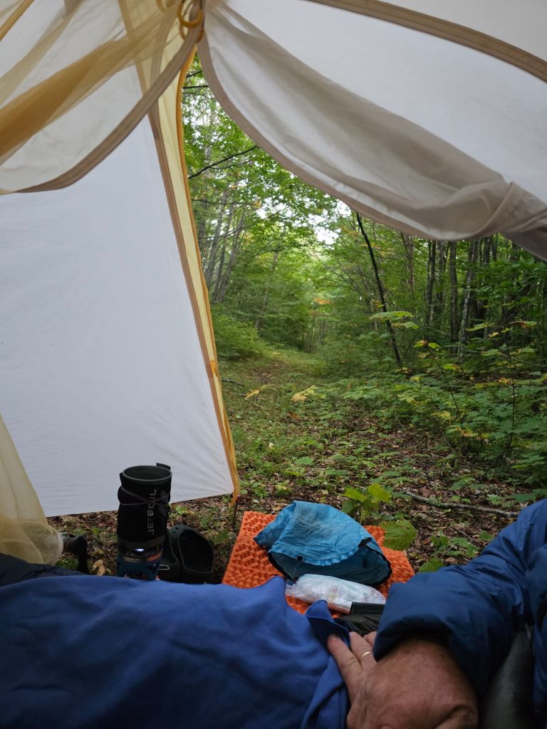
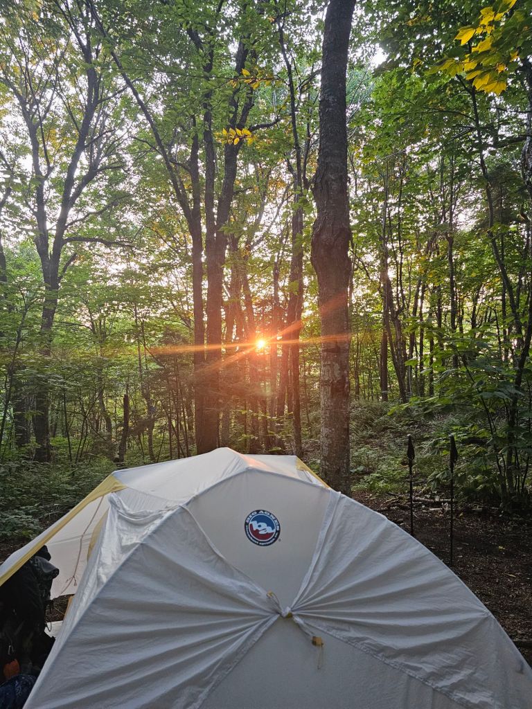
When we reached the Bigelow Col campsite, our choice to use the Katadin Hiker Pro water filter paid off once more. FarOut had this particular camp spot’s springs, noted to be iffy for water collection (essentially to collect for Sawyer Squeeze people). This is where the versatility of our pump style water filter shines. Paul was able to locate an active spring under a rock ledge and lower the collection hose down into the space and pump out enough water for our evening’s dinner and breakfast and walking the next morning. Meanwhile, I set up our tent atop a wooden platform that had an open sky view. Definitely an increased chance of star gazing. By chance, I had a bit of cell service that now indicated a 23% chance of rain by 9pm. What? That meant, on goes the rain fly. No lazy star gazing tonight.
Day 64: (Sept 2) 11.9 mi (2017-2028.9)
So, the rain fly proved to be an excellent addition. 8:30 pm, with gusting winds, it began to rain. Secure in the thought that all was “good,” I didn’t think much about ensuring my side of the fly/vestibule was secure and tight down to the platform. This resulted in waking to the exterior of my down quilt and everything on my half of the tent being sopping wet. Overnight, the direction of the wind had changed… up and under my side of the tent. Awesome.
I’m literally trying not to get blown off the top
This led to a freezing cold, wet to the core march up to a damp cloud engulfed Avery Peak (4088 ft.). In so many ways, it was comical.
Just enough sun to do the job
Atop Little Bigelow, we had a yard sale and took the opportunity to dry out our gear. From there, we had a nice descent over sloping granite slabs down toward Flagstaff Lake. Just past the lake, we camped on a snowmobile road as the sun dipped and the temperature dropped.
Day 65: (Sept 3) 18.4 mi (2028.9-2046) Kennebec River Crossing
It started as a cold and windy morning, where the green tunnel provided a measure of protection, and the tread was actually quite pleasant. We walked by ponds (East and West Carry Pond), which, for us, were more in the lake category. The wind was blowing enough to create whitecaps, which resulted in a hard NO for taking the time to swim.
Eventually, the tread degraded to pronounced roots and rocks surrounded by mud the consistency of cookie dough. Even with that, we were able to keep a good pace that would get us to the shore of the Kennebec River and a possible crossing. And then, suddenly, the last two miles became extremely daunting. It was if a giant two year old had pitched a massive and sustained tantrum. Trees torn up and tossed everywhere. Missing tread and difficult to follow trail markings wandered without apparent purpose. This was ankle breaking territory. I specifically told myself to be very careful, as this would be an awful place to fall… and then, of course, CRASH! In an instant, I was wedged in between sharp and unforgiving rocks, amist a patch of poison ivy. This time, my right knee (the working one) took the brunt of the landing. My pack was caught up in the poison ivy, and I was having difficulty getting up. It took Paul grabbing the top of my pack to lift me enough to get out of my painfully precarious position. As I suspected, my knee was bleeding and beginning to swell slightly. I was, however, mobile. I spent the next mile cussing out this stupid tread of trail and limping carefully all the way to the river.
This past season, one of our riders (Kim) on our PCT Southern Terminus Shuttle told us how she lived on the Kennebec River and how she could see the AT hikers from her house. She was excited that we were doing the AT, and although she was going to be hiking the PCT, she would let her husband know when we were coming and that we would be able to stay at their place to zero and resupply, if we’d like. At the time, the Kennebec River seemed so gar away. We filed that info away. Just after starting the AT, she contacted us to let us know she had sustained a trail ending injury and would be home when we got to the river. While we were sad for her, we were glad she was home. Therefore, over the last couple of weeks, we have been updating Kim as to our location. While it was after the normal river crossing time, due to the upstream dam water let out, we called Kim to let her know we had reached to shore. “I’ll come get you now,” she told us.
* As a side note: The ATC provides a canoe crossing service from 9 am. till 2 pm. to transport hikers across the Kennebec River. They don’t want hikers crossing on their own and possibly drowning and/or getting caught in a swifter and deeper current if/when the dam upstream starts releasing water.
Glad to be picked upWatching across the river for Kim
As we waited for our ride across the river, we expected a power boat or jet ski, but several minutes later, there was Kim paddling a canoe up river to get us. Turns out, Kim is a professional whitewater river guide, so paddling upstream in these conditions wasn’t a problem. She is very familiar with this river and its currents. Into the canoe we climbed with our packs. In no time, we were pulling up onto the shore of her waterfront home.
She had set aside their Airbnb loft for us to use for , if we’d like. Once unloaded, we were off to the local pub and rafting lodge for beverages, some fresh food, and hours of trail talk. Kim had quite the experience on the PCT.
Day 66 (Sept 4) Zero!
No miles! Food . Laundry and resupply. The day started with a hearty breakfast prepared by Kim and more stories and trail banter. Kim was a wealth of information about the area we were to traverse next and an exceptional historical resource. As we suspected, these forests were not so thick, and the trail tread was healthier. The AT crossing of the Kennebec River had been relocated due to hikers nearly drowning as they tried to wade across, not knowing whether the dam had released water or not. They moved it to where it is now, as the crossing is not “walkable” and won’t tempt people to try and cross.
Day 67: (Sept 5)5.3 mi (2046-2051.3)
My right knee was still feeling a bit sore, and frankly, I wasn’t sure it was ready to hike on with a 4 day resupply. Kim suggested we slack-pack up from the Kennebec river to the Pleasant Pond, and she’d pick us up. My new insoles had yet to arrive, but our new shoes had. What a better way to break in the new shoes and test the knee. We packed some water, a couple snacks, and hit the trail. For the most part, I had no problem with either knee. The walk had some obstacles but was not particularly stressful. We walked so well and so fast that we decided to stroll 1.5 miles down the road that Kim was to collect us from. When she met us, she had another great idea. As the day was quite warm, why not cool off with a river float. We grabbed our beat-up shoes, and she got lifejackets for us. We drove up to the “old” AT crossing spot. She parked her car and we all walked down to the river. Into the crisp and refreshing water we plunged. The drift was just right. We floated down the Kennebec back to Kim’s house, laughing and waiving at the hikers “rafted up” waiting for the next day. We swore that two of them were Rolling Stone and Scout. We waved and yelled to no avail. That evening, we had dinner with Kim and her family. I’d have to say that this was probably the best stay and zero for us to date. It felt like we were on vacation. Thank you Kim. We needed that.
Day 68: (Sept 6) 14.9 mi (2051.4-2066.4)
Kim dropped us off where we left off. Up we climbed. It was not that difficult, and soon we had views as promised by Kim. Up to Pleasant Pond mountain, then Middle Mountain, and finally, Moxie Bald Mountain.
Unbeknownst to us, it was Kim’s birthday, and she and her brother had decided to hike up to her favorite mountain, Moxie Bald. The irony of the day is that we missed her by 10 minutes. In fact, when we got to a road crossing and saw a car parked not far from the trailhead, we laughed, “Wouldn’t it be funny if that was Kim’s car?” Her foot was still not fully healed. Surely it wasn’t hers, we figured. Suprise. Suprise. It was her car. I’m so sorry we missed her and the opportunity to share her birthday hike.
Our day ended literally at the end of an old logging road in search of a place to camp. Once set up on the “culdesac,” I quickly explored a narrow trail that led to an awesome view of Bald Mountain Stream.
Tomorrow, we get into Monson, and finally set our eyes (and feet) on the infamous Shaw’s Hiker Hostel.
Last week, found Paul trying to deal with an ever growing toothache. Muscle and joint pains are par for the course when thru-hiking, but a toothache, now that’s something taking a zero can’t really fix. Or can it? Believe it or not, there happened to be a dentist in Rangeley, and they miraculously had a cancelation that would enable Paul to be seen on the morning of our zero.
Day 59: (Aug 28) Zero in Rangeley
It rained most of the night and into the morning. Once again, our timing into town has been spot on for us. Laundry. Food resupply. Outfitters for another new pole lower half and general lounging. Oh ya, and a dentist visit.
The prognosis? You’re gonna need a root canal! Now where does one get that done? Back home he’d be referred out to an oral surgeon. Lucky for us, the dentist in Rangeley is also an oral surgeon. In fact, he’s the only dentist AND oral surgeon within 200 miles or more. What are the chances that…
Paul would have a substantial toothache on trail
The very town that the ache was becoming unbearable, there would be a dentist.
That he’d get an appointment for the very next day?
The dentist is ALSO an oral surgeon, and he once lived in Mission Viejo?
There would be a cancelation that would enable Paul to have his root canal the following morning of his first visit?
An already full Motel would have another night available?
So many stars had to align for this to happen as it did. Providence. Simply Providence. The only catch was that Paul needed to get to the town Kingsfield, a mere 60 miles or so away, to the only pharmacy in the 100 mile radius for antibiotics to take on trail following the root canal. Lyft would be $285 each way. We asked the motel operators if they knew of any car rental service or trail angels that might help us out. They gave us two numbers. The second number happened to be Bill, a local trail shuttle driver. The day before, when we were in the rain walking the 3 miles back from the IGA with paper bags filled with our resupply food (don’t ask us why we didn’t bring our packs, we seem to keep forgetting to do that). He recognized us as thru-hikers and pulled over to give us a ride to our motel… unsolicited, and there was no charge. Bill told Paul that if he was ready to go, he would “squeeze” him in and get him to Kingsfield like now! All for $60. Providence strikes again.
All we have left to do now is pack and wait for the morning, and hope all goes well, with no complications.
Day 60: (Aug 29) 3.7 mi (1976.8 – 1980.5)
We packed up and hoofed it to the dentist. While Paul was getting his root canal, I updated our blog and IG posts. Everything went well, and an hour and a half later, we were on the curb, hitching back to trail. It was now 1 p.m., so we’d have a short afternoon on trail. Within 3 minutes, we had a ride.
With Paul’s face partially numb, we began a slight climb over sparse roots and rocks and sticky mud. We decided to pull up early when we reached Eddy Pond. Our climb up into The Bigelows could wait till morning.
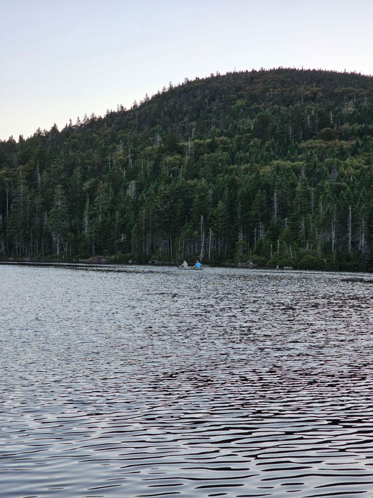
On the shoreline, there are canoes, paddles, and actually lifejackets available for use to explore and fish the pond. We set up our tent and then spent the rest of the afternoon paddling about the moderately sized pond, adorned with its own island and beaver hut. The water was calm, and the day was simply gorgeous. Near 2 hours later, Rolling Stone and Scout arrived. We quickly caught up as light was waining, as they also wanted a turn in the canoe. They were searching in earnest for their first moose encounter.
Rolling Stone and Scout
Day 61: (Aug 30) 9.8 mi (1980.5 – 1990.3)
This morning, we awoke with essentially 200 miles till Katahdin, which meant we were nearing the 500 mile mark, and hopefully a robust set of trail legs.
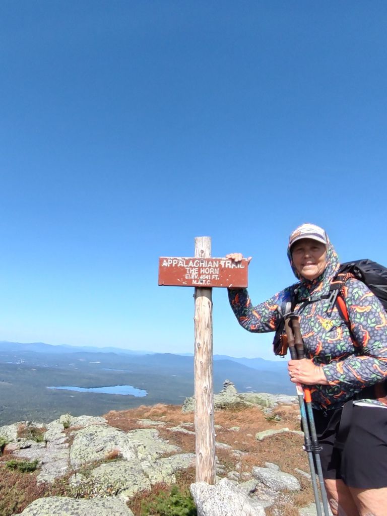
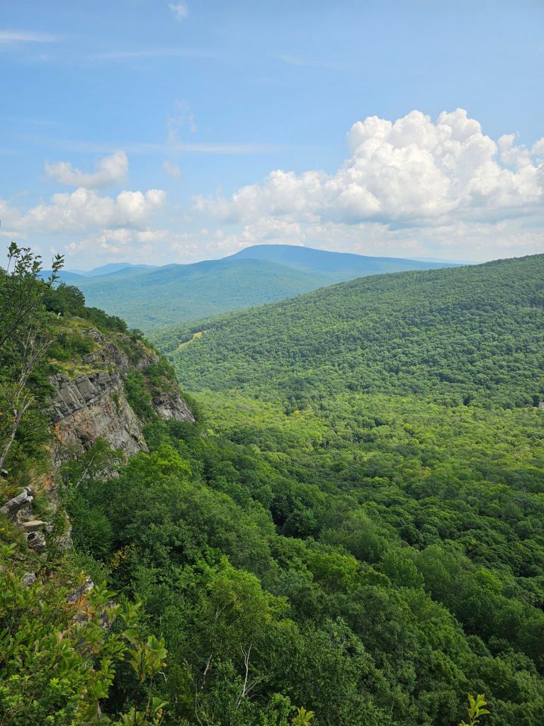
Without fail, the trail began with a morning climb all the way up to Saddleback Mtn (4120 ft.) With a clear day, we were afforded great views of the surrounding area and ski runs below us.
Saddleback led to Saddleback Horn (4041 ft.), whose descent was quite tough, requiring interesting ladders in some places. Who makes these trails? A steep descent generally means another climb, this time to Saddleback Jr. (3655 ft.) At this juncture, we spoke with a SOBO hiker and exchanged trail tread info. Apparently, his idea of “flat” and our idea of flat are vastly different. He told us that our last 4 miles to the river crossing are “basically flat. You’ll be thinking, am I still in Maine?” We attempted to get him to clarify “flat” in order to hopefully set a realistic mileage for the day. He further reiterated that there were some “ups” and “downs,” but the tread was “really nice.” The young man, whose pack was enormous, turns out, was a lying son of a bitch! Yes, there were ups and downs, but the tread was ALL MAINE. ROOTS AND ROCKS… but mostly roots, and, oh ya, some mud.
Down from Saddleback Jr.Up from the river crossing
By the time we dropped down to the river, we were worked. It was all I could do to make the climb up to the old railroad spur road to camp. We crossed a creek that fed into the river and set up camp. If it had been earlier, and the weather was warmer, we would have had the chance to swim, but not today. Some serious cold weather and rain were rolling in, and we needed to plan an exit strategy… just in case.
Day 62: (Aug 31)18.7 mi (11.59 blue blaze)
We knew crappy cold weather was coming in, and if we were going to get into Stratton, for a resupply before stores closed, we were going to have to get creative. The AT was set to take us up into rain and howling winds for several climbs that would provide NO VIEWS whatsoever. Cold wet climb over and down slick wet rocks. We already know that is not a good idea. So, we created an alternate route. And, as I write this even a couple weeks later, it’s been the most fun we’ve had on trail. This is why we thru-hike. Yes, it was longer, but the miles were “easier” in that we were actually hiking. Of course it required some bushwhacking, bog slogging, back tracking, and a pond circumvent, but what an adventure. It got cold and spat on us a bit, requiring us to don our rain jackets and gloves, but every time we gazed above us, we saw the mountain above engulfed in a cold, wet, and unrelenting cloud of shear misery. What’s an extra few miles when you’re having fun?!
Once we got to the highway, we walked/hitched our way into Stratton and scored the last room at the White Wolf Inn and Restaurant, when we originally were told by other hikers that everything had been booked up due to weather. Apparently, not everything was booked. Truth be told, if it wasn’t for the bar tender at the pub where we wanted to eat yelling at us in a very gruff and uninviting manner, to leave our packs outside, we never would have gone to the White Wolf…hence our detour to the White Wolf. Thanks for yelling at us, buddy. You made your day… truly! No sleeping outside and packing up a wet tent tonight!
This week finds us with a bit of recovery and then back into the grind (up/down hill), but with actual rewards for our efforts…VIEWS!!! Thank you, Maine, for not being just hard.
Day 53: (Aug 22) 8 mi
One thing we learned hiking the CDT (Continental Divide Trail) is that the “redline” is not often the best and/or only acceptable line of travel. You’re still walking to your goal, but in a more exploratory and often adventurous fashion. After our good night’s sleep and perusal of our available maps, we opted to venture out on our own and create our own route to Grafton Notch. This would add quite a few miles as opposed to the “redline,” but we needed some “mindless” walking and some actual, sustained, direct sunshine. We are both used to regular sun exposure. It helps with mood and motivation. And while the green tunnel keeps you cooler, for us, it gets depressing. My knees also needed a downhill break.
Our route took us along forested areas with wide open views of the hills (mountains) we had come from and would be headed, later on. Wild blackberries and raspberries often flanked us on both sides. We had a moose encounter with a young moose who came shockingly within 40 ft of us as we stood as motionless as possible so as to not spook it and keep it from charging us. At one point, it looked like it was about to pin its ears back, and we thought, Well, this is about to get interesting. And then, it turned, shook its head and trotted down the forest service road. Phew! (I was able to capture the whole encounter on video, but it will only upload to Instagram, 2moremilesadventures)
Our route then became a “white blazed” ATV trail with a bridge that led to an active logging area. Apparently, this route had been posted closed on one end, but not on ours. Otherwise, we would have taken the redline. No matter, as we’d only have to watch for an occasional vehicle (and giant tree-slayer…only name I can think to call this massive and amazing machine…that replaces saw welding lumberjacks), and they had all been alerted to our presence. Our route dumped us out at the Grafton Notch State Park, where we continued on foot to the parking area down the highway. In total, our ByPass and alternate added 8 miles. A small price to pay for the views and moose encounter.
Once at the Grafton Notch, it took us a matter of 3 minutes to get a hitch into Bethel, Maine. A nice couple on the way to visit her mother gave us a lift and took us not only to the outfitters, but gave us great Intel on the layout and history ( land granted to settlers who fought to “conquer ” Canada in 1690’s) of our destination of Bethel, as they drove us toward town. One thing they have is roadside “stands” selling produce, or even baked goods! No one is tending the stand, so any purchases are via honor system for the items you take…cash or venmo. We stopped at a pie stand and purchased fresh maple moonpie cookies. At the outfitters we were able to find everything we needed (new socks, pack covers, mountainhouse, a new filter cartridge – #3 so far), to include “Franken Pole” parts to fix my broken trekking pole. After a quick tour of town and lodging options, they dropped us at what has been the best burger joint so far this thru-hike. Butcher Burger. While there, we ran into two other hikers we have been leap frogging with, Long Island and Cheddar. They were staying at The Knoll Hostel, and the owners had lent them their car to run errands. The Knoll was full for the night, so we booked with them for a Zero for our next day. For the night, we ended up in a classic New England bed and breakfast (who regularly accepts AT thru-hikers), The Holidae House B&B. Great room (with an actual bathtub) and fabulous breakfast. It was centrally located in this very walkable 4-season town next to the post office and grocery store.
Day 54: (Aug 23) ZERO miles (well, maybe 2)
After a great night sleep and a tasty breakfast, we sauntered down to the thrift/consignment store in search of long johns, quicker drying shorts, and a sleep shirt. We found all three for a steal and mailed some stuff home, all before check out and our pickup by “Doogie” from The Knoll Hostel.
Entrance to The Knoll Hostel
The Knoll Hostel is run by a couple (Doogie and Home Spun) who have opened up their home for the hiking season to 6 lucky hikers a day, 7 if theres a couple who will share the double bed. It’s a full-service hostel that includes, rides to and from Grafton Notch, laundry, shower, and a family style dinner for $75/pp. They have converted their “finished” basement into a dormitory of sorts. It’s a great vibe and total relaxation. They even lent us their car to run our town chores. While shopping for resupply, we ran into our “crew”.
Sweat Potato, Popeye, me, Paul, Scout, and Rolling Stone
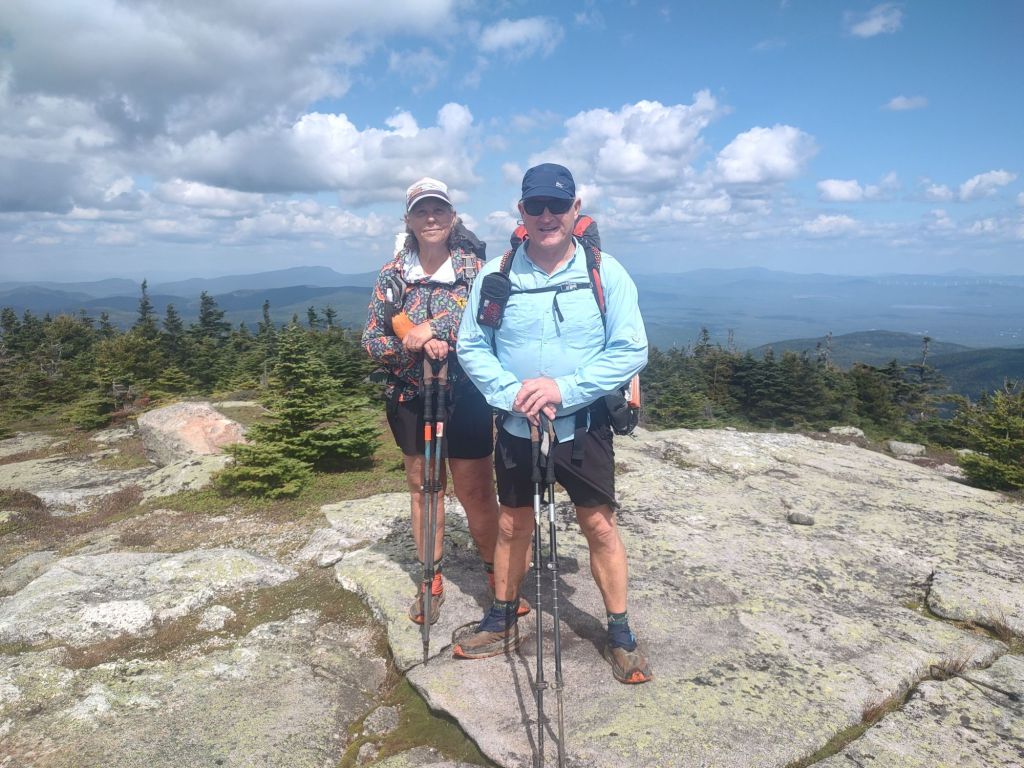
Day 55: (Aug 24) 10.3 mi (1829.9 – 1940.2)
Getting dropped off at Grafton Notch by Home Spun and Doogie
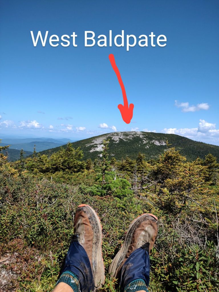
Doogie and Home Spun dropped us at the Grafton Notch, where we would know head into (and over) what is called the Baldpates.
Warm air and clear skies made for fairly pleasant hiking, even though we had plenty of climbing to do from the Grafton Notch. 2167 feet to be exact. Notches on the East Coast are equivalent to saddles or passes for us in the West.
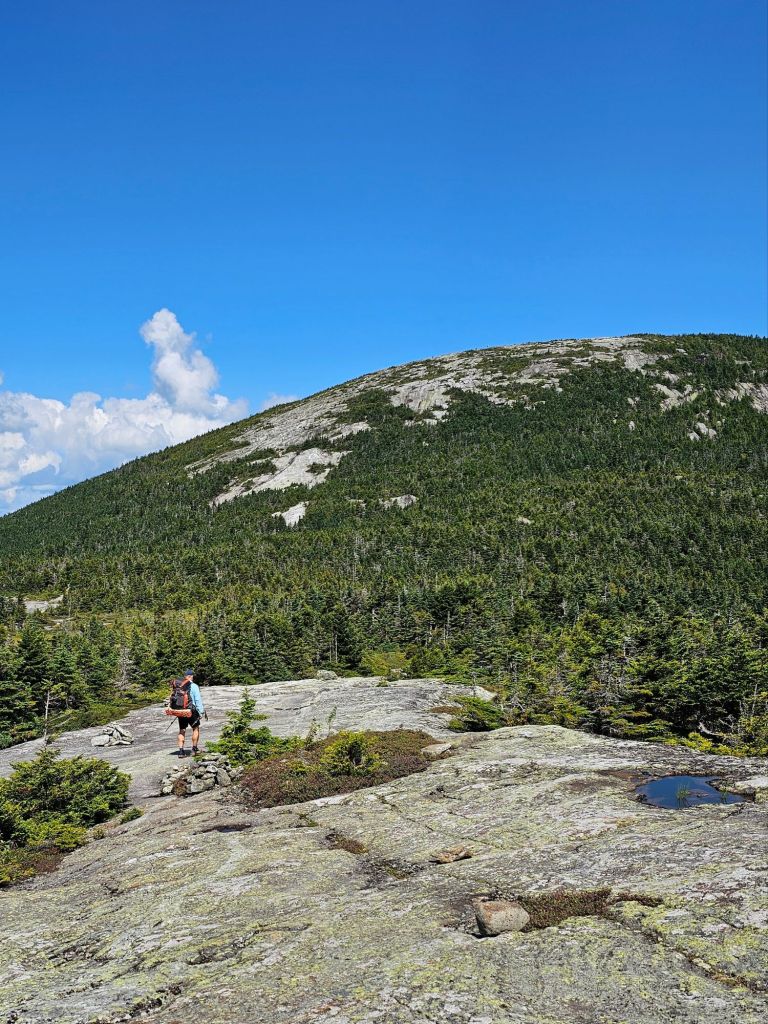
First up, the West Baldpate at 3662 ft. Before our final ascent of the West Baldpate, we sat atop a Knoll and watched as other hikers walked often in zigzag fashion up and over a steep exposed granite face, hence Baldpate (a bald mountain).
Of course, between and after the West and then East Baldpate (3790 ft), there were steep descents that often included ladders. However, our late start for the day made for very short breaks during our grueling descent from the East Baldpate to our camp spot for the night.
Sadly, we passed awesome places that had it been earlier in the day we would have stopped for a swim.
Day 56: (Aug 25) 10.1 mi (1840.2 – 1850.3)
We awake knowing we have a mandatory morning climb up to Blue Mountain that is replete with false summit after false summit.
Hiker hunger makes me think of S’Mores
Rain is on the forecast for the day, so the clouds are moving in and out behind us, creating unique views and oddly a plethora of iconic smells along the way. Something about the temperature, moisture, and varied vegetation released smells of waffles, “Christmas,” and incense.
We make our way to the first shelter (Hall Mountain Lean-to) after finally reaching the top of Wyman Mountain, and the “gang” (Popeye, Rolling Stone, Scout) is all there for lunch. Rolling Stone and Scout are slack packing this stretch and are worried about an incoming rain storm, so they want to move fast and light and may sit out tomorrow if it rains. We, on the other hand, have rain gear and aren’t afraid to use it.
Lunch is followed by a 1000 ft steep descent and a wicked, and unforgiving 1300 ft climb (iron rungs tapped into rock, and sketchy root rock scrambles) for 1.4 miles to Moody Mountain.
As we crawl our way to the top, knowing full well that there most likely will be an equally treacheous descent whilst racing against an impending rain, we come upon two volunteers who are working their way down the trail updating the white blazes. Paul strikes up a conversation with them, and they chuckle about the gauntlet of a climb while I teater on the edge of lightly flowing rockface “waterfall.” Fully exhausted, and past the point of tears, we take a break at the top of the mountain and prepare for our descent as rolling thunder bellows and a light rain begins to fall. Luckily the descent is somewhat graded and easier than we had anticipated.
We camped just before the Black Brook river crossing near Popeye and took a quick peak at tomorrow’s thigh deep river crossing. We decide we will do it in our Crocs. Once we return to our tent and settle in, rain begins to pummel our thin rooftop of sylon. It rains steadily till early morning.
Day 57: (Aug 26) 12.7 mi (1850.3 – 1862.7)
We wondered whether the constant rain would affect the river depth, but it was as placid as ever. While there were rocks in which to “rock hop”, and avoid getting our feet/shoes wet, we decided it was less stressful just to walk across in our Crocs and hope it didn’t get more than thigh deep.
Once across the Brook, we began our near constant climb. We are beginning to notice a morning trend that includes climbing.
It took us 3 hours to finally reach the “official ” summit of Old Blue Mountain. We had been warned about it’s many false summits, and they were correct. We had our best views while climbing, as all we saw at the top was a nice rock upon which to lunch.
When we got to the Bemis Spring Trail junction, we decided to explore this option of descent. The descent was kushy, in that it wasn’t fully rocks and roots, but pleasant forested tread of actual dirt.
It took us through a “young” forest that looked like it had been harvested 10 years ago and weaved its way through a narrow boggy area that required careful foot placement until even that became futile. We laughed in acknowledgment that often we pay a “price” for our alternate routes, or in this case, a marked blue blaze. We ended the day back on the Appalachian Trail, one mile from Hwy 17, having walked 2 miles more than the red route.
Day 58: (Aug 27) 14 mi (1962.8 – 1976.8)
Today was a town day, so we made sure we were hiking by 7am. We passed several tents with people who had passed us earlier yesterday. Sometimes, they look at us oddly when they pass us later, like, “How did you get ahead of me?” We (meaning me) may not be fast, but we are steady and use the day’s available light.
Beam me up!
A cold mist had settled on the highway as we climbed the mile up from the river valley below. Across the highway, we climbed a bit more through a softly forested area with stretches of muddy obstacle courses. Today, the trail would take us along the shore of a pond that frankly should be called a lake. If the air wasn’t so cool, we would have been tempted to take a swim. The rest of the day was uneventful, and when we got to Hwy 4, we hitched into Rangely and were dropped at the IGA grocery store where I ate a pint of Talenti, and Paul had a pack of salami and a coke. As we sat outside on the curb gorging ourselves and researching where to stay, the same guy who had given us a ride stopped by with a business card of the place for us to stay, and its price. “They have two rooms left. Youbetter call right away,” he told us. Awesome. We called the Town & Lake Motel. They had one room left. Perfect! Now to walk there. On the way, we hit Sarge’s for another round of food. We had one more important chore to complete. For the past 4 days, Paul has had a serious toothache, under a crown that was placed a year ago. Time to find a dentist. How hard can that be?
Our zero spent at the Barn Hostel proved very inciteful. Our next venture was to be the Wildcats, a treacherous mountain range full of boulder scrambles with steep descents. The incoming weather (tomorrow’s) was expected to be wet and stormy. Two of our hiking friends had just returned from doing the Wildcats and, in their words, “got lucky,” as “it was super sketchy.” Rolling Stone (just a little older than us) almost broke his wrist in a fall. Sweat Potato, who rock climbs for fun, fell once and luckily landed on his backpack and almost fell two other times. Both of which would have led to serious injury.
The Wildcats are hard enough as they are, but add wet and cold, and my lack of bouldering ability due to near paralyzing fear of heights (or rather abrupt descents), The Wildcats, at this time, will have to be a hard pass.
With that decision made, we set about to ready ourselves for the next phase of this physical gauntlet that is the Appalachian Trail. As we will pass on the 20.9 miles of The Wildcats, we will be treading via “old school” and pick up the AT via where it once roamed, the Mahoosac Trail (proper) right out of Gorham.
Many of our friends encouraged us to stay another night at The Barn due to the incoming thunderstorm , but The Barn was full, and it wasn’t like we were going into The Wildcats.
Idiots. Us, not them.
Day 50: (Aug 19) 9.5 mi to Dream Lake
Paul, from The Barn hostel dropped us off at the Mahoosuc Trailhead. He reminisced about when he hiked the AT in the mid 1970’s. He told us that the trail originally went through Gorham and continued right where we were getting back on trail. He told us that “they” rerouted the AT to make it more “remote” and challenging, because more than just thru-hikers are using the trail, and “they” didn’t want it going through towns…anymore.
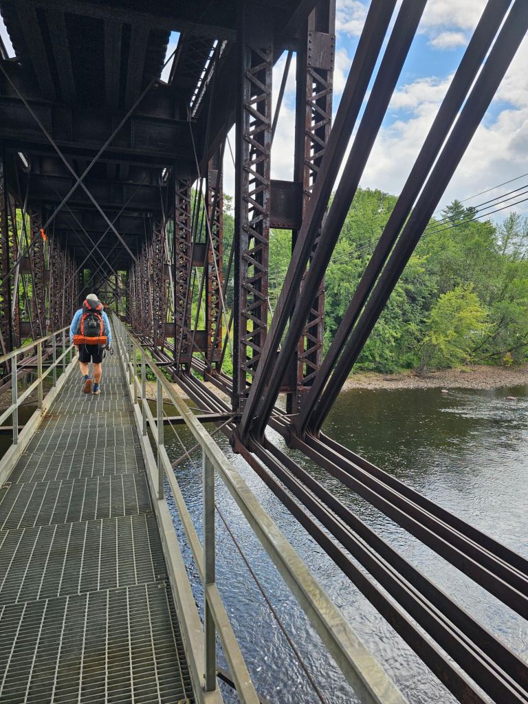
Our first gauntlet was to squeeze under the footpath bridge that spans the Androscoggin River with our packs on (training for the “Mahoosuc Notch” we joked.
Then, we climbed up a steep but easy tread trail to Mount Hayes (2555 ft.). It was misty, but pleasant.
Dark clouds starting to move upon The Wildcat range in the far background
From an opening in the clouds, we could see The Wildcats in the near distance becoming engulfed in angry black clouds. From the looks of it, we made a good decision.
These leaves look like someone spread rose petals on the trailBreathtaking pond viewFungi in a rowOur camp spot at Dream Lake
We hoofed our way over easily manageable boulder, root, and puddles all the way to Dream Lake and found a marginal place in which to set up our tent for the night. No doubt about it, rain was coming. This would be the first of many nights where my airmattress would slowly leak, to the point of uncomfortable contact with immovable roots and/or rocks. And, of course, at the height of the downpour, I needed to pee.
Day 51: (Aug 20) 8.4 mi (1908.5– 1916.9)
It rained hard most of the night. But let up after 8 am, which allowed us to get going. We needed the extra sleep, as our last night at The Barn Hostel was anything but restful…for anyone staying there that night. A SOBO guy (Wallet) had the bed directly across from us and snored like a torture machine ALL NIGHT! Except for when he occasionally stopped breathing. The dude has some serious sleep apnea going on. It was so bad that even my Bose earpods on “quiet” couldn’t fully drown him out. Sadly, not one of the 10 of us upstairs had the cajones to wake him up. Maybe we each thought, surely he’ll roll over, or stop. Even Sweat Potato downstairs could hear the man. Lesson learned. Not gonna be polite if it happens again.
Today’s trail seemed to step it up a notch. It was dreary and wet all day. The temperature had dropped significantly, which kept our breaks pretty short.
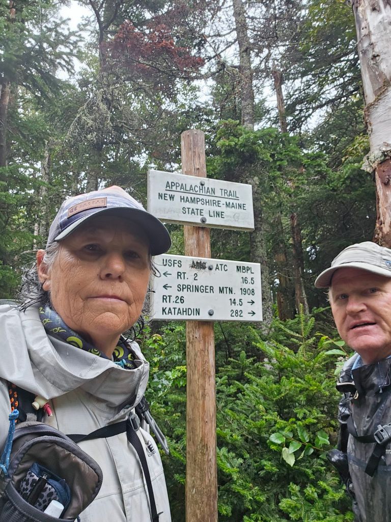
Today also marks another state completed on the Appalachian Trail, New Hampshire. Maine welcomed us in the most inhospitable way.
Maine’s “Welcome Mat”
We had hoped to make it a 10+ mile day, based on yesterday’s tread, but that was a hard NO. We acknowledged early on that our destination would be the Carlo Col shelter. And, as with all our end of days, we had an unexpected gauntlet to pass.
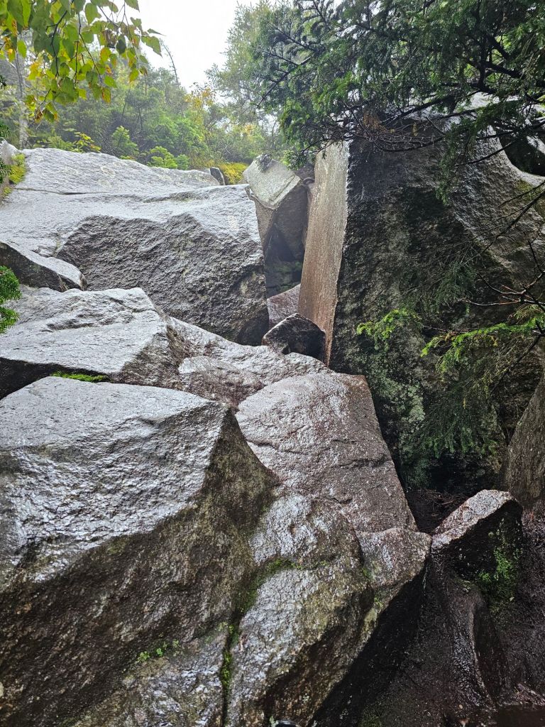
We descended from up there. This picture does NOT provide scale.
In fact, the crazy descent, or should I say, escape from Moldor type sliding and wedging down and through giant slabs of wet pointy boulders the size of VW Vans was memorable, in the wrong kind of way. It set off the “Frodo” alarm, as the antithesis of “make wise decisions,” but there were no other options but to proceed. Off go the packs. Loud is the profanity. We are now soaked to the core, clamoring and sliding through and down wet granite smeared with grainy mud. What The F**k, is all we can think. Who in their right mind thinks this safe or better yet fun? Our focus? Get to the shelter so we can start warming ourselves, as we are acutely aware that we were nearing the beginning stages of hypothermia.
It was 5:30 and the shelter was full. WTF? Where did these people come from? Only two people passed us this day. Not one of the packs in the shelter appeared to be thru-hikers. Muggles! Don’t they know they’re supposed to stay home when there’s a predicted thunderstorm? Only us idiotic and insanely driven thru-hikers are “supposed” to be out here in these conditions. Shivering and now finding my dexterity diminishing quickly, we throw up our tent on a slick platform in the driving rain. I finish the rest of the setup while Paul collects water for dinner and the following morning. It’s everything I can do to get out of my wetted out clothes and rain gear and into our hopefully dry sleep clothes and quilts. Paul’s a champ and back with water in tow. Unlike me, he is not shivering violently. My toes are a light shade of purple. That would explain why I haven’t felt them for a couple hours. It took nearly 2+ hours to warm up enough to stop shivering and proper color to return to my toes. It’s not that our rain gear failed or even wetted out. It’s that the hiking was so strenuous that we couldn’t help but sweat profusely in it. A constant and cold wet wind precluded us from taking off the protective rain gear. Thus, we were in a conundrum. Take rain gear off to reduce sweat, or keep on to prevent becoming cold. We are aware of what causes or can lead to hypothermia, and yet we inched way too close to the edge. Why? No choice but to carry on. Hike to stay as warm as possible because this trail gives you no options. It is a two foot wide “path” through a rock infested, tree choked forest. There was NO place to pull off and set up. Trust me, we looked. Our topo maps are less than helpful due to the actual terrain. So when we look at the map and see lines far apart that would generally indicate fairly “flat” terrain, it can’t tell you what occupies said terrain. Here, it is thin, crowded trees and their friends the rocks.
Finally warm, we slept soundly to the drumming of rain against our fly.
Day 52: (Aug 21) 9.6 mi (1922 – 3.6 mi of Mahoosuc Notch ByPass)
Morning came, and the rain had stopped. The forecast for the day showed no rain till mid afternoon. This meant pack up all our gear and get a moving. There is nothing better than putting on cold, sopping wet clothes and mud infused socks and shoes. Today’s trail was another unexpected gauntlet.
Needless to say, we got a full body workout. We had jungle gym type crazy climbs, at times with ladders and metal rungs to “assist” ones ascent (or for SOBOs, descents). Sunken bog boards to find and balance upon so as not to fall into an unknown abyss of quicksand like mud. Incredibly steep and sopping wet rocks that the tread of our shoes miraculously stuck to like glue. Trustthe shoes. Trust the rocks was our mantra for the day. A constant river of water flowing in the trail under our water logged feet. But today, we were rewarded for our extraordinary efforts. Views. Beautiful views!
For once, the weather cooperated with us enough so that it didn’t start to actively rain until we were down from the steep peak on the right, pictured above, and back into the green tunnel, that mostly is the Appalachian Trail.
Man, did it start raining! The trail was now an active stream, creating waterfalls beneath us as we moved ever closer toward the infamous Mahoosuc Notch, a 1 mile treacherous crawl, squeeze and scramble that is challenging even in dry conditions. And then came the fall. A misstep. A toe caught on root. A slip underfoot due to mud. I’m not sure, but the impact was significant. I found myself face down, right arm trapped unusually underneath me, wedged between a muddy rock outcropping with a river of water flowing by my cheek. My left shin had impacted with something enough so that I swore I had surely broken my tibia. Crying and swearing at this gawd awful trail was my only outlet as I completed an internal assessment of body parts and their condition. Paul called to me to “Can you get up?” Can I get up? I’m nearly upside down! Paul had totally missed what had happened. As he climbed back up toward my twisted position, I was able to slowly withdraw my arm from underneath me. Man, did that shoulder hurt (the one I had surgery on last year). Paul helped untangle me from my pack so I could further assess my shin. Okay, not deformed. Searingly painful to the touch, but not to pressure upon standing. Hmm. Definitely gonna leave a mark, I think to myself. Shoulder feels “crunchy,” but has full, slightly uncomfortable mobility.
We are now a mile from the beginning of the West Mahoosuc Notch, and the ByPass turn off. We talk with a SOBO hiker who just made his way up through the “Notch”. “Holy shit, that was tough! It took me four hours to go one mile through that ridiculousness. Crazy dangerous! You’d best camp before it starts and rest up. You’ll need it…and hope it’s not raining still.”, he tells us. Decision made. Turn off it is. Negotiating these past few miles in the rain has been difficult. This recent fall has me rattled, and Paul too. It’s not worth it. For us it’s not worth the assured injury, or worse yet, fatality. Number one rule of thru-hiking? DONT DIE!
We get to the intersection and make the left turn onto the 7 mile ByPass. We’ll take the extra miles, of it keeps us from further injury.
Now that’s a nice trail!
The rain abates, and the tread turns to “West Coast” type foot fall. Less roots. More dirt. Four times, we cross a river engorged by the rain. The last crossing is the deepest (thigh) and most technical. We take our time. In this, we are comfortable. Moving water is our jam. We finished the last crossing and joke. Well,our shoes and rain pants are finally clean!
The trail flattens and leads onto a gravel “road”. It’s like walking on carpet. We allow our minds to wander and strike up a conversation as we walk. We haven’t been able to do this in weeks. It’s late, so we collect water and look for the next available pull off in which to camp. We find a perfect place, and set up. We eat all but our breakfast for the morning, and two bars for the next day’s hike to the Grafton Notch, and a hopefully a hitch into Bethel, Maine. I finally get a good look at my shin. The skin is broken with a large bruised lump underneath it. Yup. That left a mark for sure! What a day!
The Presidentials, with each peak named after early American presidents, was just as hard as it was beautiful. It presented quite the challenge not only physically but mentally and emotionally. The route over/through the Presidentials, the Crawford Path is one of the oldest continuously maintained hiking trails in the country, first created and maintained by Ethan and Allen Crawford in 1819. The AT follows a good portion of this path. Here’s how we fared.
Day 45 (Aug 14): 7 mi. (1851.2 – 1858.2)
So, our plan to have a zero (or two) and finally rest from the Whites was dashed when we looked at the coming weather window to summit Mt. Washington on a “clear” day. If we hiked out the next day, Friday would put us on Mt. Washington minus crappy weather. Mt. Washington is infamous for “the most extreme weather on earth,” having clocked winds at over 231 mph, April 12, 1934. Many companies use this aberrant weather vortex to test gear. Thus, we’d prefer a “clear” day. To reduce pack weight, we tried to schedule stays at the AMC Huts along the way, but no spots were open. We then decided we’d “gamble” and only carry two days of food for the four days of hiking, and try our luck at scoring the WFS (work for stay) positions at one or more of the Huts. Pack lightly, and trust that we’ll get lucky. Worst case scenario, we’ll supplement our food carry with bars from the Huts and/or resupply from the Mt. Washington “deli” and carry out from there.
After hatching that plan the night before, we were informed that two thru-hikers staying at the Old Colony hostel decided to cook a communal meal for everyone. Turns out, they were chefs that worked at a steakhouse. So, they cooked what they knew…steaks, pork chops, mashed potatoes, fresh veggies, and corn on the cob. The beer, PBR (what hikers crave), was provided, too. It was a feast to behold and to consume.
Corn cob, pork chop, mash potatoes, veggies, and another steak…initial plate.
We lamented the fact that we had so much trail magic food earlier, but we did our best. This was one of the first times on trail, since “Hiker hunger” has arrived, that we were truly satiated at the end of the day. A full stomach made for a sound and restful night’s sleep, that’s for sure!
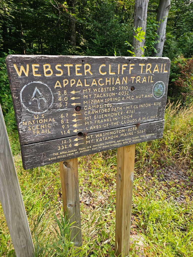
Jeff dropped us at the 302 and we immediately began to climb. First on the menu, Mt. Webster, a climb of 3,910 ft. This climb actually afforded us quite a few opportunities for pretty good views. While the trail tread was manageable, it was steep and the climb up to Webster presented us with more than a few challenging scrambles, followed by a mud bog, that if you had an errant step off the bog boards, you’d find yourself probably neck deep in mud.
The climb to Mt. Jackson was less challenging but still required some sketchy down scrambles…my personal favorite (not!). Needless to say, we got a full body workout. When we arrived at the Mizpah Hut, near 5 pm, we decided to divide and conquer. Paul went to secure a campsite while I wandered into the Hut to see if there were WFS spots available. Eureka! We totally lucked out. No one had asked about WFS, so we secured the two positions. This was fortuitous as there were no tent platform sites available. So far, so good. One-half of our food plan is fulfilled. Just before the paying guests ($220/ea gets you dinner, a bunk and breakfast) began dinner, we were given our work assignment. It was a douzy. De-ice and clean two large refrigerators and a large coffin freezer. It took us nearly an hour and a half, mainly because we don’t half-ass things, and it needed adult type cleaning and organizing, as opposed to the 20 something college kid idea of “clean” and “organized”. Once the guests were done with their meal, and the Croo had cleaned all the dishes, we were called into eat. Our job was to eat ALL the leftovers. Otherwise, what’s left has to be packed out. We were just as thorough with the leftovers as we were with the fridge and freezer. Pulled pork, veggies, bread, and dessert. The youngsters were amazed at our eating prowess. Years of practice… which leads to “fat camp,” or in this case, the Appalachian Trail. Tonight, we are full and out of the rain, as we are directed to sleep upstairs in the “library.”
Day 46 (Aug 15) 4.7 mi (1858.2 – 1862.9)
Mizpah Hut
The hall light outside the library kept me from a deep sleep, and it was a little (actually a lot) warmer than we’ve been used to as of late, but our stuff was dry and we were still mostly full from last night. Up and packed by 6:30 a.m., we grabbed a cup of coffee and waited for the rain to slow. Today, we would have short miles to the Lake of the Clouds Hut due to the incoming weather. We also hope to be able to secure two of the four WFS spots at that Hut.
Today, we were able to catch up to Grit and walk with her for a while. For the most part, the route was pleasant with some great views. Around just about every corner, you could catch a view of the famous red roofed Washington Hotel down below.
Mt. Washington Hotel (we also saw this from Mt. Moosilauke)
It reminded us of seeing Mount Shasta on the Pacific Crest Trail. For 300 miles, we had a view of that mountain. Probably not the case here, though. About a mile from the Lake of the Clouds Hut (LOC), the clouds rolled in, requiring us to don our rain jackets. And 10 minutes before literally running into the fog encased LOC Hut, loud, rolling thunder bellowed from on high as the temperature dropped a little further.
Lake of the Clouds Hut
Again, our luck held, and we were able to secure two of the four WFS positions at the LOC Hut. Unfortunately, there was not much to do at the Hut, but wait and try not to eat all our food. We’d still have two more days, but at least now we’d filled in the blank days we had started this section with. It took forever it seemed to warm up from our short hike, as the building was unheated and a bit damp, and so were our hiking clothes. Our WFS job ended up being dish duty after we had eaten our fill of lasagna, veggies, and cake. Paul squirreled away two pieces of cake for our morning’s breakfast. By 9:30 pm we were able to move some tables and get to sleeping. Tomorrow is going to be a long day. To be honest, we are a bit concerned about our weather window and how the descent from Mt. Washington will be.
Day 47 (Aug 16): 7.7 mi (1862.9 – 1870 +.6)
Sunrise
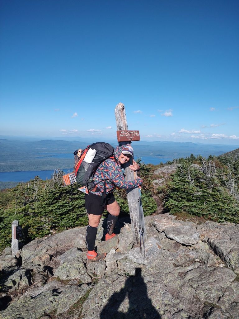
Just after 7 a.m., we head out for our 1.4-mile climb up to Mt. Washington, the highest elevation on the Appalachian Trail.
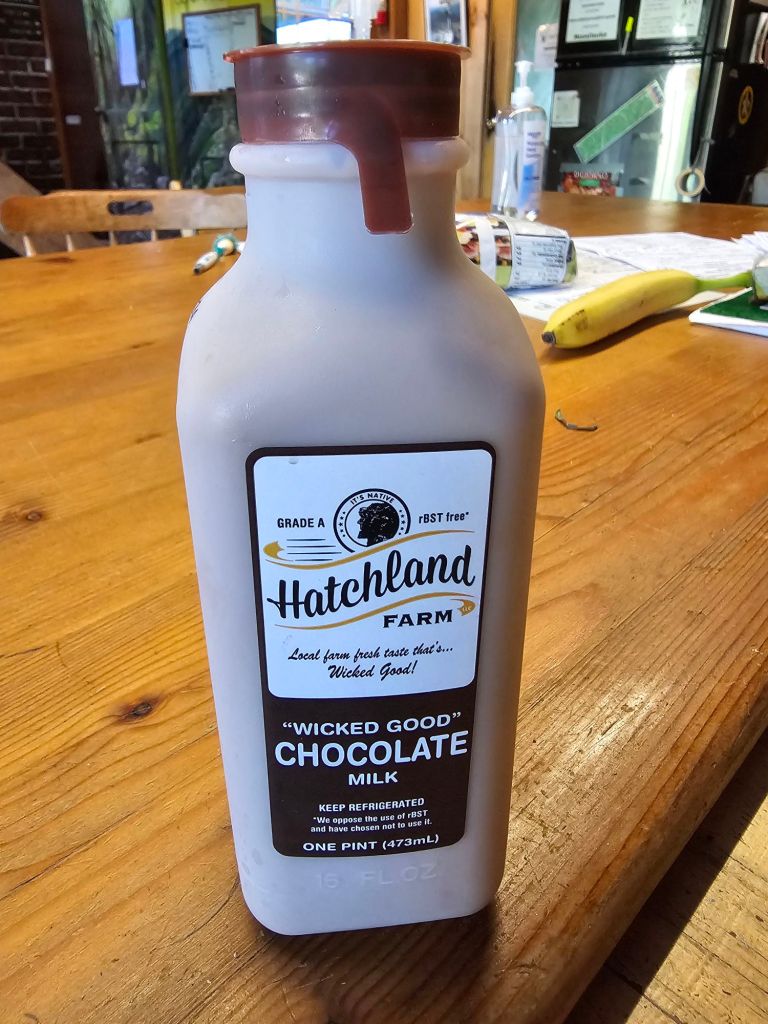
As it turned out, the skies had cleared a bit, and the sun was doing its best to make an appearance. Remarkably not a breath of wind was felt as we climbed up to Mt. Washington. We reached the top, cluttered with towers and buildings, and made our way to the summit sign for an obligatory picture. I won’t say it was a warm sunny day, but it wasn’t raining, and the wind was still negligible. We made a brief detour into the visitors center and the gift shop for a postcard to mail from the mountain. We decided we would send our new granddaughter (3 months old) a card for posterity. And, as breakfast was paltry, we decided to grab ourselves a few “vittles” to top us off. Paul, a coffee and cinnamon roll. Me, a chocolate milk and a moon pie. All for $17!
1110 calories!
Before long, wisps of clouds started to form on the horizon. It was time to skedaddle. The hike down from Mt. Washington nearly broke me. Nothing but rocks. Some rocks were “organized” enough to pick ones way across without much thought, but most of the descent toward Madison Spring Hut was tedious. We opted not to climb the other peaks along route, as they were not part of the AT.
The Cog rail up to Mt. Washington The Cog
The first few miles were somewhat “enjoyable,” in that we were rewarded with stunning views. But to have to pick ones way over sharp and often loose boulders whose path was suggested by rock pile carins was, for me, brutal. I am not a climber or a fleet of foot. I am a misplaced but determined water sports gal, of which rain does NOT count. At one point (with 3 miles to go), I literally lost my shit and just sat down. I had no desire to walk any further on this treacherous trail. I screamed at the fact that this section is supposed to be maintained by the AMC, and people pay a shit ton of money to walk Hut to Hut. How is it that with thousands of people doing this year after year, and all the money they collect, they can’t figure out how to flip and move a series of rocks to make a more distinguishable trail. And then it happened. I pulled myself together cause there was nothing else to do, and low and behold, not 1 mile later, an entire mile of perfectly organized rocks, just prior to the Madison Spring Hut. Providence. Nothing more. Nothing less.
Perfectly organized rocks (mostly flat)
When we reached the Madison Spring Hut, they had no vacant bunks to buy and no WFS. Needless to say, I was 100% worked and out of steam. The next place to camp trail was 2 miles away with a 1500 ft descent through a boulder field. Our only choice was a side trail, the Valleyway Trail, which we were told was part of the old AT route, and a USFS campground a half mile down that trail. We decided to take the vintage route. On our way down, this sign was posted just before one would reach the Hut.
While the descent was steep, it was way more negotiable. Water flowed from everywhere, which made the fact we had packed out water from the Hut for dinner and morning coffee a little silly. But then, water is easier to carry downhill as opposed to uphill.
We found the campground to be fairly full but made a slightly sloped spot “work.” We ate what we had left for food and kept a bar for breakfast. Sleep came without effort. Suddenly, in the middle of the night, we awoke with a start. Mini bears (mice) had somehow invaded our nylon domicile. We figured they must have snuck in a bit earlier when I crawled out to go to the bathroom, and with no open door, and finding nothing to snack on, they were trying to figure how to get out. After a flurry of activity, spotlighting them with our headlamps, we were able to get them to exit. Phew. This is one of the many reasons we prefer to stealth camp. Designated camping areas are hamlets for mini bears.
Day 48: (Aug 17) 6 mi. (Valleyway Trail)
The night previous, a father and daughter camped below us. They were our evening’s entertainment as the father read the instructions out loud as they worked together to erect this enormous REI tent. It would be something, maybe we’d bring for car camping. You could stand up in it, and I’m pretty sure there was room for cots.
Packing up
The trail led down to Hwy 2. It was, in our opinion, a proper and perfectly routed and maintained trail. It’s what our feet, and especially my knees, needed. Once at the highway, we unfurled our “AT hikers to Town” sign, and in 15 – 20 mins, we had a ride into Gorham, and The Barn Hostel at the Libby House, which, we are told, is the oldest operating hostel on the AT.
Presidentials done. It was time to collect two packages from the Post Office, and take a zero, and oh ya…EAT.
The Bear Taphouse and Cafe (best restaurant food on trail so far)
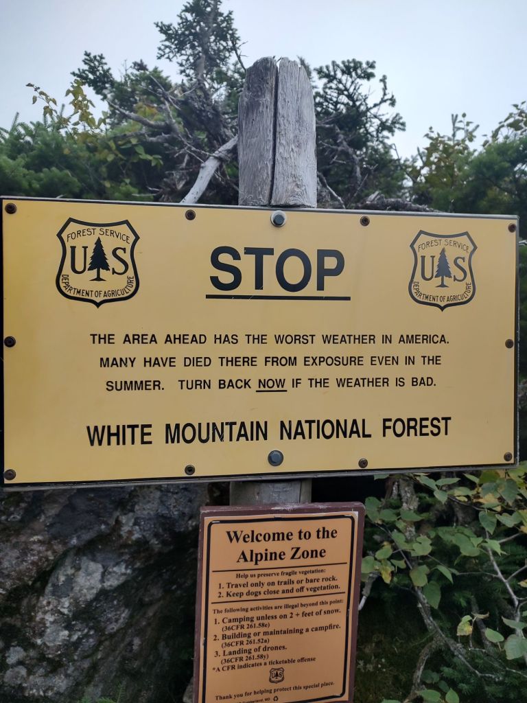
We have finally reached the much talked about and frankly “feared” White Mountains. The Appalachian Trail traverses the White Mountain National Forest and is “divided” into three sections. “The Kinsmans”. “The Presidentials ” and “The Wildcats”. Each is purported to be successively harder than the previous section. Overall, this 100-mile stretch is said to be the “hardest” section of this already hard trail.
Nervous chatter is the norm at the Hikers Welcome Hostel. Most hikers here are NOBOs with nearly 1800 miles under their belts, and they’re fretting just a bit. We barely have 350 miles, and our trail legs have yet to arrive…fully. ‘Expect your mileage to be cut in half’, they say. We are not sure what that will mean for us. In any event, this should be interesting.
Day 36: (August 5) ZERO miles
Hiker Welcome Hostel was just what the doctor ordered. Housing out of the rain. Ways to charge electronics, laundry ($4 wash, 4$ dry), and ride to the store for vittles every night (where the chocolate milk lives) and great comradery. People you thought were way ahead, come rolling in. People you haven’t seen in miles and miles suddenly show up. Laughter, smiles, and stories of “Where were you when…” And Miss Janet. Miss Janet is fixture along the Appalachian Trail. She was our primary shuttle driver and chief story teller of everything Appalachian Trail from Georgia to Maine. Patience was our host at the hostel, a PCT 2019 alumnus, and a previous helper at Scout & Frodo’s.
Sweat Potato, Rebound, Grit
Our only job for the day was Eat. Sleep. Blog. Eat some more. Drink. Wash clothes/shoes and inserts. Eat. Dry air mats. Drink. Eat. Pack for tomorrow’s slack pack of Moosilauke. Set the alarm and go to bed.
Day 37: 9.7 mi Mt. Moosilauke (1798.3 – 1807.8)
Miss Janet
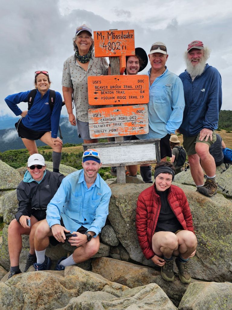
Up at 6 a.m. for our 7 a.m. shuttle ride with Miss Janet to Kinsman Notch to hike SOBO up and over Mt. Moosilauke and back to the Hiker Welcome Hostel. The best part was that we wouldn’t be wearing a full pack. We’re carrying PB&J sandwiches, water, and our sit pads.
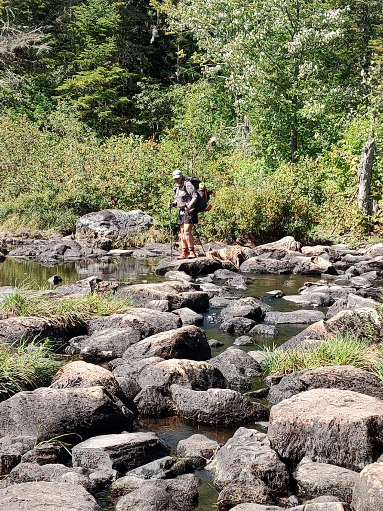
Out of the shoot, we have a river crossing with no other safe option other than to get our feet wet and ‘walk’ em dry’. The air is cool, and the terrain instantly becomes steep.
Our initial climb (1883 ft.) was alongside a lengthy cascading waterfall lasting 1.5 miles. The remaining climb to 4802 ft. was “gradual” compared to the hand over fist crawl to the first hut and end of the waterfall. Eventually, we met up with the group we rode in with at the top. Getting to the top reminded us of the CDT and walking Ridgeline. We did not expect to see SO MANY people at the top…besides thru-hikers. There had to be 40+ people scurrying about the top, to include the 1981 alumnus from Dartmouth. One of the group members remarked upon their ascent, “last time I was up here was my freshman year”. Apparently, it is “required” by the Dartmouth freshman to hike Mt. Moosilauke. I’m glad I didn’t go to Dartmouth. While it was nice to have a view (for a brief moment), it was time to head back down the mountain and back to the hostel.
Hiker Trash
Day 38: 7.5 mi (1807.8 – 1815.3)
After chugging a quart of chocolate milk and a packet of oatmeal, it was time to hoist our packs and load into the shuttle. It was 7 a.m. and we were off, once again, to Kinsman Notch to start NOBO to Lincoln NH. The morning was almost brisk, and the humidity was seemingly nonexistent. What a blessing, as today would be mostly up. We would traverse over rocks, roots, submerged bog boards, and mud.
Wet feet and shoes were the norm. Our mountain ascent would be to Mt. Wolf, which offered NO view, and frankly NO suprise. Eventually, we were passed by Let it Be, Grit and Sweat Potato, who started hours after us. 1800-mile trail legs would be nice. We’re nearly a quarter of the way there.
We reached the Eliza Brook Shelter/campsites with plenty of daylight. Quite a luxury. After we set up camp, we soaked our feet in the icy cool Brook and washed our mud infused socks. The amazing thing is that today is the first evening we’ll go to bed with dry clothing. What a concept…and a feeling!
Day 39: 8.8 mi
This was a mild section
Today was HARD! Wet feet and an uphill scramble over boulders. If it was this time last year, there would be no way I’d be able to have hoisted myself up and over some of these boulders, logs and crags. My shoulder would not have been healed enough to do all that is being required of us.
South Kinsman…and the “view” with Sweat Potato and Grit
Two mountains climbs were on the menu for the day. South Kinsman (4358 ft.) and North Kinsman (4293 ft.), neither of which provided a unobstructed view of anything. If it did, it would only be an endless array of the tops of trees. We did pass by our first AMC (Appalachian Mountain Club, but most comments on FarOut refer to it as the Appalachian Money Club), and wow! Nothing like a large lodge in the middle of nowhere, perfectly situated by a small lake. We figured the 4 mile hike to the parking lot couldn’t be that bad if there were little kids bouncing around the lodge. Oh, it was that bad, probably because we were super tired from our seemingly neverending parkour course. In my exhaustion, I managed to allow an errant tree branch to attack me yet again along the length of my right forearm, which made for a bloody mess. If figured it would be best to let it bleed, and for giggles, I wiped it on a tree trunk or two for the muggles to wonder about. Just as we make the turn to the “blue line” toward the Liberty Spring parking lot, it starts to rain. We are good for now, as the tree canopy keeps us mostly dry. We are doing our best to sync our arrival to the parking lot with our shuttle to the Old Colony Ski Club and stay as dry as possible. Our plan is to zero, in Lincoln at the Old Colony Ski Club. As it starts to pour proper, Jen comes racing into the parking lot. She is one of the ski club key members, along with Jeff, who helps run the club as a hostel in the summer for Appalachian Trail hikers.
Gotta say, this is one of most hospitable places we’ve been yet. $50/pp to “join”, then $25/ea for every night there after. Coffee in the morning. Full use of an industrial kitchen.
Market and dining nearby (like 5 min walk), AND they run you into the Price Chopper Market and Lahoots outfitters for free. The Shuttle to pick you and town chores all included in your stay. With a laundromat next door, what more could one ask for. It’s a bit of a vortex… but a good one!
Yes, it is!
Day 40: ZERO (August 9th)
A gaggle of Hiker Trash
Laundry. Shopping. Eating. Drinking. Outfitters.
Day 41: 5mi. (1824.2 – 1828.1 + 1mi blue route)
Instead of taking another zero, we opt to head out to catch a weather window that will hopefully allow us to make it up and over four mountains before the predicted thunder showers begin in earnest.
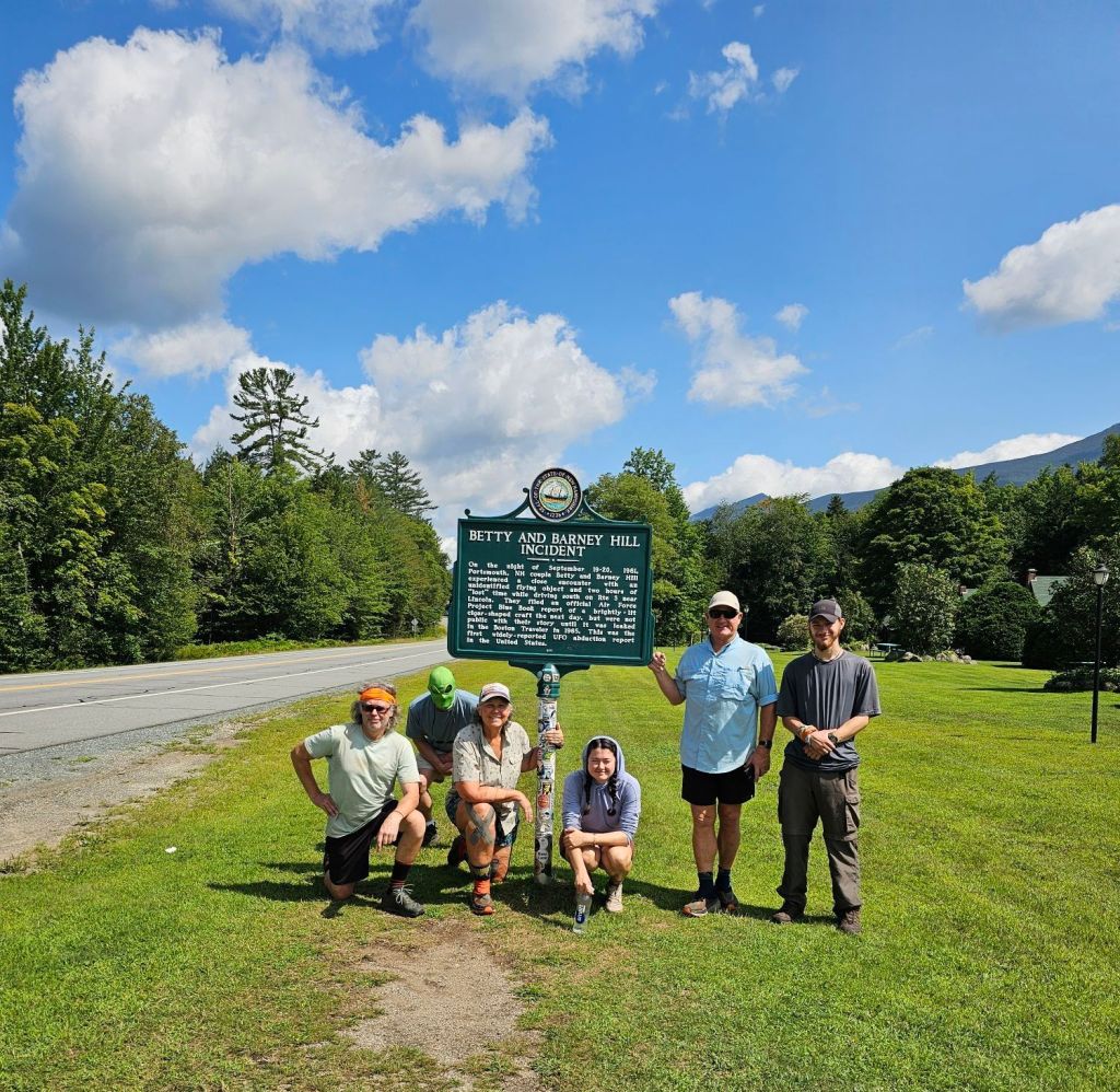
On the way to our drop-off point, our hosts stop by a famous New Hampshire icon. An alien abduction site. Photo ops for all, as Jen tells us the story.
We get dropped off at the Flume Gorge Vistor center parking lot with 5 other hikers. We notice a Disneyland like line of people waiting to pay to get into the Gorge and walk the 3-mile (r/t) platform type walk to see the Gorge. We chuckle at how ridiculous that seems, and then remember, we’re paying A LOT of money to hike (actually hike, climb, scramble, trip and fall) all day and sleep in the mud, dirt, and rain. Who’s the dummy?
As we were starting a bit late, and we’re carrying 4 days of food, we had initially thought we’d stop at the Liberty Springs campsites, run by the AMC, but then decided to save our money and continue on till we found a good stealth site. We found a place tucked away in the trees and just after the bulk of the climb to Little Hatstack Mountain. This would set us up nicely for the following morning. Little Haystack Mountain(4780 ft.), Mt. Lincoln(5089 ft.), Mt. Lafayette(5260 ft.), and Mt. Garfield(4467 ft.).
Night sky from our stealth site.
All was well and good. The morning and most of the day was brisk and a bit windy, but we had mostly clear skies as well as a busy trail. We sometimes forget to account for muggles out for recreation on a weekend. This would be a 10 mile day.
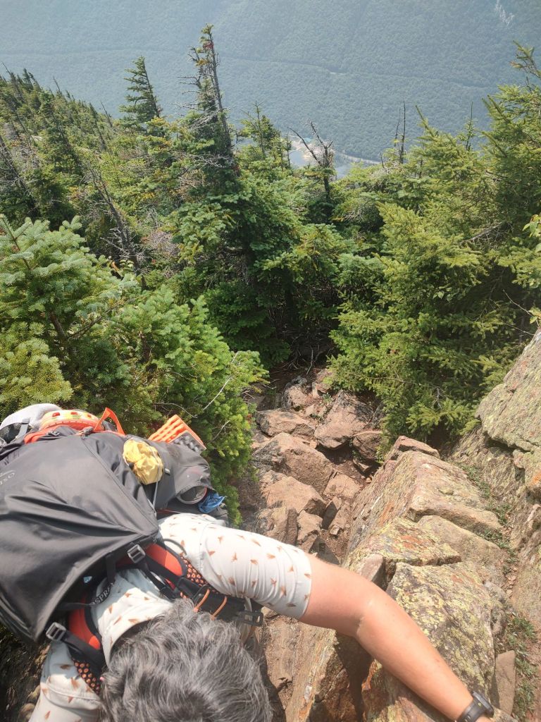
All seemed good, until our descent to Galehead Hut, coming down from Mt. Garfield. It appears that we missed the memo that says the seriously steep descent will involve the actual scaling of a waterfall, complete with water flowing beneath and often over your feet.
At the top. How do we get down?Photo does not give depth perspective. Think 70-80% incline, or in this case decline.
Talk about terrifying! Needless to say, by the time we reached Galehead Hut (built in 1932), we (meaning I, to the point of tears) were seriously outta steam. They only had one WFS (work for stay) spot open, and no camping at or near the hut. To our dismay and total lack of understanding, not all AMC huts have camping available or nearby. One of the Croo members, when we asked about where we could camp and that we were AMC members, actually walked us to a seriously concealed stealth site not far from the Hut. Awesome. We were so thankful, as everything else we spied was nothing but large puddles. He told us that we would be “pretty protected” from the incoming thunderstorm and that we should have an unobstructed sunset view. Sweet! Yup. God is good…All the time!
All set up and fed, we fell asleep as rain softly pattered against our tents, as thunder roared and lightning lit up the sky.
Day 43: 7.4 mi (1837.1 – 1814)
We awoke with a fairly dry fly. While it rained a good portion of the night, the morning wind left us pretty dry. After coffee in bed, we packed up and headed back to the Hut. We needed to refill our water bottles and use the restroom before beginning the day’s descent. When we arrived at the Hut, the Croo asked if we could take their “end of year” picture in exchange for a cinnamon roll. Yup! You don’t have to ask twice!
Today’s route was much nicer. It was easier on the knees for the most part and less steep. The first half of the day was foggy and cool, so we hiked for a while wearing our rain jackets. I added my Hestra liner gloves to take the edge off. We reached the Zealand Hut by the similarly named waterfall. No work for stay available, but they pointed us to campsites not too far from the Hut and just off the AT. The site was .3 from the Hut and big enough for several tents. We considered going further, but didn’t want to pass up a sure thing.
Day 44: 7.3 mi (1844.5 – 1851.8)
The wind gusted violently all night long. While the tops of the trees above us shifted and shook, not a breath of wind breezed by our tent. We were in a vacuum of stillness. It was a little eerie. This kept us warm, too warm, for the most part. But, opening the fly for more airflow meant letting in the noise of nature’s leaf blower, and I lost my earplugs.
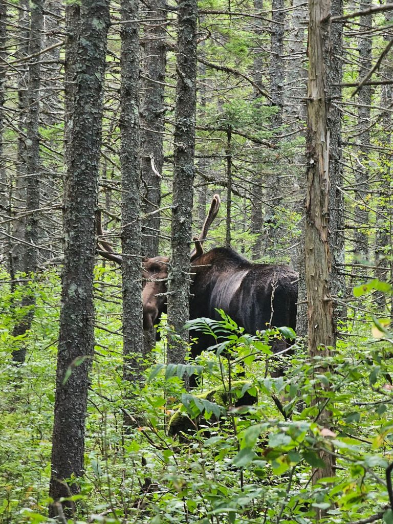
The trail to the 302 hwy was reported to be the easiest walk so far on the Appalachian Trail. While it was unusually easy tread a majority of the way, there were a few times when it returned to its “regularly scheduled trail,” of unorganized boulders and dilapidated and/or submerged bog boards. While examining our current soakers in the mud, we noticed what appeared to be a fresh set of moose tracks. And what did our wandering eyes spy, but a bull Moose not more than 25yds from us.
He picked up his big rack and glanced at us with serious disinterest. That sighting made our day. We were especially glad there were several trees between us and the Moose.
As we walked we kept waiting for the trail to degrade fully, but it never really did. Even the .5 mile 700ft descent had a manageable grade and steps. We’ve noticed a bit of a trend when walking the AT that shares it route with paths to the AMC Huts. They tend to be fairly “tame”. There is just enough “trail ” to make it feel rugged.
When we got to the parking lot, we were pleasantly surprised with “trail magic” from Mrs. B, Mr. Bogangles’ wife who is following him along the trail. He is just ahead of us on trail. PB&J sandwiches, soda, hiker snacks, OH Boy! This helped us fill the time before our previously scheduled shuttle ride from Jeff at the Old Colony Ski Club back to Lincoln for a pole repair, rest, and resupply. Time to rest up. The Presidentials are Next!
Today was fairly “easy” with regard to the climbs. The tread was either a little easier to navigate, or we are developing “goat feet.” To mitigate my foot issue, we took regular breaks on the hour. We started with a bus ride from Norwich to Hanover and then decided on a road walk to the AT Trescott Rd. trailhead to see how the feet would respond. This way, if it became problematic, we could hitch back and regroup.
It was neat to walk through the Dartmouth campus and the neighborhoods along the way. While on our road walk, at the base of hill, a man stopped us in front of his house and asked if we were “lost”. ‘No’, we replied, ‘Just testing out my foot on our way back to the AT’. He advised us that the road we were walking was steep and dangerous on foot and insisted that he drop us at the trailhead. Who are we to NOT accept such a strong suggestion? He dropped us at the Trescott trailhead, a mere 5 minutes drive from his house.
Back on uneven dirt. So far, so good. It appears that over tightened laces and the wrong shoes may have been the problem. Even so, we (I) didn’t want to push it.
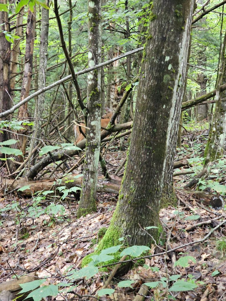
At one point, a flash of rusty brown fur and a white tip tail crossed the top of my vision (while staring at my feet, of course). The west coaster in me immediately stopped and thought, mountain lion. Shit, it’s doubling back on us! Once I came to a full stop, I could see that it was a small button buck deer. It was now doing its best to be invisible and looking at us with curiosity. For proof of fur, I clumsily snapped a picture, and we went our separate ways. Finally! A furry animal! They do exist out here.
My “mountain lion”
Up Moose Mountain, we gradually climbed. Even though I felt like I could go further, we decided to stop at the Moose Mountain shelter. Sometimes, patience is the better part of valor. The miles will Come. And, we caught up with Sweat Potato!
Day 33: 12.2 miles (1766.2 –1778.4)
Holy crap! What a brutal ending to a mostly enjoyable day, where we got our first glimpse of a sunrise.. While there were roots, rocks, and mud, it was all fairly “mild” in that no trips or falls were had. Our shoes are muddier than they ever were in Vermont, which was supposed to be muddy anyway, but New Hampshire, what the heck?! Just before our big climb up Smarts Mountain, we took a slight detour to a big blue (periwinkle, to be exact) house that rumor had it, they gave hikers ice cream sandwiches.
I am happy to say that we confirmed the rumor. Two ice cream sandwiches later (because the owner said we could) we were headed back to trail. Just before that, we noticed that the road we “detoured” onto went straight to the parking lot approach to Smarts Mountain. Same mileage, just no mud, roots, or rocks. It was a no brainer…literally.
Art via discarded propane tanksColorful flowers along all the homes and barns
For 2 miles, we did not have to think about where to place our feet. Little did we know, it was going to serve us well. While on the road, a car passed us and asked if we wanted a ride. We declined, as we were finally enjoying walking and talking. When we arrived at the lot, the same guy who offered the ride offered us beer. Now that we’ll take gladly. He was on his way to do a section SOBO. We gave him info about the trail as we sipped on an ice-cold beer. It was 3 p.m. and we had 3.8 miles and 2,134 ft to climb, with the last half mile covering the last 584 ft. All was good, and we were climbing with gusto until my foot suddenly started hurting under the arch by the heal. It felt like something was tearing away from my heal. OMG! Now what?! The day was going so well. About halfway up, after stopping and resting till the pain ceased, I discovered that the insole in my shoe (left of course) had migrated ever so slightly with all the wet and mud and twisting of footing, that the edge of it was rubbing my arch, causing the pain. Shit. Oh, and did I mention we were back again at near 100% humidity? With 2 miles to go, we had a view of what we later discovered WAS Smarts Mountain. It seemed way too tall and way too far away. I tell ya, this trail is so difficult to measure distance by any means. As it was hot, water was an issue. Apparently, one is supposed to carry their water up the mountain to ensure there is water as the spring by the ranger hut has been drying lately. With the last stream being highly tanic (rusty colored from plant material), we decided to trust the last comment on FarOut that there are pools from which to collect at the spring up top.
It looks flat, but its actually greater than 45°
By the time we reached the last half mile ascent, I was on fumes (Paul was, too). The only thing that kept us going was a coming thunderstorm and Sweat Potato’s comment. “There are dumb asses that do this trail and make it.” If a “dumb ass” can do this, then so can we. Up we climbed over slick rock stairs with cascading water draining on both sides. Mud and even rebar steps to help you ascend the over 45° incline. Eventually, we crested the top as the day’s light was fading. ‘Holy Crap, that was brutal’ was the consensus of everyone packed into and around the Ranger hut. Whoever thought of this route was a sadist.
Nothing to see, or be up in with a thunderstorm approaching.
With a thunderstorm coming in, the climb up the fire tower was a no-go. Dinner was spent on the Ranger hut porch, and the night was spent on one of only a few semi flat places in which to erect a tent. In no time a cloud settled upon us, and down came the rain.
Day 34: 9.7 miles (1778.4 – 1788.1)
We awoke to a puddle under the tent. As long as it was on the outside, everything is okay. A breakfast bar, a hot cup of coffee, and a cat hole on the woods, and we were on our way. As the cloud was still settled upon the mountain, we figured it would rain on us most of the way down, so putting on wet clothes once again somehow didn’t feel so bad. Today would be a descent, followed by an ascent to the Hexacube, and then back down to a road, where we’d camp nearby.
This trail is daunting. If we were 10 or 11, even a teenager, it might be fun getting muddy and crawling up over roots and rocks. Holding onto narrow tree trunks to ensure your footing. Finding cracks and groves over smooth slabs of curved granite in which to ascend…carefully. Our major destination reached, we basked in actual searing sunlight accompanied by a brisk, cooling wind. We were drenched in sweat from head to foot, and we finally had a view.
As we rested, and chatted with the other hikers that we have been leap frogging the last two days (Long Island, Fern, Cheddar), we helped ourselves to a yard sale and took the opportunity to dry out all that was wet…including ourselves. And then, on the horizon the clouds began to form and turn Grey. Darnit, another (unscheduled) thunderstorm is on its way. Time to collect our gear and make the 3 mile descent to camp.
Noticibly worked from the previous day’s climb, as well as this one today, we took our time navigating the blackbean soupy trail to our stealth camp destination. Comment on FarOut tell us that this spot is “okay” if you’re fine with kids partying all night. It was Saturday night, so we were prepared.
We camped next to an old rock structure that appeared to be a settling pond for livestock or irrigation. Sounds of joyfully screaming voices with a bass beat in the background ebbed and flowed through the evening and into the night. A cacophony of explosions and their rhythm in the near distance indicated a fireworks show was nearby. Our map showed a Merriwood Camp in the vicinity of the noise. It must be the final night send-off for the week’s campers. We wish we could have at least seen the fireworks. Sadly, we couldn’t even see our hand in front of our face.
Day 35: 10 miles (1788.1 – 1798.1)
Hot. Stuffy. And muggy most of the night until it rained. I almost can’t help but welcome the seemingly nightly rain, as it cools things down just enough to go to sleep… finally. Last night was especially itchy and stinky. We haven’t showered in two weeks, and the smell is nauseating. Our only hope is to get down the trail to the Hikers Welcome Hostel for a shower, laundry, a dry place to sleep, and to take a day off and plan for the Whites!
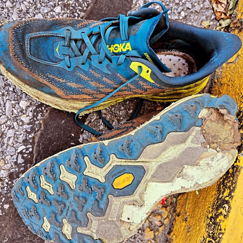
So, we didn’t get arrested, but my foot was still jacked. The tendons on the top of my foot were definitely bruised, but not as irritated as they were before we stopped. This enabled me to walk tentatively at a slow meander, which was not all that bad as we had a flat road and beautiful home/farms to admire. Our plan, as we had no cell service, was to get to the Rt. 12 parking lot at mile 1731.9, and get a ride to Norwich (22 miles away) and take a couple of days off to let this darn thing heal, or this hike will be over. We also had a package to pick up at the post office there, and we needed to find new shoes… somewhere. These 8mm drop Brooks Cascadia were NOT gonna work for me. As luck would have it, we discovered that the Abracadabra Coffee shop (on the blue route trail) was open. Score! They normally aren’t open on Tuesdays. With a fresh and hot cup of coffee, a pastry, and WiFi, we got to work looking for a sporting goods store. A ride could wait. We found Stateline Sporting Goods in New Hampshire, not far from Norwich Vermont. We had hoped to Yogi a ride from the patrons grabbing their coffee, but no one seemed aminable to putting two stinky (like the wet dog we were) hikers in their car. So, we called a shuttle service and waited. While waiting, we visited with several other thru-hikers taking advantage of the food, WiFi, and the shop’s external power sockets. Within 2 hours (as we weren’t in a hurry), we arrived at the Dan & Wit’s Market in Norwich. After chocolate milk and a coke, we called Bill, the area trail angel coordinator. He sent us a list of trail angels that might house us for two days, including the St Barnabas Episcopal Church. As it turns out, not one trail angel had available housing, so we walked over to the Episcopal Church in hopes that someone would be there to let us in, as no one was answering the phone. Lucky for us, Helen (a volunteer grounds keeper and parishioner) let us in and gave us the lay of the land. They allow hikers to stay in the parish hall basement, where they have bunkbeds (with sheets) and full use of their kitchen, and we could stay as long as we needed. Happy to have a place to stay, it was time to work on shoes.
So far, we have found the East Coast to be amazing with regard to its public transportation. So far, it’s been free, regular, and the bus drivers are super helpful. They take the time to ensure we get to where we need to go in the most efficient manner. We headed off to Stateline Sports in New Hampshire. Brown line to the Green Line with a short walk across the Connecticut River.
Connecticut River and into New Hampshire
While Stateline didn’t have my size of Hoka Speedgoats, they did have a men’s size that would work. Let’s hope they do the trick! Paul was able to get a new pair of Hoka Speedgoats as well. It was now time to mail the Brooks home. Back on the bus and into Norwich, we amble. The history and the quaintness of the homes and buildings are amazing. Last time we saw buildings this old (or older) was in Spain, when we did the Camino de Santiago.
One of the original buildings in Norwich
Once back in Norwich, we hit the post office and the Dan & Wit’s for dinner. Pizza, salad, and beer. We’ll worry about the rest tomorrow.
For the 31st, we take a much needed zero. My foot feels better, but it’s still not 100%. We spend the day catching up on the Olympics and planning out our food carry to Glencliff and the Welcome Hikers Hostel, where we’ll prepare for the much anticipated Whites. It doesn’t hurt that we avoid another thunder shower.
Today’s goal was to get into the Rutland Verizon store to get my phone fixed… and hopefully, new shoes and resupply, but the first and most important goal was breakfast. I had read about this restaurant right off the highway that serves breakfast ALL Day…till they close at 2 pm. So, the immediate and most pressing goal was to get there before they closed. In order to do that we had to catch the free public transit.
And to do that, we had to walk down to the PICO Ski lodge and wait. If we hustled, we could catch the bus with time for breakfast. Success! We made it with an hour to spare. The restaurant, Maple Sugar & Vermont Spice was just that. It even smelled like that.
It was so good, not even time for a “before” pic.
Breakfast was amazing! Paul, as usual, chose an omelet. I, on the other hand, chose the special that included sugar spiced pancakes with real (from the premises) Vermont Maple Syrup. Yum. Once fully satiated, it was time to catch the bus once more and figure out how to get to the Rutland Verizon store. Turns out, it wasn’t that hard. The public transit was free and easy. The bus drivers were GREAT! They were a wealth of information and quite the characters. We boarded one bus at the Rutland transit center and felt like we were in a sitcom. This town was once the world’s foremost place for marble but has now slipped into a bit of aged despair it appeared.
Downtown Rutland
We got to the Verizon store, and short of paying off my phone, so I could get a new phone (that I’d probably break on trail), or putting in for a replacement (which, with insurance would take 3 weeks and have to be mailed to an actual address), I opted for a wireless charger and an OtterBox Defender Case. The charging port is now protected, in the event my phone decides to charge from there, and I have a workaround to charge it via the wireless charging pad. On the other hand, Paul’s phone was hopeless and will only accept a charge from only one specific USB-C cord we have. We better NOT lose that cord! So, instead of $1600, we got out of there for $44. I’d say that’s a win.
Now, onto our next chore or task. The dilemma was, do we stay at the Hiker Hostel/Yellow Deli place downtown (for free/donation), or the Hampton Inn that we were looking directly across from the Verizon Store, the Dicks Sporting Goods and the adjoining grocery store? The fact that they gave us a decent discount, had laundry, and were in easy walking distance to our remaining tasks, pointed to the Hampton Inn. I tell ya, this hike is going to be way more expensive than we figured.
Our foray into the Dicks Sporting Goods was disappointing. When I asked the person working the shoe department what was the “drop” for the Merrells and Brooks Cascadia shoes we were trying, she replied, “What’s a drop?” Thank goodness for Google.
The trail ate our shoes!
Paul, for sure, needed new shoes ASAP. I could get by, but I thought it would be better to get new shoes for the 150 miles it would take to get our new shoes ordered and shipped to us. (This turned out to be a horrible idea) It was a no-win situation between the Brooks and the Merrells. Both were 8mm drop. I knew that going from a 4mm drop to an 8mm might be too much, but going to zero would be untenable. Brooks Cascadia it was. They felt better on my feet than my tired Hoka Speedgoats, and would protect the side of my foot much better, but I didn’t really account for what it would do on the upcoming downhills (steep down hills). While Dr. Morgan of Blazephiso thought I’d probably be okay, if I kept to short strides, I don’t think I actually communicated how sore my foot was already. After completing the rest of our “town chores,” we decided that tomorrow would be an “on-trail” zero, rather than pay for another night of air-conditioning. Before getting back to trail, and because it was a Sunday, we headed to church, dressed in our “cleanest” hiking attire (which was our just washed clothes) with packs full for 4 days of food. The first church, the bus driver dropped us at, which was beautiful, turned out to have been closed for two years, but they have yet to take down their website. The next closests, we quickly walked to, and were an hour late, as mass had just ended. Again, they failed to update their website. Luckily, some parishioners knew of another church with an 11am mass and drove us cross town to it with 10 minutes to spare. Once mass was over, it was time to walk back to the bus terminal and get a ride to the outfitters in Killington. We needed fuel for the week, and maybe they’d have a better shoe collection.
Only problem. There were NO free refills!
No shoes, but they had beer and a porch that we hung out on for a couple hours before we walked to the deli/gas station for a sandwich.
Protective gallon Ziplock
It is here that we finally fashioned our “Hiker to Town / Hiker to Trail” sign out of a paper bag. The next thing was to put it to the test. I swear, 2 minutes, and we had a ride back to trail! The irony was, it was a guy (John Boy) who had camped next to us while at the Killington Mtn lodge. He lives in Maine and was only doing a section with some friends. He and his son were now helping his friends and other hikers slack pack sections. Once dropped off at the trailhead, we discovered there was no easy place to camp. This would require an uphill climb of 5.4 miles to the nearest shelter, or find a stealth site along the way. So much for a zero mile day. Ugh! We waited at the base of the trailhead filtering and cameling up with water till it cooled down into the late afternoon before we began our unintended miles…uphill!
3.7 miles uphill, and off a crossing dirt road amongst the trees, we found a suitable stealth spot. In fact, it afforded us a glimpse of a sunset. Our first so far on trail.
Day 29: 13.4 mi (1716.1 – Abracadabra Coffee)
We were happy we attached our rain fly before going to sleep, as around 2 am it poured for an hour, and then was done. While we heard some trampling around in the woods adjacent our camp spot, we still have yet to see any significant wildlife beyond squirrels, frogs, Red Efts, and non poisonous snakes (of which, we are happy). Today, however, we witnessed a giant turkey clumsily and loudly “fly” through the crowded branches of the green tunnel, having been startled by two SOBOs marching up the trail. It was like a medicine ball had been thrown in the air and was bouncing like tennis ball off the trunks and dense array of branches, looking for escape. It was comical and tragic all at the same time. He should have just stayed put.
A “limber” tree and a useful ladder were the day’s curiosities
Today was a fairly comfortable trail. While the climbs were gradual, the downs were NOT. My feet kept sliding around in my slightly “too large” of shoes, so I tightened them down. BiG Mistake! The physicality of the days hike reminded me of water polo workouts while wearing a 10lb weight belt and holding a 10lb rubber brick or 5 gallon sparkletts bottle above my head. Oh, the flashbacks! Yup, that sport has prepared me well for situations like this. By the time we got to Luce’s Lookout and took a break, something was not right. That .2mi off trail foray to the “lookout” didn’t even provide a view as advertised unless you climbed up a rickety wooden ladder to the platform above the roof.
NO WAY! Not my cup of tea…so Paul climbed up and spent some time checking out the “view.” Just as I suspected, there were more tops of trees.
As there was a heavy thunderstorm on the horizon, expected to downpour near 7pm, we hightailed it down the side trail back to the AT. Nope. Foot not happy about that. New plan. Take the alternate in 1.7 and onto a plausibly flat road for a workaround and to relieve the foot pain. Nope. Switch out insoles to “old” Superfeet. Helps a little, but damage has been done. Laces were way too tight for too long with the steep downs and an 8mm drop. Idiot! Hmm. What to do? We finally get to the parking area, which leads to a proper gravel road…downhill, of course. There is no place to camp, so onwards we trudge. Both sides of the road have magnificent homes and some farms, all posted, “Private Property.” We look in earnest for someone peering out a window or perched on a porch, hoping for the opportunity to ask if we can pull up a patch of lawn behind their barn for the night. No such luck.
We walk on. The sun is setting, and the sky is getting darker. We (I) continue to hobble down the road. We make one turn and then another as we follow the route that will take us to Highway 12 and maybe a way to get some relief. We make another turn and discover a secluded park-like spur. No signs posted. No one around. We find a secluded place to set up next to a flowing stream and call it. While in immense pain, it’s a relief to not be walking. We’ll either wake up somewhat dry and hopefully “refreshed” and/ or pain free, or we will be talking to a bright flashlight at some ungodly hour and taken to the Pokey. Either way, we’re done walking for the day.