Harper’s Ferry and a Roller Coaster

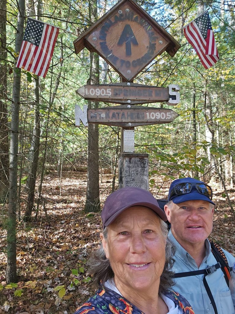
This week we make it to the “spiritual halfway point” of the Appalachian Trail in West Virginia and complete its “storied” Roller Coaster before our entrance to the Shenandoah National Park.

Day 115: (Oct 23) 10.7 mi (1161 – Harper’s Ferry 1171.7)

Today, we finally will arrive in Harper’s Ferry. This is the point where most who are doing a flip-flop of the AT start and then flip back to and continue southbound to Springer Mtn. Georgia.

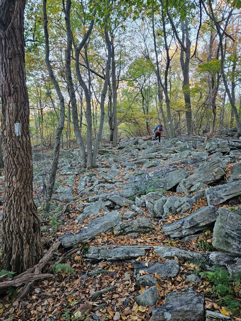
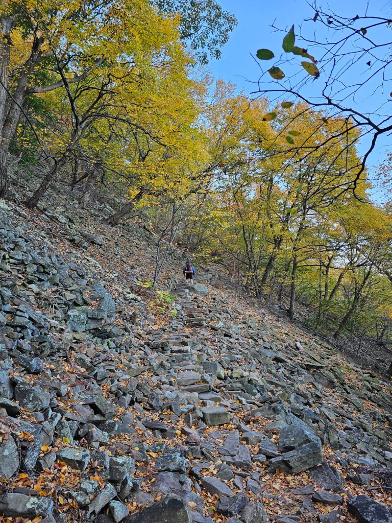
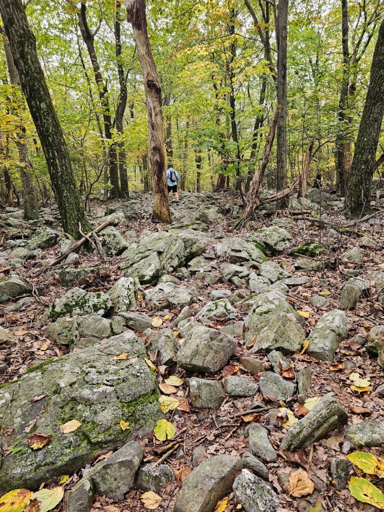
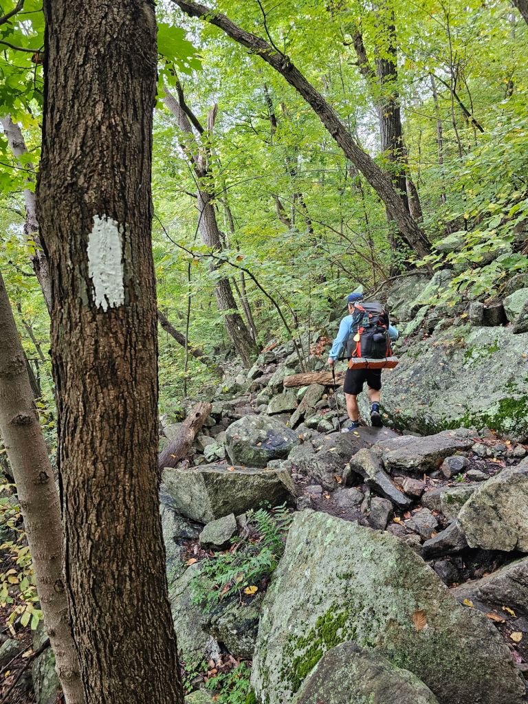
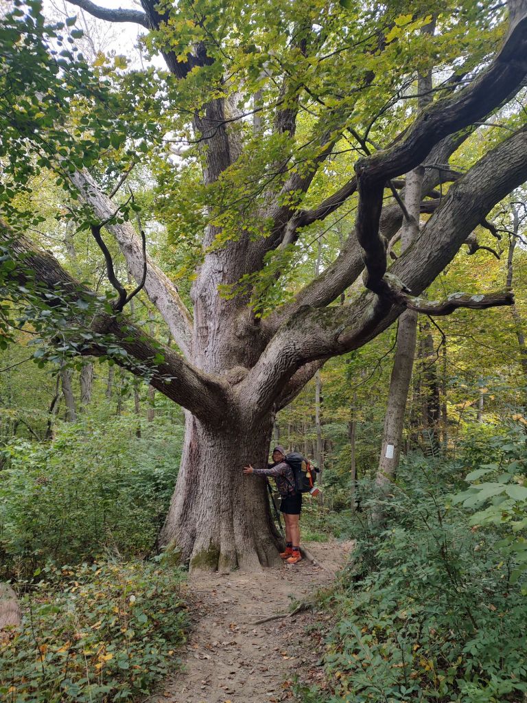
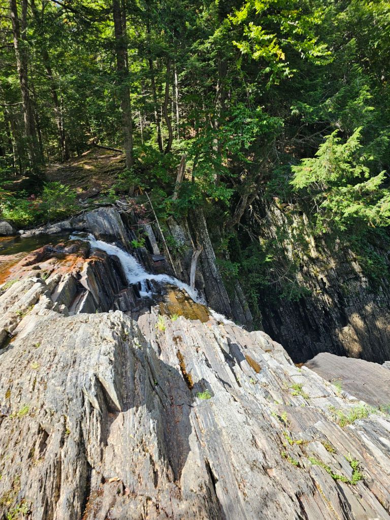
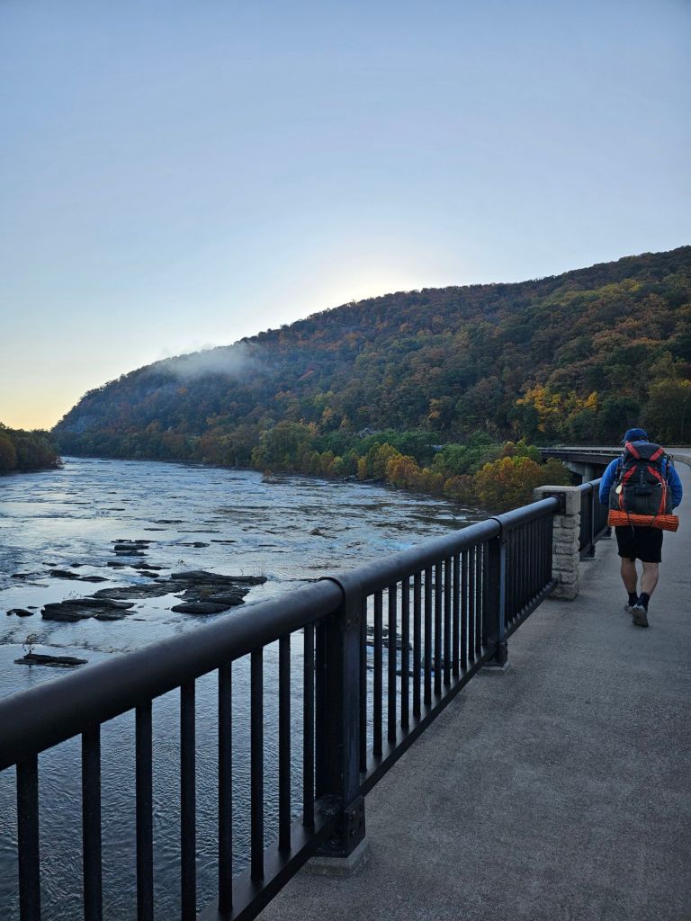
We descend from the forested rock face that oversees the Potomac River surrounded by the evolving colors of Fall. As per my norm, I failed to escape an actual trip and fall in the state of Maryland.  I was sooo close!

Mighty Potomac River

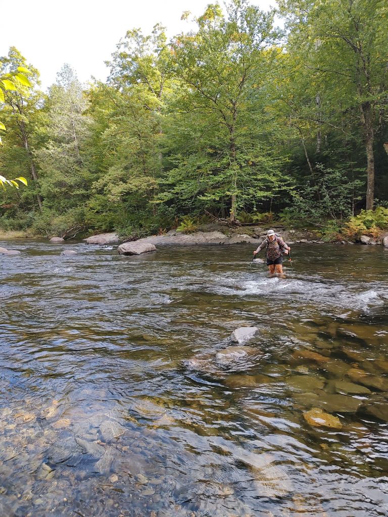
We dart across an active railway and then stroll along the crystal clear Potomac River on the Appalachian Trail that shares a multi-use trail. 

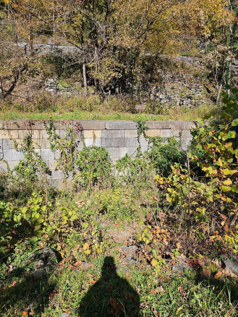
It is warm and monotonous, which allows our minds to wonder about the history that has traveled through the rails and chain of locks that parallel the Potomac.

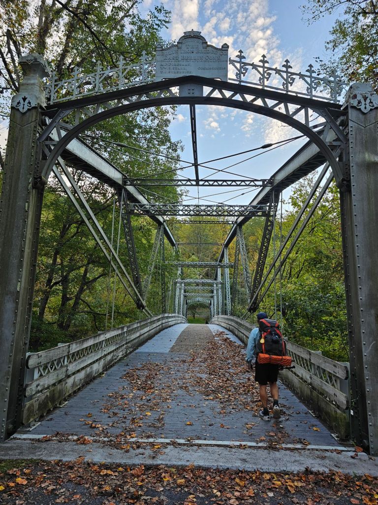
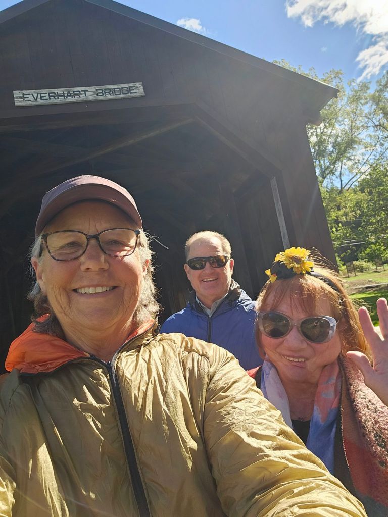
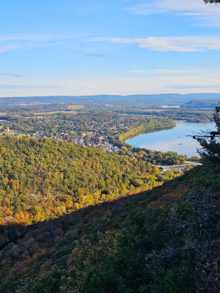
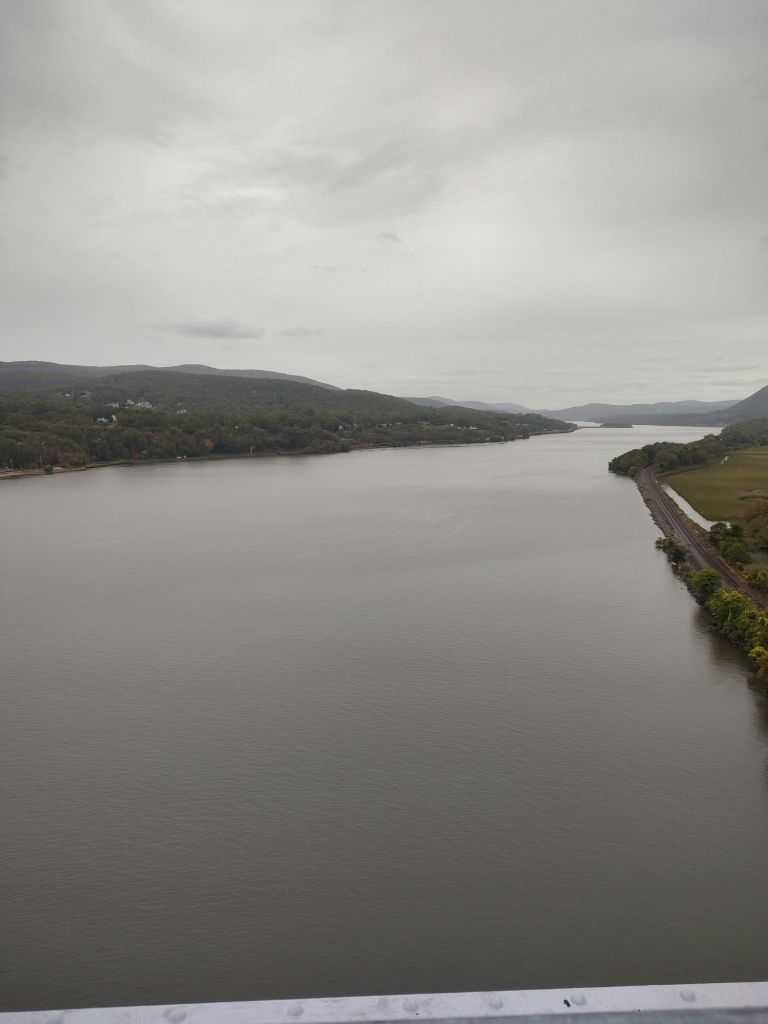
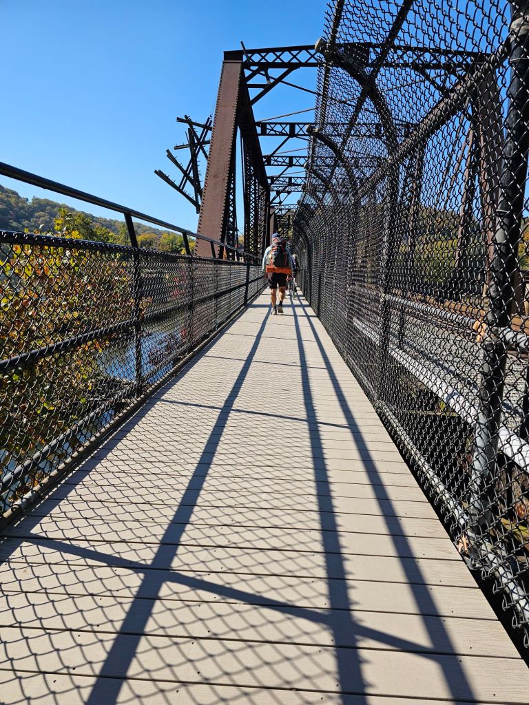
Eventually we reach a mighty tunnel bored through the dense rocks and a bridge that spans the Potomac and leads us into Harper’s Ferry.  It is nothing like what we expected, as everything seems to have been on this thru-hike of this Appalachian Trail.

This town is rich in history and definitely NOT flat. In fact, nowhere on this journey has been “flat”.

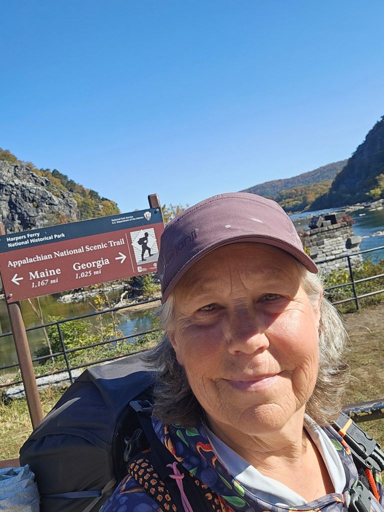
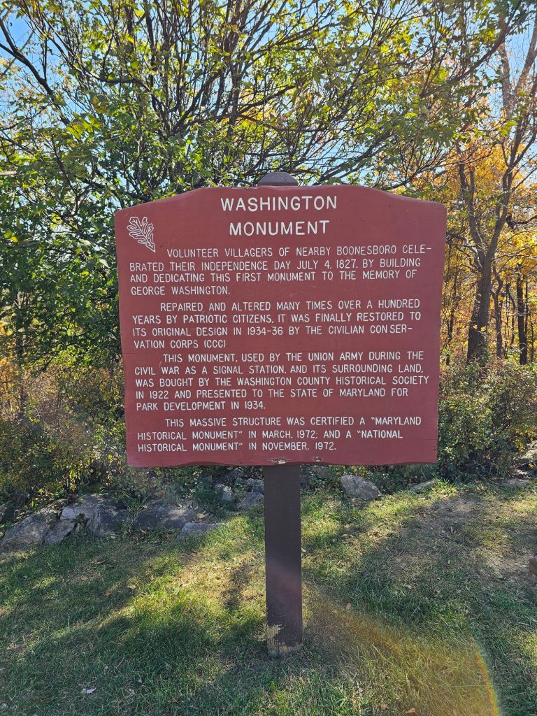
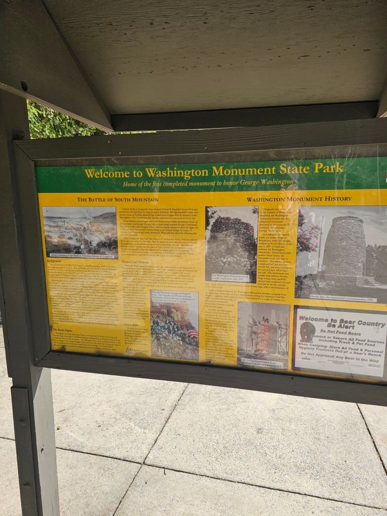
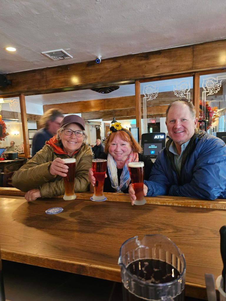
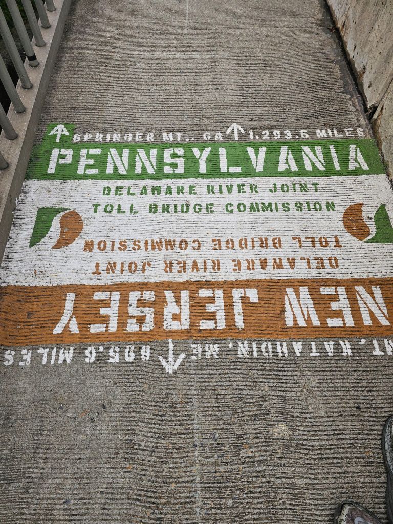
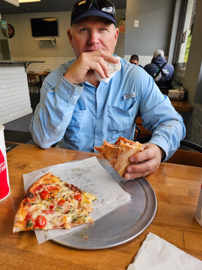
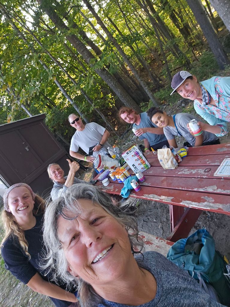
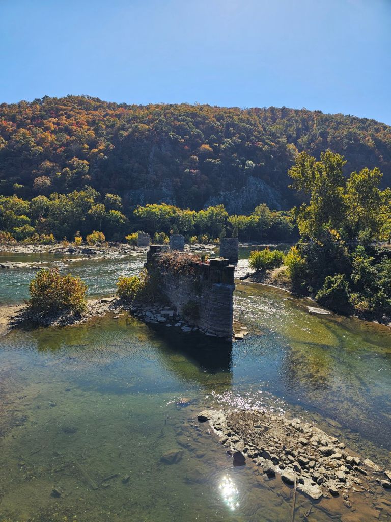
The confluence of two mighty rivers, the Potomac and Shenandoah, are located here in the gap of the Blue Ridge Mountains. To think that this scene has not changed significantly since Lewis Meriwether gazed upon it in 1803 is unreal.  Three major National Trails converge here as well. The Appalachian Trail, the Potomac Heritage Trail (924 miles), and the Chesapeake and Ohio Canal Towpath (184.5 miles). There is so much to do and see here. This town requires a more thorough exploration, but that’s not on the menu just now. First, food! Up a steep sidewalk, we walk. Stone houses and mercantile shops are pedaling all manner of souvenirs, historic trinkets, and must haves. As the Rabbit Hole has come highly recommended, we duck into there are dine on their outdoor patio. The muggles look at us oddly. I’m not sure if it’s our packs or our smell. Probably both. Beers, burgers, and a vege hummus platter later, it’s time to hoof it to the Appalachian Trail Conservancy HQ. We have questions as to what is open, available, and safe to walk. Also, we’d like to get that iconic photo in front of the building.

“Spiritual Halfway Point”

We are told by “Square Pie” that the Shenandoah’s, all the way to Black Horse Gap is open. Parts of the Smokey National Park are “opening”, but really not recommended unless you have support. The North Carolina/Tennessee border sections are closed, as expected, due to the damage from Hurricane Helene. We ask if it’s open in North Carolina from Fontana Dam south the Springer. She tells us it is. With that, we have enough information to formulate a plan for the remainder of this hiking season South. As they are closing, she gives us a ride to the Halfway Hideaway Hostel, where we take the semi-private “room” for two nights. I am hoping that will give my foot enough rest to keep marching on.

Day 116: (Oct 24) Zero

Day 117: (Oct 25) 16 mi. (Harper’s Ferry 1171.7 – 1187.7)

Shenandoah River

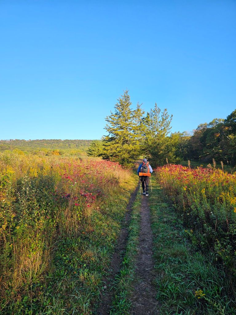
The air is crisp and requires us to don our gloves and since our hoods for warmth. We walk atop a bridge that spans the Shenandoah river as traffic zooms by. Up we climb into the hills of West Virginia, with Fall colors in full swing.

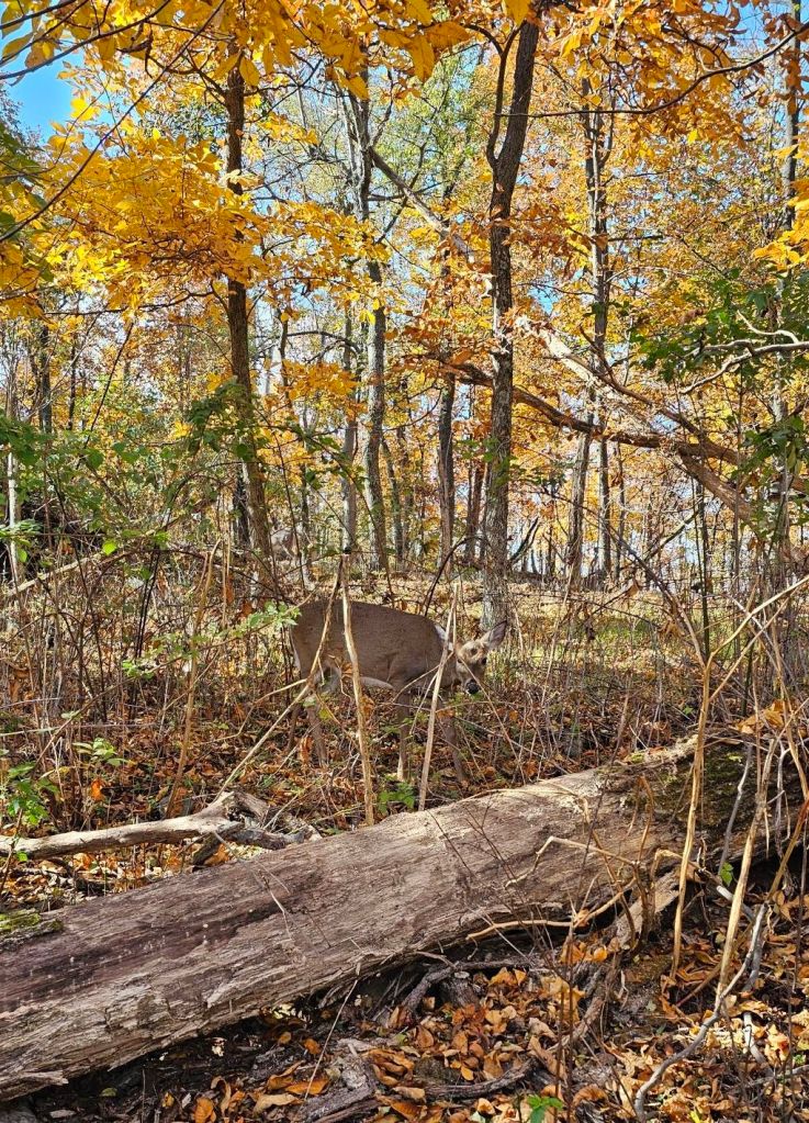
The tread is moderate and almost pleasant…for climbing. We pass deer feeding just off the trail. One stares at me incredulously,  ‘Cant you see Im eating here?!’

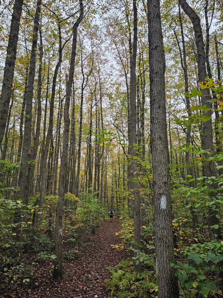
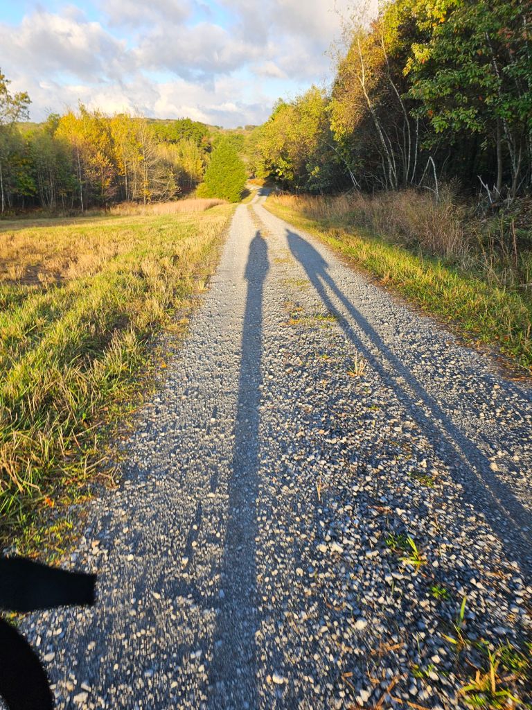
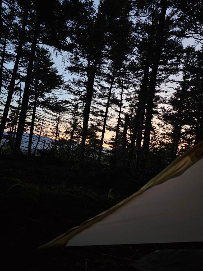
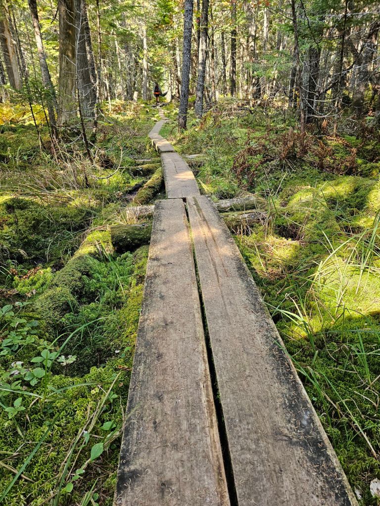
We passed a sign indicating that we had entered the “Roller Coaster.” While we have never heard of this section, we reckon that it’s a series of PUDS (pointless ups and downs). We camped after the first PUD, which, in fact, was not pointless as there was a flowing spring. This night is the first really dark night we’ve had in a while. The stars were amazing.

Day 118: (Oct 26) 10.5 mi (1187.7Ashley Hollow 1198.2)

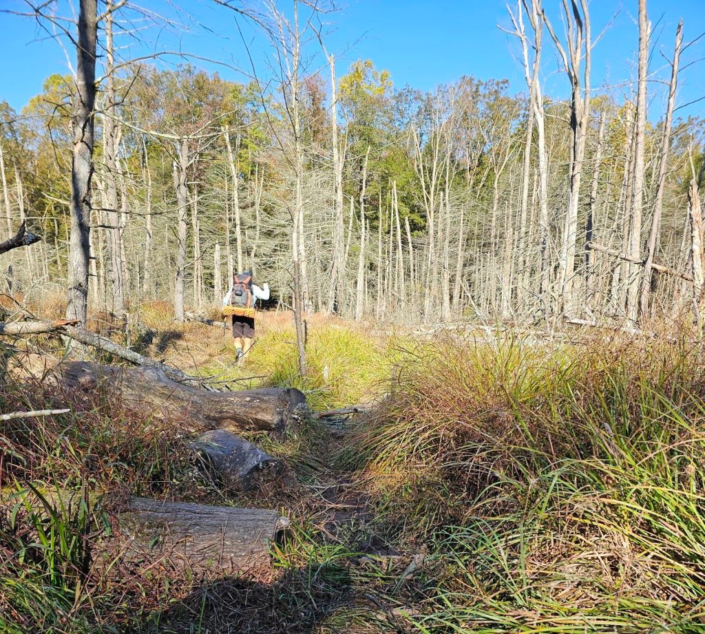
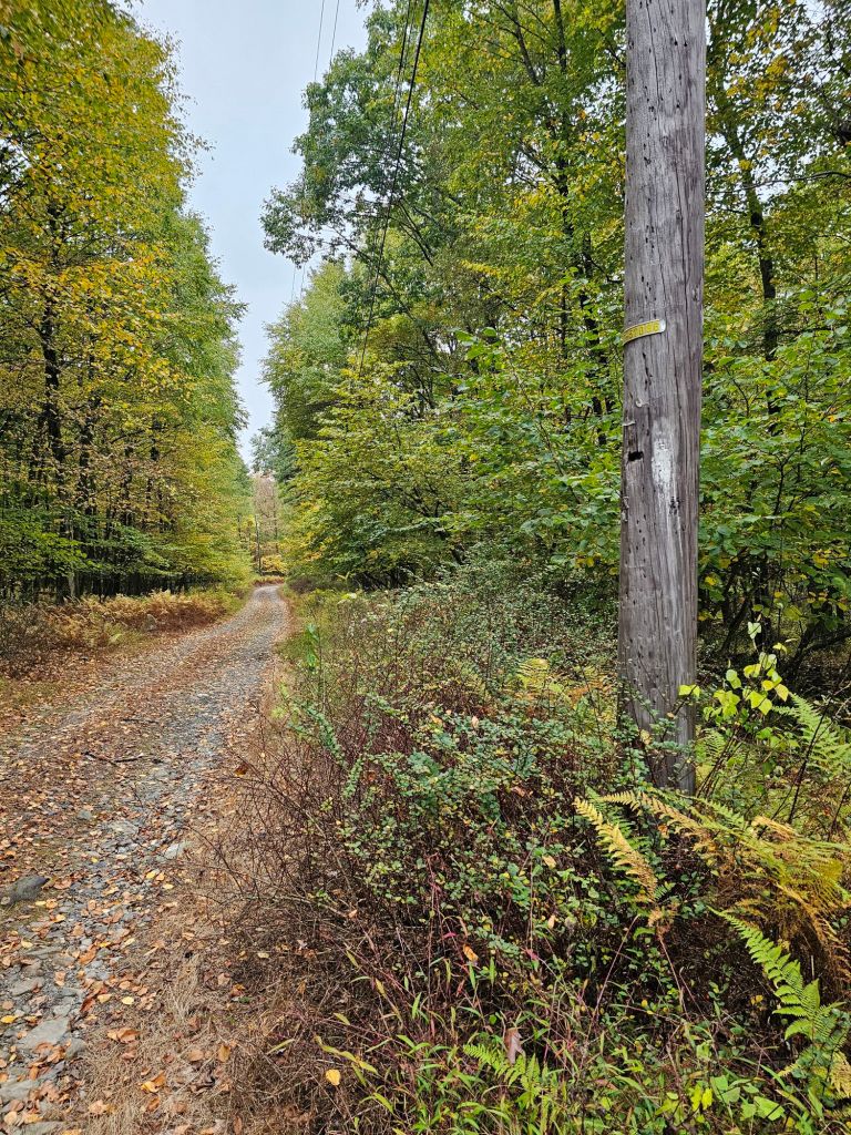
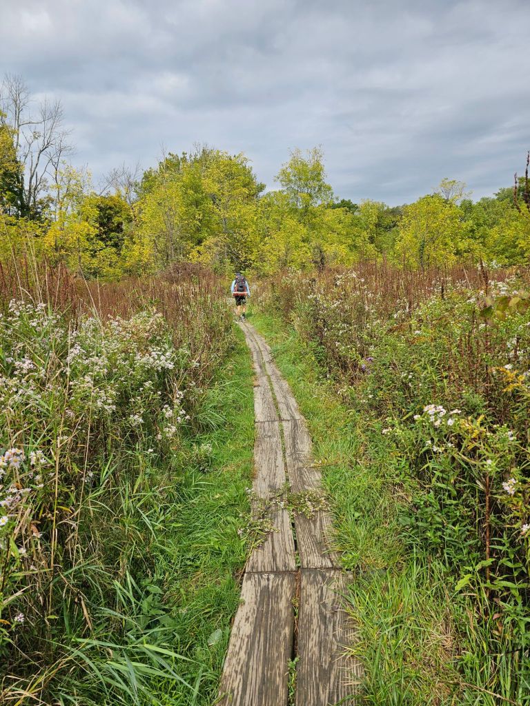
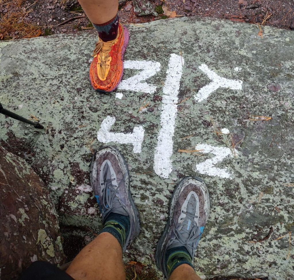
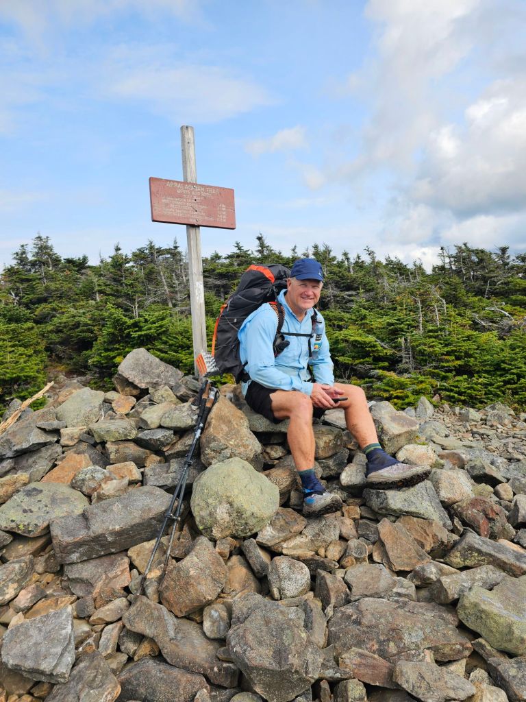
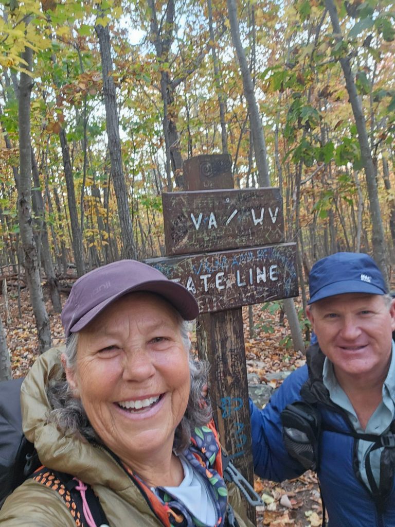
Today’s walk of the Appalachian Trail weaved to and from across the seemingly arbitrary state lines of West Virginia and Virgina. Eventually, we cross fully into Virginia proper. If there were not a sign, we’d never know, as there was no distinction in tread or vegetation.

Eight states down!

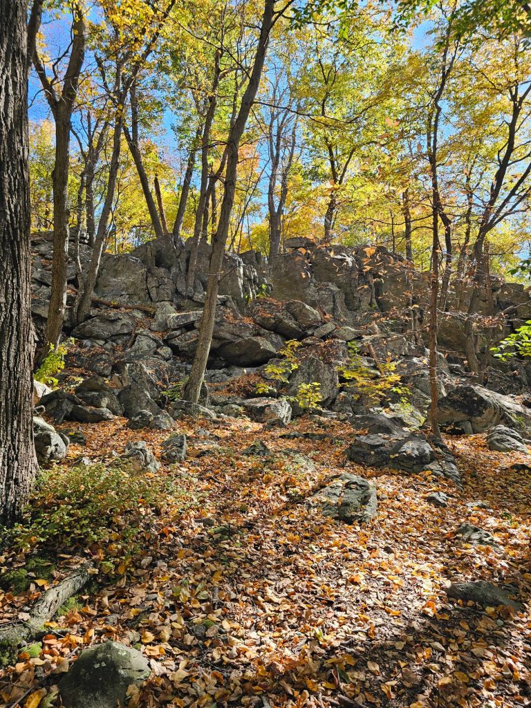
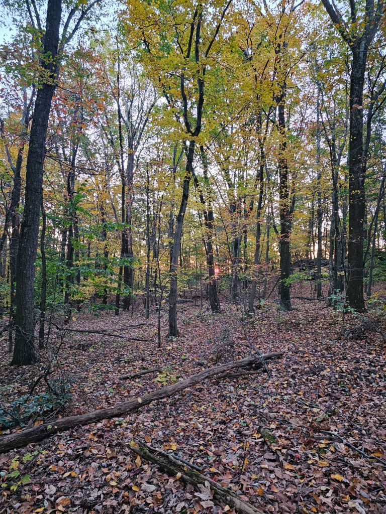
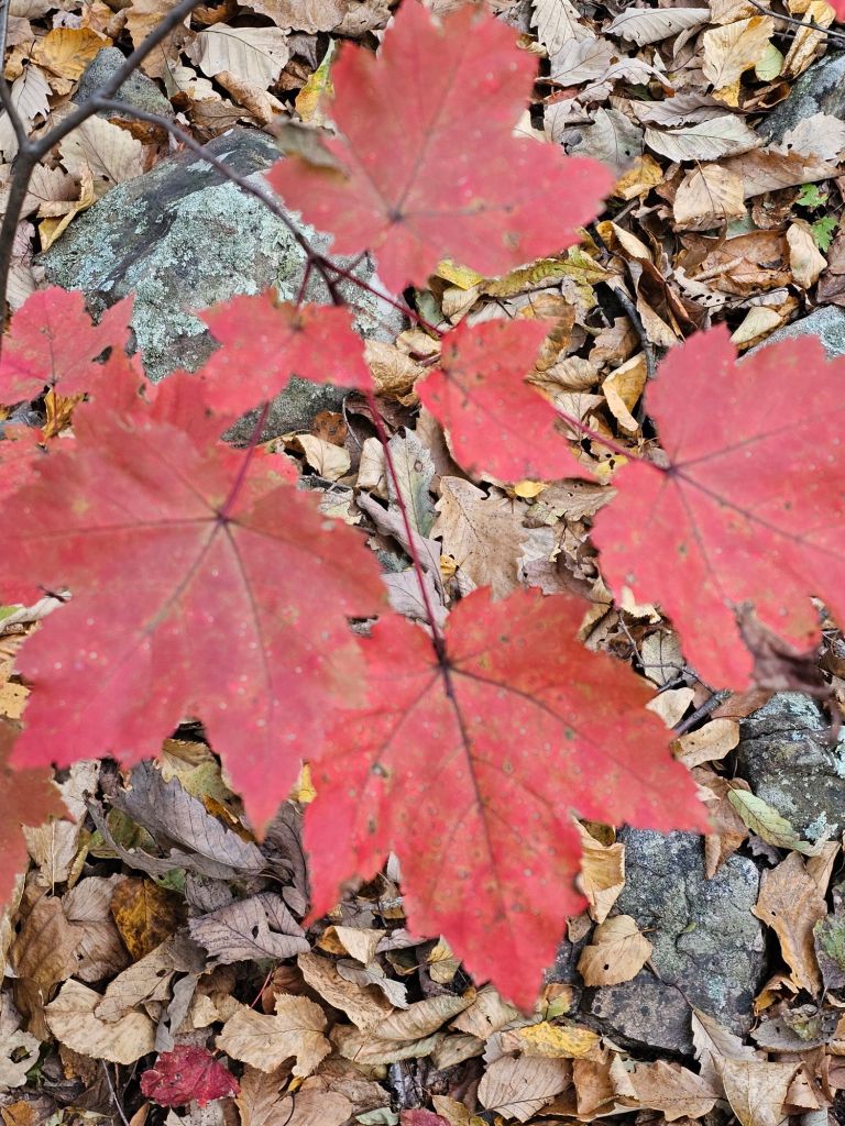
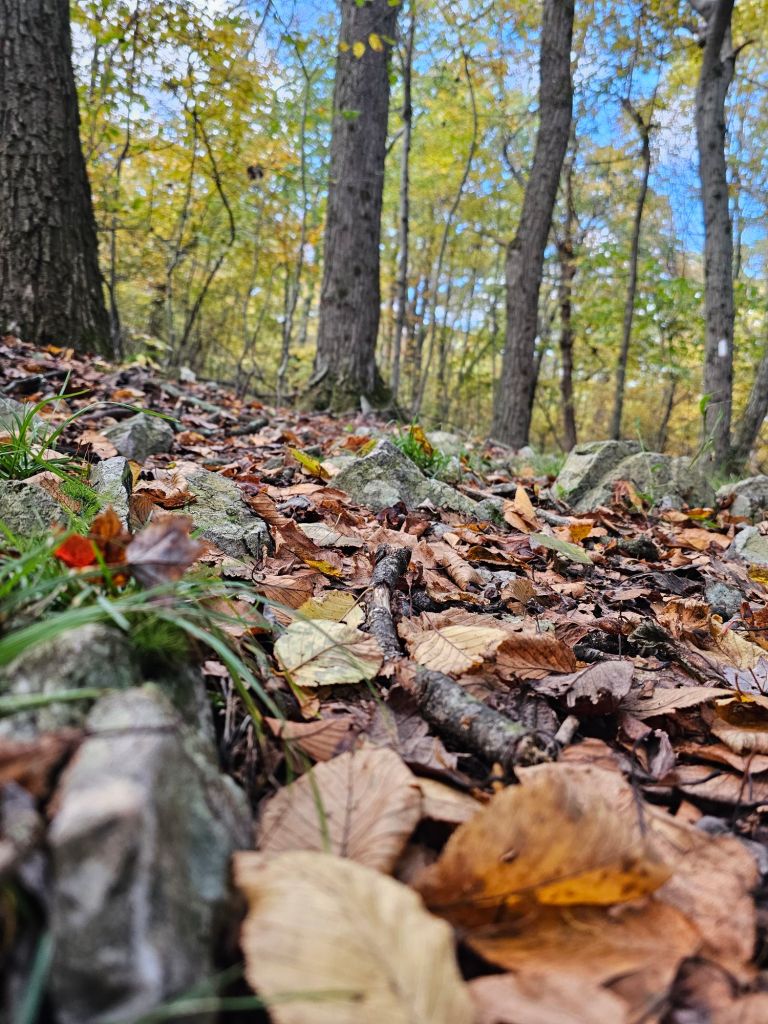
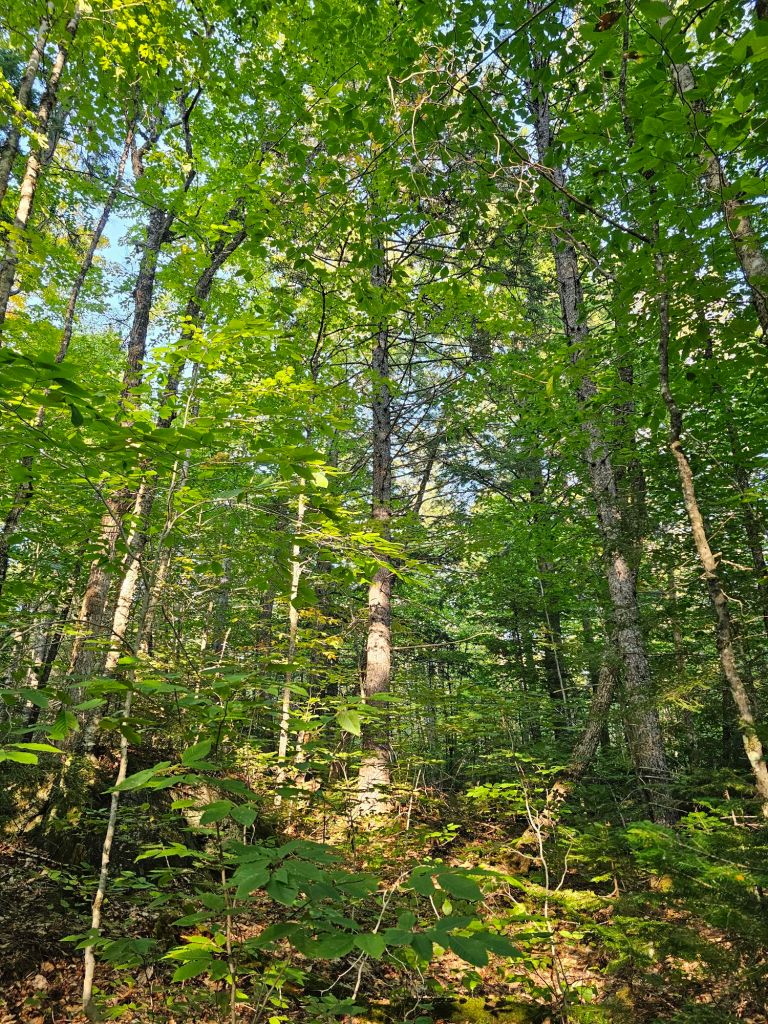
So the Roller Coaster has become quite the slog. It is, however,  the only time I have enjoyed looking at my feet. A plethora of colorful leaves line the trail on all sides and have become immensely distracting.

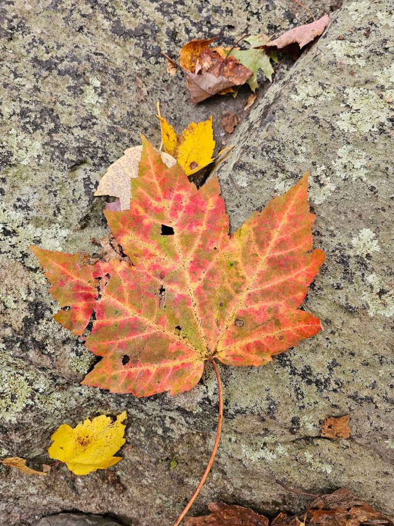
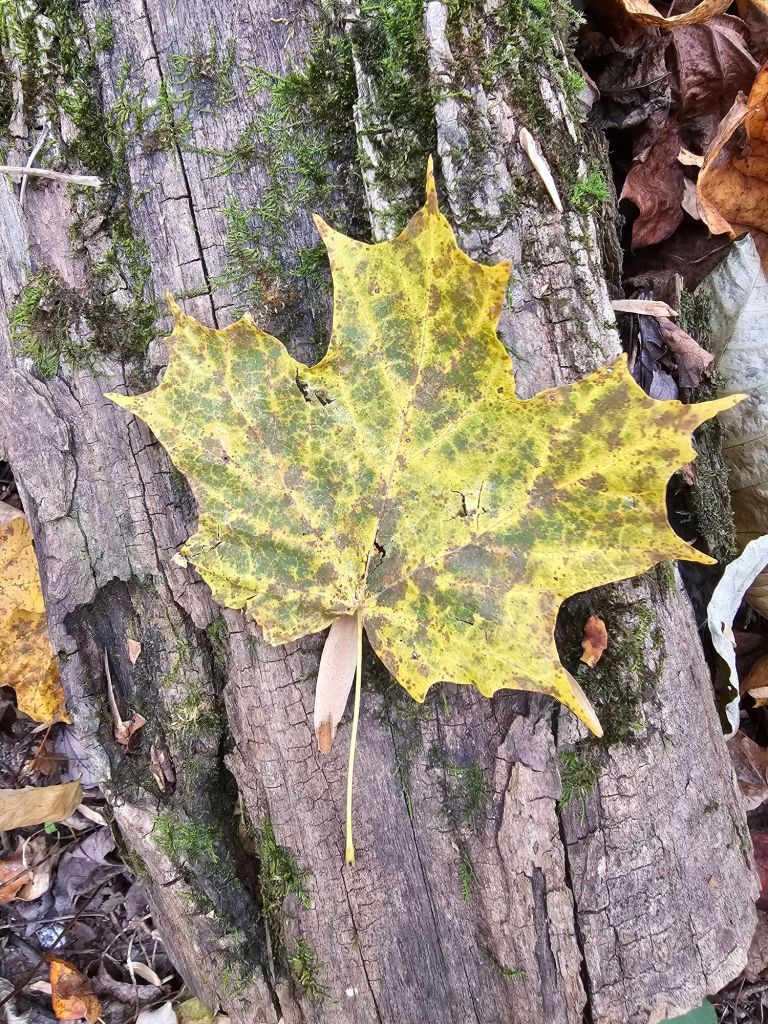
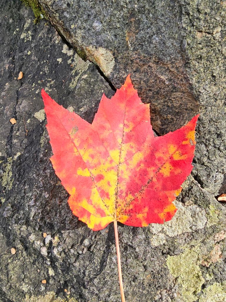
It does, however, divert my mind from recognizing and paying attention to my ever increasing heel pain. I think of my friend Jen and chuckle. If we were hiking this together,  we’d never get anywhere, as it would be Ooh look at that. Ooh, and that one. Oh my, look at that.” And with that, I took a video of what I was seeing, so when I get home, we can ooh and aah together.

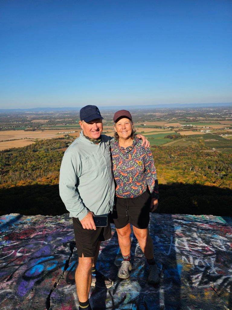
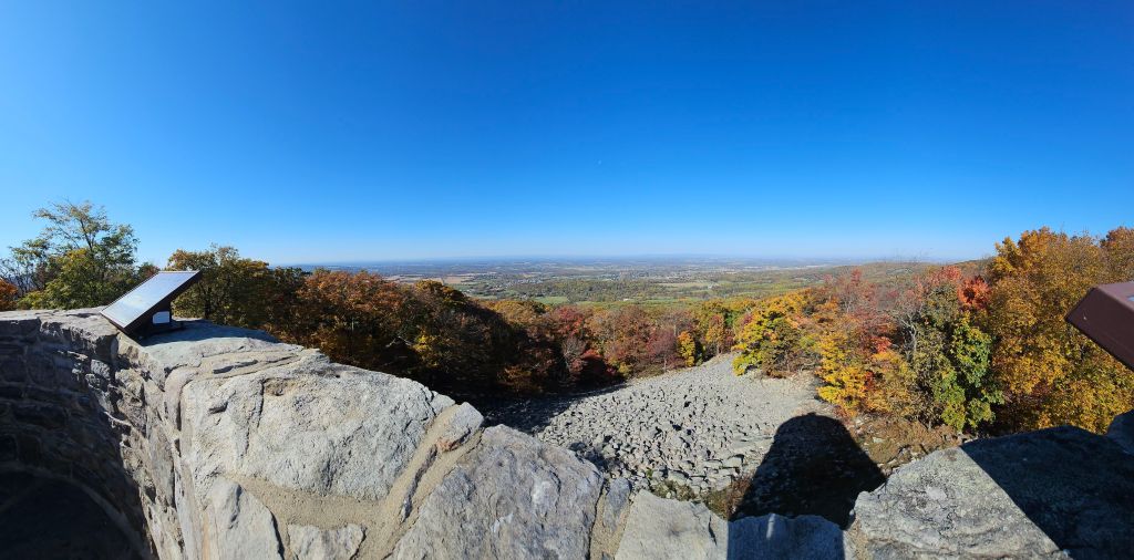
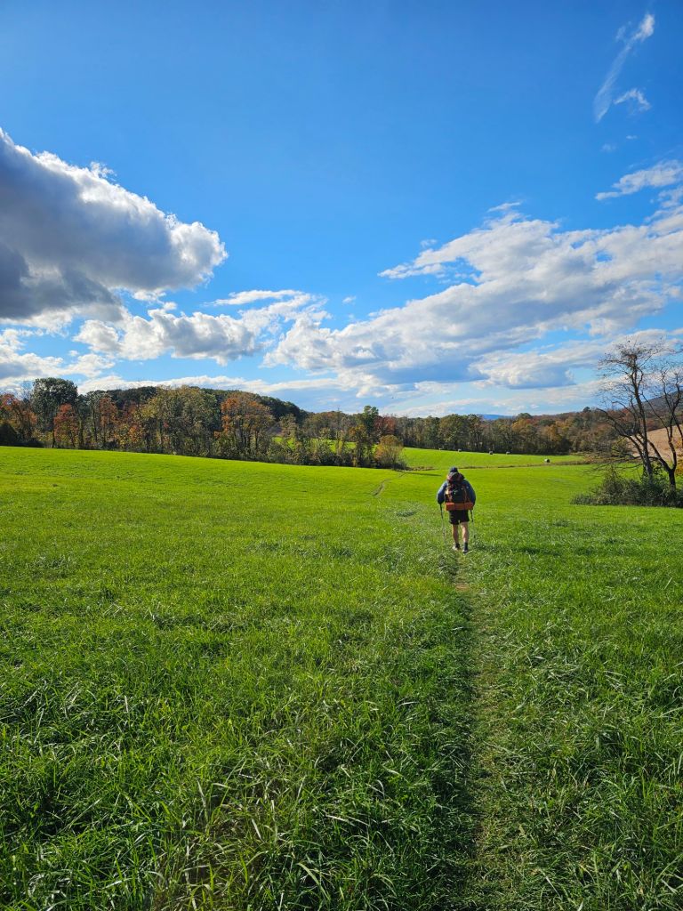
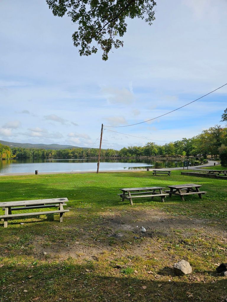
Near our second breakfast break, we came along a viewpoint just past the turn-off to Bears Den (an ATC hostel/store). There were about 10 other people enjoying the view and paid us no mind. Within no time,  hoards of other people arrived. Apparently we had our “invisibility cloaks” on, as not one Muggle acknowledged our existence as they literally stared right through us as they walked, talked (and sat) in front of us, as we quietly consumed our necessary calories whilst attempting to enjoy the splendor of the Shenandoah Valley and river below us. Finally overwhelmed by the exponentially growing crowd, we packed up and moved on seemingly without notice, by the Muggles dressed in all manner of rugged hiking attire.

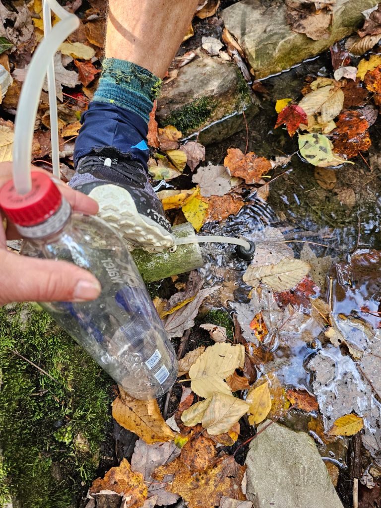
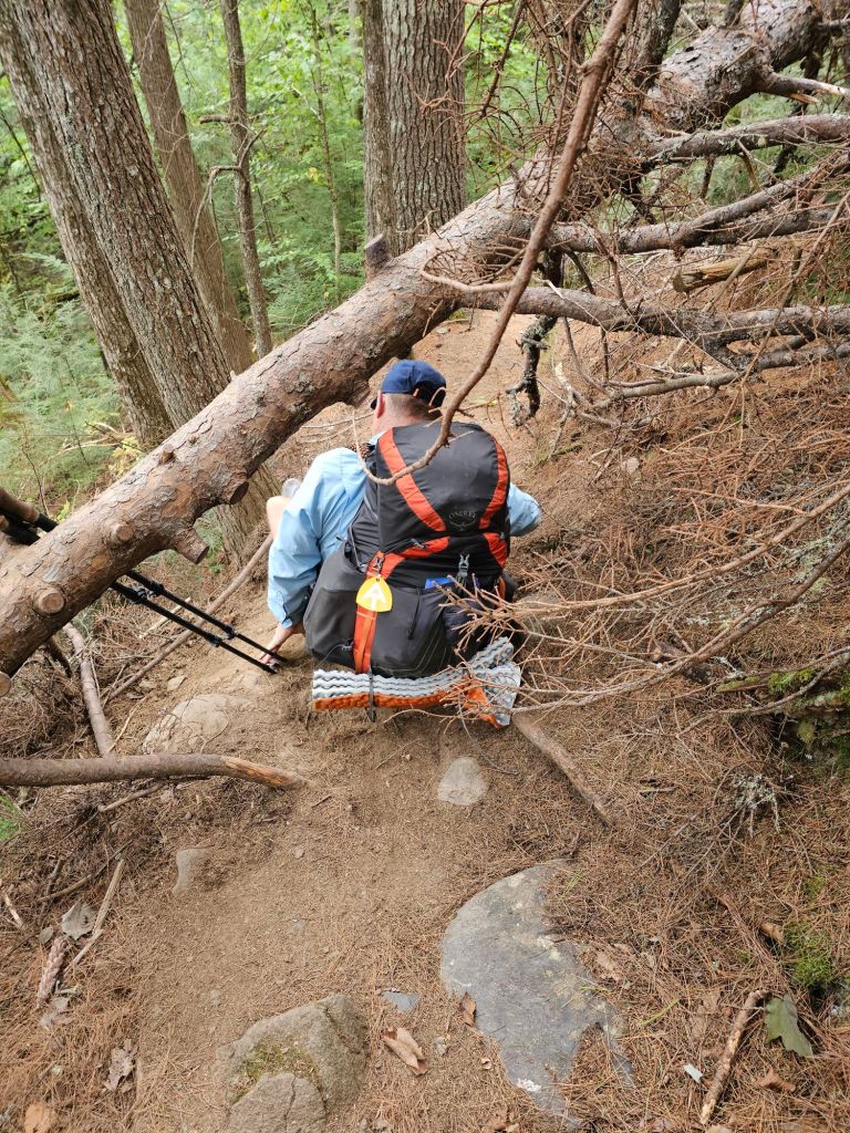
We stopped “early” as we did not expect to finish the next big climb and get to camp before dark. We set up on what appeared to be an abandoned and/or hardly used logging road, on the Forest Service side of the “Private Property” sign. With no evidence of tire tread and/or disturbed roc,  we felt comfortable setting up on the only “flat” ground we could find. As luck would have it. We were utterly wrong. Just before dark, as Paul was getting water from the creek, we spied headlights coming downhill towards us. We thought it might have been a Forest Service vehicle, but it was a property owner who had decided to use this  routes’ easement to get to his property. Having had this property for over 30 years,  he was quite shocked to come across our tent, blocking his vehicle. As we have it free standing tent, it was easy to drag it out of the way and then back.  He was confident that no other vehicles would be coming our way. We hoped he was correct.

Day 119: (Oct 27) 16.1 mi (1198.2 – 1214.3)

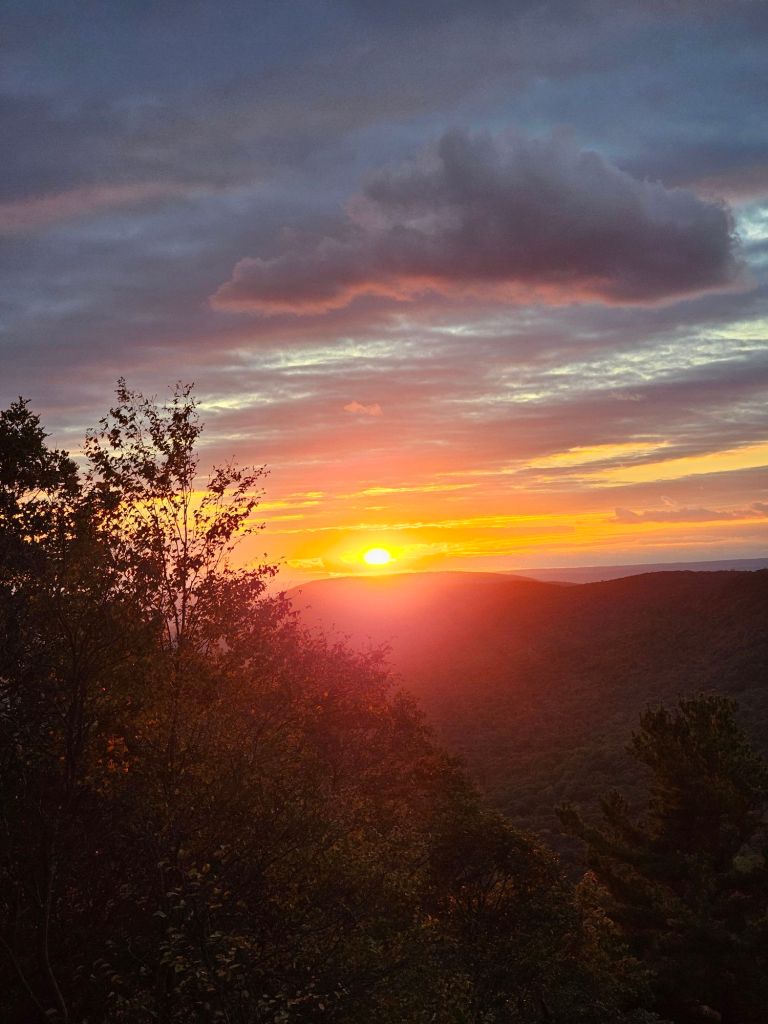
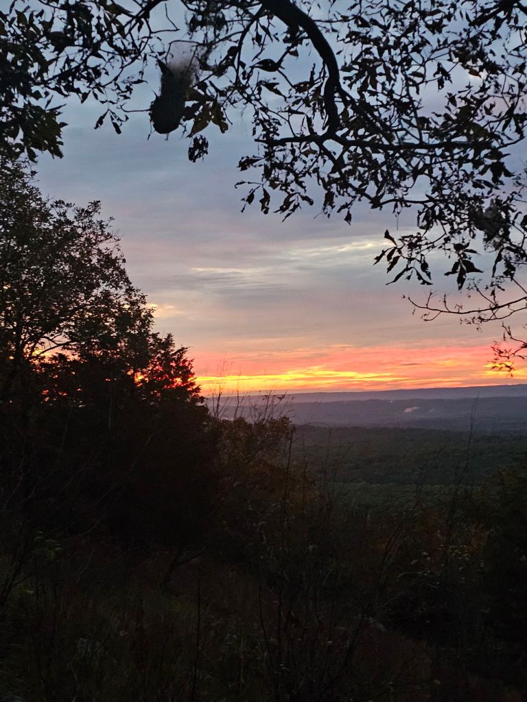
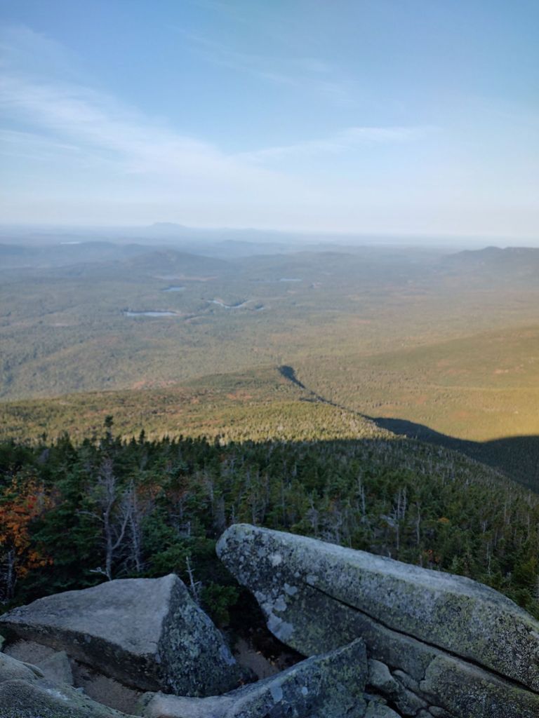
The morning was bitter, bitter cold. It was so cold that our first big climb couldn’t get us warm and sweaty. This made actually for nice walking and a memorable sunrise.

We finished the “Roller Coaster” without much fanfare. As usual, the trail signage, along with the FarOut comments, are NOBO centric. (We found that on the PCT and CDT).

NOBO signage as we “exit” SOBO

Not so much as a congratulatory mention for the SOBOs having finished the “dreaded” Roller Coaster. Maybe they realize we’ve been through way worse, and of that, they’d be correct.  Needless to say, we would have hated to do this 13.2 mile section in the heat of summer. Water carries would have been brutal!

The trail continued through colorful foliage and spaterings of unique “fruit” (Osage Orange)

Day 120: (Oct 28) 10.7 mi  (1214.3 – Front Royal)

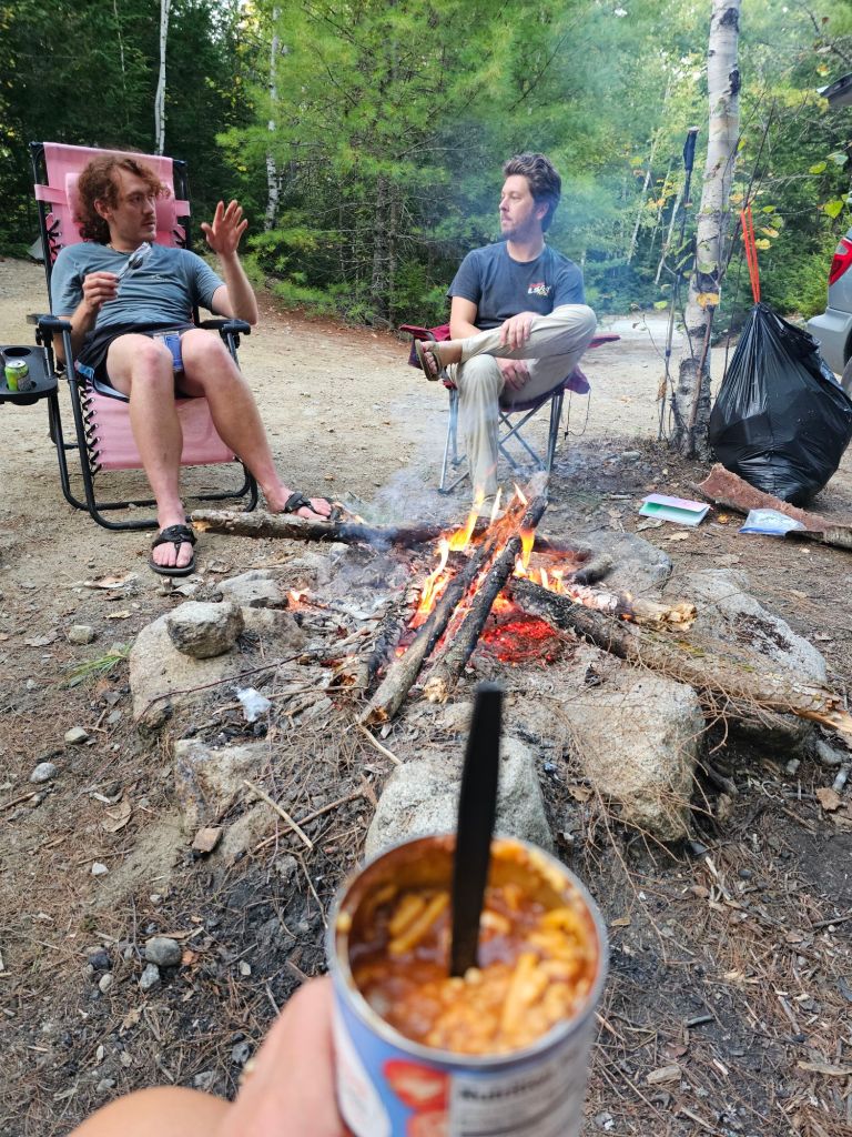
Town day mornings are special. It means fresh food, better smelling clothing (if only for a day), resupply shopping, cold beer, a shower, a bed, and usually cell service.

Paul dwarfed by these rotund and crazy tall trees

It also seems to make the miles more interesting. Today was no exception.

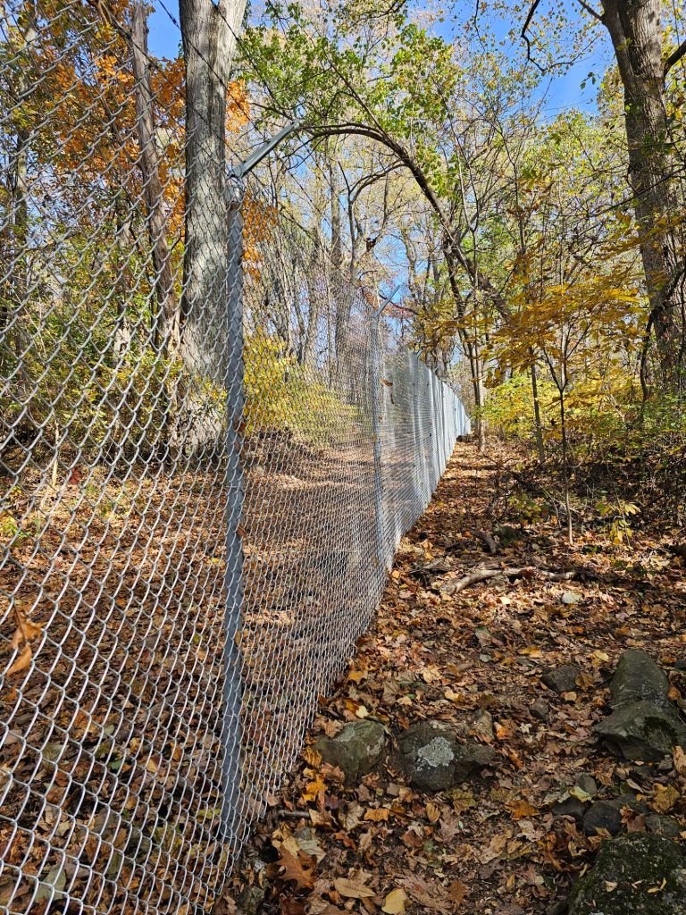
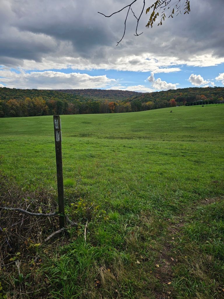
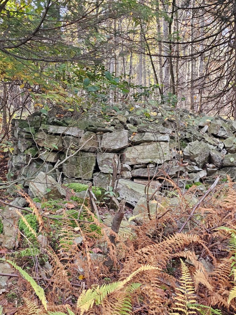
The trail weaved in and out of groves of colorful trees and along a chain link fence adorned with barbed wire and “No Tresspassing. U.S. Government Property ” signs. We wondered what secrets the vast property held, as clearly it appeared that human ingress was highly discouraged. 

Giant bird, we could not identify

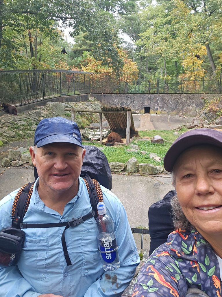
Soon, we passed bleak government/Military style buildings as we neared the highway below. High-tech entrance gates appeared as well. In some ways, it reminded us of a Jurassic Park type enclosure as we spied a massive bird we have never seen before. Hmm, maybe we were right. Turns out, we were, sort of. The enclosed area is a “Smithsonian Conservation Area,” or rather the headquarters of the Smithsonian’s National Zoo & Conservation Biology Institute.  Yup. Jurassic Park.

Just past where the Appalachian Trail crosses the highway into Front Royal, we stuck out our thumbs. In 10 minutes,  we had a ride into town where we stayed at the Baymont Inn and took another Zero and prepared to walk through the Shenandoah National Park.

Day 121: (Oct 29) Zero

Town chores, rest for my foot, and prep for entering the Shenandoah’s took up most of the day. Front Royal (once known as Helltown in the late 1700’s. It once had more bars than residents.  It has evolved since then and is currently a tourist “gateway” to the Shenandoah’s and the Shenandoah Valley. It’s an easy town to walk and appears to cater to thru-hikers. 

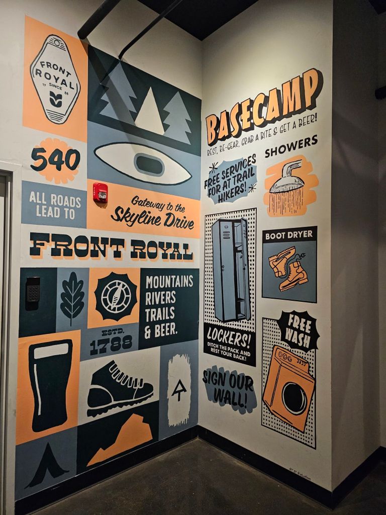
It has it own brewery, Vibrissa Bewery, that is conveniently located next to a space called Basecamp (or visa versa), which is a space set aside for hikers to do laundry and shower for free! Next door is the outfitters (Mountain Trails) and a bakery. What more could a hiker ask for?! 

Now, with regard to Shenandoah National Park, we’ve been told time and time again, “You just wait till you get to the Shennies.” Well, we’re about to enter this 107-mile stretch. We hope it’s all it’s been built up to be, cause my foot is NOT happy, and I will need visual distractions. We’ll see soon enough once our shuttle driver picks us up in the morning.

Posted in Uncategorized | Leave a comment

Maryland – A Quick Walk

Maryland went by in a flash compared to the other states we’ve walked through.  It was not without wonder or Rocks.

Day 113: (Oct 21) 14.6 (Pen Mar 1130 – Pogo Campsite 1144.6)

After an amazing home cooked breakfast of protein pancakes, eggs, ham, juice and coffee by Soola the hostel host, it was time to see what Maryland had to offer us.

Soola dropped us back at Pen Mar Park, where we filled our water bottles, admired the view, and then marched on. Of course, it was slightly uphill and through similar terrain as we had walked in Pennsylvania.

Up we climbed to a stunning rock outcropping  (High Rock) that once held an observation tower.

High Rock

The view was still there, but the tower was absent, and the rock base was covered in colorful graffiti. As we gazed upon the valley below, we couldn’t help but marvel at the history this valley holds, as it includes numerous American Revolution and Civil War battlefields, the examination of which, we’ll save for another trip.

A non-descript entrance to truly clandestine world

The locals who took our picture, gave us a quick primer of what we were looking at and added that the government gate just off the trail, was one of gated entrances to Site R, a “secret” Pentagon adjunct “bunker” deep underground the size of a small city.

Most of the day was spent cruising through a waining forest of PUDS (pointless ups and downs) and pasture land. While my foot was in excruciating pain, the change in scenery and the fact we were done with Pennsylvania helped push through it.

Day 114: (Oct 22) 16.4 mi (Pogo Campsite 1144.6 – Gathland State Park 1161)

Not gonna lie, but my foot is not doing well. The “smart” Hiker in me says I need a few days off to let things heal, or at least get it evaluated, but the stubborn athlete and determined thru-hiker says, you have no choice but to “push on”.

We marched up a hillside (South Mountain) towards a monument to President George Washington. When we reached the stone monolith structure, we learned it was the first monument ever built commerating the memory of General George Washington.

While we marched through the forest toward the monument, I couldn’t help but notice the stillness and almost “sadness” that permeated the forest as we made our way to the monument. It wasn’t until we descended from the monument and read an interpretive panel near where we had our lunch that we discovered the source of my feelings of “melancholy.”

The mountain, South Mountain, was a Civil War battlefield wherein 23,000 men died over three days. The Battle of South Mountain was a significant battle wherein Confederate General Lee took the “fight” to the North for the control of the Washington Monument that had strategic military significance. While it was a Confederate loss, it provided a “distract and strike” moment for Stonewall Jackson to capture the Union garrison (base) at Harper’s Ferry.

The rest of the day, we walked in quiet reverence by battlefields and ruins into Gathland State Park, where we found a place to stealthily camp.

Tomorrow, we’ll walk into what a friend described as  the “spiritual halfway point” of the Appalachian Trail,  Harper’s Ferry.

Posted in Uncategorized | 1 Comment

Pennsylvania (and, Scene)

Eleven days later, we are out of Pennsylvania, but that includes a 4 day interlude to a crazy good wedding in Illinois, and an additional day off with our friend Maureen from our 2015 jaunt of the Camino de Santiago.

Day 100 (Oct 8) 14.5 mi (997.7-1012.2)

We’ve done just over 1000 miles in 100 days. We thought we’d be faster and doing the kinds of miles we’re doing now right out the gate, but this is the AT, and nothing is easy or predictable, but the rocks.

As such, there is not much to report, except passing the 1000 mile mark, and then, of course, views of rocks. My left heel and arch are in excruciating pain constantly due to the  twisting and turning over the disorganized rocks, especially on the downhills of which today we tread to a just off-trail hostel, Stay-AT-Swarta.

What’s interesting about this place is that you cross historic Swarta bridge and remnants of locks used to help portage ships in the transport of supplies

It’s an interesting hostel, as we were the only ones there with no proprietor on site.  As usual,  SOBOs are left to their own design.  We texted with the proprietor, he gave us the combo to the resupply shed, and we ate till our hearts content (pizza, whoopie pies, drinks, pizza pockets) and then slept in our own enclosed bunks and had self-made very strong coffee in the morning. It’s a wonderful honor system,  wherein you tally your total consumed and pay via Venmo.

The only downfall is the constant vehicle traffic next to the hostel. But, if you’re tired enough, like we were, you’ll hardly hear a thing…especially if you use the house provided ear plugs.

Day 101: (Oct 9) 17.74 mi (1012.2-1033.5)

As we had completed our resupply the night before, all that was left was coffee and a whoopie pie. After leaving the hostel, we walked the old portage trail back to the AT. This place e is amazing with history all around it. In fact, a canoe or kayak trip down the Swatara River would be an amazing journey.

Eventually, we climbed, sans rocks, and through a bog, of which we could hardly believe it.

Soon, we were at the edge of an old abandoned rail town and its rail line that has been turned into a multi use trail. As we were pushing to get into Duncannon so our friend Maureen could pick us up and get us to the airport the next day, we decided to take the abandoned rail line/multi-use trail.

We passed by obvious signs of  “civilization,” where nature is in the process of reclamation, and wondered what it had been like the 200 years before.

Canal made to capture/transport water from a still running natural spring

Day 102: (Oct 10) 6.5 mi

Rather than Duncannon, we “pulled up” in Dauphin after being offered a ride by Wayne from Waynestock.com, who runs an outdoor festival each year. He saw us walking the roadway and thought it’d be safer if he gave us a ride all the way into town. Up till then, we were actually enjoying ourselves as we strolled through a collection of eclectic homes that varied in structure and age. I guess people were starting to wake up, and the roadway was gonna get busy soon. He dropped us at the Hardee’s, where Maureen picked us up.

It was a joyous reunion,  as we have been friends with Maureen since Spain in 2015, but haven’t seen each other since. She graciously was going to take us into Baltimore Maryland, where we were to fly out to Chicago and meet our daughter. From there, we’d drive together to Bloomfield Illinois for our nephew’s wedding. Had we known we could have taken the train, we would have, as the Chicago Marathon was the same day we were to return to Chicago and fly out.

Maureen, being the ever so gracious host, took us to her favorite haunts and gave us a quick tour of Harrisburg and the local history. We learned about the great Susquehanna River (see part 1) and the underground railroad and the rich culture of the area. It was so much more interesting than the rocks and trees we’ve been seeing through this grand state of Pennsylvania.

The trail threaded it’s way past the most magnificent and best shelter on trail thus far, the Quarry Gap Shelter. We wished we could have enjoyed the perfect amenities and thoughtful design of this shelter. We did, however, have the distinct pleasure of talking with the designer and caretakers of the shelter, who were there doing maintenance.

From there, we hit a Goodwill store for some “posh” travel clothes and then off to Baltimore and our hotel.

From the bank of the Susquehanna River

As luck would have it, while we slept soundly, indoors, all of North America was enjoying the most spectacular display of the “Northern Lights” as there ever was. We’ve been getting up every night at 2 am, for weeks since the reports of CME (Coronal Mass Explosions) activity has begun hoping to see such a display. Go figure.

Day 103- 104: (Oct 11- 12) Milosch Family Wedding

Gotta say, this wedding was worth every extra mile we put in to get here. It was a welcome break from walking, and it was great to spend time with our daughter and the Milosch clan at such a joyous occasion.

Our nephew awaiting his beautiful bride

Day 105- 106: (Oct 13-14) ZERO (back to Pennsylvania)

We flew into Pennsylvania (Harrisburg) and were greeted by Maureen. We got to play tourist a bit, in-between town chores, and eating.

A quick visit to Hershey Pennsylvania,  allowed us to mark that off the bucket list, for me. Sadly, the town did NOT smell like chocolate.

Day 107: (Oct 15) 10.3 mi (Duncannon  1047.2 – Darlington Shelter 1058.5 )

It was a cool, crisp morning as Maureen dropped us at the trail head in Duncannon. It stayed that way, most of the day.

As we walked uphill, we were greeted by those all too familiar rocks. We were treated to some nice views and a welcome terrain change.

By the end of the day, though, my foot, once again, let me know how annoyed it was. Tomorrow should be better as we finally get to see what the Cumberland Valley is all about.

Day 108: (Oct 16) 14.3 mi (Darlington Shelter 1058.5 – Boiling Springs 1072.8)

What a glorious day. Morning, of course, was ridiculously cold for our Southern California internal thermostats, but the day on the whole was amazing and much needed. We descended down from the hills, onto and through rolling pasture land. For some reason, it felt like we were actually getting somewhere.

We walked ourselves into Boiling Springs and to the outfitters before they closed for some resupply meals, a new pair of socks for Paul and New inserts for my shoes. It was a beautiful little hamlet with early American architecture. After a quick bite at the “mexican” food restaurant (101 Caffe) and a snack at the gas station for the evening, our ride to Lisa’s Hostel arrived. Soon we found ourselves in a “no frill” shed with homemade bunkbeds, racked up with an animated storyteller, “Voice of Reason”, who was fun to talk with and share stories, and a cat that purred you to sleep. While it was, in fact, a shed, it was signicantly warmer than sleeping outside, and the shower that was included was the kind that forced the dirt off and out of your skin.

Day 109: (Oct 17) 12 mi (Boiling Springs 1072.8 – Tent site @ Tag Run Creek 1084.8)

Being so cold, it was difficult to get out of our warm quilts and back to trail. And, while we didn’t intend to breakfast at 101 Caffe, we did, and it was well worth it. We and Voice of Reason surmized that it would be prudent to fill our bellies with good food and let the morning warm a bit before we got back to the  business of walking. Us SOBO, and Voice of Reason NOBO for his finish.

My foot and now, for some reason, Paul’s ankle made for a slow and “tender” day of walking.

Walking along a frost crusted cornfield, and witnessing the leaves rapidly morphing into a colorful display that defines Fall on the East Coast, we know our hiking season is about to change.

Center Point Knob

We climbed our way to the “midline” monument of the Appalachian Trail (Center Point Knob) and through an open forest of trees whose leaves provided a much softer tread.

Mid-day, we found ourselves negotiating a rock scramble over a Ridgeline strewn with monolithic rocks that had we been younger and not “rock fatigued ” would have been fun. I imagine the NOBO climber kids to be joyous through this section.

We ducked into the Green Mountain Store for a sandwich and then called it at Tagg Run Creek. 45 miles left of Pennsylvania! Now we’re getting somewhere.

Day 110: (Oct 18) 17.1 mi (1084.8- Birch Run Shelter 1101.9)

Today, we walked to another “official” halfway mark of the Appalachian Trail.  We took the obligatory photo and continued on. From there, we wandered through Pine Grove Furnace  State Park, which once was a thriving resort area where those living in the lower elevations would travel to escape the heat. We walked by an abandoned swimming pool, used by the Girl Scouts in the 1930s and numerous other “ruins” swallowed up by the natural landscape. Pine Grove Furnace is home to the Appalachian Trail Museum, which has many iconic artifacts of the early pioneers of Appalachian Trail. We wish we had more time to spend perusing the small but significant museum, but Trail miles were calling.

Up we climbed up using the old AT route past Camp Michaux, an old CCC camp, and to a ridgeline that was fairly flat where we stomped out our necessary miles for the day, all the way to the Birch Run Shelter.

Exhausted, with daylight fading quickly, we found the last “flat” piece of real estate and set up camp for the night. With the weather being good, we have found that on Friday nights and weekends, most shelters and the surrounding tent sites are filled with locals who only have to pack in not more than 2 miles to enjoy what we work all day for.

Day 111: (Oct 19) 15.8 mi (1101.9- Birch Run Shelter 1117.7)

Today, the trail threaded its way past the most magnificent and best shelter on trail thus far, the Quarry Gap Shelter. We wished we could have enjoyed the perfect amenities and thoughtful design of this shelter. We did, however, have the distinct pleasure of talking with the designer (Jim Stauch) and caretakers of the shelter, who were there doing maintenance.

Day 112: (Oct 20) (Birch Run Shelter 1117.7 – PenMar 1129.8)

Today is the day we officially walk out of Pennsylvania and cross the famous Mason-Dixon Line of the Missouri compromise and the “cultural” boundary between the “North” and the “South”.

Of all our days spent in Pennsylvania (besides our stay with Maureen), this day was most memorable.

As we reached the Mason-Dixon line, the trail crossed an active railway that mainly appears to transport coal and then brings you into Pen Mar County Park. PenMar, as it is today, is a beautifully thought-out park with a magnificent view and resplendent Pavillions. Previous to that, Pen Mar Park, in its hey-day, at the turn of the 20th Century, was the eastern United States “most popular” amusement park/resort destination for mostly the wealthy, escaping the summer heat. Various mansions surround the park nearby, a testament of a bygone era. Today, as we waited in the park for our shuttle to arrive and take us to our hostel, we watched as they unloaded a coal powered steam-engine tractor. It’s top speed is also our current average speed. 2 mph.

Tonight, we’ll stay at Sunflower Cottage hostel, directly across from the former Fort Ritchie, known for its “Ritchie Boys” during WWII. It is said that their clandestine missions and interrogation methods gathered over 60% of actionable information during WWII and helped turn the tide of the war.

Reconditioned barracks

From the hostel, it was a short walk to the Secret Taproom on the former military base. We toasted to our finish of Pennsylvania and hope that Maryland is kinder to our feet.

Posted in Uncategorized | 1 Comment

Pennsylvania. Or is it Rocksylvania? (Part One)

Now Pennsylvania is a pretty dynamic state. It’s flora and fauna. It’s geology.  It’s history. And how and where they decided to route the Appalachian Trail through Pennsylvania,  we’ll never understand. Especially after seeing an original proposal that had it going through Harrisburg, the capital of PA, a wealth of history. But no, we have to walk over a bunch of rocks in the woods and only have a quick peak of the great Susquehanna River via Duncannon.

However, the Appalachian Trail and its tread isn’t about following the human history of the East Coast, or its magnificent waterways. It is about following the results of two ancient continents colliding and the moraine of the glaciers that helped form this storied mountain range. And, it wasn’t until Pennsylvania,  for all our complaining about the rocks that I truly have begun to appreciate the significance of this difficult Trail. Of course, that doesn’t mean I won’t complain about the rocks, I just understand more about the why and how of them.

Day 94: (Oct 2) 16.8 mi (900 – 916.8)

When we got into Pennsylvania the day before, we marched up to the Church of the Mountain Center, one of the oldest hiker hostels on trail. It’s free, but it thrives on donations. While there, we met another SOBO hiker, “Pappy” who had hiked with “Let it Be”. He was having problems with his back from a fall descending the Stairway to Heaven. The Physical Therapist he called was a seasoned thru-hiker, True Grit. And this is when the world shrank just a little more. Something looked familiar about True Grit, and then it clicked as we all stared at each other with that, where do I know you from. He had hiked the PCT in 2022 and had ridden our shuttle. When he recited his start date, Paul quickly pulled up his shuttle ride picture.

True Grit – second guy from right

Smiles and stories flowed from there. Of course Pappy got his treatment, and we got a ride to Walmart for our resupply. Funny how we keep intersecting with people we’ve met in this diverse world of thru-hiking.

But wait, there’s more! Just after we left the hostel and began our foray into Pennsylvania,  we met a former 2017 AT thru-hiker, “Theory.” It is while hiking the AT that he met his wife, “G.I. Jane.” We walked and talked for a while about his hike and thru-hiking in general. He offered to meet us at the next road crossing (route 191) and slack pack us the 8.6 miles to Wind Gap. How could we turn this down?

View of Delaware River. The rest of the day was spent rock hopping in the green tunnel.

Walk over and through rocks without a pack full of a four day resupply. This was a no-brainer. At noon, Theory met us at the 191, provided us water and collected our packs from us. This was a big test of trust, to leave our packs with a “stranger”, but we also trusted our “Spidey Senses”. It was a good thing that we were packless, as the terrain got ridiculously rocky.

“Fun” times

Not boulder hopping rocky, but a dense and jagged spectrum of rocks in various heights protruding vigorously and incessantly under the soles of your feet as you make your way through an endless minefield of looming foot and knee catastrophes. It was as if we had been blindfolded and directed to walk down a narrow hallway strewn with Lego bits while only wearing socks. (Those with children will understand this reference). So, yes. Walking without a pack for our first bit into Pennsylvania was truly a blessing.

Our angel “Theory”

True to form, Theory met us at Wind Gap, a little perplexed as to where we emerged from.

Old route blaze

As we believe in hiking smarter, not harder, we found the old AT route, whose telephone poles still bore the AT white blazes and finished the last 2 miles into Wind Gap.

From Wind Gap, we climbed up (of course) another 2-ish miles as the sun began to lower into the horizon and stopped at the first flat campsite we found, just as it started to drizzle.

Day 95: (Oct 3) 14.7 mi (916.8 – 931.5)

It rained ALL night long. I had hoped it would continue into the morning, giving us (me) an excuse to sleep in, but exactly an hour before the morning alarm went off, it stopped. No rest for the weary. Uggghh. As it was still pretty dark, I reasoned that due to the rain, the rocks would be extra challenging and dangerous to walk over in the dark. Paul agreed. However, by the time we were mostly packed up, the skies had cleared, and there was enough light to walk safely. Shit. Another early morning of walking.

The topography reads as flat, but because of the rock strewn terrain, it is anything but that, and our mileage and camping spots are relegated to the campsites listed on our FarOut app. Otherwise, Wilderness camping in a tent here is difficult unless you have a hammock.

Toes “eye” or in this case “nose” eye view after a trip and fall

This makes for tedious walking and odd wanderings of the mind, even though you are mostly staring at your feet. For example. Today, I petted a tree. Let me explain. I stopped to look around and discovered a tree with splotches of the most intriguing moss. It was a soft fleshy pink color that had the appearance of cat fur. Being a tactile person, I was compelled to touch it. When I did, its texture was indeed like that of  a cat’s fur and soft like the hair of a baby. For whatever reason, I failed to take a picture of this discovery and then spent the rest of the day looking for another tree with the same “moss” to no avail. I did, however, discover another tree that appeared to have the mane of a giraffe. Its texture was that of wirey hair.

I truly think I may be losing it. Trail delirium has begun much sooner than expected.

In Pennsylvania, water is somewhat scarce, so the generosity of trail angels makes for easier water carries. While at an AT trailhead parking area, we were treated to a water cache and trail magic from Luciano, who was out for a short hike on the AT. He gifted us with fresh fruit and electrolytes,  something we sorely needed. His generosity made our day and definitely lifted our morale.

After our yard sale drying event at the trailhead, we continued on, seeing our first deer and Paul, a porcupine. And just as we were beginning to get the “rhythm” of the tread, the trail took an absurd route. It went from “flat” (think Legos on the floor) to a hard left,routing you over and through a massive boulder field of VW sized rocks (think making your way through crowded storage locker filled nearly to the top to find that one thing you need, in the very back) and then straight down similar rocks all the way to a road, where we played Frogger to get to the other side and continue our trek.

Once across the road, we looked at our map. There were confusing comments about the reroute of the AT in this area. The blazes were just as confusing. The reroute went zigzagging up the hill, crossing a perfectly good forest dirt road, which was the old AT route. As it was old, and we are too, we decided to follow the “old” route. As we walked up the road, the rerouted “new” route crossed the road at least 4 times. We camped just below the top of where the road and trail crested on the softest surface thus far on our trek. And, I finally found the “cat fur” moss I had been looking for all day.

Not as “pink” but same texture.

Pennsylvania, you are an odd duck.

Day 96: (Oct 4) 13.1 mi (931.5 -944.6)

Up with the sunrise, we continued along the “old AT” route. Along the way we discovered a long abandoned privy with a view.

The “old” route walked us past some fencing  and a plethora of jagged rocks at least twice where the “new” route of the AT traversed. We just can’t wrap our minds around the purpose of rerouting to make the path longer and frankly more difficult. Who wants that? AT one point, it looked like the old trail ended, and we could see the new route behind the fencing, but we found an alternate that circumvented both and led to the “snow trail route” that would take us into Palmerton for a much needed resupply. 

As we descended into the valley, and walked through an industrial lot, Paul called to me and pointed at his feet. There sat a dime in the middle of nowhere.  “KENNY”. We both smiled and laughed.

I picked up “Kenny” and added him to our “collection”.

Once in Palmerton, we made a stop at Bert’s for breakfast, and we’re not disappointed.  From there, we headed to the grocery store and did a quick resupply. Fully supplied, we broke out our sign and put out our thumbs on the other side of Dunkin Donuts. Within 10 minutes, we had a ride, and we’re back on trail.

Remarkably, the trail was fairly benign, and filled with curious growths. We made it to Bake Oven Knob where we had it all to ourselves. 

Ironically, we both slept horribly. Go figure.

Day 97: (Oct 5) 17.4 mi (944.6 – 962)

So the rocks just wouldn’t stop for the most part. It was totally ridiculous. Along with the blown downs, it started as a 1 mph day and got a bit better until I rolled my left ankle to the outside and then to the inside. A solitary rock, the size of a “Cutie Orange” on the side of the trail, dropped me to ground in utter searing pain. It was literally the only rock in this section of the trail. How does this happen? Paul looked at me writhing on the ground,  swearing at the trail, and asked, “How do you find these rocks?”. Pain turned to anger, which got me back on my feet and walking (with a limp) once again. Not that I wasn’t hurting,  but that I was so pissed that I was able to push past the pain and probable injury all the way to the Eckville Shelter, even though we passed a perfectly good campsite next to a stream. By the time we got to the shelter, I was concerned that I would not be able to walk by morning. It felt like something was definitely torn from the inside bottom of my heel. This could be the end. Stupid rocks.

Day 98: (Oct 6) 18.2 mi (Eckville Shelter – 980.2)

Morning came, and my ankle felt better, with the exception of being a bit discolored on the medial side. My head, however, had a big knot from slamming into the overhead bunk after coming back from peeing late in the evening.

Today, we are once again going to check out the “old AT” route and see if the tread will be better on our feet and currently deteriorating shoes. Eventually, we found our way to a game lands parking lot and onto the “old AT.”  We passed several unsuccessful hunters heading back to their cars. We also didn’t see a single deer the whole day.

Eventually, we rejoined the current AT route and descended into Port Clinton. We rested briefly at the St. John Pavillion and then walked into “town.”

St. John’s Pavillion

Port Clinton is a unique hamlet with an active and historic train depot. It’s church, St. John is a centerpiece of the community. As we walked by, services had just let out. We were greeted by the Pastor Rob, who invited us in for lunch with their church community and after we told him we were trying to get to the nearby Cabela’s for new shoes and a resupply of food, he offered to give us a ride there AND back to trail, if we needed it. Once again, timing is everything. We are truly blessed.

We walked into Cabela’s with our packs to a few strange looks. Here, we replaced our failing shoes, as well as Paul’s blood-stained shirt. While outside packing our bags, a young man, Carlos, approached us and asked if we were thru-hiking the AT. We told him we were, and he asked if he could “ask us a few questions” about hiking the AT, as he and his girlfriend want to hike the AT. We told him to ‘fire away’. We packed as we talked, and when we were done, he asked if we needed a ride back to trail. We thanked him for his offer and told him we needed to first go to Walmart to complete our resupply.  Carlos smiled broadly. “I can give you a ride there and then back to trail, if you’d like.” Well, there you have it.  Magic again! Carlos dropped us at Walmart and returned half an hour later with his girlfriend and son to take us back to trail. What a glorious day filled with kindness. What a change from yesterday’s misery on trail.

Once dropped at the Port Clinton train depot, we marched uphill, of course (1000 ft over .5 miles), and a few miles further to camp.

As the sun set vehicles passed by our camp tucked into the woods, just off the AT. It was day 2 of archery season for deer. Not sure how that works with a vehicle.

Day 99: (Oct 7) 17.5 mi (980.2 – 977.7)

Man, what a difference a new pair of shoes makes. Today, we walked through State game lands that included corridors of green belts, stone “fences,” and periodic round cistern like rock structures.

Based on the “fencing” and vegetation, you could tell the area once had homes and/or farms dating back to the 1700-1800s. We are happy the miles are coming along, as we are doing our best to get to Duncannon PA, where our friend Maureen, who we met on our 2015 walk of the Camino de Santiago, will get us to an airport, so we make our Nephew’s wedding in Illinois. It’s gonna be close, but we are highly motivated. Milosch weddings are NOT to be missed!

Of note, we collected water from a long-standing spring that I can’t help but think also provided water for Fort Dietrich-Snyder during the French-Indian War.

Our day ended with tired feet and an awesome sunset that was worth braving the bitter chill that was building.

Posted in Uncategorized | Leave a comment

Not the Jersey Shore

So, we never really knew what New Jersey was all about. We knew it was on the East Coast, but our knowledge of this state was pretty limited to episodes of The Jersey Shore and a few other things we knew:

  • They have a professional ice hockey team, The New Jersey Devils. (We’ve watched them play the Ducks on numerous occasions, to include a Stanely Cup)
  • I have a college teammate who lives in New Jersey
  • They have beach lifeguards

Things we didn’t know (and quickly learned):

  • The Appalachian Trail runs through it.
  • The “rocks” of Pennsylvania START in New Jersey (about the last 40 miles)
  • The Civilian Conservation Corps (CCC) built a lot of structures throughout the state lands
  • There is more countryside and farming than we ever imagined.
  • The tread and terrain through New Jersey is probably the most diverse we’ve encountered.
  • The forested “green tunnel” appeared more open and healthy.

It took us four and a half days to get through New Jersey. And, as you may recall, our last post had us “welcomed” by New Jersey with Paul’s unintended and unexpected double back flips off a 12 foot ledge. So here’s the rest of the story.

Day 89: (Sept 27) 17 mi (831.5-Union City, New York)

Wait. What? Ya’ll thought we were done with New York. We thought so too. But, in order to resupply, we had to duck into Unionville New York. More about that later.

So, Paul survived the night from whacking his head. I was able to get the wound to close up pretty good with some butterfly bandages I found squirreled away in our sparse first aid kit. The antibiotic ointment should keep it clean, and the buff will keep the compression on it, so we were good to hike.

From the shelter, the trail would lead us down to what FarOut and New Jersey people call “The Stairway to Heaven”. I’m not sure it was appropriately named, as it was hellish coming down. Thank goodness it was not wet.

There were nicely placed rock steps for 40 percent of the 900-foot decent with perfectly disorganized, sharply situated rocks for the remaining 60 percent. Our reward was the Heaven Farm Stand (a roadside attraction) where we had cider doughnuts and took a break. From there, we walked across a pasture, where a sign admonished us not to “approach” the cows.

From there, we entered a forest where the tread resembled the rocks of New Hampshire and then led to bog boards and eventually high wooden platforms through a marshy area and eventually a Wildlife Refuge.

As we exited the perimeter of the Wildlife Refuge, there was a house that had a fridge outside for hikers filled with sodas. After that, it was an easy walk into Unionville, where we checked into the Horler’s General Store to register to camp in their city park for free.

After we set up our tent, we perused the news feeds after the ATC sent us a message about Hurricane Helene and the immediate trail closures, of which will not affect us, just yet. Holy Crap. Not good. Paul’s brother and sister-in-law live in Asheville, NC. Nothing we could do from here, but hope and pray they are okay. It feels like they are.

Day 90: (Sept 28) 14.3 mi (Unionville – Mashipacong Shelter)

One should always be wary of free offerings, especially from a municipality.  What they and all of FarOut failed to tell us was that the town clock chimes EVERY hour ON THE HOUR! At least after midnight, the number of chimes went down. So we had that. And, it only rained a little.

After a breakfast sandwich and a coffee, we completed our resupply from Horler’s General Store and made our way back on trail. Based on the route the AT takes, it looks like we can pretty much “deli blaze” all the way to Delaware Water Gap and only carry 2 days of food.

It rained lightly on and off throughout the day. Friends kept texting us, asking us if we were “okay,” thinking we were further south than we were. Thankfully, we didn’t start a month earlier, as we most likely would have been in the thick of the hurricane. Again, sometimes timing is everything when thru-hiking.

New Jersey’s highest point

Oddly, the trail only took us within view of New Jerseys highest point, where all the other states took us up and over. We reached the shelter, hoping we would have it to ourselves. No such luck. Three other people would join us in this slightly leaking shelter. Just as I was about to change out into my dry sleep clothes, two brothers on their first backpack trip appeared. They were quite entertaining. They pretty much went into Dicks Sporting Goods and grabbed enough “gear” for 2 days. Two things they forgot. Sleep pad and a lighter. We lent them out 3/4 sit pads for the evening, and let them use our lighter. I watched as they excitedly un-boxed their items and read the instructions. They explained they weren’t sure what to get or what they would prefer, so they each grabbed something different to compare. Pretty bold, we thought, especially to do it last minute on a whim and during a rainy weekend.

Day 91: (Sept 29) 12.5 mi (Mashipacong Shelter – Brinks Rd. Shelter)

It rained most of the night, and “cleared” enough by morning for us to motivate ourselves to get going. For the most part, the day was pretty cruisey. On the “menu” of highlights for the day was a CCC Pavillion that had it not been wet and foggy, would have had a spectacular view.

It rained lightly all day. By the time we reached the Brink Road Shelter, we were too wet to continue on any further and didn’t want to deal with a wet tent, so shelter it was.

Day 92: (Sept 30) 16.4 mi (Brinks Rd. Shelter – 891.5)

It rained all night, so stopping early and staying at the shelter was a good decision. By the time we were packed up, the weather had cleared nicely.  We were pleasantly surprised when the sun emerged and stayed. Water for this section was a bit sparse in that we were pretty much relying on Springs. Today was no different. A side trail led down an abandoned road where a pipe spring flowed. This is probably why the road was falling apart. Time for a long drink and a yard sale.

After our break, we walked the ridgetop of a reclaimed road where a neighborhood once stood. Apparently, all the occupants were evicted, the homes were demolished and removed, and the land was designated as an ATC corridor. Remnants of telephone poles cut to the ground were still visible along with semi-cleared areas where houses once stood were still evident.

As we were low on snacks, we dipped down on a “blue” trail to the Mohican Outdoor Center. This place was expansive and of similar architecture to that of Asilomar conference grounds in Pacific Grove, California. In the main lodge and visitors center, they had snacks and dehydrated meals available. Confident that we would not go hungry after our purchases, we filled our water bottles for the 2.2 mile climb to our intended campsite on Racoon Ridge, where we hoped we’d be treated to an awesome sunrise in the morning.

In any event, tomorrow, we finish New Jersey and enter Pennsylvania. Looks like it will be sunrise in New Jersey and sunset in Pennsylvania. Ah, who are we kidding. We probably won’t see the sunset. We’ll be asleep by then.

Day 93: (Oct 1) 8.5 mi (891.5 – 900) Delaware Water Gap…Pennsylvania!

We awoke to a crisp morning and a beautiful sunrise, of which we lingered through its full brilliance before we packed up. Ironically,  had we gone further (.2 mi) and camped just south of Raccoon Mtn and had both a sunset and a sunrise. We’ll take the sunrise.

Miles felt like they were getting easier until we hit Sunfish Pond. What the hell?! And that’s when it hit us, we were told that the Pennsylvania rocks start way before we even get to the Delware Water Gap. And we’ve already experienced some significantly rock strewn terrain, but really? Ya had to take the trail the entire length of this glacial lake’s shoreline? You can’t even swim in that pond. I get its ecological significance of its high alkalinity that supports a few species of fish, and it is listed as one of New Jersey’s “Seven Natural Wonders”, but an interpretive sign with an overview of the pond through forested tread would have been sufficient. For the most part, the rocks continue, camouflaged by the fallen leaves that litter the forest floor, and makes for slow going. So much for “second breakfast” in Pennsylvania. We descend into the infamous Delaware Water Gap and see awesome places to swim or soak…if it had been warmer, like July. We understand why this place is another of the Natural Wonders in New Jersey. Eventually, we make our way onto footpath that spans the Delware River and runs parallel to the freeway. It vibrates and wobbles underfoot with each passing semi truck. We ready ourselves and tighten our caps from the trucks passing wind and cross into Pennsylvania.

Holy Crap! We’ve walked 900 miles!

Posted in Uncategorized | Leave a comment

Straight Otta New York

Soon, we’ll have another state checked  off our list. For the most part, New York has been in the running for one of our favorite states thus far on the Appalachian Trail. Good food. Nice tread, for the most part, and actual views for our efforts.

Day 86: (Sept 24) 15.6 mi (789.2-804.8)

With a two-day resupply out of a gas station across from the motel, we hoof it down to the Dunkin Donut shop for “breakfast” and a hitch back to trail. Our goal for the day is the Fingerboard Shelter. We stroll to the end of Hessian Lake and then begin to climb a plethora of steps that showcase the CCC’s trailbuilding prowess that leads to the top of Bear Mountain. The section we will traverse is the first and therefore oldest section of the Appalachian Trail, from Bear Mountain through Harriman State Park.

Our next and most unexpected and amazing view, that evoked a 10 out of 10 “wow” factor,  was atop Black Mtn. We paused to look around and see what we could see whilst standing on a bald of granite, and were excited and surprised to see the Manhattan Skyline on the horizon. It was like a Wizard of Oz, magical moment.

Luckily, it was a fairly cool day, so our need for water was minimal, and we knew that water was available from a faucet next to Lake Tiorati.

With water in tow for the evening and the next morning, we finally made it to the Fingerboard Shelter, but not before being captivated by a bachelor group of hearty bucks, all 8-point or better.

He’s looking at the other three coming in

Day 87: (Sept 25) 18.8 mi (804.8-817.8)

A beautiful sunrise certainly makes Starbucks Via coffee so much more palatable in the morning. We knew that we had lots of climbs for the day, but for some reason, the tread became more and more rocky. It was like New York decided that it wanted to be like New Hampshire.  It had a “mini” Mahoosic Notch, called the “Lemon Squeeze” that was a narrow rock scramble that was unimpressive and frankly, annoying, as a SOBO hiker. In addition, there was another New Hampshire-esque rock scramble that just seemed out of place, compared to the majority of tread thus far for New York.  If this continues, I fear that New York will fall out of favor with us for our favorite states thus far.

Towards the end of the day, the rocks mellowed a bit, but the roots got sneaky. In fact, one caught me by the toe, leading to a Superman style fall, wherein you’re suspended momentarily in the air stretched out like Superman. Of course, your inner child squeals with delight, “I’m flying!”. This squeal wakes the practical part of your brain, that was obviously asleep at the wheel, hence the Superman, and it’s only option is to hit the “Gravity Alert” panic button and hope the body responds with some sort of breakfall or obstacle avoidance. I hit the dirt hard, on my side (my body chose a breakfall, it appears). I find myself also wondering how torn my shoes will be. I roll into a seated position,  examine my shoe, and think I see a bear. As Paul can’t see it, and asks me if I hit my head. I look again. No bear. Just an optical illusion of shadows and swaying branches. I’m still pretty sure I didn’t hit my head.

We reach a road that heads into Greenwood Lake. The trail will continue another 5 or so miles, and then you hitch or walk into town, and we’ve been racing against an incoming storm. The moment we cross the road, the skies open up and rain upon us. We are now wet and soon will be cold in addition to being wet. We figured we might as well hitch into town now. Cars race past us with not so much as a nod. And just at the point that we’re about to bail on hitching and just keep walking, a car stops in the road, backs up, and gives us a ride. Thanks, Suzanne! She brings us into Greenwod Lake and waits while I make sure they have a room for us at the Lake Lodging Motel. She also offers to take us back to trail tomorrow if we need it. The rain is supposed to be done by 1pm. Once we settle in,  we walk to dinner in the rain and do our resupply shopping at the CVS on our way back. With a Dunkin Donuts nearly next door, tomorrow’s coffee will be awesome.

Day 88: (Sept 26) 7.9 mi (823.6-831.5) Greenwood Lake – Wawayanda Shelter

With the rain now supposedly stopping by 11 a.m., we move our back to trail time up. Paul is a bit anxious and wants to keep moving as we are not sure how long we’ll have favorable weather. Not that drizzling is bad, as it still feels fairly warm. We call Suzanne to see if she is available and leave a message. Time passes, and just before she calls back, we have a ride lined up with Paul about to load our packs into the vehicle. Frankly, I would have liked to have actually waited till 1pm and let the clouds get all the rain out of its system, but that would be 3 hours away, and we are trying to push as many miles as we can, while we can. This would prove to be a hasty, nearly trail ending, and almost fatal decision on our part.

We take the blue trail out of Greenwood Lake back to the AT. It’s misting but not terrible as we are mostly protected by the green tunnel of trees as we climb our way back up to the redline. Once again, the trail becomes rock slabs, unfortunately covered in green lichen that is extremely slippery when wet. New York is literally slipping further down our list of favorites, especially when we can see “safer” places to traverse.

New York transitions into New Jersey, and we have now walked through 6 of the 14 states on the Appalachian Trail and a total of 14 states of the triple crown trails. If we count the other states we’ve walked through or in, we’d add another 3 for a total of 17 of the 50 states in the USA. This would mean, by trail end, we will have walked through half of the states in the country. Wow.

From the later part of New York and into New Jersey, the tread was 2/3 slick rocks. The problem is that they’re nothing like Maine and New Hampshire rocks where you can be climbing up or down an active waterfall and NOT slip. You can trust your shoe tread (provided you still have some) and the rocks to hold fast in those states. This was not the case here. Thus, it made for very slow travel. Had we known these rocks were different when wet, we would have waited till the afternoon to get back on trail.

We marched on slowly and carefully picking our path for the most purchase we could get along this tortured path of Russian roulette up, over and down steep patches of lichen covered rocks. We’d often find safer routes around tall steep stands of rocks, but that took time. Paul found a flatter route that required ducking under a tree branch. He turned to pull it up and aside for me, and suddenly, the branch cracked, and Paul disappeared. I watched in horror as he fell backwards over a ledge bouncing off a protruding lip 6 ft down and flip again backwards, down another 6 feet where it looked like he landed on the back of his head and rolled once more before he came to a stop on his back. 12 feet below me lay Paul. And he had the Delorme on HIS pack. Shit. I’m thinking, how do it get down to him. Is he alive? The next thing I know, he has sat himself up and is rubbing the back of his head. “Are you okay?”, I call to him. “I was fine until my head hit this stupid rock”, he responds, stands, and then kicks the rock. I ask him if he wants me to come down to where he’s at. “No, I’ll climb back up”, he says.

Once back up, he examines the branch that broke, perplexed as to how and why it broke, after he had already lifted it once for himself. I see the blood dripping down the back of his head and take a look. Yep, he hit a rock alright. Fortunately, there was no lump forming, and it appeared to be a surface laceration about 3 inches long. (‘Tis but a scratch’, as they say in Monte Pythons Holy Grail) Superglue or steri strips would fix that easily. Problem was, we had neither. With both of us having been EMTs for decades and having responded to situations like this, we knew what to look for (as in, did we need to push the SOS button for this). The answer was no, but that didn’t mean I didn’t monitor Paul for any adverse changes that would indicate serious head trauma (read…inner cranial bleed or pressure). Our  daughter, of course, thought we should have pushed the button or had him get a CAT scan once we got to town, considering the mechanism of injury. Paul’s answer to the cut was to take out a baby wipe and rub his head vigorously to clean the wound and then don his hat once again. Of course, that made it bleed all the more. It was time for a little field finesse. It needed compression to stop the bleeding. A guaze pad and a Buff would do… and then he could put his hat back on. Mostly patched up, we continued on.

Not more than 15 minutes later, as I was ever so carefully making my way down a steep lichen covered slab, both feet suddenly shot out from under me, landing me squarely on the tail end of my pack and left elbow/forearm. My pack protected my sacrum, but nothing protected my elbow and forearm. I actually thought I had broken my arm as I couldn’t feel my fingers. Paul thought so, too. First Paul doing back flips and now me hitting the deck. This day was not going well. In each instance, our packs literally saved the day. It kept Paul from breaking his back on the protruding lip and kept his head from fully impacting the rock. And with me, it kept me from breaking my tailbone and jarring my back. We were not, however, confident our water filter had survived.

An odd but fortuitous sign

Towards the end of the day, we have an opportunity to test our filter. It worked, but it couldn’t fix the taste. Nothing could. It was that nasty. Luckily, there was a New Jersey State Park Office, just off trail with palatable water. New Jersey,  you may have redeemed yourself.

Once at our shelter for the evening, I reexamine Paul’s wound and do a thorough cleaning, add some prescription antibiotic cream, and redress the wound.

It is superficial and not deep, but stitches would be a good idea, but by the time we get to a place for stitches, it won’t be practical. Paul is still showing no signs of adverse head trauma, and I am cautiously relieved. Two more days of observation, and I’ll breathe a sigh of relief… we’ll also be closer to help, if needed.

Hopefully, the rest of New Jersey will mellow out and stop trying to kill us.

Posted in Uncategorized | 4 Comments

What a difference 700+ miles Makes

We are now solidly in New York, and it feels like we are on a different trail. In essence,  it feels like we finished one trail and are now onto another as walking a minimum of 2 mph is not a struggle based on the terrain. Maybe it’s the trail tread. Maybe it’s the trail legs. Either way, we finally feel like our mileage will match our effort, and that’s a good feeling.

FYI, our trail miles will now reflect SOBO mileage to Springer Mountain, Georgia.

Day 83: (Sept 21) 14.4 mi (749.8-764.2)

We thought yesterday’s terrain may have been a fluke and today would be a “normal” day on the AT tripping over rocks and roots. Not so, as it was rustling through leaves like a kid on an unraked lawn. Fall is beginning to emerge as the temperature has dipped a bit, and the trees are beginning to shed those leaves that have already morphed into vibrant hues of yellow gold, red and orange.

For all practical purposes, it was a cruisey day where 500ft climbs felt like “nothing”. We met several hikers on trail today, “Cookie” who’s doing a SOBO LASH (Long Ass Section Hike) and a couple out for a section NOBO.

Today, we hugged a tree, spied a completely appropriate street name, and deli-blazed for pizza and to charge our electronics at Corrado Pizzeria Gelateria.

After two massive New York Style pizza slices and a beer each, we waddled back onto trail, where Paul helped a guy change his tire, wandered some more and set up for the evening at the Shenandoah Campsite, a secluded lawn, specifically for hikers.

I think tomorrow morning we cross paths with an ontrail market just in time for second breakfast. Not gonna lie, this SOBO thing is getting good.

Day 84: (Sept 22) 15.4 mi (764.2-779.6)

Last night, there must have been an amusement park, stadium, or celebration nearby, as the sounds of a fireworks show broke the stillness of the evening. Sadly, from our location, we were unable to view the show,  and our imagination had to suffice.

Shenandoah Campsite

In the morning we discovered (actually we know), that while grass is soft and easy to set up on, things tend to be a little (or, in this case…A lot) damp in the morning. A yard sale later in the day will be on the “to-do list” for sure.

The day was filled with endless PUDS (pointless ups and downs), but nothing like the previous 700 miles. We met a gal and her friend who was hiking with her 8 month old handsome little boy, while her husband is off on a deployment.  She is finishing her final section of the AT, at the Hudson River. Quite the endeavor and commitment. A total badass for sure Check out her story on Instagram @ellie.would.go

Telephone of the Wind…Great story and concept

In addition to a random analog phone posted in the forest, the day was filled with a plethora of stone walls, narrow raised stone roads, and an unshakable feeling of reverence as we walked through the woods.

It wasn’t until we passed by the stone remains of the small pox inoculation station Gen. George Washington had built for the Continental Army during the American Revolution in the winter of 1776, that it made sense. Oh, what stories these woods hold and history it marks in the creation of our country. I feel unworthy and yet blessed to have walked through this increasingly hidden time capsule of history, as the forest reclaims what is their’s.

In a final and unexpected push, up a rock outcropping in hopes of finding a dwindling spring, we find success and prove once again that our Katadyn Hiker Pro is the water filter to carry.

In a small pool 6 inches in diameter and less than 2 inches of water, we are finally able to quench our thirst and collect enough water to rehydrate our meal for the evening. From there, we continue onto the reported “campsites” noted on FarOut, only to find them to be sloped and rocky. Thus, we bushwhacked off trail up to another ridge for a flat and rock free campsite. If you want something done right, often you have to do it yourself.

Day 85: (Sept 23) 9.6 mi (779.6-789.2) Fort Montgomery

Today is an opportunity for what Hobbits and thru-hikers call “second breakfast.” The Appalachian Market has an in-store deli on trail.

Of course, you have to dodge a bit of traffic to get there, but trust me, it’s worth it. With a rainy weather front coming in, we thought if we ate our fill there, filled our water bottles and then hoofed it as quick as we could, to and across the Hudson River, to either to the Bear Mountain Inn or a motel in Fort Montgomery we’d definitely be able to dodge the rain for the night.

We eventually descend to the Hudson River. So much history flowed through here. West Point is just out of sight. We make our way onto and across the Bear Bridge that spans the Hudson. Once across, we play a game of Frogger to cross the busy roadway and continue into and through the Trailside Zoo, built and designed by the CCC in the 1930s.

It is here that we have our first “bear encounter ” on trail. The trail eventually exists the Zoo and walks you through the Bear Mountain Inn and Resort that sits at the base of Bear Mountain and the Hessian Lake, another “nugget” in America’s history.

We duck into the “Hiker store” at the Bear Mountain Inn to see what they have for resupply.  Within minutes,  we are approached by a gentleman and asked if we’re hiking the Appalachian Trail.  We tell him we are and are looking to get to town for resupply and a place to stay for the night. He tells us he’s trail angeling his friends who are section hiking NOBO and offers to give us a ride into Fort Montgomery. Score!

We get dropped off at the Bear Mountain Motel, and get their last room. Our chores before nodding off to sleep: Laundry. FOOD. Resupply.

Posted in Uncategorized | Leave a comment

Back From Whence We Came

Day 82: (Sept 20) 4.4 mi

Up early for our flight from Bangor Maine  back to New York for the SOBO part of our Appalachian Trail thru-hike, we make our way to the ticket booth to drop our bags. Our packs are stuffed, each into a giant blue IKEA bag that we’ve been carrying since we started, for this very reason. Just as I am about to load my bag onto the scale, the bottom of the IKEA bag gives out. Now if we hadn’t of had to wait in an unusually long que, and our flight wasn’t to board in 30 minutes,  and we have yet to go through screening, this wouldn’t have been that stressful. Copious amounts of duct tape would have been applied, and all would be good. Problem. Not enough tape left on our trekking poles, and the airline attendant couldn’t find their tape. We hurriedly applied what tape we had, hoping it would hold and left our bags to be loaded onto the conveyor belt to our plane. 20 minutes to board. The security screening line seemed simple and short enough until it wasn’t.  The lady in front of me apparently hadn’t flown in a while and certainly wasn’t keen on what one could and couldn’t carry on board,  let alone wear through screening. Arguments ensued, all the while my simple tray of acceptable items sat stagnant on the belt. “Oh, please pull her aside and move her stuff,” I chanted internally, while Paul looked at me like what’s the problem and taped his watch. 10 minutes till boarding. TSA removed her belongings from the belt to the “uh oh” table where they go through your bag(s) with a fine tooth comb, questioning everything. This sends the poor, confused woman into a tizzy. I watch as the TSA guy is quite condescending.  I want to help, but know better. Finally, another TSA agent who speaks “confused woman” is able to communicate effectively to her. I think she’ll make her flight, minus a few bottles of beauty products.

We now sit calmly and patiently to be called for our boarding number. A gentleman across from us is wearing brand new Altras, and we had seen him earlier loading his pack and trying to tape up his trekking poles for transport. NOBO or SOBO on the AT, we ask. He looks at us, surprised. “I just finished yesterday,he tells us with a great big smile. How’d you know?, he asks. We tell him we saw him taping up his poles, and the new shoes were a giveaway. We tell him we summited the day before him and are now headed back to Pawling New York to go SOBO  to Springer Mountain. We would have talked longer, but it was time for his flight to board, so he wishes us “safe travels”.

Our flight was uneventful, and we land at La Guardia to a sea of interlocked traffic on the roadways below us. It’s a Friday, of all days, so traffic is especially jammed in all directions. Down to the baggage area and we collect our bags.

Duct tape and thru-hiker fix all

Thankfully, my blue IKEA bag is still mostly intact. We unpack the bags. Repack our packs and hoist them onto our backs to head to the Q70 bus to head to the Metro station… like everyone else, it appears. When the Q70 bus arrives, it’s already mostly full. A few people squeeze their way off and even more squeeze their way onto the bus, including us. Packed like sardines, we smile and nod at those looking at us and our packs quizically.

The Metro is no different,  but we know the drill. Soon, we are at the Manhattan REI. As it is not open just yet, we try our hand at resuppling from a CVC next door.

Successful but expensive, we sit outside the REI, break down the packaging, and stuff our food bags. Apparently, this is not an “everyday ” event here in Manhattan,  and we get more than a few “looks.” Apparently,  “Hiker trash” is not well known, even in front of an REI. Strange.

Once the store opens, REI employees allow us to stow our bags inside while we shop. Peakfuel meals, fuel, sleeping bag liner, hat (forgot mine at in Millinocket), water filter replacement, new trekking poles (for Paul), and a new waterproof notepad.

Fully loaded, we head back down to the Metro and to Grand Central Station.  No touristy stops for us. We have a trail to hike! Amazingly, we get a train ticket that is to leave for Pawling with 20 minutes to burn. Finally, we get to eat something other than a Biscoff cookie and bitter airplane coffee. Luckily, the food court is just before our platform, and the lines are short. Food in hand, we board our train and settle in for Pawling.

Once we arrive at Pawling, we’re not really sure what we should do. Do we hike out? Do we eat and then hike out? Do we grab something and hike out with it? Do we even have enough to get to our next resupply? It’s been a whirlwind of the past few days, and frankly, I’m still a bit tired from that 11-hour workout the other day. And, not to mention, it is much warmer here than in Maine. After looking at FarOut and the topography,  we  feel comfortable with our current resupply, as it appears that we will be able to essentially “deli blaze” (duck into town or ontrail eateries fairly frequently. Thus, we decide to grab a burrito to go and hitch back to the trailhead to do as many miles as we feel so inclined. It is 3 pm. We’ve been up since 4 am. Once on trail, we hike till 6 pm after finding an exceptionally flat spot to pitch our tent. Satisfied, we eat our burrito and nod off to sleep.

We’re true SOBOS now.

Posted in Uncategorized | 3 Comments

Katahdin!!

After securing a campsite at the Katahdin Springs Campground for the five of us (Paul and I, Sweat Potato, Just Jim and 2Fer) for the evening of the 17th, we packed up and marched into Baxter State Park. Once there, we registered with the Katahdin Springs ranger to get our permit to summit Katahdin and paid our camping fee ($34 for the site). As we were going to slack pack up to Katahdin and back, we were instructed to put in a bag all those things we weren’t going to carry with us and put our name on the bag. This gives the ranger and idea of who is still out there and/or who to look for if the bag is still there into the night. With that settled, it was a matter of waiting till morning.

As a side note: Can you believe it will be 10 years to the day that we completed the Pacific Crest Trail (PCT)? Would have been nice for this to be the finish of this trail, too, and fitting for the completion of the Triple Crown, but alas we still have many more miles to tread before we are done.

Day 80: (Sept 18) 9.2 mi

We all went to sleep with nervous anticipation. The air was warm, and there was no chance of rain for the next two days. Therefore, no need for the rain fly. A full moon lit up the night, casting an eerie glow to the stillness of the night. An overly full bladder from cameling up all afternoon for the next morning’s climb had me up at least 3 times throughout the night.

4:30 a.m., the alarm starts beeping. Rise and shine. We got some climbing to do. We solemnly pack the gear we are not carrying in the two IKEA bags we have been carrying since landing in New York on July 1st.

Breakfast is consumed in the glow of red headlamps. Once done, Paul takes the bags to the lean-to, outside the ranger’s office, and I hang the remainder of our food at the bear hang site. It’s go time.

Sweat Potato walks in front. He’s game to be the first one to summit for the morning.  We sign the log and continue the approach via the 5.2 mile Hunt Trail. For NOBOs, these will be the last official miles of their Appalachian Trail thru-hike. For us, it’s the end of what people tell us is the hardest portion of the Appalachian Trail. We’ll see once we flip back to Pawling New York and head south. We hope they are right. We still will have 1400 miles or so still to walk.  First, we have to get up this mountain, and then, of course, down, which I am NOT looking forward to.

It’s 5:30 am, and with head lamps lighting our path, we march single file up the Hunt Trail. Sweat Potato and Just Jim lead as they are much faster hikers. We pause 2 miles up trail at the Joy spring for our last water refill for the day. It’s mostly well-built trail and steps until it isn’t. Then, it’s white blazes painted on giant boulders and scrawny trees. With trekking poles stowed, the full body workout begins. Pull-ups to scale boulders. Dips to get down. Leg presses. Triceps. Front rows. You name it. This is no longer a walk. Angled iron, hand and foot holds, appear periodically to help you gain better purchase on the rocks as you contort your body up, over, and in-between massive odd angled rocks. Often, I have to change footing as my left knee won’t push past 90°. Many times, I require assistance from Paul to complete the clamor up awkward boulders.. My fear of heights along some portions of this ascent become realized and greatly enhanced.  A slip or a misstep is all it would take to end this “hike”. And, in the back of my mind, I am noting, “I’m gonna have to go down this as well? Needless to say, this gives me great pause and slows my ascent to the annoyance of Paul.

Thankfully,  the weather is perfect, and the views (where there’s a wide base for me to feel comfortable looking) are amazing. We couldn’t ask for better conditions.  We feel truly blessed.

Katahdin is thankfully the first “hump”. The rest is a less scary view of Knife’s Edge.

Eventually we clear the scrambling, and it’s time to break out the trekking poles to finish the ascent over the “flat” section to the summit. Hikers are coming down and give us messages from Sweat Potato, that he’ll be at the summit till noon, and then will continue on over Knife’s Edge. It’s nearly 11 am. We’ve been at this since 5:30 am. I am in tears as I am completely exhausted mentally and physically,  and there’s still just under a mile to go to the top. My biggest problem on rocks is which one to step on…so many choices and ADHD doesn’t help. I look for the dirtiest ones, as most people have stepped there, to narrow my options. More people tell, as they are headed down, “Your son said he’ll wait until you get there. Don’t worry”. I’m relieved and then mad at myself for keeping Sweat Potato from starting Knife’s Edge. I also chuckle at the fact they assume he’s my son, but that’s okay, we’ve kind of adopted him, as he calls himself our “trail son” anyway. (By the way, he hasn’t called to tell us he made it home safely…typical)

Paul has made it to the summit before me. I follow several minutes behind and finally summit at 11:35. What a relief! Wipe the Sweat. Wipe the tears. It’s time for hugs and photos!

We spend a bit of time resting, admiring the view and fueling up for our descent. We decided to take the Abol Slide Trail descent instead of going back down the Hunt Trail. We hope it’s a good decision.

Leaving the summit toward the Abol Slide Trail

On the way down, we ran into Colossus.  He was supposed to hike up with us earlier this morning.  He should have stayed in our campsite instead of at the Birches Shelter, then he’d have gotten up with all of us rather than sleeping through his alarm, as another hiker told us. Sweating like a mad man, he was hoofing it as fast as he could to meet up with Sweat Potato to traverse the Knifes Edge with him. Unfortunately,  he was an hour too late.

As we reached the edge of the Abol Slide descent, we took another breather. This was going to be tricky. Probably best to stow the trekking poles again, as this is going to require 4wd, and some butt sliding for sure.

Downward, we climb, following the blue painted blazes marking the “trail,” which is more of a climbing/bouldering route. Soon, our hands become chaffed from clutching crevices and edges of the rough granite boulders as we carefully descend. Lower yourself to one rock ledge, then slide on your butt to another, then turn around, find a hand and foot hold, and lower yourself to another rock. Repeat as necessary.  This goes on for hours. It takes us 2 hours to travel .8mi of the 3 mile “trail”. We have a shuttle to meet by 4:30 pm at the Abol Campground. It’s gonna be tight.

Eventually, the scramble makes a hard right and begins to traverse the mountain toward treeline, as opposed to continuing the descent through the rock slide. The traverse becomes switchbacks that evolve into trail, where we can break out the trekking poles to assist in our descent.  Paul’s tired poles unexpectedly break mid shaft, and he tosses them in exasperation. This will be the 6th time one or both poles have broken on this trail for us. I think I broke two poles on the CDT, and not one pole broke for us on the PCT.

With 30 minutes to spare, we reach the Abol Campground and our pick-up point. It has been one hell of a day. We just completed an 11-hour nonstop full-body workout. The best part is that we made it up to Katahdin and then down without getting injured. Even though my feet and knees are screaming at me in pain, I am completely happy. By far, this is the hardest thing, physically, either of us has done in our lives. The hard part of this ridiculous trail is done. At least, that’s what they’ve told us.

Once the shuttle arrives, we grab our bags and squeeze in with the rest of the finishers who are headed to the AT Outfitters Hostel. We are handed a cold drink by the driver and on our way. It’s a 30 min drive, but it feels like forever. My knees are throbbing. Another hiker offers me his Aleeve. I gladly down them. By the time we get to the hostel, my knees have calmed down. Out of the van, we clamor. Grabbing our packs, we look at each other in disbelief. Stairs?! Ugh!! Single file we stagger into the office to check in. Up another set of stairs (really?!) We climb to our bunk room. And who should we encounter as we enter, but Sweat Potato! How did he beat us here? we asked him. “OH, I hitched.” In fact, he had already showered. “Hey, let me take you to dinner,” Sweat Potato says, “Do you want to shower or just go now?” Now! Is our reply. We are starving and could definitely use a beer.

It’s at dinner that Sweat Potato shares that he can’t find Paulie Llama. He was supposed to summit with him, and then hand him over to us to take to Springer Mtn for our finish. Oh No! This is a travesty. I messaged 2FER and ask if he saw Paulie Llama in the campsite. He did not. Sweat Potato later that evening tears through his pack. Still no Paulie Llama. Somewhere. Somehow, Paulie Llama vanished. He probably didn’t want to summit again, like he did with Scout. And certainly didn’t want to traverse Knife’s Edge. He must have hopped out of Potato’s pack along the Hunt Trail. Either that, or he wandered off into the campground and hid before morning. It’s a mystery.

Paulie Llama, last seen sipping a Baxter Lager

Day 81: (Sept 19) Bus to Bangor Airport

So there was a snafu with the hostel, in that they failed to put us on the list for a shuttle ride to Medway to catch the bus to Bangor Maine. After some searching and a few calls, we secured a ride for the morning with Llyod.  As Paul, myself, Sweat Potato and Little Bit were loading our packs into the bed of Lloyd’s truck, who should roll in in a car towing a scamper trailer, but Collosus He had continued over Knife’s Edge and down to the Roaring Brook Campground where he slept under a picnic bench, and then hitched a ride this morning into Millinocket, just in time to get to the bus station. This guy has the best luck. Except for the fact that I forgot to pick up his bag from the Lean-to, like he had asked me to the night before our ascent of Katahdin. Sorry, man. To be fair, he could have reminded me on his way up Katahdin. But being the happy guy that he is, no worries, the hostel will pick up his gear and mail it home to him.

The bus ride was pleasant and filled with laughter and stories. The bus driver even went the extra mile (literally) and dropped us at the airport where our hotel was. Sweat Potato hung with us till his plane left and joined us as we wandered to the laundromat. We didn’t want our fellow passengers to suffer from our clothing’s stench.

Tomorrow, we will fly back to New York, back to where it all started 80 days ago, and head south.

Posted in Uncategorized | 9 Comments

100-mile Wilderness?

100-mile Wilderness here we come

We have finally reached the fabled and much anticipated 100-mile Wilderness. What we came to find out is that the anticipation and angst were unnecessary, and the fables are  purely hype. Now, this may be because of where we started, and a true SOBO and NOBOs opinion may differ, but we were significantly underwhelmed. It wasn’t Narnia,  as we expected. However, it did have its memorable moments, as does any adventure. Some of which were our best moments on trail to date.

Day 71: (Sept 9) 10.4 mi (2082.7-2093.1)

We hitched out of town early, as we were anxious to get back on trail and didn’t feel like waiting around for people to rally from Shaw’s for the shuttle back to trail. Our hitch involved a pickup truck with a 12 pack of “Natty Ice” seated squarely on the center console.  It was 7 am, the hitch was only a couple miles, and he seemed fairly sober.

It felt good to be back on trail.  We were anxious to see what the 100-mile Wilderness was all about.

We passed by picturesque ponds, hoping that we’d see a moose swimming. 3.5 miles into our hike, Sweat Potato passed us. “Well. Well. Well”, was his standard greeting for us.

500 ft below

We saw him again at mile 5, where the “tallest falls” on the AT are located and lunched there. Potato had told usbhe was going to take all the “blue blaze” options (mostly waterfall excursions) in the 100-mile Wilderness and was excited about them. He’d see us at Baxter State Park and summit with us. Onward, he went. We continued for another couple miles, where we clearly walked past a sharp turn to our left and descended a well-worn and arduous trail until we realized we were significantly off trail.

This “blue blaze” took most of our thunder and after having to do a thigh deep river crossing and clamoring across the tracks of a wrong rail line, we called it,  at the Wilson Valley Lean-to.

Day 72: (Sept 10) 11.4 mi (2093.1-2104.5)

Up with sunrise and back to climbing. We were afforded views for our efforts, but we really didn’t know what we were looking at. We couldn’t tell Katahdin from White Gap Mtn…at this point being West Coasters.

We have been increasingly confused about the meaning of a designated Wilderness is out here, as we have found this 100-mile Wilderness to be quite noisy with man-made sounds…railroad, logging trucks, planes overhead. (Heck, we even passed by the debris of an old plane wreck.)

We are somewhat bewildered,  and yet are looking forward to that eventual  “wow factor” that we’ve been promised. Not sure if the “wow” is supposed to be the massive roots we have to weave through or the downed  tree across the trail with all the branches cut off.

Maybe the morning’s sunrise from our makeshift campsite tomorrow, on the mountain top, will be our “wow factor”.

In any event, we have been moving faster than we expected and were able to move our first resupply bucket up a day, which may set us up for a one day earlier summit of Katahdin.

Day 73: (Sept 11) 11 mi (2104.5-2115.5)

*I know 11 miles on Sept 11th. It seems kind of planned. Nope, it’s just how it ended up. Our pace lately has been 1-1.5mph depending on the type of up/down.

Up with the sunrise. A cold wind blew all night long. Fall is coming. This was the first time we slept with all our cold weather gear. Dressed in layers we set out.

We have noticed that our water filter is on its last legs. The tannins in the water have been reaking havoc on our filter, but it’s still working for us, and we expect it will last all the way to Katahdin. Our last water below the Chairback Lean-to tasted like pennies. It had a significantly high iron content. We probably need it anyways. On the way down to our rendezvous with our resupply at the Katadin Ironworks rd (KI), we ran into “Kiwi”. She had somehow injured her leg/knee and was working her way to KI road where the kind people from Shaw’s would pick her up at 3:45…the same time as our resupply. Wow, had we not called for a day earlier drop, she might have had to wait to be picked up till the next day. Needless to say, things happen for a reason. As we all waited at the KI rd, we shared a bit of laughter and stories with Kiwi and her hiking partner, “Just Angela,” who so far has been equally underwhelmed by100-mile Wilderness. In some ways, I think they were happy to be getting off trail. They both had flights for October 1st, and thought they’d rent a car and actually see some sights. As they were getting off trail, we were the happy recipient of their “left overs”, as we’ve been hungry since starting this 100-mile Wilderness. 

Once resupplied,  we marched our way 3 miles to the Gulf Hagas (The Grand Canyon of Maine) and Hermatige Preserve, Croc hopped across the Gulf Hagas Brook and camped just outside the Preserve. Now, this place was pretty neat, in that it was significant.  The Gulf Hagas is a deep slate Gorge, nearly 500ft deep, where loggers used to toss cut trees for transport to lakes (ponds) for collection to the mills. And, in the Hermatige Preserve, in this specific forest, the trees were coveted and sought after for their girth, length (up to 120′ tall), and their straightness as mast for tall ships through the 1600-1800’s. These masts had to support sails that weighed over 4,000 lbs and took the strength of 20 men to hoist the mainsail. This particular preserve has not been logged for going on 200 years. We couldn’t help but admire those surviving would be masts.

Day 74: (Sept 12) 14 mi (2115.6-2129.6)

Today was nothing but climbs. The good thing is that they were steady and mostly had stone steps. First up, Gulf Hagas Mtn (2683′), followed by West Peak (3181′), Hay Mtn (3244′) and finally White Cap Mtn (3644′) where we had cell coverage AND a view!

So, a total of 3425′ ascended and 3622′ descended for the day. We’ve done more on the CDT. We had the opportunity to set up for a 3pm resupply pick up the next day, but we’re not confident we could make it by 3pm, as after White Cap Mtn, there was a 3 mile descent, and we weren’t confident of terrain and/or how my knees would respond. We should have just made the commitment to 3 pm. We ended our day at the East Branch Lean-to, where tent sites were somewhat wanting… a bit uneven and rooty.

Day 75: (Sept 13 – Friday) 11.8 mi (2129.6-2141.4) Jo Mary rd.

This was THE BEST HIKING DAY EVER!!!

We slept in thinking that we’d lolligag about, swim in a lake and meander to Jo Mary rd for our resupply for the following day at 11am. An hour into our hike, we realized that we could make the 3pm resupply, today. With our Delorme, we messaged Shaw’s asking if they could add our bucket to this afternoon’s resupply.  Unfortunately,  their driver had already left, so back to plan A. I finally get to swim. Then, at 10:15 am, we get a text. “We can do 3pm”. Aw man. I was looking forward to that swim. To ensure someone is there for the resupply bucket, Paul grabs the rest of my water and hands me the Delorme and the water filter. His plan is to high tail it as fast as he can to Jo Mary rd, 8 miles away. I will get there as fast as I can, as we have no idea what the tread will be like. Again, no swimming. Argh!

Turns out, the tread was aminable to our quest. Paul actually made it to Jo Mary rd by 1:40pm. I picked up my pace a bit, as the tread continued to be “easy.” Just past Cooper Pond, where I was to swim, and while sitting on a plank over a creek filtering water, who should appear, but Sweat Potato. “Well. We’ll. Well”, was his greeting. Frankly, I was surprised he was even behind us. He looked haggard, and was slowly headed to Jo Mary Rd to also collect a resupply bucket. Collosus, had gone ahead (like Paul) to ensure that someone was there to collect their bucket. Apparently, his allergies were getting the best of him. He didn’t get to sleep until 2 am. when it started to rain. As Tylenol was his only cure, he asked if I had some. I didn’t, but I assured him that Paul did. However, he would be at Jo Mary Rd. This assurance of more Tylenol enabled him to take what he had left. With that, we walked and talked down the trail at pace that surprised Sweat Potato.  Somehow, we walked fast enough to catch up to Collosus,  who we found taking a brief break. By our calculations, we had time to spare and continued our walk and talk all the way to Jo Mary Rd. Miraculously, we arrived by 2:15.

But, even better, we arrived to dueling trail magic! One of the thru-hiker’s parents had set up on the road with drinks (assorted beer and soda), candy, and other assorted snacks.

I even got to try Maine’s signature soda.

The other trail magic was on the other side of the bridge with assorted beverages (beer and soda), hot dogs, chili, and fruit. What?!? We toggled between the two sites as we waited for our bucket to arrive. Paul was flabbergasted that not only I but the other two arrived with me. It was a joyous reunion.

Once our resupply arrived, we decided to camp nearby, rather than march on for more miles. Paul had run most of the 8 miles to the road. He deserved extra rest, and a breakfast of eggs, bacon and hash browns were going to be served in the morning by the trail angel, “Peaches”.

With regard to how our bucket suddenly came to be in the 3pm drop off, we asked Shaw’s driver. He told us that he has a specific route when he has drop-offs at KI and then Jo Mary rd. After arriving at KI rd, he found his route to Jo Mary closed and then had to double back toward Shaw’s.  When he called and told them what he had to do, they had him swing by Shaw’s and grab our bucket. Providence! Best Day Ever!!!

Day 76: (Sept 14) 15.2 mi (2141.4-2156.6) Nahmakanta Lake

We skipped the trail magic breakfast as we were still full from the night before. For once, the trail was relatively flat, which allowed us to move at well over 2mph. We took a break at Antlers Camp. Had we not had such amazing trail magic at Jo Mary Rd, we would have moved on and camped here. It had great sites and swimming opportunities.  Our goal was Nahmamanta Lake, and based on our current pace, we could have a swim once there and time to dry off before the sun set.

Just past the Potaywadjo Spring Lean-to where we found Sweat Potato napping and an excellent nearby spring, we ran into Rolling Stone and Scout. They were on their SOBO sojourn from having summited Katahdin to Caratunk, where they will finish. We asked them about Katahdin and the miles ahead of us.

Our first view of Katahdin

They told us about a couple of view opportunities of Katahdin from the lakeshore and collecting clams from the Nahmakanta Lake, but NOTHING about the last 3 miles to Nahmakanta Lake. Bastards.

Nahmakanta River

The trail toward Nahmakanta Lake followed the Nahmakanta river and just past the Namakanta Lean-to, and for the next 3 miles left to Nahmakanta Lake, the tread changed. I mean radically! It was like the AT decided to step it up a notch with their trail maintenance and formation. It was a “Wow” moment, that’s for sure. It was as if the roots suddenly were on steroids. The roots covered all portions of the trail and surroundings like Medusa’s hair. A tangled web of torture. Our 3 mph dropped immediately to .5mph. The only way to work through it was cacophony of profanity and nonsense songs on Spotify. As a bonus, just before reaching the lake, they threw in a unavoidable seep of brackish mud. Dry shoes no more.

Just before exiting this gauntlet of disappointment,  I turned and saw a sign oriented for SOBO, “The Great Circle Trail.” It was everything I could do NOT to get out my Sharpie and write in Jerk between Circle and Trail. Once at the Lake, we were hard pressed to find a proper place to camp, as most everywhere was occupied by earlier arriving NOBOS. We were, however,  happy that all the beach sites were taken as the black flies were ferocious.

We did get an awesome sunset, and we were another day closer to summiting Katahdin. And, we’ve finally had a “Wow” moment in the 100-mile Wilderness. Not the enduring “wow” we expected, but a “wow” we certainly won’t forget anytime soon.

Day 77: (Sept 15) 14.5 mi (2156.6-2171.1) Rainbow Springs C/S.

Today was nothing like yesterday, but we were still on guard, as we were traveling so well. Moving with ease, we made it to the Rainbow Spring Lake campsite by 4 pm. Draining into the lake is icy cool Spring water via narrow pipe.

Rainbow Springs Lake

Even so, we had to filter it as the spring was a large open pool, not 10 feet from the lake. Sweat Potato arrived just after us, having probably napped somewhere and camped nearby us. Here, we met “Just Jim” a retired Army Lt. Col. The three of us would travel together the remainder of the 100-mile Wilderness.

Our site had an open sky above us, so as there was no rain in the near forecast, we slept without our rain fly. I’m thinking that maybe it would have muffled the constant noise of the lake and forest. Between the dueling loon calls, the Moose charging through our camp, and other nocturnal animals on Crack, it was a wonder we got any rest. This has got to be the loudest Wilderness we’ve ever been in. Day and night. Tomorrow morning. Abol Bridge!

Day 78: (Sept 16) 11.3 mi (2171.1-2182.4)

We strolled to Abol Bridge, with the last miles of the 100-mile Wilderness fairly pleasant, but certainly not flat. We’ve been waiting and searching in earnest for the 17 miles of “flat” we were promised. We were beginning to think we’ve had our leg pulled.

Katahdin in the background

At the Rainbow Ledges we get a view of Katahdin and with just enough cell service, we make our reservation with the AT Outfitters Hostel for a ride from Abol Camp (in Baxter SP) for the afternoon of the 18th to the hostel in Milinocket.

When we stroll up to the Abol Market, we are a little surprised. We are continually finding that what we expect and what we see are widely different. Several other hikers are “rafted up” at the picnic table outside the store. Beer, chips, sandwiches, whoopie pies are splayed on the table. Ranger Donald Duck is briefing everyone on how tomorrow morning’s  campsite “lottery” will go. How early we can line up, and also to assure us that he will find us a place to camp for summiting. 

More hikers arrive and talk turns to how lucky we’ve been with the weather, and all the lies we have been told along the way, like how “easy” it will be after (insert mountain range or forest). Another hiker arrives he looks very familiar.  It’s “2fer”. We met him the first year we started our shuttle service in 2022. He is now about to finish his triple crown! He thought it was incredibly fitting that we would be there for the start and now finish of his triple crown.

In order to get a good night sleep, Just Jim secured a cabin that sleeps 6. This also includes the opportunity for a shower and to charge electronics.  At his invite, we and Sweat Potato joined him and split the difference.  Score! We ready ourselves for an early morning wake up to get in line and secure a campsite at Baxter for the day prior to our summiting of Katahdin. What we didn’t realize is that each of the bunks metal slats would creak loudly at the slightest movement. Not good for a group of tossers and turners. We all laughed at the ridiculousness and the irony of our predicament and slept as best we could.

Day 79: (Sept 17) 5 mi

We get up at 5 am. to get to the Abol Bridge to set ourselves up for the cue for a camp spot in Baxter. There’s a giant “bubble” of hikers just behind us, and we aren’t sure if they’ve picked up the pace.  We’ve heard tale of missing out on the 12 spots available at the Birches. We didn’t want to have to walk 5 miles from the bridge (the border of Baxter State Park) to the Hunt Trail in the dark in order to summit Katahdin.

We sit on the bridge in quiet anticipation, swatting at mosquitoes and watching the sunrise. Ranger Don won’t arrive till 7 am, and we are the only 4 in “line.” Around 6 am the group of youngsters ( all 20 somethings) from yesterday afternoon’s picnic table gathering march by us single file. They are on their way to summit, and aren’t worried about the “extra” 5 miles. We preemptively congratulate them on their summit and completion of the AT and wish them well as they pass with wide toothy smiles. 7 am rolls around and we are still the only ones in the cue. So much for that strategy.  Instead of the Birches, we discover they have a campsite available at Katahdin Spring. It will save about a mile of morning walking.

Ranger “Donald Duck”

With a spot secured for the night, we march back to the cabin to collect our gear and grab a few more things from the store to tide us over till Milinocket.

Posted in Uncategorized | 4 Comments