July 2: Day 15: (15 miles… felt like 30) 1776 – 1790.9
Morning started with Paul seeing two white swans. I only saw two white blobs, as my eyes were swollen from having mistakenly rubbed them the night before with bug spray on my hands. Unlike most mornings of late, all our gear was dry, to include our socks!
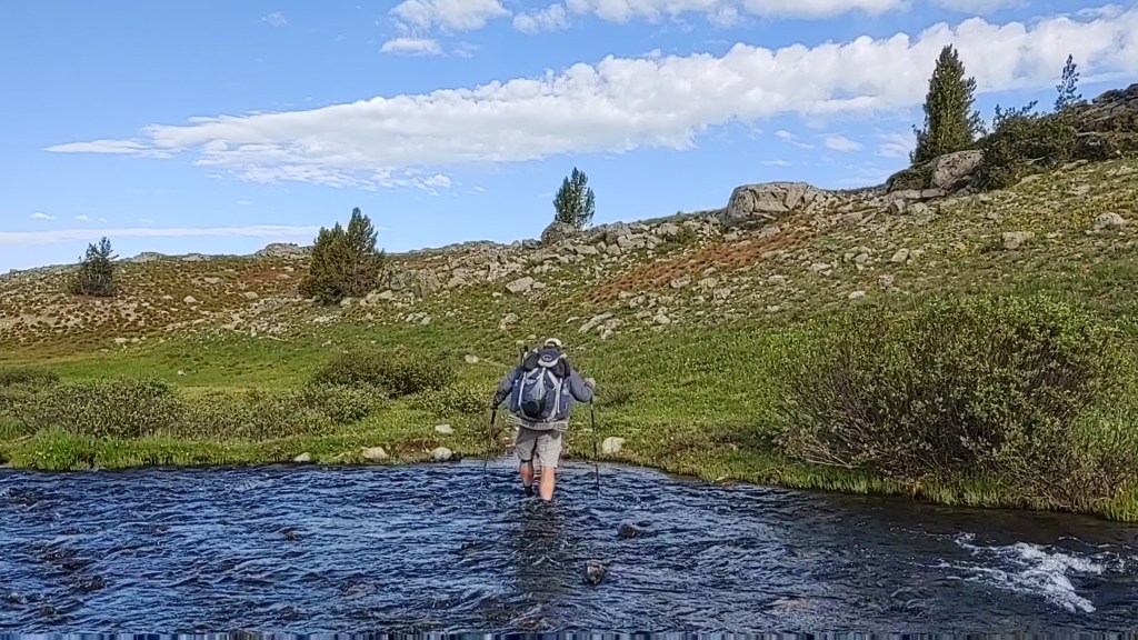
This morning’s miracle would not last long as the day’s trail required that we fully immerse our feet in icy cold streams and slick mud for a good part of the day.
We passed countless amazing meadows and lakes. The area was so pristine it begged for “civilization”.
We picked several places along the way we would have built a cabin or two.
It was probably the most beautiful day we had had so far. The scenery was spectacular, almost too good to be true.
As the day progressed so did the fervor of the mosquitos. They seemed to be multiplying exponentially. Hordes of them followed behind each of us, and when we stopped for a breather they surrounded us like a buzzing fog. One could easily be driven crazy by this. This made the assault on Hat Pass even more so rigorous. Nevermind that the path was filled with a stream of water running downhill in it, and that each step awoke a new horde of mosquitos that joined their brethren in their torturous assault upon us.
Or, the fact that the elevation gain on these beach lungs and legs was wearing to both. By this time we had no choice but to don our rain gear and head nets to avoid the sting of their needle noses, and to ensure we maintained sufficient blood volume.
Still not the top of Hat PassApproaching the top
So, sticky with sweat and feet wilting from being wet with a few blisters coming into full bloom, we emerged over Hat Pass “triumphant” in that a slight breeze kept the mosquitos at “bay”… briefly. The view was breathtaking, in so many ways.
Now the descent
Now for the descent. The plan was to get as far as we could, to set us up for the next day, and get into Pinedale for our resupply. We reached another pass. This time NOT snow capped, but teaming with mosquitos!
We had no choice but to set up and retreat to our nylon fortress.
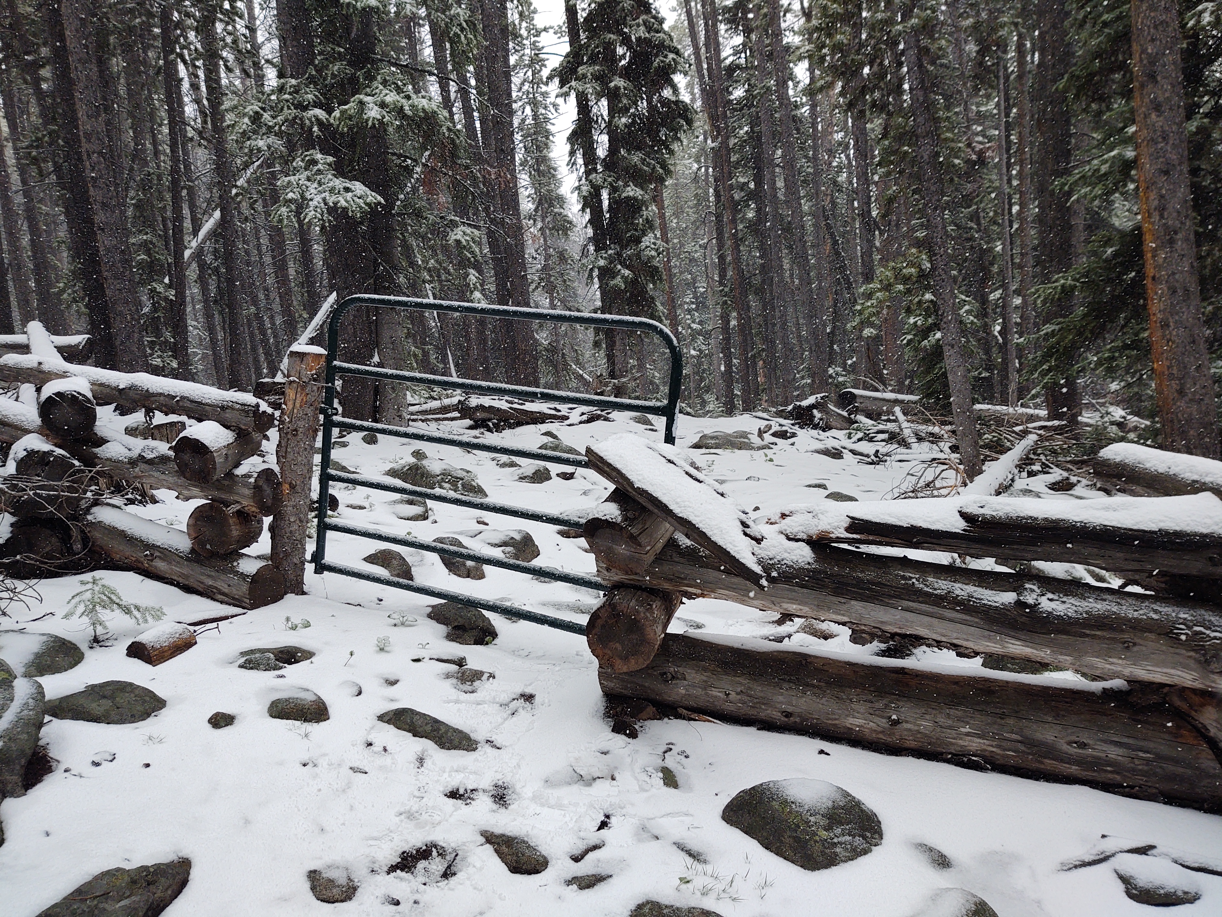
We left Meeks lake knowing we had a day of climbing (elevation gain). The skies threatened us constantly, and we eventually switched to our rain jackets. If anything, it helped buffet us against the wind.
Don’t let this “flat” tread deceive you. It’s rock strewn and slippery as snot
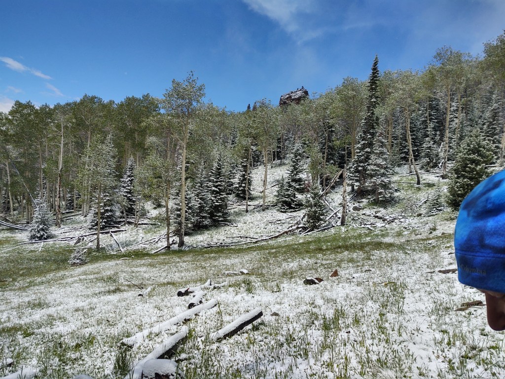
Today we headed towards the snow capped mountains. The air was brisk, and a good part of the trail was flooded or muddy. Keeping our shoes dry would not be an option…again. As we gained in elevation, the views became more stunning.
The dramatic skies and stunning scenery
Weather threatened us most of the day. The bulk of the day was spent in an “uphill” posture. The jagged grey relief frosted in white against the troubled blue sky made for awe inspiring views. A feast for the eyes, and soul for that matter.
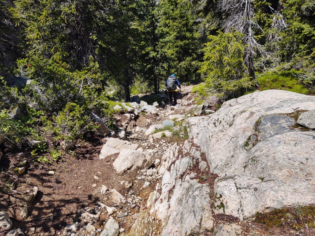
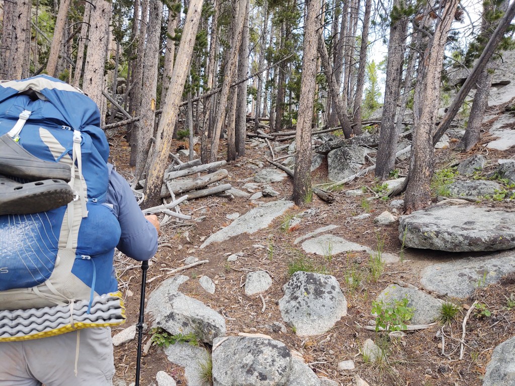
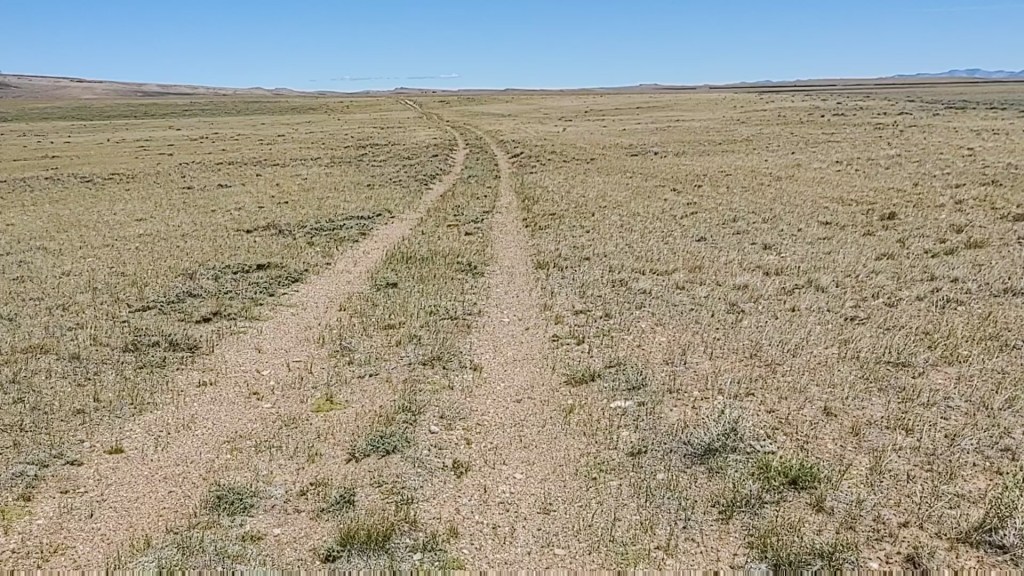
Water in The “WRR” is NOT scarce like the Great Divide Basin. Also, in the WRR, required attention to ones footing, is a MUST now. There is no mindless rhythm to walking.
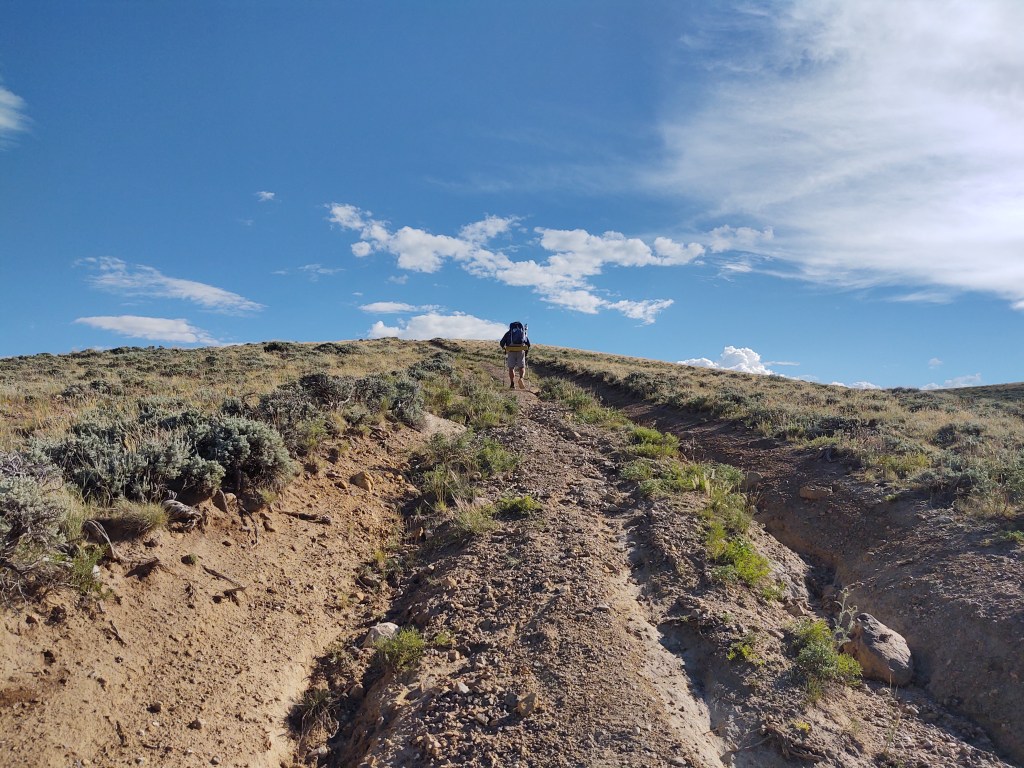
Uneven, rock strewn, often waterlogged, tread is the norm here. Ones brain and feet must stay in “sync”. The “sync” part, however, has eluded me most of my life. Hence my penchant for water sports. The more I told myself NOT to trip on that rock or root, the more it happened. Paul on the other hand can walk, talk and look at the Guthook mapping without fear of an unexpected faceplant or ankle turnover. I tried walking behind Paul and watching where he put his feet with marginal success. My problem is that my ADHD brain gets sidetracked from concentrating on walking with all the splendor and beauty around me. Thus, I end up with a 30 mile effort for 15 miles.
We passed the NOBO “exit” for the Cirque de Towers alternative, where it rejoins with the CDT. Considering all the mountains within that alternate route, we are glad we did not take it. Far too treacherous for us with the snow and all the “scrambling” that goes with that route.
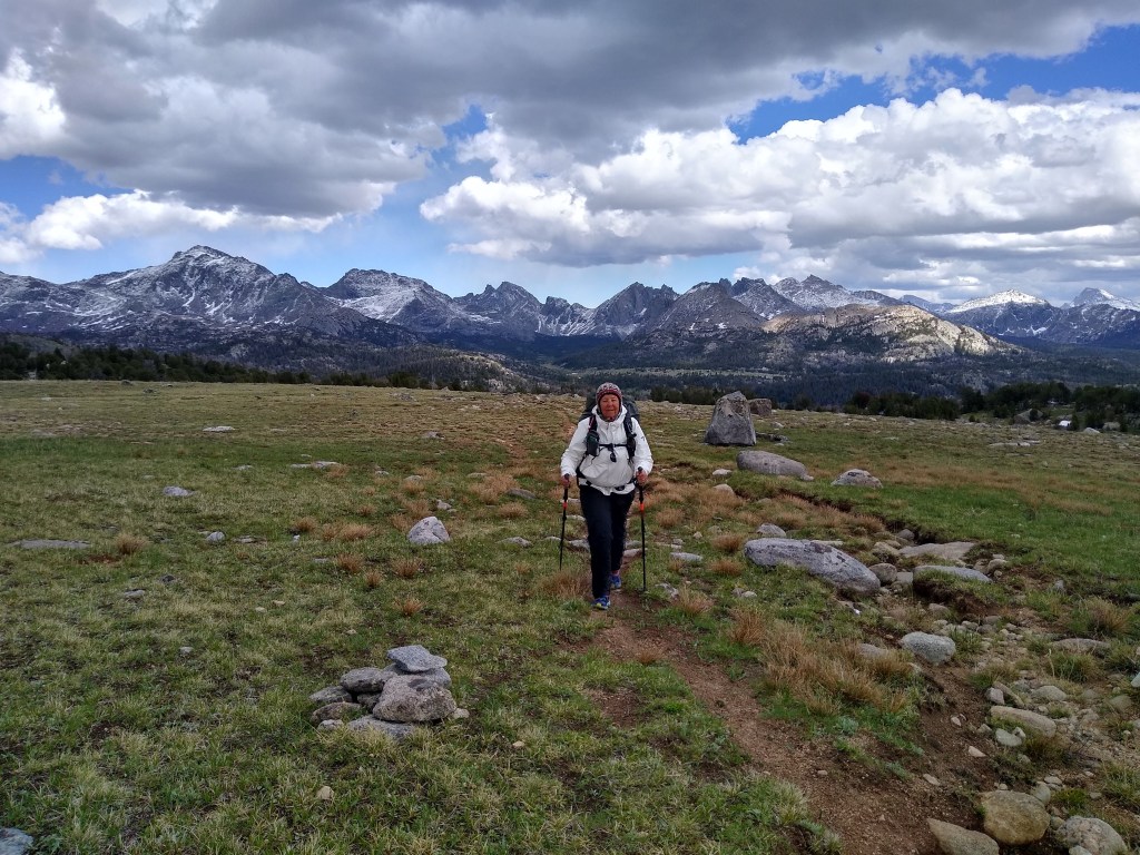
“Top of the World”
The literal and actual “high” point of the day was when we reached the top of this knoll. It felt like we were on the top of the world. The 360° view was mesmerizing. Granted, we had a hard time standing fully erect against the forceful wind, and were a little concerned about having our rain fly’s ripped off our packs, but it was the absolute “high” to our day. I assume this is why it is called the “Wind River Range”. We were fighting against a “river of wind” to remain standing.
Down the other side we plodded in marsh like conditions till we twisted and wound our way to a relatively dry and mosquito-less meadow. Here we called it an exhausting but wonderful day.
June 30: Day 13 (1736- 1761) Wind River Range: 15 miles
The night before we tried to have a fire, but it started snowing on us so we retreated to our tent. When we awoke it was snowing lightly, just like the night before.
Nothing was or had really stuck to the ground. Considering we had a river crossing the evening prior, our shoes and socks were NOT dry. They weren’t even warm. As it was really only ice crystals, we dressed for rain seeing as we were going to be descending in elevation throughout the day.
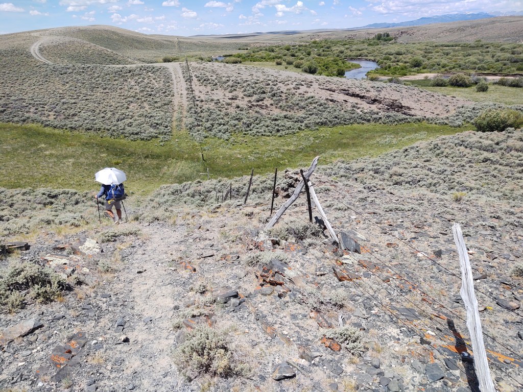
The trail markings were sparse and we had a hard time following the trail. After an icy thigh deep river crossing, things got dicey. I left my water bottle on the other side of the river…and rather than cross the river two more times, I decided to go without (I had two more). No sooner did we cross the river, but the trail disappeared. This required a bushwack through dense vegetation and a muddy bog. To add another degree of difficulty we really couldn’t feel our feet just yet from having crossed the glacier cold river.
How Paul did not see that my umbrella and hat were about to take their own “hike”, we will blame on the “snow”
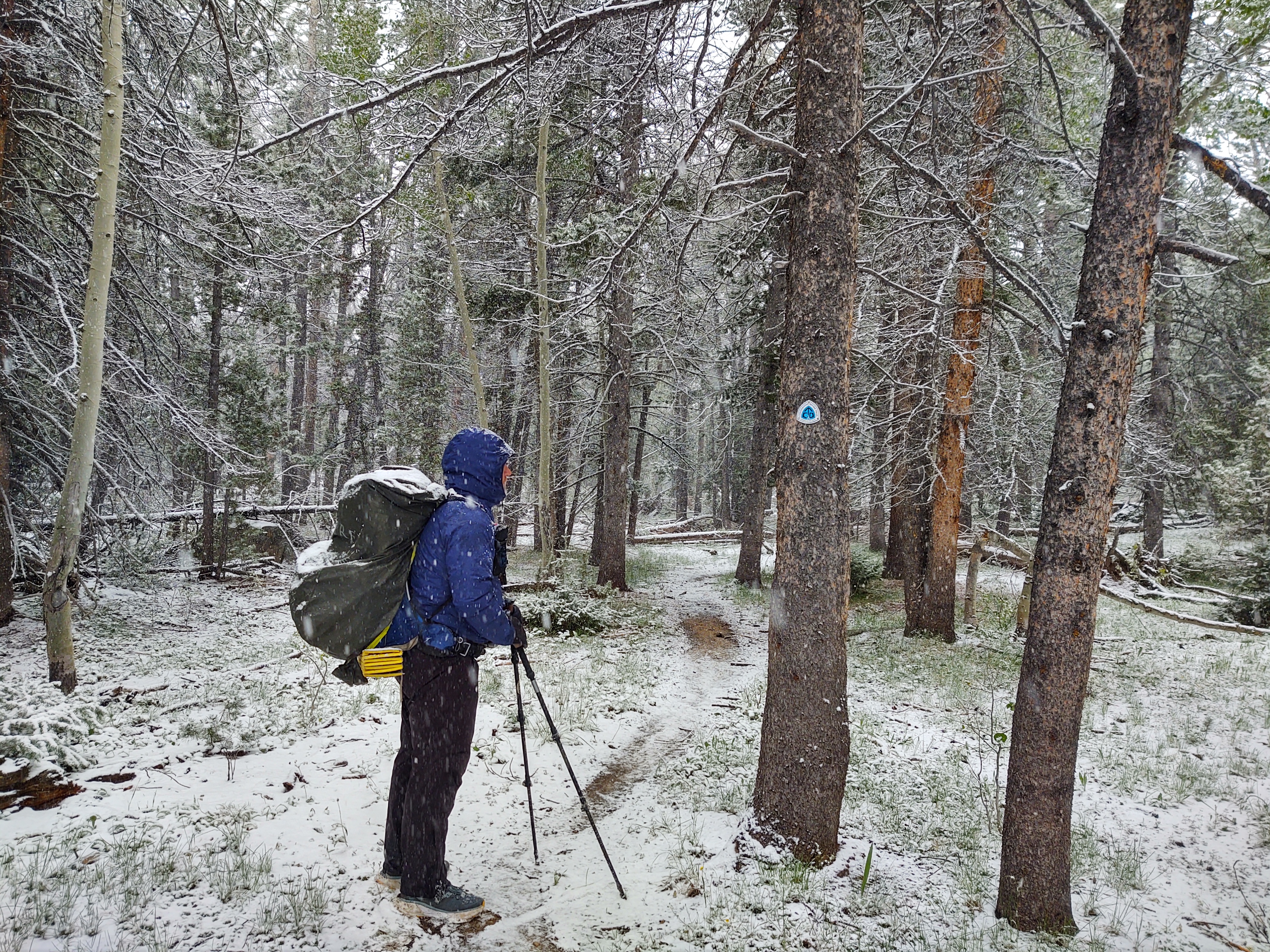
And just when we located the trail using Guthook, it began to snow. Medium size flakes began to fall upon us and the trail. In some ways we were happier with the snow, as we didn’t have to worry about becoming fully soaked. Our feet were enough. Medium flakes turned into big fluffy flakes falling at an alarming rate.
The sense of urgency to keep moving and descending was building. We didn’t want to lose the trail or get stuck up here in the event it dropped more than a couple inches.
A couple hours into our trek, it became cold enough that the snow was now sticking and starting to cover the ground and foliage.
What day was it, we joked. Have we been out that long that we were already into November? For nearly 8 hours it did NOT stop snowing. It only oscillated between big fluffy snowflakes and bean bag sized snow pellets. At times the sun would peak through the snow filled clouds and we’d stop and “thaw” ourselves.
We started to make an alternate plan, in the event the snow did NOT stop as we descended elevation. The plan was to exit at Sandy Lodge if the storm got worse.
Eventually the snow slowed and came to a stop as we approached another thigh deep river crossing. Here also, we needed to collect some water. We figured it’d be a better idea to take the time to collect our water first, before we crossed, and were uncomfortably cold…again. Just as we finished getting our water, the snow spigot got turned on once again…full throttle.
We retreated under a large pine that sheltered us from the snow. We sat there for nearly an hour watching it snow. Paul used his umbrella to shelter him further while I had to use our tyvek ground cloth. Earlier, most likely when we did our obligatory CDT bushwacking, I lost my umbrella AND hat. They must have gotten stripped off my pack. I hope someone finds and enjoys them both. Maybe it will be a bit of “trail magic” for them.
An hour passed and the snow abated. At least here we took the time to have a snack while we waited as we hadn’t eaten, except for breakfast. Try as we might, we couldn’t find a dry way in which to cross this deep, swiftly moving creek. Rather than take off our rain pants, we rolled up the legs, thinking that it couldn’t be deeper than our knees. Oh, it was. That’s the problem with clear water. It’s hard to tell the actual depth. Mid thigh it turned out to be. We should have taken off our rain pants . Now we were going to be walking in frozen wet shoes AND pants. Nothing to do but walk ourselves warm and hopefully dry.
We neared the trail head to Sandy Lodge. We considered taking that route, but opted not to as the sky appeared to be clearing, and our weather app indicated that the next 2-3 days should be no precipitation. Onward we trudged, almost dry and warm now.
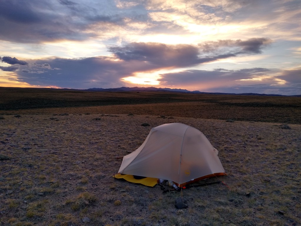
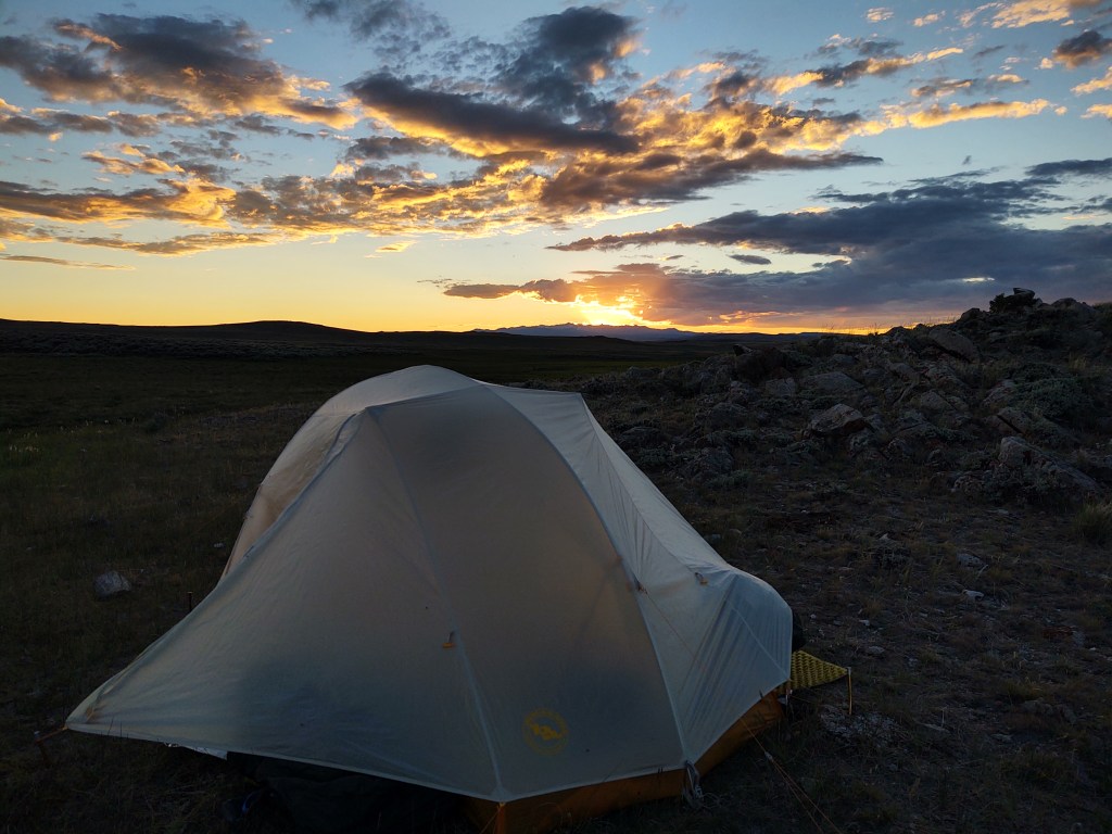
Our 15 miles for the day put us at Meeks lake. We took the side trail off to Meeks lake and had it all to ourselves. A slight breeze off the lake allowed our tent, rain fly and sleeping bags to dry fully before we retreated into them for the night.
We had no problem falling asleep this night. We hoped our weather app was not fibbing.
So, we awoke to everything damp. Mild condensation inside, and a completely saturated rain fly. The skies were completely grey with no sign of brightening. We had a decision to make. Should we stay or should we go. At the very least we had to shake the moisture from our rain fly before it started to rain, inside. It was cool and crisp out. The meadow grass we had parked ourselves on was wet and the temperature was close to 40°. The rain had stopped, which allowed us to remove and shake our fly… somewhat “drier”. We spread out our rain jackets for some airflow and to dry them off as best we could. My jacket, a Columbia OutDry is full PVC and made to keep you fully dry. Paul’s on the other hand is not fully PVC, but is an REI rain jacket that generally does the job. His jacket was wetted out through and through. There was no way we were going to get going before his jacket was at least 90% dry…inside and out. Coffee, and a check of our weather app became the remedy.
We had three options.
Stay put and ride out the weather till it breaks.
Pack up and start moving, and spread our stuff out to dry when the sun breaks.
Pack up and walk a mile or so back to the campground and “yogi” a ride to Lander or Pinedale and regroup.
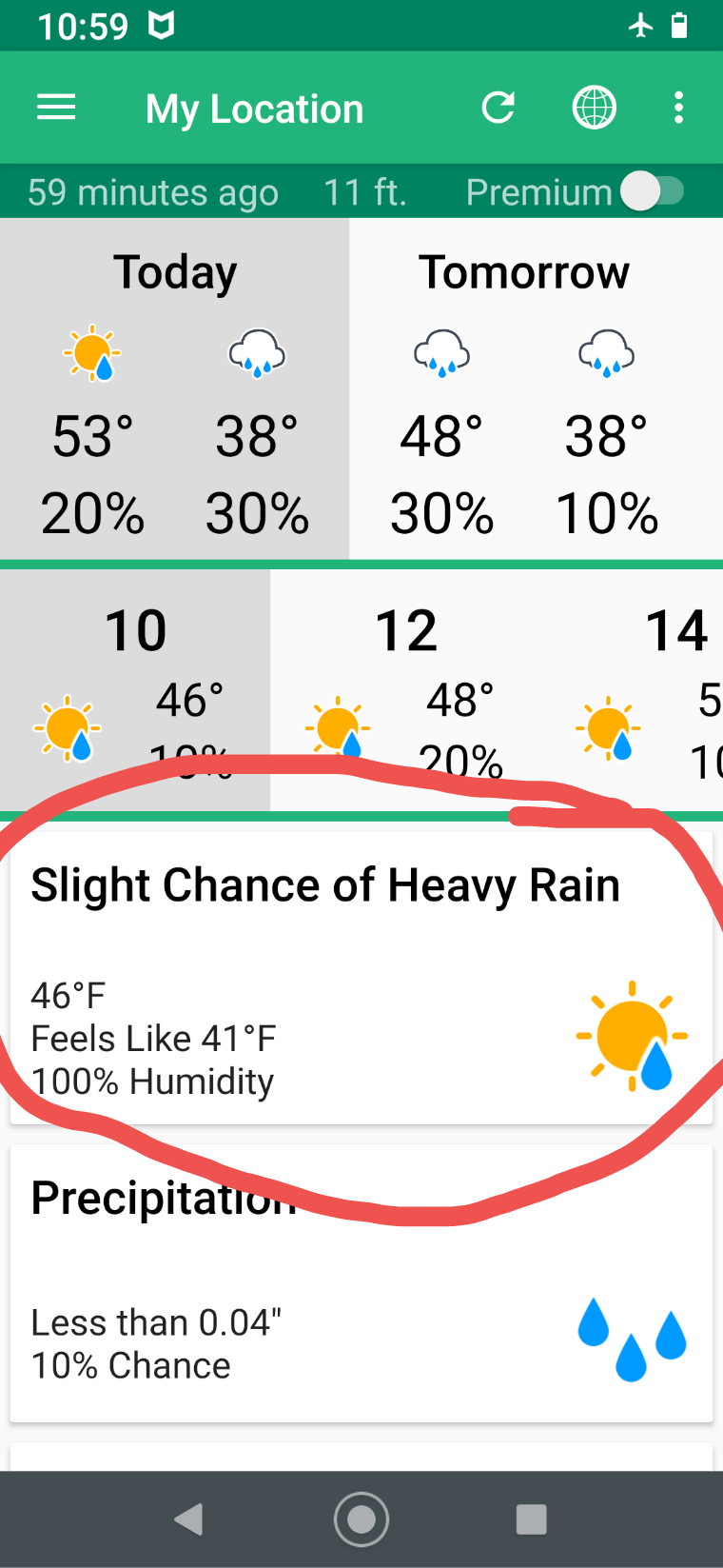
We chose to ride it out and see if the weather broke. It wasn’t until 1230 that our gear was dry enough to set out. We knew that the next day was a greater chance of “heavy rain” as opposed to the “moderate” rain we have been experiencing. And because we we’re headed over 10,000 feet, we needed to have gear that was dry, to ensure we could stay as warm as possible.
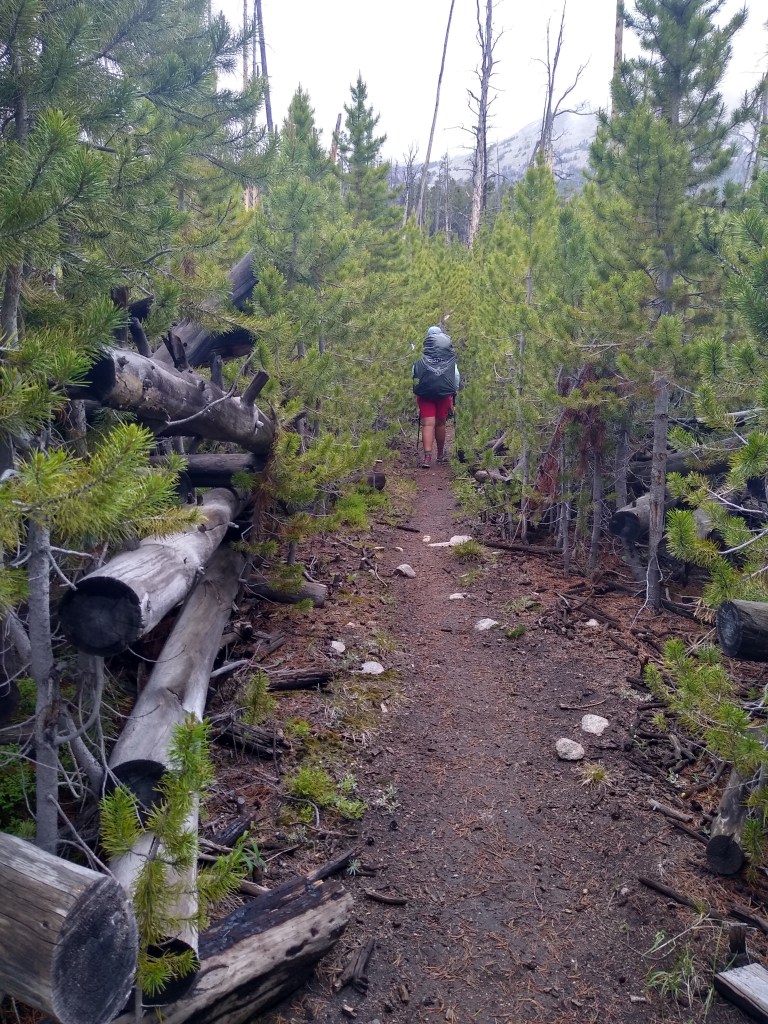
Up we climbed for the rest of the day. Some steep, some slow stair stepping over the next 6.8 miles. Soft tread. Rocky tread. Mushy muddy tread. It ran the gambit. The air became thinner and thinner, which made for slow going when your legs feel like cement. It drizzled slightly, and then as we were approaching 10,000 feet, the drizzle turned to snow. Good thing all our gear is dry we thought.
Up and over 10,000 ft and back down toward a raging river, that is called a creek. As we descended, we played mud puddle “hopscotch”, doing our best to keep our shoes as dry as possible. I don’t know why we tried so hard, as we ended up having to cross said raging knee deep creek with our shoes on anyways. Once across, we collected our water for the evening and next morning. And then searched for a place to camp before it started to snow/rain. We found a great place under a large tree that partially covered our tent…just in case it decided to pour or snow on us. After some well deserved hot food, we hunkered down for a cold night’s sleep.
We’ll see what the morning brings. I won’t be surprised if our shoes and socks are frozen.
Wyoming you are fickle. How it is that we can go from being hot and bone dry, to cold and sopping wet, in a day, amazes me.
As we were trudging up the trail we were lamenting the fact that we aren’t “stupid light”. Meaning, we carry ALL the “just in case” gear that what we call “stupid light” people don’t. Granted, these people are generally fast as lightning and crush crazy miles, so the likely hood that they get caught in a storm of any magnitude is rare. But if they do, it could spell trouble for them.
When we talk about “just in case” gear. We are talking about the following:
A three season tent
20° sleeping bags that zip together
Tyvek ground cloth
Full actual rain gear
Fire starter
Dry change of clothes
Long johns
Gloves
Half a camp towel
First aid kit (abbreviated)
An extra day of food (for both of us)
Delorme InReach (with its own dedicated battery charger)
We, on the other hand carry ALL the “just in case” gear, on top of our “slow walking” days of food. I say “slow walking” because we can’t just seem to get up to 20+ miles a day, which would make our pack weight much more comfortable.
On hot blue sky days, this “just in case” gear feels like a burden. But when the weather changes for the worst (rain/snow) these “just in case” items can be a life saver. Today was such a day.
It is, only day 11, and we keep gaining altitude, but dammit we should be crushing it by now! If we were faster, maybe we would have been able to walk our way out of this “unscheduled” storm. Or, maybe we would have been at 10,000 feet and been hit with it. Who knows. In any event we are “prepared”…at least enough to not die, we hope. The fact we’re nearly three times the age as most crumb crunchers that do the CDT is still no excuse for feeling/being so “slow”.
Although, today is the first day that we didn’t finish with our feet feeling like we were walking on glass. They were soft, squishy and caked in mud. But they felt good, compared to walking 117 miles on hot country roads.
The night before, was our first attempt at hanging our food. Namely because there were TREES! Hanging ones food in sagebrush is ineffective. We figured we’d better get good at it before we hit grizzly country. When we awoke were pleasantly surprised it was still there. Today however, we employed the OMDB method (over my dead body) of securing our food. We slept with it. Why you ask? It was pouring rain and had been for last third of the day. We were sopping wet, and didn’t give a shit.
The day started as overcast and cool, but promising as our Delorme weather report had us at 10-30% chance of rain. Pretty good odds we thought. Note to self. Las Vegas is not a good option for us.
“Take the picture quick…it’s starting to rain…again!”
It spritzed on us as we walked up and through dense woods and high chaparral.
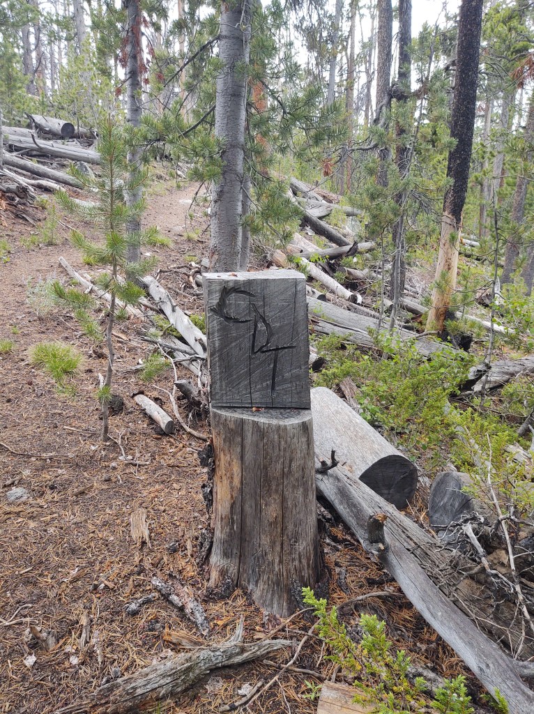
Some trail “markers” are one of a kind
The forested areas were fraught with a tangle of blow downs.
Progress would have been torture had a guy on horseback, with a chainsaw, not gone before us. We figure he (they) cleared the trail a day or two before us based on the fresh saw dust. A special Thank You to whomever did this!
For the most part, we didn’t even need to don our rain gear. Then Paul, in frustration, uttered the magic words,”I wish it would just make up its mind. Either pour rain or just stop!” And like magic, thunder rolled, lighting darted around us, and the skies poured down upon us. His utterance, of course, was just as we were about to crest an open bald. With urgency, we ducked for cover into a den of densely packed pines and put on our full rain gear. Here, we sat and counted the seconds between flashes of lighting and the thunder. 2 seconds was the closest. Eventually it “stopped”, back to the light drizzle that Paul was so annoyed with.
As long we kept moving, we stayed “warm”. We began to formulate a plan of how we were going to erect our tent in the event the rain failed to cease. We were also lamenting that we had not purchased the specific ground cloth to our “skinny jean” tent, that allows you to put up the fly first. The fact we considered it “too heavy”, is ironic.
The first plan involved finding tree cover. This was not an option where our days mileage put us. The second was to end a mile earlier at an actual campground, with flat “dry” ground and some cover, but there was an icy river to ford. Third option, pre-stage poles, 4-stakes and ground cloth. Race out to space, spread cloth, stake tent corners, attach poles, spread rain fly… FAST!
Success! It also helped that the rain abated a bit. This allowed us to toss our gear into our tent, “dry”. And so went the night with non-stop rain.
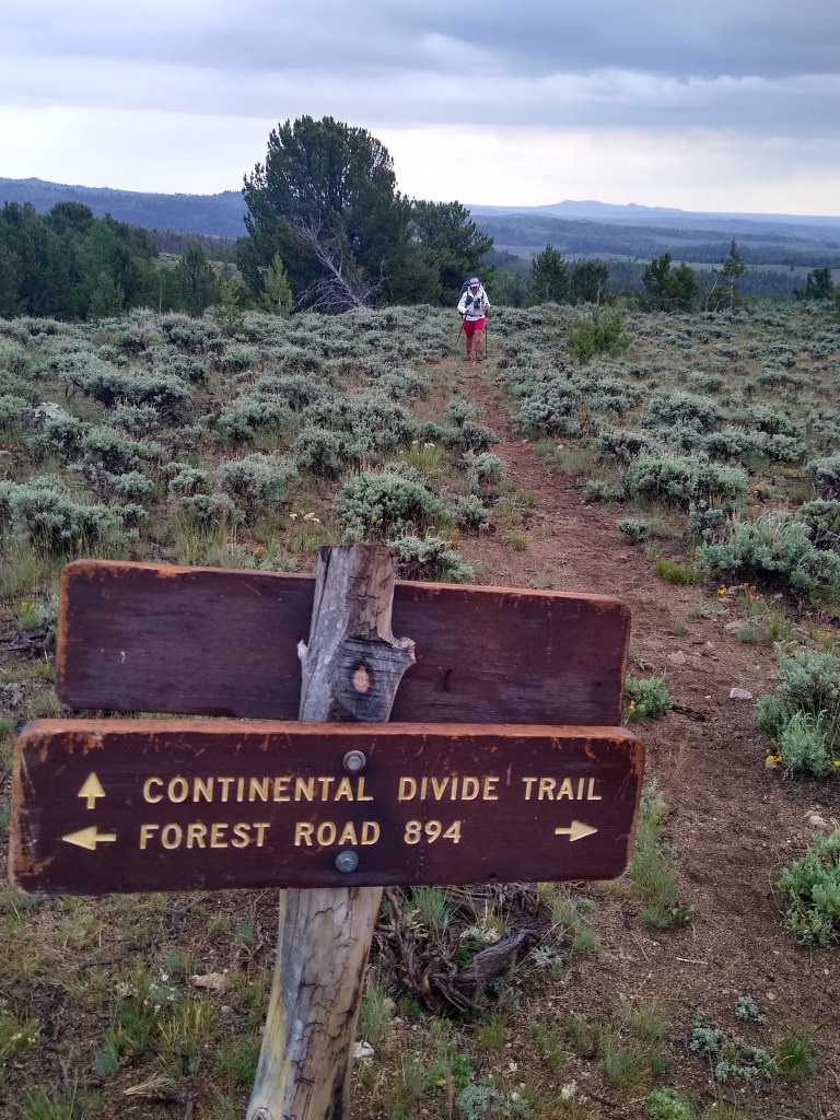
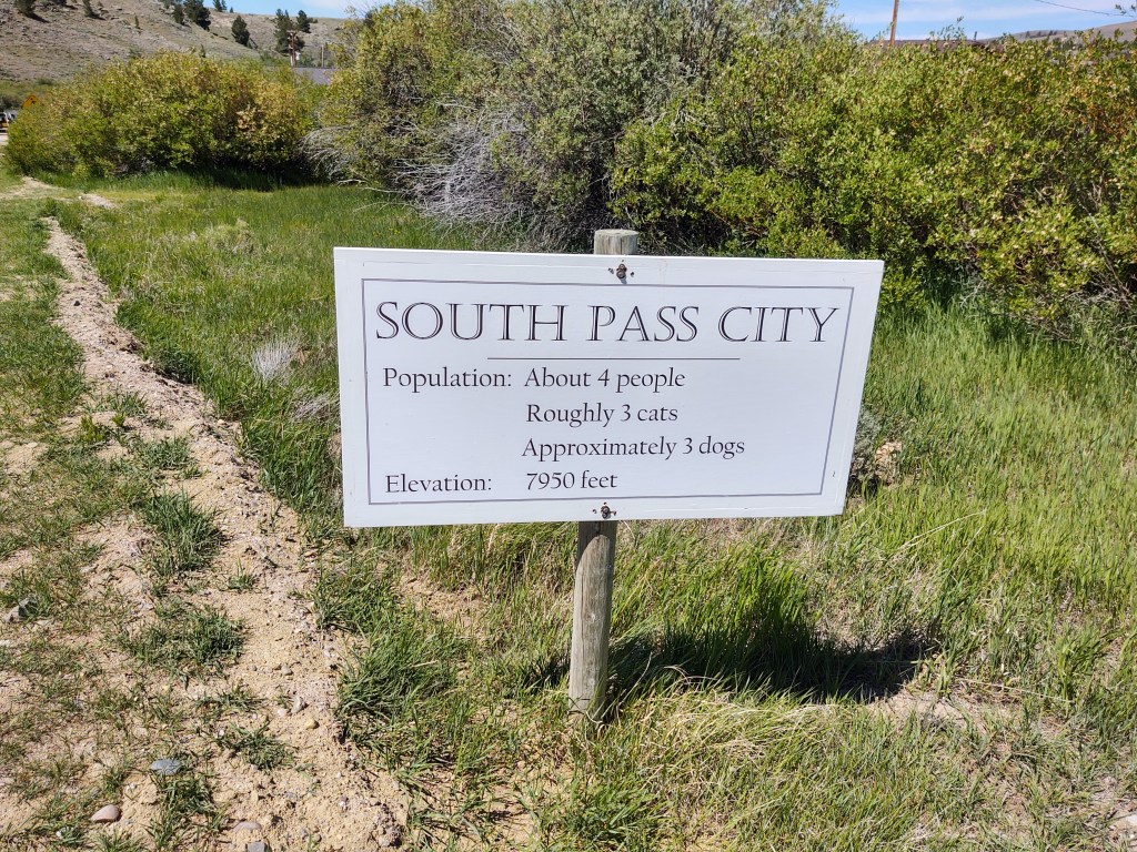
We walked out of Atlantic City (uphill of course) after a hearty breakfast at the Miner’s Grubstake, and made our way to South Pass City, where we would collect our first resupply of this journey on the CDT. A hefty headwind dogged us the entire 4.5 miles to South Pass City. I don’t know why we were surprised.
When we arrived at South Pass City, they initially said that they did NOT have our resupply package. WTF?! A frantic search for our shipping receipt ensued so we could call the postal service to find out what happened. The gal told us there was a hiker box in the storage area that we could go through and maybe resupply from there. I followed her to the storage area, and immediately saw our package. She had overlooked it. Phew!! At the “thru-hiker” picnic table, we unpacked our resupply…6 days of food = nearly 12 additional pounds. Yikes! And yes, we added bear spray and for some reason our microspikes. (The last time we saw the Wind River Range, it had been blasted with snow…again. We tend to over prepare.) The start of this leg was going to be onerous.
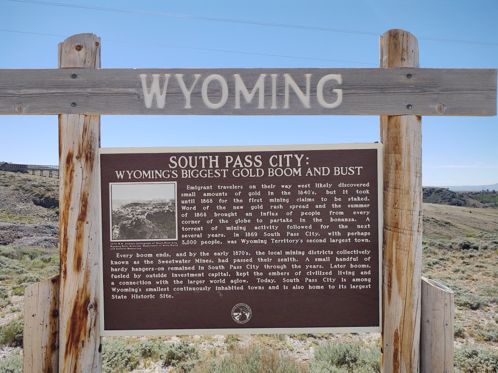
South Pass City is a Wyoming State Historical Park that the CDT happens to travel through. The significance of South Pass City is not only that there was a gold rush here as well, but it is a geological anomaly wherein there is a break in the Continental Divide mountain range that allows passage over to the west coast. South Pass is the lowest point on the Continental Divide, and is natural crossing point of the Rockies. It was also pretty much the “half way” point of the Oregon Trail. Nearly half a million people immigrated to the West through this Pass, which makes it a more than significant land mark in our Great American Western history.
5 miles out of South Pass City we find ourselves resting in the shade, on perfectly flat, non-pokey ground,without the use of an umbrella. There are trees here. Actual trees! Pines and Aspens. A reprieve from the wind we hide amongst the trees on soft debris free ground for our first break.
This is not to say we didn’t have a 20 mph headwind the entire time. And…that it wasn’t mostly an uphill experience. At least it involved different scenery.
We are not sure if we are in bear country yet, so we now have the added wrinkle of hanging our food bags and hoping they are still there in the morning.
**this post is a bit long. You have been forewarned
Day 8: (5 miles)
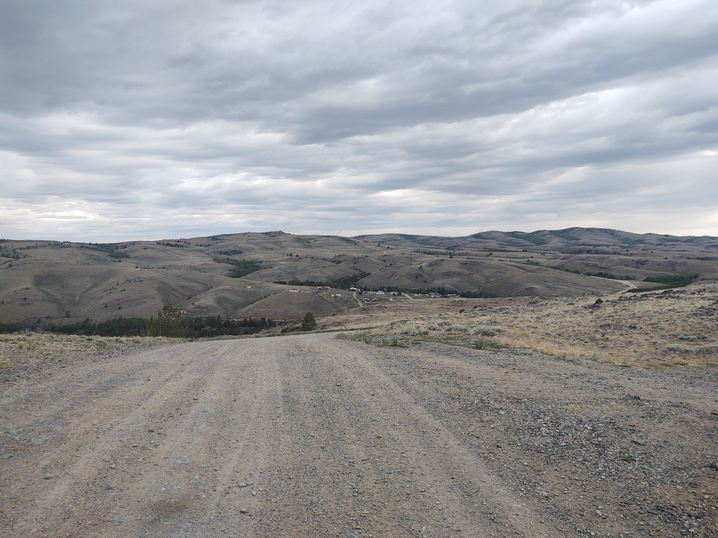
Up with the morning sun, we continue our road walk into Atlantic City for breakfast. We eat our last Snicker’s bar knowing that fresh food is “near”. Five trucks passed us going the opposite direction. Not gonna lie, if one was to have been going our way and asked us if we wanted a ride, we would have taken it. But…that didn’t happen. When we reached the turn off to Atlantic City, we made note of the “trail” to South Pass City. It was going to be an overland bushwack for the most part.
When we rolled into Atlantic City, we saw one person. Bob Boyd (his name was on his Air Force Veteran’s hat, and the next day we would have a lengthy and pleasant conversation). We asked him where we could get something to eat.
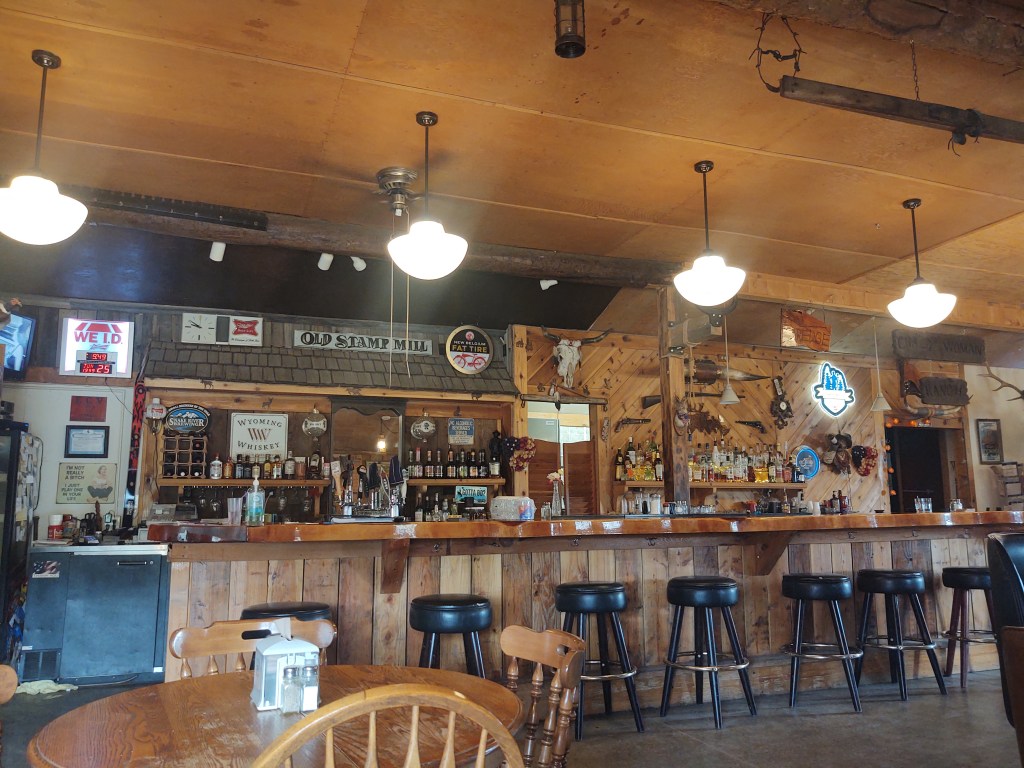
He directed us to the Miner’s Grubstake. We rolled in just in time for breakfast.
The owners, Dale and Laurel are “expats” from California, and were our server, cook and bartender. Considering that it began to rain while we were eating breakfast, we asked Laurel if she knew of a place to stay for the night. Turns out she had a cabin for rent that included, a hot shower, laundry, WiFi and Cable TV. For the two of us, it was a deal we couldn’t resist.
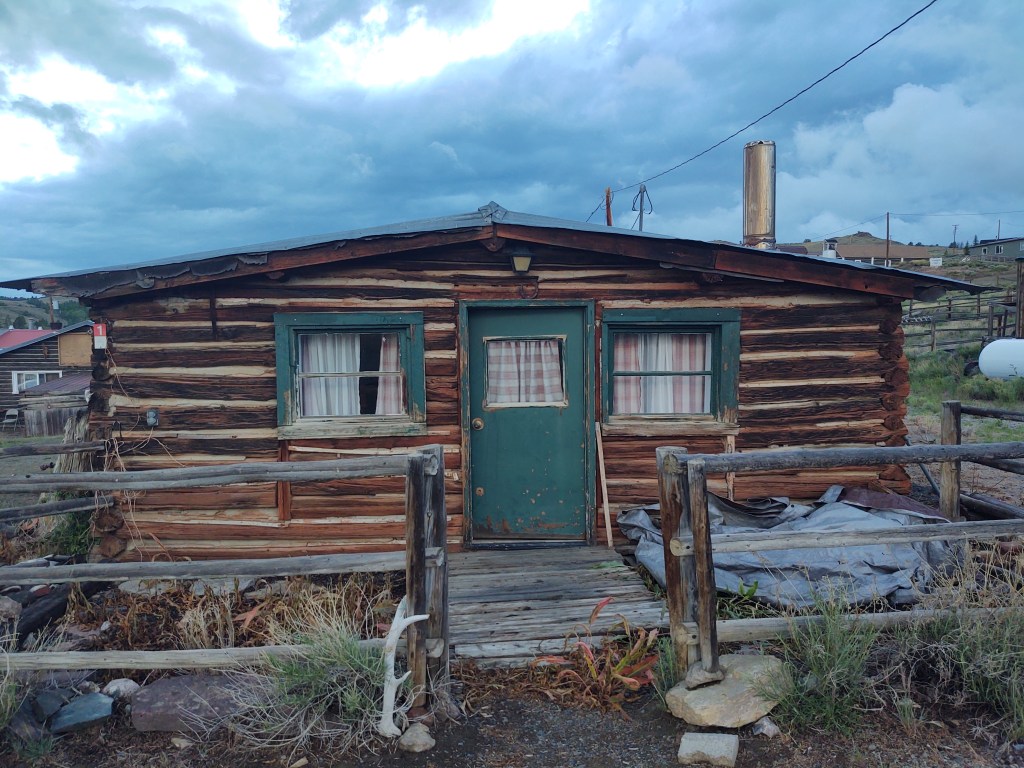
1868 Assay Building
The cabin, turns out, is a historic building built in 1868. It was originally the Assay Building during the first gold rush era of Atlantic City. This is would have been where the Miner’s had their gold weighed and recorded. We wondered how much gold slipped under the original flooring. And no, there was no easy access to under the cabin… we looked. Laurel got a good laugh out of that.
Day 9:(Zero Day)
The evening before, while dining on the best burgers we have ever had, we asked Laurel if we could stay another night. “No problem”, was her answer. We were worked. We have found that as we get older, our recovery time gets longer and longer. We didn’t need to enter the Wind River Range on half a tank, so we spent another night/day with our feet up.
Dale and Laurel
Business was sort of “slow”, due to COVID-19. This however, allowed us to talk quite a bit with Laurel who is jovial and quite endearing. We hit it off immediately. I asked her how she and Dale found themselves in Atlantic City. She and Dale had been to Sturgeous (the motorcycle rally), stopped in at Atlantic City, and basically “fell in love with the town”. Laurel, a licensed nurse (Graduate of UC Davis) sold her Elderly Board and Care business in California when they moved to Atlantic City, and then they bought the Miner’s Grubstake. They have owned and operated the Miner’s Grubstake for going on 12 years now. They are looking to sell and “retire”, but they have no plans to move. She just wants to be able to “sit on the other side of the bar”. There is no mistaking that both Dale and Laurel love their life in Atlantic City. They enjoy meeting people from “all over the world” and for the most part “being the local hub”, especially during the winter. Laurel said that the town “swells to around 57 residents during the summer”, with around “35 diehards” year round.
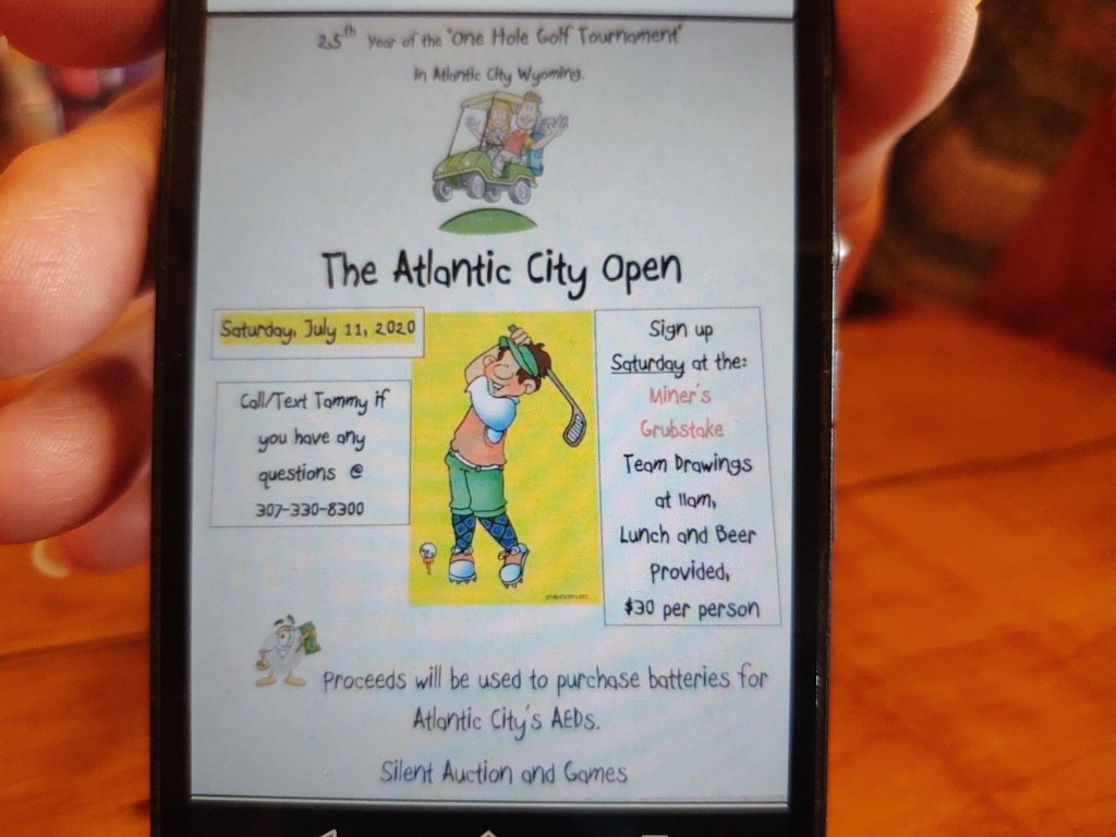
The town host an annual “Greater Atlantic City Golf Tournament”. There is, in fact, ONLY one hole that ends into a tuna can with an ATV flag to mark it. It’s advertised as a “Hole 1, par 72 ” 4wd/cross country course.
The topo of the course.
You have 10 balls to start with, and start way up the hill at the Big Atlantic Gulch “Y”. It sounded like a blast and were dismayed that our timing was such that we couldn’t be around for it on July 11. We have vowed to return and play in that tournament. It’s right up our alley. Three Stooges style of golf.
I asked Laurel who does most of the cooking. She pointed directly at Dale. “I’ll make the soups and salads, but he mostly cooks. He’s the grill master”, she said with a smile.
Finishing touches to her specialty Bloody Mary
Laurel’s expertise clearly is being the “hostess with the mostess”, and making killer Bloody Mary’s. “The secret is leaving a little in the shaker, so you can taste it and make sure it’s good”, she told me.
*A little history about the Miner’s grubstake building:
The building was originally the Green Mountain Inn, bar and restaurant and resided in Jeffery City. It was moved to Atlantic City in 1986
1988 it was called the “Red Cloud Saloon”
1999, a change of ownership renamed it to the “Dredger Station Bar and Cafe”
2006, a change of ownership renamed it to the “Miner’s Grubstake Bar and Restaurant”
2009, Dale and Laurel bought the Miner’s Grubstake, expanded it’s footprint and installed two custom bar tops. The wood came from a single Red Cedar tree from California. The bar top measures 22ft long and 4 inches thick. (It is truly beautiful, and beers slide over the top…just like in the ‘Old West’ movies)
When we weren’t eating, we wandered around the town on a walking tour of the historic buildings. It is said that Atlantic City is home to the oldest building in Wyoming.
Wyoming’s oldest building?
We also got an inside look and tour of the Miner’s Delight Inn. It’s co-owner, Bob Boyd gave us a tour and told us some wonderful stories of his life. The Miner’s Delight Inn, in it’s original “hey-day” in the 1970’s is said to have “put Atlantic City on the map”. The original owners (Paul and Gina Newman…not the actor Paul Newman) were escaping the hustle and bustle of city life to run a fine dining establishment. Paul was a Cordon Bleu trained chef. Dining was by reservation only, and you ate whatever the chef had prepared for the evening. Prior to the building being an Inn and dining establishment, it was the site of an early military camp, Camp Stambaugh. Boyd lifted the table cloth draped over a long table. “See, this is one of the mess tables from the Camp”. He also showed us the original, still working, stove by which meals from that era were cooked.
History can be found in the most obscure of places. This is the beauty of walking from place to place, and taking the time to speak with the “locals”. As we talked more with Boyd, he told us of his now deceased wife whom he met in second grade and grew up with. Her dad liked him, but she wouldn’t give him the time of day. “She was a beauty and could have anyone she wanted. I was a tall gangly redhead. I couldn’t compete”. He entered the Air Force and specialized in procurement and negotiations. He served during the Cuban Missle Crisis, in Turkey and in Vietnam. When he returned to California, he received a “call” from the girl who only saw him as a childhood friend. They began writing each other. He said he “played hard to get”, but eventually “got the girl of his dreams”. They were married for 57 years, before she died of cancer. When he left military service he became a “rescuer” and collector of Classic cars, and built a 30 year business from it. He said it all started when he saw a bunch (500) of “old” cars on a country farm. The owner was selling them for scrap metal. Boyd bought 350 cars for $25/each. The rest is history. He has a collection of 30+ Classic cars, and showed us pictures of his favorites. He drives a fire red Corvette. I told him of my garaged classic Ford. His eyes brightened, like a kindred soul. As he talked he kept apologizing for “keeping” us “so long”. We told him we enjoyed his stories and thought his life was fascinating. Because it was. We were talking to a well decorated Veteran who served his/our country well. Why wouldn’t we want to listen. Thank you Bob Boyd, for giving us the time of day. The pleasure was all ours.
Ironically, we had never planned on making a stop at Atlantic City, but we are glad we did. The side trip enriched our lives, fattened our bellies and rested our bodies.
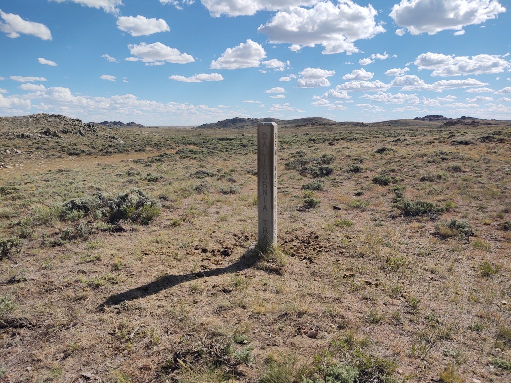
Up early, our goal was to get to South Pass City to pick up our resupply. Well, that didn’t happen. Along the way we tarried at the Oregon Trail, California Trail and the 35 mile Seminoe Cut-off, trying to look for wagon wheel remnants. (These trails were the “freeway” systems of the early pioneers.) Then we soaked our feet in a slough, bathed in a river and dined by a creek. Such is the life of now a quasi-thru-hiker. (We’ve decided that we’re in no hurry to push miles, and to focus on enjoying the journey)
The tread wasn’t any different, but our conversation was. Here we were complaining about our feet, the tread and the heat, and then we’re faced with pioneer’s pathways of the 1840’s. We’re not worthy. They had leather soled boots, “heavy” clothing and no navigation devices besides a scout, the stars and maybe previous tread (wagon) marks from prior travelers.
CDT and Oregon Trail markers
The Oregon Trail is 2170 miles long. Most people (350-500 THOUSAND) left out of Kanas City. So by the time they reached the part(s) of the trail we were treading on, they were pretty well seasoned. They averaged 160 days to Oregon. That’s about 12-15 miles a day. Again , we are not worthy. We have a lighter load and good maps, and still only manage to make 15 miles a day.
Breakfast stop
The California Trail broke off from the Oregon Trail and led directly to the California gold fields. Unlike the current “population” of the CDT, groups of 20-50 wagons would travel together on these trails. Finding water was just as important then as it is now, traveling through The Great Basin.
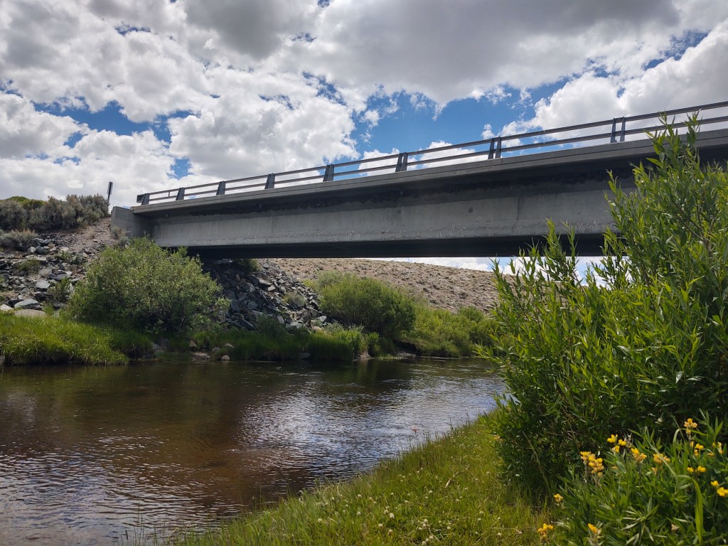
The Seminoe Cut-Off allowed travelers to avoid the 4 crossings of the Sweetwater River. We on the other hand were looking forward to the Sweetwater River. The benefit of the Seminoe Cut-Off was there was a bridge over the Sweetwater River, originally fashioned by French fur traders. One of the bridges builders was called “Seminoe”, hence the Seminoe Cut-Off name.
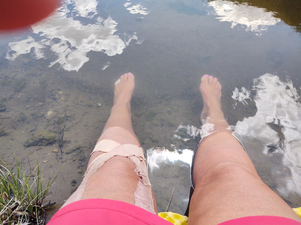
Harris Slough
When we got to the Harris Slough, we watered up a bit and soaked our hot and swollen feet in its icy pools.
We tried to entice the tiny minnows to “feast” on our calloused feet, like in those fancy pedicure places, but we had no takers.
Sweetwater River to our right. So close, but yet so far
Next stop was the breathtakingly beautiful Sweetwater River, and a much needed bath. We didn’t bother to strip down, but soaped up (with biodegradable Camp Soap) and did our best to rid ourselves of the grime and nearly unbearable stank.
Sweetwater River
Once “clean” and refreshed, we started on our way once again. We didn’t make it far (5 minutes), as it was still ridiculously hot. Instead we took the first turn-off down to Willow Creek. Here we spent the rest of the afternoon lounging on soft grass, in the shade of young Willow trees, by a swiftly flowing creek, waiting out the heat.
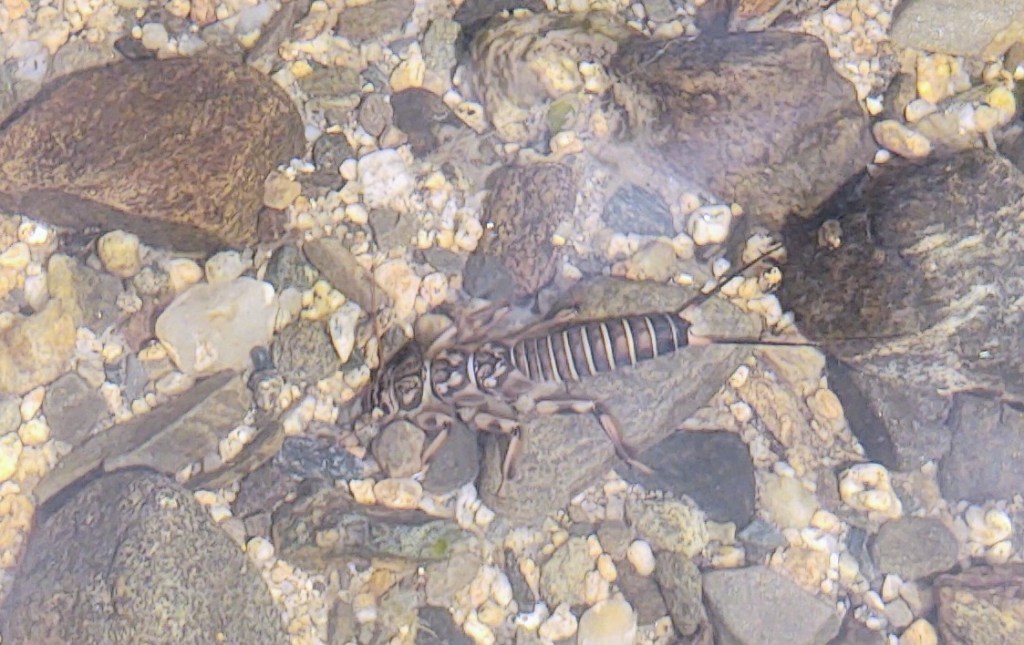
Not much larger than 1 inch
I made an interesting discovery in the creek looking for fish. I found a Mayfly larve. I fly fish with Mayflies, but have never seen Mayfly larve.
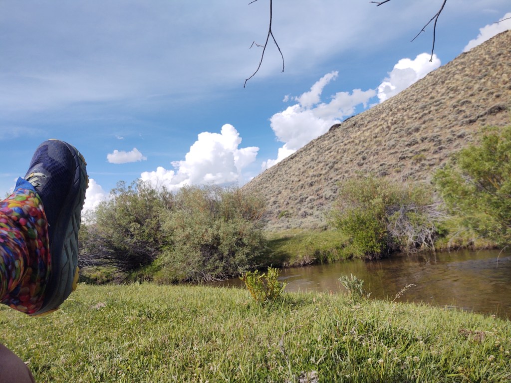
Willow Creek
Rather than carrying our water for dinner, we decided to dine at the creek. This made for a lighter carry, and we resumed walking toward the “cooler” part of the day. The sun does not set till well after 9 pm so we had plenty of daylight to do another 4-6 miles.
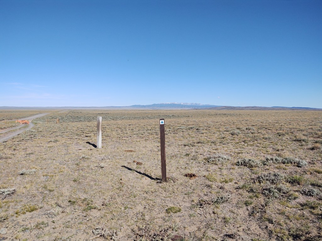
We followed the trail markers and confirmed our path with Guthook. Suddenly the “easy” tread of ranch roads disappeared, but the trail markers and Guthook had us bushwacking overland through the Sagebrush.
This was toward twilight, and considering the likelihood of stepping over a bush and onto a snake, or overturning an ankle, we searched for an alternative. We honestly have it a good “college try”, but eventually said “F-it. What are we doing?!” There also was no place for us to adequately set up our tent. Luckily 3/10th of a mile from where we stood was a road that parallels the CDT trail. Even better, said road eventually intersects with the CDT. This was a “no brainer”. We took our heading and began to walk in the direction of the road. Miraculously I found a “game” trail that led directly to the road. (I strongly suspect that most people on the CDT get to the point where we were and decide to do the same thing. Hence the “game” trail.
Glorious gravel road
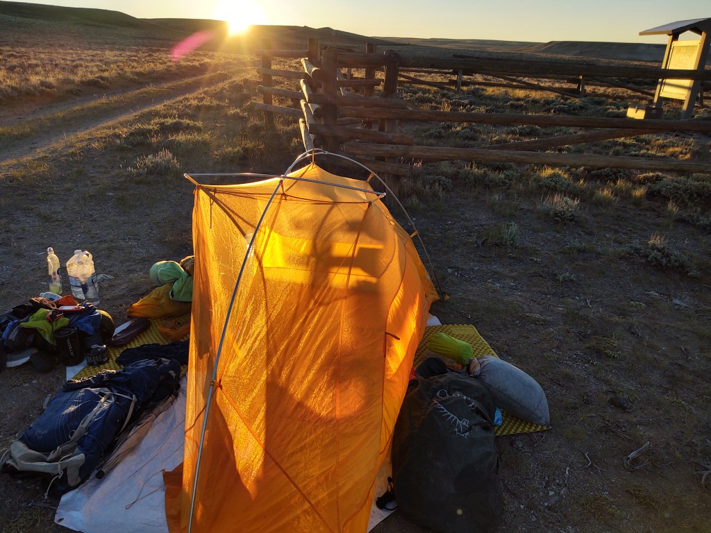
Once we reached the road we were greeted with a magnificent headwind. We walked until we found a safe place off the improved gravel road to camp for the night. The wind howled and the skies threatened to rain. We took an inventory of our food and decided that a side trip to Atlantic City was in order. And with that we went to sleep as our tent leaned sideways in the wind.
When we finished the evening before, we half ass erected our tent, we were so worn out. Never did we think hurricane like winds would make our already uncomfortable tent, even more uncomfortable. (Our tent is the equivalent of Paul wearing skinny jeans. It’s uncomfortable for both of us…we should have gotten the 3-man and not worried about the minimal “extra” weight).
We had staked down the corners of our Big Agnes TigerWall 2UL tent, but not deep. We didn’t face it structurally to withstand direct wind. Besides the clips on the fly to the tent body, and the stakes for the vestibule doors, we didn’t guy anything out. BIG Mistake!
No sooner did we close our eyes, but great wind gusts began to buffet our tent. Quickly we reached under the fly and fastened the velcro tabs to the tent poles, and pulled our gear more snuggly under the vestibules. We briefly considered getting out to pound in the stakes but then surely our tent would blow away if we were not in it. Therefore, we rode it out. It was like trying to sleep in the dryer section of an automatic car wash…but you’re NOT in your car.
We obviously were exhausted enough to eventually fall asleep, and awoke, thankfully, to no winds. Concerned the wind “switch” would be flipped again, we packed up as quickly as we could and were on our way.
The air was crisp enough to start out with our puffies on, but with clear skies, we knew the sun, and possibly wind, would become brutal…again.
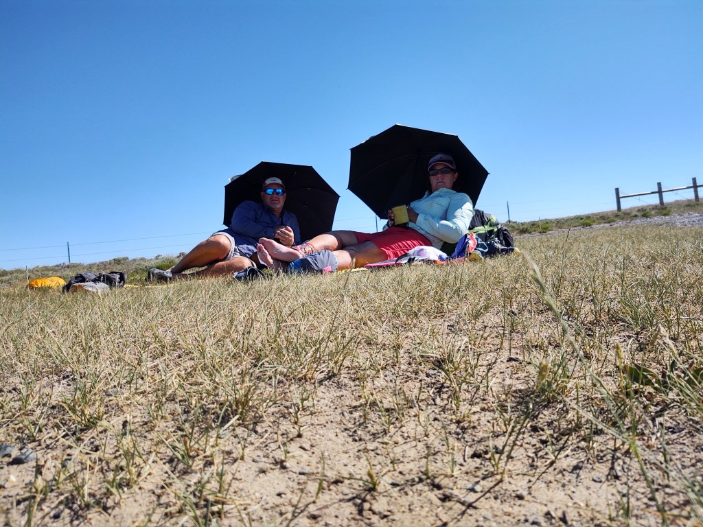
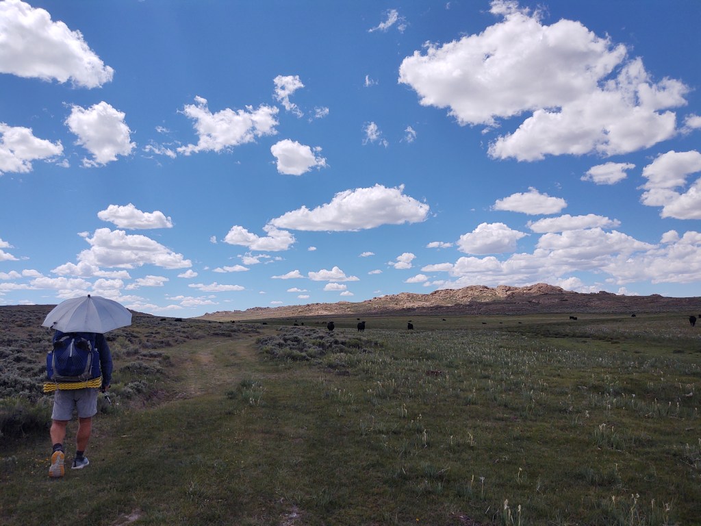
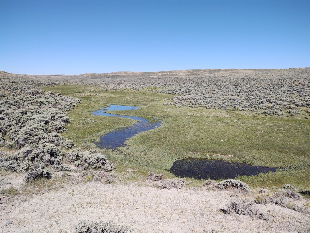
Umbrellas up way before our breakfast stop. We were amazed at the “wealth” of available water there was in this section of The Great Basin.
Springs and rivelets filling clear pools of crisp cool water made for swaths of greenery in a bland pallet of scenery.
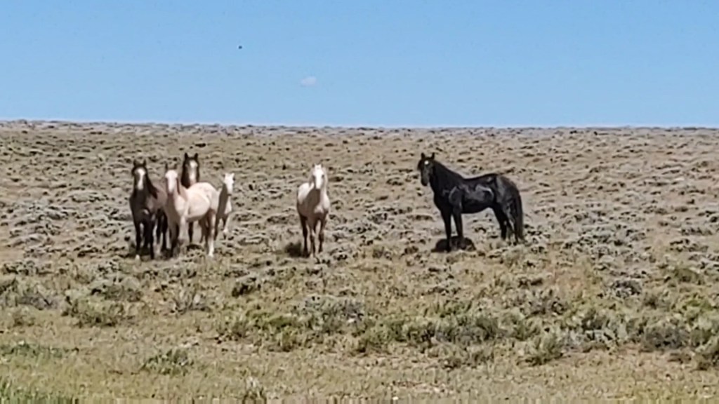
They came within 25yds of us
Gangs of wild horses flourish here in The Basin. They found our umbrellas curious and would come closer to us than we expected. It was a little disconcerting, but amazing as well.
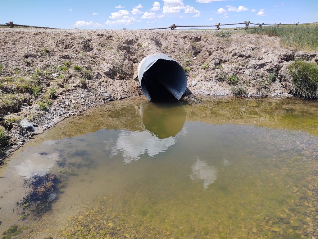
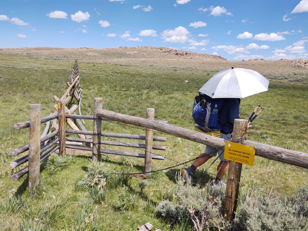
Entrance to Weasel Springs
If you don’t pay attention, you’ll pass this one even if your en route to it. If there is a sign that says “No Camping within this fence”…and a wooden chicane, investigate further.
If I didn’t have 20-15 vision I would have been hard pressed to see the short, squat, silver cistern nestled within a tan rock outcropping. Up to this point the day had been a long hot, monotonous haul. We were blessed with relatively flat tread, a few ups and a gentle breeze that allowed us to use our umbrellas.
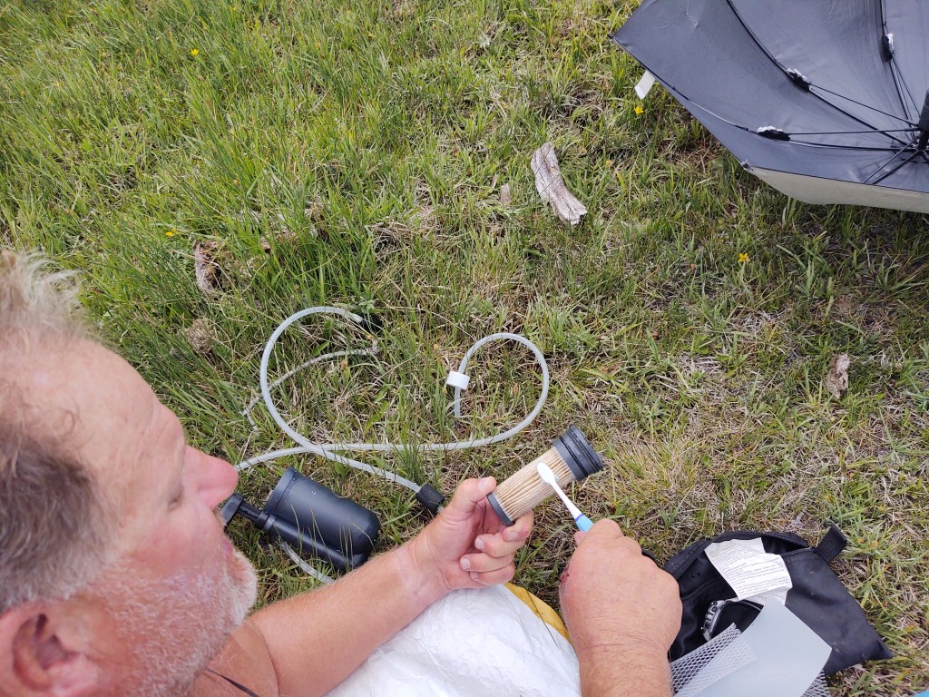
With already “enough” water to make it to Weasel Springs we passed more than a few clear spring fed ponds and gently flowing “creeks” to camel up and eat our lunch here. We walked down the narrow green meadow and dropped our packs on the large rocks. Opened the lid of the cistern and found a thin sheen of bugs floating on the surface nearly a foot below the top edge. No worries, we have a Katadyn Hiker Pro pump. We’ll get the water below the bugs. Paul lowered the nozzle into the drink and began to pump with great difficulty. Shit, our pump is clogged… probably with cow shit from the cow pond water. Normal attempts via the directions to unclog it failed…too much shit (literally).
To clean the filter required a sacrifice… Paul’s toothbrush. He was able to “clean” it off enough to collect several liters of the icy clear spring water. It’s a safe bet that we will be ordering another replacement filter as we continue on.
Yup. That’s Paul’s toothbrush
Here we spread our tyvex and enjoyed cold water, lunch and a bit of a siesta before pushing on.
Glorious Spring Water
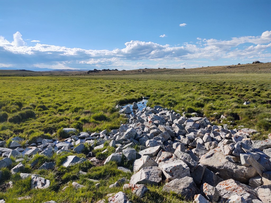
Our next stop, would be Upper Mormon Spring, for water and the evening camp spot. Now that was truly and “Easter egg” hunt. Directions on Guthook were vague.
Mormon Spring…a pile of rocks in the middle of a meadow
But after “grass cup” walking, we located the spring and then set up camp. We still had a few miles in us, but we were in an oasis, surrounded by wild horses, docile cattle and super chickens (sage grouse). Who could ask for more? An amazing sunset? We’ll, we had that too.
Like it or not today was going to be at least 19 miles. We got up with the sunrise, packed up and headed on our way. Breakfast would be “served” at the next water 3.4 miles away with a 800 ft elevation gain. We weren’t sure how we would feel having slogged through a torrential downpour and miles upon miles of “beach” sand the previous day. The air was crisp and the scenery was vast. This would be our first glimpse of actual trees!
Verizon LTE “Hot Spot”
At the apex of our climb we found that we had cell signal, strong enough to send an email, listen to voicemail and log into my InReach account to make some changes.
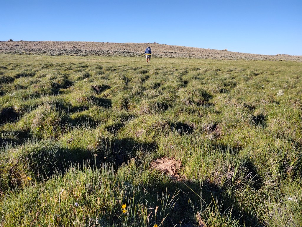
Today was all about water management. Camel up at each source. Carry enough to make it from each source. Take into account the fact that it was going to be a scorching clear day, seemingly void of any wind…a Wyoming first (for us). Water was a-plenty for the first 8 miles, and the tread, while mostly stair stepping up, was easy on the feet, legs and lungs (mostly). Having come from sea level, we still were not fully acclimated to the increasing elevation. In any event, we were feeling pretty good. The only thing we had to complain about was our new Sea to Summit pillows that just don’t take into account those “side sleepers” with broad shoulders. In the midst of our complaining, we neglected to negotiate an important turn just after a gate and continued straight down what we thought was the CDT for half a mile. By the grace of God, Paul happened to decide to recheck where the next water source was, only to discover that we were not only off trail, but going in the complete WRONG direction. Embarrassed, we turned around. It was then that we saw where we were supposed to be. For a brief moment, we considered bushwacking across the ravine that separated us from the actual trail. Remembering that “short cuts” aren’t always short, we about-faced and stomped back uphill to where we had gone wrong. We made our own little trail marker in hopes of saving other CDT hikers from making the same mistake.
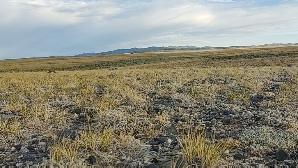
Once on the right path we wandered over hill and dale, still amazed at the vastness of this country. Most people would say that there is “nothing” to see, but I beg to differ.
Wide open spaces. Rich blue skies, accented with brilliant white clouds that take on a life of their own. Hidden springs oozing from the folds of rolling hills creating narrow blankets of rich greenery where wildlife, cattle and pioneers of not too long ago refresh themselves. Fresh, clean air that carries the scent of sage. An ecosystem that is “built” for and thrives in these very conditions. This is not to say it isn’t brutally monotonous walking, but the wonder and beauty are still there.
The trail took us from sagebrush plains and through a narrow pine pocked forested hillside, where we spied mule deer feeding. Down the trail led to a fenced off spring area that was little more than a cowy mud pit. Bummer, as this was supposed to be where we refilled our water. A quick check on Guthook showed two “ponds” a little further down the trail. Only problem is that we had to get through the throng of cattle milling about, and blocking our way. Paul employed his best cowboy impression (based on Westerns we’ve watched) to get the cows moooving. And then there was the bull.
He stared us down big time, and lowered his head. Shit. This is NOT going to end well, we thought. It was like Paul and the bull were playing “chicken”. Luckily, Paul won and the bull reluctantly turned and walked away. Most likely because his herrum (the bull’s) was walking away as a result of Paul’s, “Ya! Get a move on! Ya! Let’s go!”, and waving of his arms.
After herding the cattle out of our way, we took a side trip down to one of the two large ponds. Here we rested for our hour and filtered ice tea colored water, that looked sort of “clear”…once filtered.
Based on Guthook, our next water was another cow pond, or the CDTC water cache…12 miles. The water was best served with highly concentrated Crystal light lemonade, or other flavor additive, but it would have to do.
We climbed for the remainder of the afternoon and into the early evening.
Miraculously we had little to no wind, and were able to use our umbrellas to reduce the temperature to a “comfortable” 95°.
We “lunched” atop one of the high points on the trail where we got cell reception and watched a YouTube video of a group of gals (The Wander Women) who were about a week ahead of us on the CDT.
With feet slightly recovered, we marched on taking breaks as necessary in addition to our 4 mile routine. As daylight was turning to dusk, we walked past the cow ponds located a mile before the cache. We had 1.5 liters of water left between us. Do we stop here and get water…just in case? Or do we press on, and go for the cache? When thru-hiking it is never a good idea to rely on caches, but we figured we take a gamble. Our fall back plan was that if we got to the cache and it was empty, we’d spend the night there, use our 1.5 liters for dinner, and in the morning slack pack back to the pond and collect water. At least we had a plan.
Even before we approached the cache, fervent prayers were being uttered.
As we weaved through the chacain into the fenced off cache, we paused before opening the box. “Please Lord, let there be water here”, was the final prayer.
Prayers answered and successful gamble. Fresh. Clear. Tasteless water!