

We have finally reached the fabled and much anticipated 100-mile Wilderness. What we came to find out is that the anticipation and angst were unnecessary, and the fables are purely hype. Now, this may be because of where we started, and a true SOBO and NOBOs opinion may differ, but we were significantly underwhelmed. It wasn’t Narnia, as we expected. However, it did have its memorable moments, as does any adventure. Some of which were our best moments on trail to date.
Day 71: (Sept 9) 10.4 mi (2082.7-2093.1)
We hitched out of town early, as we were anxious to get back on trail and didn’t feel like waiting around for people to rally from Shaw’s for the shuttle back to trail. Our hitch involved a pickup truck with a 12 pack of “Natty Ice” seated squarely on the center console. It was 7 am, the hitch was only a couple miles, and he seemed fairly sober.
It felt good to be back on trail. We were anxious to see what the 100-mile Wilderness was all about.
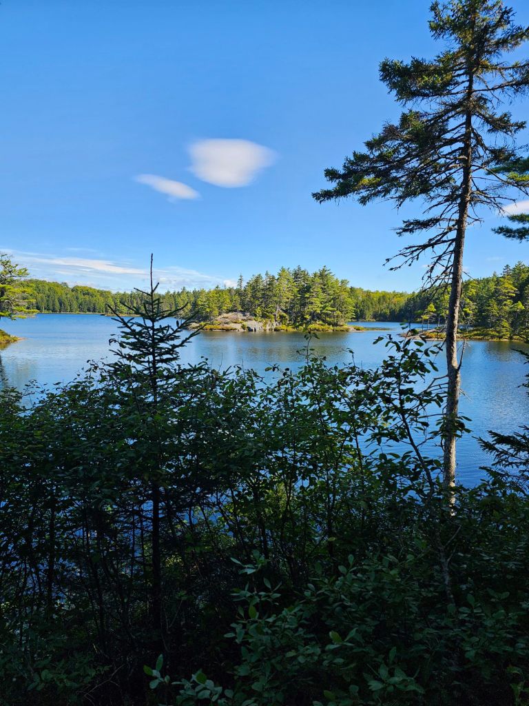
We passed by picturesque ponds, hoping that we’d see a moose swimming. 3.5 miles into our hike, Sweat Potato passed us. “Well. Well. Well”, was his standard greeting for us.
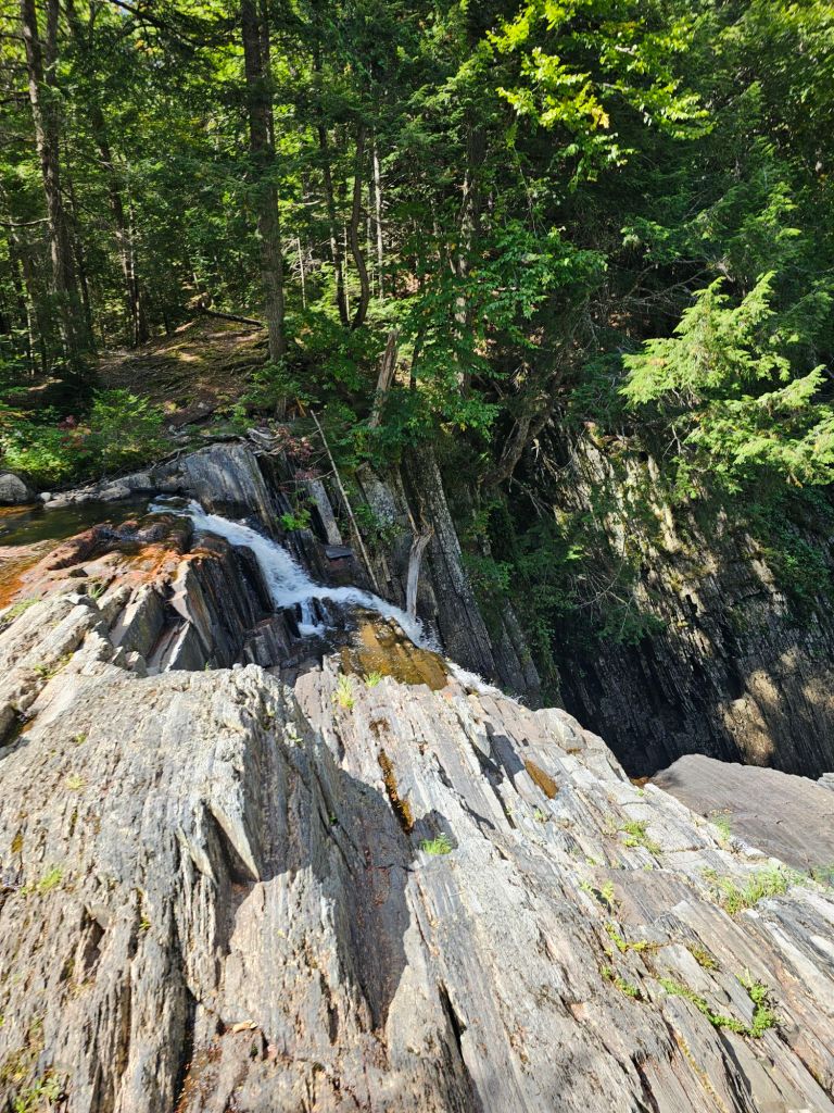
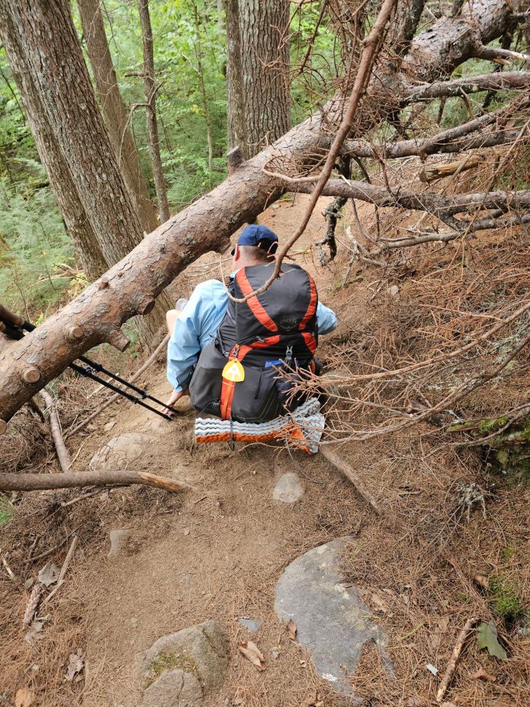
We saw him again at mile 5, where the “tallest falls” on the AT are located and lunched there. Potato had told usbhe was going to take all the “blue blaze” options (mostly waterfall excursions) in the 100-mile Wilderness and was excited about them. He’d see us at Baxter State Park and summit with us. Onward, he went. We continued for another couple miles, where we clearly walked past a sharp turn to our left and descended a well-worn and arduous trail until we realized we were significantly off trail.
This “blue blaze” took most of our thunder and after having to do a thigh deep river crossing and clamoring across the tracks of a wrong rail line, we called it, at the Wilson Valley Lean-to.
Day 72: (Sept 10) 11.4 mi (2093.1-2104.5)
Up with sunrise and back to climbing. We were afforded views for our efforts, but we really didn’t know what we were looking at. We couldn’t tell Katahdin from White Gap Mtn…at this point being West Coasters.
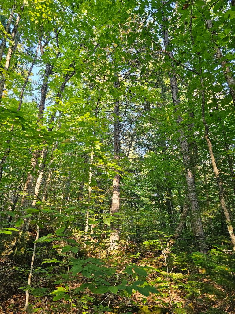
We have been increasingly confused about the meaning of a designated Wilderness is out here, as we have found this 100-mile Wilderness to be quite noisy with man-made sounds…railroad, logging trucks, planes overhead. (Heck, we even passed by the debris of an old plane wreck.)

We are somewhat bewildered, and yet are looking forward to that eventual “wow factor” that we’ve been promised. Not sure if the “wow” is supposed to be the massive roots we have to weave through or the downed tree across the trail with all the branches cut off.

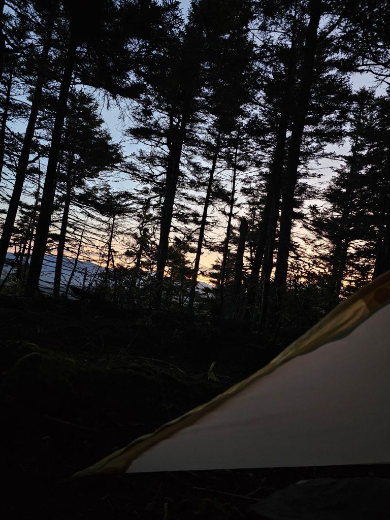
Maybe the morning’s sunrise from our makeshift campsite tomorrow, on the mountain top, will be our “wow factor”.

In any event, we have been moving faster than we expected and were able to move our first resupply bucket up a day, which may set us up for a one day earlier summit of Katahdin.
Day 73: (Sept 11) 11 mi (2104.5-2115.5)
*I know 11 miles on Sept 11th. It seems kind of planned. Nope, it’s just how it ended up. Our pace lately has been 1-1.5mph depending on the type of up/down.
Up with the sunrise. A cold wind blew all night long. Fall is coming. This was the first time we slept with all our cold weather gear. Dressed in layers we set out.
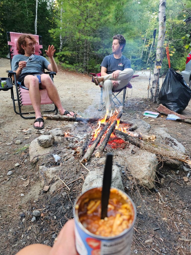
We have noticed that our water filter is on its last legs. The tannins in the water have been reaking havoc on our filter, but it’s still working for us, and we expect it will last all the way to Katahdin. Our last water below the Chairback Lean-to tasted like pennies. It had a significantly high iron content. We probably need it anyways. On the way down to our rendezvous with our resupply at the Katadin Ironworks rd (KI), we ran into “Kiwi”. She had somehow injured her leg/knee and was working her way to KI road where the kind people from Shaw’s would pick her up at 3:45…the same time as our resupply. Wow, had we not called for a day earlier drop, she might have had to wait to be picked up till the next day. Needless to say, things happen for a reason. As we all waited at the KI rd, we shared a bit of laughter and stories with Kiwi and her hiking partner, “Just Angela,” who so far has been equally underwhelmed by100-mile Wilderness. In some ways, I think they were happy to be getting off trail. They both had flights for October 1st, and thought they’d rent a car and actually see some sights. As they were getting off trail, we were the happy recipient of their “left overs”, as we’ve been hungry since starting this 100-mile Wilderness.

Once resupplied, we marched our way 3 miles to the Gulf Hagas (The Grand Canyon of Maine) and Hermatige Preserve, Croc hopped across the Gulf Hagas Brook and camped just outside the Preserve. Now, this place was pretty neat, in that it was significant. The Gulf Hagas is a deep slate Gorge, nearly 500ft deep, where loggers used to toss cut trees for transport to lakes (ponds) for collection to the mills. And, in the Hermatige Preserve, in this specific forest, the trees were coveted and sought after for their girth, length (up to 120′ tall), and their straightness as mast for tall ships through the 1600-1800’s. These masts had to support sails that weighed over 4,000 lbs and took the strength of 20 men to hoist the mainsail. This particular preserve has not been logged for going on 200 years. We couldn’t help but admire those surviving would be masts.
Day 74: (Sept 12) 14 mi (2115.6-2129.6)
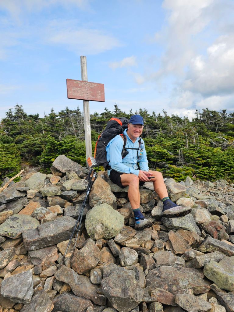
Today was nothing but climbs. The good thing is that they were steady and mostly had stone steps. First up, Gulf Hagas Mtn (2683′), followed by West Peak (3181′), Hay Mtn (3244′) and finally White Cap Mtn (3644′) where we had cell coverage AND a view!


So, a total of 3425′ ascended and 3622′ descended for the day. We’ve done more on the CDT. We had the opportunity to set up for a 3pm resupply pick up the next day, but we’re not confident we could make it by 3pm, as after White Cap Mtn, there was a 3 mile descent, and we weren’t confident of terrain and/or how my knees would respond. We should have just made the commitment to 3 pm. We ended our day at the East Branch Lean-to, where tent sites were somewhat wanting… a bit uneven and rooty.
Day 75: (Sept 13 – Friday) 11.8 mi (2129.6-2141.4) Jo Mary rd.
This was THE BEST HIKING DAY EVER!!!
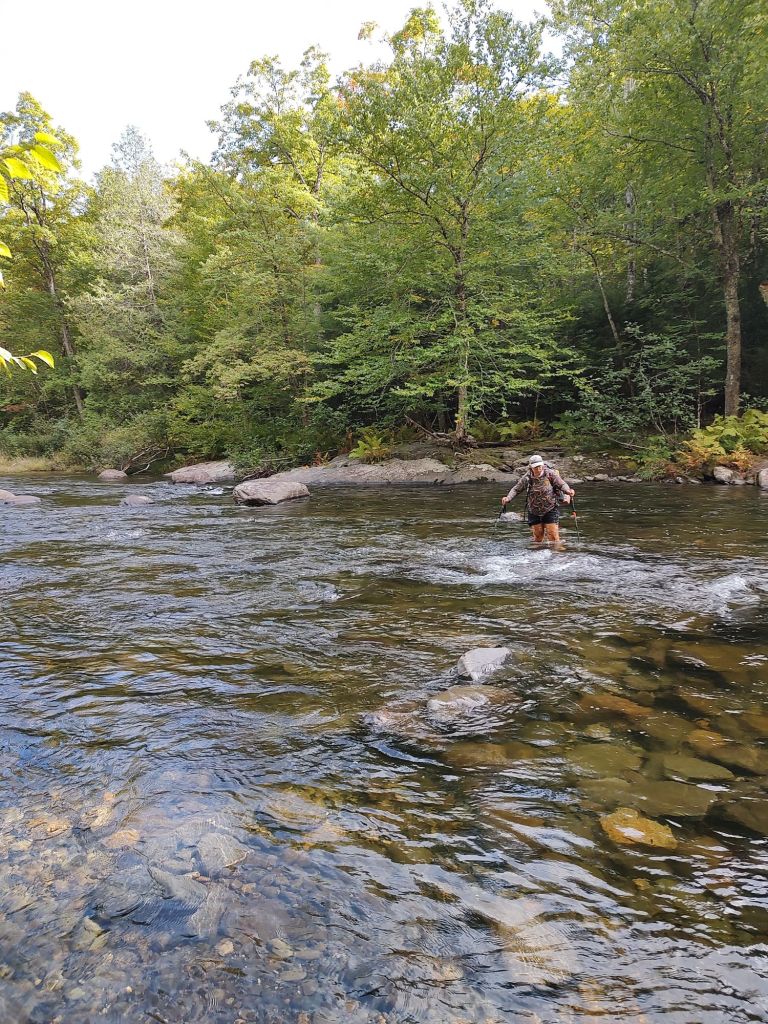
We slept in thinking that we’d lolligag about, swim in a lake and meander to Jo Mary rd for our resupply for the following day at 11am. An hour into our hike, we realized that we could make the 3pm resupply, today. With our Delorme, we messaged Shaw’s asking if they could add our bucket to this afternoon’s resupply. Unfortunately, their driver had already left, so back to plan A. I finally get to swim. Then, at 10:15 am, we get a text. “We can do 3pm”. Aw man. I was looking forward to that swim. To ensure someone is there for the resupply bucket, Paul grabs the rest of my water and hands me the Delorme and the water filter. His plan is to high tail it as fast as he can to Jo Mary rd, 8 miles away. I will get there as fast as I can, as we have no idea what the tread will be like. Again, no swimming. Argh!

Turns out, the tread was aminable to our quest. Paul actually made it to Jo Mary rd by 1:40pm. I picked up my pace a bit, as the tread continued to be “easy.” Just past Cooper Pond, where I was to swim, and while sitting on a plank over a creek filtering water, who should appear, but Sweat Potato. “Well. We’ll. Well”, was his greeting. Frankly, I was surprised he was even behind us. He looked haggard, and was slowly headed to Jo Mary Rd to also collect a resupply bucket. Collosus, had gone ahead (like Paul) to ensure that someone was there to collect their bucket. Apparently, his allergies were getting the best of him. He didn’t get to sleep until 2 am. when it started to rain. As Tylenol was his only cure, he asked if I had some. I didn’t, but I assured him that Paul did. However, he would be at Jo Mary Rd. This assurance of more Tylenol enabled him to take what he had left. With that, we walked and talked down the trail at pace that surprised Sweat Potato. Somehow, we walked fast enough to catch up to Collosus, who we found taking a brief break. By our calculations, we had time to spare and continued our walk and talk all the way to Jo Mary Rd. Miraculously, we arrived by 2:15.

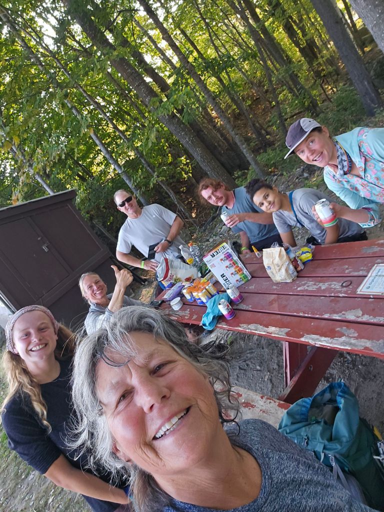
But, even better, we arrived to dueling trail magic! One of the thru-hiker’s parents had set up on the road with drinks (assorted beer and soda), candy, and other assorted snacks.

The other trail magic was on the other side of the bridge with assorted beverages (beer and soda), hot dogs, chili, and fruit. What?!? We toggled between the two sites as we waited for our bucket to arrive. Paul was flabbergasted that not only I but the other two arrived with me. It was a joyous reunion.


Once our resupply arrived, we decided to camp nearby, rather than march on for more miles. Paul had run most of the 8 miles to the road. He deserved extra rest, and a breakfast of eggs, bacon and hash browns were going to be served in the morning by the trail angel, “Peaches”.
With regard to how our bucket suddenly came to be in the 3pm drop off, we asked Shaw’s driver. He told us that he has a specific route when he has drop-offs at KI and then Jo Mary rd. After arriving at KI rd, he found his route to Jo Mary closed and then had to double back toward Shaw’s. When he called and told them what he had to do, they had him swing by Shaw’s and grab our bucket. Providence! Best Day Ever!!!
Day 76: (Sept 14) 15.2 mi (2141.4-2156.6) Nahmakanta Lake
We skipped the trail magic breakfast as we were still full from the night before. For once, the trail was relatively flat, which allowed us to move at well over 2mph. We took a break at Antlers Camp. Had we not had such amazing trail magic at Jo Mary Rd, we would have moved on and camped here. It had great sites and swimming opportunities. Our goal was Nahmamanta Lake, and based on our current pace, we could have a swim once there and time to dry off before the sun set.
Just past the Potaywadjo Spring Lean-to where we found Sweat Potato napping and an excellent nearby spring, we ran into Rolling Stone and Scout. They were on their SOBO sojourn from having summited Katahdin to Caratunk, where they will finish. We asked them about Katahdin and the miles ahead of us.

They told us about a couple of view opportunities of Katahdin from the lakeshore and collecting clams from the Nahmakanta Lake, but NOTHING about the last 3 miles to Nahmakanta Lake. Bastards.

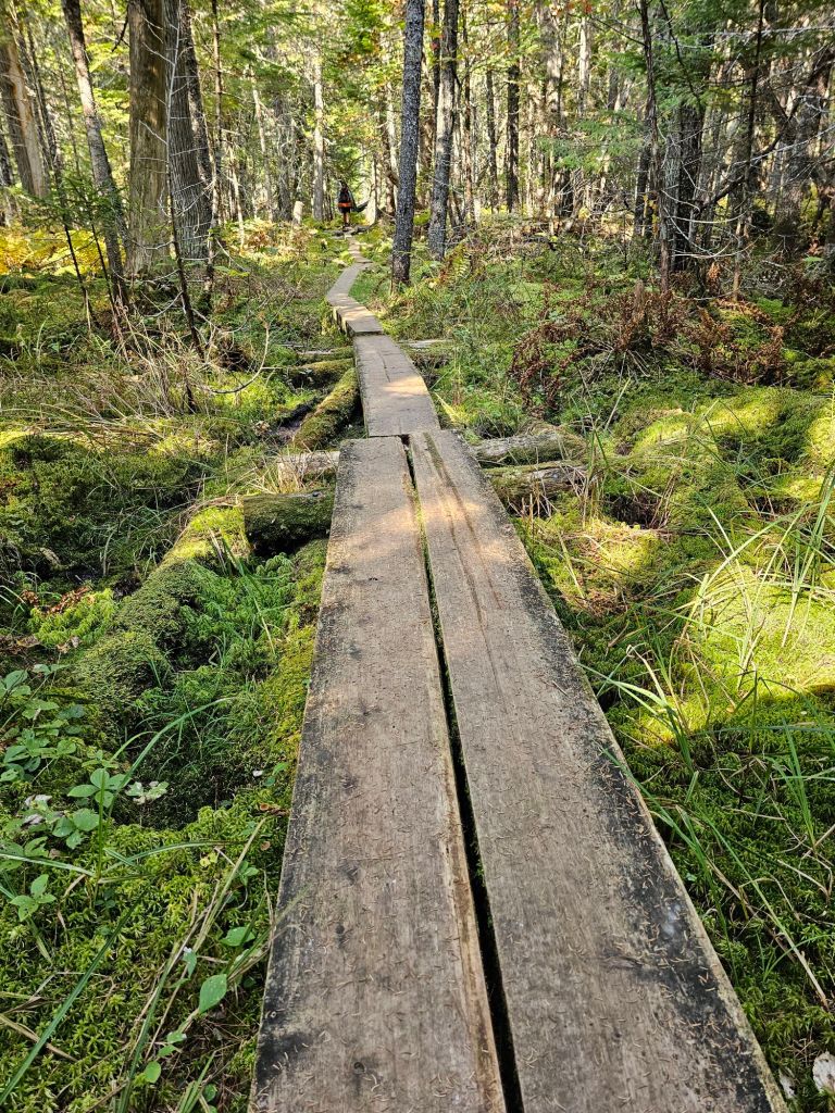
The trail toward Nahmakanta Lake followed the Nahmakanta river and just past the Namakanta Lean-to, and for the next 3 miles left to Nahmakanta Lake, the tread changed. I mean radically! It was like the AT decided to step it up a notch with their trail maintenance and formation. It was a “Wow” moment, that’s for sure. It was as if the roots suddenly were on steroids. The roots covered all portions of the trail and surroundings like Medusa’s hair. A tangled web of torture. Our 3 mph dropped immediately to .5mph. The only way to work through it was cacophony of profanity and nonsense songs on Spotify. As a bonus, just before reaching the lake, they threw in a unavoidable seep of brackish mud. Dry shoes no more.
Just before exiting this gauntlet of disappointment, I turned and saw a sign oriented for SOBO, “The Great Circle Trail.” It was everything I could do NOT to get out my Sharpie and write in Jerk between Circle and Trail. Once at the Lake, we were hard pressed to find a proper place to camp, as most everywhere was occupied by earlier arriving NOBOS. We were, however, happy that all the beach sites were taken as the black flies were ferocious.
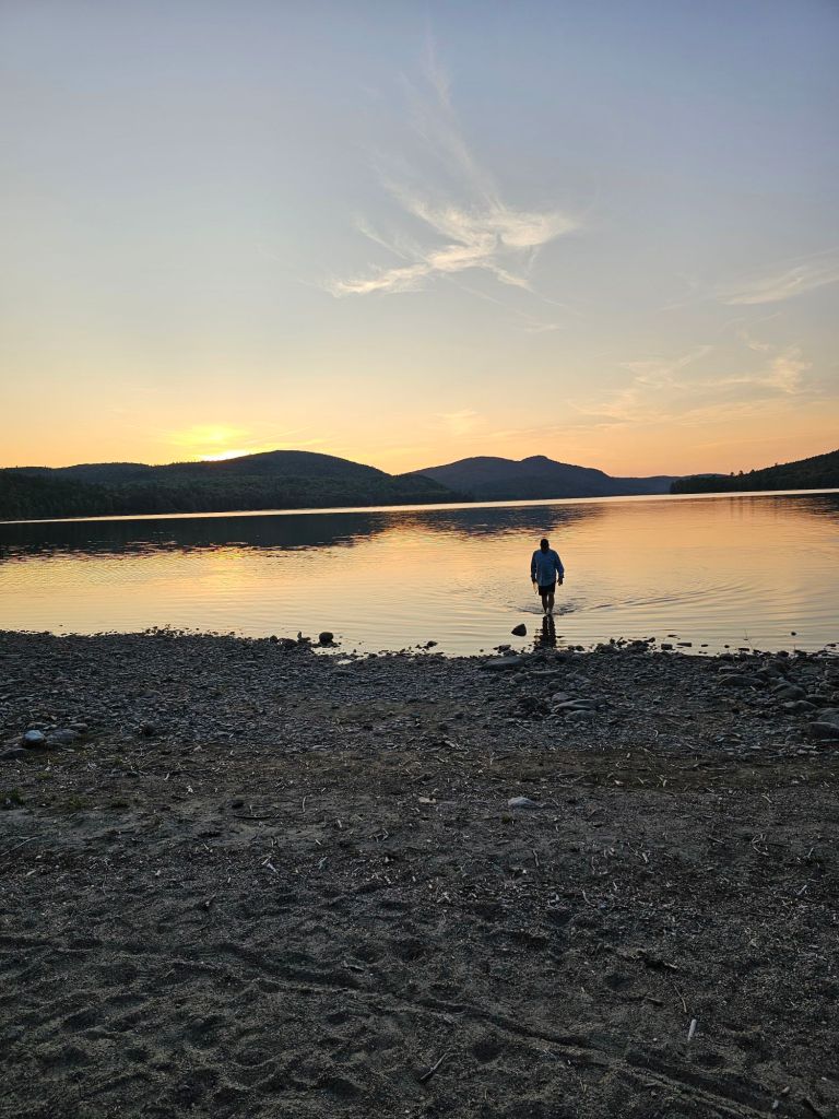
We did get an awesome sunset, and we were another day closer to summiting Katahdin. And, we’ve finally had a “Wow” moment in the 100-mile Wilderness. Not the enduring “wow” we expected, but a “wow” we certainly won’t forget anytime soon.
Day 77: (Sept 15) 14.5 mi (2156.6-2171.1) Rainbow Springs C/S.
Today was nothing like yesterday, but we were still on guard, as we were traveling so well. Moving with ease, we made it to the Rainbow Spring Lake campsite by 4 pm. Draining into the lake is icy cool Spring water via narrow pipe.
Even so, we had to filter it as the spring was a large open pool, not 10 feet from the lake. Sweat Potato arrived just after us, having probably napped somewhere and camped nearby us. Here, we met “Just Jim” a retired Army Lt. Col. The three of us would travel together the remainder of the 100-mile Wilderness.
Our site had an open sky above us, so as there was no rain in the near forecast, we slept without our rain fly. I’m thinking that maybe it would have muffled the constant noise of the lake and forest. Between the dueling loon calls, the Moose charging through our camp, and other nocturnal animals on Crack, it was a wonder we got any rest. This has got to be the loudest Wilderness we’ve ever been in. Day and night. Tomorrow morning. Abol Bridge!
Day 78: (Sept 16) 11.3 mi (2171.1-2182.4)
We strolled to Abol Bridge, with the last miles of the 100-mile Wilderness fairly pleasant, but certainly not flat. We’ve been waiting and searching in earnest for the 17 miles of “flat” we were promised. We were beginning to think we’ve had our leg pulled.

At the Rainbow Ledges we get a view of Katahdin and with just enough cell service, we make our reservation with the AT Outfitters Hostel for a ride from Abol Camp (in Baxter SP) for the afternoon of the 18th to the hostel in Milinocket.


When we stroll up to the Abol Market, we are a little surprised. We are continually finding that what we expect and what we see are widely different. Several other hikers are “rafted up” at the picnic table outside the store. Beer, chips, sandwiches, whoopie pies are splayed on the table. Ranger Donald Duck is briefing everyone on how tomorrow morning’s campsite “lottery” will go. How early we can line up, and also to assure us that he will find us a place to camp for summiting.
More hikers arrive and talk turns to how lucky we’ve been with the weather, and all the lies we have been told along the way, like how “easy” it will be after (insert mountain range or forest). Another hiker arrives he looks very familiar. It’s “2fer”. We met him the first year we started our shuttle service in 2022. He is now about to finish his triple crown! He thought it was incredibly fitting that we would be there for the start and now finish of his triple crown.
In order to get a good night sleep, Just Jim secured a cabin that sleeps 6. This also includes the opportunity for a shower and to charge electronics. At his invite, we and Sweat Potato joined him and split the difference. Score! We ready ourselves for an early morning wake up to get in line and secure a campsite at Baxter for the day prior to our summiting of Katahdin. What we didn’t realize is that each of the bunks metal slats would creak loudly at the slightest movement. Not good for a group of tossers and turners. We all laughed at the ridiculousness and the irony of our predicament and slept as best we could.
Day 79: (Sept 17) 5 mi
We get up at 5 am. to get to the Abol Bridge to set ourselves up for the cue for a camp spot in Baxter. There’s a giant “bubble” of hikers just behind us, and we aren’t sure if they’ve picked up the pace. We’ve heard tale of missing out on the 12 spots available at the Birches. We didn’t want to have to walk 5 miles from the bridge (the border of Baxter State Park) to the Hunt Trail in the dark in order to summit Katahdin.

We sit on the bridge in quiet anticipation, swatting at mosquitoes and watching the sunrise. Ranger Don won’t arrive till 7 am, and we are the only 4 in “line.” Around 6 am the group of youngsters ( all 20 somethings) from yesterday afternoon’s picnic table gathering march by us single file. They are on their way to summit, and aren’t worried about the “extra” 5 miles. We preemptively congratulate them on their summit and completion of the AT and wish them well as they pass with wide toothy smiles. 7 am rolls around and we are still the only ones in the cue. So much for that strategy. Instead of the Birches, we discover they have a campsite available at Katahdin Spring. It will save about a mile of morning walking.

With a spot secured for the night, we march back to the cabin to collect our gear and grab a few more things from the store to tide us over till Milinocket.

What a great trip. Thanks so much for sharing
More to come!
Near the end. You two were cranking out the miles. Incredible lifestyle!
Lee
Still cranking. Trail legs have arrived…finally!