
This week finds us with a bit of recovery and then back into the grind (up/down hill), but with actual rewards for our efforts…VIEWS!!! Thank you, Maine, for not being just hard.
Day 53: (Aug 22) 8 mi
One thing we learned hiking the CDT (Continental Divide Trail) is that the “redline” is not often the best and/or only acceptable line of travel. You’re still walking to your goal, but in a more exploratory and often adventurous fashion. After our good night’s sleep and perusal of our available maps, we opted to venture out on our own and create our own route to Grafton Notch. This would add quite a few miles as opposed to the “redline,” but we needed some “mindless” walking and some actual, sustained, direct sunshine. We are both used to regular sun exposure. It helps with mood and motivation. And while the green tunnel keeps you cooler, for us, it gets depressing. My knees also needed a downhill break.

Our route took us along forested areas with wide open views of the hills (mountains) we had come from and would be headed, later on. Wild blackberries and raspberries often flanked us on both sides. We had a moose encounter with a young moose who came shockingly within 40 ft of us as we stood as motionless as possible so as to not spook it and keep it from charging us. At one point, it looked like it was about to pin its ears back, and we thought, Well, this is about to get interesting. And then, it turned, shook its head and trotted down the forest service road. Phew! (I was able to capture the whole encounter on video, but it will only upload to Instagram, 2moremilesadventures)
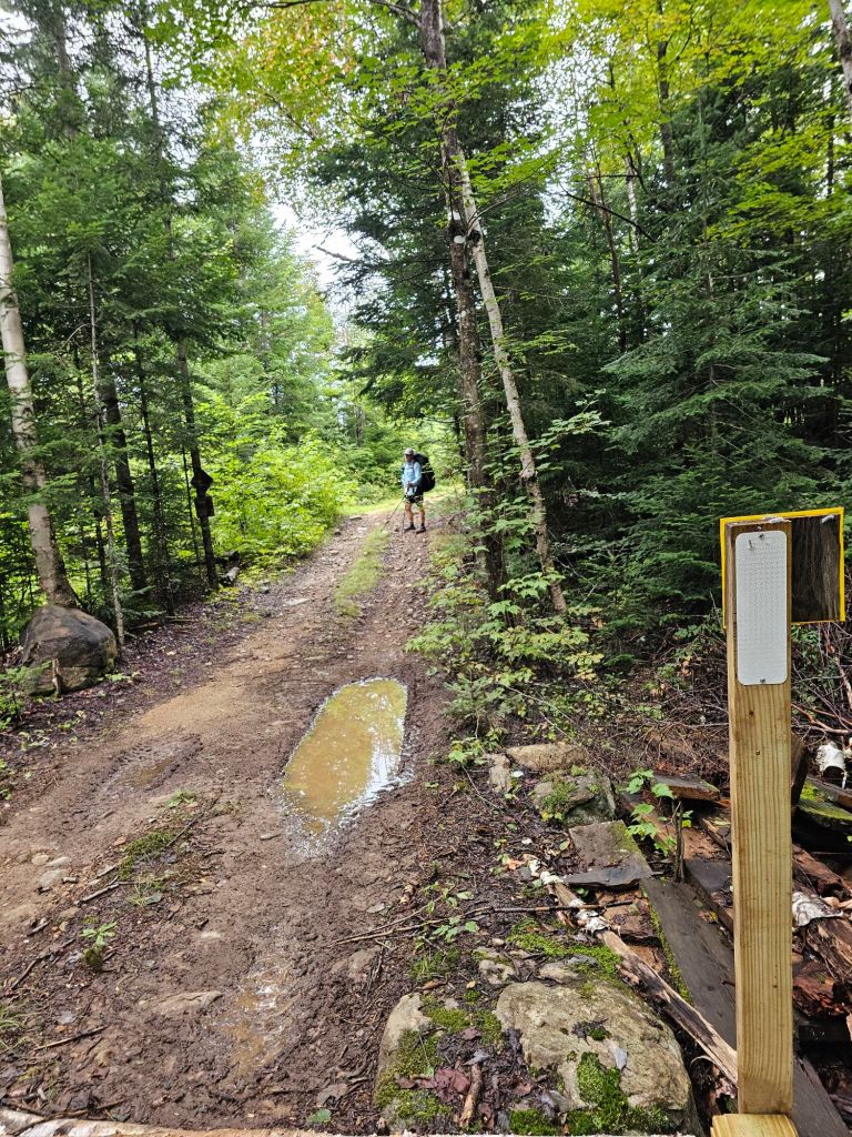
Our route then became a “white blazed” ATV trail with a bridge that led to an active logging area. Apparently, this route had been posted closed on one end, but not on ours. Otherwise, we would have taken the redline. No matter, as we’d only have to watch for an occasional vehicle (and giant tree-slayer…only name I can think to call this massive and amazing machine…that replaces saw welding lumberjacks), and they had all been alerted to our presence. Our route dumped us out at the Grafton Notch State Park, where we continued on foot to the parking area down the highway. In total, our ByPass and alternate added 8 miles. A small price to pay for the views and moose encounter.
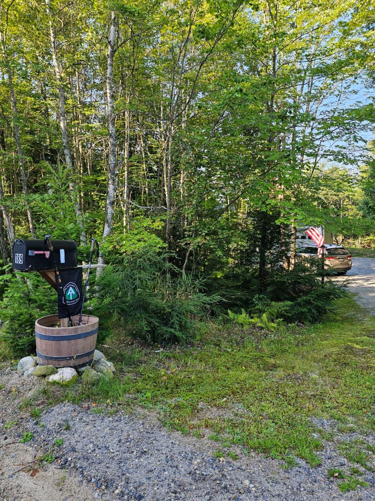
Once at the Grafton Notch, it took us a matter of 3 minutes to get a hitch into Bethel, Maine. A nice couple on the way to visit her mother gave us a lift and took us not only to the outfitters, but gave us great Intel on the layout and history ( land granted to settlers who fought to “conquer ” Canada in 1690’s) of our destination of Bethel, as they drove us toward town. One thing they have is roadside “stands” selling produce, or even baked goods! No one is tending the stand, so any purchases are via honor system for the items you take…cash or venmo. We stopped at a pie stand and purchased fresh maple moonpie cookies. At the outfitters we were able to find everything we needed (new socks, pack covers, mountainhouse, a new filter cartridge – #3 so far), to include “Franken Pole” parts to fix my broken trekking pole. After a quick tour of town and lodging options, they dropped us at what has been the best burger joint so far this thru-hike. Butcher Burger. While there, we ran into two other hikers we have been leap frogging with, Long Island and Cheddar. They were staying at The Knoll Hostel, and the owners had lent them their car to run errands. The Knoll was full for the night, so we booked with them for a Zero for our next day. For the night, we ended up in a classic New England bed and breakfast (who regularly accepts AT thru-hikers), The Holidae House B&B. Great room (with an actual bathtub) and fabulous breakfast. It was centrally located in this very walkable 4-season town next to the post office and grocery store.
Day 54: (Aug 23) ZERO miles (well, maybe 2)
After a great night sleep and a tasty breakfast, we sauntered down to the thrift/consignment store in search of long johns, quicker drying shorts, and a sleep shirt. We found all three for a steal and mailed some stuff home, all before check out and our pickup by “Doogie” from The Knoll Hostel.
The Knoll Hostel is run by a couple (Doogie and Home Spun) who have opened up their home for the hiking season to 6 lucky hikers a day, 7 if theres a couple who will share the double bed. It’s a full-service hostel that includes, rides to and from Grafton Notch, laundry, shower, and a family style dinner for $75/pp. They have converted their “finished” basement into a dormitory of sorts. It’s a great vibe and total relaxation. They even lent us their car to run our town chores. While shopping for resupply, we ran into our “crew”.

Day 55: (Aug 24) 10.3 mi (1829.9 – 1940.2)
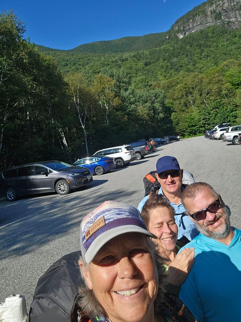
Doogie and Home Spun dropped us at the Grafton Notch, where we would know head into (and over) what is called the Baldpates.
Warm air and clear skies made for fairly pleasant hiking, even though we had plenty of climbing to do from the Grafton Notch. 2167 feet to be exact. Notches on the East Coast are equivalent to saddles or passes for us in the West.
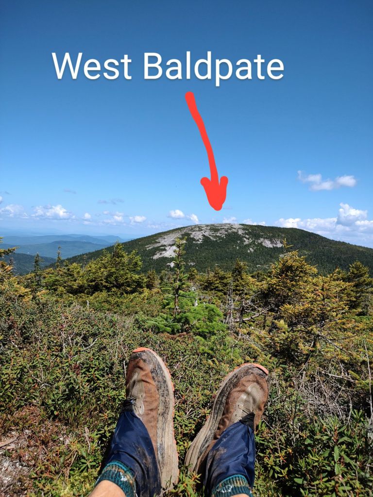
First up, the West Baldpate at 3662 ft. Before our final ascent of the West Baldpate, we sat atop a Knoll and watched as other hikers walked often in zigzag fashion up and over a steep exposed granite face, hence Baldpate (a bald mountain).
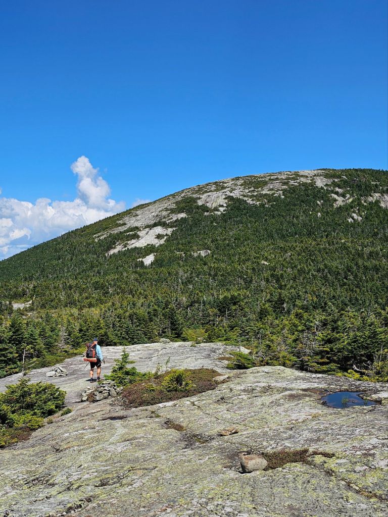

Of course, between and after the West and then East Baldpate (3790 ft), there were steep descents that often included ladders. However, our late start for the day made for very short breaks during our grueling descent from the East Baldpate to our camp spot for the night.

Sadly, we passed awesome places that had it been earlier in the day we would have stopped for a swim.
Day 56: (Aug 25) 10.1 mi (1840.2 – 1850.3)
We awake knowing we have a mandatory morning climb up to Blue Mountain that is replete with false summit after false summit.

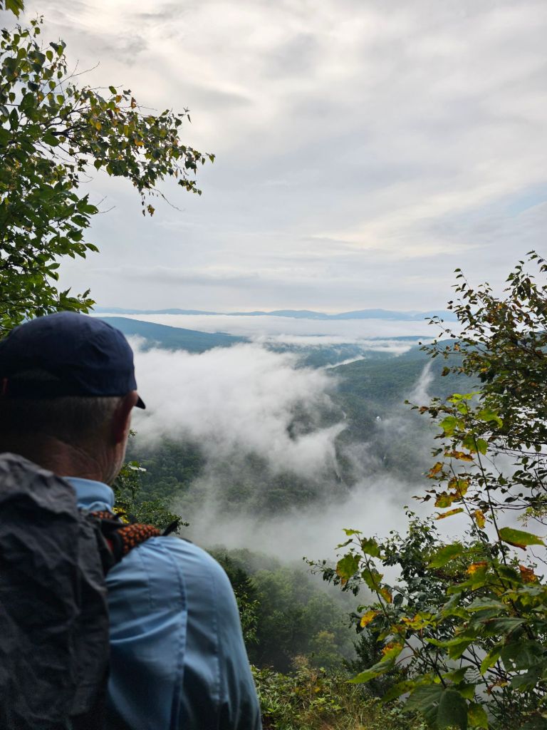
Rain is on the forecast for the day, so the clouds are moving in and out behind us, creating unique views and oddly a plethora of iconic smells along the way. Something about the temperature, moisture, and varied vegetation released smells of waffles, “Christmas,” and incense.
We make our way to the first shelter (Hall Mountain Lean-to) after finally reaching the top of Wyman Mountain, and the “gang” (Popeye, Rolling Stone, Scout) is all there for lunch. Rolling Stone and Scout are slack packing this stretch and are worried about an incoming rain storm, so they want to move fast and light and may sit out tomorrow if it rains. We, on the other hand, have rain gear and aren’t afraid to use it.
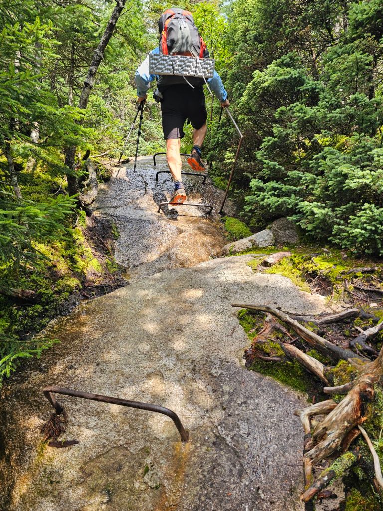
Lunch is followed by a 1000 ft steep descent and a wicked, and unforgiving 1300 ft climb (iron rungs tapped into rock, and sketchy root rock scrambles) for 1.4 miles to Moody Mountain.

As we crawl our way to the top, knowing full well that there most likely will be an equally treacheous descent whilst racing against an impending rain, we come upon two volunteers who are working their way down the trail updating the white blazes. Paul strikes up a conversation with them, and they chuckle about the gauntlet of a climb while I teater on the edge of lightly flowing rockface “waterfall.” Fully exhausted, and past the point of tears, we take a break at the top of the mountain and prepare for our descent as rolling thunder bellows and a light rain begins to fall. Luckily the descent is somewhat graded and easier than we had anticipated.
We camped just before the Black Brook river crossing near Popeye and took a quick peak at tomorrow’s thigh deep river crossing. We decide we will do it in our Crocs. Once we return to our tent and settle in, rain begins to pummel our thin rooftop of sylon. It rains steadily till early morning.
Day 57: (Aug 26) 12.7 mi (1850.3 – 1862.7)
We wondered whether the constant rain would affect the river depth, but it was as placid as ever. While there were rocks in which to “rock hop”, and avoid getting our feet/shoes wet, we decided it was less stressful just to walk across in our Crocs and hope it didn’t get more than thigh deep.
Once across the Brook, we began our near constant climb. We are beginning to notice a morning trend that includes climbing.
It took us 3 hours to finally reach the “official ” summit of Old Blue Mountain. We had been warned about it’s many false summits, and they were correct. We had our best views while climbing, as all we saw at the top was a nice rock upon which to lunch.
When we got to the Bemis Spring Trail junction, we decided to explore this option of descent. The descent was kushy, in that it wasn’t fully rocks and roots, but pleasant forested tread of actual dirt.

It took us through a “young” forest that looked like it had been harvested 10 years ago and weaved its way through a narrow boggy area that required careful foot placement until even that became futile. We laughed in acknowledgment that often we pay a “price” for our alternate routes, or in this case, a marked blue blaze. We ended the day back on the Appalachian Trail, one mile from Hwy 17, having walked 2 miles more than the red route.
Day 58: (Aug 27) 14 mi (1962.8 – 1976.8)
Today was a town day, so we made sure we were hiking by 7am. We passed several tents with people who had passed us earlier yesterday. Sometimes, they look at us oddly when they pass us later, like, “How did you get ahead of me?” We (meaning me) may not be fast, but we are steady and use the day’s available light.

A cold mist had settled on the highway as we climbed the mile up from the river valley below. Across the highway, we climbed a bit more through a softly forested area with stretches of muddy obstacle courses. Today, the trail would take us along the shore of a pond that frankly should be called a lake. If the air wasn’t so cool, we would have been tempted to take a swim. The rest of the day was uneventful, and when we got to Hwy 4, we hitched into Rangely and were dropped at the IGA grocery store where I ate a pint of Talenti, and Paul had a pack of salami and a coke. As we sat outside on the curb gorging ourselves and researching where to stay, the same guy who had given us a ride stopped by with a business card of the place for us to stay, and its price. “They have two rooms left. You better call right away,” he told us. Awesome. We called the Town & Lake Motel. They had one room left. Perfect! Now to walk there. On the way, we hit Sarge’s for another round of food. We had one more important chore to complete. For the past 4 days, Paul has had a serious toothache, under a crown that was placed a year ago. Time to find a dentist. How hard can that be?

What a great trip so far! Good luck with the dentist! Tooth aches are NO FUN! Happy Hiking!
Love the photos this round of the blog. Good people, good food, beautiful forest. Moose encounter- bonus!
Lee