
DON’T DIE!!!
Our zero spent at the Barn Hostel proved very inciteful. Our next venture was to be the Wildcats, a treacherous mountain range full of boulder scrambles with steep descents. The incoming weather (tomorrow’s) was expected to be wet and stormy. Two of our hiking friends had just returned from doing the Wildcats and, in their words, “got lucky,” as “it was super sketchy.” Rolling Stone (just a little older than us) almost broke his wrist in a fall. Sweat Potato, who rock climbs for fun, fell once and luckily landed on his backpack and almost fell two other times. Both of which would have led to serious injury.
The Wildcats are hard enough as they are, but add wet and cold, and my lack of bouldering ability due to near paralyzing fear of heights (or rather abrupt descents), The Wildcats, at this time, will have to be a hard pass.
With that decision made, we set about to ready ourselves for the next phase of this physical gauntlet that is the Appalachian Trail. As we will pass on the 20.9 miles of The Wildcats, we will be treading via “old school” and pick up the AT via where it once roamed, the Mahoosac Trail (proper) right out of Gorham.
Many of our friends encouraged us to stay another night at The Barn due to the incoming thunderstorm , but The Barn was full, and it wasn’t like we were going into The Wildcats.
Idiots. Us, not them.
Day 50: (Aug 19) 9.5 mi to Dream Lake
Paul, from The Barn hostel dropped us off at the Mahoosuc Trailhead. He reminisced about when he hiked the AT in the mid 1970’s. He told us that the trail originally went through Gorham and continued right where we were getting back on trail. He told us that “they” rerouted the AT to make it more “remote” and challenging, because more than just thru-hikers are using the trail, and “they” didn’t want it going through towns…anymore.
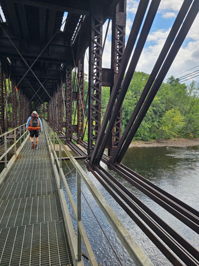
Our first gauntlet was to squeeze under the footpath bridge that spans the Androscoggin River with our packs on (training for the “Mahoosuc Notch” we joked.
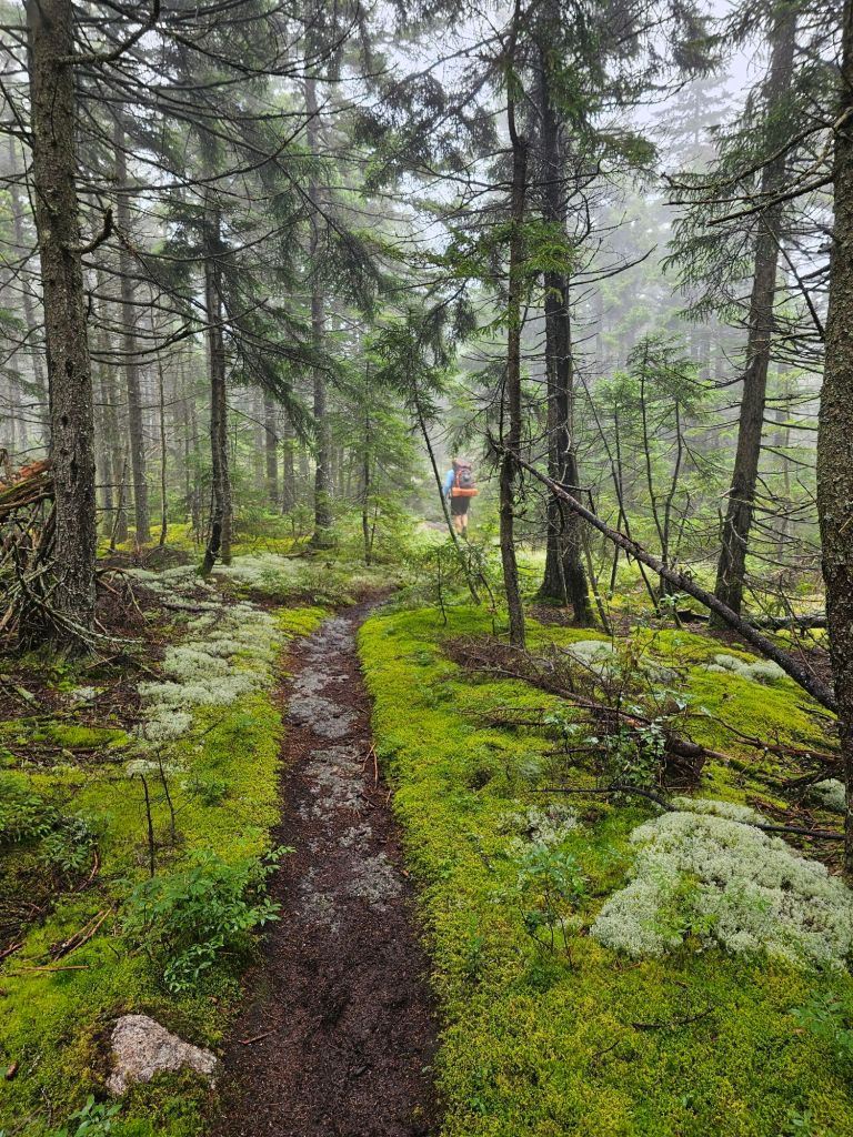
Then, we climbed up a steep but easy tread trail to Mount Hayes (2555 ft.). It was misty, but pleasant.

From an opening in the clouds, we could see The Wildcats in the near distance becoming engulfed in angry black clouds. From the looks of it, we made a good decision.
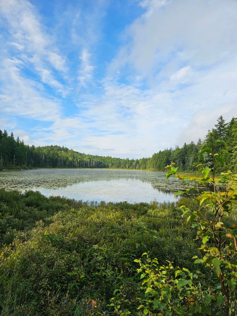


We hoofed our way over easily manageable boulder, root, and puddles all the way to Dream Lake and found a marginal place in which to set up our tent for the night. No doubt about it, rain was coming. This would be the first of many nights where my airmattress would slowly leak, to the point of uncomfortable contact with immovable roots and/or rocks. And, of course, at the height of the downpour, I needed to pee.
Day 51: (Aug 20) 8.4 mi (1908.5 – 1916.9)
It rained hard most of the night. But let up after 8 am, which allowed us to get going. We needed the extra sleep, as our last night at The Barn Hostel was anything but restful…for anyone staying there that night. A SOBO guy (Wallet) had the bed directly across from us and snored like a torture machine ALL NIGHT! Except for when he occasionally stopped breathing. The dude has some serious sleep apnea going on. It was so bad that even my Bose earpods on “quiet” couldn’t fully drown him out. Sadly, not one of the 10 of us upstairs had the cajones to wake him up. Maybe we each thought, surely he’ll roll over, or stop. Even Sweat Potato downstairs could hear the man. Lesson learned. Not gonna be polite if it happens again.
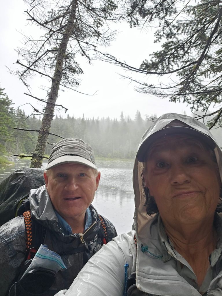
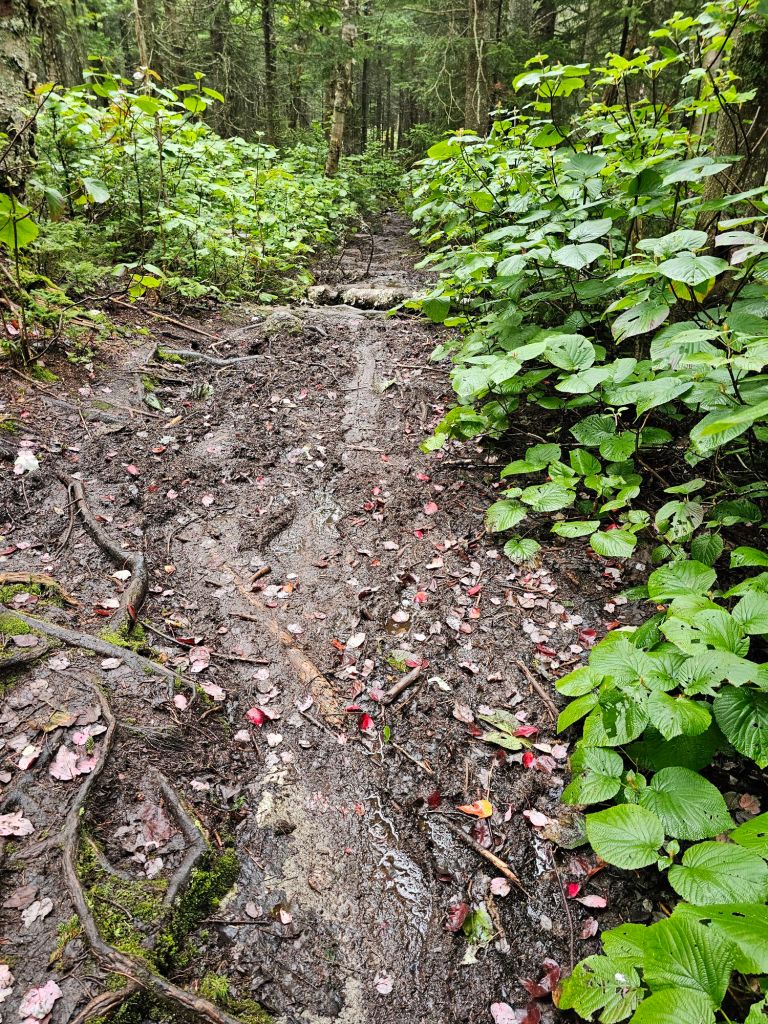
Today’s trail seemed to step it up a notch. It was dreary and wet all day. The temperature had dropped significantly, which kept our breaks pretty short.
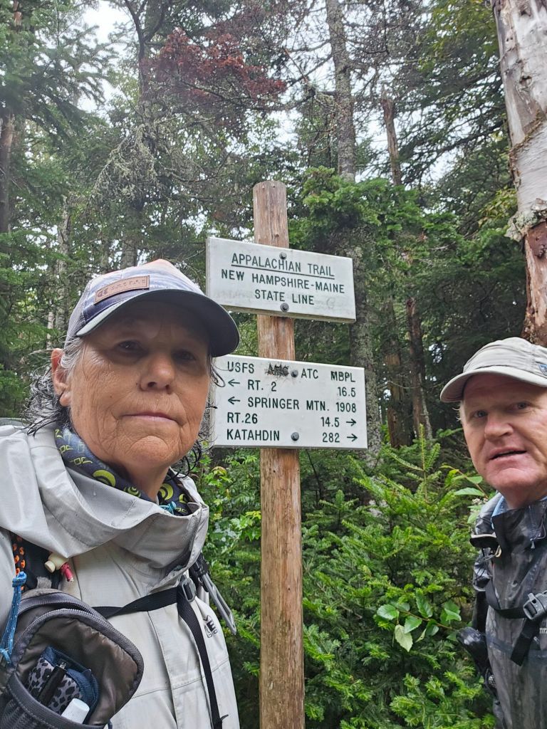
Today also marks another state completed on the Appalachian Trail, New Hampshire. Maine welcomed us in the most inhospitable way.

We had hoped to make it a 10+ mile day, based on yesterday’s tread, but that was a hard NO. We acknowledged early on that our destination would be the Carlo Col shelter. And, as with all our end of days, we had an unexpected gauntlet to pass.
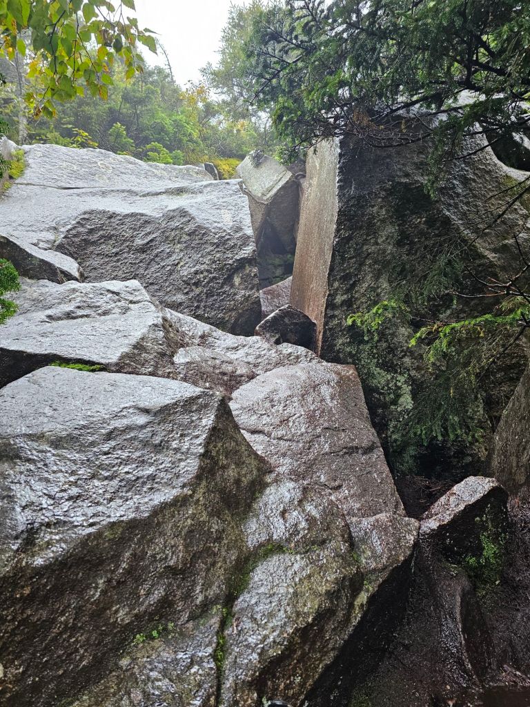
In fact, the crazy descent, or should I say, escape from Moldor type sliding and wedging down and through giant slabs of wet pointy boulders the size of VW Vans was memorable, in the wrong kind of way. It set off the “Frodo” alarm, as the antithesis of “make wise decisions,” but there were no other options but to proceed. Off go the packs. Loud is the profanity. We are now soaked to the core, clamoring and sliding through and down wet granite smeared with grainy mud. What The F**k, is all we can think. Who in their right mind thinks this safe or better yet fun? Our focus? Get to the shelter so we can start warming ourselves, as we are acutely aware that we were nearing the beginning stages of hypothermia.
It was 5:30 and the shelter was full. WTF? Where did these people come from? Only two people passed us this day. Not one of the packs in the shelter appeared to be thru-hikers. Muggles! Don’t they know they’re supposed to stay home when there’s a predicted thunderstorm? Only us idiotic and insanely driven thru-hikers are “supposed” to be out here in these conditions. Shivering and now finding my dexterity diminishing quickly, we throw up our tent on a slick platform in the driving rain. I finish the rest of the setup while Paul collects water for dinner and the following morning. It’s everything I can do to get out of my wetted out clothes and rain gear and into our hopefully dry sleep clothes and quilts. Paul’s a champ and back with water in tow. Unlike me, he is not shivering violently. My toes are a light shade of purple. That would explain why I haven’t felt them for a couple hours. It took nearly 2+ hours to warm up enough to stop shivering and proper color to return to my toes. It’s not that our rain gear failed or even wetted out. It’s that the hiking was so strenuous that we couldn’t help but sweat profusely in it. A constant and cold wet wind precluded us from taking off the protective rain gear. Thus, we were in a conundrum. Take rain gear off to reduce sweat, or keep on to prevent becoming cold. We are aware of what causes or can lead to hypothermia, and yet we inched way too close to the edge. Why? No choice but to carry on. Hike to stay as warm as possible because this trail gives you no options. It is a two foot wide “path” through a rock infested, tree choked forest. There was NO place to pull off and set up. Trust me, we looked. Our topo maps are less than helpful due to the actual terrain. So when we look at the map and see lines far apart that would generally indicate fairly “flat” terrain, it can’t tell you what occupies said terrain. Here, it is thin, crowded trees and their friends the rocks.
Finally warm, we slept soundly to the drumming of rain against our fly.
Day 52: (Aug 21) 9.6 mi (1922 – 3.6 mi of Mahoosuc Notch ByPass)
Morning came, and the rain had stopped. The forecast for the day showed no rain till mid afternoon. This meant pack up all our gear and get a moving. There is nothing better than putting on cold, sopping wet clothes and mud infused socks and shoes. Today’s trail was another unexpected gauntlet.


Needless to say, we got a full body workout. We had jungle gym type crazy climbs, at times with ladders and metal rungs to “assist” ones ascent (or for SOBOs, descents). Sunken bog boards to find and balance upon so as not to fall into an unknown abyss of quicksand like mud. Incredibly steep and sopping wet rocks that the tread of our shoes miraculously stuck to like glue. Trust the shoes. Trust the rocks was our mantra for the day. A constant river of water flowing in the trail under our water logged feet. But today, we were rewarded for our extraordinary efforts. Views. Beautiful views!


For once, the weather cooperated with us enough so that it didn’t start to actively rain until we were down from the steep peak on the right, pictured above, and back into the green tunnel, that mostly is the Appalachian Trail.
Man, did it start raining! The trail was now an active stream, creating waterfalls beneath us as we moved ever closer toward the infamous Mahoosuc Notch, a 1 mile treacherous crawl, squeeze and scramble that is challenging even in dry conditions. And then came the fall. A misstep. A toe caught on root. A slip underfoot due to mud. I’m not sure, but the impact was significant. I found myself face down, right arm trapped unusually underneath me, wedged between a muddy rock outcropping with a river of water flowing by my cheek. My left shin had impacted with something enough so that I swore I had surely broken my tibia. Crying and swearing at this gawd awful trail was my only outlet as I completed an internal assessment of body parts and their condition. Paul called to me to “Can you get up?” Can I get up? I’m nearly upside down! Paul had totally missed what had happened. As he climbed back up toward my twisted position, I was able to slowly withdraw my arm from underneath me. Man, did that shoulder hurt (the one I had surgery on last year). Paul helped untangle me from my pack so I could further assess my shin. Okay, not deformed. Searingly painful to the touch, but not to pressure upon standing. Hmm. Definitely gonna leave a mark, I think to myself. Shoulder feels “crunchy,” but has full, slightly uncomfortable mobility.
We are now a mile from the beginning of the West Mahoosuc Notch, and the ByPass turn off. We talk with a SOBO hiker who just made his way up through the “Notch”. “Holy shit, that was tough! It took me four hours to go one mile through that ridiculousness. Crazy dangerous! You’d best camp before it starts and rest up. You’ll need it…and hope it’s not raining still.”, he tells us. Decision made. Turn off it is. Negotiating these past few miles in the rain has been difficult. This recent fall has me rattled, and Paul too. It’s not worth it. For us it’s not worth the assured injury, or worse yet, fatality. Number one rule of thru-hiking? DONT DIE!
We get to the intersection and make the left turn onto the 7 mile ByPass. We’ll take the extra miles, of it keeps us from further injury.

The rain abates, and the tread turns to “West Coast” type foot fall. Less roots. More dirt. Four times, we cross a river engorged by the rain. The last crossing is the deepest (thigh) and most technical. We take our time. In this, we are comfortable. Moving water is our jam. We finished the last crossing and joke. Well, our shoes and rain pants are finally clean!
The trail flattens and leads onto a gravel “road”. It’s like walking on carpet. We allow our minds to wander and strike up a conversation as we walk. We haven’t been able to do this in weeks. It’s late, so we collect water and look for the next available pull off in which to camp. We find a perfect place, and set up. We eat all but our breakfast for the morning, and two bars for the next day’s hike to the Grafton Notch, and a hopefully a hitch into Bethel, Maine. I finally get a good look at my shin. The skin is broken with a large bruised lump underneath it. Yup. That left a mark for sure! What a day!

What an adventure! Difficult hiking and conditions for you two. Thanks for the descriptive and humorous writing Dee. Huge respect for your epic through-hiking lifestyle. Stay alive! Lee
Don’t know if it’s more of a “sickness” as opposed to a lifestyle, but we are doing our best NOT to violate Rule #1.😁
OMG this feels like insanity x100