
8/23: 16.3 mi (1576.8 – 1593.8)
Holy shit was that an eye opener. I don’t know how this slipped by us, but it did. It was so significant for us that I devoted a single blog post for this day’s climb.
I remember seeing video and photos of the the Parkview Lookout, but I never thought it would be this early in Colorado on our CDT SOBO trek.
Up until this point our lungs have NOT caught up with our legs. It takes some time to expand these sea level lungs. No time like the present!
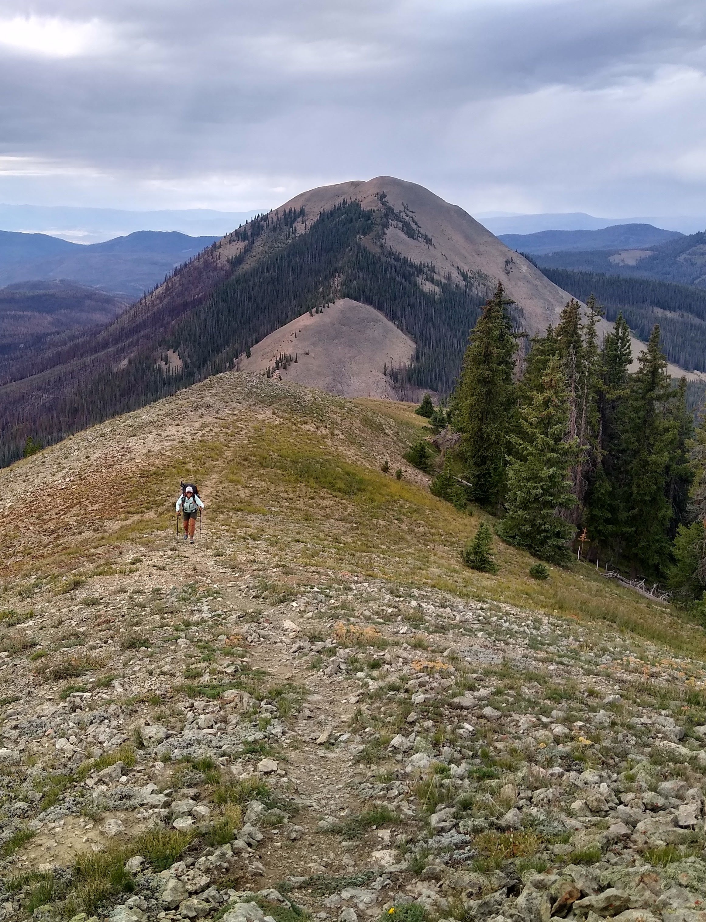
We camped 6.2 miles from the summit to Parkview Lookout. A two mile trek to the last available watering hole, we had breakfast and drank a liter and a half. We were climbing to 12296 ft. And the next water was now 11 miles.

No worries we thought as it was still early, and the morning was quite cool. We would carry a liter and a half. How hard could the climb be? We were already at a little over 10,000 ft. 2,200 ft over four miles, shouldn’t be that hard? Oh how wrong we were.
The initial climb was “pleasant”, and had mild switchbacks. We were pacing ourselves appropriately, because the wind was starting to gust and we didn’t want to get too sweaty…and wet out our jackets. At some point we decided to stow our jackets. The sun had emerged so we thought it would continue to warm. Silly beach dwellers!
Our only reference to where we were was our Guthook app and intermittent carins, that mostly blended into the hillside. My greatest concern about reaching over 12,000 ft was how I would handle the altitude. I have altitude issues and was a little concerned my head would “explode”.


Thought this was 12,000 ft…NOT!
When Paul announced that we had reached 12,000 ft I was ecstatic. Only problem was, we hadn’t. For some reason the orientation on his app had us going the other way. We had another 1000 ft to climb!
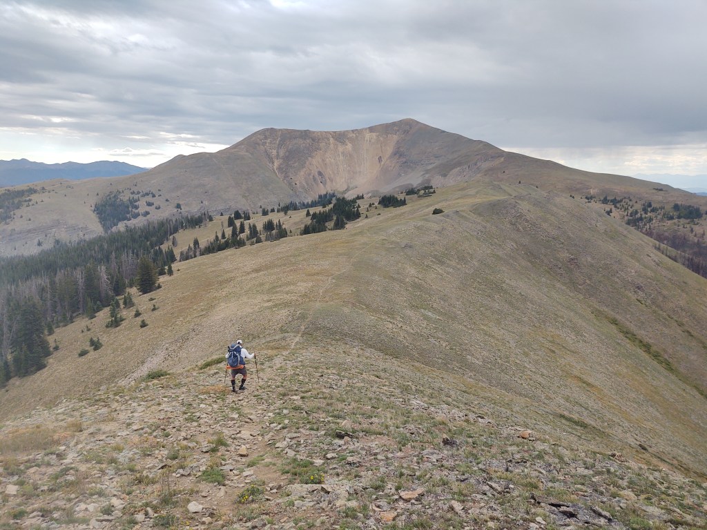
The wind howled mercilessly. It was biting cold. Behind us, the clouds on the horizon, were grey and menacing. They were blowing in our direction. Not a good sign.
The further we walked the more the trail, as far as a distinctive tread, became relatively non-existent. It was a hike your own hike kind of vibe. We traveled carin to carin. It was difficult to see more than one carin at a time due to angles and elevation. At one point it began to mist (a non-committal type of rain here), so we put on pack covers and our rain jackets in addition to our other jackets and gloves. Of course we were still in shorts.
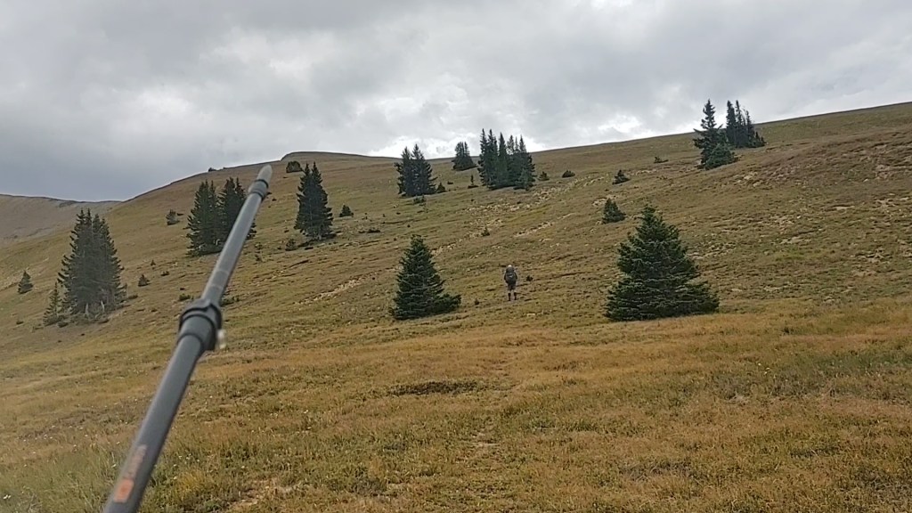
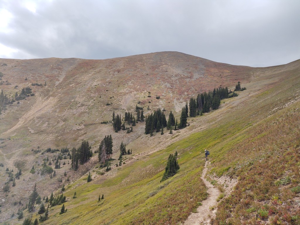
We finally got to the base of a rather steep hill. One carin loomed high above us. Surely this must be the top, and our destination we thought. But where was the the trail? Where were the switchbacks? Silly hikers, there is no defined trail, because there are NO switchbacks. This is the CDT. Get your ass up the hill as you please. Up and across the face of this massive hill in the gusting wind, that would buffet every step, ever mindful that we did NOT want to be caught at the top, if the storminess behind us decided to visit…fully. Halfway up to that carin, we spied another. And halfway up to the next we spied yet another.

One more carin and we spied a square structure at what hopefully was the top. Son of a bitch! Totally my fault. Two days prior I had looked across the horizon, wondering where we were headed and asked Paul, “is that a square rock or a building way over there?”. ” Don’t know. Don’t care. I doubt we are going there”, was his reply.
Oh yes, we went there. Paul just marched straight up. I made my own “switchbacks”, forcing myself to take at least 40 steps, then 60 steps, then 100, before taking a break to re-oxygenate my lungs and especially, legs.

Paul made the top first, and was gesturing for me to hurry up. Frankly, I thought he was being an ass. Like I could move any faster, I thought. He was the one who gave me my trail name, OneSpeed. What I didn’t know, was that he was watching the skies in the near distance grow darker behind me. Bolts of lightning flashed from under the black mass in the sky.

When I finally got to the Lookout, I was elated, but not for long. So much for having lunch and admiring the view. A quick snack and equally quick video, it was time to beat feet and get off this mountain.

We practically ran down the trail to treeline. Now I can move when properly motivated, but that doesn’t mean I’m not fully gased, or happy about having to do so. But, it beats being struck by lightning.
Once we reached treeline, we breathed a sigh of relief, as it began to sprinkle. We still had 4 miles till a reliable water source, so no rest for the weary.
With a mile or so to go before water, we crossed a highway. By that time, I didn’t really care about water. I just wanted to stop and take a break…eat some food. We crossed the highway and plopped down in the shade. A blue truck was parked in the large turnout. We suspected that the owner was out for a hike. After an hour or so, it was time to get moving, and just like that, two heavily laden backpackers appeared. They, of course, were preceded by their dog who came over to us and insisted that we pet him. We, happily obliged the dog. One needs a “dog fix” from time to time.
From there, a conversation ensued. The couple had planned on a two day backpacking trip, but decided to turn around when they discovered the creeks they assumed were flowing, weren’t. We talked about water and where we had come from and showed them where the water sources were on our Guthook app, if they wanted to head out again. They were done, but offered to fill our water bottles with the water they had stored in their truck. They even offered us a beer! What a roller coaster of a day, so far. We gladly accepted the water and beer. This made having to walk another 6 or so miles, through a stark burn area, not so bad. This meant we didn’t have to conserve our water, as the cloudy sky was now bright and sunny, without a hint of wind.
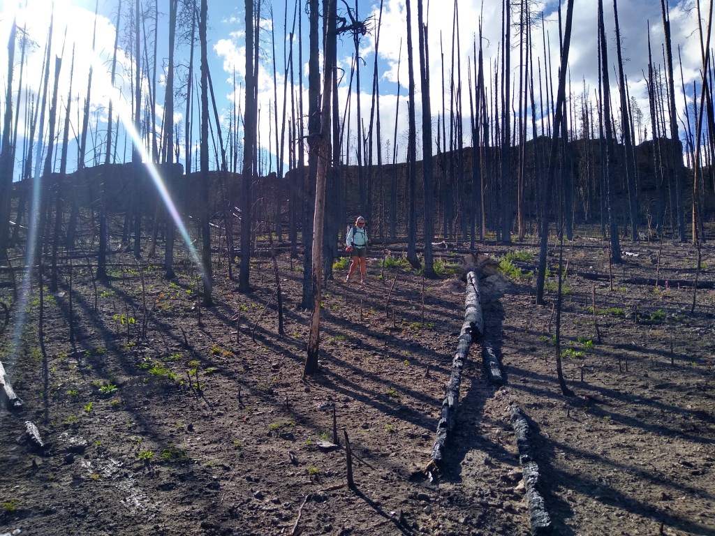
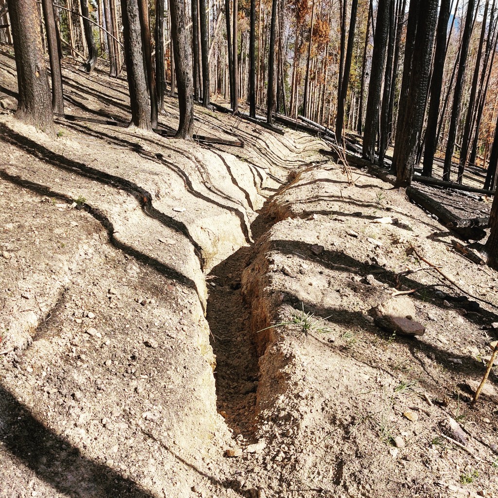
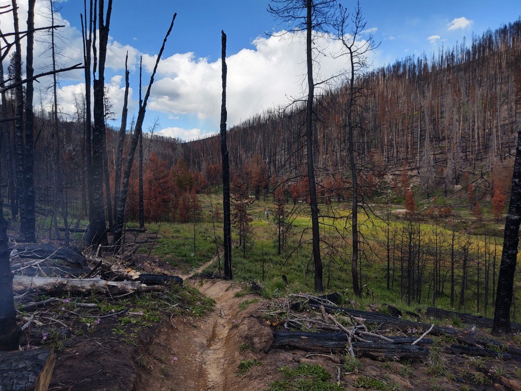
We weaved our way through and around a tangle of burnt and trees. It appeared that the fire was so hot that it literally scorched the earth. This made for interesting, and quite sandy tread. Deep troughs lined the trail at times, evidence of the erosive properties of water and gravity.
Within a mile of our intended camp spot we ran into the most unusual and amazing character. His trail name was “Wolf” and he was hiking the CDT…in both directions. He was a career Army Veteran (retired) who loved hiking. In fact before joining the Army, he had hiked the Appalachian Trail (AT) five times, and the Pacific Crest Trail (PCT) three times. He’s closing in on 30,000 miles of trail hiking. He was now in the process of hiking the CDT North and Southbound, section by section. To do this, he parks his car at one end of a section, hikes the section one-way and then back again to his car. He figures that, next year he will do the CDT, again…in one direction and will become a Triple, Triple Crowner. (To be a Triple Crowner one has to have thru-hiked the AT, PCT and CDT…not in any particular order. There are currently only about 500 people who hold the title of Triple Crowner, but the number is growing.) From what we know of, there are double Triple Crowners, but no Triple Triple Crowners. And we thought we were crazy. Hiking the CDT once will be more than enough for us, but THREE times?! What an amazing feat, and what dogged drive and discipline. One of the happiest guys we’ve met on trail so far. A far cry from the NOBO we met just as we entered the burn area, who told us, “I can’t fucking wait to get out of Colorado”. He did Colorado ONCE. “Wolf” is doing both ways, at the same time, and is happy about it. “Wolf” was also a wealth of information about what we had to look forward to. His attention to detail was remarkable. If anything, he was truly in his element. When we get annoyed or dismayed about the CDT, we’ll just think of “Wolf”, and then stop our whining. March the hell on, and enjoy it damnit! Not everyone gets to do these things…even once.
We parted ways and headed in opposite directions to camp, as the light was waining and cooler air was settling into the narrow river canyon the trail traveled through.
In all, it was quite the roller coaster of a day from the emotions we felt, to the people we encountered and the literal trail we tread. All that in span of just over 16 miles and less than 12 hours (or so).

Simply AMAZING!
There are actually a few triple triple crowners — Heather Anderson “Anish” is one. And she also did her final triple in one calendar year. She’s amazing!
I thought as much, and ya “Anish” is amazing.