
8/14 – 8/17 (1373 – 1463.9)
On Friday August 13th we arrived in Rawlins after hitting the REI in Utah to get new long johns (for me), gloves and shoes (for Paul), a new air mattress (for me), as mine had gone flat over a week ago, and a new Katadyn Hiker Pro water filter. Somehow our filter developed a crack and we weren’t confident crazy glue would work… completely. We also stopped at Costco for some resupply food and new trekking poles (for me).
When we rolled into Rawlins, we mailed packages to Steamboat Springs and had a few hours to find a place to store our truck for the next three months. All but one place was available, but it fit our needs and the owner gave us a ride back to our hotel.

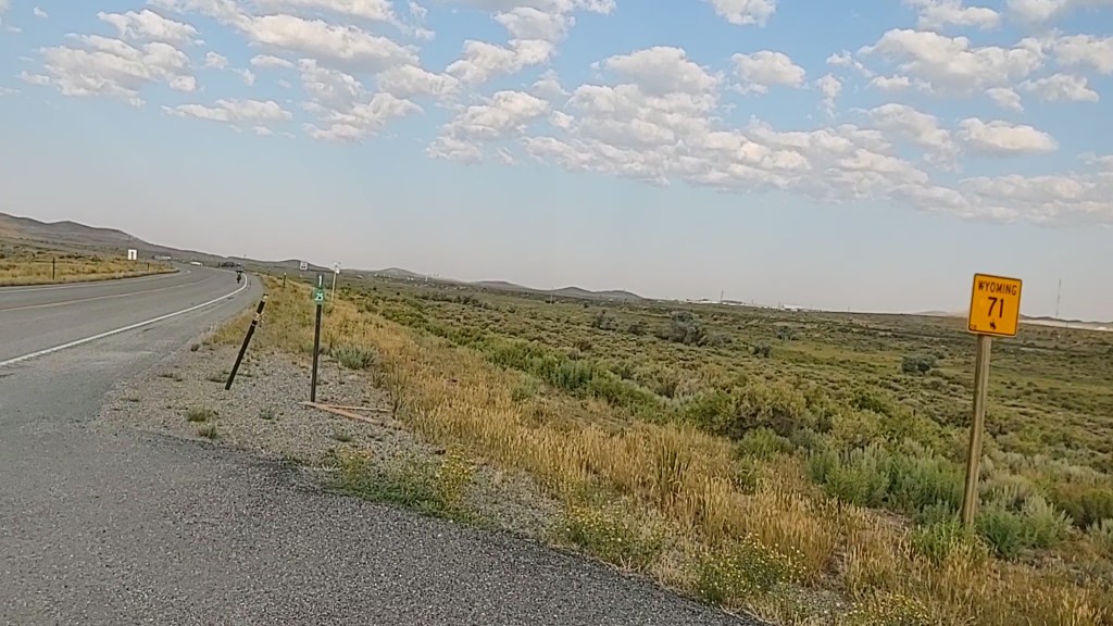
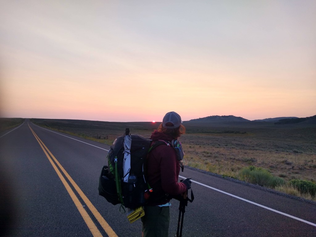
8/14 (1373-1406.4: 35 miles) The following morning we set off through the vacant streets of Rawlins, and onto the CDT. Mexico here we come!

We had a decision to make. Continue to road walk the 36 miles on (paved) Hwy 71 till it intersects with the CDT, or walk as far as Bridger Pass road, access a water cache and then follow the “redline”.
We did even better. We road walked for 5miles AND got a hitch from Rawlins’ CDT Ambassador, Jake, to Bridger Pass road. He was in his way to hike Bridger Peak at Battle Pass. We didn’t need to access the cache as Jake provided us with freshly iced Gatorades. This shaved off 10 miles of a brutal road hike on an ever warming asphalt. The day’s temperature was supposed to reach the 90’s, and with the Wyoming wind, we figured our umbrellas may not be useful. However, this particular day, the wind was almost non existent.
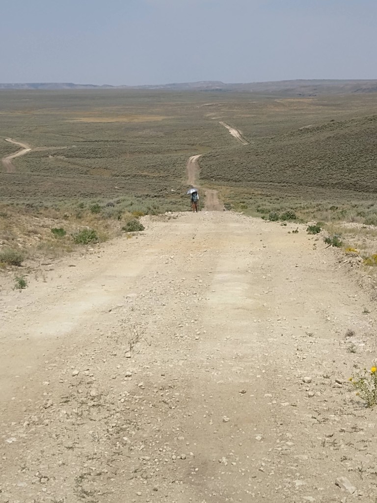
We marched on a well used dirt road for 20 miles in the searing heat, taking breaks every 3-4 miles, and getting water where we could.

We watered up at a particularly nasty pond (clearer than the others) who’s water was “rated” as “bitter” (highly alkaline) but “drinkable”, as a last resort before the Muddy Creek spot where we hoped to get water. Luckily we found a spring/pond off trail (not listed on Guthook) and were able to switch out the bitter pond water for a more palatable liquid. We topped off all our water bottles, just in case Muddy Creek was, well muddier than the last notes left on Guthook’s water report for that site.
When we arrived at the creek, we found it less than desirable. This required that we “dry camp”, which means that we did not heat/use any water, but resorted to eating our snacks for dinner. This allowed us to save our last liter of water for the following morning’s trek to a more reliable water source, some 5 miles away.
We were however, treated to one of the most lengthy and spectacular sun sets either of us had ever seen.
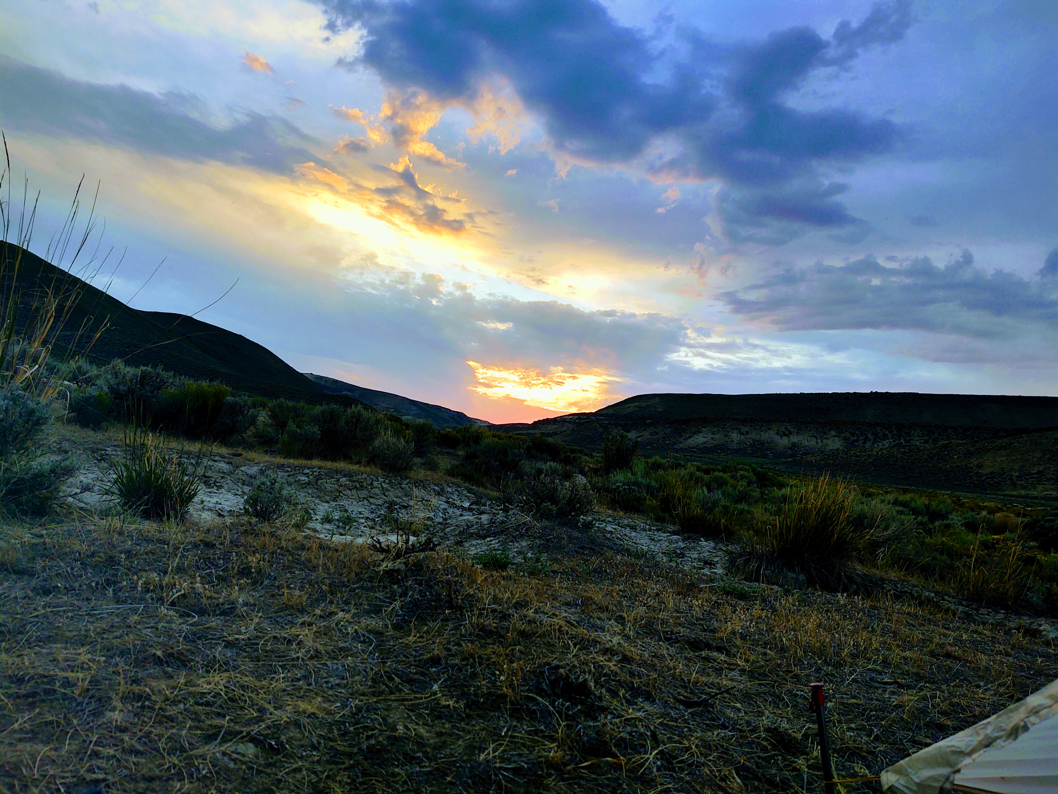
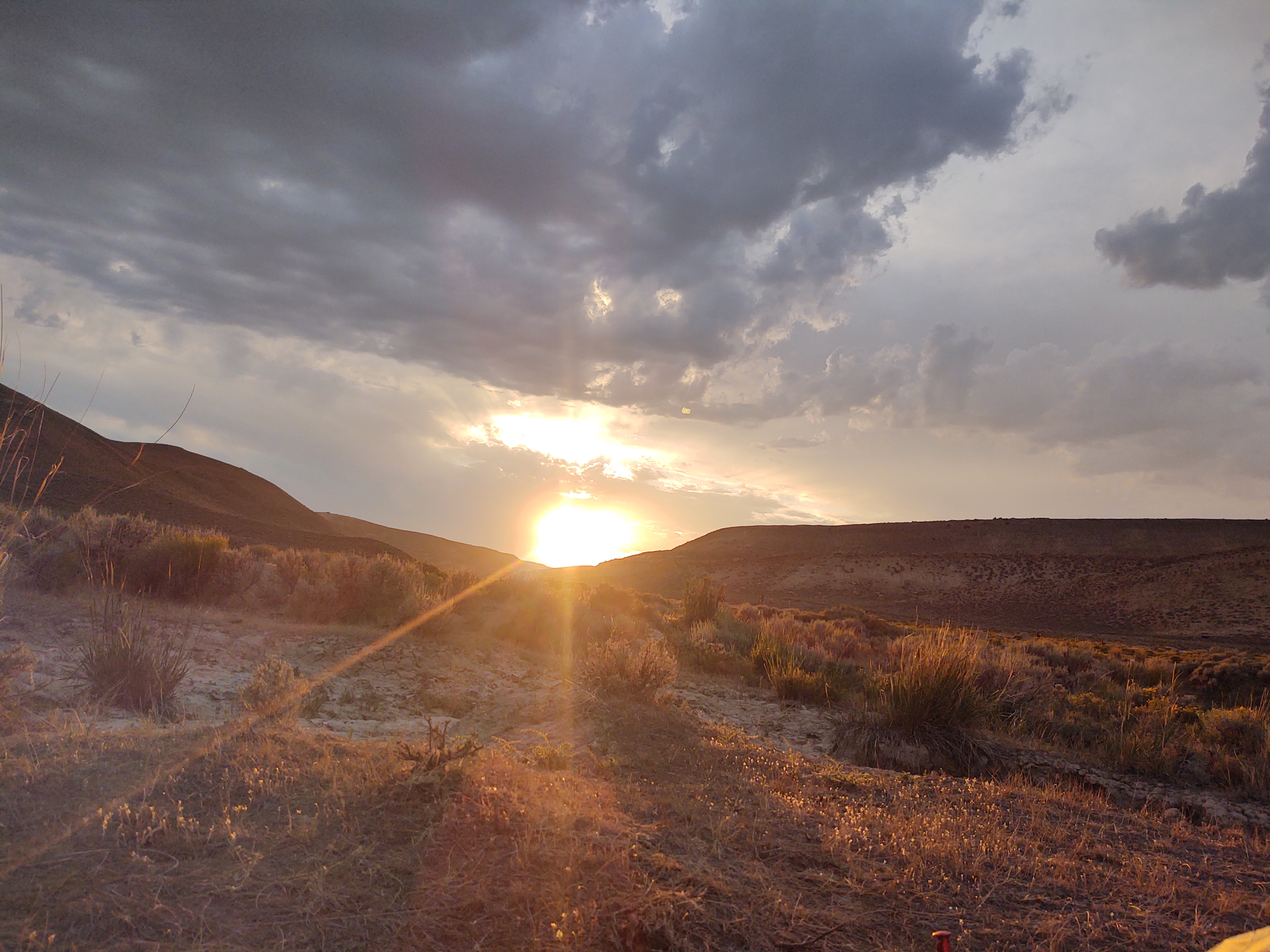
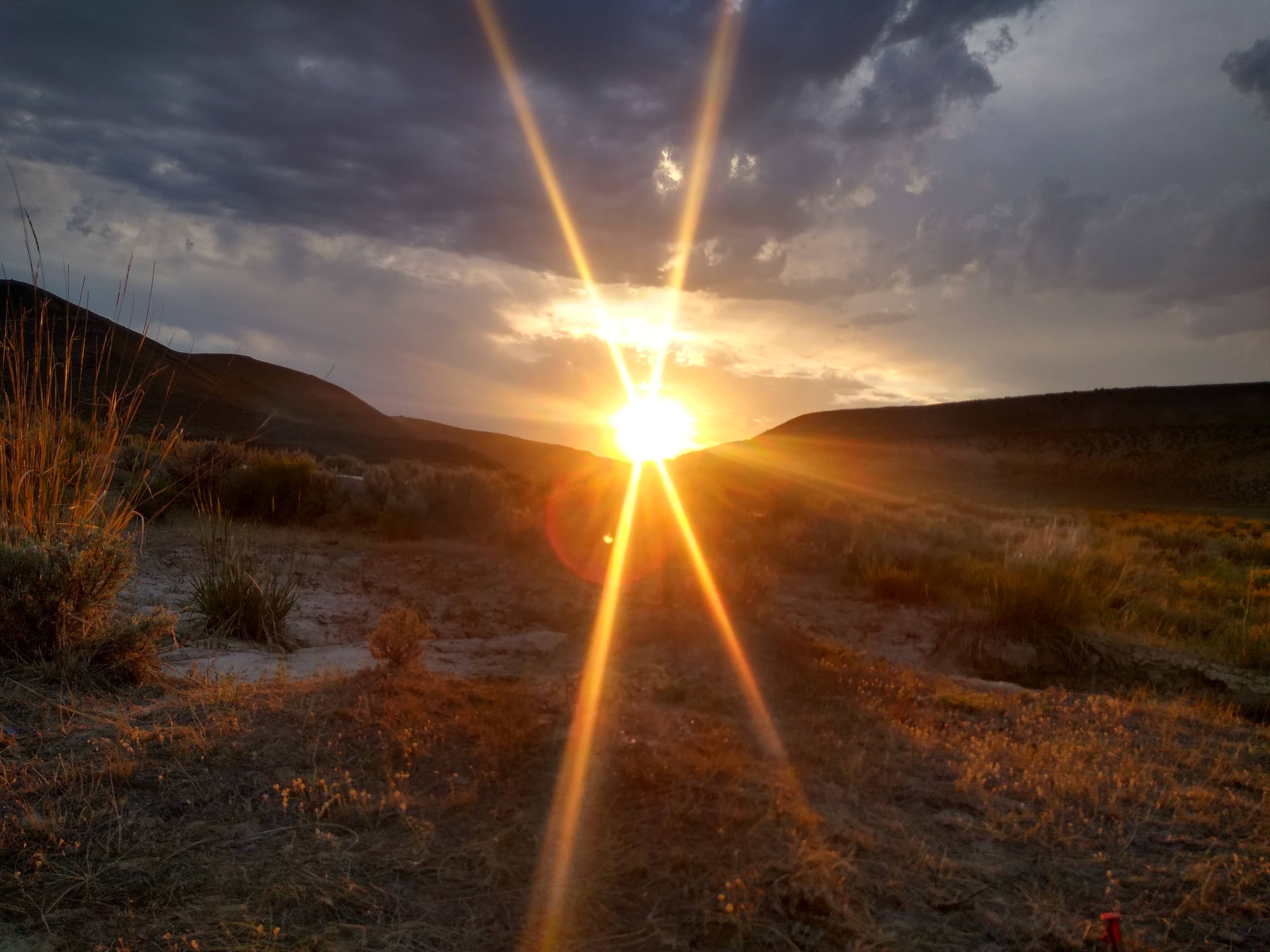
We may have used entirely too much of our phone’s storage capturing the brilliance of this sunset. Once the sun and set, the “light show” began. Giant flashes of lightning lit up the sky to our north. As it was so far away, no rumbling of thunder followed. Eventually fatigue overcame our evening’s entertainment on the “CDT TV”, and we drifted off to sleep.
8/15: 22.8 miles (1406.4 – 1429.2)
It appears that as the morning light exposed our tent’s placement, the area’s chief Bull had a problem with it. Luckily we had decided to rise early and pack quickly, in order to get to water…and morning coffee. Had we not not, I’d dare say that the Bull would have done more than just dust up the ground, “moo” , shake his weiner at us and stomp toward us. As I finished packing up, Paul was looking for rocks, to hurl at the Bull, just in case the clanking of the trekking poles didn’t work to ward him off enough, so we could skedaddle without being trampled.
We got away without any further incident, even though the Bull did try and follow after us. As such, we made excellent time to the next water…5 miles away. It was a stream that had been rehabilitated, which was short for they figured out a way to keep the cows from fouling the water. Here we watered up and had breakfast. This might turn into a “thing” – hiking a couple miles in the morning, and then having breakfast. Our next water was some 6 miles further, and was fabled to be a piped spring.
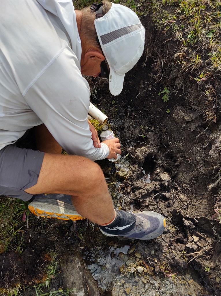
Glory of glories, it was true! It was delicious and icy cold. Here we “cameled up” and drank 2 liters each, as well as filling our water bottles. This section of the Great Basin (Red Basin actually) has very few good and reliable water sources this time of year.
The day’s walk was through wide open spaces and vast stretches of sage brush. We spied a few pronghorn, who saw us and ran…like the wind, as well as a few rust colored mule deer.
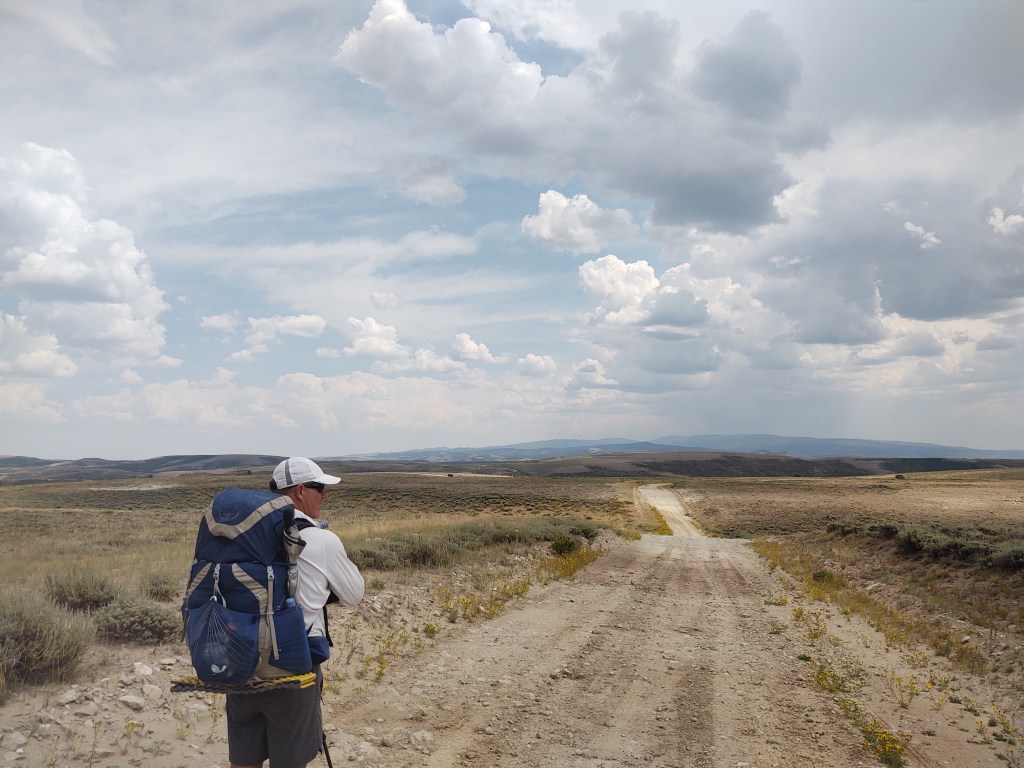
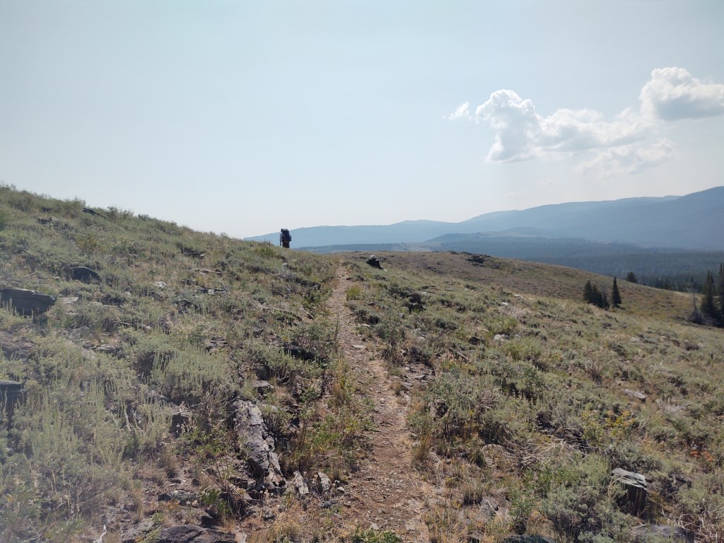
Most of the day was overcast, which made for a pleasant trek. The first half of the day was mostly walking a dirt road. The second half of the day morphed into “two-track” (ATV). As we slowly climbed in altitude, trees became available for a shaded lunch stop, and nap.
We concluded our day, camped aside a clear flowing creek, nestled in a narrow valley with short green grass and wandering deer. If we didn’t know any better, one would have thought we were in a county park.

8/16: 20.1 miles (1429.2-1449.3)
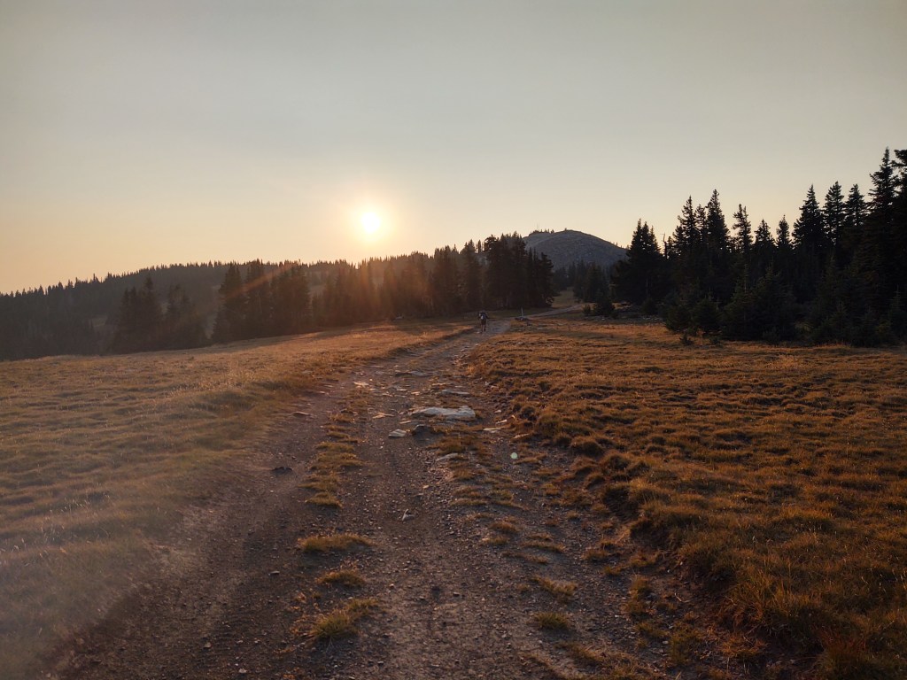
Up early to beat the heat, we rolled up camp sans breakfast and were hiking uphill with headlamps before sunrise. In no time our trail intersected with Hwy 71, that now once more became the official CDT.
After a 1.5 mile road walk down the middle of a perfect asphalt road, the CDT made a left onto a dirt road and headed toward the hills, and trees. At the turn off we stopped for breakfast. We had 12 more miles till good/reliable water, that of course involved a 1500 ft climb, but over the 12 miles.
From breakfast we carried two full liters, just to be safe. In all we would be gaining significant elevation (2877 ft), as our intended end point, making it a 20 mile day, would be at 10,620 ft. Tomorrow morning we will crest 11100 ft, our highest on the CDT so far.
8/17: 14.6 mi (1449.3 – 1463.9)
Up early again. This time no coffee. It’s a town day! The idea was to get going, and hopefully have a full breakfast in the town of Encampment and/or Riverside. This did not mean that we didn’t stop some three miles in (1451.5) on an amazing hillside to eat what little breakfast food we had left and sip coffee, and gaze at the hazy ripple of mountains before us, as the sun rose. For us, it’s the best part of the day. The youngsters seem to like sunsets better. I think we’re more drawn to sunrise as it’s a promise of a new day, full of potential.
As usual for the past few mornings, Thomas sauntered by us and smiled as we sipped steaming Via coffee from our plastic cups.
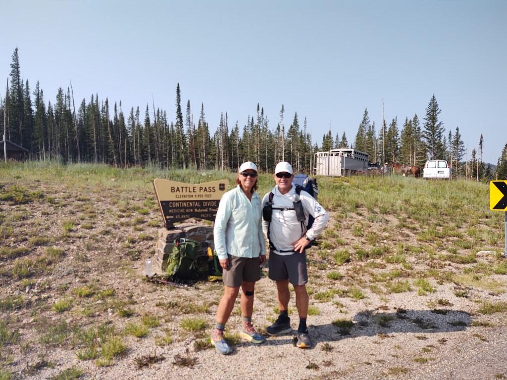
When we got to Battle Pass, Thomas was still trying to get a hitch. Paul got out our sign, “CDT Hikers to Town”, and in no time we had a ride. They dropped us at Riverside, as it had the best Country Store. We did a quick (and expensive) resupply and then wandered over to the Mangy Moose for a beer, while waiting for the restaurant next door to open. No breakfast meal for us…darn.
After fueling up with “fresh” vittles, we wandered over to the Carbon County Visitor’s Center. Here we charged our electronics and met the most interesting man…in the world. “Cowboy Wadsworth”. He is a WWII veteran, who was full of stories, that oddly were very close to home. He was quite familiar with Newport Beach, Mammoth, had surfed Doheny and Trestles. Skied and built the Yoddler in Mammoth. We talked about the 395 and how lush the orchards used to be along that stretch before LA used up all the water. He was full of stories, laughter and vigor. Time passed quickly. He thanked us for stopping in. He even finagled a ride for us back to Battle Pass. When we go to pick up our truck from Rawlins when we finish the trail, we are going to make a point to stop in again. He says he’s there every day.
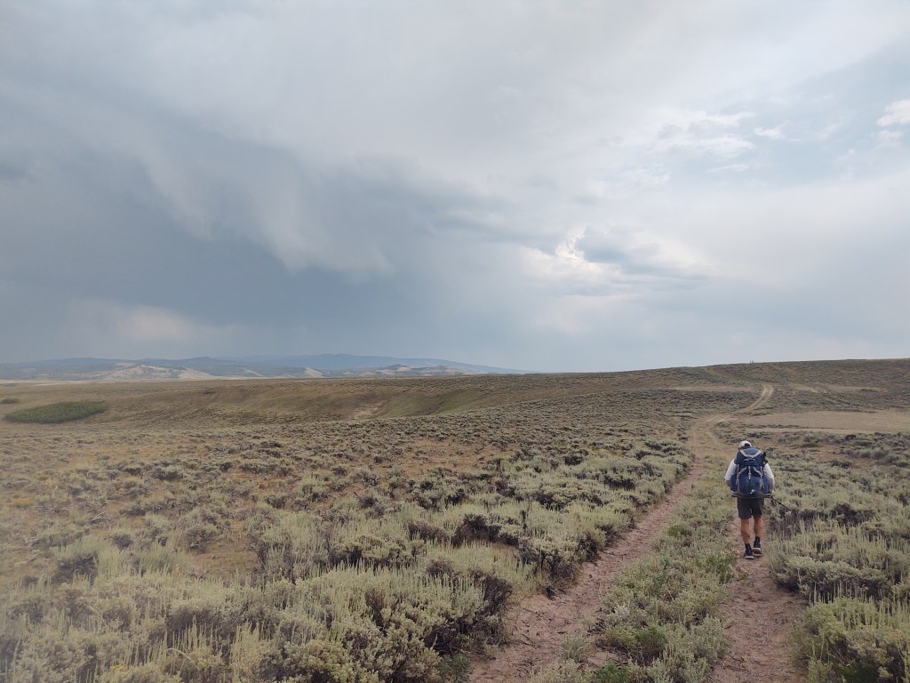
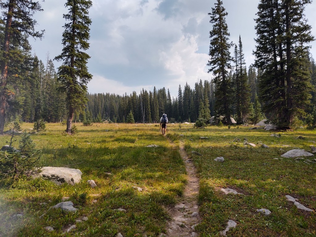
Once back at Battle Pass, we were treated to an easy trail with wide open green grassy meadows and easy rolling climbs. For awhile we also played the “can we walk out of a brooding storm?”, and “where’s the next carin?”
Eventually we ran out of steam and found a semi flat piece of ground, near water and called it a day…still in Wyoming.

Can’t wait until you write a book about your many hikes! Just love reading about your sagas! So much fun. Take care, be safe and all that jazz! jan
Doing our best to stày safe