
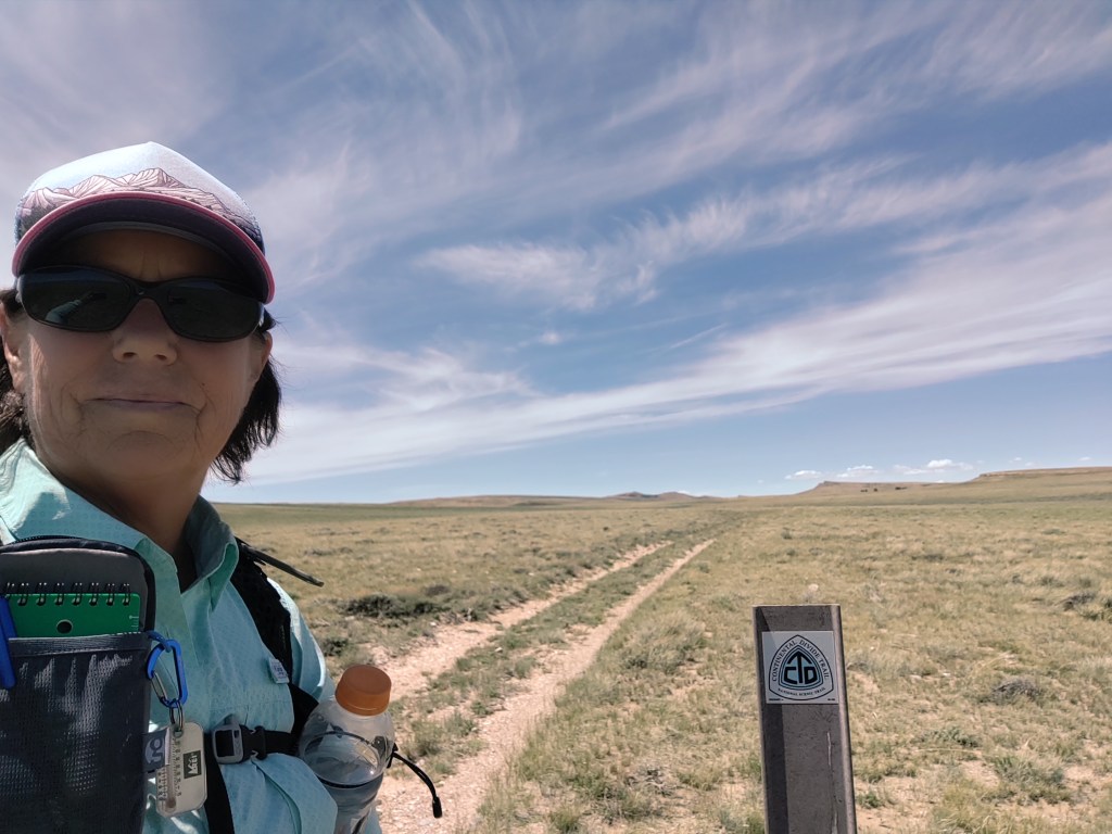
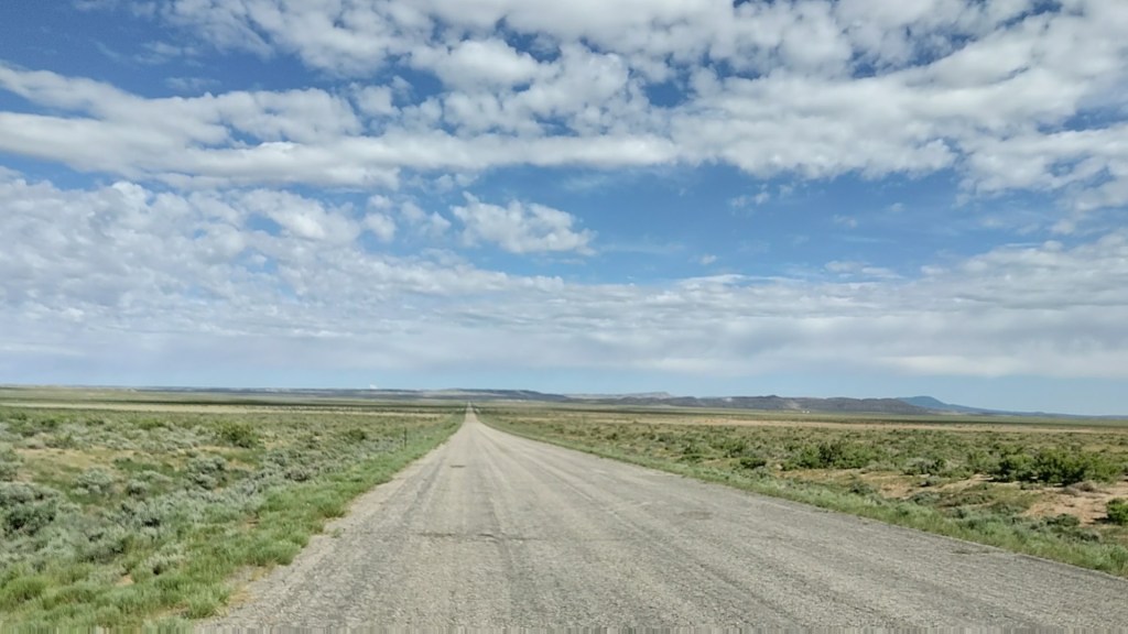
Our first 12 miles of the CDT out of Rawlins, into the Great Divide Basin was everything we read about. The Great Divide Basin is one of the only areas where the accumulated rainfall stays “local”, as there is no outlet that flows to either the Atlantic or the Pacific. The ground is so “thirsty” that it gets absorbed rather quickly.

Dirt road walking. Some single track. Over-land follow the carins. Over-land search for and prop back up the carins. Over-land navigation…NO carins. Of that, we were right at home.

The terrain was reminiscent of our hunting adventures. Dry and dusty, covered in sage and bitter brush.

Right off the bat we saw three young bucks and a doe. Not much further down the trail we were treated to four pronghorn, who ran like the wind when they saw us. Horny toads of all sizes, playing “Frogger” would scurry across our path at regular intervals.

That reminds me, did I happen to mention the wind? The wind in Wyoming is unrelenting, much like waves crashing on a beach. Sound wise, we were right at home. In fact the first night at our hotel we woke up to what we thought was big surf…it was only the wind. Before setting off, we spent two days in Rawlins running around mailing packages and getting ready to go. During that time the wind blew 25-30 miles an hour, non-stop.
But according to a local, “Winters are really harsh around here that’s when the wind starts to blow.” Note to self, don’t be here during winter.

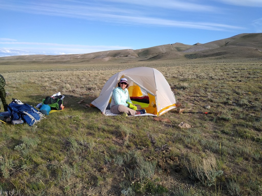
As luck would have it, we actually had little to no wind our first day on the trail out of Rawlins. Temperatures didn’t get much over 70. Our (my) pace was half strides as my pinky toe was still in the throws of repairing itself, so smaller steps were in order to keep it from screaming at me for pushing off too briskly. Other than that, and with the exception of heavy packs laden with food and water, we found the trail much easier than our normal training hikes. Finding a flat place without sharp rocks and plants to set up camp, that’s a whole other story.
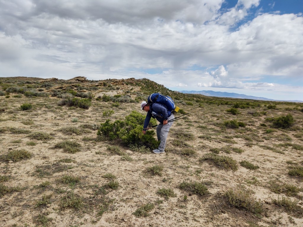
Day 2 (16 miles): This morning started out pretty good until we had to start bush whacking. Finding carins became nearly impossible, as just about every fiberglass CDT sign post had snapped at it’s base. We assume from the wind.
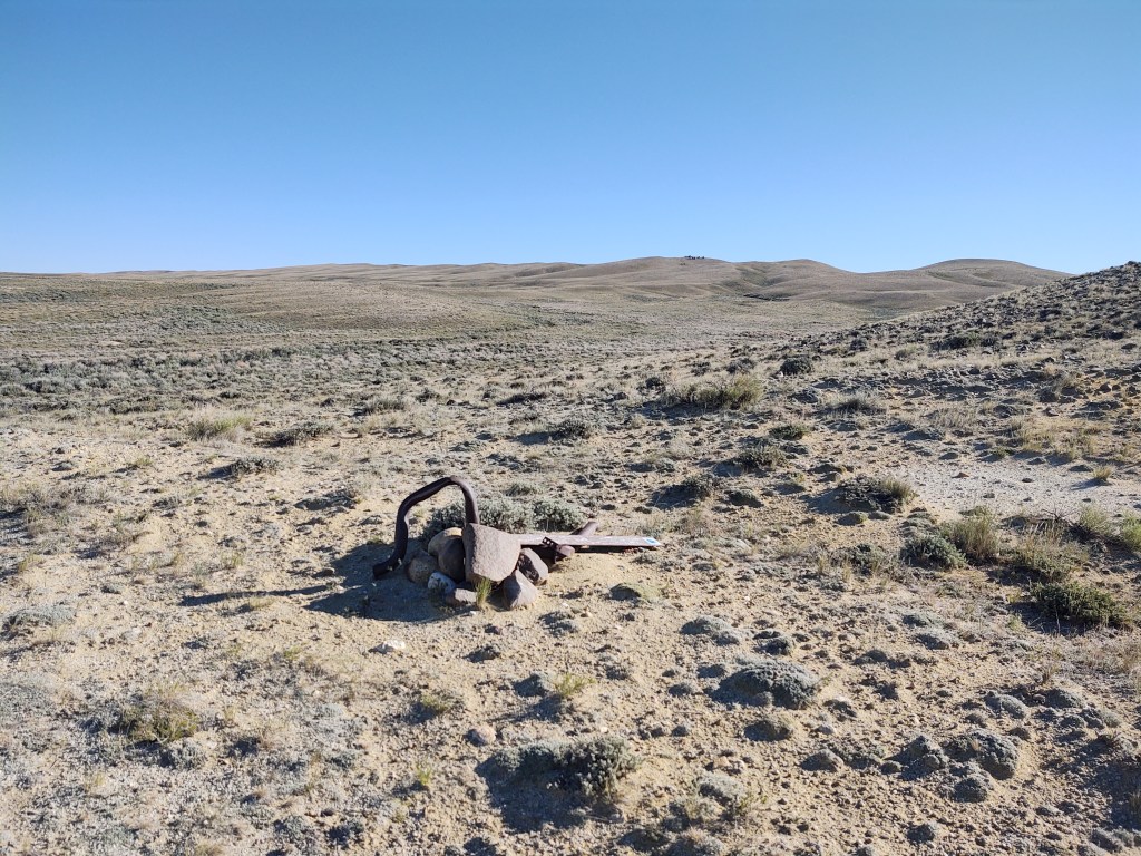
We had to look for “unusually piled” rocks to find our way. At one point, a herd of wild horses galloped past us within 25 yards. It was a spectacular sight to see. We watched them as they expertly made their way through the scrub brush, kicking up rust colored soil.
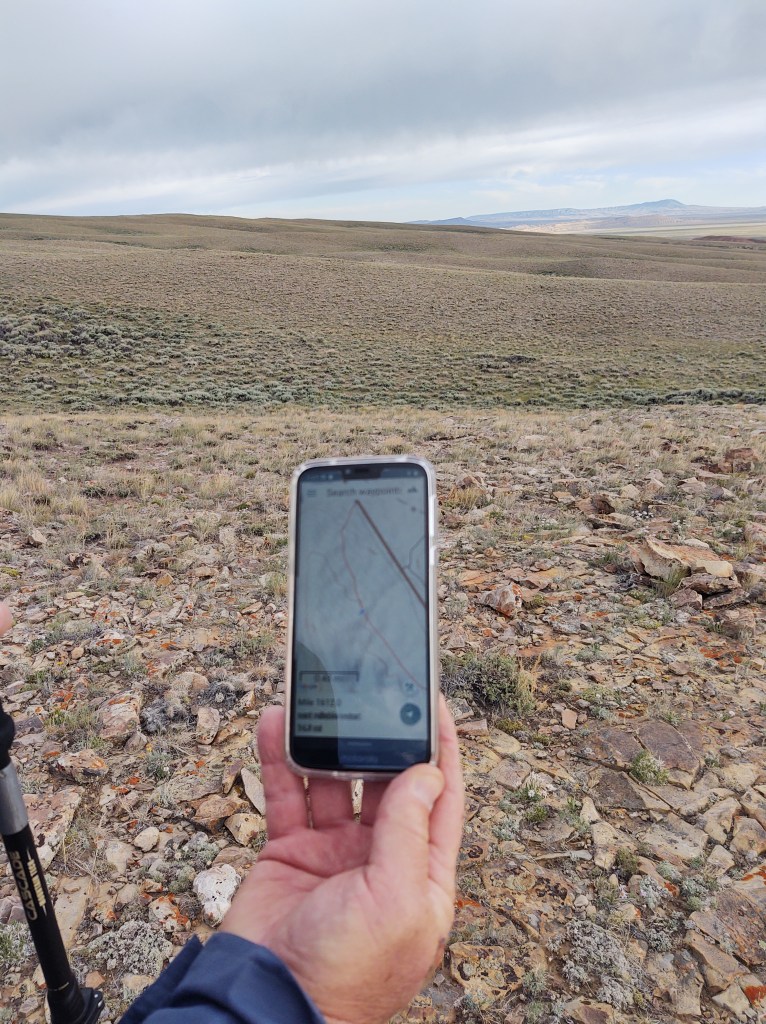
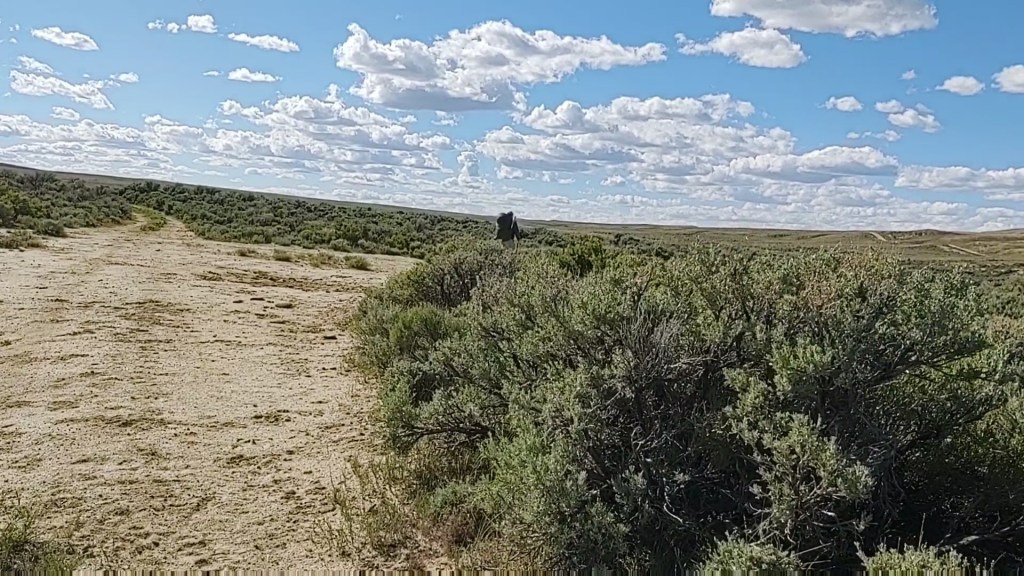
We did our best to follow the “red line” that marks the trail on our Guthook app, but it was painfully slow. Not the app, but us. The topo mapping on the app didn’t necessarily “match” the terrain we were faced with. At one point we decided instead to follow the horses. They had gone down a wash and continued away from us toward a road we had used to cache some water. We took this as a sign and we followed their path as they obviously knew where they were going. We found it infinitely “easier” than the required bushwacking through sage and bitter brush to follow “official” CDT route. Eventually it led us to Oil to Mine road, of which we were familiar.
As we walked the asphalt road, we lamented the fact that not only did we forget to bring a set of binoculars, we had also turned down a pair offered by our friend Mike, believing we already were carrying too much weight as it was. Idiots! Binoculars would have made ALL the difference finding the carins regardless of their “state of repair”, and would have made our progress all that more efficient. As it was, it took us two hours to go three miles! Too late now. Two and a half hours later, we finished our 5 mile road walk, reconnected with the CDT, and collected our cached water.
After an hour off of our aching feet (road walking takes a toll on ones feet), we started on our way. Our destination was Bull Springs, another 7 miles or so. Had we not cached water, it would have been a 19 mile stretch from the last water at Fish Pond Spring to Bull Springs. At our pace, and over this terrain, that would have meant having to carry 5 liters each…an extra 10 pounds!

As a side note: while we rested and ate our lunch, we couldn’t help but notice the darkening skies in the near distance. ‘Surely it won’t rain, will it’, we thought. No sooner than we were 2 miles into our next leg, but fat droplets of rain began to fall, followed by ground shaking thunder…and hail. Quickly we donned our pack covers, rain jackets, and unfurled our umbrellas. We watched the skies for any signs of lightning, wherein we would have to hastily abandon the umbrellas and figure out how to make ourselves “small”.

Drenched and cold, we found an outcropping of rocks to block the wind and sit out the rain a bit. It eventually passed us nonchalantly, afterwhich we regrouped and continued on our way. At least the trail would not be dusty.

Once the rain passed it became searing hot once again as we traveled over dusty and rock strewn ATV/ranch roads and a few inadvertent game/cow trails. On the CDT one needs to constantly check the Guthook app or you can find yourself walking into oblivion. I dare say that paper topo maps would even be helpful as ever feature looks so similar and there are so many tracks to choose from.
With 2 more miles to go, the terrain changed slightly and a swath of greenery began to appear. Hallelujah, we were just about to Bull Springs. We arrived with plenty of daylight to get water and continue, but we were gased. But then we knew that these first few days, if not weeks would be challenging as we build our trail legs and backs.

After a healing nap, we (Paul) collected water from the cistern within the spring. A red winged black bird continued to dive at and “yell” at Paul as he collected our water. It wasn’t until we saw the nest at the edge of the spring that we understood why.

Bull Springs is aptly named, and is cow central. The cows were quite curious and a little territorial with us having taken up a portion of their “lounge” area.
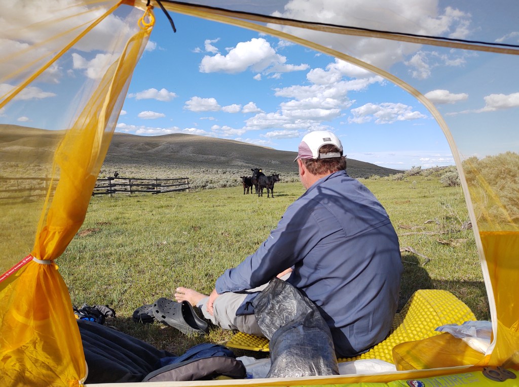
The bull on the other hand couldn’t be much bothered with his “attention” elsewhere. In fact we are sure that he is an old bull as he had his way with about every cow in the area. Our dinner’s “entertainment was “cow porn”…an unforgettable experience.

Wyoming was my favorite state on the CDT. I loved the Winds. Great photos!
We are finally getting to trees…and soon the Winds!
Dead carcasses…..nope
Horned toads…..nope
Wild animals roaming to and fro….nope
(Please say you have a firearm or two….yes?
Areas of no trail in site….nope
Missing cairns….nope
Thunder storms with no place to take cover…..definitely nope
You guys are real troopers
Please stay safe. Love you guys!
(In truth with all the shite happening this year, what better place to be than where you are now.)
We are now experts at “Social Distancing”
Oh yes windy Wyoming. BTW I learned the umbrella shaft is fiberglass so no worries in lightning.
Phew! That’s a relief…for me. Paul’s is still metal. Oops.
Are you sure? I have the original chrome dome and while it looks like metal I was assured it was fiberglass. I was tossing that baby during the lighting storms on the JMT.
Paul’s bent in the wind
Hmmm only word of mouth.. Wonder how I could test.
I searched for specs this is the only thing I found and it says no metal and addresses lightning and article is from 2013. http://www.metrotomountain.com/journal/gear/go-lite-umbrella_776.php
Well that works for us. Thank you!
Let’s have Paul test it. LOL
Hahahahahahahaha
Stay safe you two! Enjoying your blog and great pics. A hui hou, Malama Pono.
Thank you!