
HAPPY NEW YEAR!
Things got a little hectic and busy when we got back from our Wyoming trip, so here’s the last installment of that adventure. In fact, I have at least two others from last year to post, which I will do next week. In any event, I expect 2019 to be filled with many “mini” adventures, and if all goes well, 2020 will see us hiking the CDT (Continental Divide Trail).
So on with our story…
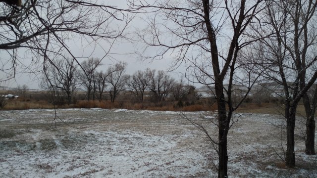
If you don’t like the weather, wait a day…it might get worse (or better). Each day we spent in South Dakota, the weather presented us with the exact opposite of the day before. Our first day in South Dakota was grey, cold, wet and windy. Our second day was windy and cold, but clear sunny skies. Day three gave us no wind, with bright warm sunshine to take the edge off the cold. Day four we awoke to snow on the ground. I think the only constant for us was the fact that it was COLD everyday…compared, of course, to San Clemente’s balmy average of 72 degrees year round. Traveling cross country and recreating in different states of our diverse and great nation always serves to put things into perspective and increase the appreciation factor for the hardships (and frankly the sheer grit) the pioneers who settled this land had. AND, an even greater appreciation for the ancient Native Peoples way of life. Throughout this trip I looked in earnest for, and couldn’t help but imagine the hundreds of thousands of buffalo that once thundered across these vast parries of South Dakota, now essentially replaced by cattle. I asked Roy why more people don’t raise buffalo, seeing as it is a rising trend in red meat consumption for those wanting leaner meats. “Fences” was his answer. For cattle, the three wire fences are demarcation walls as to where they can “roam”. For buffalo, they are not even “suggestions”. If you want to understand the essence of roaming, think buffalo. They are big, strong, and will go where they please, fence or no fence. Electric fencing seems to be the only way to contain them…temporarily, and that is not cost effective for most ranchers who often have thousands of acres of fencing to maintain. While on this trip I also came to a better appreciation of those hearty souls who choose to grow our food and raise the cattle we consume. It’s a hard life. It won’t necessarily make you financially wealthy (by SoCal, or even “big city” standards), but it is certainly purposeful and fulfilling for those I talked with. These people are “salt of the earth”.
With our hunting adventure “over”, we packed up, said our goodbyes, and hit the road…slowly. We were gonna hunt every edge of South Dakota we could, in a blizzard if we had to. As snow fell lightly all around us, we made our way down the county roads, and eventually to pavement and highways, where creeping along at 20 mph is frowned upon. We, are sad to report that we were not successful in our “road hunting”. Turns out though, that our slow perusal may have saved us from disaster. Before we left the county roads and soon lost cell signal, we failed to check where the nearest/next gas station would be. We are used to one every 5 -20 miles or so, and therefore thought nothing of it. This is not the case when you are traveling across South Dakota, and thus, we had set ourselves up for abject failure. By the time we noticed our fuel gauge, it was at less than 1/4 tank, and we were driving into a hearty headwind through the now immensely rolling hills of South Dakota. Paul reduced our speed to 55mph, which got us some strange looks from those who passed us on a roadway posted 70mph. I’m sure they saw the California plates and thought…”Well that explains everything”. We did the math in our heads, and made rough estimates as to how much fuel we still had and its possible range, give or take 5 – 10 miles with the headwind (using an average of 17-22 mpg). By the time we got cell service and could map our next gas station, the needle had just entered the reserve zone, (of which we had no idea, actually how much of the 19.3 gallons of fuel remained, via our analog fuel gauge). This meant we had either 2 gallons or 5 gallons remaining, as for when the needle “rests” on reserve, it has been known to sit there for quite some time without moving.

By now, we were at the point of no return for we surely didn’t have enough fuel to go back to Faith (60 miles), and neither were we confident we had sufficient fuel to make it to Newell, let alone get picked up hitch-hiking to and from a gas station on this sparsely traveled highway. We resigned ourselves to the fact that we had no choice but to deal with whatever was going to happen, and began to pray (a lot) for at least a mini “miracle”…wherein we could coast within 2 -5 miles of the gas station. 35 miles to go, the fuel gauge was at the “empty” end of the reserve marker. 25 miles to go, it read “empty”. 15 miles to go, we were sure we were on “fumes”, and would soon be getting more than enough exercise. 9 miles and we are still rolling. 7, and we can see the outskirts of a town. 5 miles, and our prayers for a miracle have evolved into ones of thanksgiving. 2 miles and we creep into town and make the left turn towards the town’s only two gas stations. With the gas station in sight, our tank has been on “empty” for at least 25 miles, and our car has yet to sputter to stop. We are more than relieved and overjoyed. Our prayers had been answered. I’m not just saying this, but this was truly a miracle, for even without a headwind and rolling hills, we should have run out of gas miles ago. Paul pulls into the first gas station and checks the fuel price (like it should matter at this point!). The one across the way is 3 cents cheaper per gallon, and to my amazement he continues to the next gas station. I fully expect the car to die in the middle of the road, having now truly pushed our luck, but thankfully it doesn’t. We fill the tank. 19.3 gallons. Bone dry! From here we zero out the “trip gauge”, and enter into “nerd zone”. Math will be done. Physics formulas will be utilized. Theories will be tested. We have another 1200 miles till we’re home. We should have a more than educated guess as to what constitutes a half/quarter and what even the “reserve” tank means, fuel and mileage wise. South Dakota turns into Wyoming, and as we enter Wyoming and head south along the I-85 we are treated (and tormented) by giant sized mule deer peacefully grazing in enourmous herds…on PRIVATE land! We pull to the side of the road and admire them from afar with our binoculars. Our destination is Cheyenne, Wyoming, or there abouts. Prior to reaching the outskirts of Cheyenne, I spy what I think is an elk standing majestically in full view on the opposite side of the road from us, as if it was a fullsize trophy mount you’d see in Cabela’s or Bass Pro. As we look closer and pass the animal, it is NOT an elk but the largest (monster) mule deer we have ever seen…including Cabela’s. We pull to the side of the road and turn around, hoping to get a better look and ideally take a picture. he, however, had turned tail and headed into a draw and out of camera view. We watched mournfully as he shepherded his herd back into the folds of the prairie, in awe of what we had seen.
Seeing as my father had turned us onto a discount camping membership, Passport America, we decided to price check the campgrounds in that area, as our normal option to camp on Forest Service or BLM land was really not much of an option by then. We chose the Terry Bison Ranch RV park . The price was good, we should see buffalo…finally, and it had a famous resturant, where Teddy Roosevelt is said to have dined.
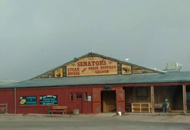
The food was good, but a little pricey…for our tastes. As the check-in office was closed we wandered the camping facility, that was remarkably packed with what appeared to be long term RV campers. We found a “secluded” campsite in which to pitch our tent, and ended up with a bit of frostnip on our fingers by the time we were done. Paul placed the packages of our pheasant on the roof of our car to ensure that they would remain frozen for the next leg of our trip home. Scrunched down into our co-joined sleeping bags (the beauty of having Western Moutaineering bags, one right zip and the other left zip) we listened to an oldtime radio drama, about some man who felt the need to “escape” his wife who was too “adoring” and “needy”, only later to drown her and marry this other gal, who was just as “needy” but then discovered that the spirit of the wife he drowned had assumed the body of the woman he had recently married…bum, bum, bummm. Of course this led to fantastical dreams that oddly enough included a train.


As light invaded our tent, so too did the sounds of the freeway and hordes of geese. What is it with Wyoming and geese? We unzip our tent and now realize we are within 100 yards of the freeway, and imagine that…railroad tracks (that explains the train). At least 100 geese patter about less than 25 yards from us, with more coming in. Our breath clouds before us as we exhale. Our tent, the pheasants on our roof, and our picnic table are coated in a crystaline frost. We pack up quickly and head to the shower room to thaw out and dress. We pay our fee ($25), at the now open office, staffed by California ex-pats who will be experiencing their first Wyoming winter…(good luck with that), and are on our way. Soon we exit Wyoming, and with the appearance of Fort Collins, Colorado, civilization in a concentrated and polished form smacks us in the face. Starbucks, Costco, Macy’s, REI, with all manner of strip malls and fancy big box stores, and people. Lots of people, and lots of cars. What a difference 15 miles makes.

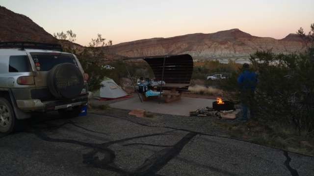
We continue from the I-25 to I-70 as we weave through a portion of the Rocky’s and drool over the ski areas we pass. We initially were headed to Moab, Utah where we were to meet up with a friend of ours from our 2014 PCT adventure, “Hemlock”, who is now a National Park Interpretive Ranger. Unfortunately we got our signals crossed, and she is headed on a 2-day backpack trip, so we vow to reschedule a visit with her. From the I-70 we decide to take a road, certainly less traveled on our way to Panguitch Utah, via the I-72. We have the road to ourselves and with daylight dimming we pull off the road at Forsyth Reservior and have the campground (with a USFS pit toilet) all to ourselves, complete with a plethra of perfectly aged/dried wood for a warming campfire to dine beside and “warm-up” before turning in. The skies are absent any clouds as day melts into night. Here there is no “light pollution” to mask the brilliance of Milky Way and bright white stars above us. It is perfectly quiet, save for our voices, as we speak in hushed tones. In no time the temperature drops wherein warmth of the fire is worthless, unless of course you are standing directly in it. How did the pioneers survive this?

Morning comes in brisk fashion. Our FJ’s outisde temperature guage registers 17 degrees. Of that we would concur. The still frozen birds atop our roof are retrieved and replaced in our cooler. Hot coffee and slightly frozen day old donuts are this morning’s breakfast. Panguitch Lake, and a Forest Service dirt road (Horse Valley Rd) to the Red Creek Reservior to survey the previous season’s fire damage are this day’s goal. Once again we have the highway to ourselves. Wildlife, with the exception of cattle is sparse. Open pastures turn into narrow canyons accompanied by even narrower streams and abandonned homesteader cabins in various degrees of decay. Prior to Panguitch we come upon the Robert Leroy Parker family homestead. Robert Parker, you ask? What’s the significance, and why would the Park service make this a landmark Historical site? Robert Parker, was more famously known as BUTCH CASSIDY of southwest OUTLAW fame, and the memorable highly embellished movie, “Butch Cassidy and the Sundance Kid“.


It is a small historical park, in the process of renovation, complete with a restroom. Old pictures on site show that this area was once lush with vegetation, which helps answer ‘who the hell would decide to live/homestead here’ for goodness sake. A quick wander about the premises and voyeristic gander at the the one-room house and out-barn, and we are on our way once more. It is interesting to see from where this notorious outlaw hailed, and begs to question, at what point in ones life does one turn from a cute little kid with smiles and wonderment to a life of crime.
We stop at the only open diner in Panguitch, who’s coffee was horrible, but their buttermilk biscuts more than made up for it! From Panguitch lake we turn off onto Horse Valley road make the bumpy run to Red Creek, where we normally deer hunt out of. In 2017 a massive fire, sparked from a knucklehead burning trash on private property…on a windy day. It consumed 72 square miles, to include a good portion of the area we hunt in. We wanted to scout it out, and survey the remaining habitat to see if putting in for the next year’s draw would be worthwhile. This fire was hot and vicious as the fuel levels where at a historic high, as conservancies that “oversaw” the area(s) had failed to properly maintain the forest (as it had been done in the past) and remove/thin the trees and the thick underbrush, believing (mistakenly) that it was “better” for the wildlife for the area to stay “natural”. The thick underbrush ensured that trees that would normally survive a forest fire, for the most part, didn’t. Vast swaths of once healthy trees were transformed into groves of “widow-makers”, with the soil beneath them sterilized by the intense heat leaving the ground still barren of vegetation over one year later. We were, however, happy to see that the area we normally hike into had escaped being ravaged by the fire. We had thought we would camp a Red Creek, but the day was still “young” and the wind had just started to howl, so we pushed on toward home. We wrestled with the idea of driving all the way home, but thought better of it, so just outside of St. George we decided to try our luck at Quail Creek State Park, as opposed to Sand Hallow State Park where we had camped the first night out on this hunting roadtrip.

It was nice pulling into a spot early for a change, and setting up with actual daylight and warmth. We had brought the rest of the wood from the previous night with us, and were further supplemented by a “neighbor” who was pulling up stakes to avoid the coming wind event/storm(50-70mph) forecasted for early afternoon the next day. We wondered if we should do the same, but elected not to as we would be on the road fairly early anyways, and we didn’t have a trailer to contend with.
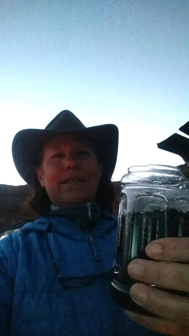
The evening’s air was blissfully “warm”, which allowed us to actually enjoy our evening’s campfire and the remainder of our adult beverages in improvised “cups”.
As the sun rose the next morning, we were further awakened by the intermittent shudder of our tent and banging of the vestibule door. It appears that the wind event was arriving a bit earlier than expected. By the time we packed up and were on the road, a red haze had filled the air. In the distance we can see Sand Hallow state park where we had considered camping, and are immensely glad we listened to that “little voice” prompting us to pull into Quail Creek in the first place. In the near distance, a gritty red “fog” hovers over Sand Hallow State Park. We could only imagine what it would have been like in a tent…at 4 in the morning. We head west bound on the I-15 with a hearty head-wind, reminiscent of “Windyoming“, reducing our gas mileage significantly. As we exit Las Vegas and cross into California, the winds continue. “Arson weather”, we remark to each other, not knowing that two significant and historically devestating fires are currently raging in their second day of chaos; the “Camp Fire” that wiped out the town of Paradise (killing 86 people, and leaving many more homeless), and the Woolsey Fire in the Simi Valley area that would later reach into Malibu and race toward the Pacific Ocean consuming practically everything in its way.
We arrived home to hazy skies and the acrid smell of smoke in the air. A bitter-sweet return from a memorable trip, thankful that our family was safe and free from harm’s way, yet knowing that hundreds, if not thousands, of people’s lives had now been turned upside down whilst we were out recreating.
A reminder to Count your blessings…daily.
