
166.6 miles to Springer Mountain plus 8 more to Amincola Falls State Park, Georgia from Fontana Dam is all that left for this season. Next season, come September, we’ll return to finish what is available of those areas closed or difficult to access. That was the plan… until it wasn’t.
Fontana Dam is the tallest dam on the East Coast, measuring 480 ft, and was built in 1942, taking only 36 months to complete. It spills into the Little Tennessee River. The shores of this massive reservoir span 238 miles of shoreline.
Day 131: (Nov 8) 4.4 mi (20230.8 Fontana Dam – 2035.2 Walker Gap)
Greg picked us up around noon from the Enterprise Rental facility and drove us the 1.5-hour route to Fontana Dam over a winding road. It was a beautiful day. Skies were clear, the air warm and the hillsides were colorful. As we drove, we were somewhat surprised, as we hadn’t realized how rugged and steep this next section would be. PUDS till the end, I guess. As such, we expect nothing less from this trail.

We had factored in our late start for the day into our daily mileage projection, making today a planned “nero”. And, after the 4 mile, nearly 2000 foot climb up from the dam to Walker Gap, we were glad we did.
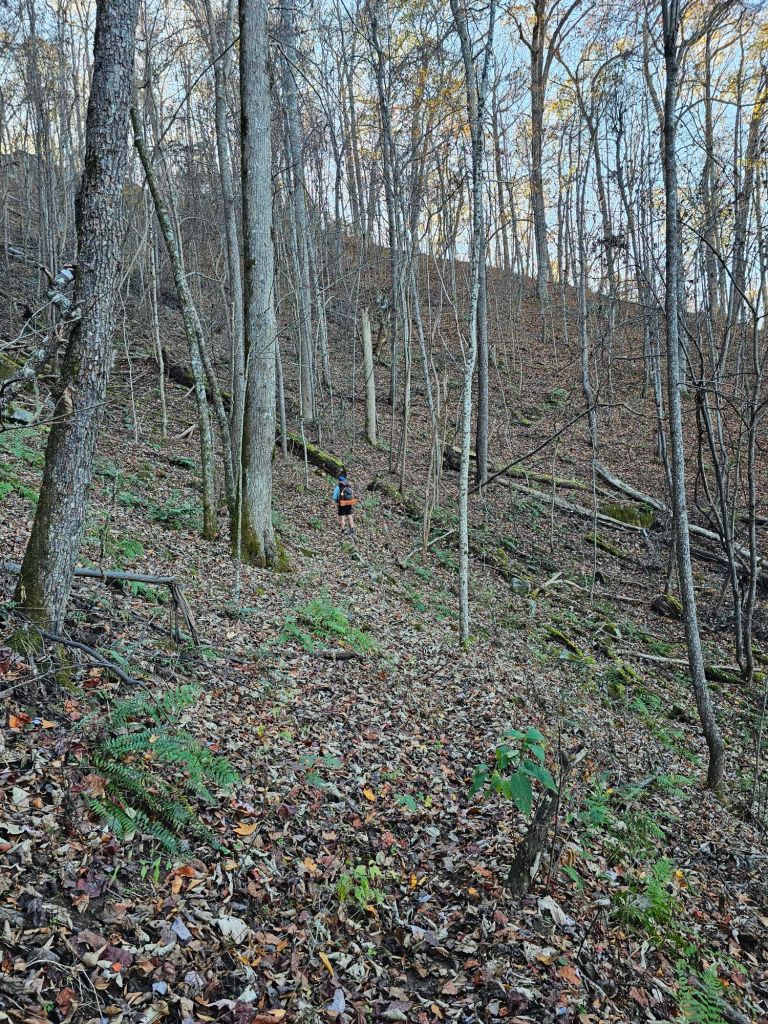
More leaves than we expected filled the well of the trail as we climbed, causing us to slip more than once from the leaves piled in the recesses of the hidden root and rock steps. We hoped this was a fluke, as the canopy above us was thinned, but nothing like what we had experienced going through the mountains of the Shenandoah in Virginia.
Day 132: (Nov 9) 11.5 mi (2035.2 Walker Gap – 2046.7 Stecoah Gap)
Today was to be a 14.6 mile day, with a finish at the Locust Cove Gap campsite. Somehow, that didn’t happen.
Right out the gate, my foot was NOT happy with the 4 mile climb we did yesterday afternoon. I thought new shoes would help the next 175 miles go by “easier.” But, what I discovered and knew all along, it was the tread, not the shoes that make the hike enjoyable or NOT.
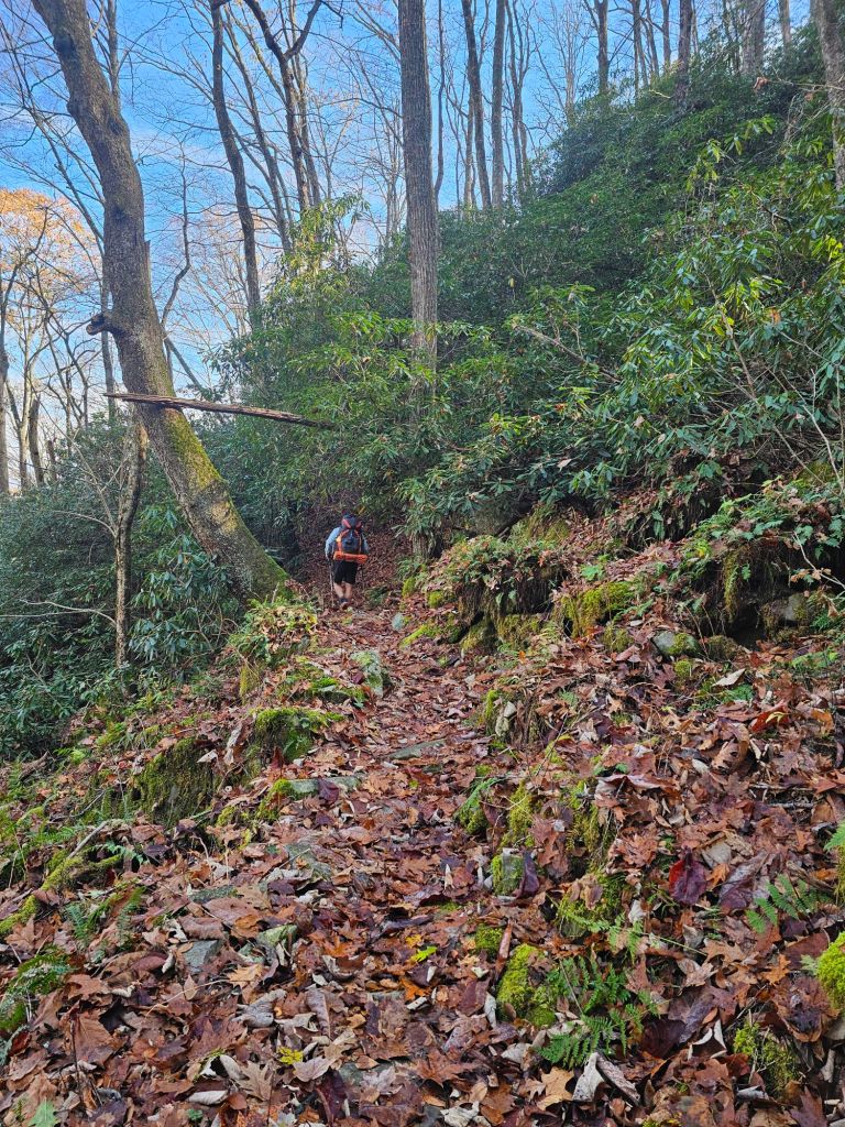
The tread was still mostly leaf filled, although some portions were tamped down from previous foot travel. Areas where the ground was damp from seeps and springs quieted the aggressiveness of the leaves. Midway through our hike, we passed two ladies out for a day hike. The one gal had broken her wrist in a fall while hiking on the Appalachian Trail several months earlier and was “mostly” healed. She was chomping at the bit to get back on trail. They figured a day hike of 8 miles would be a good test. We wished each other safe travels and continued, each in the opposite direction.


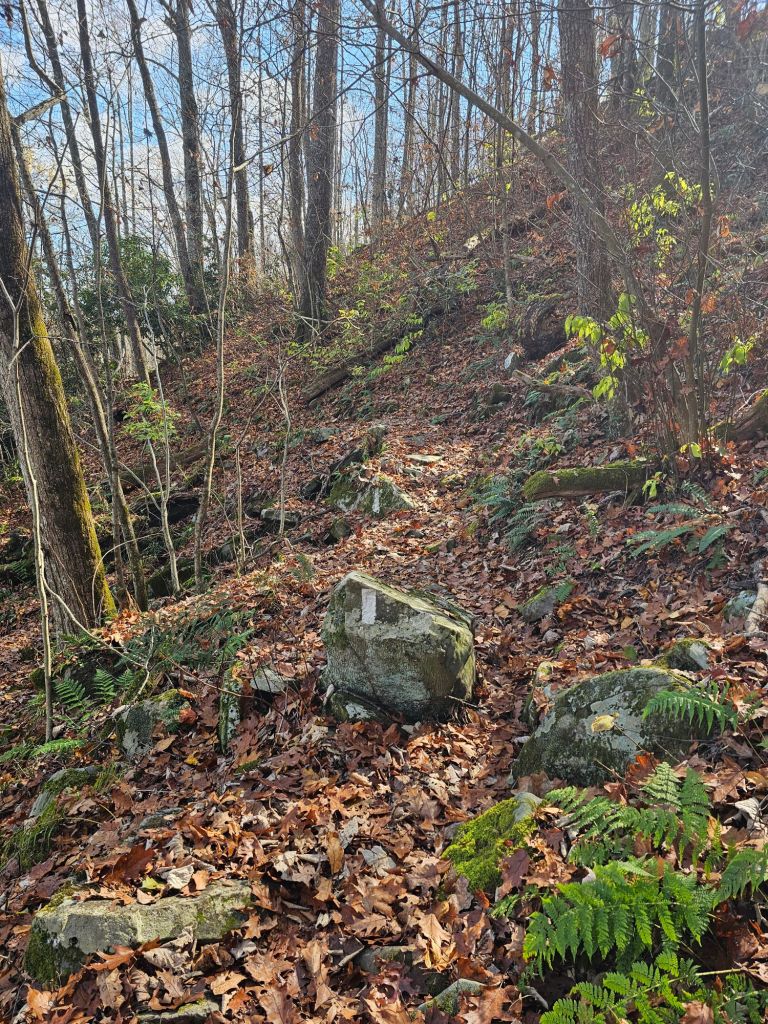
We went through varied vegetation, but always shuffling through dry leaves, 6-8 inches deep. Paul did his best to clear leaves from the hidden obstacles that aggravated my foot pain, but it was a daunting task. We painstakingly made our way through a slick rocky section.

With one more step to go, my right foot began to slide under a dry leaf atop a tilted slab of rock. While the foot stopped, my body failed and in slow motion my body folded backwards while my leg continued forward. I could feel the strain on my femur in the socket of my hip. This was going to be bad. And then, it was if I was held up (long enough to let my knee bend) and lowered gently , sustaining a mere scrape on my right knee. Paul stared in disbelief. “I thought you were going to break your leg”, he said. “I don’t know how you escaped that.” I’m pretty sure it was my guardian angel saving the day once again.

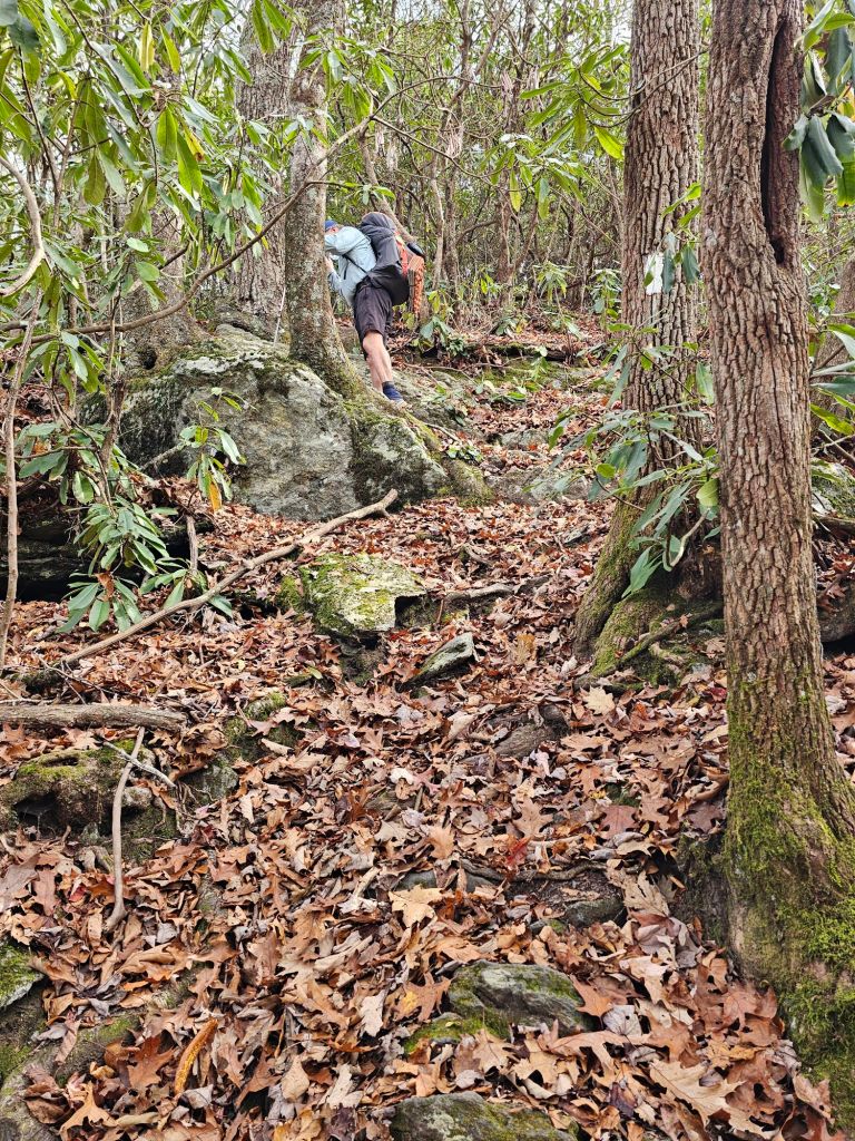
At the top of another PUD, we took a lengthy break. We wondered if this (walking almost blindly) was going to continue to be the status of the trail the rest of they way to Springer. We may not have factored enough time if our pace is going to be less than 2 mph with all this accumulated elevation gain and loss and leafy debris lining the trail. Careful walking is exhausting and time-consuming. We decided that when we got to the NOC (Nantahala Outdoor Center) another 13.8 miles ahead, we’ d reevaluate our plan and maybe skip ahead to Georgia, to buy us some time. As it was, we now had 7 more miles till we could refill water, and the last 3 miles of it would be another steep climb. And while we had “cameled” up and topped off at the last water source, the day was quite warm , so we knew the end of the day might be rough.
Then came the descent to Stecoah Gap. Unbeknownst to us, it included a thing called by the NOBOs, Jacob’s Ladder. 647 ft in .54 miles. While they would ascend it, we would descend it. Blindly.

With the trail completely engulfed in leaves, we poked and slipped our way down to the gap. Paul reached the gap way before me, as the descent was painfully tedious for me, to say the least. We crossed the busy road and made our way to the trailhead parking area and plopped ourselves down on the picnic table. We were parched. The construction in the area made it too difficult to access a spring that was supposed to be nearby. We tried to get the attention of cars that had briefly pulled into the “lot” to Yogi some water, but apparently, we unknowingly had our invisibility cloaks on. Hmm. What to do.
And then came the question. We asked each other if we were having fun. Were we enjoying ourselves? The resounding answer was no. Paul was concerned that if we continued and the trail didn’t improve in its tread, it was only a matter of time before I truly wrecked myself, or he, God forbid, became injured himself. A friend had recently messaged us saying, “Don’t let the AT permanently hurt that foot. There are still so many beautiful trails to hike.” Definitely some sage advice. We spend a good amount of time at that picnic table mulling over our options. Not “having fun” or being “bored” with the scenery is not sufficient to send us packing. We’re just too goal oriented and stubborn. We are, however, very clear on what situations or events would send us packing.
- A family emergency/event that required our presence
- Unsafe conditions and/or a significant weather event that made continuing dangerous.
- A debilitating injury, or one that will not or can not heal enough to continue without risk of further injury.
I would say that two of the three appeared to have been met for us. It was time to call it. We had already planned to return next September to hike the rest of Virginia, and whatever areas that reopened and were available, so what’s another 100 miles? Provided, I haven’t a permanent injury.
Confident and a tinge remorseful with our decision, we stretch out our thumbs to hitch to wherever anyone will take us.
With the sun starting to set, an older couple who live by the Appalachian Trail comes to our rescue. They can’t believe we are still out hiking. ” How do you see the trail with all the leaves in it?”, they asked. Exactly why we are done, we tell them. They deliver us to Bryson City, a tourist town, on what is Veteran’s Day Weekend. Could our timing have been anymore expensive?

It’s Saturday night, and we get the last room at the Relax Inn, that is perfectly priced and located near the downtown of this quaint town.
Once settled in, we wandered downtown to the brewery to drown our sorrows and feed our hiker hunger.
We duck into the Mountain Layers Brewing Company, enticed by its live music and food truck out back. While there, we noticed two gals that look strangely familiar. One is guarding her left shoulder/arm as they talk and sip a beer. Ah yes! It is the two ladies (Laurie and Jenny) we talked to earlier in the day. They are equally surprised to see us as well. We ask how their hike went. “Not well,” they reply. Laurie tripped and fell on her left shoulder and now can’t lift her arm above her head. They explained that they were having a hard time seeing the tread, hence the trip and fall. We tell them that we have ended our hike as well due to the dangerous conditions and the unyielding pain in my foot. We spend the evening talking about different trails and hiking in general. It was nice to have an actual conversation with someone other than ourselves.
Day 132: (Nov 10) Zero miles
We elected to spend another day in Bryson City to rest my foot and make our exit plan. We awoke to a rainy, drizzling morning as we hoofed it to coffee, which made us feel even better about our decision.
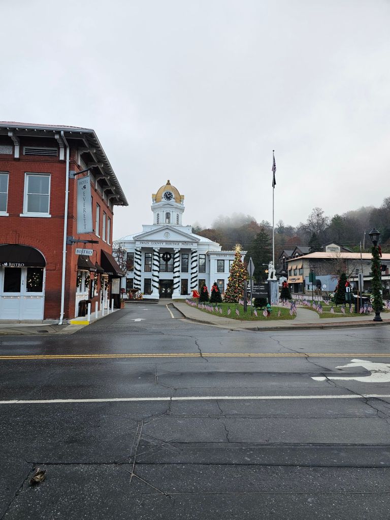
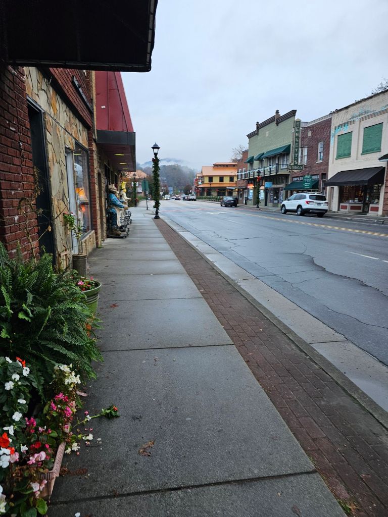
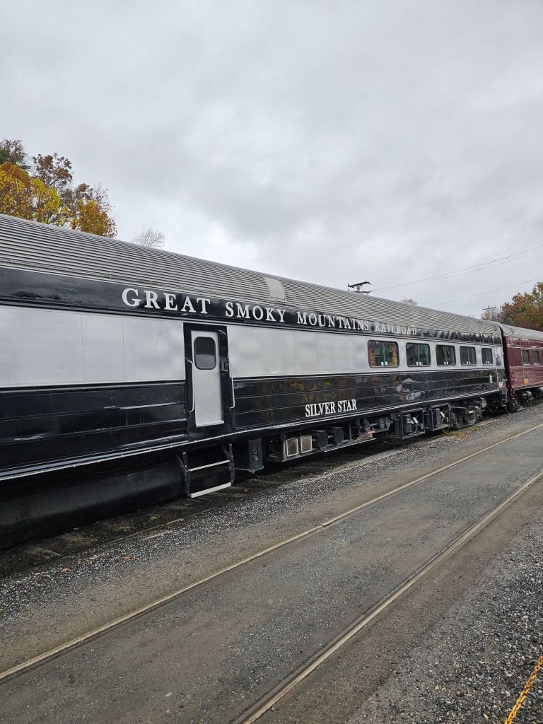
We walked through town with its Christmas decorations already up and across a bridge over the Tuckasegee River to Mountain Perks for breakfast. There, we noticed that a railroad runs through the town. The Great Smokey Mountains Railroad. A heritage and freight railroad based out of the town. During the fall, before Christmas, they offer a “Polar Express” excursion, as well as other steam-powered excursions through the Nantahala Gorge or beside the Tuckasegee River.
Later that day, we contacted Jen and Greg (Chica & Sunsets) to see if they had an opening at their Airbnb for the next day, before we booked our rental car from Franklin. Once confirmed that they did, we went about making new plans to get home.
Day 133: (Nov 11) To Franklin
The night before, I thought I had successfully booked a Lyft to Franklin from Bryson City to avoid the long out and back for Greg, but no. While Lyft and Uber are “available ” in North Carolina, there apparently were no drivers in this neck of the woods. No worries, our thumbs will do our walking for us.
We set up just outside a gas station on the road that leaves out of Bryson City just after 11 am. Within 20 minutes, we had a ride. While she was originally only going half the distance to Franklin, she offered to take us all the way, as she has friends who have hiked the Appalachian Trail. We were sure to slip her some cash for her generosity.
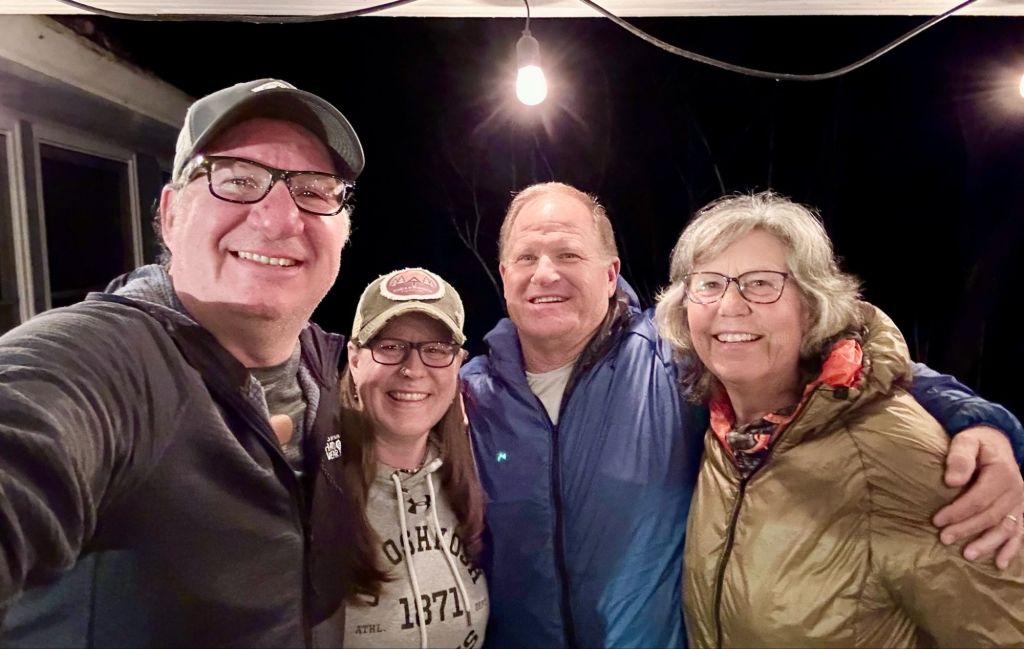
We arrived at Chica & Sunsets Airbnb. Jen and Greg welcomed us with open arms. We hadn’t seen them since they rode our shuttle and stayed at CLEEF during their 2024 PCT thru-hike attempt earlier this year. Greg, unfortunately, sustained a trail ending injury some 400 miles into their intended PCT thru-hike. As such, considering our current situation, we completely understand what they went through in making a decision to halt a thru-hike and visa versa. They just have a jump on recovery: mind, body, and soul.
Their Airbnb is an awesome place to chill. It’s decorated in all manner of AT paraphernalia. While doing our laundry, I perused through their adventure picture books. In their AT book, I noticed a picture of a hiker we met on trail this year.

Theory. He was the one who helped slack pack us at the beginning of Pennsylvania. We are constantly amazed at how interconnected or even small the thru-hiking world is. What do they say? Seven degrees of separation? I’d say this was not even two degrees.
In addition to their adventure books, both Jen and Greg are accomplished writers, having bailed on the corporate world and gone what we’d call “responsibly feral”. Click here for their bio.
Our plan was to spend the night and then have Greg drop us off at the Enterprise Rental Car location the next morning after his shuttle runs.
Later that afternoon, and into the evening, we dined and shared stories, drinks, and laughter with Jen and Greg. It’s probably one of the most enjoyable evenings we’ve had in quite a while. We didn’t realize how much we needed this. Thanks guys!

You two make good decisions based on sound principles. Are you truly done and going home? If so, huge congratulations and enjoy your Fall /Winter. Thank you for all the writing Dee. I really enjoy reading the narratives and seeing your photos. You each have a guardian angel- your partner! Lee
Yup. Done for now. Time to heal.