
Day 63: (Sept 1) 8 mi. (2009-2017)
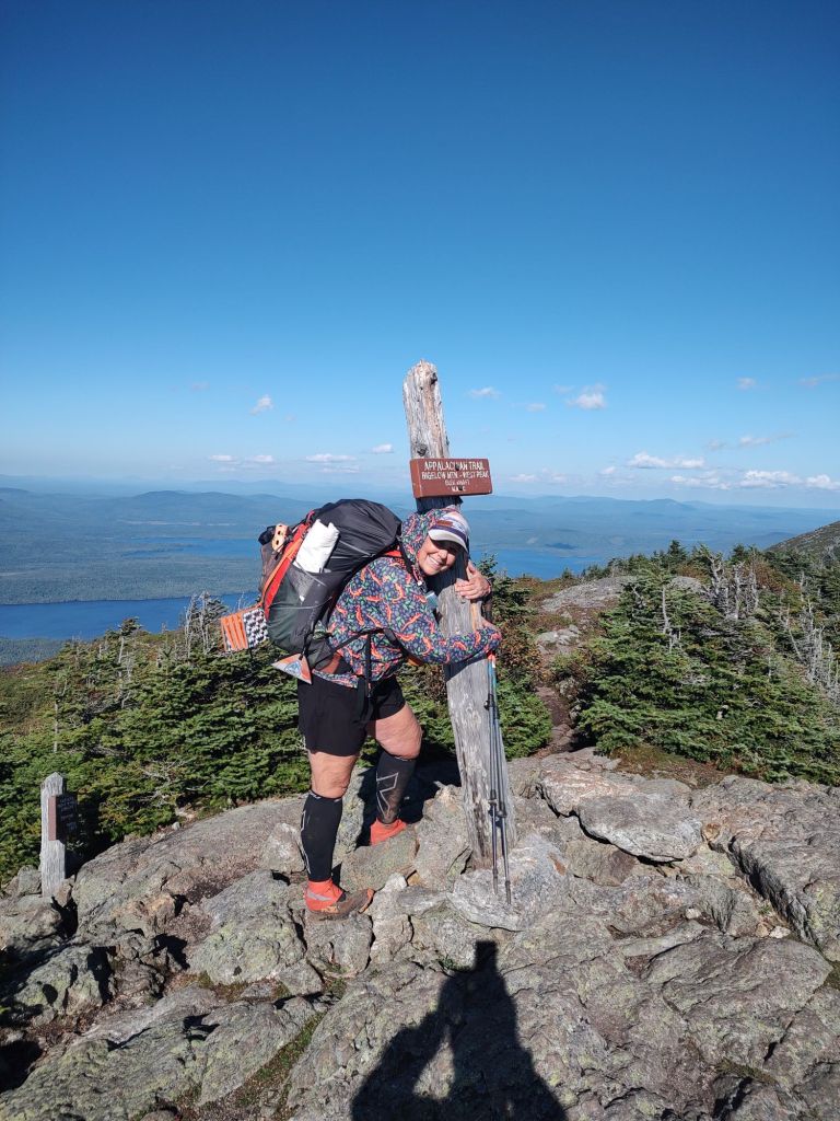
A hot shower. Rinsed out socks. Hot meal. A toilet, and a bed. Simple pleasures on trail, if only briefly, as yesterday was a nero. Hot coffee and a breakfast sandwich at the gas station in Stratton, we made quick work of getting a hitch back to trail. In no time, we were negotiating roots and now mud for another morning climb of South Horn (3831 ft.) and West Peak (4145 ft.).


Today would be a nero as well, in that we weren’t really sure how the terrain would be, and frankly, we weren’t that motivated after having crushed miles the day before.
By the time we reached West Peak, it was late afternoon, and the wind had picked up significantly. The air was definitely crisp and biting. Avery Peak would have to wait till the morning.
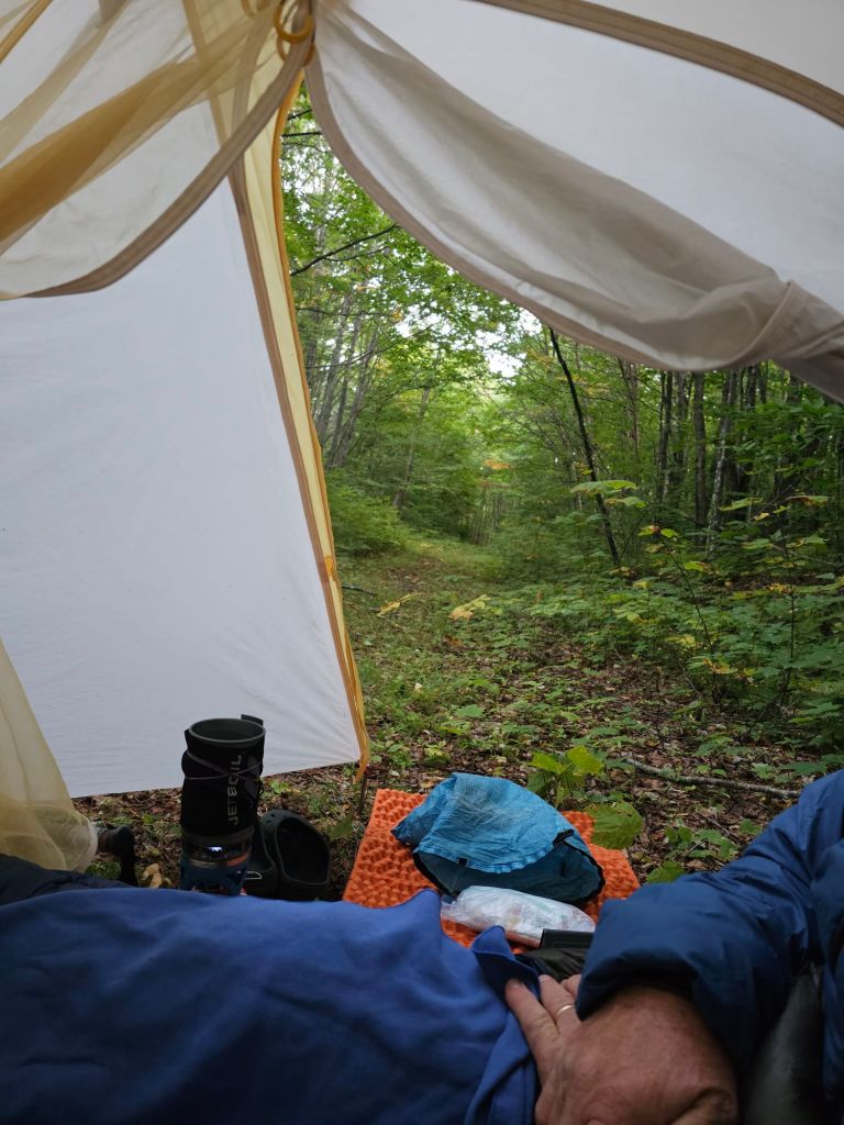
When we reached the Bigelow Col campsite, our choice to use the Katadin Hiker Pro water filter paid off once more. FarOut had this particular camp spot’s springs, noted to be iffy for water collection (essentially to collect for Sawyer Squeeze people). This is where the versatility of our pump style water filter shines. Paul was able to locate an active spring under a rock ledge and lower the collection hose down into the space and pump out enough water for our evening’s dinner and breakfast and walking the next morning. Meanwhile, I set up our tent atop a wooden platform that had an open sky view. Definitely an increased chance of star gazing. By chance, I had a bit of cell service that now indicated a 23% chance of rain by 9pm. What? That meant, on goes the rain fly. No lazy star gazing tonight.
Day 64: (Sept 2) 11.9 mi (2017-2028.9)
So, the rain fly proved to be an excellent addition. 8:30 pm, with gusting winds, it began to rain. Secure in the thought that all was “good,” I didn’t think much about ensuring my side of the fly/vestibule was secure and tight down to the platform. This resulted in waking to the exterior of my down quilt and everything on my half of the tent being sopping wet. Overnight, the direction of the wind had changed… up and under my side of the tent. Awesome.

This led to a freezing cold, wet to the core march up to a damp cloud engulfed Avery Peak (4088 ft.). In so many ways, it was comical.

Atop Little Bigelow, we had a yard sale and took the opportunity to dry out our gear. From there, we had a nice descent over sloping granite slabs down toward Flagstaff Lake. Just past the lake, we camped on a snowmobile road as the sun dipped and the temperature dropped.
Day 65: (Sept 3) 18.4 mi (2028.9-2046) Kennebec River Crossing
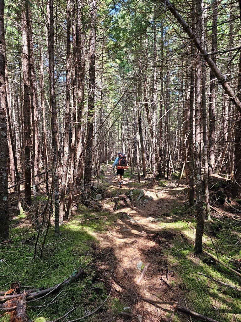
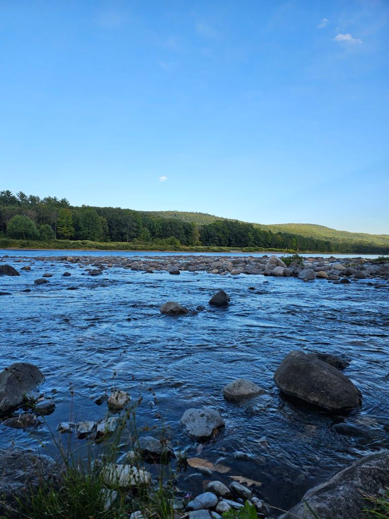
It started as a cold and windy morning, where the green tunnel provided a measure of protection, and the tread was actually quite pleasant. We walked by ponds (East and West Carry Pond), which, for us, were more in the lake category. The wind was blowing enough to create whitecaps, which resulted in a hard NO for taking the time to swim.

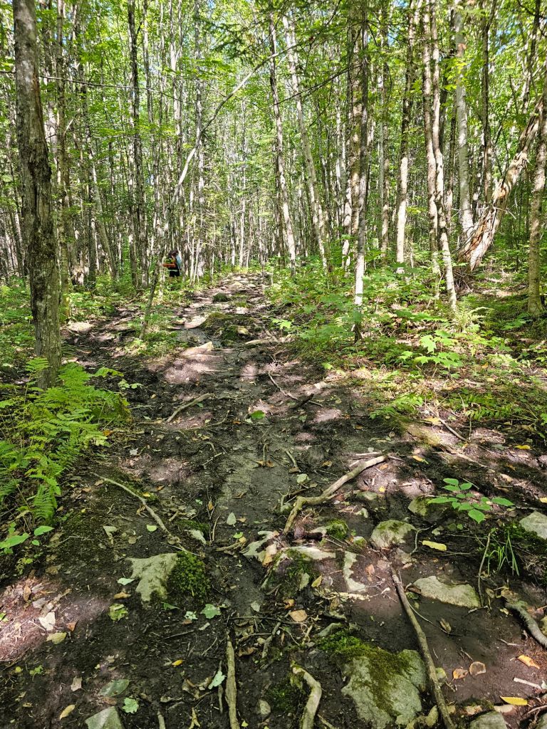

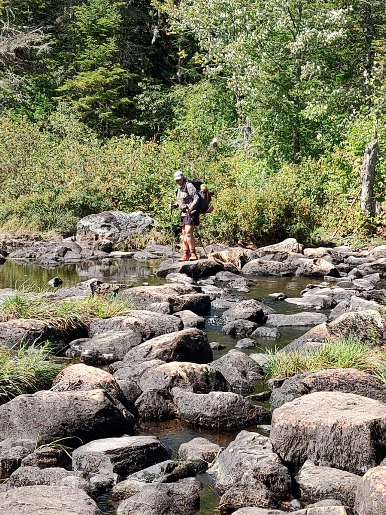
Eventually, the tread degraded to pronounced roots and rocks surrounded by mud the consistency of cookie dough. Even with that, we were able to keep a good pace that would get us to the shore of the Kennebec River and a possible crossing. And then, suddenly, the last two miles became extremely daunting. It was if a giant two year old had pitched a massive and sustained tantrum. Trees torn up and tossed everywhere. Missing tread and difficult to follow trail markings wandered without apparent purpose. This was ankle breaking territory. I specifically told myself to be very careful, as this would be an awful place to fall… and then, of course, CRASH! In an instant, I was wedged in between sharp and unforgiving rocks, amist a patch of poison ivy. This time, my right knee (the working one) took the brunt of the landing. My pack was caught up in the poison ivy, and I was having difficulty getting up. It took Paul grabbing the top of my pack to lift me enough to get out of my painfully precarious position. As I suspected, my knee was bleeding and beginning to swell slightly. I was, however, mobile. I spent the next mile cussing out this stupid tread of trail and limping carefully all the way to the river.
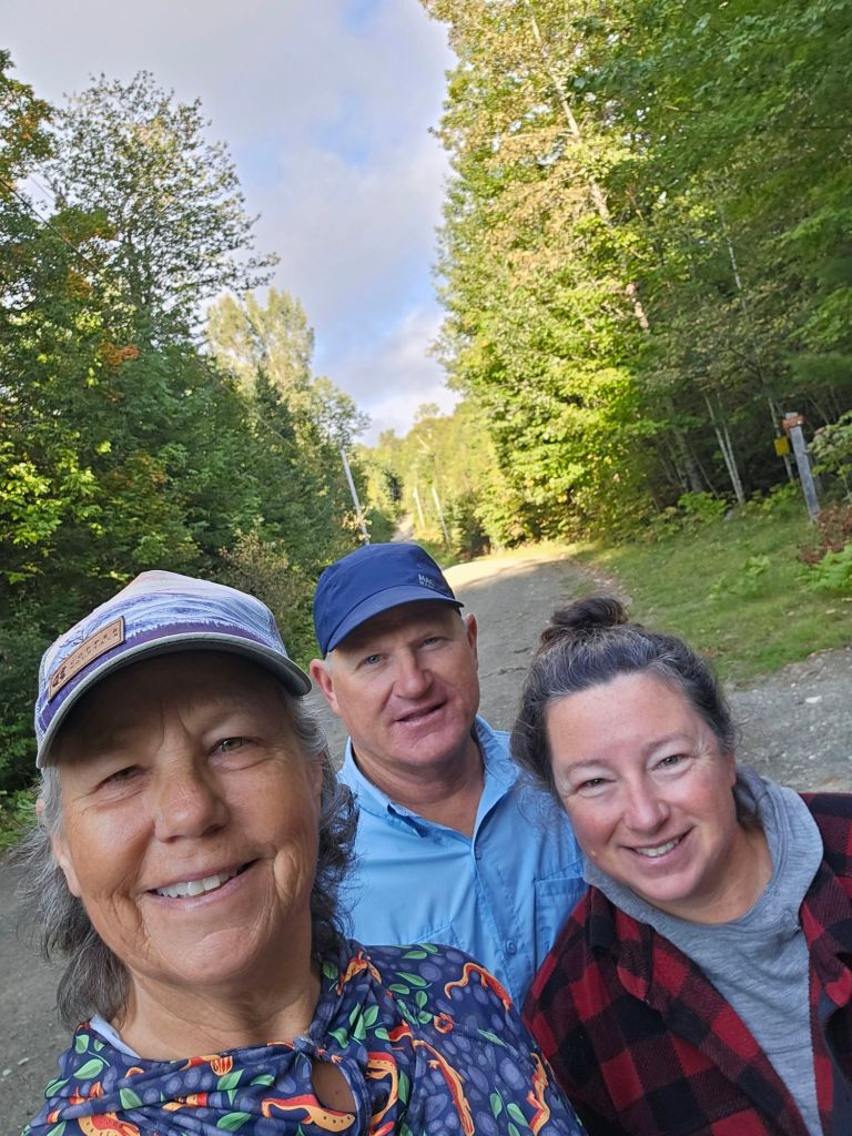
This past season, one of our riders (Kim) on our PCT Southern Terminus Shuttle told us how she lived on the Kennebec River and how she could see the AT hikers from her house. She was excited that we were doing the AT, and although she was going to be hiking the PCT, she would let her husband know when we were coming and that we would be able to stay at their place to zero and resupply, if we’d like. At the time, the Kennebec River seemed so gar away. We filed that info away. Just after starting the AT, she contacted us to let us know she had sustained a trail ending injury and would be home when we got to the river. While we were sad for her, we were glad she was home. Therefore, over the last couple of weeks, we have been updating Kim as to our location. While it was after the normal river crossing time, due to the upstream dam water let out, we called Kim to let her know we had reached to shore. “I’ll come get you now,” she told us.
* As a side note: The ATC provides a canoe crossing service from 9 am. till 2 pm. to transport hikers across the Kennebec River. They don’t want hikers crossing on their own and possibly drowning and/or getting caught in a swifter and deeper current if/when the dam upstream starts releasing water.

As we waited for our ride across the river, we expected a power boat or jet ski, but several minutes later, there was Kim paddling a canoe up river to get us. Turns out, Kim is a professional whitewater river guide, so paddling upstream in these conditions wasn’t a problem. She is very familiar with this river and its currents. Into the canoe we climbed with our packs. In no time, we were pulling up onto the shore of her waterfront home.

She had set aside their Airbnb loft for us to use for , if we’d like. Once unloaded, we were off to the local pub and rafting lodge for beverages, some fresh food, and hours of trail talk. Kim had quite the experience on the PCT.
Day 66 (Sept 4) Zero!
No miles! Food . Laundry and resupply. The day started with a hearty breakfast prepared by Kim and more stories and trail banter. Kim was a wealth of information about the area we were to traverse next and an exceptional historical resource. As we suspected, these forests were not so thick, and the trail tread was healthier. The AT crossing of the Kennebec River had been relocated due to hikers nearly drowning as they tried to wade across, not knowing whether the dam had released water or not. They moved it to where it is now, as the crossing is not “walkable” and won’t tempt people to try and cross.
Day 67: (Sept 5) 5.3 mi (2046-2051.3)
My right knee was still feeling a bit sore, and frankly, I wasn’t sure it was ready to hike on with a 4 day resupply. Kim suggested we slack-pack up from the Kennebec river to the Pleasant Pond, and she’d pick us up. My new insoles had yet to arrive, but our new shoes had. What a better way to break in the new shoes and test the knee. We packed some water, a couple snacks, and hit the trail. For the most part, I had no problem with either knee. The walk had some obstacles but was not particularly stressful. We walked so well and so fast that we decided to stroll 1.5 miles down the road that Kim was to collect us from. When she met us, she had another great idea. As the day was quite warm, why not cool off with a river float. We grabbed our beat-up shoes, and she got lifejackets for us. We drove up to the “old” AT crossing spot. She parked her car and we all walked down to the river. Into the crisp and refreshing water we plunged. The drift was just right. We floated down the Kennebec back to Kim’s house, laughing and waiving at the hikers “rafted up” waiting for the next day. We swore that two of them were Rolling Stone and Scout. We waved and yelled to no avail. That evening, we had dinner with Kim and her family. I’d have to say that this was probably the best stay and zero for us to date. It felt like we were on vacation. Thank you Kim. We needed that.
Day 68: (Sept 6) 14.9 mi (2051.4-2066.4)
Kim dropped us off where we left off. Up we climbed. It was not that difficult, and soon we had views as promised by Kim. Up to Pleasant Pond mountain, then Middle Mountain, and finally, Moxie Bald Mountain.


Unbeknownst to us, it was Kim’s birthday, and she and her brother had decided to hike up to her favorite mountain, Moxie Bald. The irony of the day is that we missed her by 10 minutes. In fact, when we got to a road crossing and saw a car parked not far from the trailhead, we laughed, “Wouldn’t it be funny if that was Kim’s car?” Her foot was still not fully healed. Surely it wasn’t hers, we figured. Suprise. Suprise. It was her car. I’m so sorry we missed her and the opportunity to share her birthday hike.
Our day ended literally at the end of an old logging road in search of a place to camp. Once set up on the “culdesac,” I quickly explored a narrow trail that led to an awesome view of Bald Mountain Stream.


Tomorrow, we get into Monson, and finally set our eyes (and feet) on the infamous Shaw’s Hiker Hostel.
