
AUGUST 5 – 11, 2024
We have finally reached the much talked about and frankly “feared” White Mountains. The Appalachian Trail traverses the White Mountain National Forest and is “divided” into three sections. “The Kinsmans”. “The Presidentials ” and “The Wildcats”. Each is purported to be successively harder than the previous section. Overall, this 100-mile stretch is said to be the “hardest” section of this already hard trail.
Nervous chatter is the norm at the Hikers Welcome Hostel. Most hikers here are NOBOs with nearly 1800 miles under their belts, and they’re fretting just a bit. We barely have 350 miles, and our trail legs have yet to arrive…fully. ‘Expect your mileage to be cut in half’, they say. We are not sure what that will mean for us. In any event, this should be interesting.
Day 36: (August 5) ZERO miles
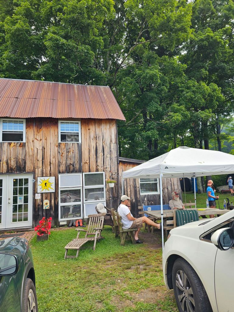
Hiker Welcome Hostel was just what the doctor ordered. Housing out of the rain. Ways to charge electronics, laundry ($4 wash, 4$ dry), and ride to the store for vittles every night (where the chocolate milk lives) and great comradery. People you thought were way ahead, come rolling in. People you haven’t seen in miles and miles suddenly show up. Laughter, smiles, and stories of “Where were you when…” And Miss Janet. Miss Janet is fixture along the Appalachian Trail. She was our primary shuttle driver and chief story teller of everything Appalachian Trail from Georgia to Maine. Patience was our host at the hostel, a PCT 2019 alumnus, and a previous helper at Scout & Frodo’s.

Our only job for the day was Eat. Sleep. Blog. Eat some more. Drink. Wash clothes/shoes and inserts. Eat. Dry air mats. Drink. Eat. Pack for tomorrow’s slack pack of Moosilauke. Set the alarm and go to bed.
Day 37: 9.7 mi Mt. Moosilauke (1798.3 – 1807.8)

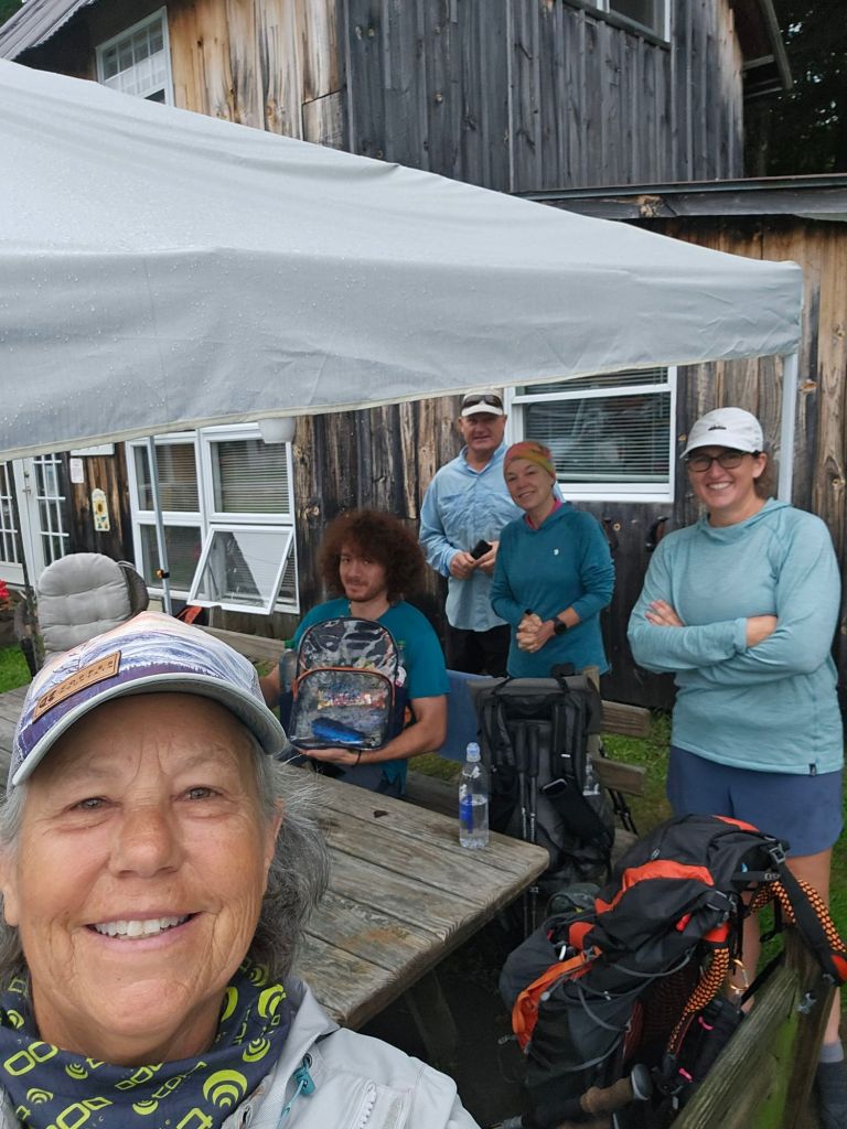
Up at 6 a.m. for our 7 a.m. shuttle ride with Miss Janet to Kinsman Notch to hike SOBO up and over Mt. Moosilauke and back to the Hiker Welcome Hostel. The best part was that we wouldn’t be wearing a full pack. We’re carrying PB&J sandwiches, water, and our sit pads.


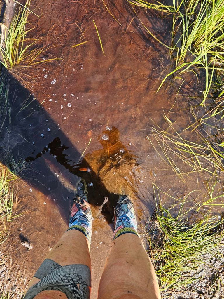
Out of the shoot, we have a river crossing with no other safe option other than to get our feet wet and ‘walk’ em dry’. The air is cool, and the terrain instantly becomes steep.
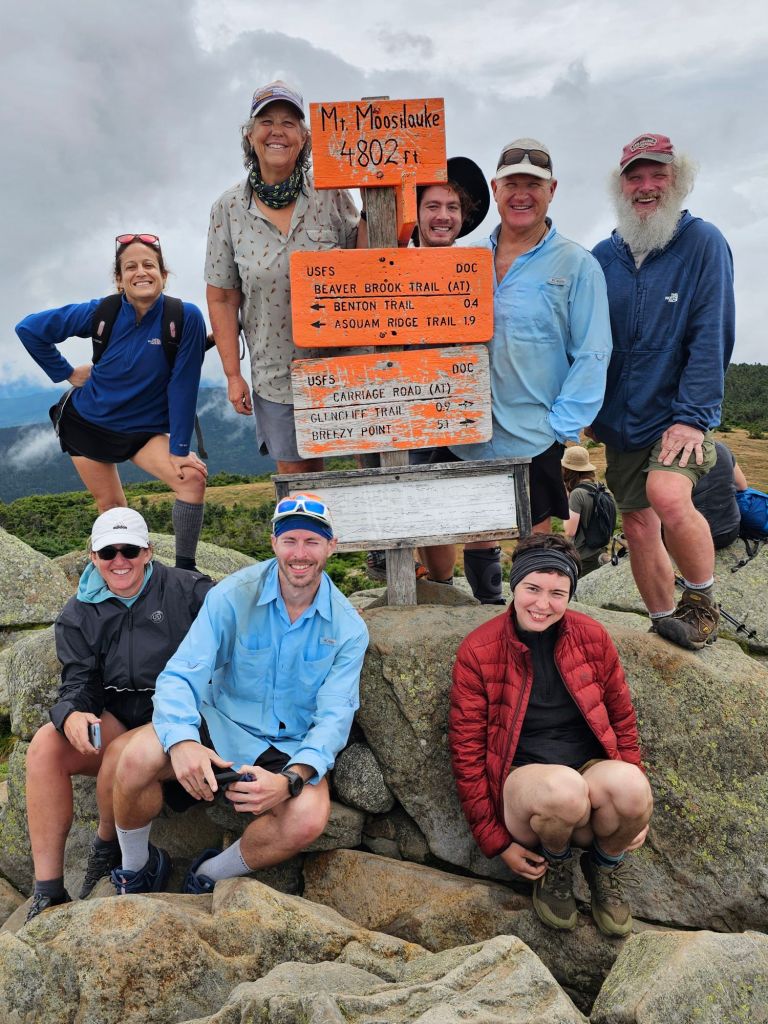
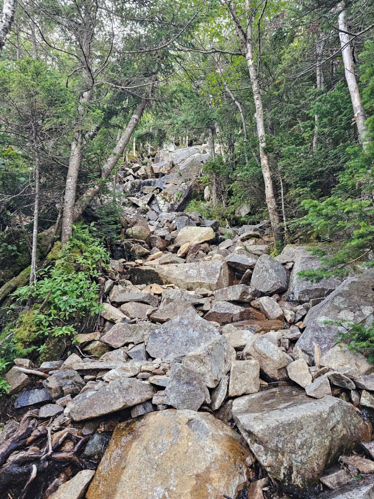
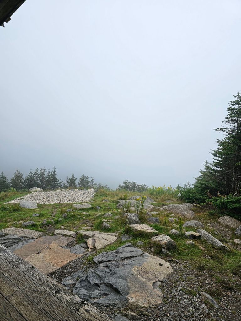
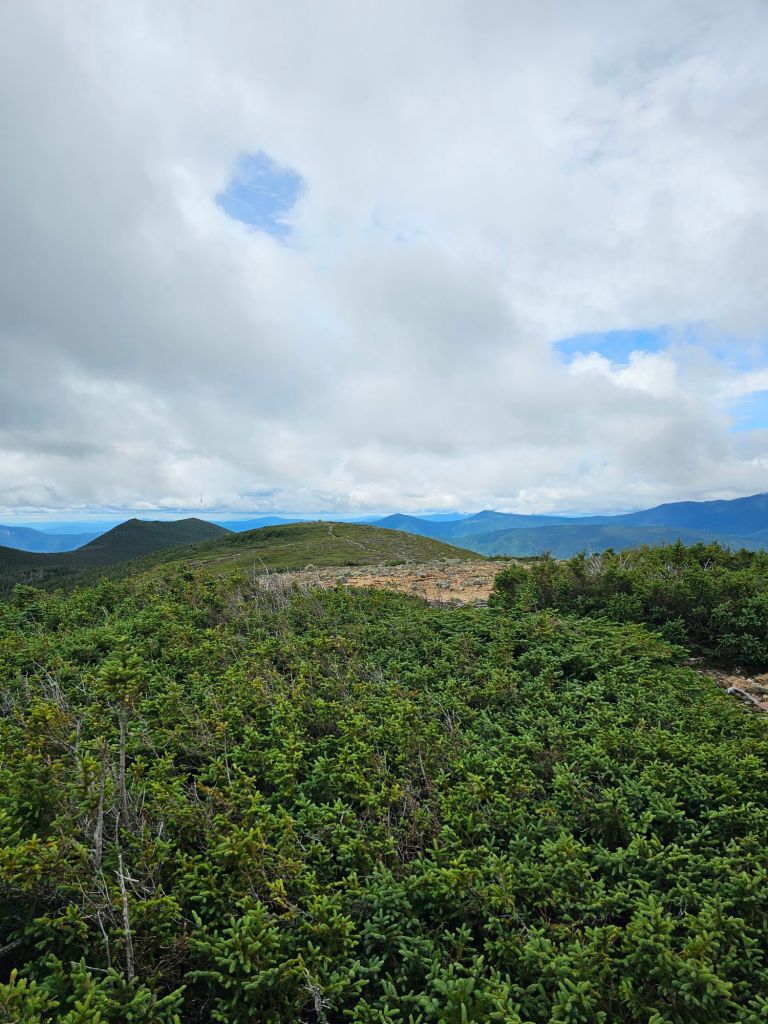
Our initial climb (1883 ft.) was alongside a lengthy cascading waterfall lasting 1.5 miles. The remaining climb to 4802 ft. was “gradual” compared to the hand over fist crawl to the first hut and end of the waterfall. Eventually, we met up with the group we rode in with at the top. Getting to the top reminded us of the CDT and walking Ridgeline. We did not expect to see SO MANY people at the top…besides thru-hikers. There had to be 40+ people scurrying about the top, to include the 1981 alumnus from Dartmouth. One of the group members remarked upon their ascent, “last time I was up here was my freshman year”. Apparently, it is “required” by the Dartmouth freshman to hike Mt. Moosilauke. I’m glad I didn’t go to Dartmouth. While it was nice to have a view (for a brief moment), it was time to head back down the mountain and back to the hostel.
Day 38: 7.5 mi (1807.8 – 1815.3)
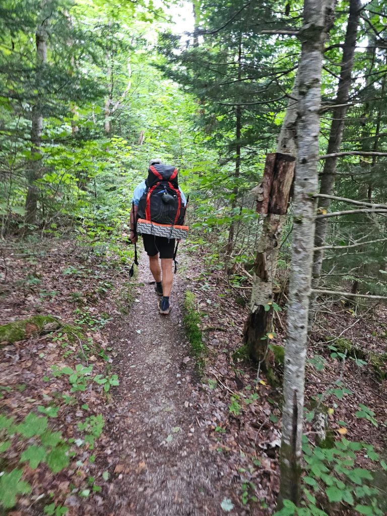
After chugging a quart of chocolate milk and a packet of oatmeal, it was time to hoist our packs and load into the shuttle. It was 7 a.m. and we were off, once again, to Kinsman Notch to start NOBO to Lincoln NH. The morning was almost brisk, and the humidity was seemingly nonexistent. What a blessing, as today would be mostly up. We would traverse over rocks, roots, submerged bog boards, and mud.
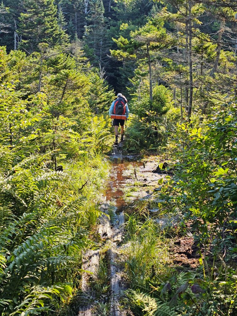
Wet feet and shoes were the norm. Our mountain ascent would be to Mt. Wolf, which offered NO view, and frankly NO suprise. Eventually, we were passed by Let it Be, Grit and Sweat Potato, who started hours after us. 1800-mile trail legs would be nice. We’re nearly a quarter of the way there.
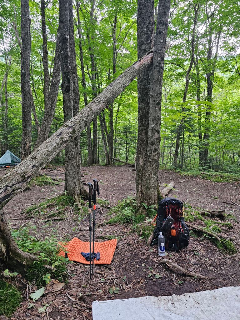
We reached the Eliza Brook Shelter/campsites with plenty of daylight. Quite a luxury. After we set up camp, we soaked our feet in the icy cool Brook and washed our mud infused socks. The amazing thing is that today is the first evening we’ll go to bed with dry clothing. What a concept…and a feeling!
Day 39: 8.8 mi
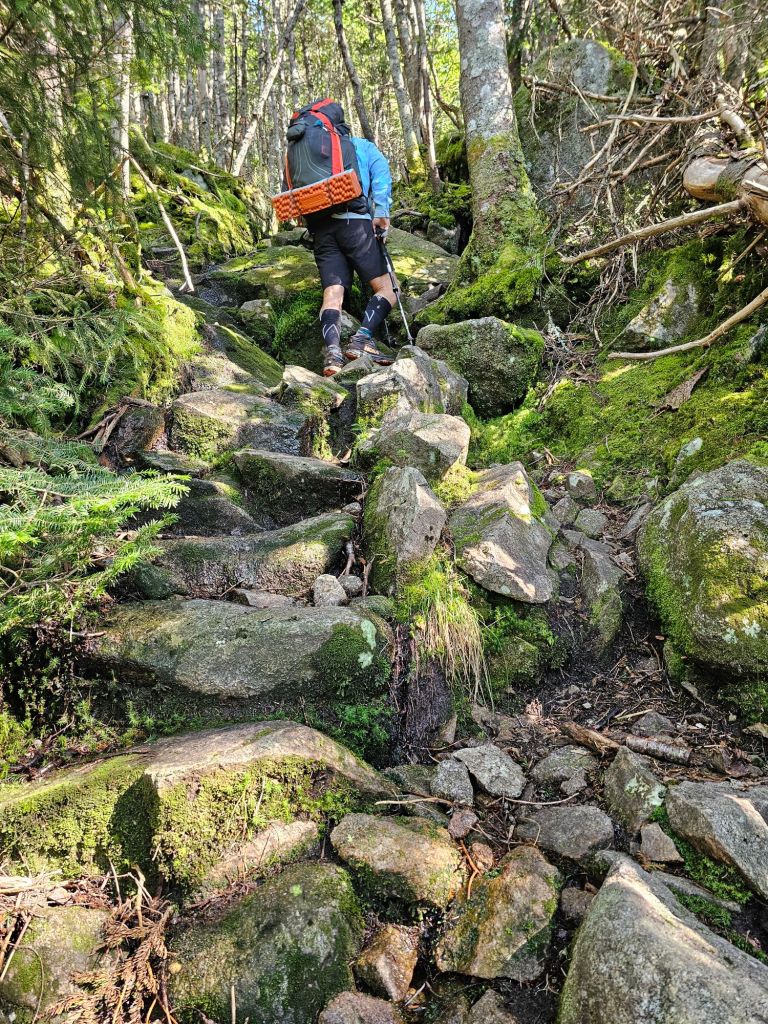
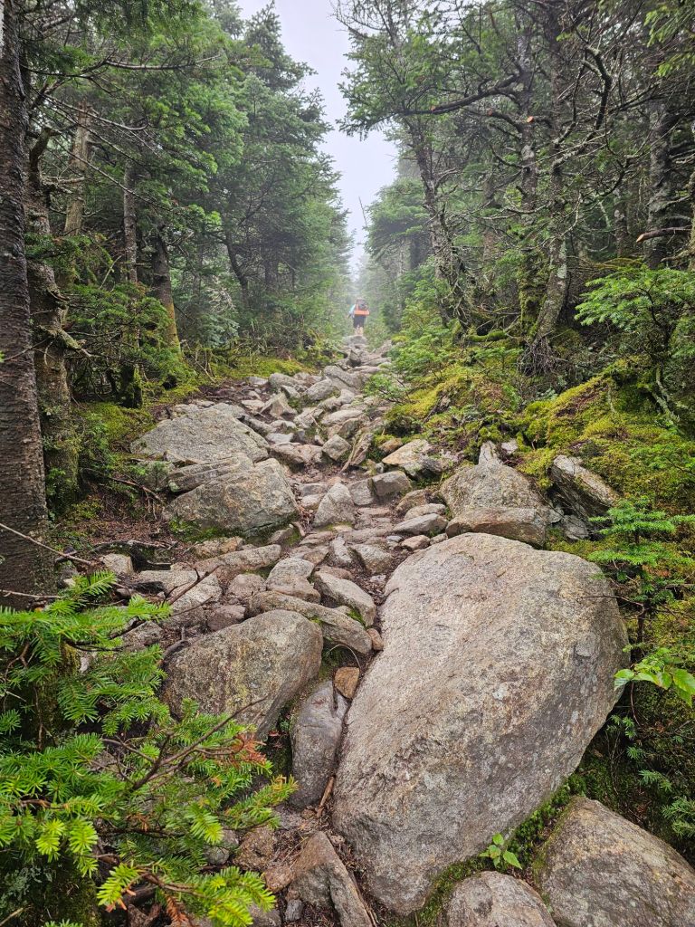
Today was HARD! Wet feet and an uphill scramble over boulders. If it was this time last year, there would be no way I’d be able to have hoisted myself up and over some of these boulders, logs and crags. My shoulder would not have been healed enough to do all that is being required of us.

Two mountains climbs were on the menu for the day. South Kinsman (4358 ft.) and North Kinsman (4293 ft.), neither of which provided a unobstructed view of anything. If it did, it would only be an endless array of the tops of trees. We did pass by our first AMC (Appalachian Mountain Club, but most comments on FarOut refer to it as the Appalachian Money Club), and wow! Nothing like a large lodge in the middle of nowhere, perfectly situated by a small lake. We figured the 4 mile hike to the parking lot couldn’t be that bad if there were little kids bouncing around the lodge. Oh, it was that bad, probably because we were super tired from our seemingly neverending parkour course. In my exhaustion, I managed to allow an errant tree branch to attack me yet again along the length of my right forearm, which made for a bloody mess. If figured it would be best to let it bleed, and for giggles, I wiped it on a tree trunk or two for the muggles to wonder about. Just as we make the turn to the “blue line” toward the Liberty Spring parking lot, it starts to rain. We are good for now, as the tree canopy keeps us mostly dry. We are doing our best to sync our arrival to the parking lot with our shuttle to the Old Colony Ski Club and stay as dry as possible. Our plan is to zero, in Lincoln at the Old Colony Ski Club. As it starts to pour proper, Jen comes racing into the parking lot. She is one of the ski club key members, along with Jeff, who helps run the club as a hostel in the summer for Appalachian Trail hikers.
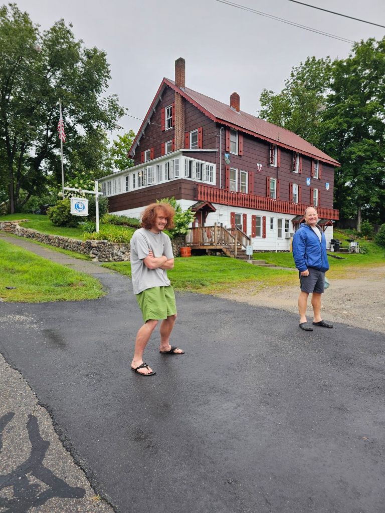
Gotta say, this is one of most hospitable places we’ve been yet. $50/pp to “join”, then $25/ea for every night there after. Coffee in the morning. Full use of an industrial kitchen.
Market and dining nearby (like 5 min walk), AND they run you into the Price Chopper Market and Lahoots outfitters for free. The Shuttle to pick you and town chores all included in your stay. With a laundromat next door, what more could one ask for. It’s a bit of a vortex… but a good one!

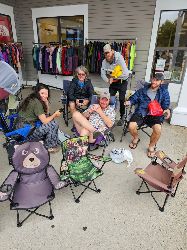
Day 40: ZERO (August 9th)

Laundry. Shopping. Eating. Drinking. Outfitters.
Day 41: 5mi. (1824.2 – 1828.1 + 1mi blue route)
Instead of taking another zero, we opt to head out to catch a weather window that will hopefully allow us to make it up and over four mountains before the predicted thunder showers begin in earnest.
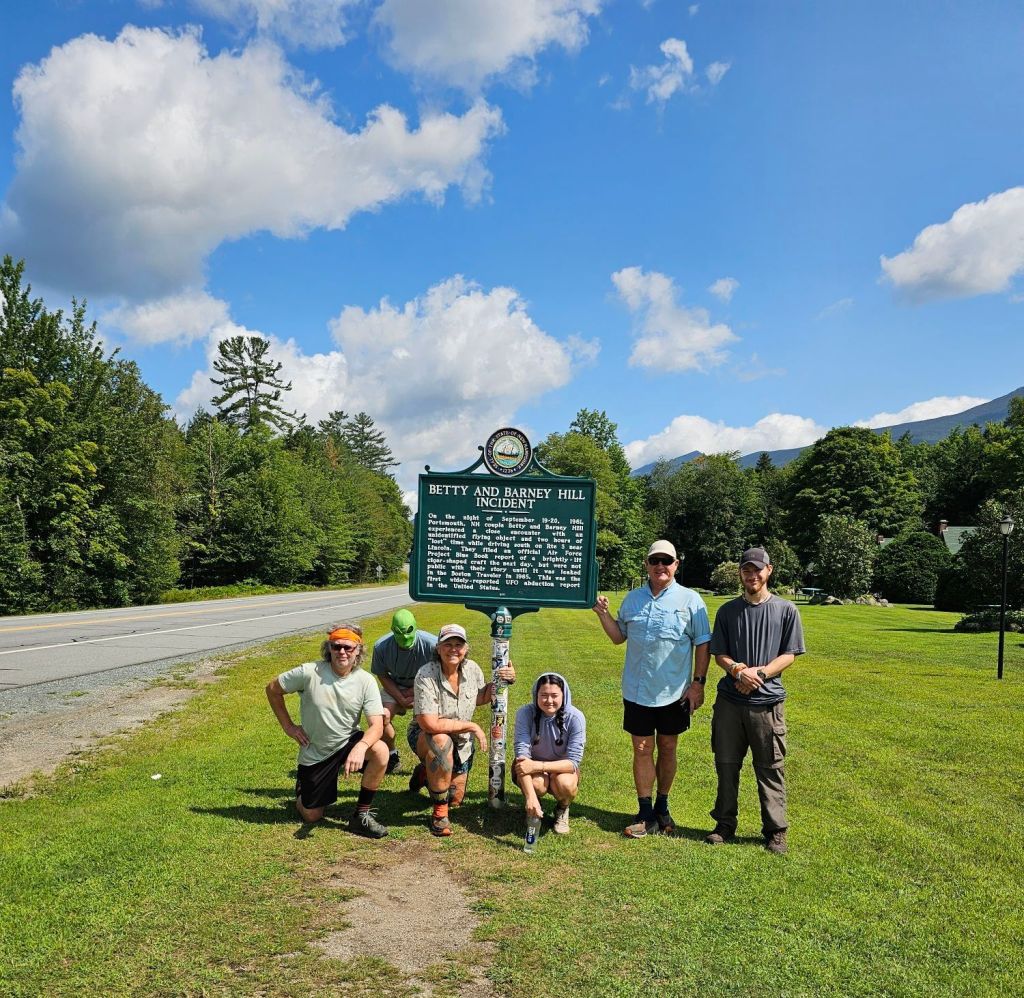
On the way to our drop-off point, our hosts stop by a famous New Hampshire icon. An alien abduction site. Photo ops for all, as Jen tells us the story.
We get dropped off at the Flume Gorge Vistor center parking lot with 5 other hikers. We notice a Disneyland like line of people waiting to pay to get into the Gorge and walk the 3-mile (r/t) platform type walk to see the Gorge. We chuckle at how ridiculous that seems, and then remember, we’re paying A LOT of money to hike (actually hike, climb, scramble, trip and fall) all day and sleep in the mud, dirt, and rain. Who’s the dummy?
As we were starting a bit late, and we’re carrying 4 days of food, we had initially thought we’d stop at the Liberty Springs campsites, run by the AMC, but then decided to save our money and continue on till we found a good stealth site. We found a place tucked away in the trees and just after the bulk of the climb to Little Hatstack Mountain. This would set us up nicely for the following morning. Little Haystack Mountain(4780 ft.), Mt. Lincoln(5089 ft.), Mt. Lafayette(5260 ft.), and Mt. Garfield(4467 ft.).

All was well and good. The morning and most of the day was brisk and a bit windy, but we had mostly clear skies as well as a busy trail. We sometimes forget to account for muggles out for recreation on a weekend. This would be a 10 mile day.


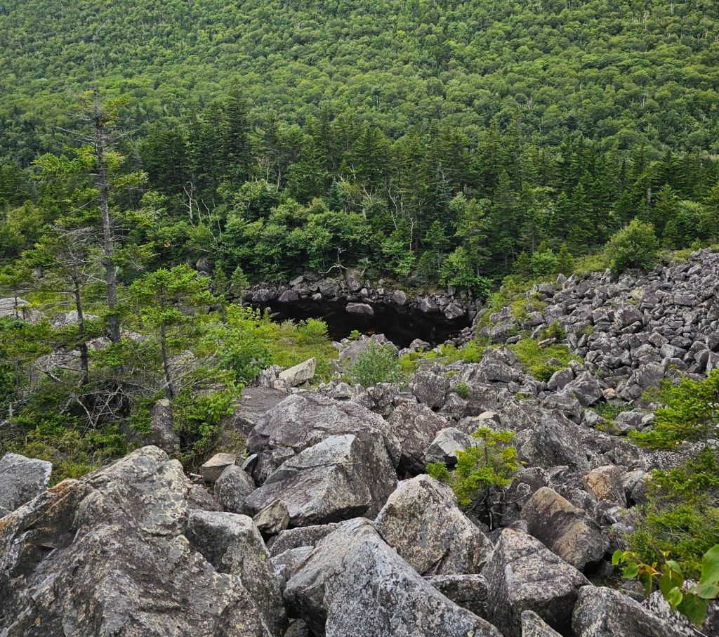
All seemed good, until our descent to Galehead Hut, coming down from Mt. Garfield. It appears that we missed the memo that says the seriously steep descent will involve the actual scaling of a waterfall, complete with water flowing beneath and often over your feet.

Talk about terrifying! Needless to say, by the time we reached Galehead Hut (built in 1932), we (meaning I, to the point of tears) were seriously outta steam. They only had one WFS (work for stay) spot open, and no camping at or near the hut. To our dismay and total lack of understanding, not all AMC huts have camping available or nearby. One of the Croo members, when we asked about where we could camp and that we were AMC members, actually walked us to a seriously concealed stealth site not far from the Hut. Awesome. We were so thankful, as everything else we spied was nothing but large puddles. He told us that we would be “pretty protected” from the incoming thunderstorm and that we should have an unobstructed sunset view. Sweet! Yup. God is good…All the time!

All set up and fed, we fell asleep as rain softly pattered against our tents, as thunder roared and lightning lit up the sky.
Day 43: 7.4 mi (1837.1 – 1814)
We awoke with a fairly dry fly. While it rained a good portion of the night, the morning wind left us pretty dry. After coffee in bed, we packed up and headed back to the Hut. We needed to refill our water bottles and use the restroom before beginning the day’s descent. When we arrived at the Hut, the Croo asked if we could take their “end of year” picture in exchange for a cinnamon roll. Yup! You don’t have to ask twice!

Today’s route was much nicer. It was easier on the knees for the most part and less steep. The first half of the day was foggy and cool, so we hiked for a while wearing our rain jackets. I added my Hestra liner gloves to take the edge off. We reached the Zealand Hut by the similarly named waterfall. No work for stay available, but they pointed us to campsites not too far from the Hut and just off the AT. The site was .3 from the Hut and big enough for several tents. We considered going further, but didn’t want to pass up a sure thing.
Day 44: 7.3 mi (1844.5 – 1851.8)
The wind gusted violently all night long. While the tops of the trees above us shifted and shook, not a breath of wind breezed by our tent. We were in a vacuum of stillness. It was a little eerie. This kept us warm, too warm, for the most part. But, opening the fly for more airflow meant letting in the noise of nature’s leaf blower, and I lost my earplugs.

The trail to the 302 hwy was reported to be the easiest walk so far on the Appalachian Trail. While it was unusually easy tread a majority of the way, there were a few times when it returned to its “regularly scheduled trail,” of unorganized boulders and dilapidated and/or submerged bog boards. While examining our current soakers in the mud, we noticed what appeared to be a fresh set of moose tracks. And what did our wandering eyes spy, but a bull Moose not more than 25yds from us.
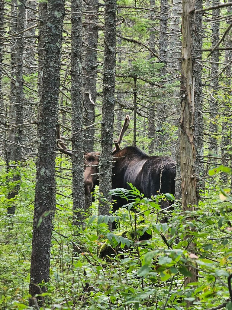
He picked up his big rack and glanced at us with serious disinterest. That sighting made our day. We were especially glad there were several trees between us and the Moose.
As we walked we kept waiting for the trail to degrade fully, but it never really did. Even the .5 mile 700ft descent had a manageable grade and steps. We’ve noticed a bit of a trend when walking the AT that shares it route with paths to the AMC Huts. They tend to be fairly “tame”. There is just enough “trail ” to make it feel rugged.

When we got to the parking lot, we were pleasantly surprised with “trail magic” from Mrs. B, Mr. Bogangles’ wife who is following him along the trail. He is just ahead of us on trail. PB&J sandwiches, soda, hiker snacks, OH Boy! This helped us fill the time before our previously scheduled shuttle ride from Jeff at the Old Colony Ski Club back to Lincoln for a pole repair, rest, and resupply. Time to rest up. The Presidentials are Next!


Seriously amazed at your mental and physical endurance. Go team!
I think my hair color will be white by the end of this hike